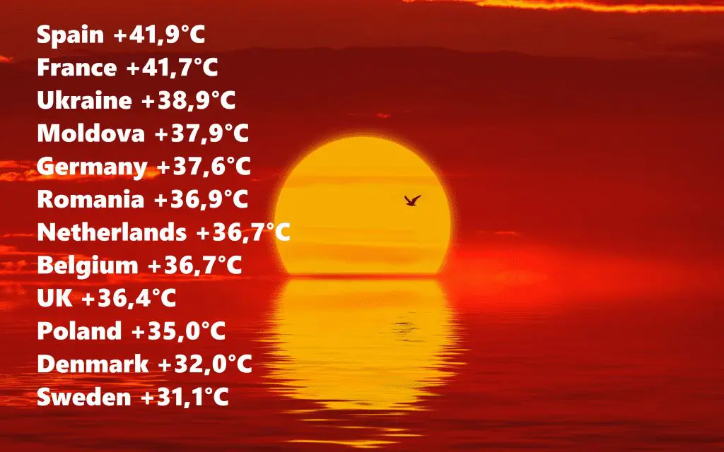
Big forecast up to the end of August 2020 for Europe + current heatwave TOPs: France +41,7°C, Ukraine 38,9°C, Germany +37,6°C, UK +36,4°C, Poland +35,0°C, Sweden +31,1°C
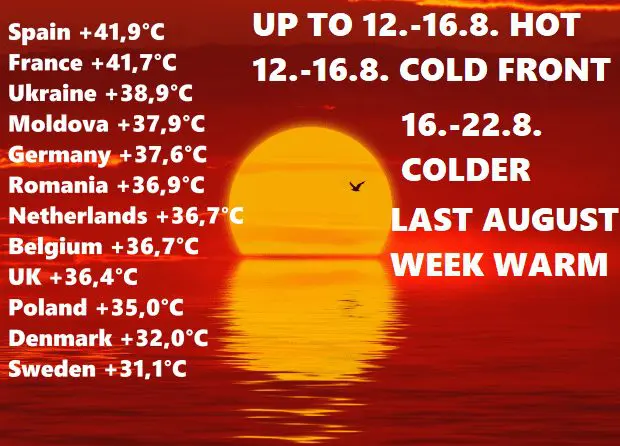
Heatwave is bothering a large part of Europe, from France +41,7°C to Sweden +31,1°C
On Friday and Saturday, really hot circulation pattern persists over Europe and current heatwave is very similar with previous – with the highest temperatures of the year 2020 over a few regions of Europe, but with larger area-affected.
On Friday, +41,7°C in southwestern France was measured and this temperature is only 0,2°C below July´s maximum value from previous heatwave. In London, +36,4°C was measured – it is the highest August temperature in UK since 2003.
Extremely hot air has shifted till Saturday over Benelux and Germany, with maximum temperatures up to +37,6°C in Germany (Trier-Petersberg), +36,7°C in Belgium (Diepenbeek), and +36,7°C in Netherlands (Arcen).
In Spain, +41,7°C was measured on Friday and +41,9°C on Saturday.
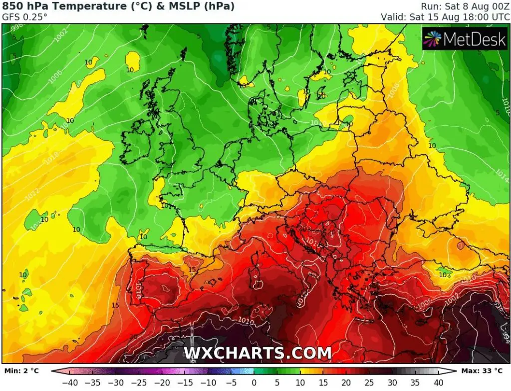
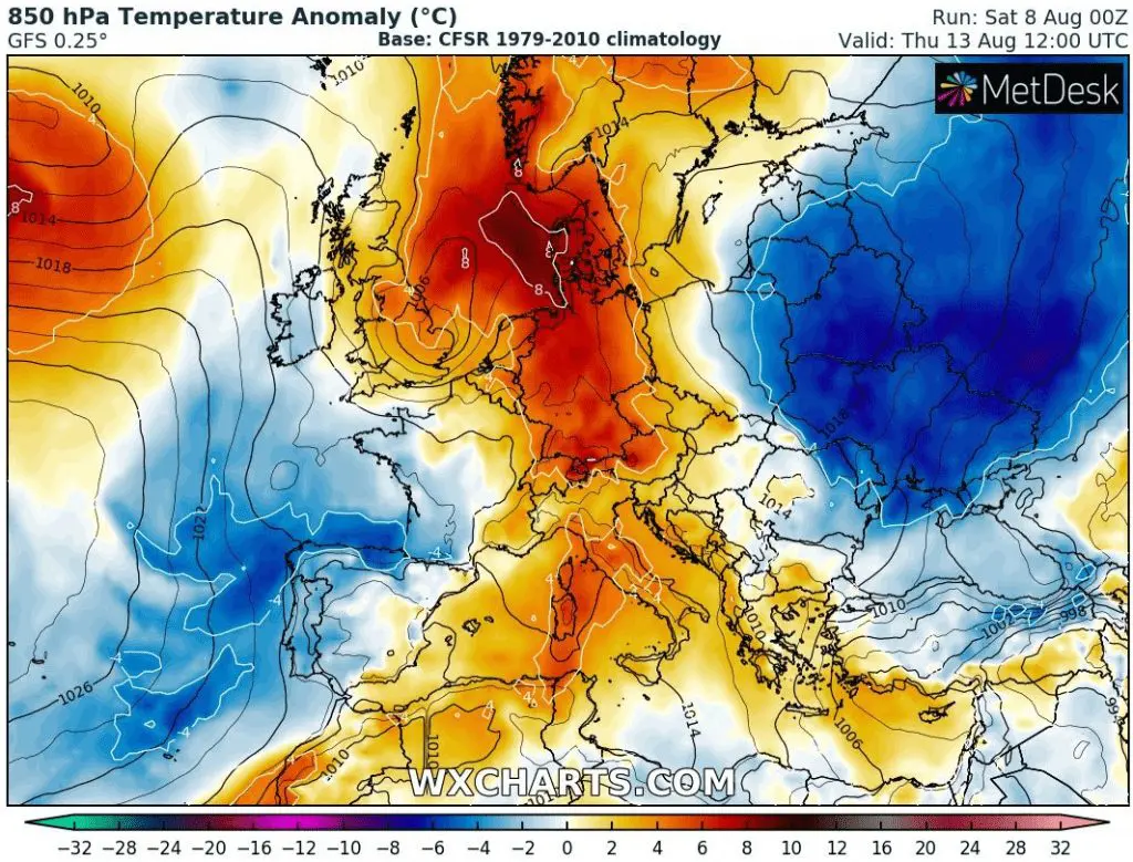
Extremely hot air hit an eastern Europe, NE Balkan and Carpathian region too. Its a relict of July´s heatwave which has stayed here, while over western and southern Balkan severe storms was bringing floods, severe wind gusts and heavy rain. In Ukraine on Friday was measured +38,9°C (Kherson), in Moldova +37,9°C (Tiraspol). in Romania +36,9°C (Buzau) and in Bulgaria +35,0°C (Sliven). In Slovakia was measured +34,0°C on Friday (Jaslovské Bohunice) and in Hungary +33,7°C (Mosonmagyarovar), +35,0°C in Poland (Slubice) and in Czech republic +33,3°C (Doksany) on Saturday.
Andau in Austria reports +34,5°C and Magadino in Switzerland +33,0°C on Saturday.
Tropical air moved above southern Scandinavia, too, in Sweden was measured +31,1°C on Saturday (Malmo) and +30,5°C on Friday (Goteburg). Very hot was in Denmark too, +32,0°C on Friday (Borris) and +31,3°C on Saturday (Brandelev).
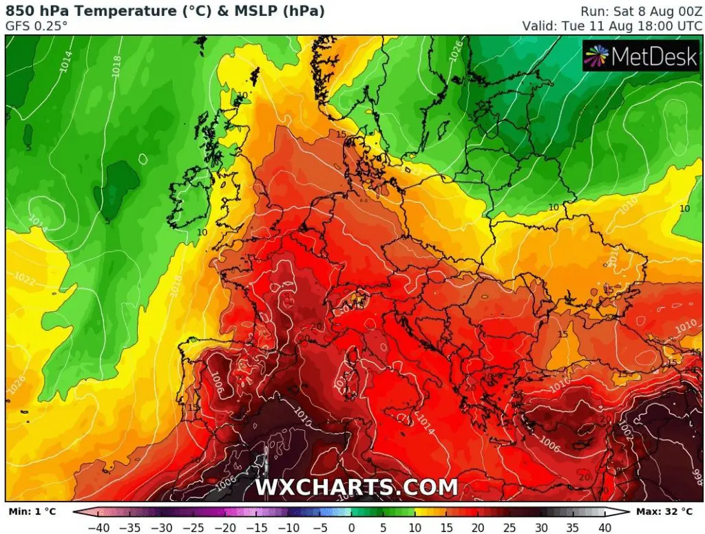
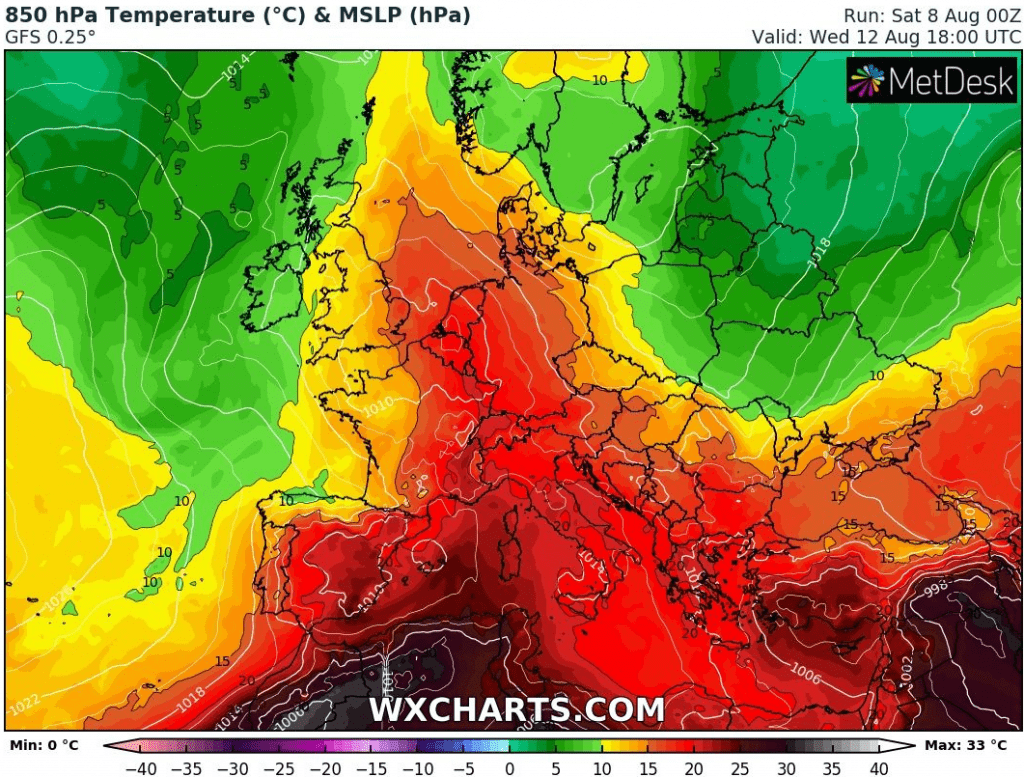
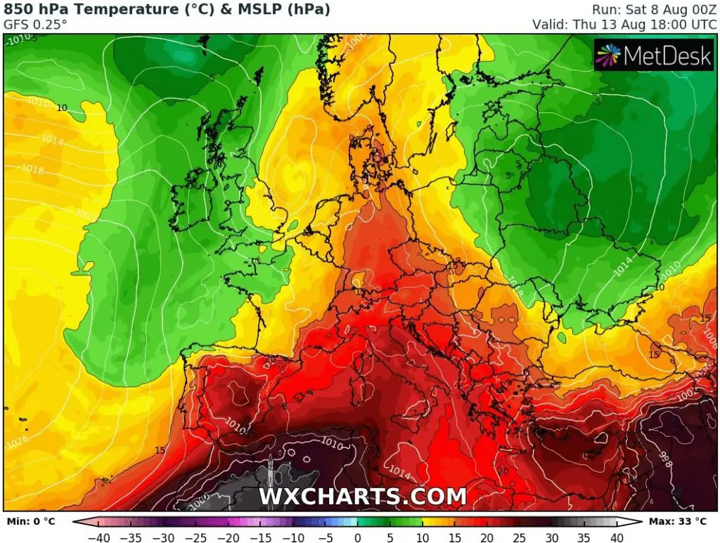
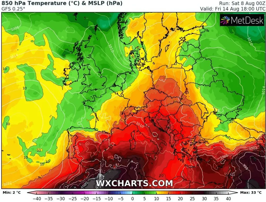
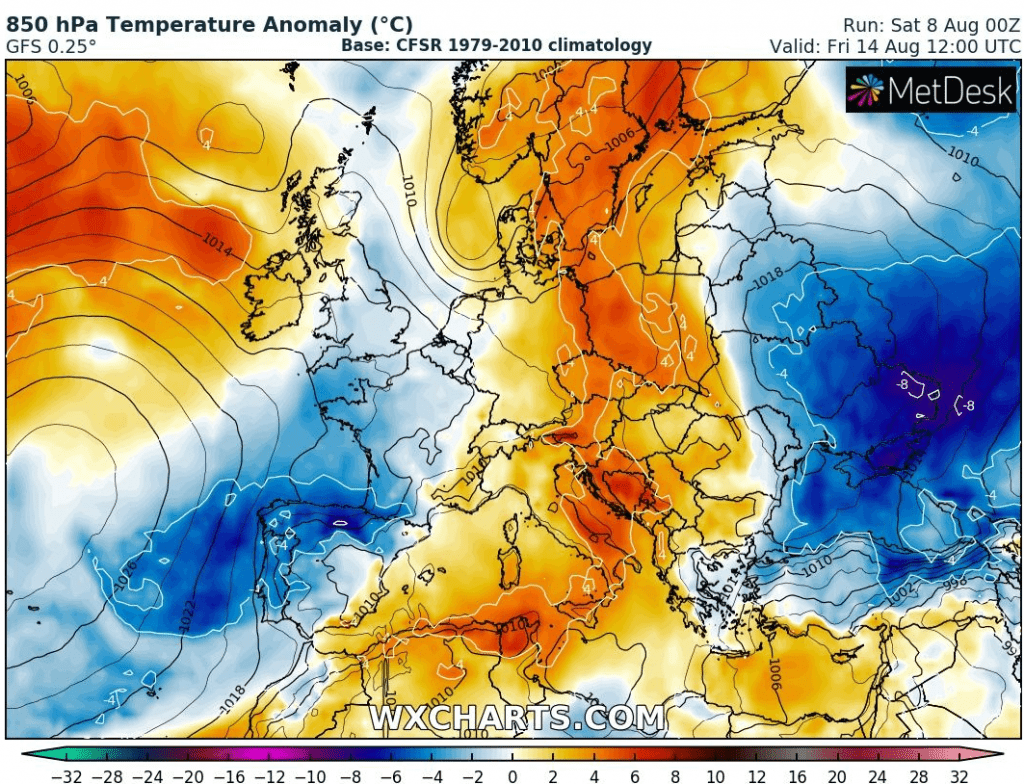
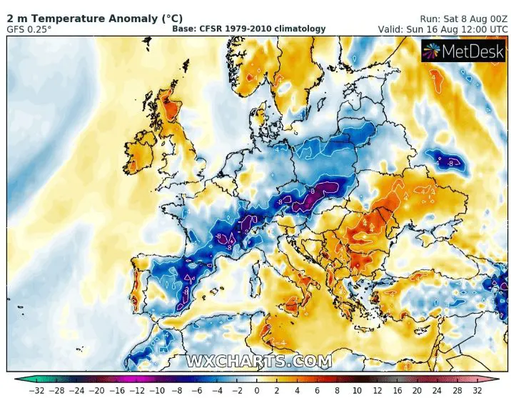
Cold front could arrive sooner, with cooling down effect between 12.-16. August, 16.-22. August colder days, but summer can return yet last August week
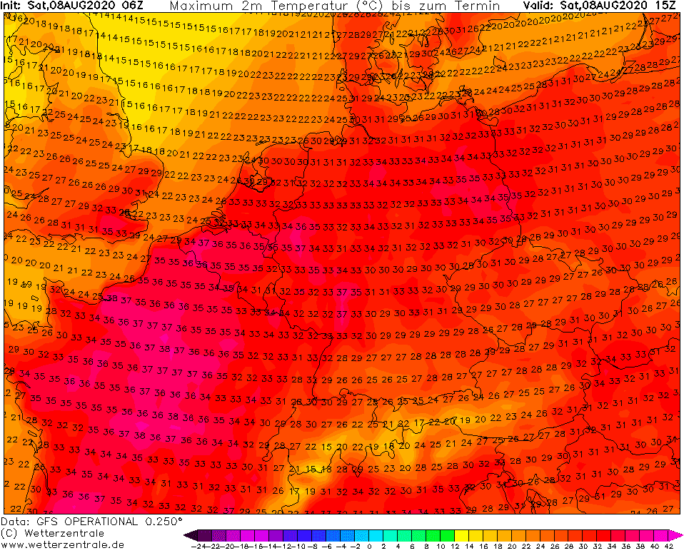
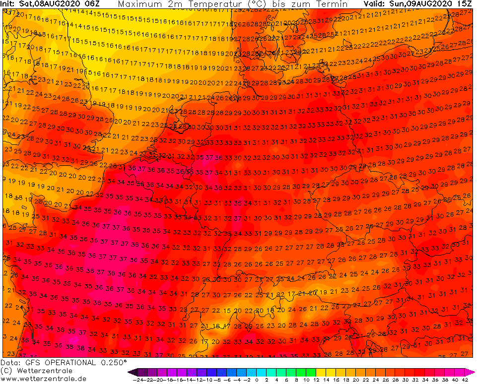
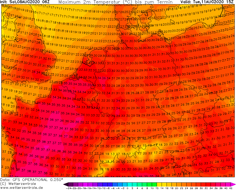
During the next days will be over parts of Europe still anomalously hot. In France +42°C, in Germany and Benelux +38°C, in Poland +37°C, Alpine and Carpathian region +36°C, over Balkan +40°C and over southern Scandinavia up to +33°C is possible. In England, hot spell will produce very rare tropical nights with minimum temperature above +20°C too (during 1961-1990 has London only 8 tropical nights) and up to +36°C is still possible.
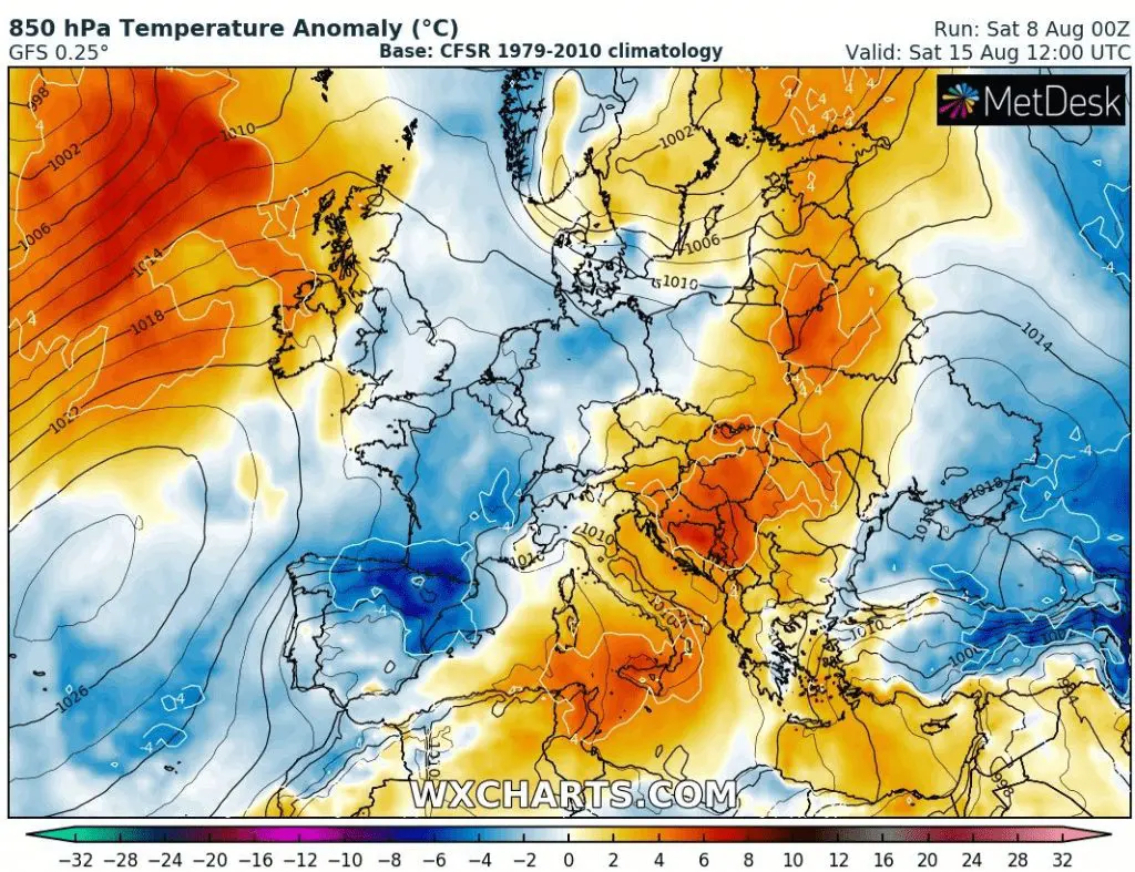
Unfortunately, hot summer weather maybe wont hold over parts of central Europe up to 20. August, but only up to 16. August (over Balkan and eastern Europe longer).
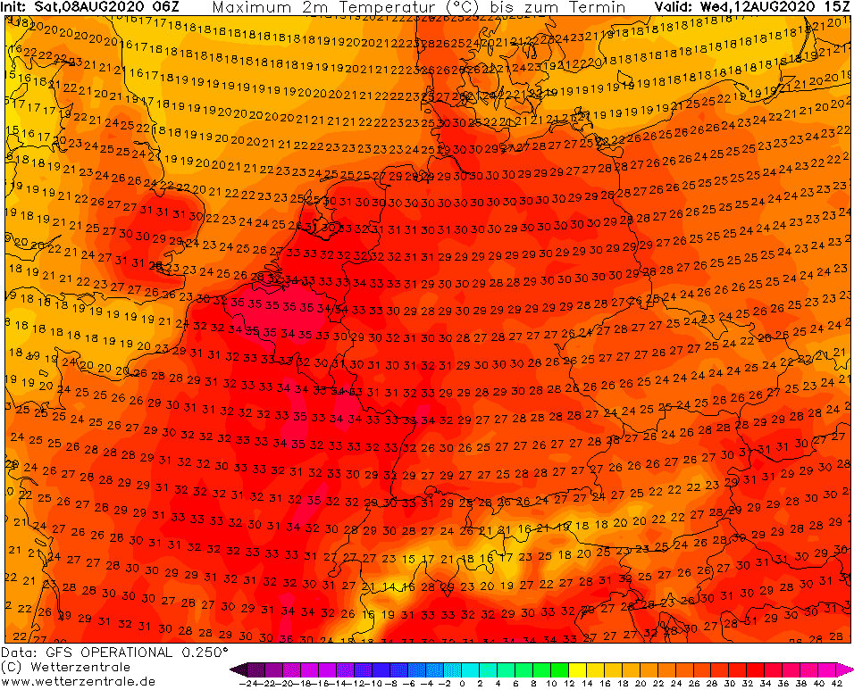
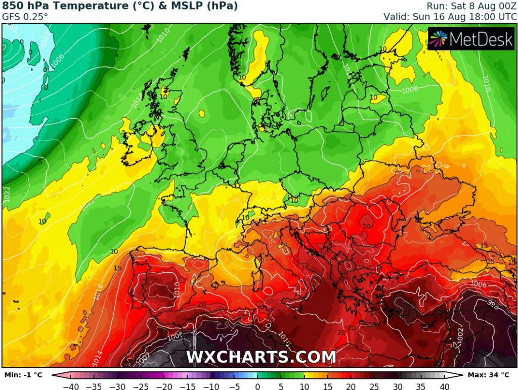
In western France, cold front will arrive already in Wednesday, 12. August and between 12.-16. August, colder air will be moving eastward over Central Europe. Eastern part of Central Europe will have tropical days on 16. August, yet. Then, heatwaves will shift over Balkan.
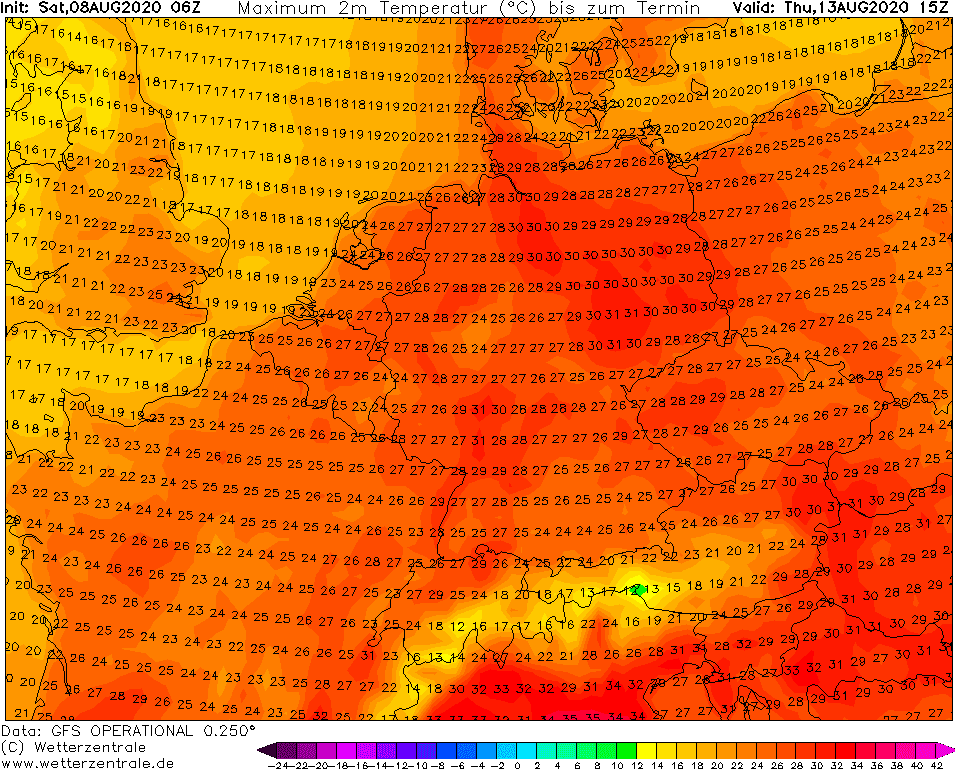
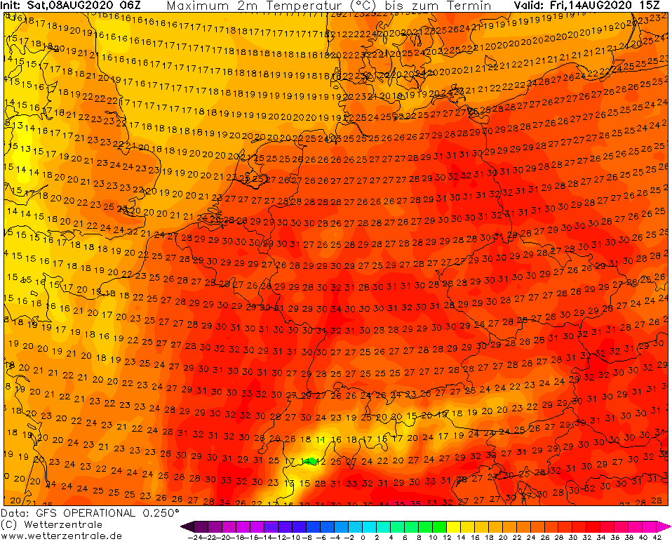
Between 16.-22. August is waiting us a colder weather with possible storms, showers or fresh mornings, but good news is, that during the last week of August 2020, could return hot, tropical weather, yet (days which are not seen in GFS outputs yet). Although not so extremely hot as these days, but summer wont be ending, yet.
Animations of pressure+precipitation / temperature anomaly of air mass / temperature in 850 hPa for 8.-23. August 2020
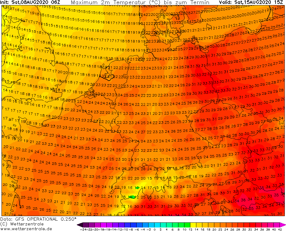
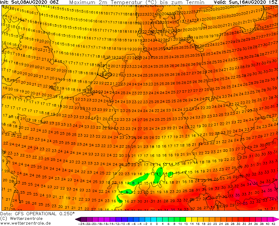
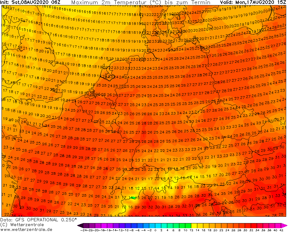
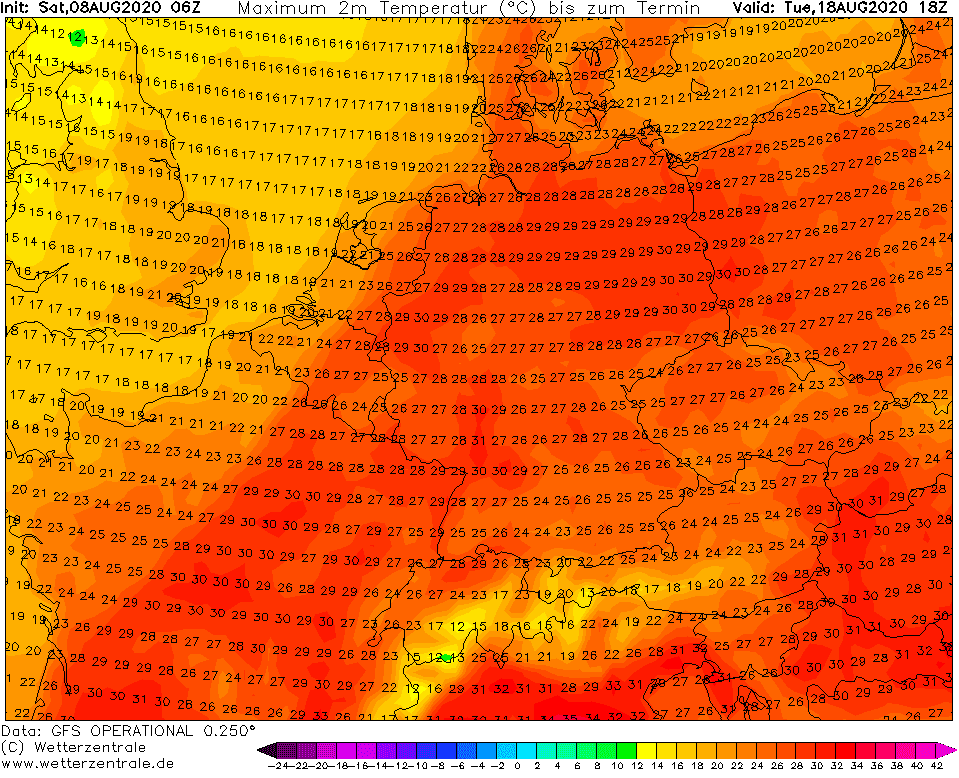
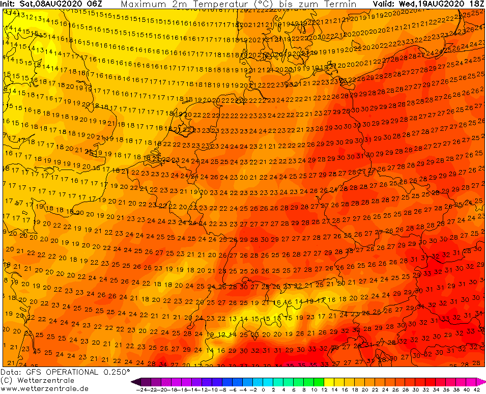
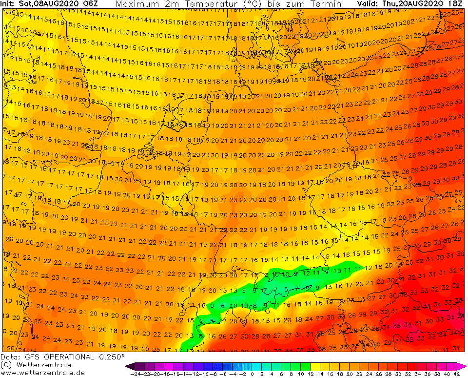
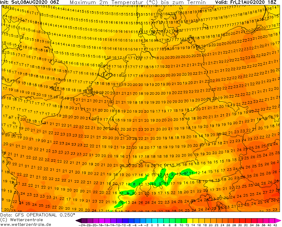
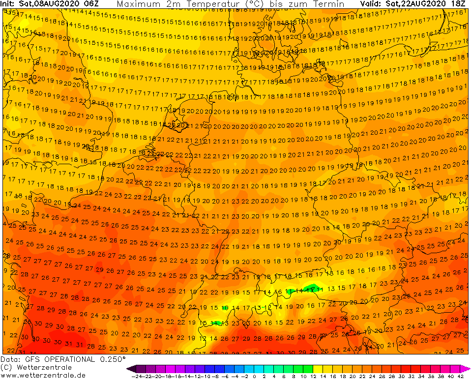
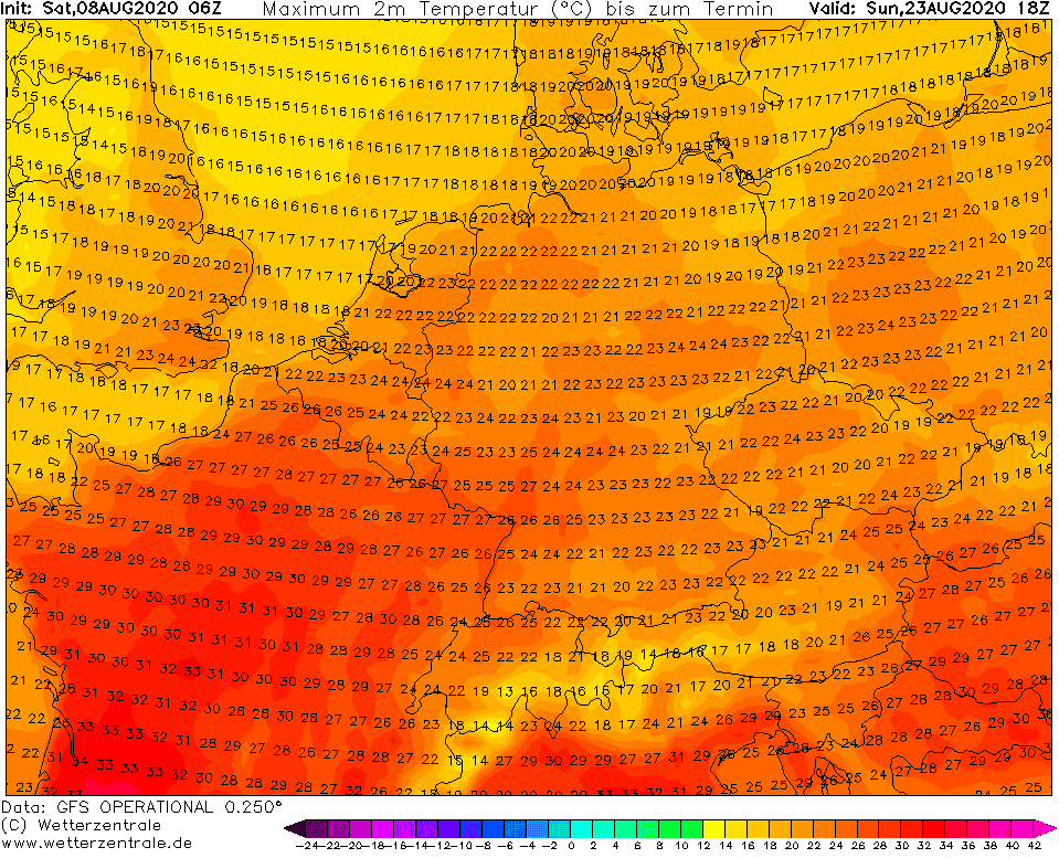
Predicted maximum temperatures over Europe for 8.-23. August 2020 according to GFS (note: its needed cca 2 degrees to add to get possible absolute maximum temperature in your country):

Measured and predicted temperatures over West Europe according to Meteociel.fr and Meteo France:


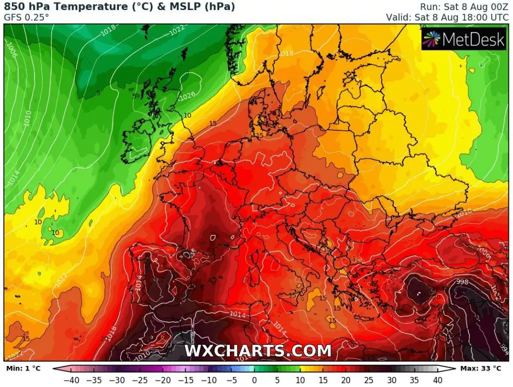
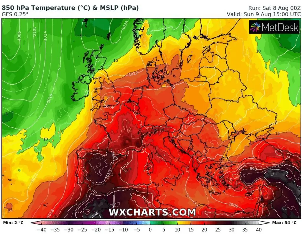
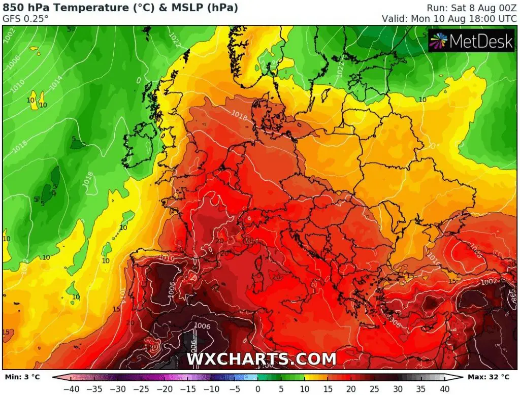
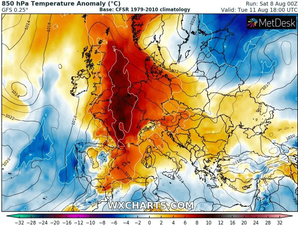
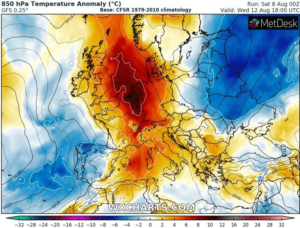
T850 hPa and its anomaly during the period 8.-16. August 2020 over Europe:


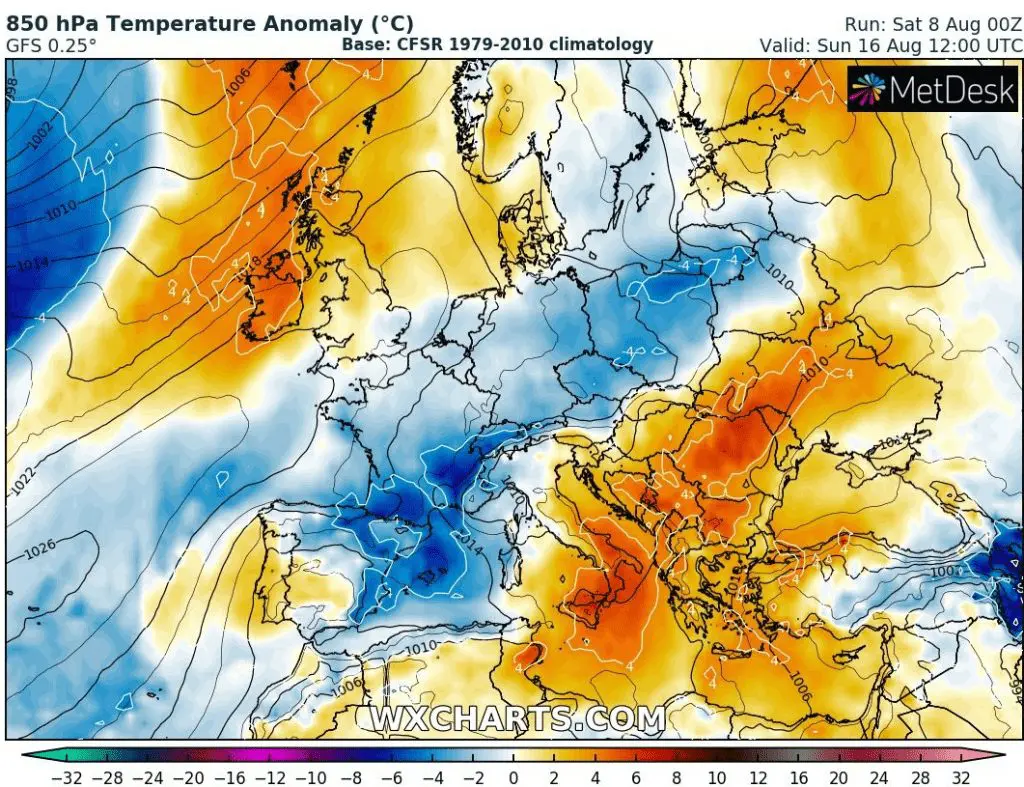
Possible temperature anomaly in 2 metres on 16. August 2020, after arrival of cold front:
Accumulated precipitation totals for the period 8.-23. August 2020 in Europe:
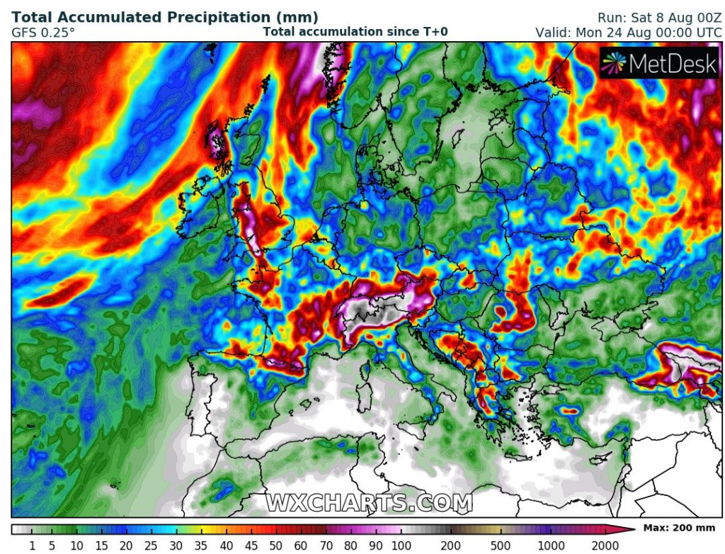

Illustration photo: https://wallpapershd.info/download/wallpaper-silhouette-red-sun-bird-sunset-1584262084/3840×2400


