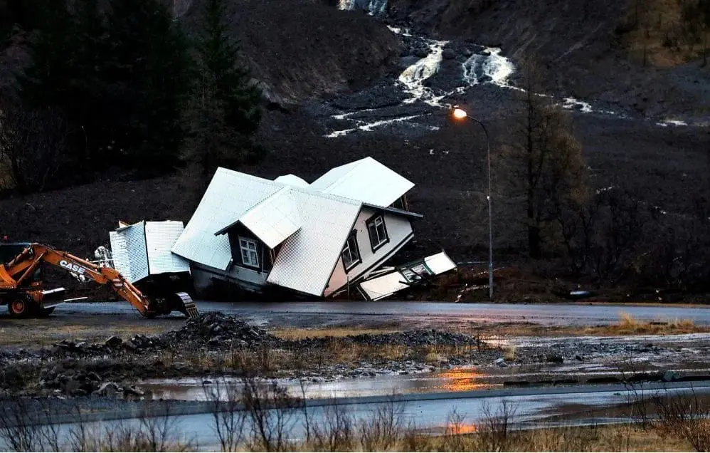
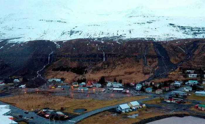
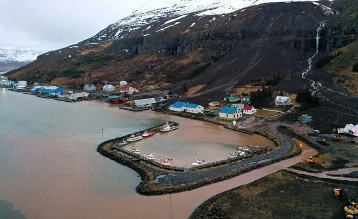
Iceland with the highest rainfall ever: 570 mm / 5 days with result of landslide disaster in Seyðisfjörður
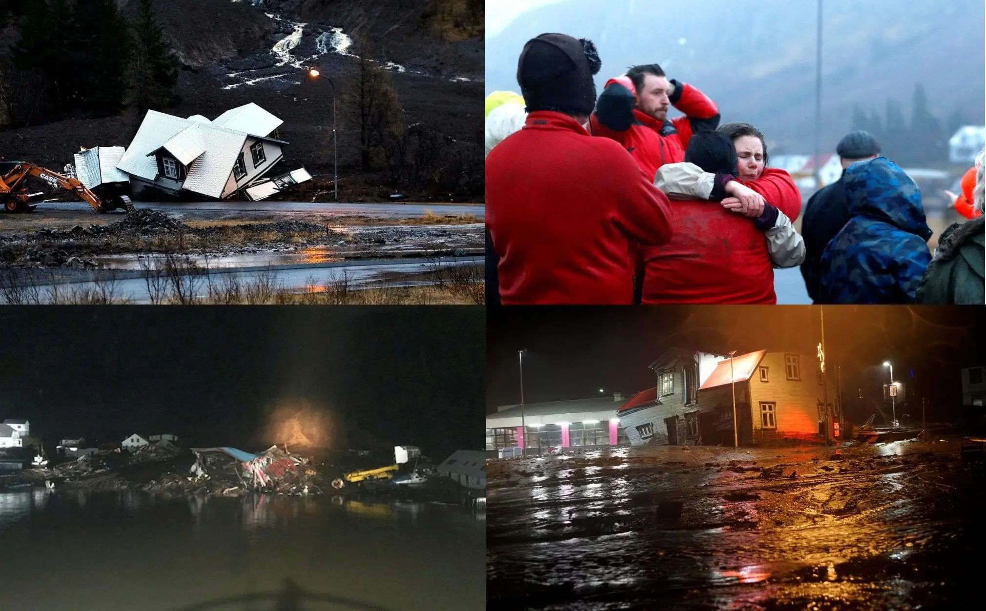
According to the Icelandic Met Office, tells mbl.is, the precipitation in Seyðisfjörður between 14.-18. December 2020 is the most recorded during a five-day period in Iceland, ever. It amounts to 570 mm (22.44 inches). By comparison, average annual precipitation in Reykjavik is 860 mm (33.86 inches) /https://icelandmonitor.mbl.is/news/news/2020/12/20/pictures_of_damage_done_by_landslides//.
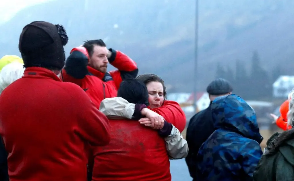
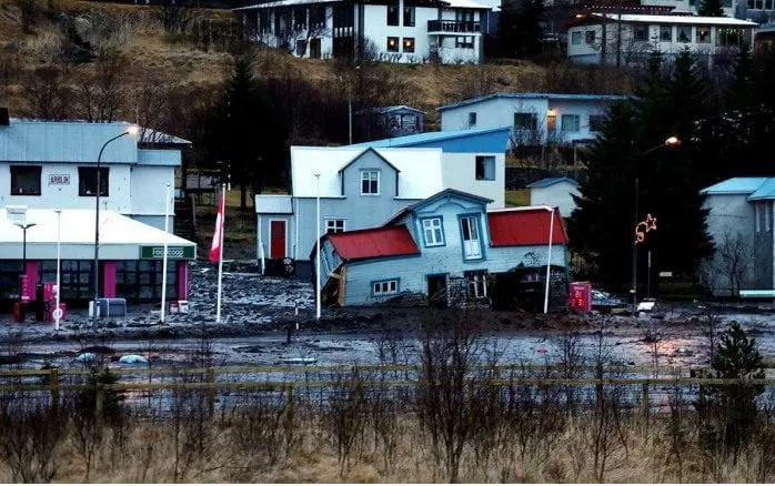
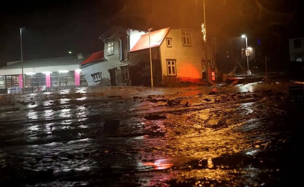
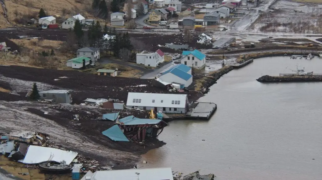
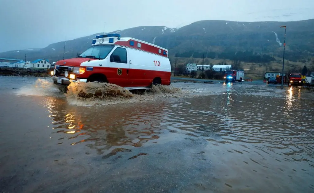
Most Seyðisfjörður residents, or 581, were evacuated from their homes after the strongest landslides on Friday, 18. December 2020. The mudslides moreover knocked out power to some parts of Seyðisfjörður /https://www.icelandreview.com/society/seydisfjordur-mudslides-hundreds-displaced-hope-to-return-by-christmas//.
Nearly 300 of 659 inhabitants cannot return to their homes as of yet.
Before heavy rains and forecasted floods or landslide previously had warned Severe Weather Europe.
Iceland hit before a Christmas 2020 series of heavy rains thanks to cyclonic weather, which later shifted over western and southwestern Europe /https://mkweather.com/2020/12/21/dramatic-floods-in-the-uk-and-heavy-rains-winds-in-western-europe-forecast/; https://mkweather.com/2020/12/23/spain-with-expected-winter-conditions-heavy-rains-floods-frosts-and-snow-videos-floods-in-barcelona-valencia-region//.
After shift of deep pressure systems above continental Europe during Christmas 2020, powerful cooldown is expected in many parts of Europe /https://mkweather.com/2020/12/20/europe-christmas-2020-and-new-year-2021-forecast-all-europe-under-the-snow-soon-severe-christmas-cooldown-and-heavy-forsts-during-new-year-celebrations//.
Thanks to anomalous blocking circulation, Iceland expects soon sunny anticyclonic, while many parts of Europe and Mediterranean anticyclonic weather next month (until 22. January 2021) /https://mkweather.com/2020/12/22/january-2021-forecast-for-the-world-from-ecmwf//.
In Siberia, anticyclonic blocking weather should bring one of the heaviest frosts for last years /https://mkweather.com/2020/12/23/extreme-blizzard-in-japan-big-photogallery-and-65c-frosts-in-siberia-thanks-to-extreme-blocking-pattern-expected//.
After 22. January 2021, probably up to the end of winter 2021, will return over Iceland bad, cyclonic weather, with next floods and landslides risk thanks to transition to strong NAO+ phase /https://mkweather.com/2020/12/22/january-2021-forecast-for-the-world-from-ecmwf//.

Infographics: