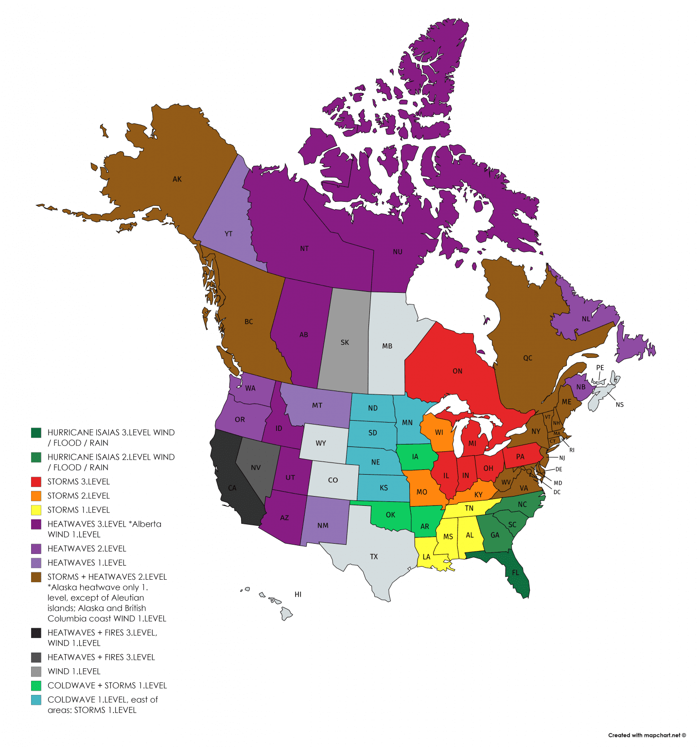
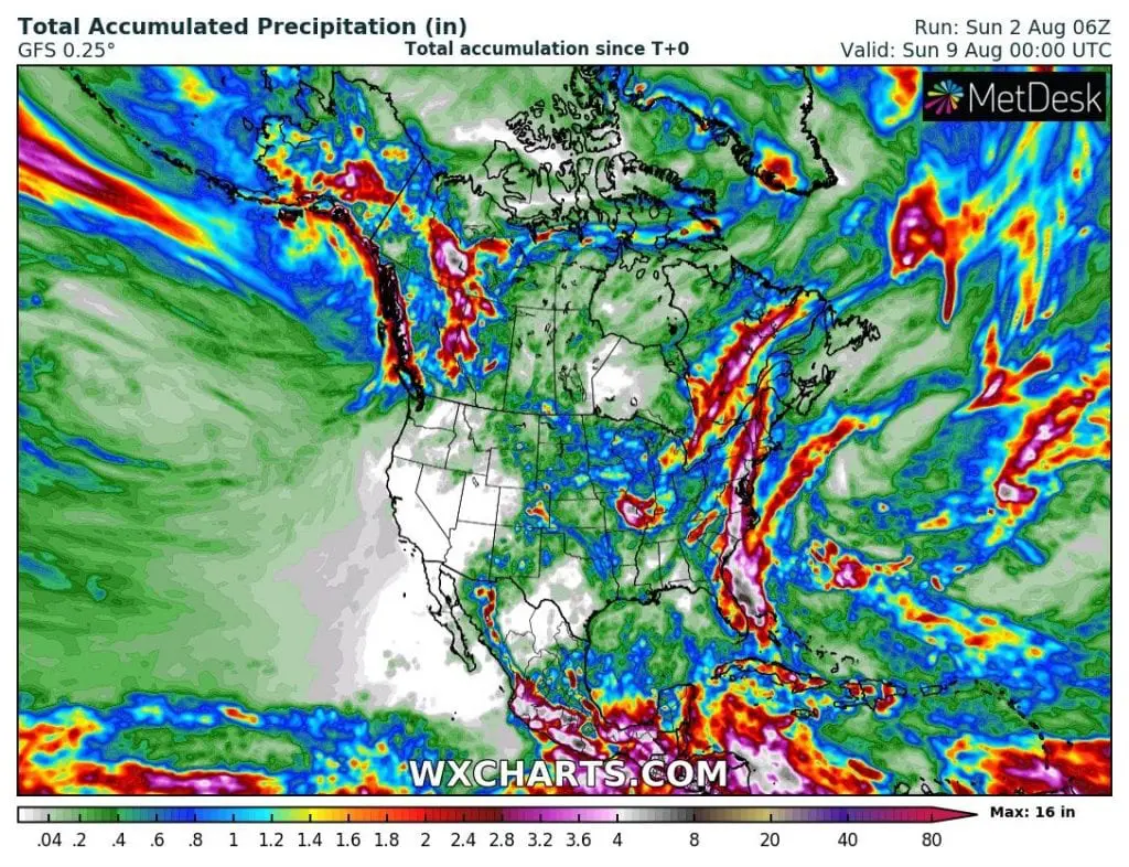
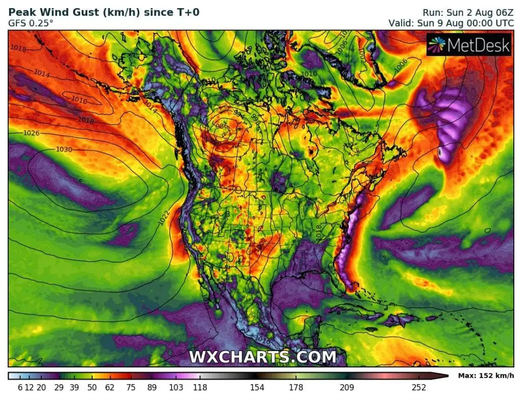
Hurricane Isaias reached 1st category, before arrival above Florida and then weakened to tropical storm. However, after return over the Atlantic ocean, it could become a hurricane again. It will hit a whole East Coast and Northeast – a center of storm will be copy the coastal line during next days, till Thursday. GFS model expects maximum precipitation amount 16 inches (406 mm) above the ocean near Florida and wind gusts up to 95 mph / 152 kmh above East Coast area during next 7 days.
Isaias is not only about potential floods in wide-spread area from Florida to Quebec, but too about a coldwave, which will cause during the next period in Midwest and all eastern half of the US and Canada. There are temperatures deeply below normal in area expected with only weak chance to storms. On the contrary, west of continent will be extremely hot during the all 16-day outlook.
Above Atlantic, next tropical depression is evolving /https://www.accuweather.com/en/hurricane/tropical-depression-ten-joins-hurricaneisaias-in-atlantic/786385/, but its possible impact on circulation above US and Canada won´t appear so large as impact thanks to Isaias.
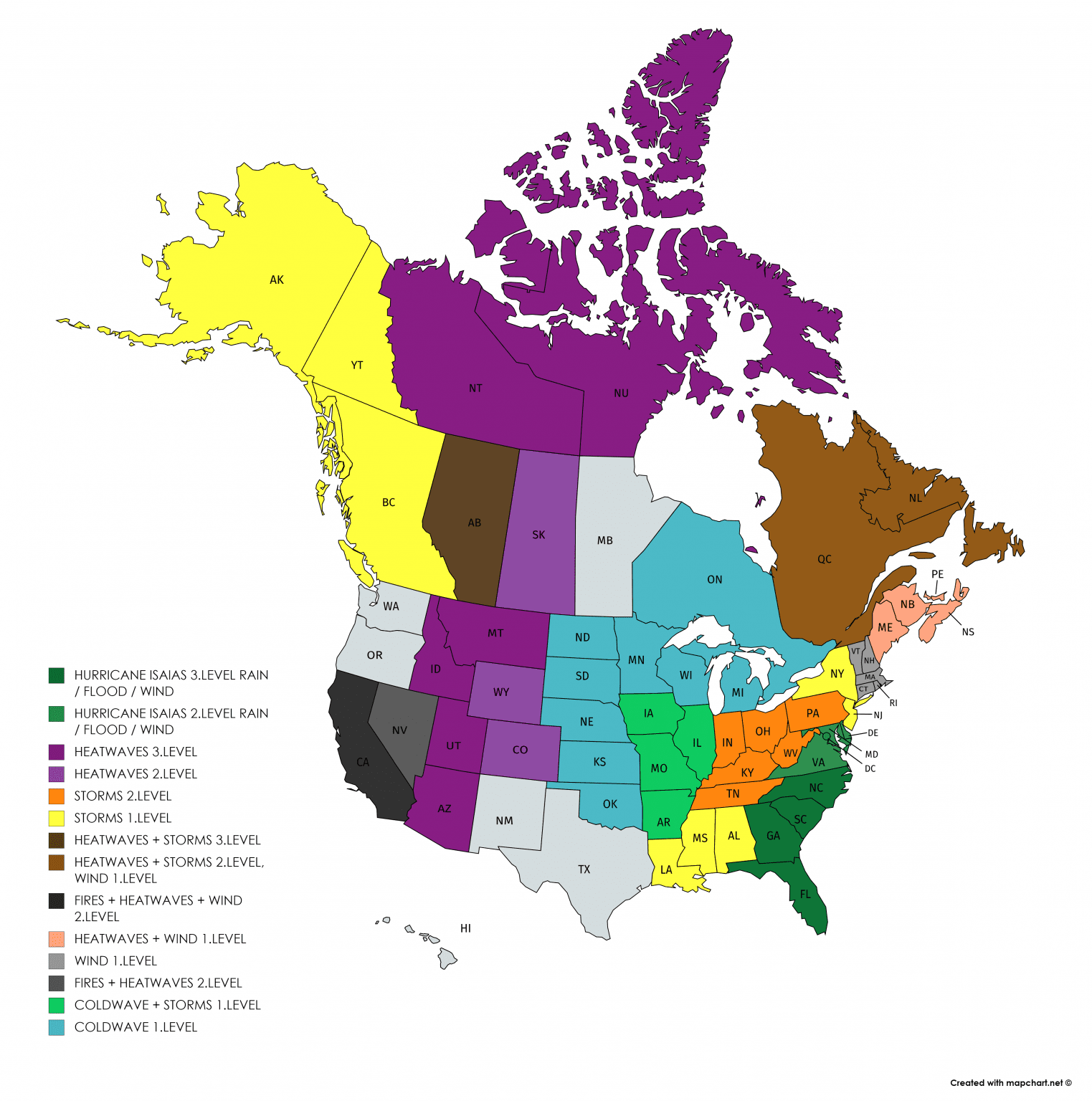
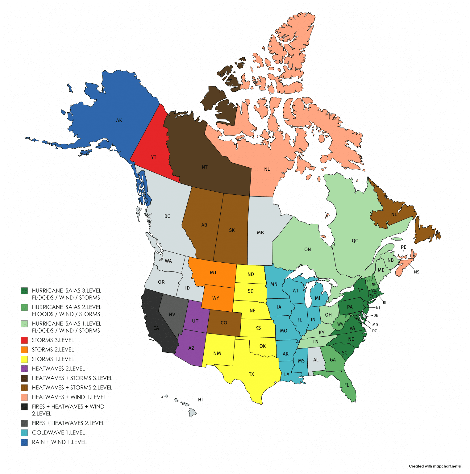
Gradually, a heatwaves will spread over all continent again, with new big, this time August 2020 heatwaves, with next tropical days and severe storm potential across large part of North America. Look the next 16-days animations below 3-day warnings.
Warnings Mkweather for SUN-MON-TUE 2.-4. August 2020