There are already available detailed outputs of air pressure, temperature and precipitation within ECMWF forecasts for January 2021 for the World /https://www.ecmwf.int/en/forecasts/charts/ and too outputs of circulation regimes (for January and the first half of the year 2021) and tropical storms activity (until 17. January and the first half of the year 2021), therefore we should look at them, individually, continent after continent.
Europe: Peak of Winter 2020/2021 already between 31.12.2020 – 22.1.2021!
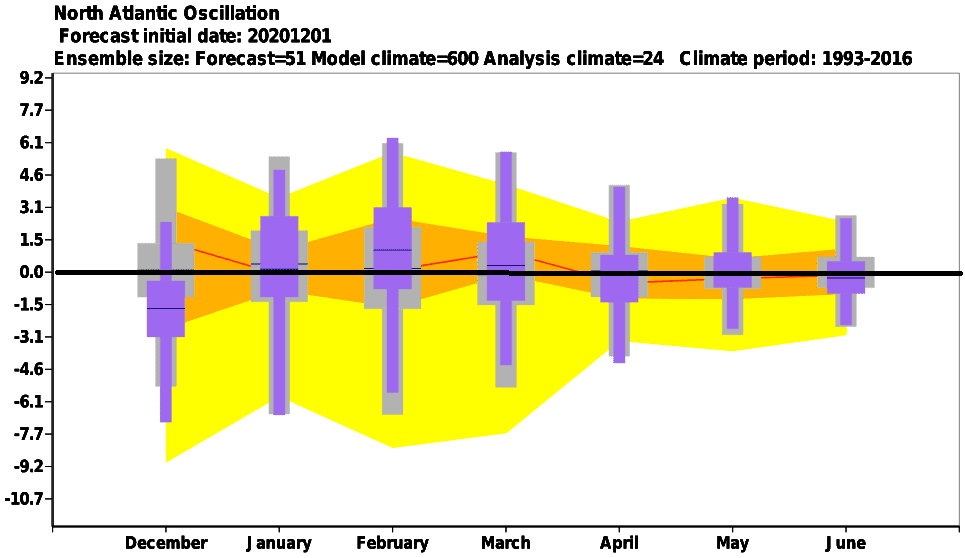
Expected atmospheric blocking and NAO- phase between 31. December 2020 and 22. January 2021 should mean, that peak of Winter 2020/2021 should hit Europe already during next month.
Currently, SSW (Sudden Stratospheric Warming) has started and gradually, cold air floods Europe mainly during the first decade of January 2021, with extremely high pressure over northern Atlantic and Siberia and anomalous low pressure above Mediterranean, what is appropriate circulation regime for severe cold blasts and snowing.
Between 15. January and 5. February is expected increase of NAO index, gradually with warm conditions across Europe, for a time should be extremely warm and almost such as during the spring.
In February 2021 should surprise Europe even warmer weather, with strong NAO+ /Mkweather forecasts from the Summer 2020 had true: https://mkweather.com/2020/07/29/first-forecast-for-winter-2020-21-early-powerful-coldwaves-nov-dec-then-weakening-of-cold-pattern-and-warm-jan-feb-mar/ and next updates, too: https://mkweather.com/2020/09/24/updated-forecast-for-winter-2020-21-still-nao-ao-in-first-half-of-winter-nao-ao-in-second-half-of-winter-permanent-la-nina-and-surprisingly-easterly-qbo-possible/; https://mkweather.com/2020/11/24/winter-forecast-2020-2021-final-outlook// – February near this circulation should be very to extremely warm, with spring maximum temperatures during sunny periods, but morning frosts.
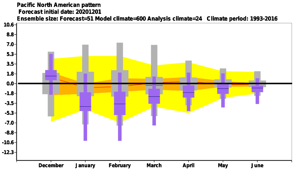
North America: Warm, warm and warm!
USA and Canada should have the strongest frosts and blizzards of the Winter 2020/2021 already behind them (or shortly before), because only the start of the year 2021 should be regionally cold, then all January 2021 is expected to be very warm, with absence of extremely Arctic air masses over this North-Hemispheric sector.
Warm weather will be a result of combination of NAO-, La nina and PNA- patterns.
Mexico should be warm, but its western coast will be colder thanks to La nina, Caribbean with neutral to warm conditions.
Southern USA and northern Mexico and Caribbean will be very dry, while western coast of Alaska, British Columbia, Washington state and Oregon extremely rainy, with persisting floods.
Only Alaska should alive really cold peak of Winter 2020/2021.
Asia: Strong frosts in Siberia in early January 2021, from Middle East to northern India possible floods, in SE Asia tropical threat
Blocking high and NAO- (and AO-) over northern and mid-latitudes should cause extremely storng frosts in parts of Siberia and continental and Eastern Asia mainly during the first half of January 2021.
NAO- phase should be associated with increased risk of storms and floods in region from Middle East (mainly northern half) up to northern India.
Tropical threats are expected in SE Asia – thanks to La nina and wet MJO.
South America: Strongly under La nina effect
In Southern America, typical La nina summer circulation pattern is expected during January 2021.
It means cold north and western coast, stormy north and Amazonia and possible drought in central Brazil, while Argentina, La Plata region and southern Brazil should experience with next severe storm round thanks to powerful heatwaves.
Australia: colder and stormy peak of Summer 2020/2021, tropical threats in Northwest
Australia will be thanks to expected La nina and wet MJO very stormy in northern and eastern half, with expected tropical threats in northern and western regions. However, severe storms are expected in eastern parts of the continent, too.
Only South Australia should be very hot with extreme heatwaves and wildfires, far away from tropical activity.
New Zealand expects hot, anticyclonic, but for a time too stormy January 2021.
Weather regimes in Oceania will behave mainly according to leading La nina pattern.
Africa: Northern Africa with cold and stormy NAO- first half of January 2020, continent mostly stormy and hot
Northern Africa will profit from NAO- and blocking regimes above Northern Atlantic, Europe and Asia, with possible cold blasts, rains and snow in the mountains mainly during the first half of January 2021 – with an expected peak of Winter 2020/2021.
Above a continent, low pressure and warm, only in the south colder weather is expected, only in southern subequatorial zone and Eastern Africa should be dry.
Warm weather during the second half of January will return over northern coast of Africa, too, thanks to expected NAO+.

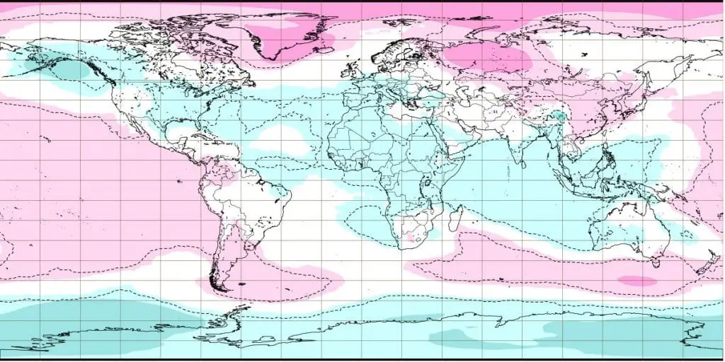
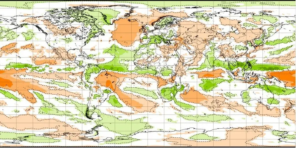
Air pressure anomalies for weeks between 28.12. 2020 – 1.2.2021
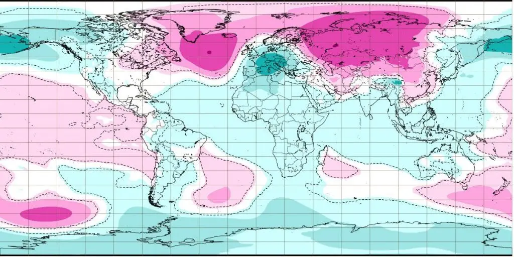
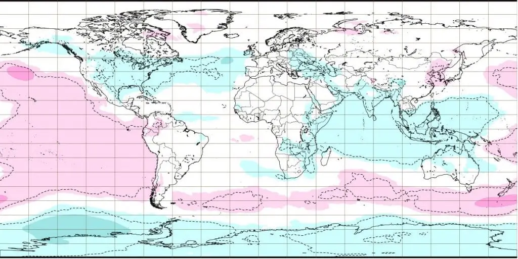
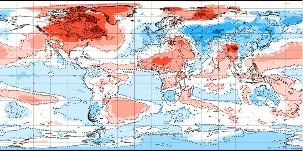
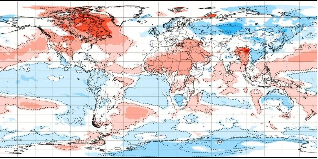
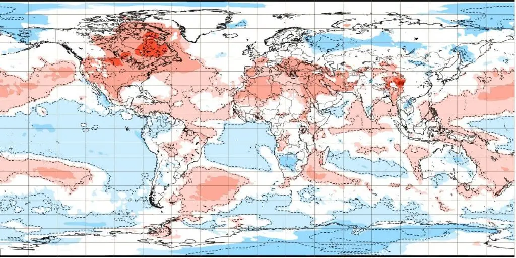
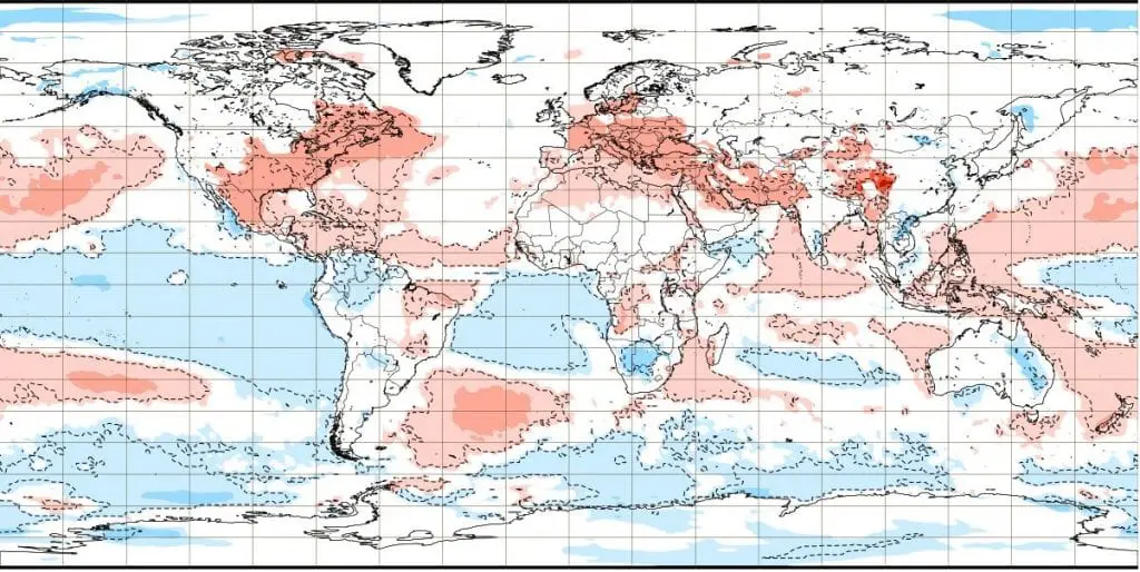
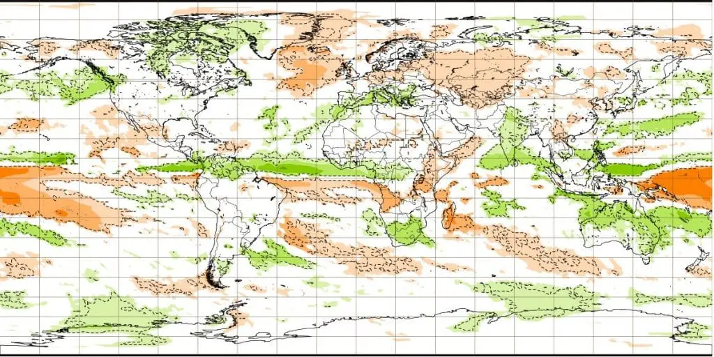
Temperature anomalies for weeks between 28.12. 2020 – 1.2.2021
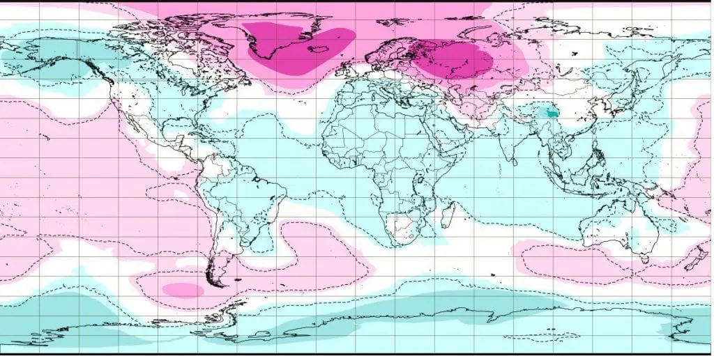
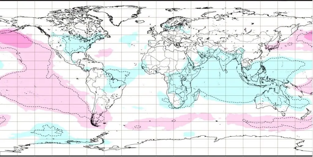
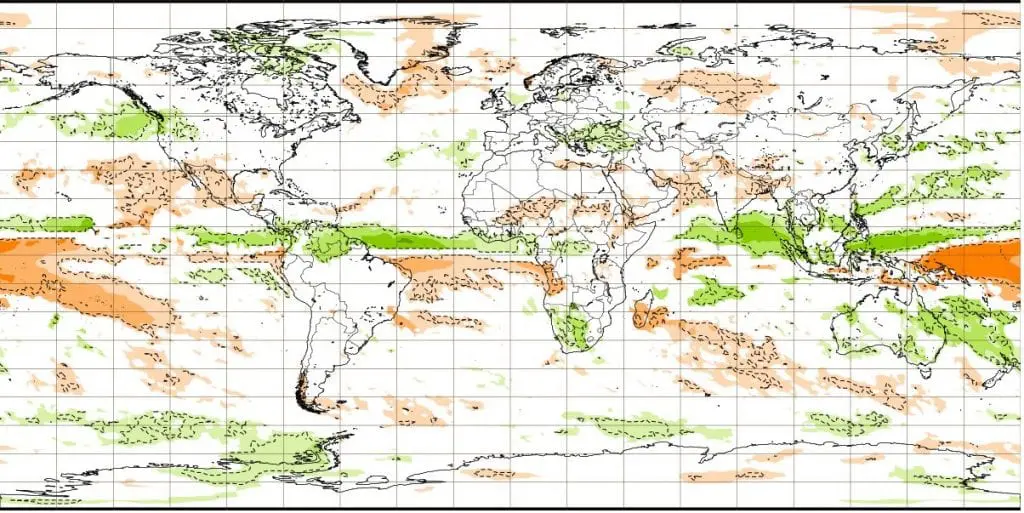
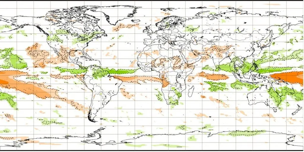
Precipitation anomalies for weeks between 28.12. 2020 – 1.2.2021
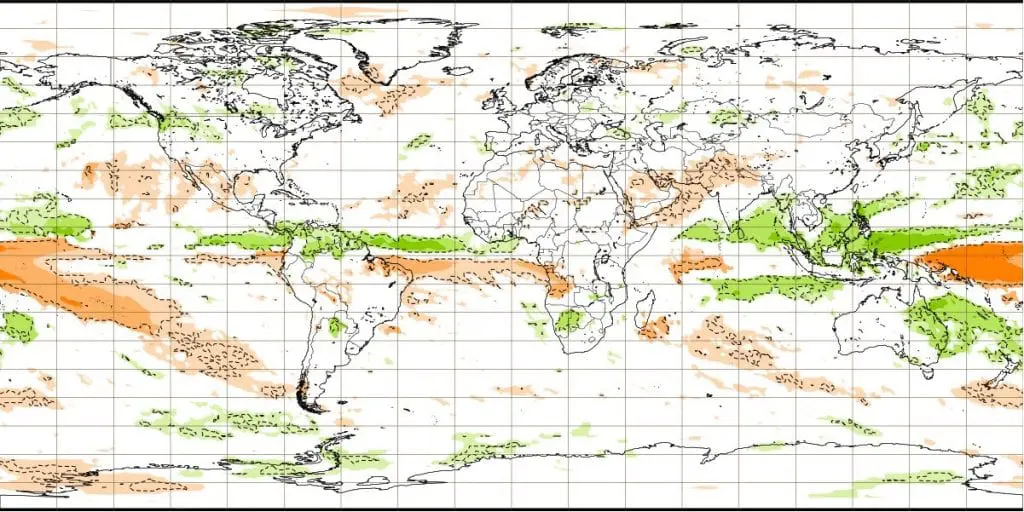
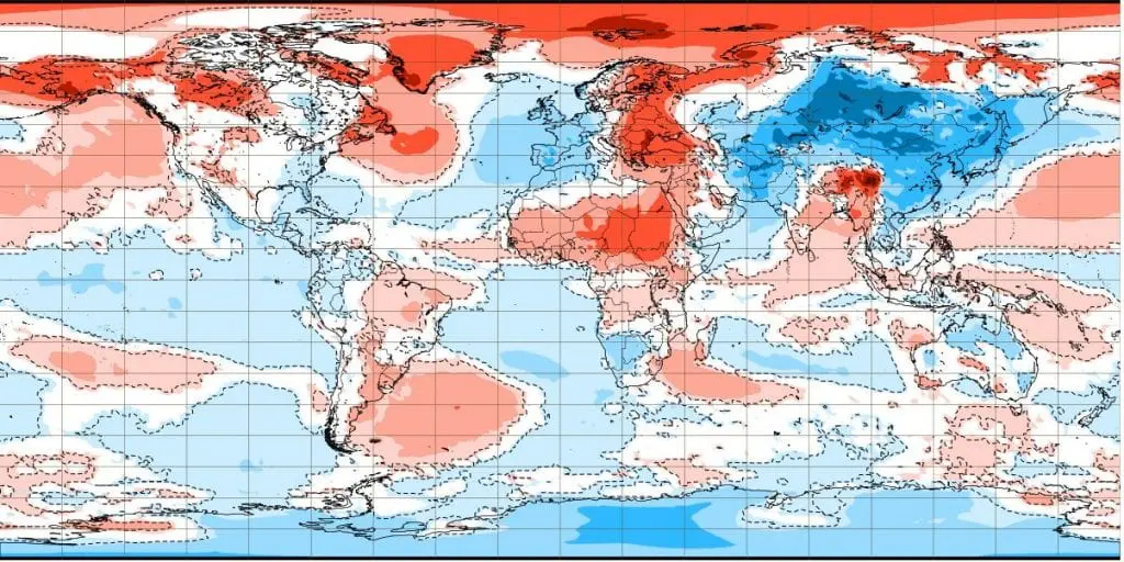
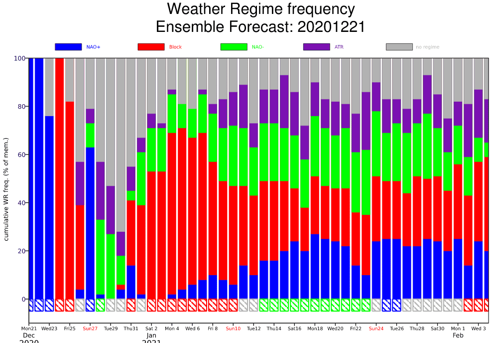
Circulation regimes
Tropical cyclones until 17. January and outlook for first half of the year 2021


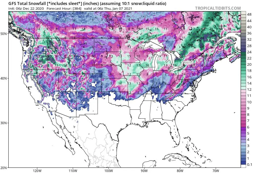
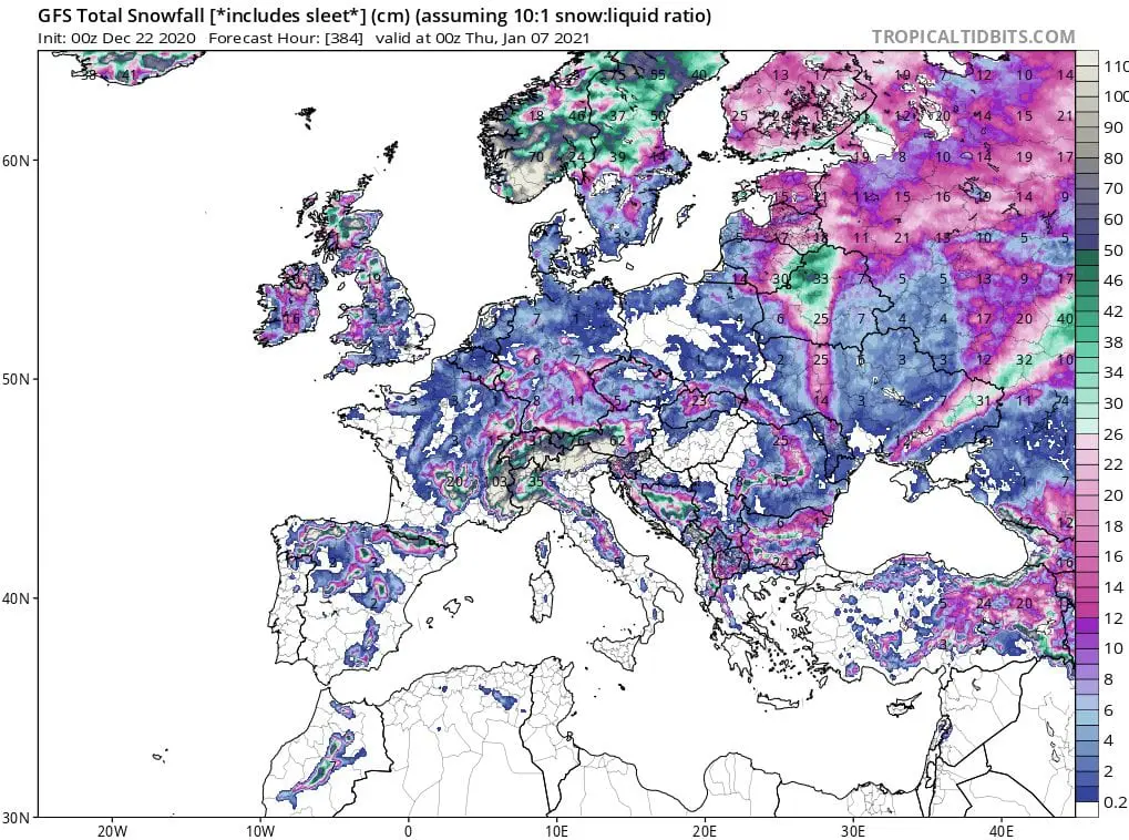
Expected snowfall until 7. January 2021 /tropicaltidbits.com/GFS