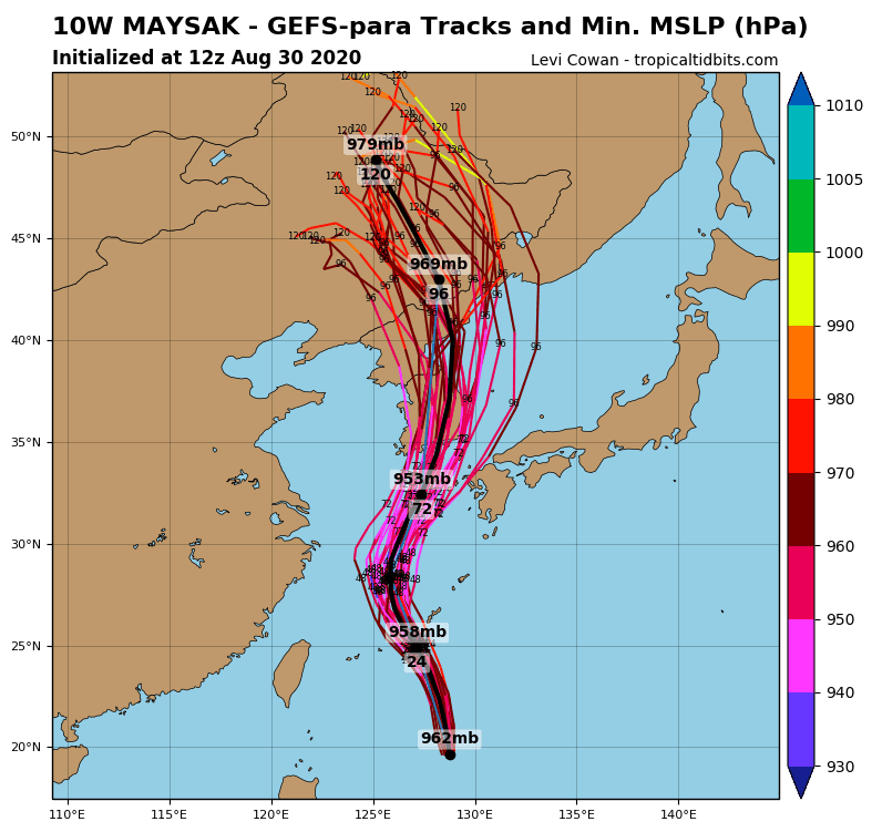
Japan hits next tropical storm from southeast after typhoon Maysak (Atlantic Cat 4 equivalent, Wednesday) on Sunday
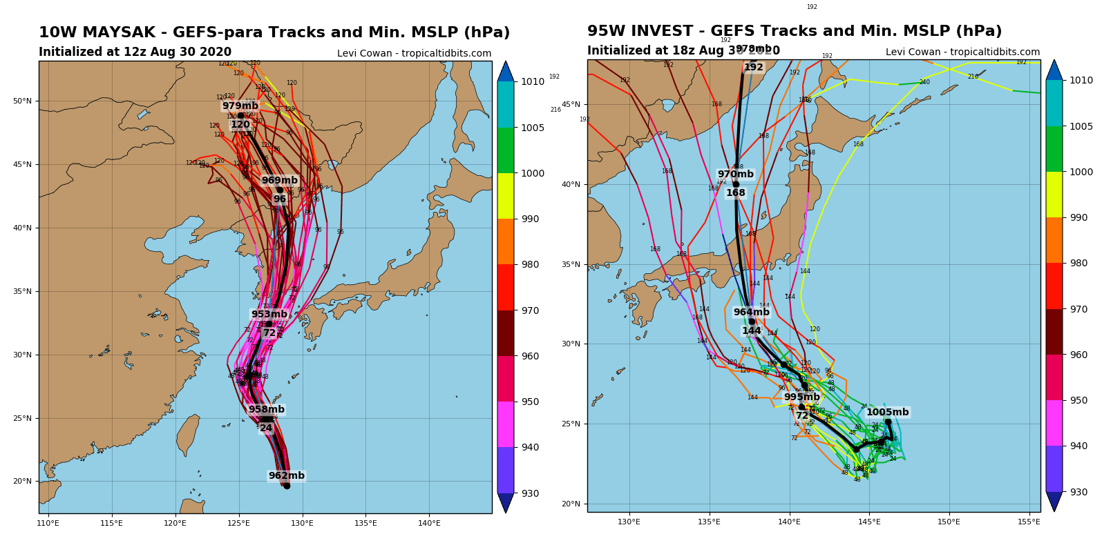
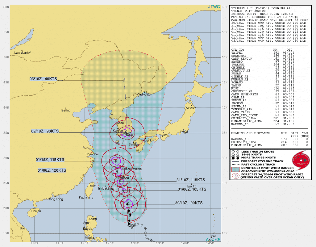
Further strengthening is expected and Typhoon Maysak is forecast to reach peak intensity on Monday with winds of about 220km/h (140 mph) with significantly higher gusts.
This would make it equivalent to a Category 4 Atlantic hurricane on the Saffir-Simpson scale.
The system will then cross the Ryukyu Islands with the winds only slowly easing down as it moves through the East China Sea.
Typhoon Maysak is expected to hit South Korea at approximately 3am on Wednesday (18:00GMT Tuesday) with possible power of equivalent to a Category 3 major hurricane in South Korea, near Busan.
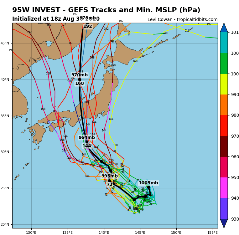
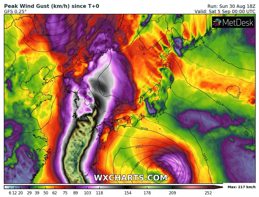
Expect of Maysak, next tropical storm is developing southeastward from Japan. System hits Japan according to forecasts on Sunday, 6. September 2020.
Tropical storm Inwest 95W could bring significant rainfall to Japan on Sunday and Monday 6-7. September 2020 to densely populated areas. Wind gusts won´t be so severe as near Maysak, but could cause problems in coastal areas.
Last week, Typhoon Bavi, the strongest typhoon of the year so far with sustained winds of 155km/h (96 mph), struck the western side of South Korea before going on to cause damage in North Korea on Thursday.
Infographics: tropicaltidbits.com, wxcharts.com

Sources:
https://tropicaltidbits.com/storminfo/#95W
https://tropicaltidbits.com/storminfo/#10W


