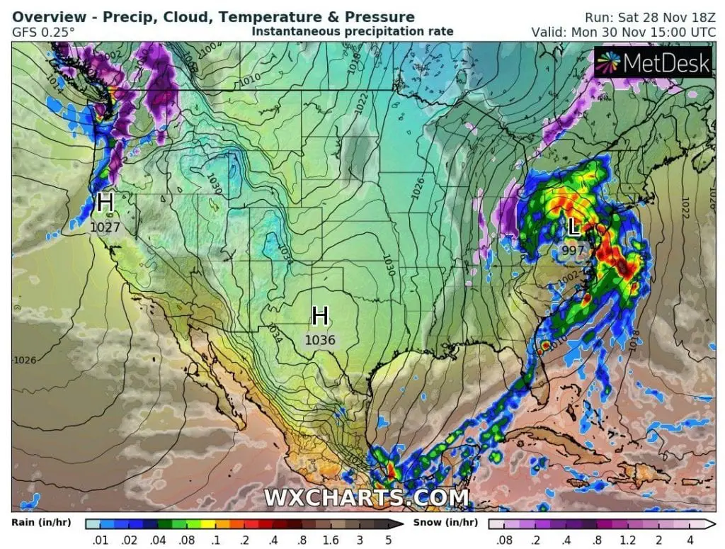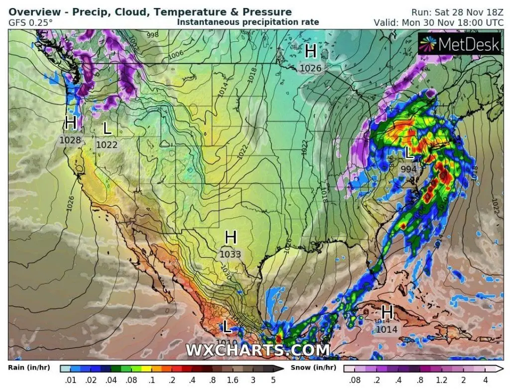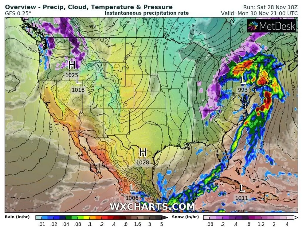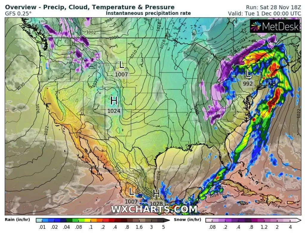
Severe storms are already shifting above southern and southeastern USA northeastward and already next 4, days, they will go through all eastern coast including Mid-Atlantic, Northeast, eastern Midwest, Great Lakes region and parts of Ontario and Quebec, with peak in Northeast around Monday 30. November – Tuesday 1. December 2020.
Storms will have possible destructive character /https://mkweather.com/2020/11/26/extreme-storm-hits-northeast-on-30-november-1-december-2020// with severe wind gusts up to 120 km/h on the Northeast coast and heavy rains should cause regional floods.
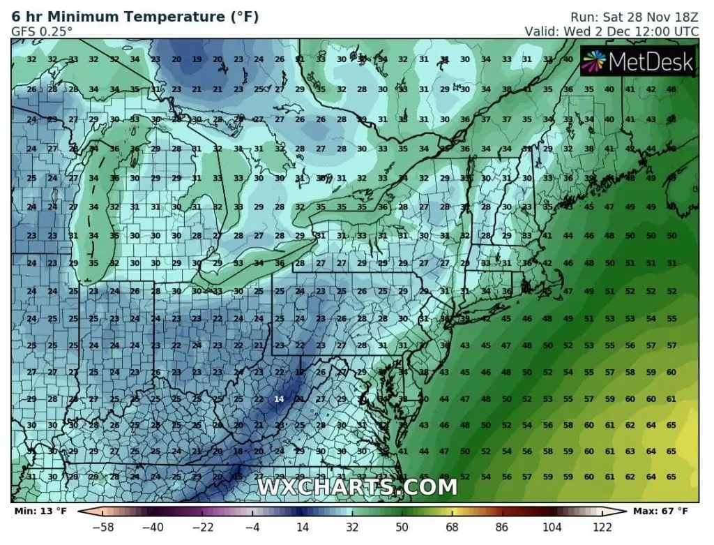
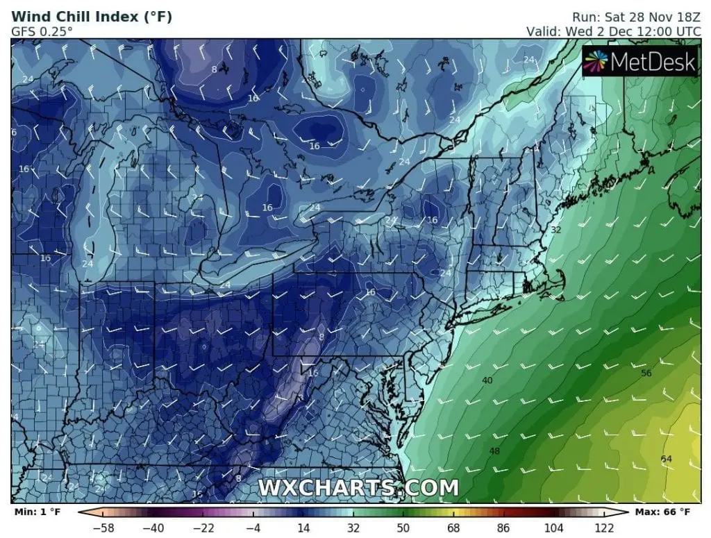
However in Ohio, West Virginia and parts of Pensylvania, New York state or Kentucky, snowfall is expected, near severe winds regionally with blizzard conditions, partly too in Ohio Valley, but mainly, thanks to lake-effect in northern Ohio and northwestern Pensylvania and New York.
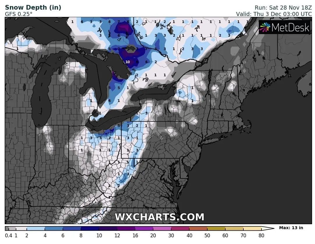
In norther Ohio, really severe blizzard conditions should surprise locally – in some counties, snow cover around 12 inches / 30 cm is expected during next workweek, gradually.
In Ontario, situation should be even more extreme, with 20 inches / 50 cm of snow near Great Lakes.
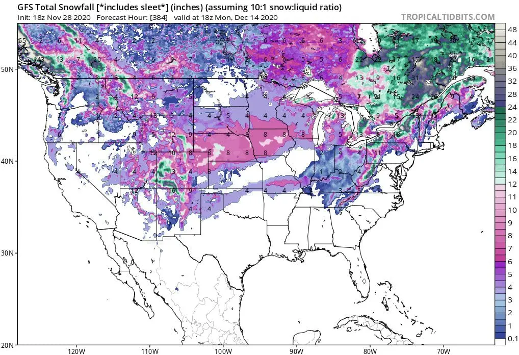
Until the half of December 2020, snow cover will appear almost in all, except for southeastern states of the USA.
Blizzard conditions and snow calamity is expected mainly in Labrador, in lake-effect regions near Great Lakes (mainly eastward from Great Lakes) and parts of Rocky Mountains.
Infographics: wxcharts.com, tropicaltidbits.com: