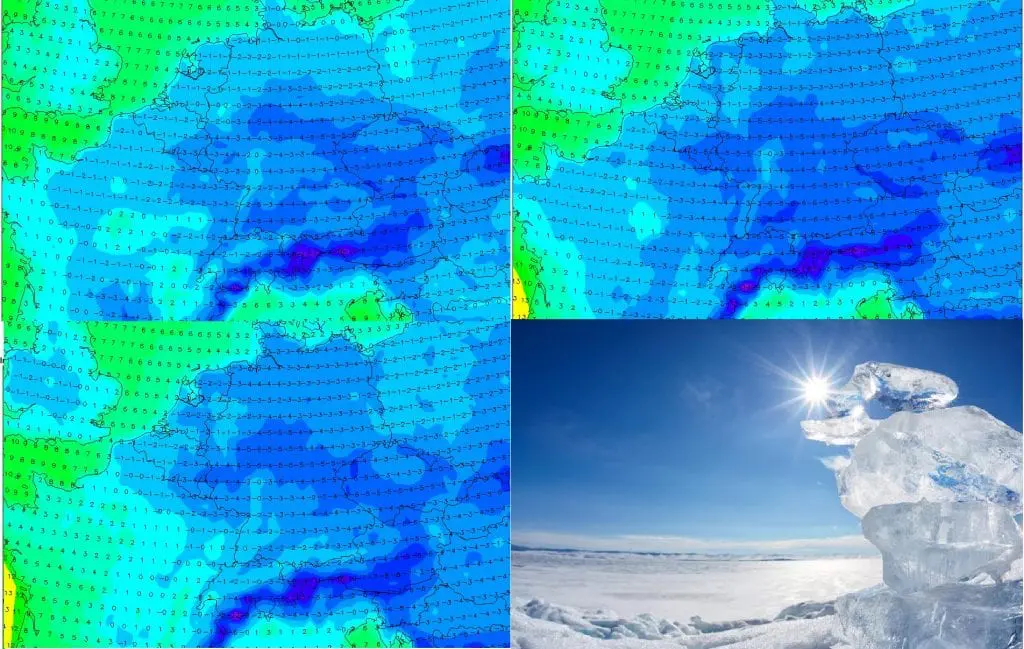
First cold wave /https://mkweather.com/2020/11/22/first-snow-and-frosts-up-to-14c-in-continental-europe// of very cold period expected until the Christmas 2020 /https://mkweather.com/2020/11/19/first-forecast-for-christmas-2020-in-europe-higher-chance-of-cold-and-snowy-weather// has brought the first serious frosts under -10°C (up to -14°C) in Central Europe and Balkan.
According to current materials, strong frosts will stay over Europe next days in high pressure, too, but the worst is only before us.
Such was in Mkweather articles longer expected, approximately 1-month lasting cold period between 20.11. and Chirstmas 2020, the strong frosts should hit in continental Europe mainly at the end of November and during the first December 2020 decade.
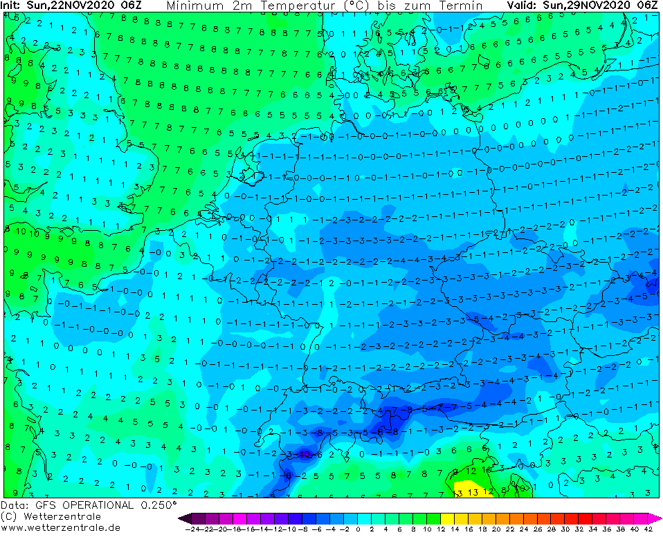
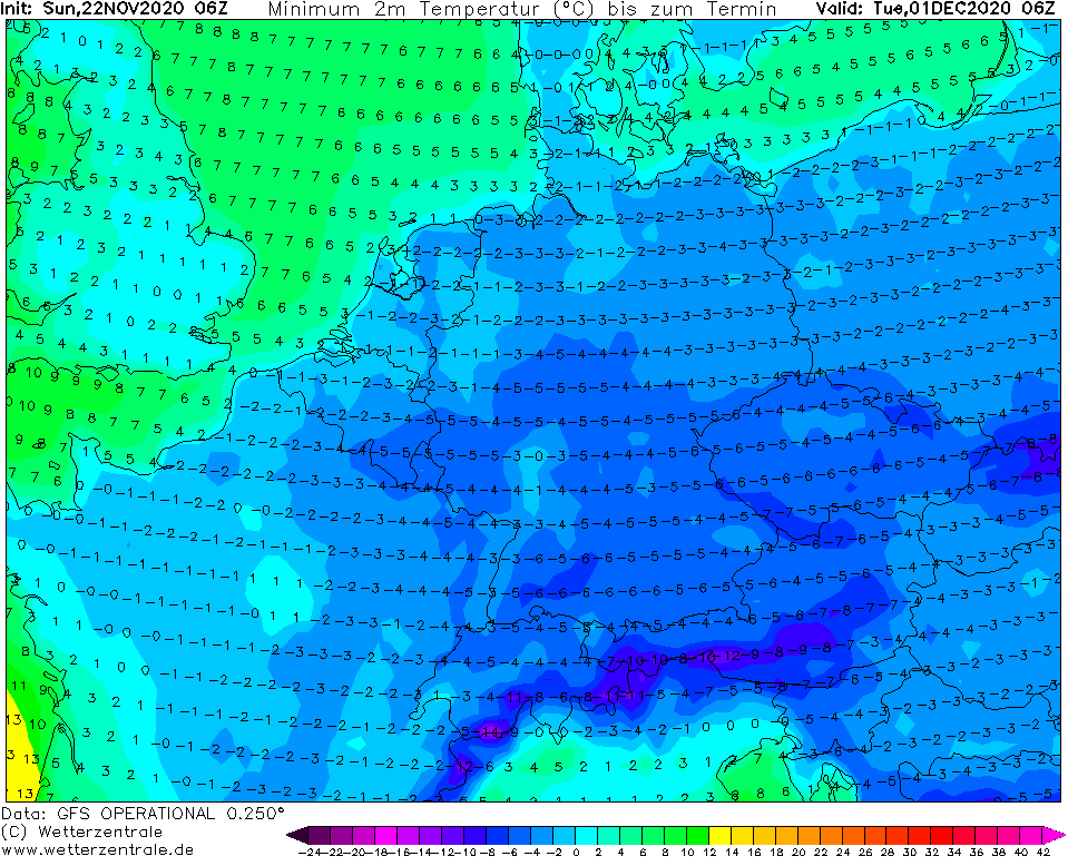
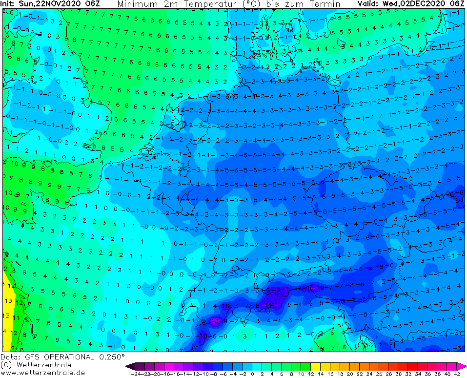
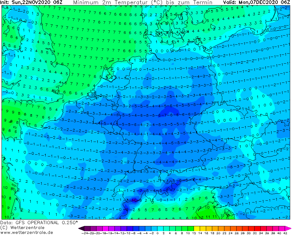
It appears to severe frosts occasionally under -10°C in lowlands and rarely first -20°C of the season in basins and valleys under 800 MASL during this period, with regional ice days with all-day frosts.
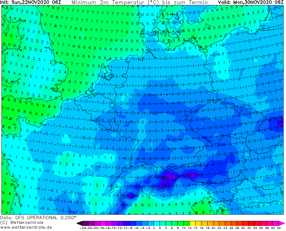
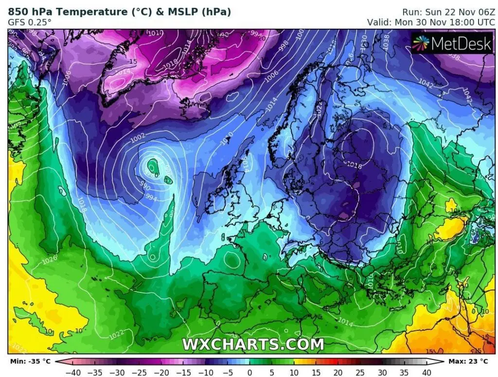
Above Central Europe will shift already around 30. November extremely cold air below -10°C in 850 hPa in Poland and Carpathian region, what in basins an valleys with snow cover should drop minimum temperatures up to -15/-20°C during the first December 2020 days.
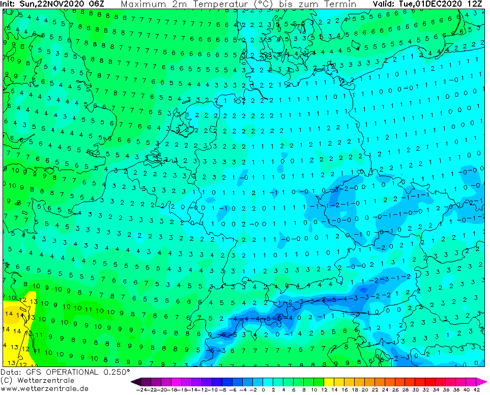
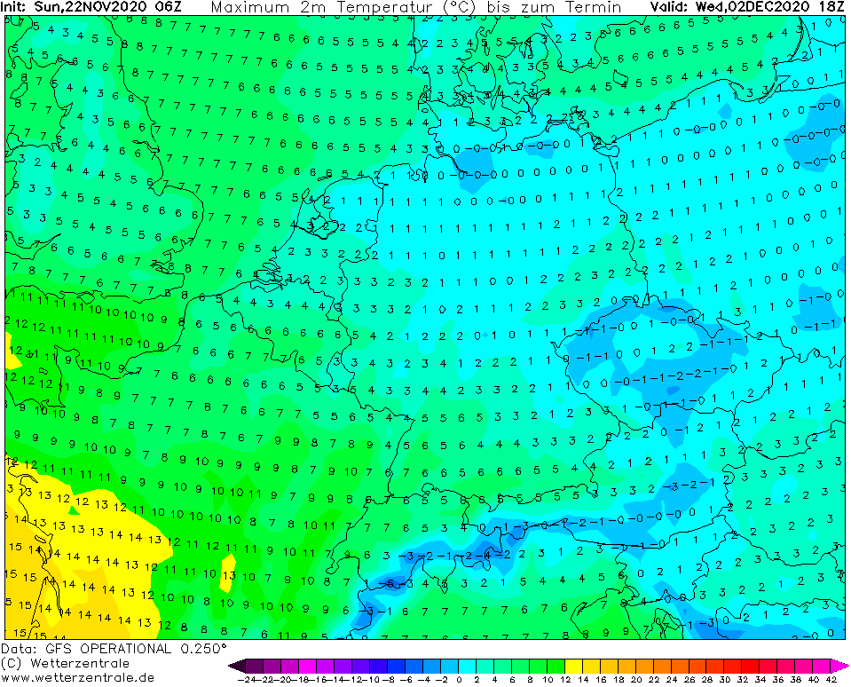
Ice days should appear near fogs and low cloudiness in lowlands, too.
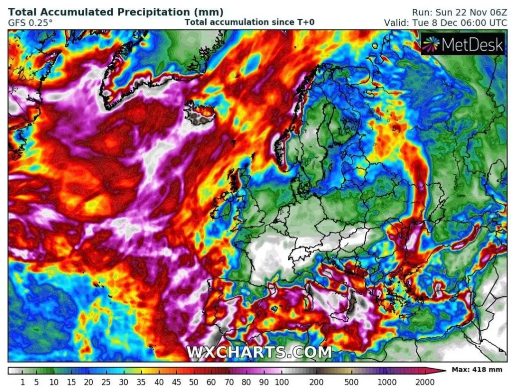
According forecast tools, this expected period above central parts of Europe should be anticyclonic and above Mediterranean, 2 major cyclonic systems should moving from west to east. If these forecasted conditions change to more cyclonic for central Europe, it will mean more snow for region. As we should notice on 16-day projections below, Balkan will be under the snow, from these Mediterranean systems, while Alpine and Carpathian regions expect calm anticyclonic type of weather.
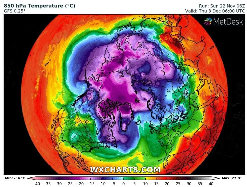
Hemispheric view to T850hPa shows, that the biggest probability of extreme frosts in Europe will be around 3. December, when from Svalbard will flow above Scandinavia and Europe extremely cold air, in northern Scandinavia below -20°C (in 850hPa), what should mean frosts around -30/-35°C in Lapland and up to -15/-20°C in basins and valleys in central parts of continent.
Next similar dose of extremely cold air should arrive above Europe preliminary around 15. December – again from Canada and Greenland to Atlantic and European sector of the Arctic.
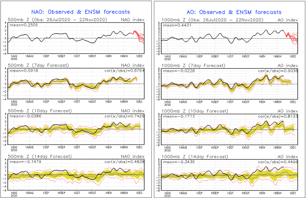
AO and NAO index fall under 0 at the beginning of December 2020, what is good signal for coldwaves in next 2-3 weeks.
Mkweather will watch the situation and brings fresh news and updates about European early winter coldwaves, soon. Forecast for Christmas 2020 will be continuously updated, too.
T850 hPa under -10°C above Poland / Carpathians /wxcharts.com:
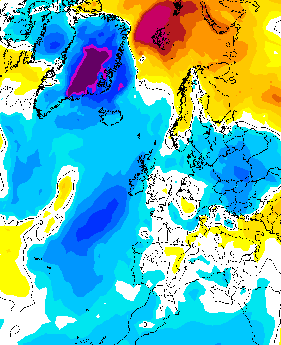
T850 hPa anomaly for 30.11. 2020 /wetterzentrale.de:

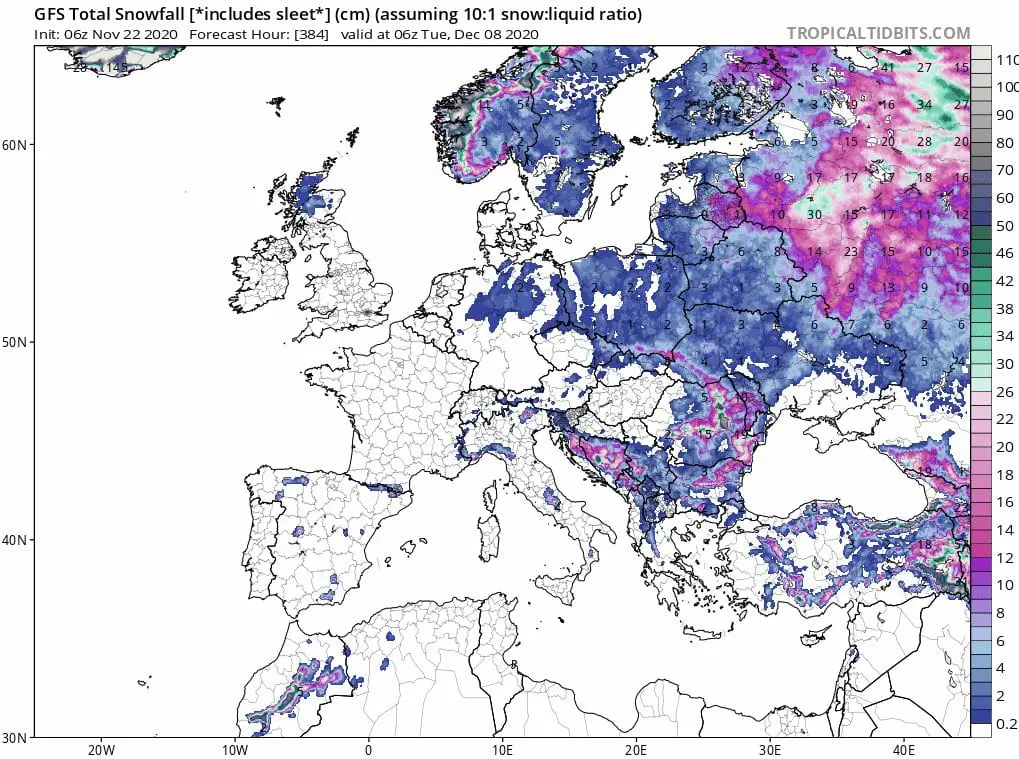
Expected snow cover in Europe until 8. December 2020 /tropicaltidbits.com:
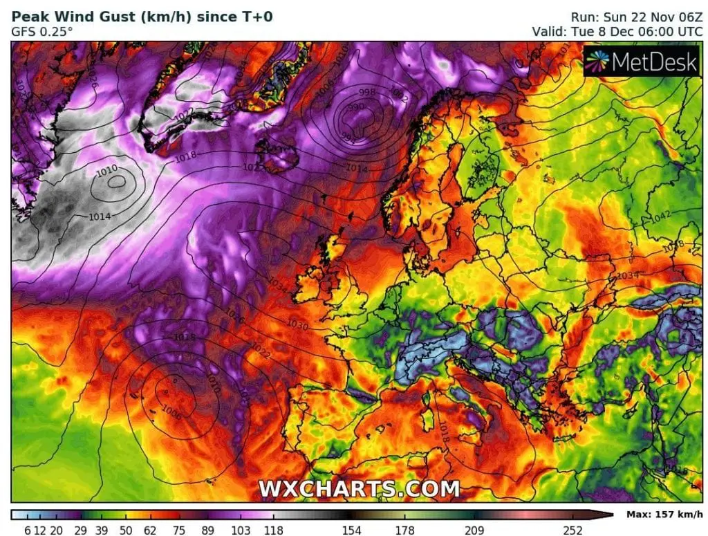
Accumulated precipitation and Max wind gust in Europe next 16 days /wxcharts.com:
Hemispheric view for 3.12.2020 – cold air above European sector of Arctic /wxcharts.com:
AO and NAO index – 16 days:
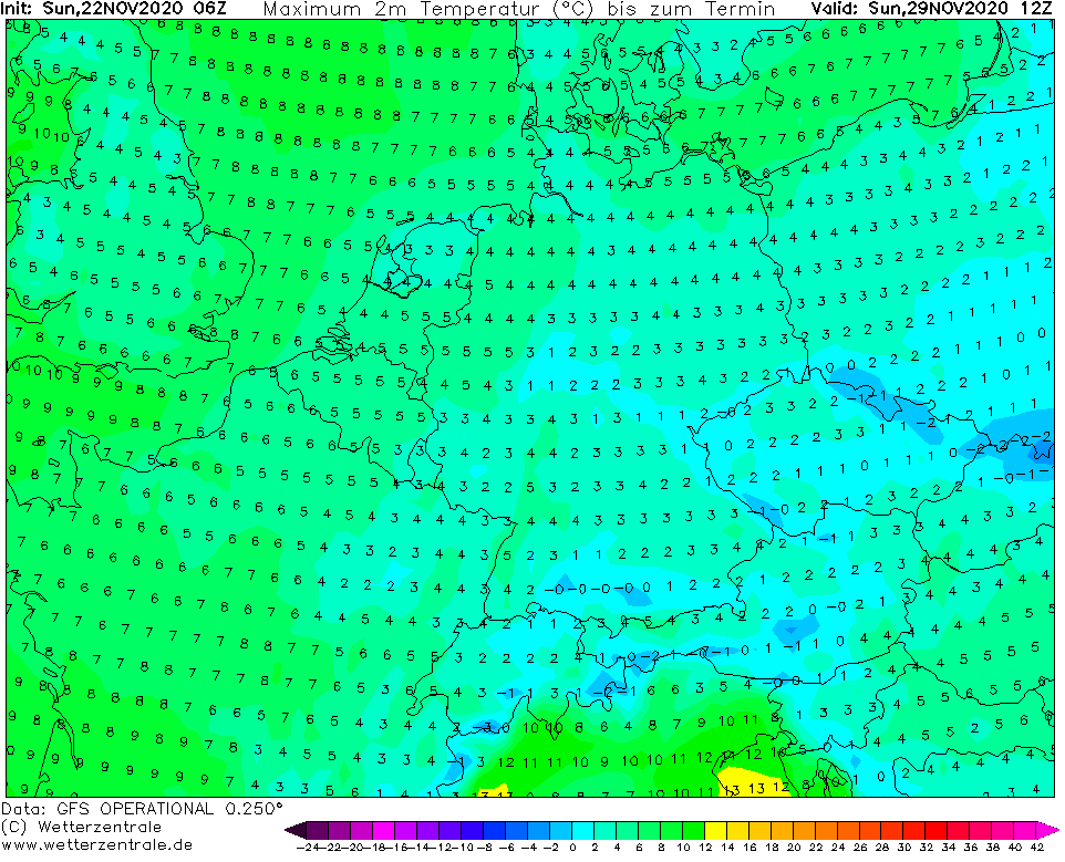
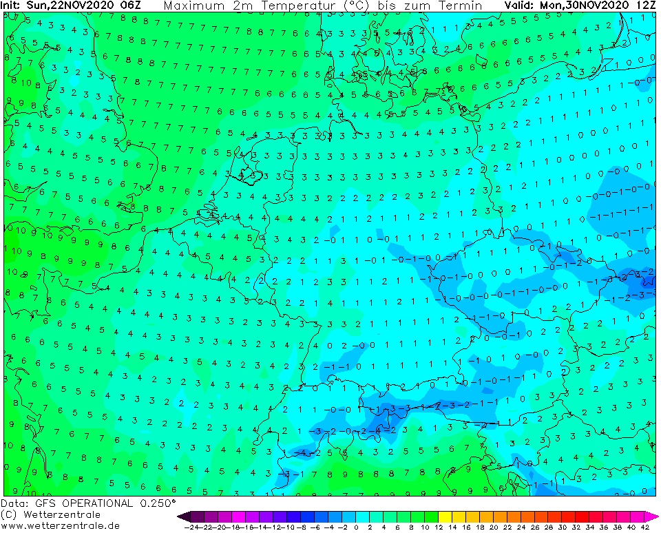
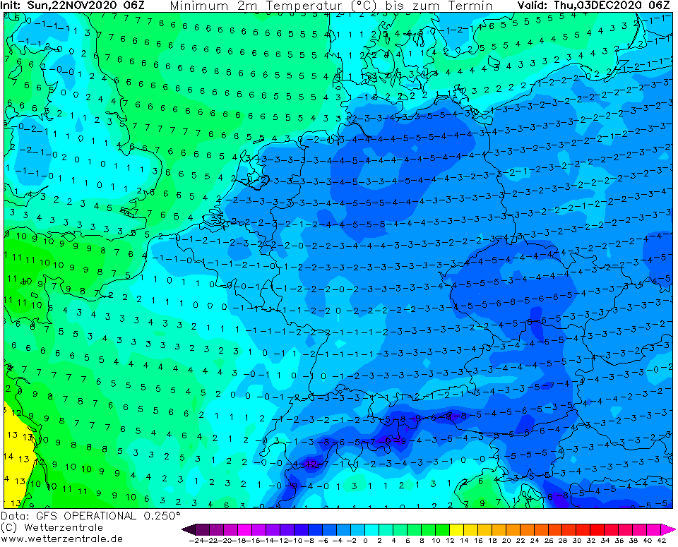
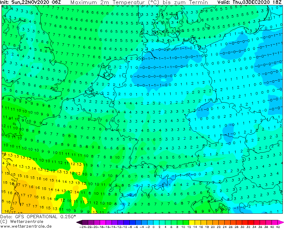
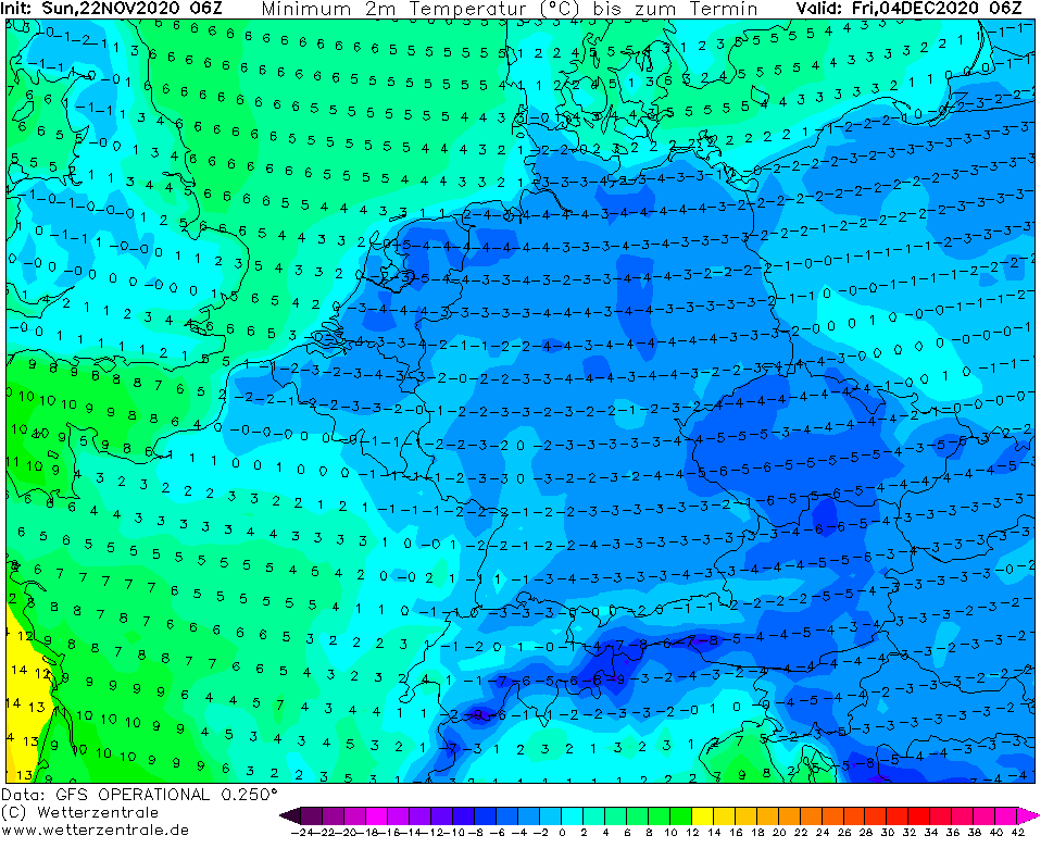
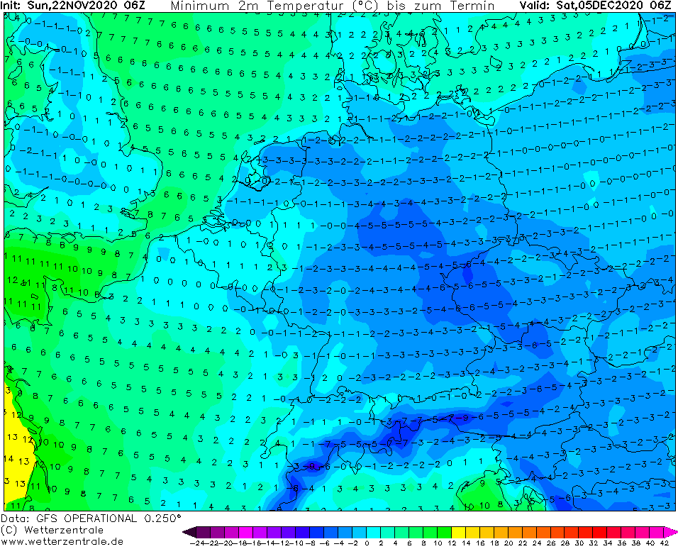
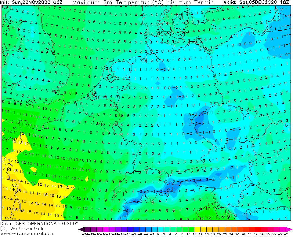
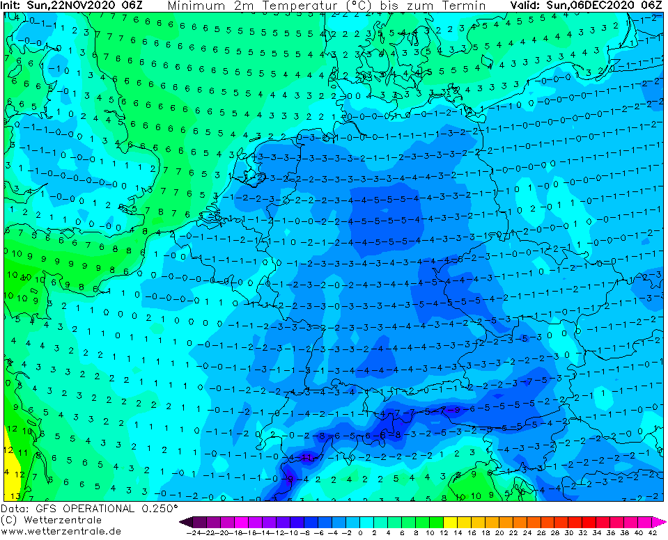
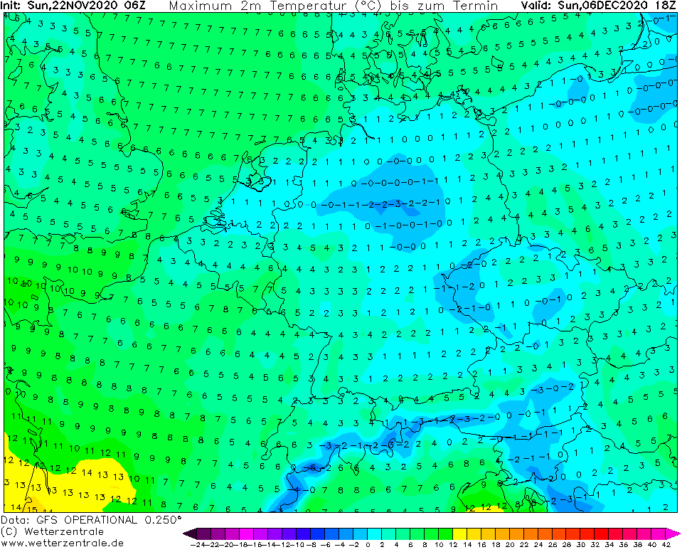
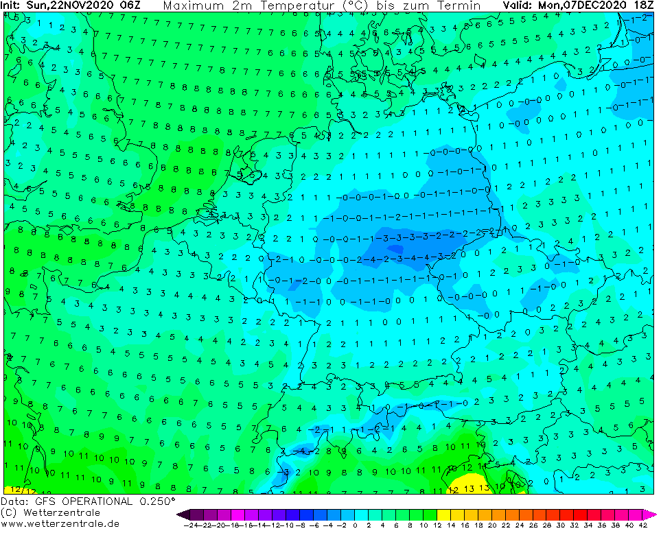
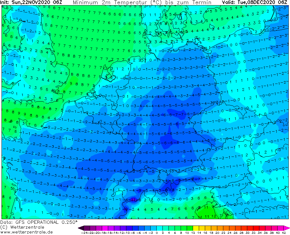
Minimum and maximum temperatures between 29.11.-8.12. 2020 in central parts of Europe /wetterzentrale.de: