After Bavi, Maysak and Haishen has arrived to Japan after longer break from typhoons /series of Mkweather articles about typhoons and tropical storms in Japan and Korea you will find here: https://mkweather.com/?s=japan and here https://mkweather.com/?s=korea/ the next tropical threat, although tropical storm Dolphin and tropical storm from depression 12W Twelve have occurred, yet /https://mkweather.com/2020/09/23/tropical-storm-dolphin-hit-tokyo/; https://mkweather.com/2020/09/12/tropical-storm-12w-twelve-hits-tokyo-region-coast-on-sunday//.
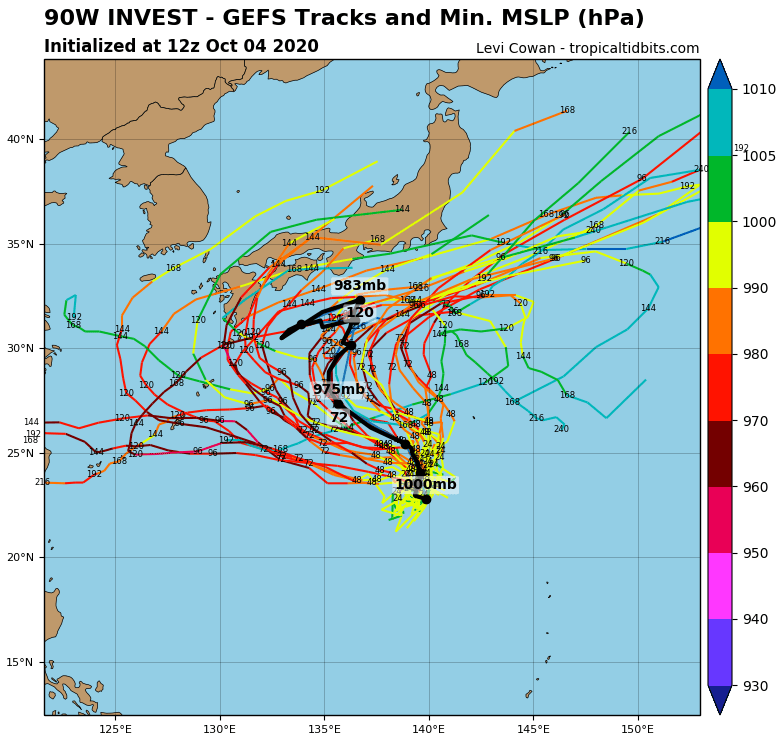
In October, a new tropical threat has appeared in forecast models and already around 10. October, should Japan hit the next typhoon of the season, with unknown name, for now.
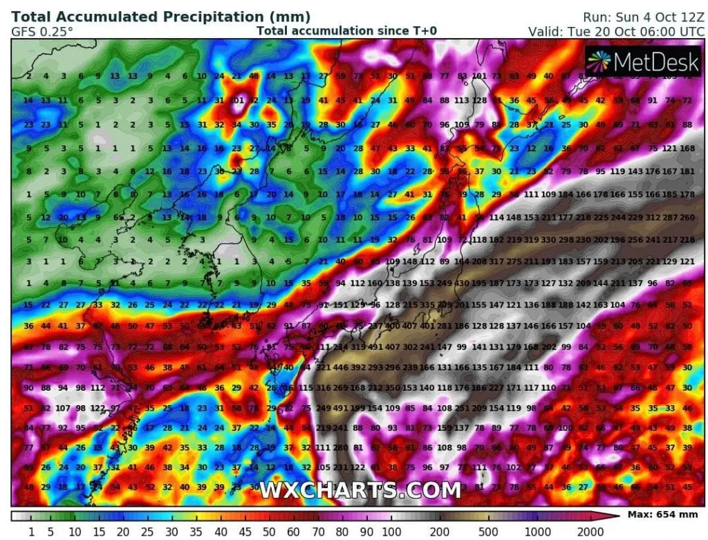
On the east coast of Japan, extreme rainfall of up to 400 mm until 20. October is expected, most of it from expected typhoon from tropical depresion 90W Invest.
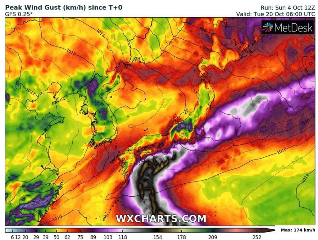
Wind gusts of up to 174 km/h are projected (over 200 km/h possible), with possible severe wind gusts 100-150 km/h along eastern Japan coast.
System would have to hit Japan already at the weekend, Saturday and Sunday, 10.-11. October on its parabolic track.
We will monitor the situation and during the work-week we will bring a fresh information about expected strength and effects of the tropical system.
Ingohraphics: tropicaltidbits.com, wxcharts.com: