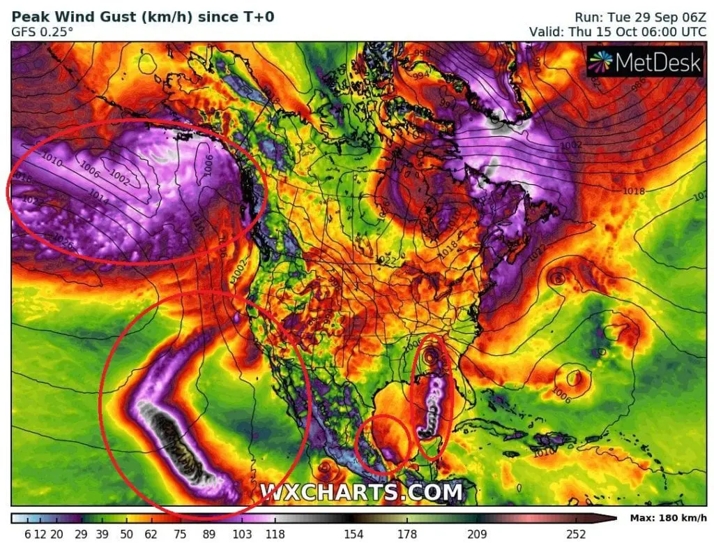
Remnants of ex-hurricane (From 18E EIGHTEEN) should hit California until 10. October, area of interest near Mexico Gulf Coast, ex-typhoon Kujira hit Alaskan coast

There are 4 interesting areas of tropical cyclones activity to watch in North American sector these days.
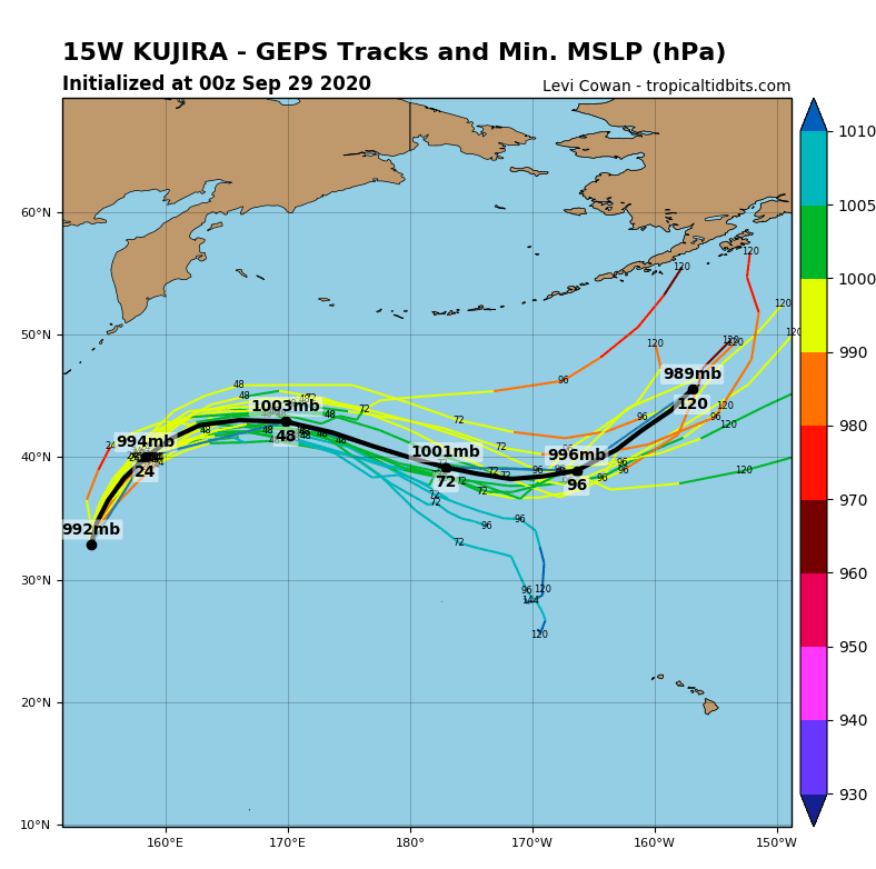
First, not fully North-American is typhoon Kujira, which arised above western parts of North Pacific /https://mkweather.com/2020/09/27/tropical-activity-will-shift-from-atlantic-to-pacific-next-2-3-weeks-tropical-storm-kujira-expected-typhoon-has-formed-over-nw-pacific// and is moving over northern parts of Pacific towards Alaska, where its remnants should bring winds and rainfall.
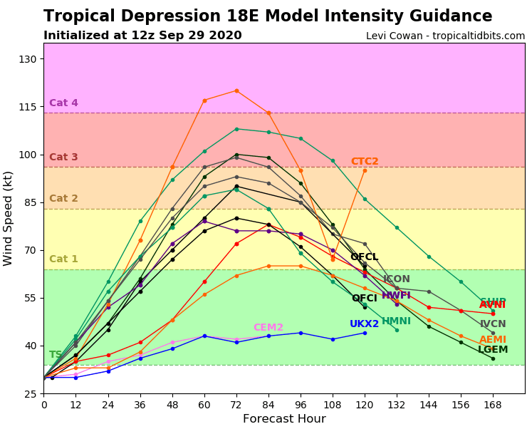
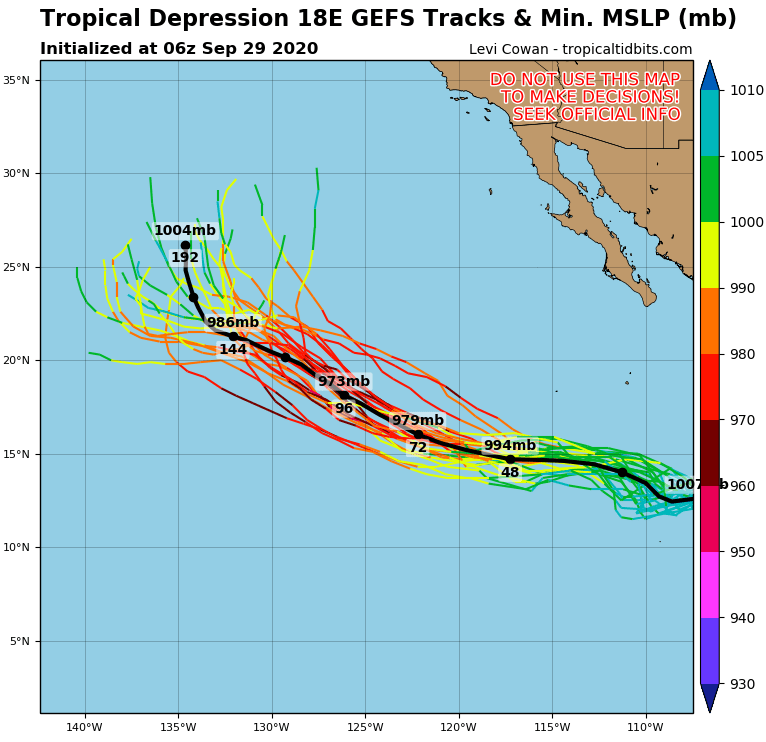
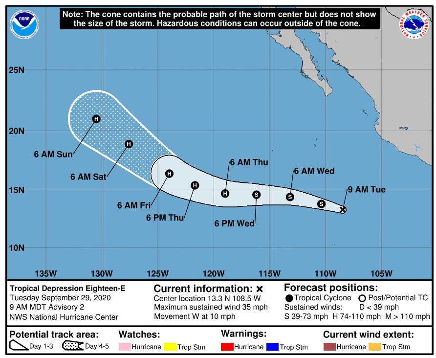
Second, the most severe, but over the ocean waters located, is expected hurricane (up to Category 4, from tropical depression Eighteen) easterly from Mexican coast over East Pacific, which should turn direction to northeastward and its remnants should hit California around 10. October 2020.
Third area is situated in southwestern parts of Gulf Coast, near Yucatan Peninsula in Mexico. It is an area to watch, where should arise next tropical storm of the Atlantic hurricane season, Gamma and bring rainfall and winds to Mexico.
Fourth, the most risky, far and uncertain tropical storm or hurricane should occur in Gulf Coast after 10. October 2020, when wet phase MJO is after more than 3 week dry period expected.
Good conditions for development of hurricanes and tropical storms over Atlantic area will be continue between 10.-25. October 2020, with possible second peak of hurricane season 2020. Mkweather will updating the hurricane / tropical storm forecast during early October, therefore, you will have fresh information about current situation on our site.
Infographics: wxcharts.com, tropicaltidbits.com, weathernationtv.com