Siberian winter from Lisbon to Vladivostok! A new ECMWF 6-week forecast is here!
Every 4 days, ECMWF publicly updates a forecast for 6 weeks.
There are the newest outputs from 4. January 2021 – outputs, from which some literally take breathe away.
Mainly next 2 weeks will be in Northern Hemisphere critical, after one from the strangest SSW ever, with 1094,3 hPa pressure in Mongolia (the highest air pressure in Earth in history) and 921 hPa near Alaska (the lowest extratropical air pressure in Earth history, equivalent of hurricane Category 5), with subsequent strong AO- and NAO- phases and even stronger expected coldwaves across Northern Hemisphere.
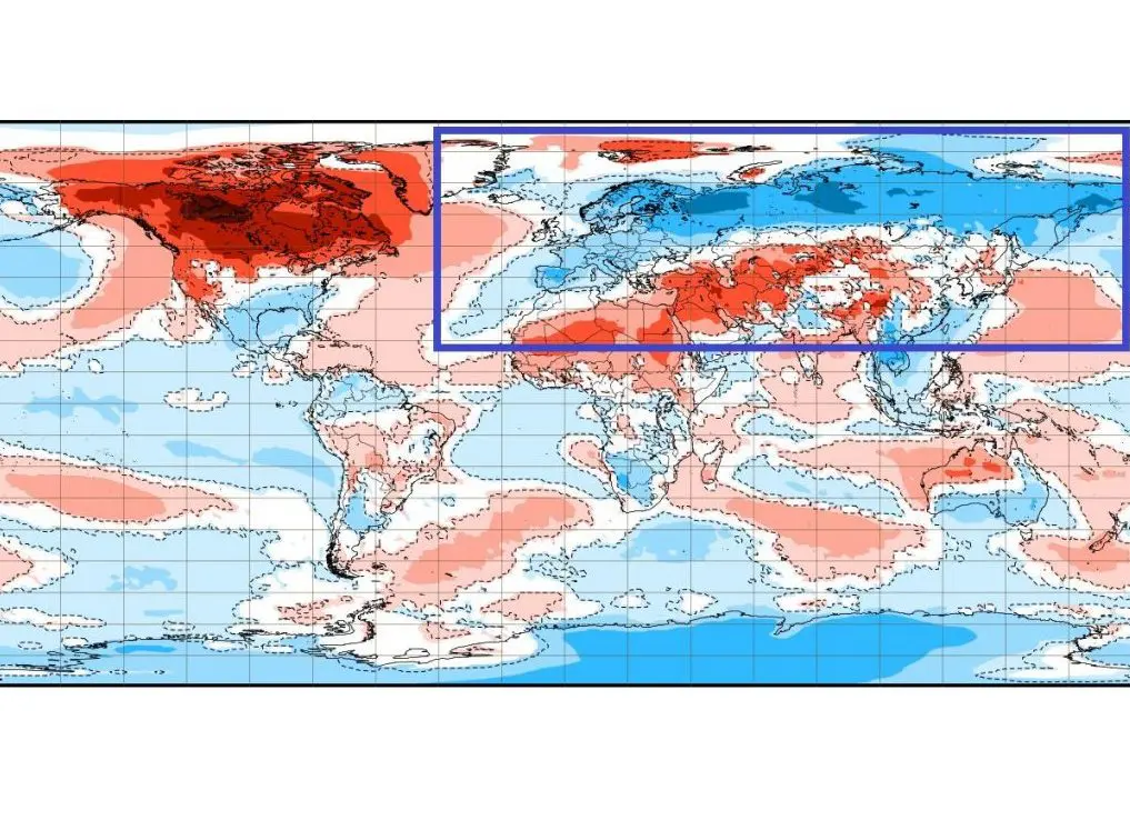
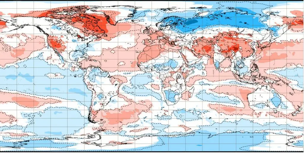
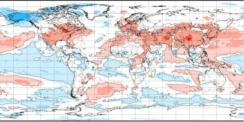
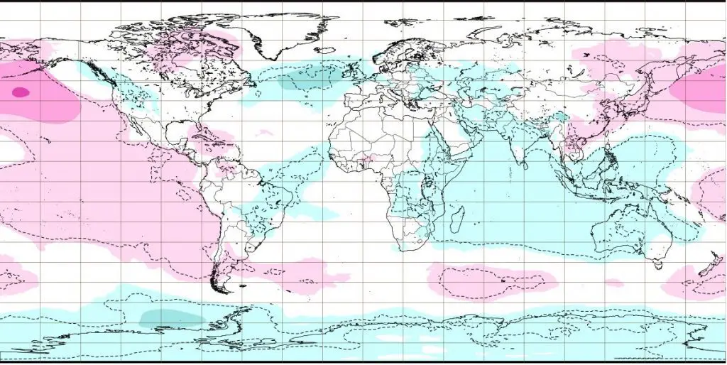
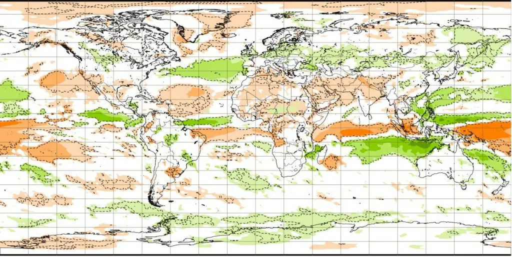
Such we should to see on output A), negative temperature anomaly during the peak of Winter 2020/2021 is evident from Azores to Hawaii, or continental, from Lisbon to Vladivostok, with really extreme Siberian cold blasts in Europe, Asia and Northern America (air with Siberian origin).
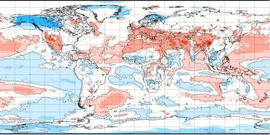
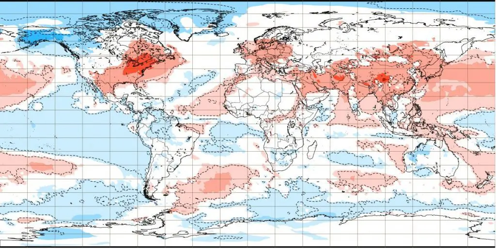
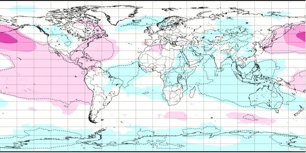
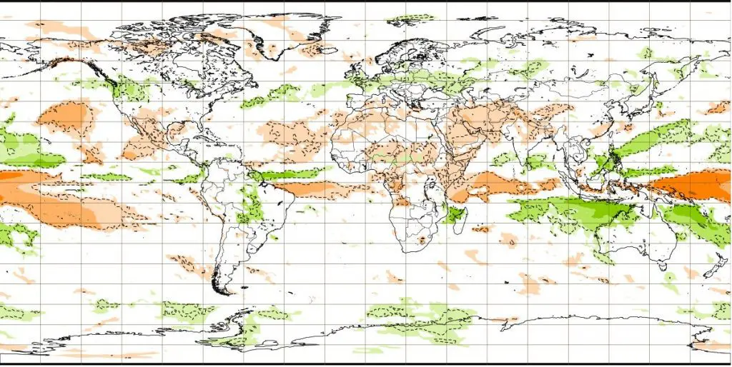
Output B) describes air pressure anomaly across the world during next 7 days – between 4.-11. January 2021. We should notice, that extreme strong blocking high field will be situated in long region from China to northeastern Canada, including Icelandic cyclone region. This blocking high gradually brings extreme frosts into many regions.
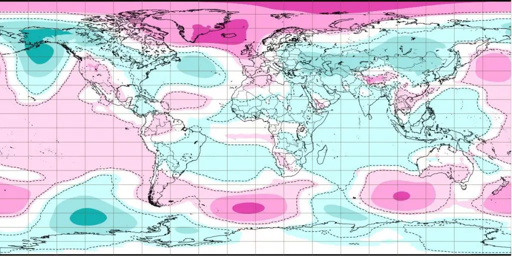
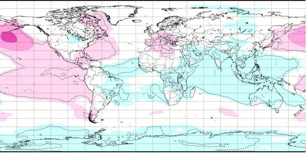
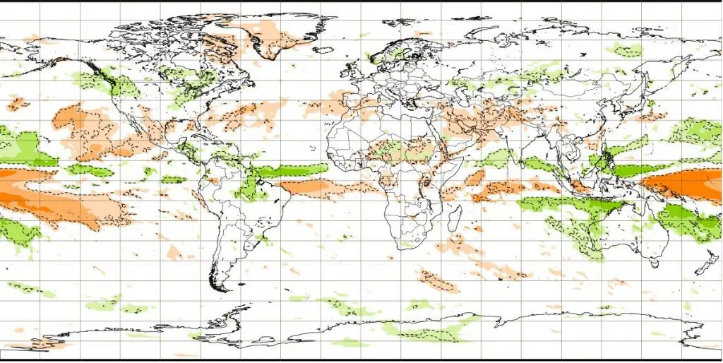
On image C) we should see, that Icelandic low will be during next 7 days (4.-11. January 2021) totally destroyed by continental and Arctic pressure high, what means very cold conditions for northwestern, western and southwestern Europe.
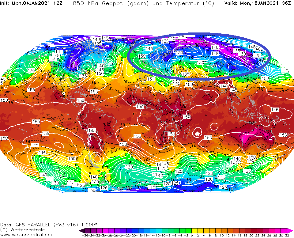
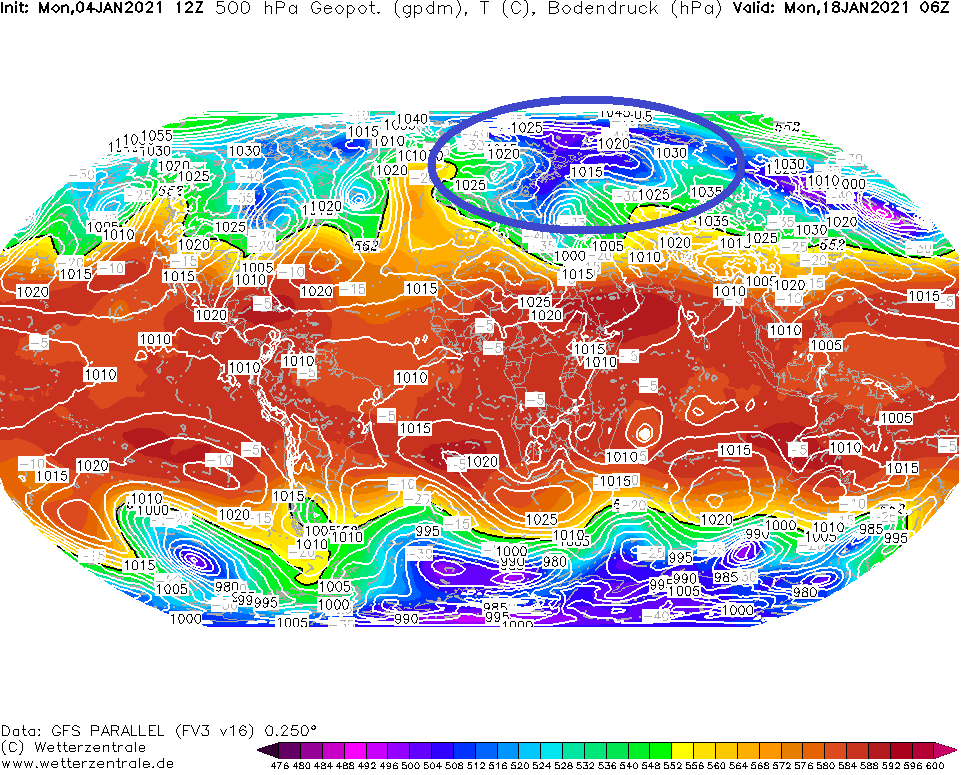
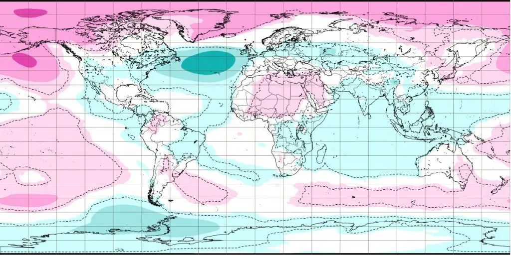
Last 2 outputs, D) and E) offer watch to absolute peak of Winter 2020/2021 – the coldest forecasted day, 18. January 2021 (this day should be changed yet) – we should see, that Siberian air with anomalous temperature in 850 hPa will flood large parts of Europe (western Europe will experience with peak of winter a few day sooner). Low geopotential should mean lot of snowfall for parts of Europe, and high pressure in European parts of the Arctic should signalize, that after heavy snowfall will arrive this robust remnant of Siberian high in full power, accompanied by severe winter conditions and notified extreme frosts.
List of articles related to this topic you should find at the end of this article – Mkweather already next days will bring fresh updates of forecasts related with severe winter conditions forecasts for Europe, North America and East Asia.
A) Week 11.-18. January 2021 – negative temperature anomaly from Azores to Hawaii (or Lisbon to Vladivostok) /ECMWF
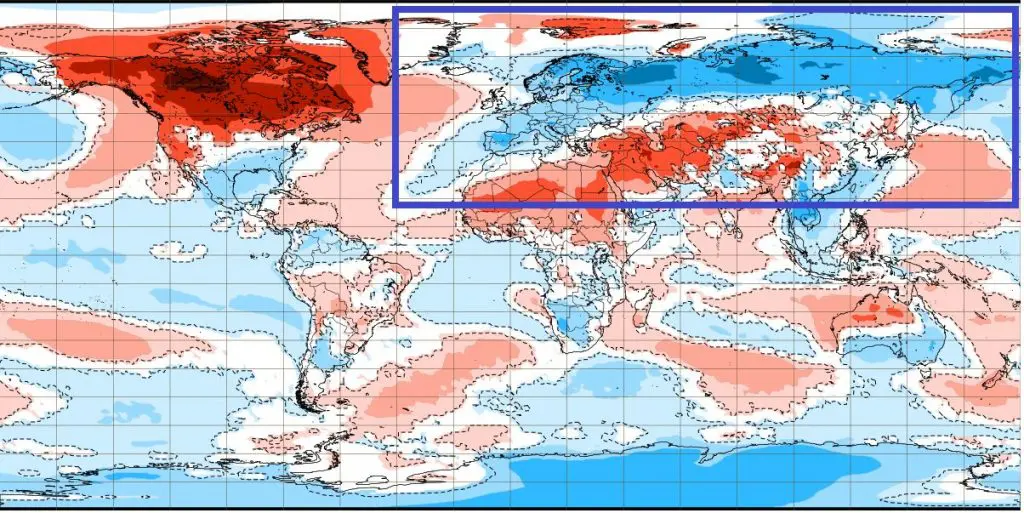
B) Week 4.-11. January 2021 – anomalous blocking pattern (purple) from China to NE Canada and Mediterranean cyclogenesis /ECMWF
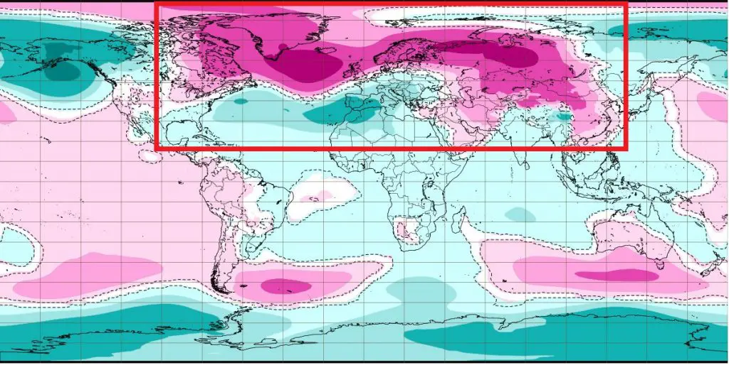
C) Week 4.-11. January 2021 – any precipitation in region of Icelandic stationary pressure low /ECMWF
D) Siberian air during its outbreak in Europe, 18. January 2021, T850 hPa /wetterzentrale.de
E) Geopotential in 500 hPa (blue = very low), but very high air pressure with Siberian origin over European sector of Arctic /wetterzentrale.de
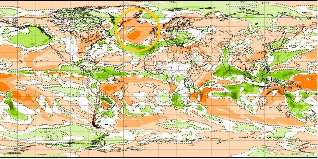
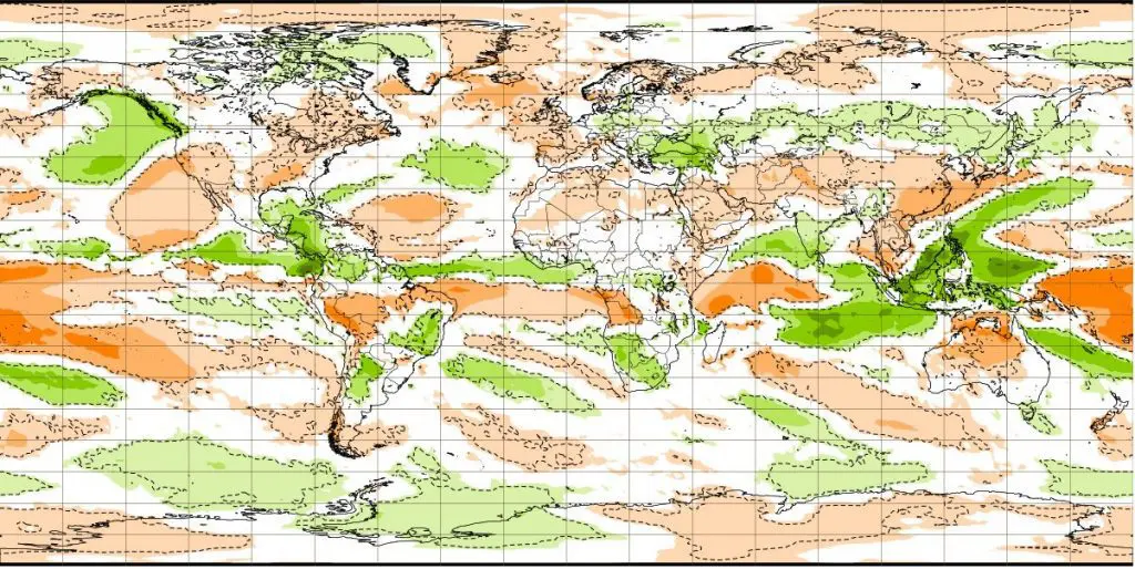
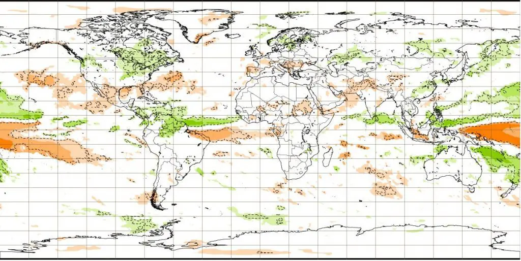
6-week ECMWF forecast from 4. January 2021 for the period 4.1.-15.2.2021 (weeks from Monday to Sunday) – Up temperature, in the middle air pressure, down precipitation anomalies from long term average /ECMWF
https://www.ecmwf.int/en/forecasts/charts


Read more:


