The 2nd deepest summer cyclone in history over Arctic, heatwave starts on the West – near Seattle +109°F / +43°C is expected
In the front side of robust low pressure through above west Pacific, during these days is peaking advection of extremely hot air across western parts of USA and Canada. Not very far from Seattle, +109°C / +43°C is on Thursday expected /weathernationtv.com/.
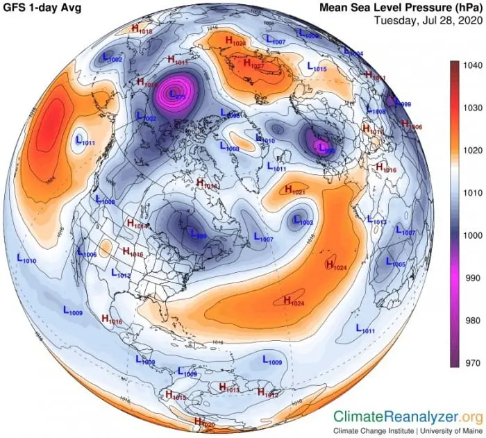
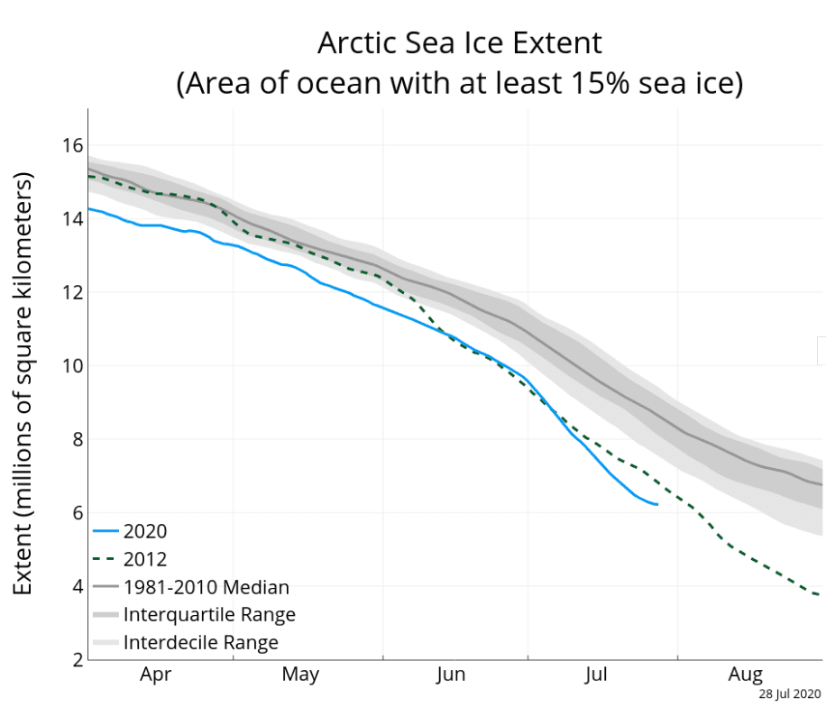
Deep cyclone, which has linked with this big area of deep pressure over Arctic, has the second deepest pressure in summer in Arctic in record – only 968 hPa. First cyclone of this type was storm-cyclone above Arctic from August 2012 /https://agupubs.onlinelibrary.wiley.com/doi/full/10.1029/2012GL054259/. These conditions were linked with record-breaking loss of 2012 Arctic sea ice area.
Currently, sea ice anomaly is the largest in record, more than in 2012. Anomalous low pressure are arriving after unprecendent weeks with anomalous Arctic high and after record-breaking temperatures in Svalbard and Verkhoyansk /https://mkweather.com/2020/07/26/record-heat-hits-longyearbyen-217c-71f/; https://mkweather.com/2020/07/17/siberian-heat-38c-100f-flowed-above-north-pole-arctic-ice-loss-reached-the-newest-mid-july-record-pattern-strenghing-global-warming-hole-anomaly-which-can-make-british-isles-cold-til/; https://mkweather.com/2020/07/12/38c-101f-behind-polar-circle-in-siberia-5-years-after-unprecedent-event-with-40c-104f-in-nunavut-northern-canada//.
In intentions with possible seasonal forecast to autumn 2020 and winter 2020/21 /https://mkweather.com/2020/07/29/first-forecast-for-winter-2020-21-early-powerful-coldwaves-nov-dec-then-weakening-of-cold-pattern-and-warm-jan-feb-mar// can play this development a key role in evolution of circulation for next months (record low Arctic sea ice area, stronger GW hole, AO – and NAO- during autumn, larger area with Siberian snow cover in autumn, an possible coldwaves in early winter 2020/2021).
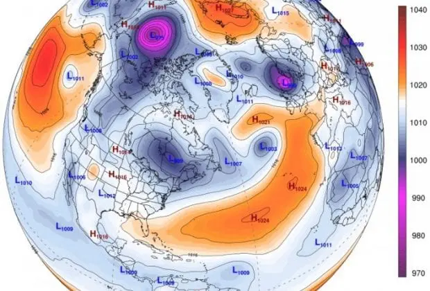
Anomalous Arctic low on pressure map /https://www.severe-weather.eu/global-weather/arctic-cyclone-mk/?fbclid=IwAR1nolLzx92sWO5prgxApL8_s4-xaIdJRT6PBB2ipsl0zMZpirOtQbJYuz4/

https://www.weathernationtv.com/


