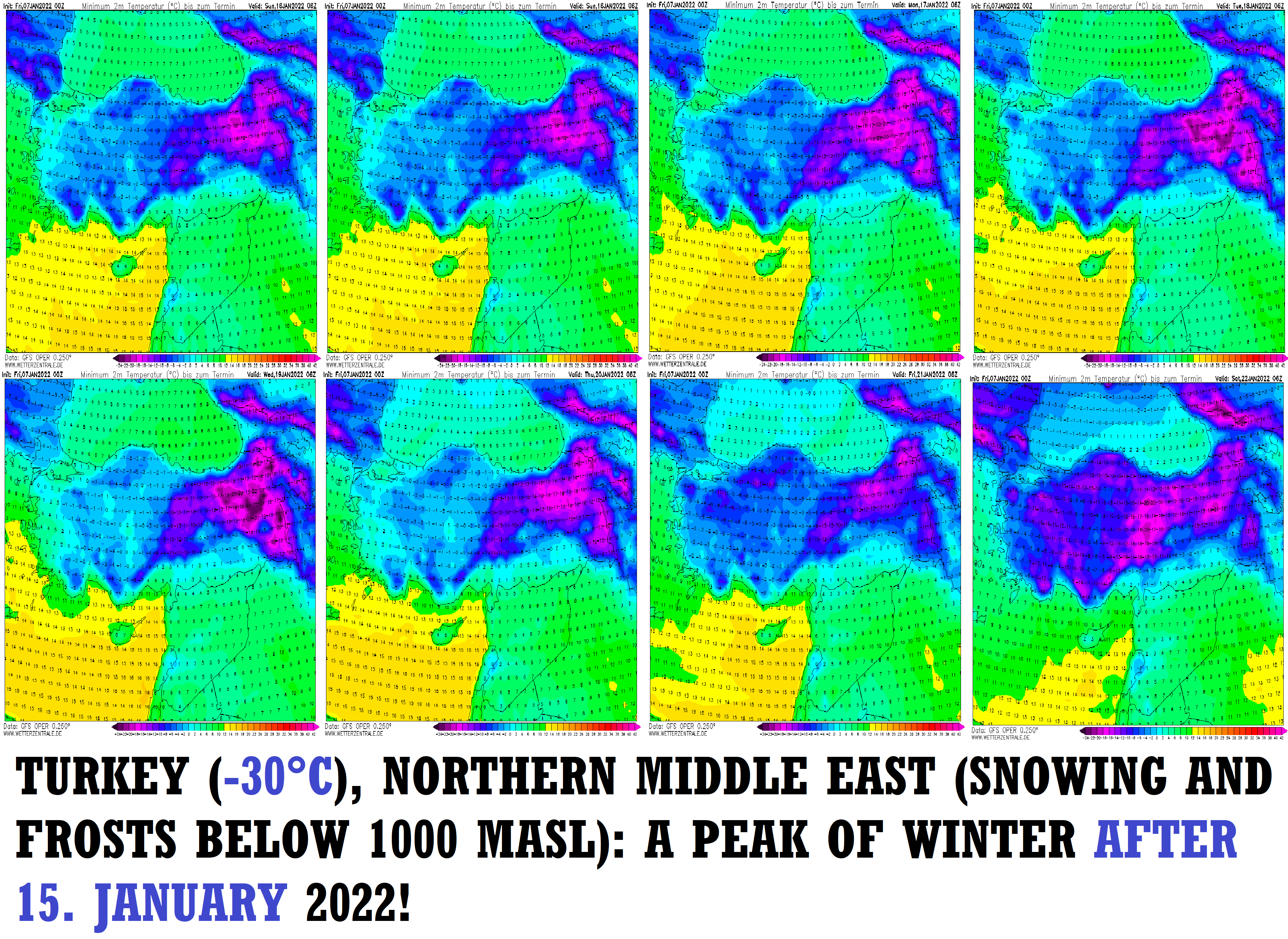
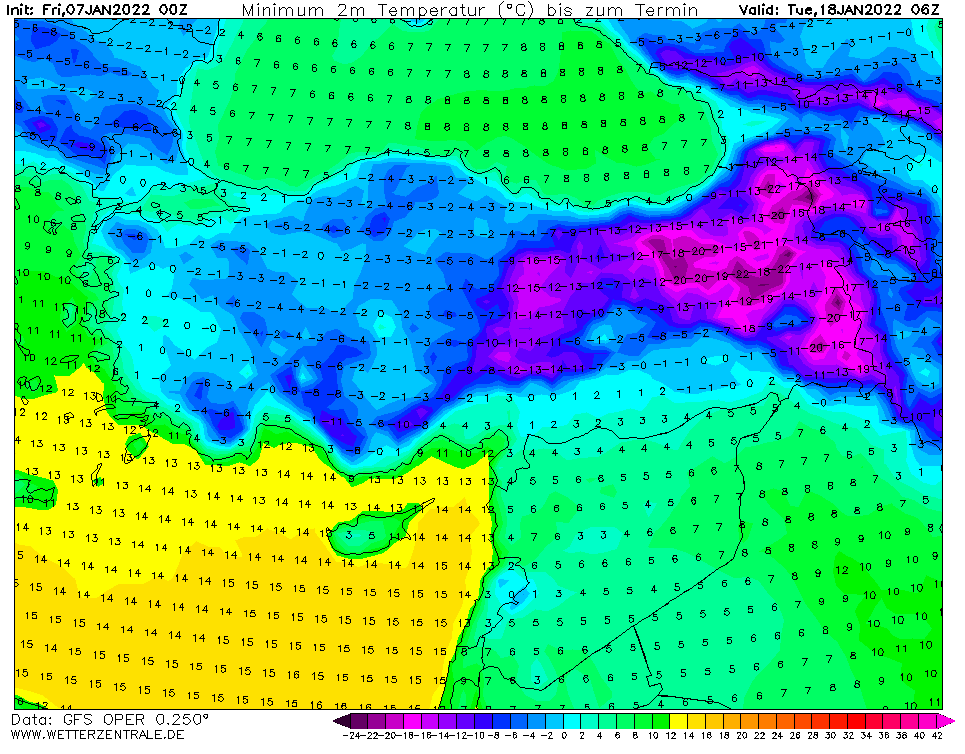
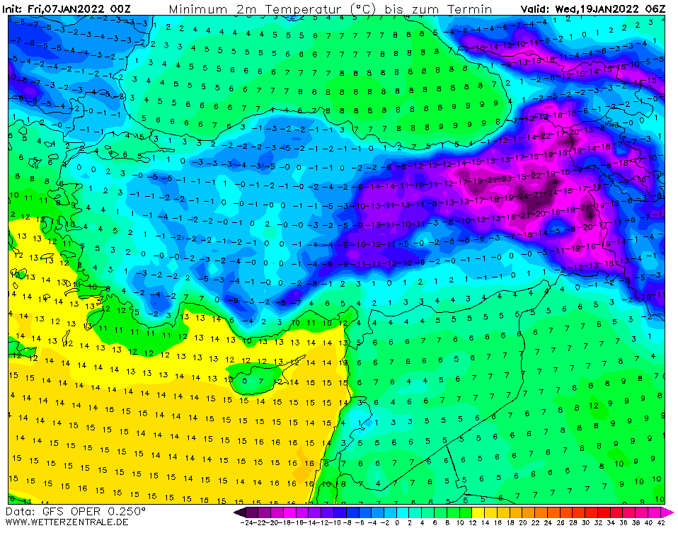
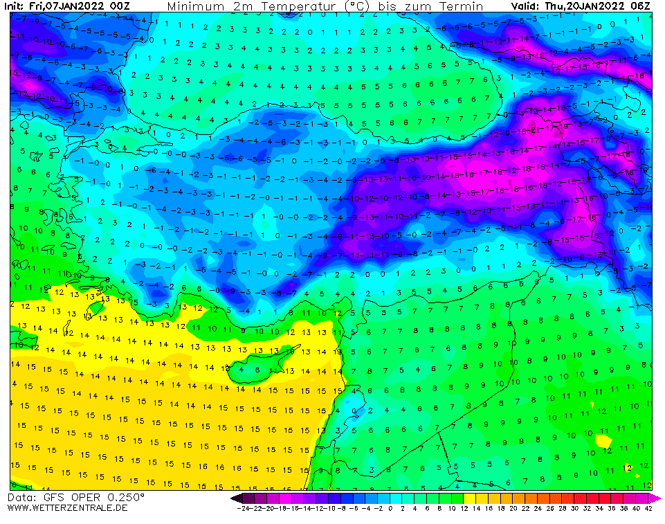
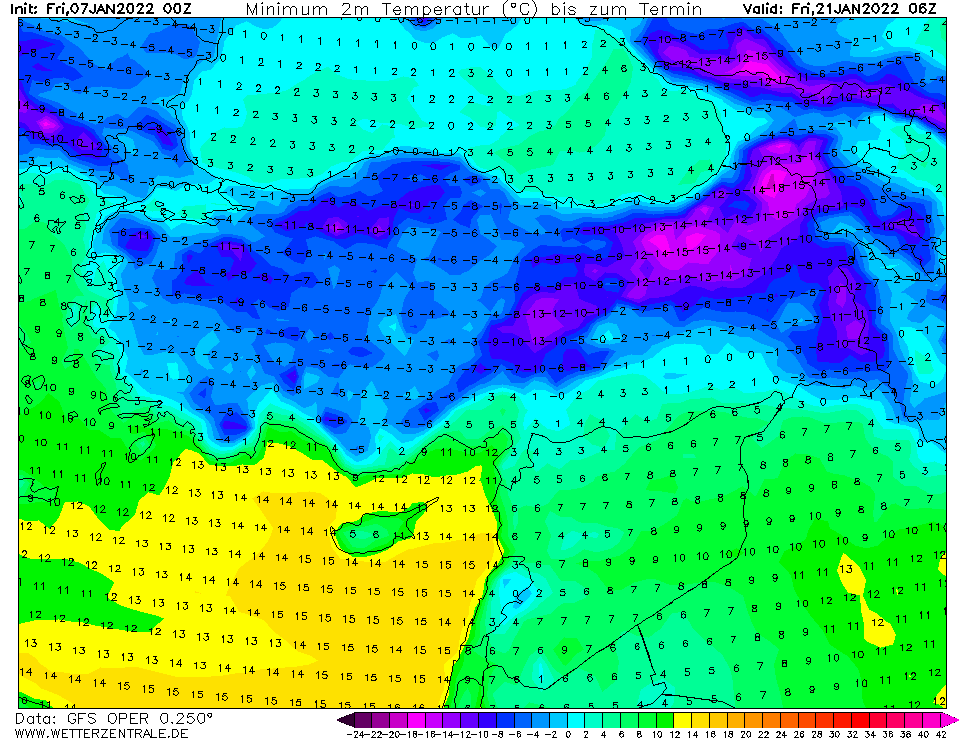
The next peak of winter for Turkey (East with -30°C) and northern Middle East (frosts and snowing below 1000 MASL) after 15. January 2022!
An upcoming Greenlandic, Arctic, and Siberian blasts above Europe and later western Asia should according to the latest runs of GFS persist above Europe long 10-12 days and bring the next anomalously cold period and snowfall.
In the next series of articles, we will look gradually at predicted temperatures and snowfall in Continental (Central) Europe, British Islands, France, Iberia, Italy and Balkan, Eastern Europe, Turkey, and the northern Middle East, and Scandinavia.
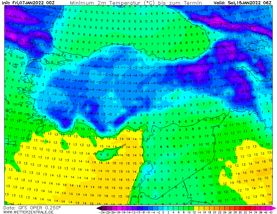
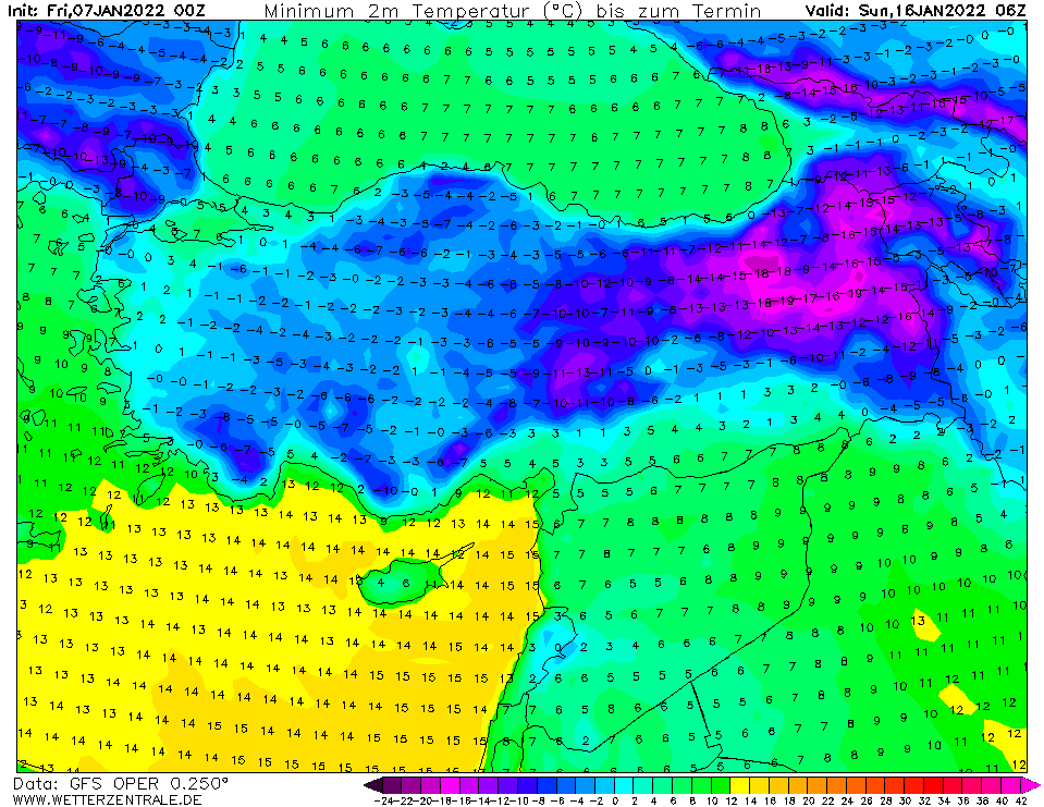
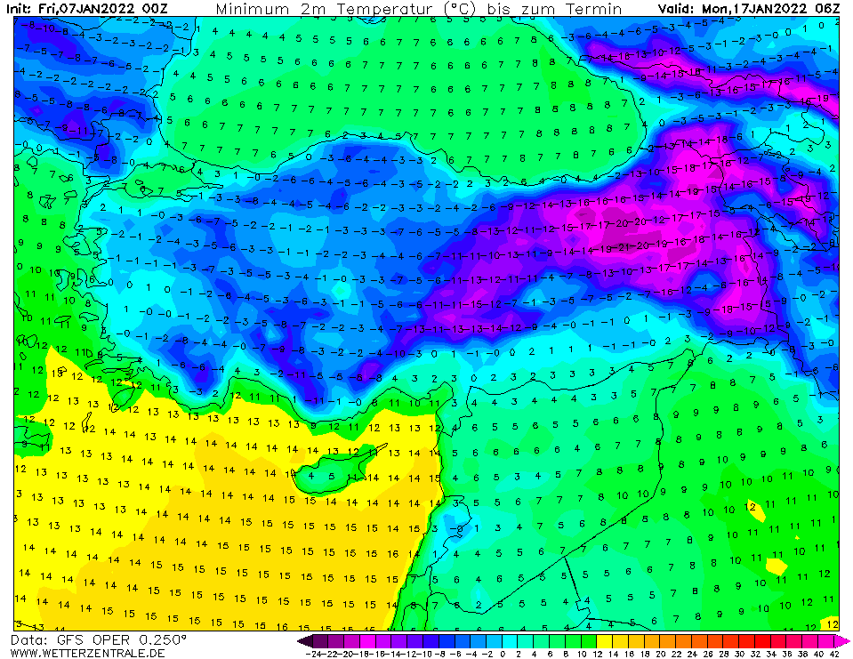
For Turkey and the northern Middle East, GFS in the last runs has seen a severe coldwave after 15. January 2022, in higher elevated, densely populated basins in Eastern Turkey with frosts up to -30°C and snowing and frosts below 1000 MASL in the northern Middle East (Lebanon, Israel, Syria, Jordan, NW Saudi Arabia, Iraq, Iran…later in the month Pakistan, Afghanistan, and northern India thanks to Western Disturbances)
Maximum temperatures should drop below 0°C, with ice days (all-day frosts), rarely, Arctic days, with maximum temperatures below -10°C should in mountainous regions of Turkey and Caucasian region appear.
In many parts of Turkey and in the mountains around 1000 MASL in Lebanon, Israel, Syria, Iraq, Iran, and northern Saudi Arabia, snowfall should appear, in mountainous Eastern Turkey with heavy blizzards and snow calamity (similarly such as during the previous coldwave: https://mkweather.com/villages-in-eastern-turkey-buried-under-4-meters-of-snow-temperatures-dropped-below-30c/).
Prolonged extremely cold weather should have an effect on health, power outages, or problems in travel, especially in mountainous regions.
In metropolitan cities, minimum temperatures will be higher, around 0/-15°C in Turkey, in Eastern Turkey around 1500 MASL around -15/-25°C, in valleys it should be -10/-20°C, rarely up to -30°C and in the coldest highly-elevated mountainous valleys up to -40°C. Regions around 1000 MASL in the northern Middle East should report morning frosts up to -5°C and snowing, along the coast and in lowlands, heavy rains, clouds, and winds, with fresh temperatures, are expected.
Coldwave will be gradually shifting eastward from Europe, above Western Asia, and finally above northern India, with a possible peak of Winter 2021/2022 in many regions.
Frosts are forecast to start already in around 8 days, but the arrival of winter conditions from Europe are quite probable because, in Europe, frosts start already in 4-5 days.
Illustration picture: wetterzentrale.de
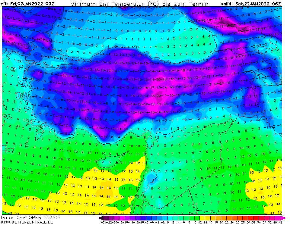
Source: wetterzentrale.de
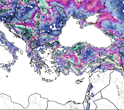
Expected snowfall. Source: tropicaltidbits.com (6.1. 12Z)


