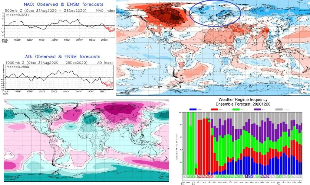
Updated ECMWF 6-week forecast for the World: Absolute peak of the Winter 2020/21 in continental Europe around 15. January after decline of NAOi below -2 and AOi below -4!
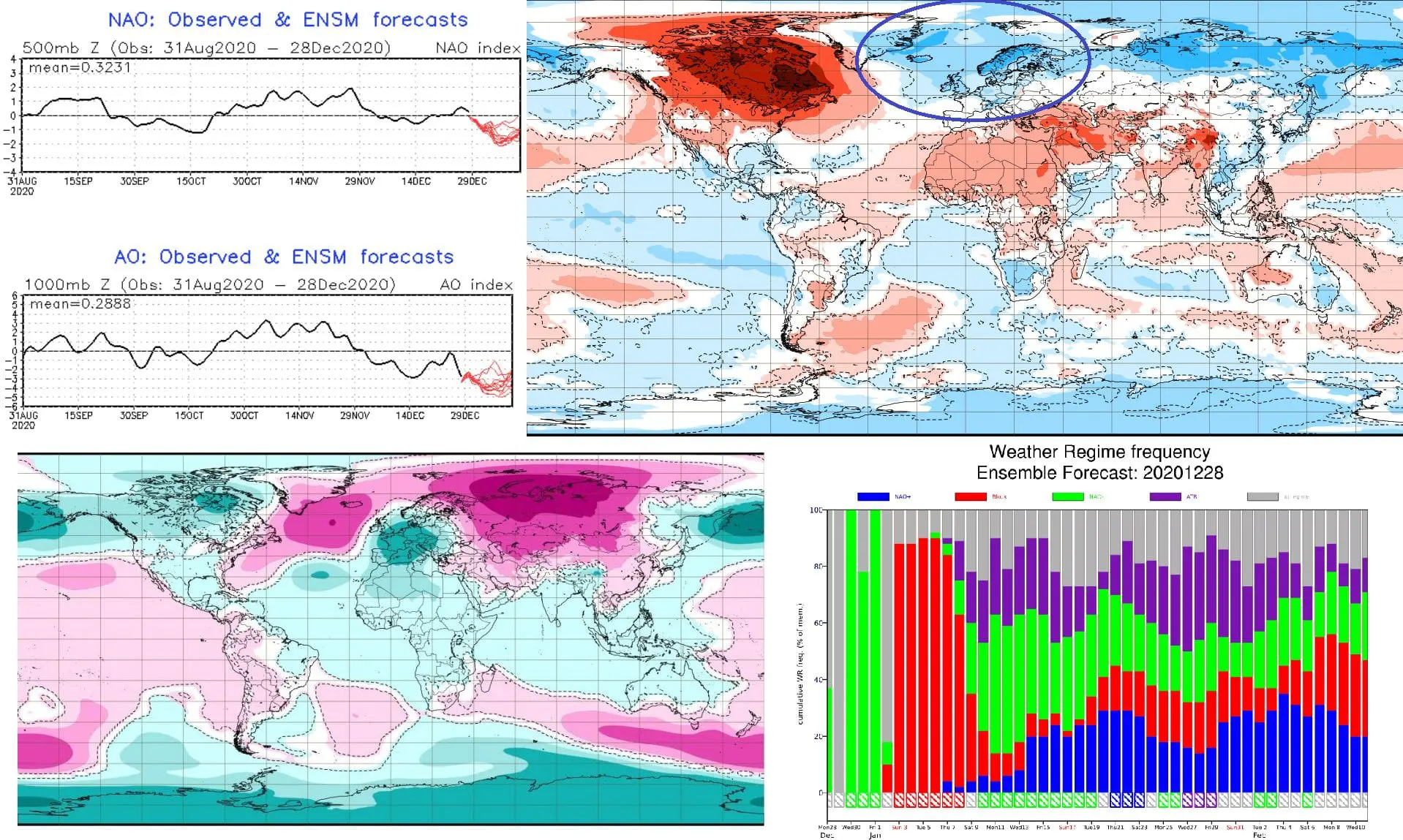
On 28. December have been updated new outputs of ECMWF for next 6 weeks and we should look at them and consider, how are chances for expected peak of Winter 2020/2021 in Northern Hemisphere, with main focus on Europe.
While in Europe, Asia and coast of northern Africa is expected a peak of Winter 2020/2021, USA and Canada will experience thanks to very strong NAO-/AO- phase with extremely warm winter weather.
Before a Christmas, we have updated forecasts, that a peak of Winter 2020/2021 is coming /https://mkweather.com/2020/12/24/a-peak-of-winter-2020-2021-in-europe-is-coming-blocking-situation-and-nao-until-24-january-2021-expected-then-strong-nao-until-the-end-of-winter-2020-2021/; https://mkweather.com/2020/12/22/january-2021-forecast-for-the-world-from-ecmwf//.
It´s only a week after prognoses and Oymyakon has already reported the lowest minimum temperature since 2002 /https://mkweather.com/2020/12/28/oymyakon-lowest-temperature-since-2002-572c-in-monstrous-pressure-high-1076-hpa// and in Norway it has cooled down up to -43,3°C /https://mkweather.com/2020/12/29/siberian-blocking-extreme-cold-air-in-norway-433c-finland-411c-only-week-after-all-time-december-scandinavian-record-18c//.
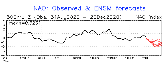
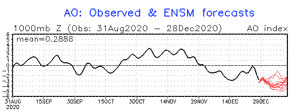
it´s not all – extreme blocking pattern over North Atlantic, Europe and Asia will continue minimally next 2 weeks, and then, declines of indices of Arctic and North Atlantic Oscillation reach absolutely minimum of the Winter 2020/2021 – NAO index will drop below -2 and AO index below -4, what will cause, that extreme blocking pattern will come into strong negative NAO / AO phase during the second decade of January 2021, with expected peak of Winter 2020/2021 in continental Europe! (meanwhile the USA and Canada will be / are usually extremely warm during strong NAO-/AO-).
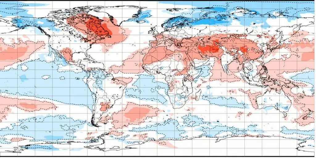
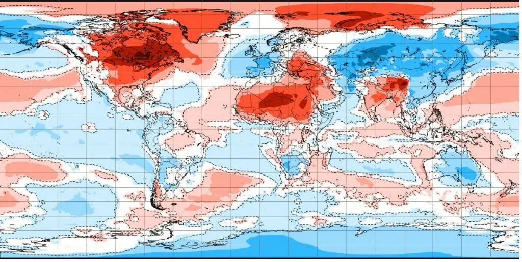
Possibility of the peak of Winter 2020/2021 is evident from fresh outputs of ECMWF from 28. December 2020, below – mainly below temperature average during third week (11.-18. January) of outlook and neutral air pressure field above continental Europe should mean, that Siberian air for a time will shift over Central Europe, Balkan and possibly too Western Europe or British Islands already around 15. January 2021!
It should mean frosts below -20°C in valleys and basins, below -10°C in lowlands and all-day frosts, in the coldest valleys maybe Arctic days with all-day temperatures below -10°C.
If a deep snow cover formed, extremely strong frosts between -20 and -30° C could surprise in frost valleys and basins, and too, in Scandinavia, temperatures should drop extremely low, into interval -45 / -50°C during this possibly Siberian cold blast.
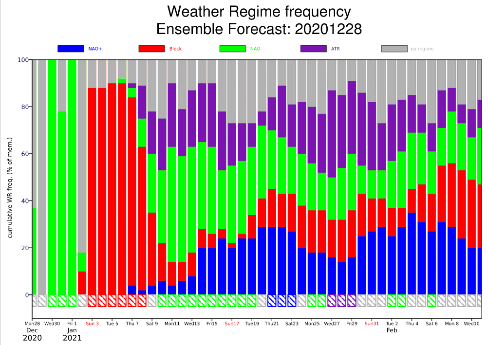
Already after 20. January 2021 should appear NAO+ signal above Europe, with gradual warming and transition to early spring weather during February 2021, such has been notified in Mkweather articles and Winter 2020/21 forecasts on Mkweather earlier. Possible early spring conditions after an expected peak of Winter 2020/2021 until 20. January 2021, Mkweather will describein the next article, where we look at the newest outputs – if extreme strong AO+ and NAO+ phase for February 2021 is still forecasted.
Soon, we will update a wetterzentrale / GFS temperature forecast maps for watched period around 15. January 2021, with commentaries, how deep below zero should temperatures drop in European regions.
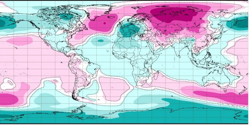
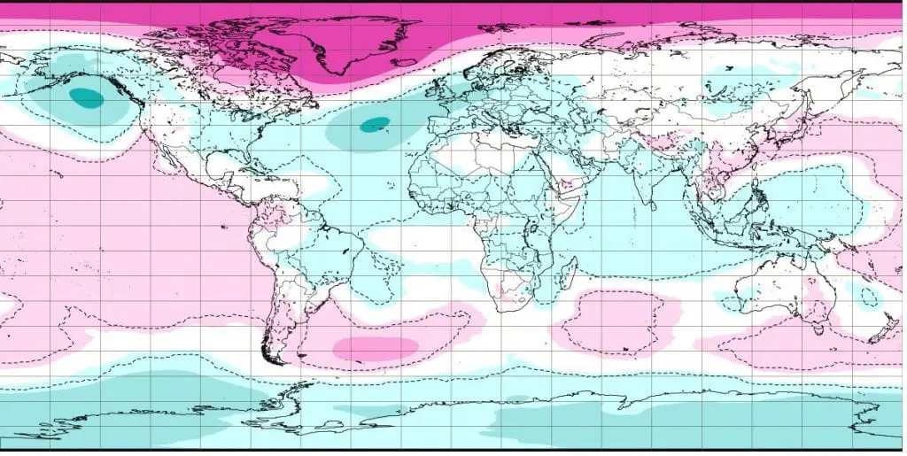
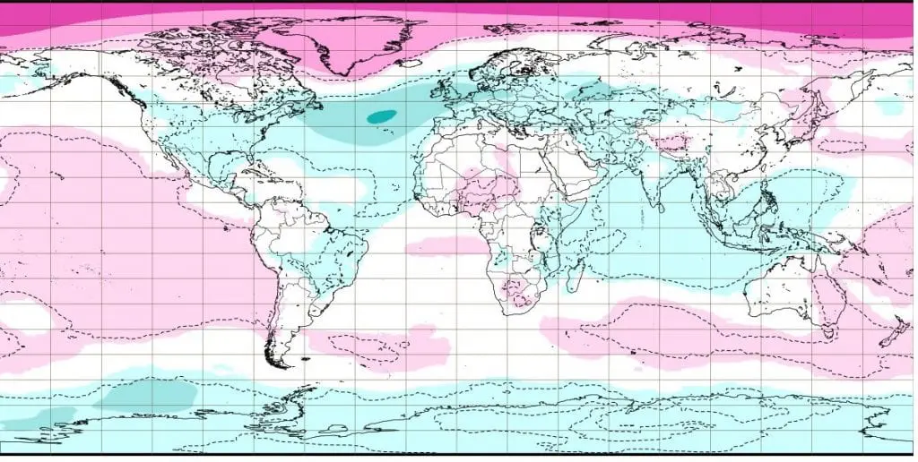
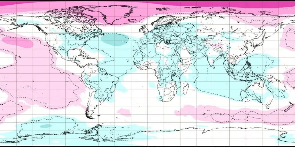
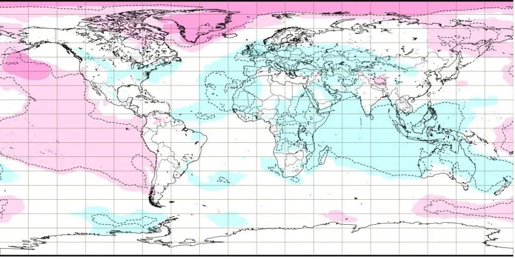
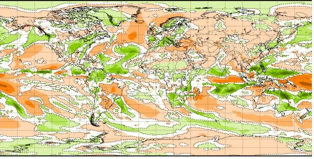
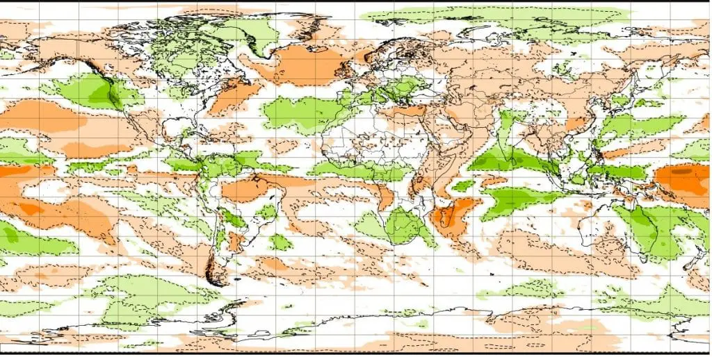
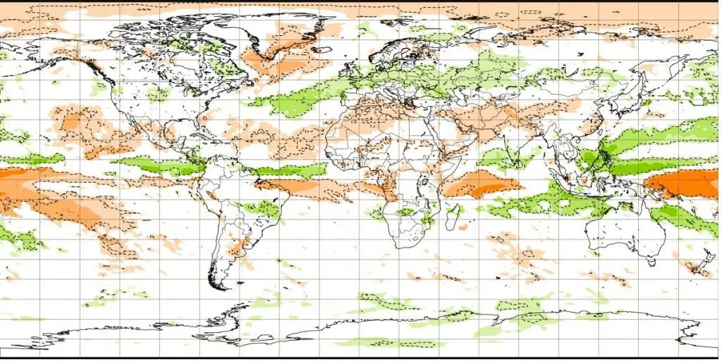
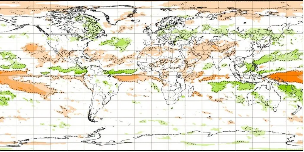
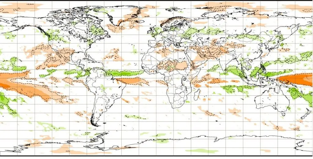
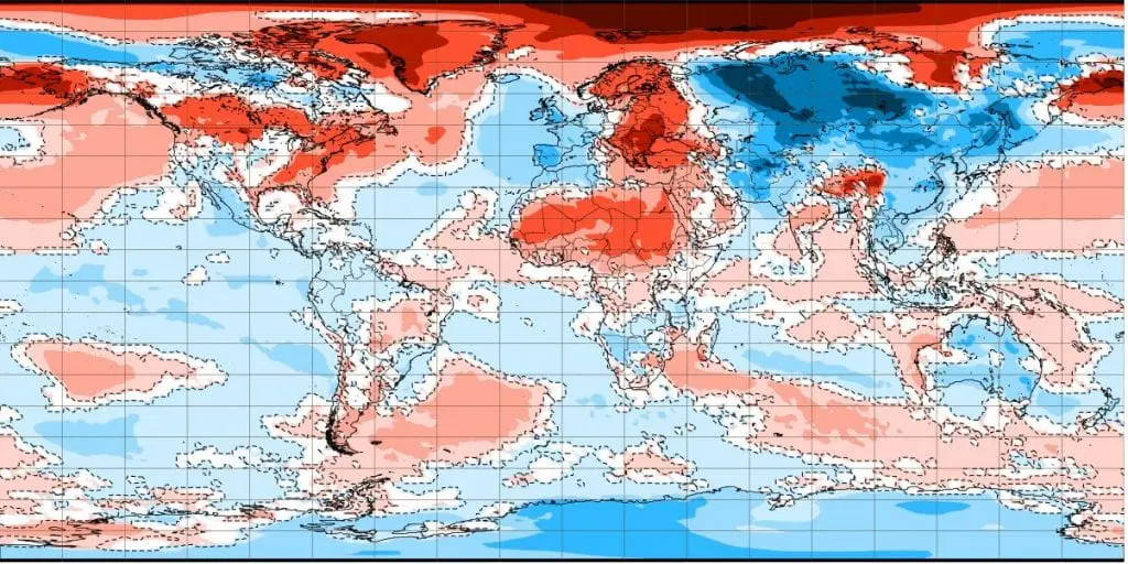
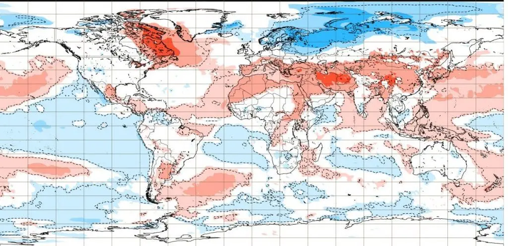
Forecasts for 6 weeks from 28.12.2020 to 8.2.2021 /weeks Monday-Sunday/ – amomalies of goepotential (up), precipitation (in the middle) and temeprature (down) from long term average /ECMWF
28.12.-4.1.
4.-11.1.
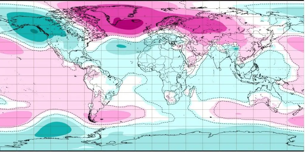
11.-18.1.
18.-25.1.
25.1.-1.2.
1.-8.2.
28.12.-4.1.
4.-11.1.
11.-18.1.

18.-25.1.
25.1.-1.2.
1.-8.2.
28.12.-4.1.
4.-11.1.
11.-18.1.

18.-25.1.

25.1.-1.2.
1.-8.2.