Already in previous article we have pointed to explosive potential of Mediterranean low over Adriatic and part of Central Europe /https://mkweather.com/2020/12/03/central-europe-and-balkan-close-to-20c-and-3rd-level-warnings-before-blizzard//.
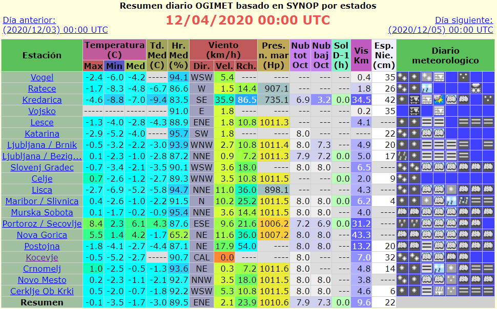
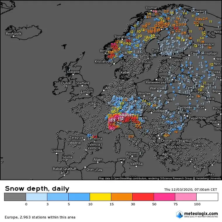
In the northern part of this system, extreme snowfall accumulations have created above large part of territory of Slovenia, southern Austria, northern Croatia and northern Italy during last 36 hours (from Wednesday to Thursday, 2.-3. December 2020), with result local acumulations up to 50 cm of fresh snow in western Slovenia! Some snow has fallen in Czechia, too, but it was only few centimeters.
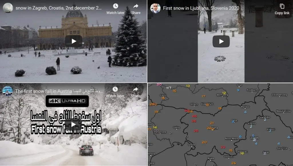
Snowing hit Zagreb and Ljubljana, with Mediterranean climate, too.
In more southern parts of Croatia and in Serbia, severe winds have occurred – in Vrsac, Serbia (lowland) was measured wind gust 115 km/h and in Split, Croatia, 101 km/h.
In Split has fallen near severe winds 138 mm of rain on Thursday, 3. December 2020 for only 24 hours, in Messina, Italy 66 mm. In parts of Croatia, main highways were closed due to freezing rain.
People from the region immediatedy shared lot of videos on Youtube.
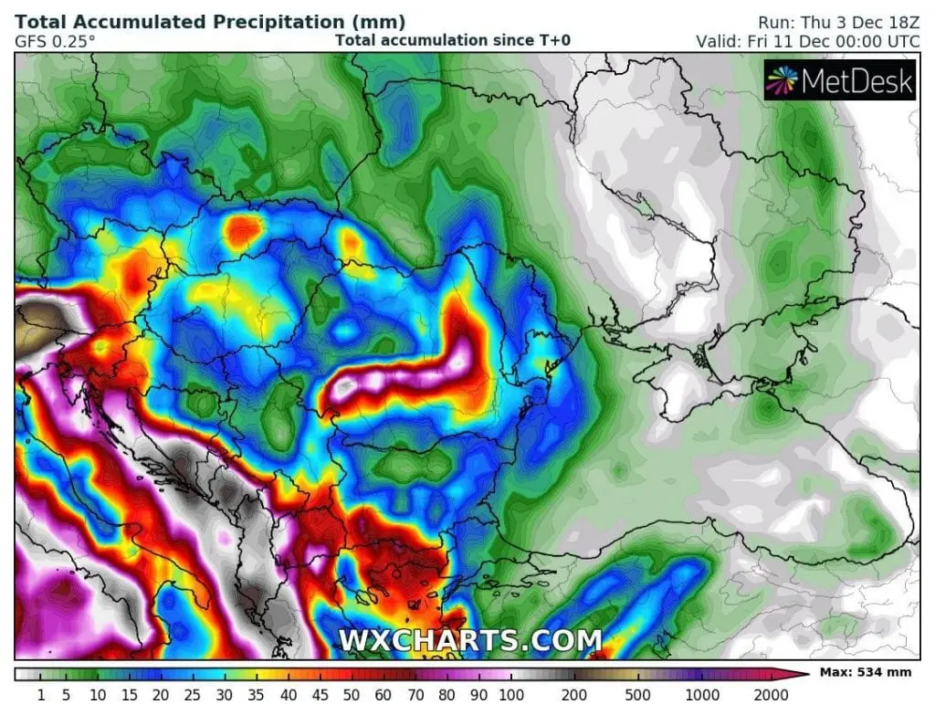
Next 7 days (until 10. December 2020), next heavy rains and snowfall are expected in the region, mainly in Adriatic, with possibility of floods and snow calamity in the mountains.
In the Alps, 4 meters of snow is expected /https://mkweather.com/2020/12/04/polar-vortex-is-here-in-the-alps-4-meters-of-snow-expected//.
Infographics: meteologix.com, ogimet.com, wxcharts.com: