Record rainfall in Alaska: Dangerous floods and landslides – Next Triple-cyclone is coming from Pacific
Alaskan coast is bothered by severe rain- and snowstorms in early winter 2020/2021.
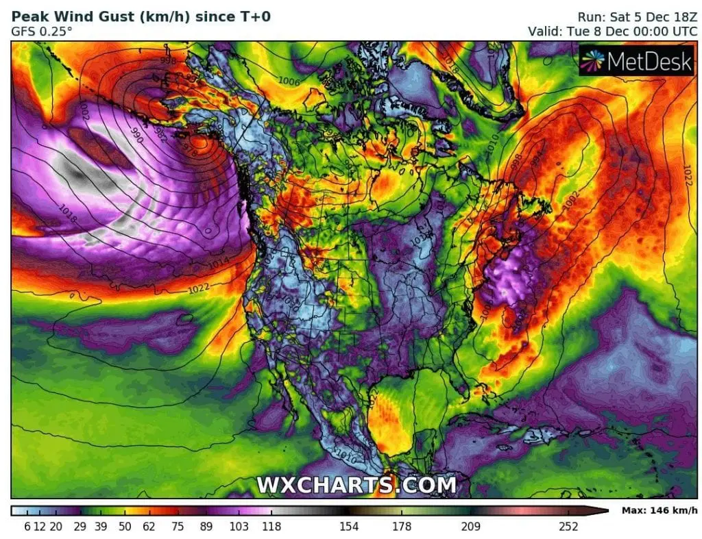
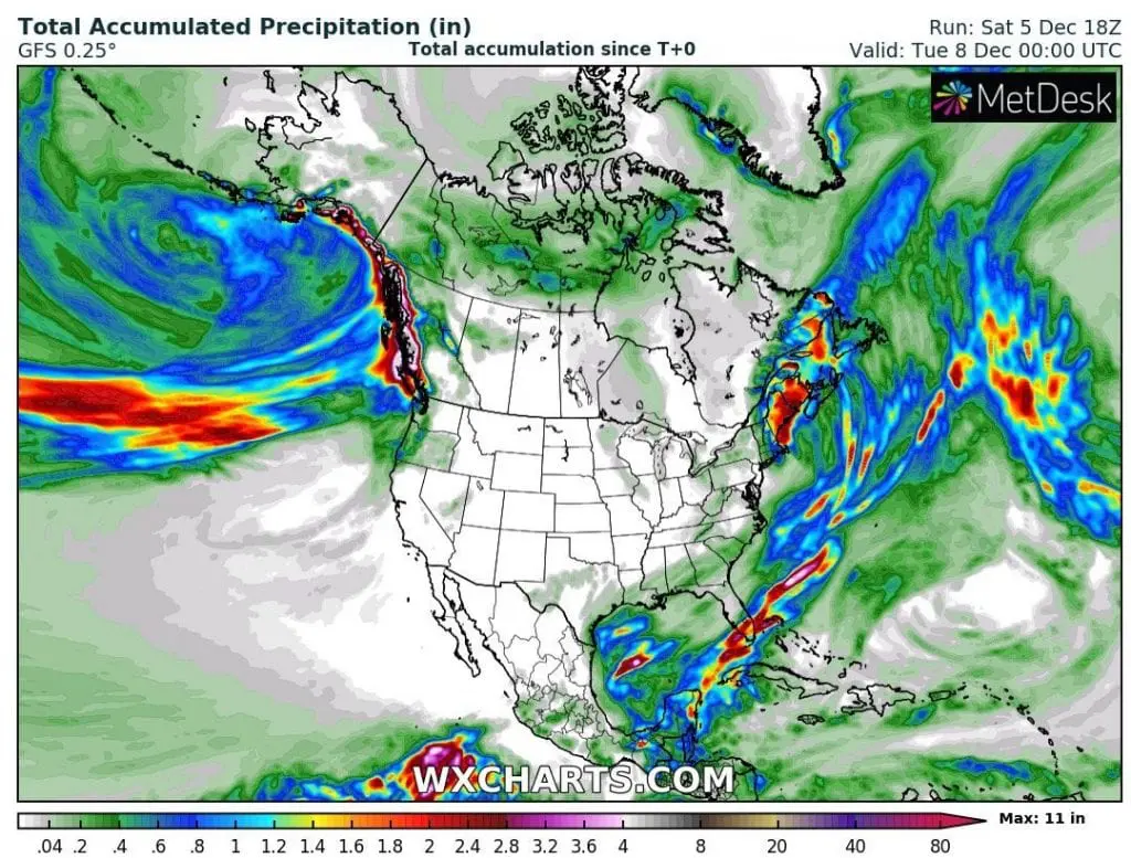
Firstly, extreme amounts of 48-hour precipitation dropped in southeastern coast of Alaska on 1. and 2. December 2020 – up to 9.75 inches / 248 mm (floodlist.com), then a monster cyclonic system is moving towards Alaskan coast, with next extreme rainfall, up to 15 inches / next 48 hours (Sunday and Monday, 6.-7. December 2020).
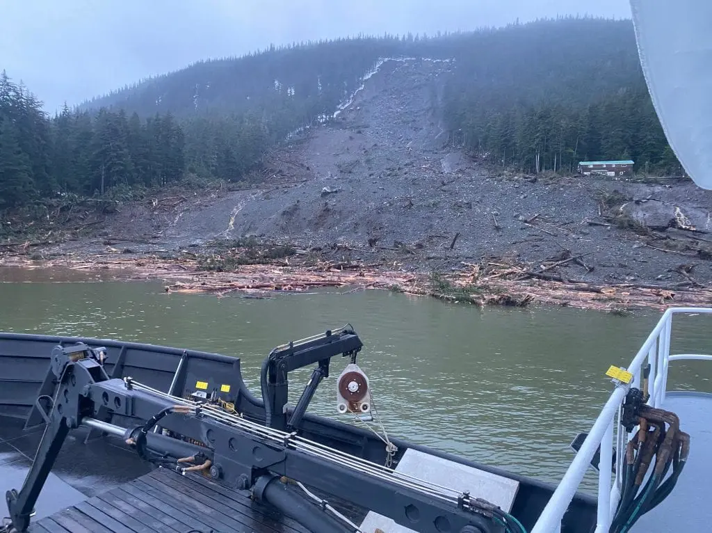
Heavy rains in first 2 December days caused a large landslide on the coast in Haines – 4 people has been found and 2 are still missing.
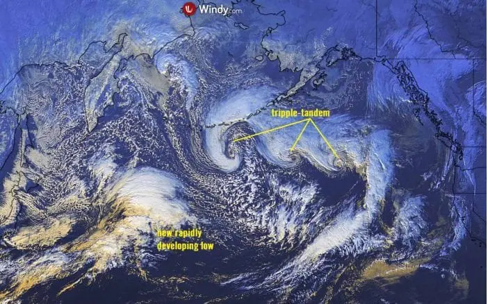
Over northern Pacific, trio of cyclones such a monsterstorm are moving above Alaska and next floods and landslides are during next week possible.
Thanks to La nina and PNA+ phase, bomb cyclogenesis will be during winter 2020/2021 very frequent in the region, with significant cooling effect of northwestern parts of Northern America- mainly Alaska, Yukon and British Columbia, but too Northwestern Territories, Alberta and Saskatchewan.
Mkweather Winter 2020/2021 forecast for the USA and Canada (and Europe, too) you will find on /https://mkweather.com/2020/11/24/winter-forecast-2020-2021-final-outlook//, La nina seasonal outlook on /https://mkweather.com/2020/11/14/forecast-for-world-winter-2020-21-and-summer-2021-according-to-enso-predictions-strong-la-nina-winter-neutral-summer//, NOAA winter and December forecast reviews on /https://mkweather.com/2020/11/29/winter-forecast-for-usa-from-noaa/; https://mkweather.com/2020/12/03/updated-forecast-for-december-2020-for-the-usa-from-noaa//.
Infographics: