Winter 2021/2022 in Europe should start very early, NAO- and cold airflow are predicted
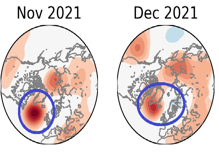
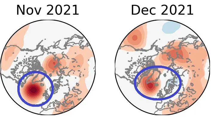
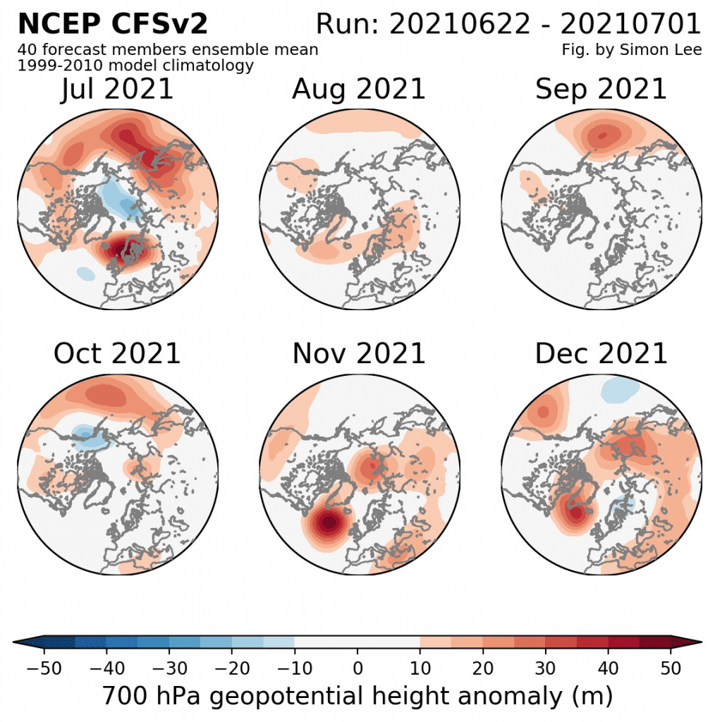
According to NCEP CFSv2 40 members mean 1999-2010 model climatology forecast for early Winter 2021/2022, available on the page /https://simonleewx.com/cfsv2_monthly-anomalies//, extremely strong positive geopotential in 700 hPa anomaly is forecasted for parts of Northern Atlantic in November and December 2021.
This positive geopotential/air pressure anomaly means, that Icelandic low should be during these months extremely weak, Azores high possibly anomalously weak, too, with the result of the negative phase of North Atlantic Oscillation (NAO- phase).
This phase means big potential for atmospheric blocking and early winter coldwaves in Europe at the end of the year 2021.
Moreover, in December 2021 output, a low geopotential anomaly is outlined above Scandinavia, which should mean similar circulation such as during Spring 2021, when above Scandinavia anomalous pressure low and above the Atlantic anomalous high-pressure ridge were persisting long months.
Flowing on the backside of the cyclonic system above Scandinavia and on the front side of high-pressure anomaly above the Atlantic should bring more coldwaves than usual.
This information will be on Mkweather updated, including the outlook for all Winter 2021/2022, with other materials, soon.
For now, it appears, that after hot Summer 2021, cold Autumn 2021, with extremely strong Hurricane season 2021 is expected and then, early shots of winter should surprise already in November or December 2021.
Early materials about the possible evolution of weather during the next winter, Winter 2021/2022, are available here:
- https://mkweather.com/the-next-cold-winter-strong-la-nina-in-winter-2021-2022-forecasted/
- https://mkweather.com/first-forecast-for-winter-2021-2022-weaker-la-nina-such-as-in-2020-2021-but-still-big-hopes-for-extreme-coldwaves/