Before coldwave with snowing and frosts in South Africa, we warned before a few days /https://mkweather.com/south-africa-2-antarctic-fronts-with-snowing-and-subsequent-frosts-hit-the-region-in-the-next-few-days//.
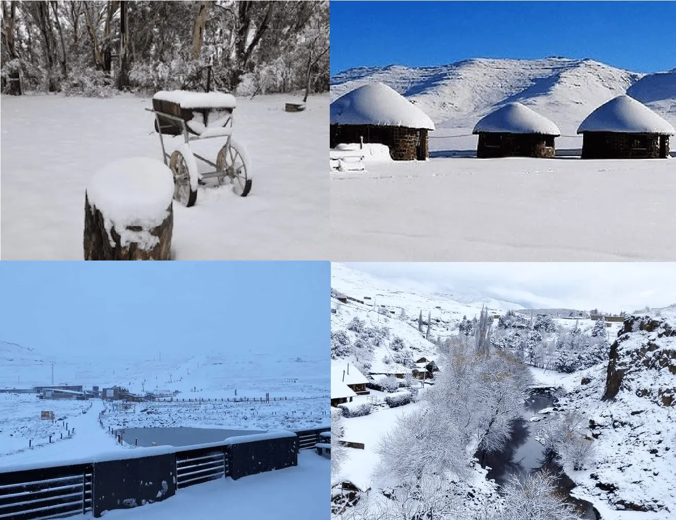
The country really hit Antarctic fronts and in higher elevated, densely populated basins was snowing, again.
Temperatures thanks to humidity although aren´t so low, such as during center of pressure high above the area, but temperatures a few degrees below zero had produced snowfall in many parts of Drakensberg Mountains in SAR and Lesotho.
In some parts dropped up to 20 cm.
A strong temperature anomaly from the long-term average was from Thursday, 19. August 2021 projected into southern parts of the country, and cold anomaly hits during the next 3 days other parts, too.
On Monday, 23. August 2021, a new heatwave will start, but already around 28. August, the next shorter, but extreme coldwave is forecasted for parts of South Africa, Namibia, Botswana, Lesotho, and Eswatini, with a possible last significant severe frosts and snowing of the season. Temperature anomalies during this coldwave should reach more than -15°C.
The long-termly cooling of Antarctica is causing together with the La Nina pattern good conditions for Antarctic outbreaks across South America, South Africa, Australia, New Zealand, and Oceania. Although heatwaves dividing simple coldwaves should be strong and average character of winter season neutral, extreme frosts, such as in July 2021 in Namibia, Botswana and Zimbabwe should appear /https://mkweather.com/antarctic-winter-in-africa-namibia-100c-botswana-77c/; https://mkweather.com/botswana-97c-only-09c-from-the-all-time-national-record/; https://mkweather.com/johannesburg-sar-70c-all-time-july-record-zimbabwe-67c-2021//.

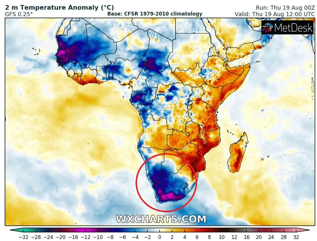
Source: wxcharts.com
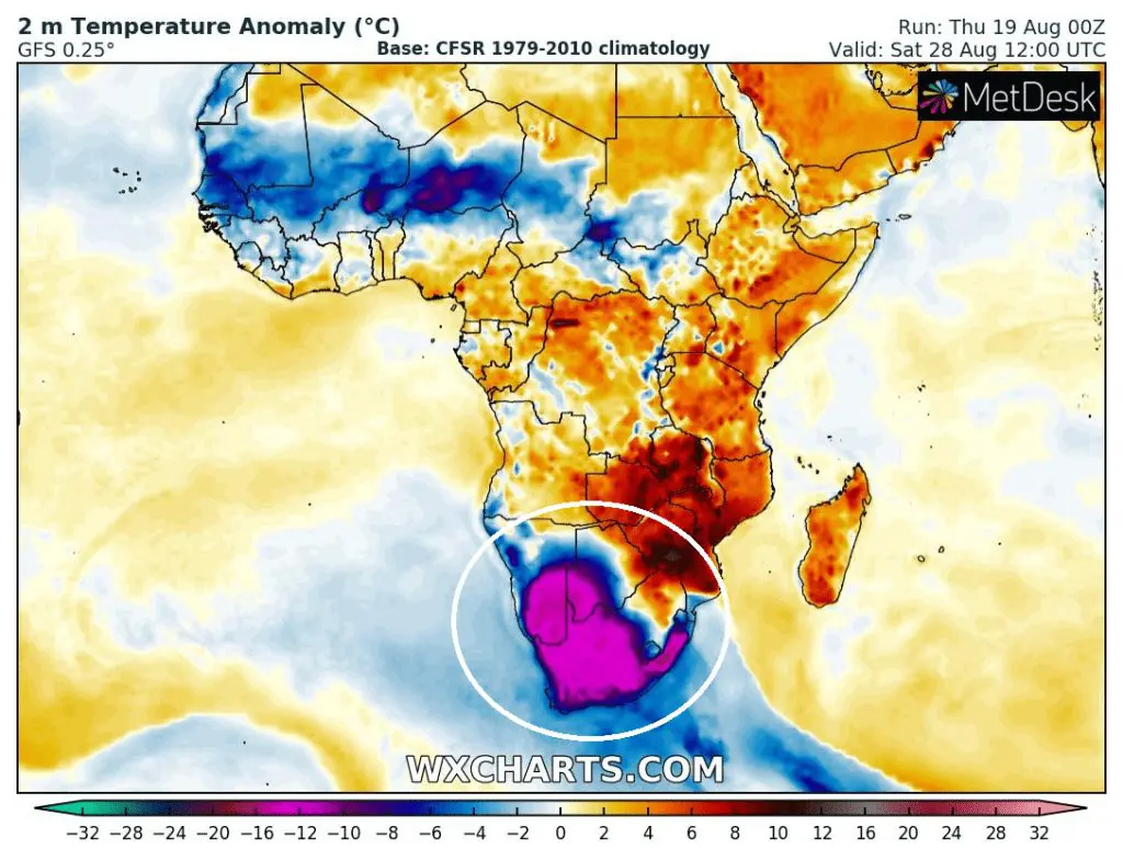
Source: wxcharts.com


