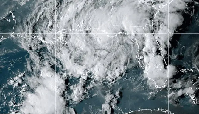
A stormtrack of Tropical storm Mindy – not above northeastern Mexico, Texas, and Louisiana, such was previously forecasted, but above Florida, Georgia, and South Carolina was relatively surprising, and inhabitants of the southeasternmost parts of the USA in the last hours experienced with severe storms and strong winds, regionally /https://mkweather.com/a-possible-tropical-storm-mindy-should-hit-texas-louisiana-mexico-maybe-mississippi-alabama-and-florida-the-next-hurricane-in-the-gulf-coast-possible-around-15-9-and-around-8-12-9-near-wester//.
The system brought rainfall 1-5 inches (25 – 125 mm), with local floods, winds reached minimum threshold for classification of a tropical storm.
The system is bringing worsening weather mainly in northern Florida, southern and eastern Georgia, and southeastern South Carolina. Then will be continuing above the Atlantic.
Meanwhile, Hurricane Larry hits Newfoundland and then aims towards southeastern Greenland and Iceland.
Above the coast of West Africa, the next tropical system is developing, but the outlook for the next 40 days of the Atlantic hurricane season is favorable – weaker tropical activity is forecasted between 10. September – 20. October 2021, thanks to dry MJO pattern, with 4, 5, 6, and 7 MJO phases /https://mkweather.com/weaker-hurricane-season-between-10-september-20-october-dry-mjo-phases-456-and-7//.
However, above the Caribbean or Gulf Coast, the next weaker systems – tropical depressions, tropical storms, or weaker hurricanes should during this period appear, therefore, won´t be fully apathetic to watch tropical activity forecasts in the next weeks.
Still, above-average Atlantic hurricane season is forecasted and the next round of severe tropical activity should arrive in the second half of October or the first half of November 2021, according to estimates.
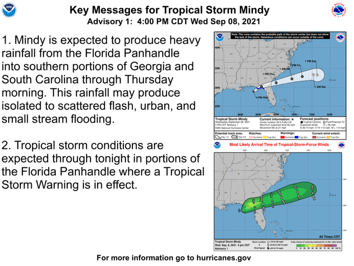
Source: NOAA
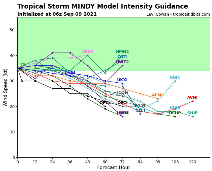
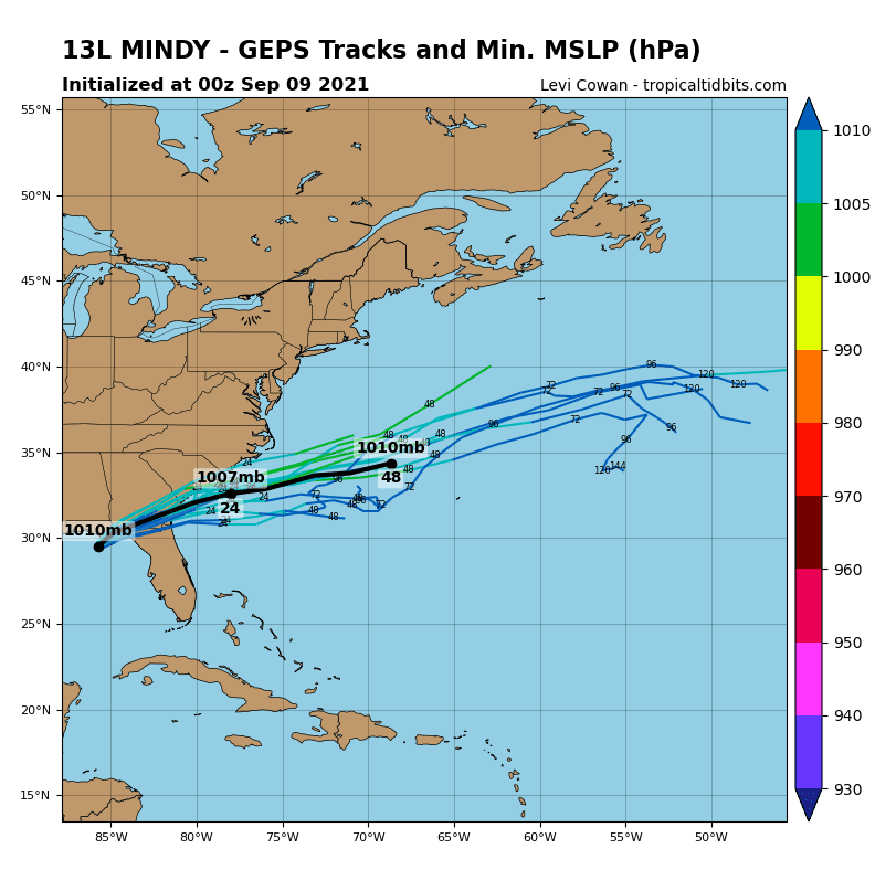
Source: tropicaltidbits.com
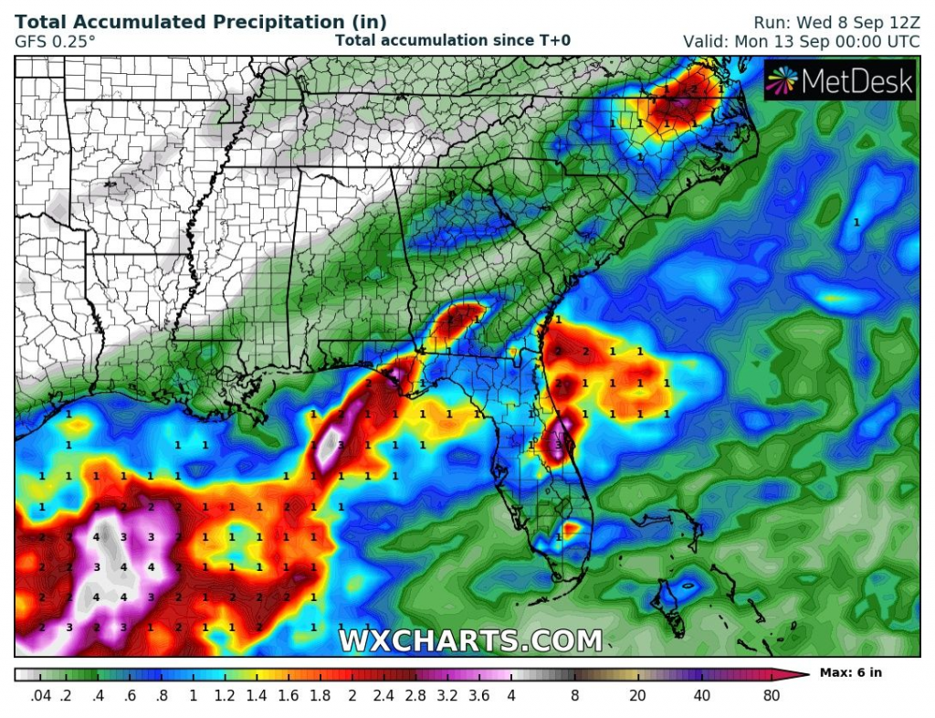
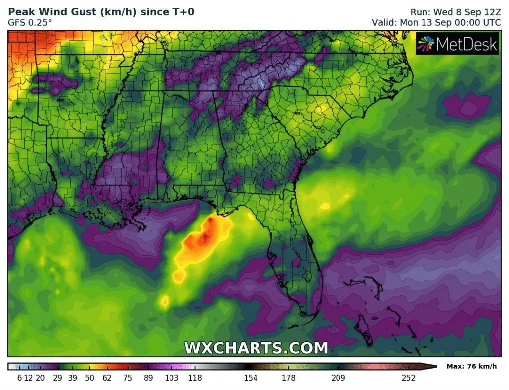
Source: wxcharts.com


