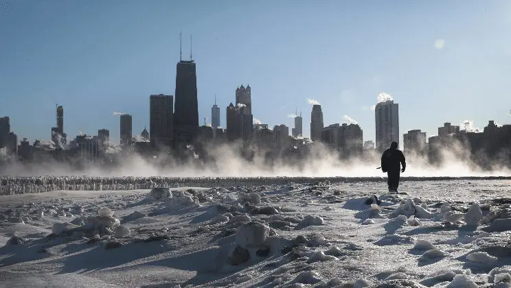
Arctic high pressure and long-term extreme frosts are expected until 17. February 2021 over large parts of the USA and Canada.
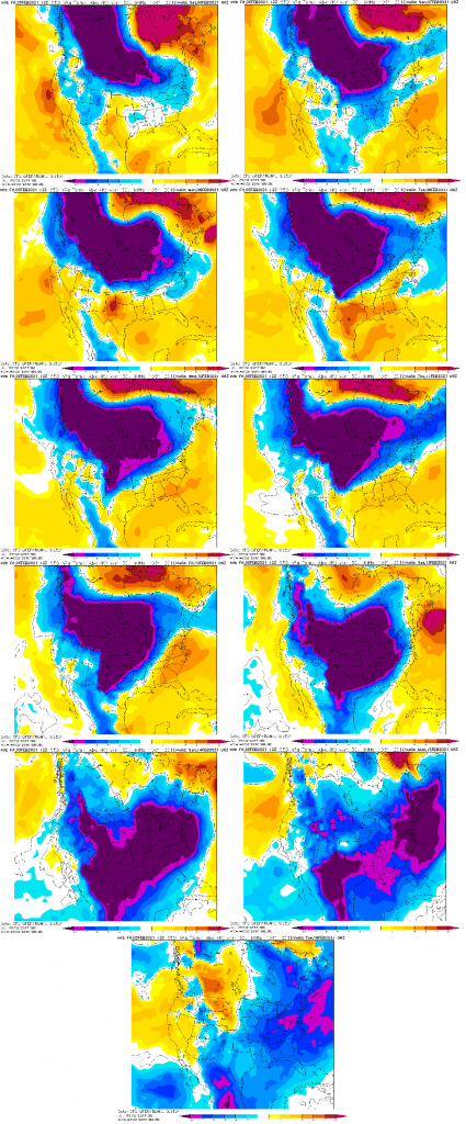
Arctic Oscillation Index should drop anomalously low, between -6 and -7, what means extremely strong, widespread and recrod coldwave for many parts of the USA (and parts of Canada).
Already on Friday, 5. February, temperature in Stafansson, north-central Canada, temperature dropped to -48,5°C /-55.3°F. In Fort Chipewyan, Alberta (238 MASL), temperature already on Saturday, 6. February, dropped to -41,5°C / -42.7°F and it is still decreasing.
For next days, bone-chilling winter is predicted almost for whole territory of the USA – very interesting it should be in Rocky Mountains, where temperatures should drop below -45°C / -50°F.
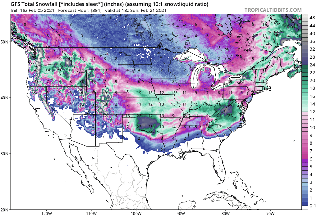
Snow is forecasted for southern states, too, with 2 possible regions with blizzard conditions (Oklahoma and Virginia).
Mass of anomalously cold air will slowly shifting from northwest to southeast during next 10 days and many Americans will experience with the coldest winter conditions of the season, with possibility of regional temperature or snowfall records.
I guess we are doing negative Arctic Oscillation (AO) next week. That means very high pressure over the Arctic & perhaps colder USA signal. pic.twitter.com/C5kiCMkhbX
THIS is the Arctic Airmass that will break loose and head into the USA this weekend. We will feel it in Texas by Wednesday of next week. 🥶 pic.twitter.com/hH1Y5GiTd6