
After second windstorm – Francis, which is bringing over Europe severe winds from Monday till Thursday 24.-27. August 2020, third pressure low will come to Europe, but it won´t be a windstorm fortunately.
All trio of pressure lows together is causing gradual cooling of continent, with 3 separately coldwaves till end of August 2020.
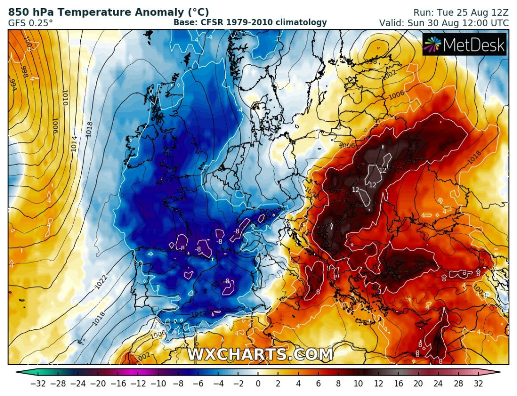
Before arrival of cold front linked with this third cyclone, warm air will start flow over southern France and Central Europe during last days of August 2020, but advection of hot air will be the strongest over Eastern Europe and easternmost parts of Central Europe and Balkan from around 29.8.-2.9.2020.
West Europe and gradually Central Europe too, stay in cold air during last August days and at the start of September (UK already in cold air on Wednesday 26.8., Central Europe up to 4.9.2020, but before cold front warm, yet).
Meanwhile in Ukraine could temperature reach up to +38°C, in many parts of western and Central Europe maximum temperatures gradually will reach only +15/+20°C, near heavy rain lower in northern parts. Unexpectedly hot can be together with Ukraine in Belarus, Baltic states, Moldova, but too eastern Poland, Slovakia and Hungary shortly before arrival of powerful cold front at the end of the month.
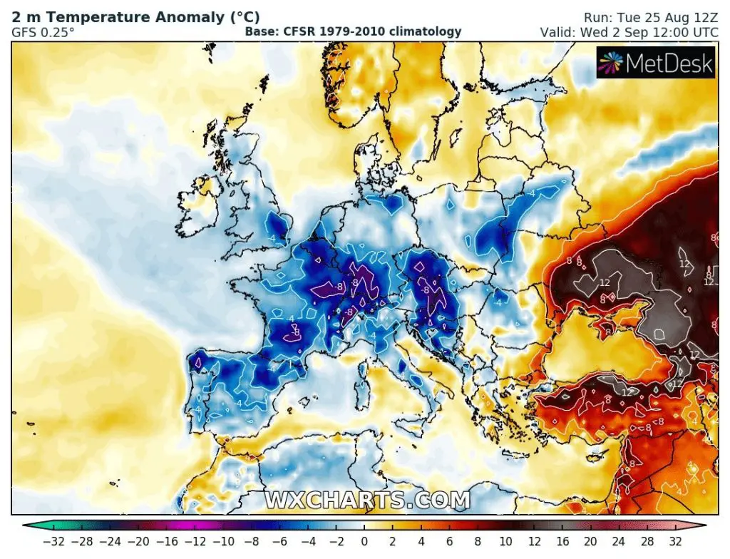
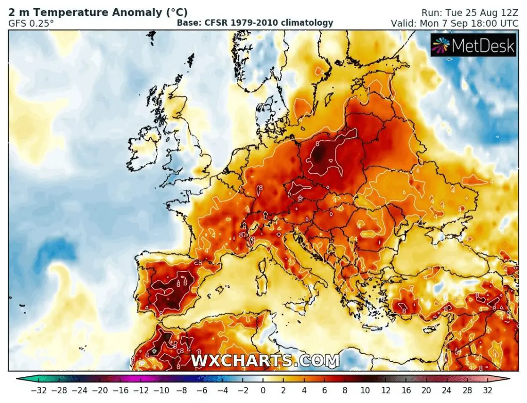
First September decade (1.-10. September 2020) will bring at first this coldwave, but later, between 4. September (UK, France) – 9. September (East Central Europe) will arrive cca 3-4 day heatwave with possible tropical temperatures across France and Central Europe (southern France up to +36°C, Germany, Alpine and Carpathian region up to +32/34°C).
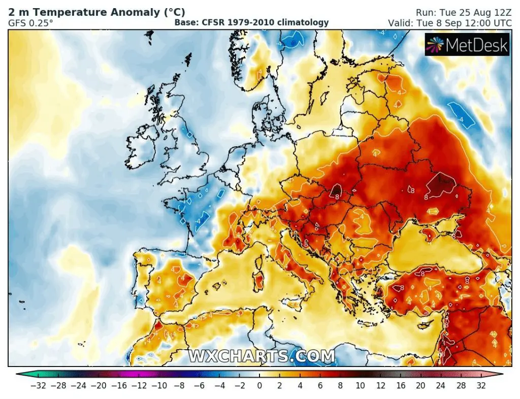
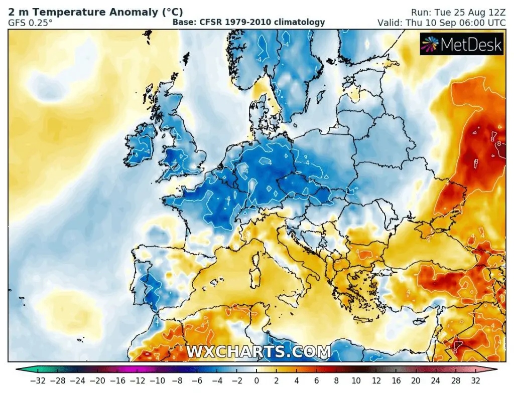
At the end of decade, over British Isles already from 7. September, in Central Europe from 9. September could arrive next strong coldwave after next cold front with the next windstorm. This windstorm, however can moving along northern stormtrack (British Isles – Scandinavia), therefore Mediterranean, Balkan and southernmost parts of central Europe won´t be affected very intense by cold, rain and wind and summer will be continue here with moderate breaks (Spain and Turkey still up to +40°C, Balkan and Italy +36°C). In contrary, in the North can be very cold, rainy and windy with maximum temperatures only +10/+15°C regionally.
Precipitation/Pressure, T850 hPa and T2m anomaly over Europe 25. August – 10. September 2020 /wxcharts.com:

The most powerful shots (coldwaves and heatwaves above Europe during the next period) /wxcharts.com
Accumulated precipitation till 10. September 2020 – Mediterranean stays in hot tropical air far from stormtracks of pressure lows with rain and wind /wxcharts.com:
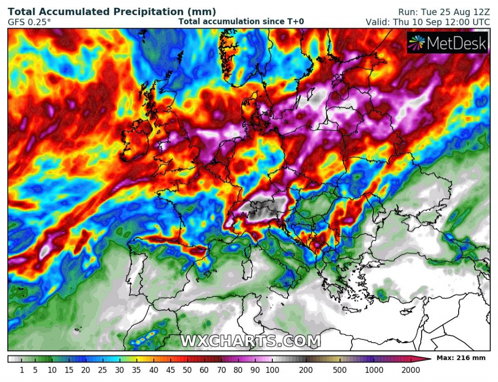

Illustration photos: https://www.merriam-webster.com/words-at-play/words-for-autumn-fall; http://www.cruzine.com/2010/11/25/autumn-photography/


