In Benelux temperatures up to -25°C and snowfall rarely up to 50 cm, in France snowfall up to 20 cm and frosts up to -20°C and in England snowfall up to 30 cm and frosts up to -15°C – this is an extreme scenario of Beast from the East for the warmest parts of western Europe.
Many regions report untraditionally deep snow cover, but in warmer areas have appeared floods – mainly in France, including Seina in Paris. Floods last week scared parts of Greece and Turkey, too, but in very warm conditions.
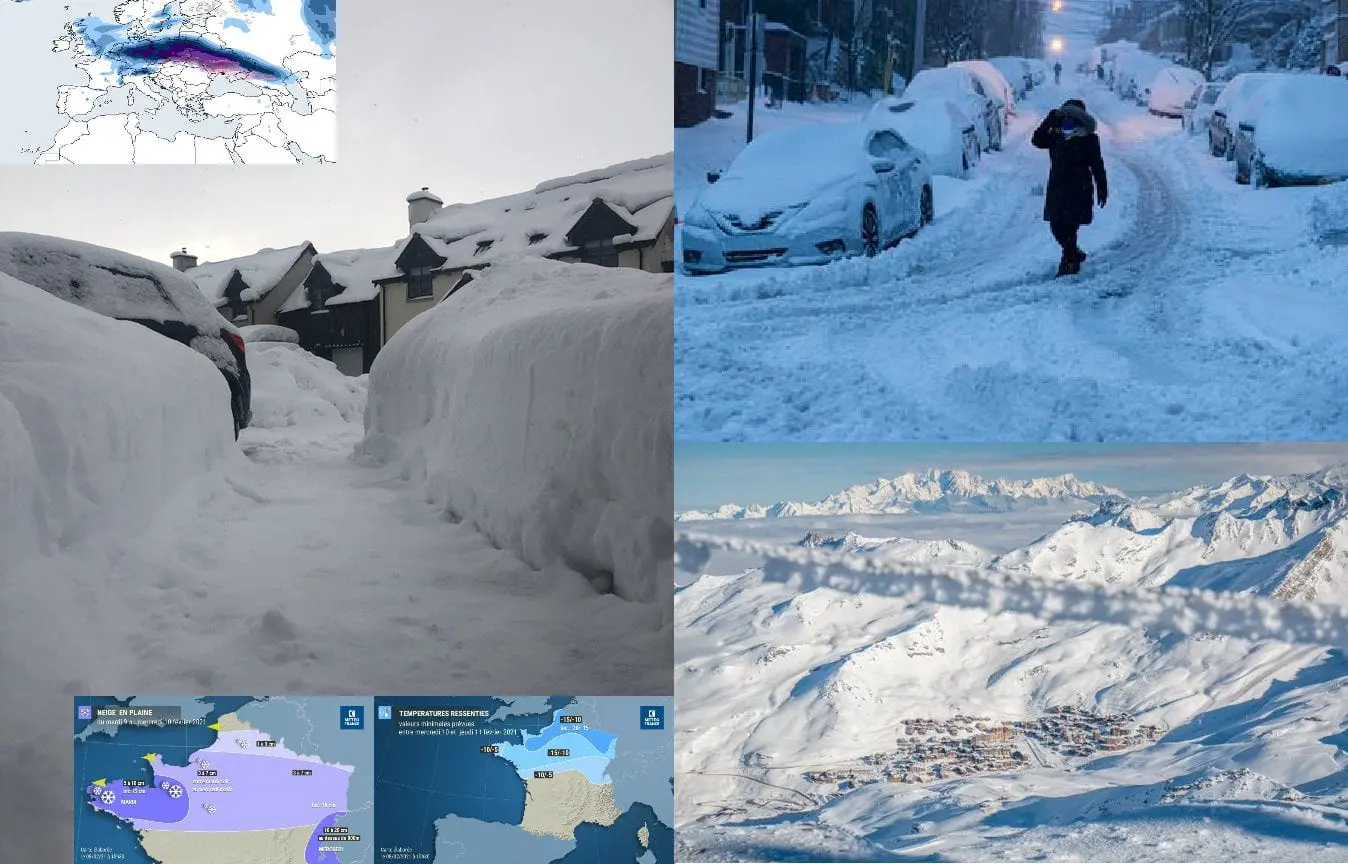
It´s a solid west-European winter in outlook for the next days – while Central Europe is preparing for -33°C frosts (the newest estimates) and even worse snow calamity in the line from Ukraine to northwestern Germany, western Europe experiences with the second – and stronger, Beast from the East of the year.
In lower situated basins and valleys in the French Alps, should temperature drop into -25/-30°C even, at the end of the week.
Extreme Siberian blast will be on Mkweather carefully watched in every part of Europe and we will bring measured extreme temperatures overviews from European countries every day.
LRPT image from the 8:44 GMT west pass of the Meteor M2 weather satellite. Remnants of former storm depression Darcy over Europe, which brought a lot of snow in the Netherlands yesterday. pic.twitter.com/WlBHYHMpEZ
In the Netherlands we don't expect a lot of snow in the wintertime, but storm Darcy has now left us with piles of it. You can either stay warm inside or face the cold and ride the sleigh outside! What will you do?#snowstorm#Darcy#Netherlandshttps://t.co/wmuw8snEyg
The next featured resort in our postcards from the mountains series is must- #ski resort, @Val_Tho, France: “We’re looking forward to sharing this beautiful setting with our favourite clients again when we can. Whenever you’re ready, we’ll be here for you” https://t.co/667uk689j3pic.twitter.com/c7GBde2zVd
🇩🇪: "Rail and road traffic across swaths of Germany were disrupted as snow blanketed the country's transport network. Winter weather also disrupted travel in Belgium, the Netherlands and the UK, with more snow predicted across much of northern Europe."https://t.co/RERJqCBQlN
If I can believe my Twitter feed, people in Belgium are currently driving their cars like my son is sliding down our hill every day in Norway. #snowpic.twitter.com/dr6UJLVQdd
— Lellybrookes 🏴🐬🏴🐳 (@lesleybrookes) February 8, 2021
Experts have warned of heavy snowfall and strong winds in the south-east of England, and have announced that it may snow up to 30 cm in some areas. #uksnowpic.twitter.com/E032Wy5TOe
— Craig Connor – Photojournalist 📷 (@ConnorReachPLC) February 8, 2021
VIDEO: 🇬🇧 A thick layer of snow covers the landscape of the Yorkshire Dales in northern England after #StormDarcy brought snow and freezing temperatures to parts of the UK #Askriggpic.twitter.com/hB2RTeDoJc
Heavy snow continues to fall around Ipswich in Suffolk as Storm Darcy brings disruption to south-east England and East Anglia as bitterly cold winds continue to grip much of the nation pic.twitter.com/EswOwqFA4o
Snowfall will continue through the next few days with some places seeing another 2-5cm on top of what's already falling. In some areas, this could be up to a further 10cm pic.twitter.com/ut2N756bYD