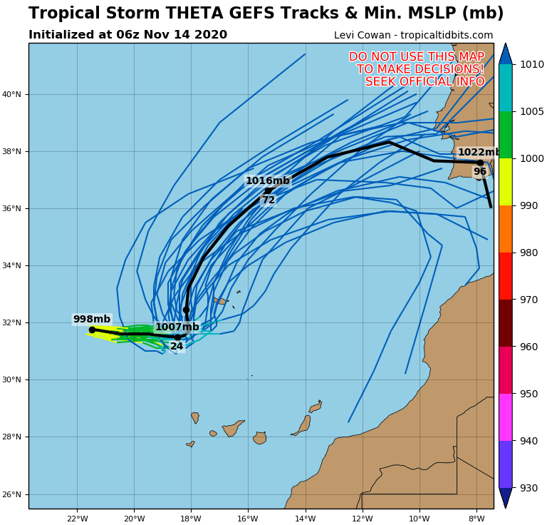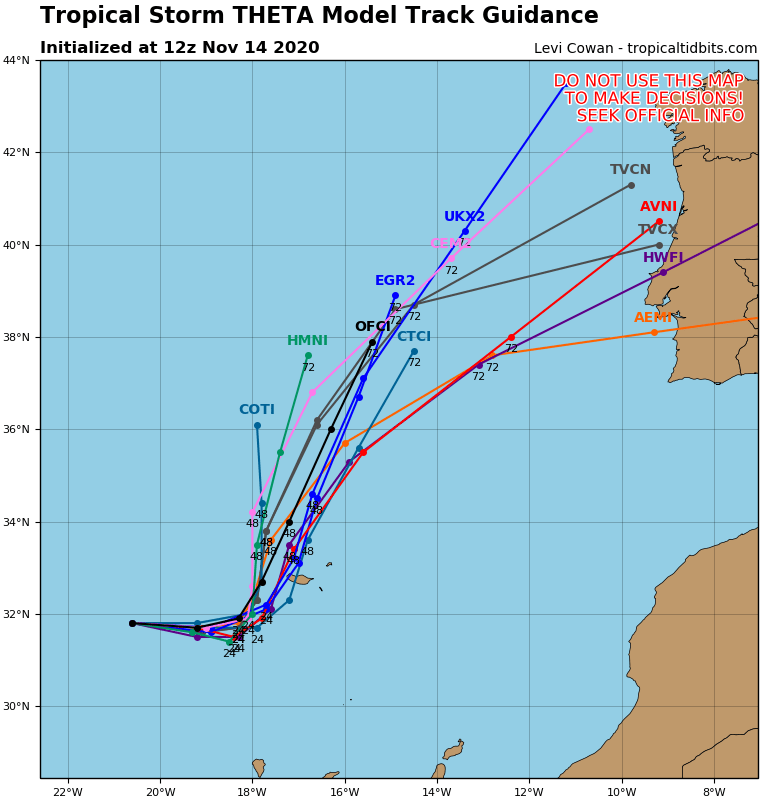
Tropical storm Theta not far from Madeira has weakened to a tropical depression, but remnants of a system with possible strong impact hit Portugal and Spain already around Tuesday, 17. November 2020.
The most probably forecasted stormtrack of ex-Theta are situated on a line Madeira – Lisbon or more northern, Madeira – Porta or even Madeira – La Coruna.
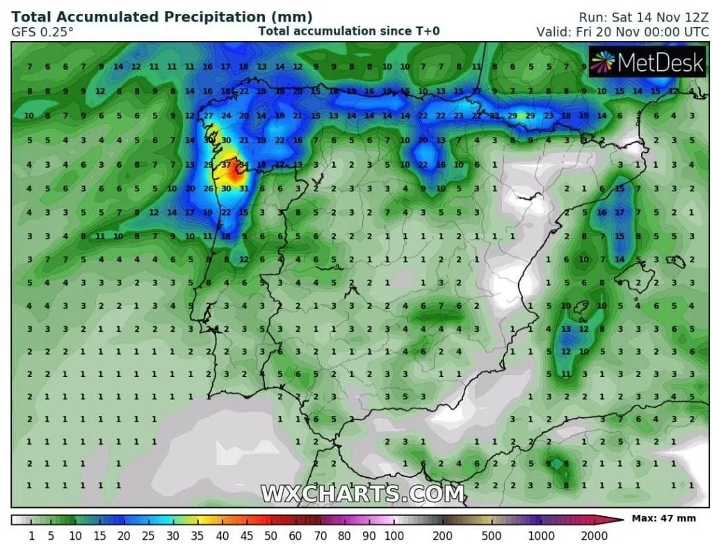
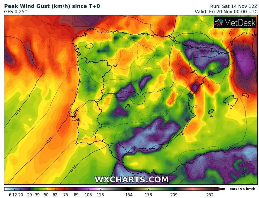
Model GFS in its last runs has forecasted possible flash floods with local rainfall 50-100 mm (it should be higher than is showing model, locally) and possible wind gusts up to 75 – 100 km/h in Porto and Braga region, northern Portugal and neighboring region of northwestern Spain (Vigo, La Coruna).
Atlantic hurricane season 2020/2021 is the strongest hurricane season ever, with together 31 tropical storms until the half of November 2020 (last Iota such a possible major hurricane hit next week Central America – more on Mkweather homepage).
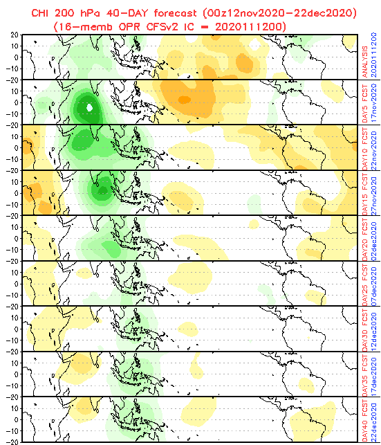
Favorable MJO conditions for tropical storms development should stay over Atlantic sector until 20. November, then neutral or weak wet MJO phase is forecasted around 7.-12. December 2020 (it has shifted from 30. November to later dates), therefore until 20. November or 10-15 days before a Christmas we should seen last tropical storms of a season – Kappa, Lambda, Mu, Nu, Xi, Omicron, Pi, etc…
What do you think, how many tropical storms will be result of extreme active hurricane season?
Infographics: tropicaltidbits.com, wxcharts.com, NOAA:
