19% of Greece under the snow, the snowiest December since 2004!
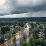
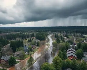
Lower elevated parts of the country hit in the last 5 days heavy rains up to 301 mm, with a result of 1 dead.
Already in the last Mkweather article, we were informed about the extreme blizzard in Balkan in the last days, with result of up to 1 meter of snow in mountainous areas and up to 40 cm in metropolitan areas, e.g. Belgrade, Serbia or Tuzla, Bosnia, and Herzegovina /https://mkweather.com/beograd-serbia-tuzla-bosnia-and-herzegovina-with-40-cm-snowfall-most-of-balkan-after-a-blizzard//.
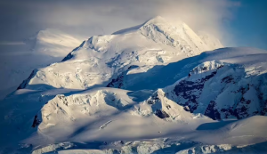
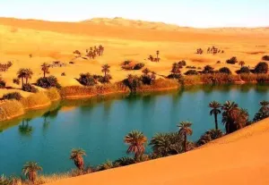
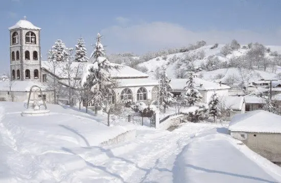
Severe snowstorm has shifted above Greece, too, from where the heaviest early winter snowfall in the last 17 years is reported.
19% of the territory of Greece is covered under the snow, which is the highest December value since 2004.
The average daily snow cover for the period from 2004 to 2021 in early December is about 4% according to /https://www.ekathimerini.com/news/1173691/annual-rainfall-and-snowfall-records-broken-in-december// and the National Observatory of Athens.
Snowfall in the last day appeared in many populated parts of the country, e.g. in Florina or Attica.
Florina, 650 MASL, reported on 13. December temperatures only in interval -0,8°C / +0,8°C.
However, in some parts of the country, freezing rain has appeared.
In Athens, the minimum temperature dropped to +6,6°C and in Heraklion, Crete, to +9,8°C.
In the outlook, an even stronger coldwave, with a possible snowing and frosts around Christmas time and New Year 2021-2022, is forecasted.
Snow should appear during this period regionally along the coast of Greece and very rare snow cover should appear in metropolitan areas.
Cold weather is forecasted to persist in the southern half of Europe until 25. January 2022, but gradually should replace cold blocking pattern sunny, but still with very cold nights, NAO+ /https://mkweather.com/ecmwf-6-week-forecast-for-europe-until-24-january-2022//.
Snow fell in parts of Greece including Attica https://t.co/irbg8x6bd1 pic.twitter.com/7cxpj6TK0b
— Tornos News Int'l (@TornosNewsCom) December 14, 2021
Will it or won't it… cold air so very close to the UK as we head into Christmas but the exact position of the high pressure is crucial in deciding where the cold ends up.
— Highlandweather (@highlandweather) December 14, 2021
It looks increasingly likely Europe will have a cold Christmas, snow for Greece looks more likely than UK pic.twitter.com/Wgc5ggEewx
Let it snow let it snow ❄️❄️#Serres #Greece https://t.co/q2cUel10lv
— Andromache Tziamou (@MaggieTziamou) December 13, 2021
Snow in Florina, Greece😍❄️❄️❄️ https://t.co/3fMaBdEmEQ
— Black Mamba🪬Aka فوتيني 🇬🇷🇸🇦 (@mamba_aka) December 13, 2021
Record breaking snowfall in Greece:
— Don Penim (@Don_Penim) December 14, 2021
.."In terms of snowfall, satellite data showed that on Saturday, December 11, 19% of the country was under cover of snow, beating a 17-year record."..https://t.co/5HwSGSdKjH
One woman dies as torrential rain floods large parts of Greece https://t.co/nR71WUIkwr via @Greek Herald pic.twitter.com/M6o3cLTBB1
— qwerty (@qwerty14117587) December 13, 2021
Storms pound parts of Greece, kill one https://t.co/52641hrMhO #Reuters #Floods #Storms #Greece
— The Fiji Times (@fijitimes) December 13, 2021
Massive floods in Greece, now.
— Extinction Rebellion Global (@ExtinctionR) December 12, 2021
It won't stop. We can only stop it getting even worse.https://t.co/5JSd8Uq7pU
Heavy #rain has caused a river to flood in central #Greece and the whole valley is underwater. The climate crisis is being normalized, extreme weather is becoming the norm.
— Agisilaos✊🏾🌍 (@Agisilaos_K) December 12, 2021
Drone video: https://t.co/5Yuc01QUep#climatecrisis #flood #πλημμυρα #κλιματικηκριση pic.twitter.com/8ndT3IdoCc
Our thoughts are with our partner community @mwa_townhall #Greece as almost the entire Municipality of #Western #Achaia, below the National Road Patras-Pyrgos, is affected by #flood. #EUCivPro #DRR #ResilienceForAll https://t.co/drvwXAyPOi pic.twitter.com/gERg193ShH
— SRC-CMINE (@resiloc) December 11, 2021