The next 2 weeks without summer: A big Arctic forecast for European cities – damages on sensitive plants (frosts), a worsening of virological situation, difficult tourism and warm clothes preparations!
Before severe late summer and early autumn coldwave we informed in the last articles /https://mkweather.com/10-15-day-coldwave-for-europe-maximum-temperatures-only-8-14c-regionally-and-the-first-frosts-in-valleys/; https://mkweather.com/autumn-in-europe-is-coming-the-last-august-days-brings-the-arctic-blast-temperatures-rarely-should-drop-to-3c-and-the-first-ground-frosts-are-possible/; https://mkweather.com/autumn-in-europe-is-coming-the-last-august-days-brings-the-arctic-blast-temperatures-rarely-should-drop-to-3c-and-the-first-ground-frosts-are-possible//.
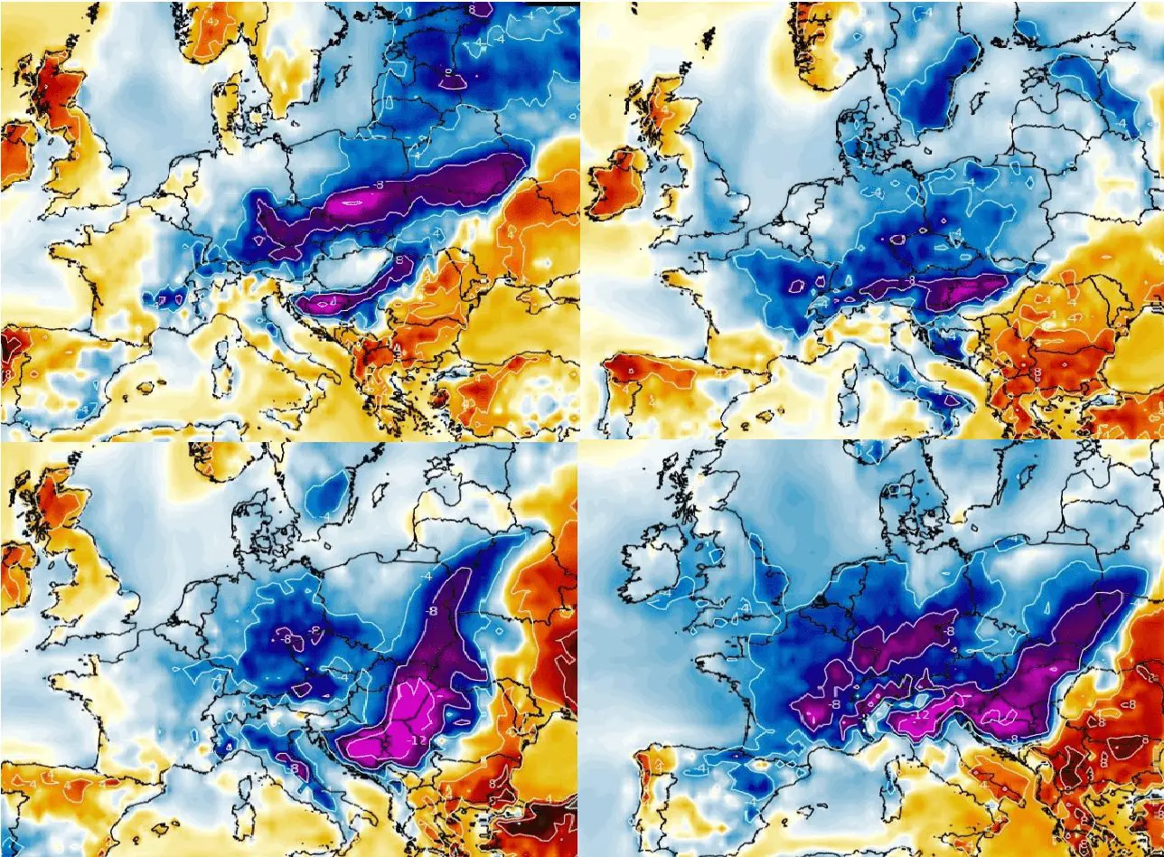
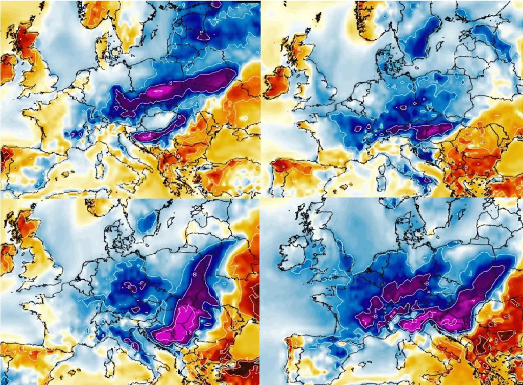
Arctic air is forecasted to hit large parts of Europe already between 23. August and 6. September, with really cold times, with negative temperature anomalies, heavy rains, strong winds, cloudiness and the first ground frosts or rarely frosts in valleys.
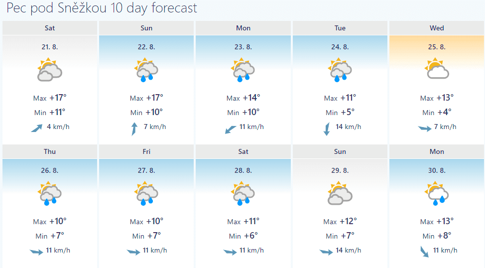
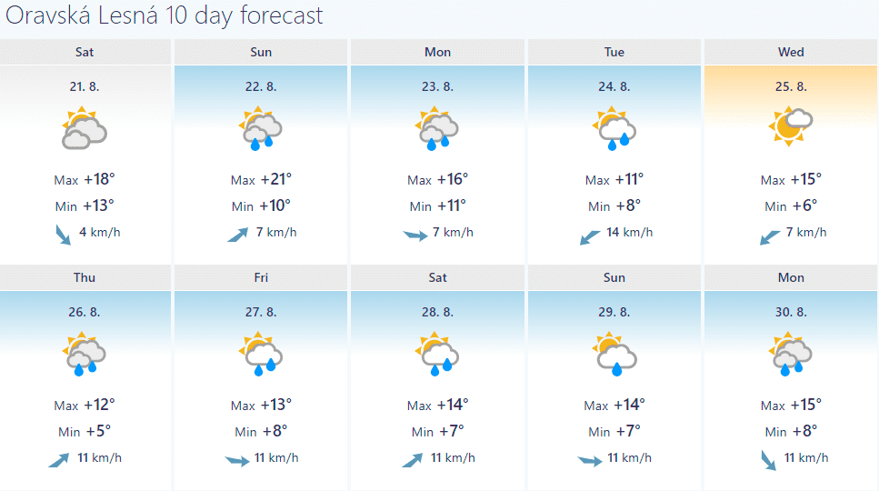
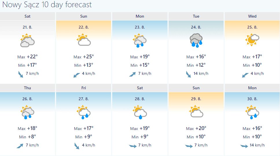
In this article we used 10-day forecasts from https://www.foreca.com/ for better imagination, how low should temperatures drop during the next period.
E.g. in Central-European basins and valleys, maximum temperatures only +10°C and minimum temperatures around +3°C are possible.
Many European cities in the basins, Scandinavia, and the Baltic region expect maximum temperatures during the coldest day only around +15°C.
Cities in the warmest lowlands and western and southern regions expect the coldest day with maximum temperature mostly below +20°C or around +20°C.
This won´t be a tropical summer and daily temperatures will be a lot of time -5/-10°C, regionally below -15°C from the long-term average.
Such we mentioned in previous articles:
- the first frosts and ground frosts are possible mainly in frost valleys and basins, therefore, protection of sensitive plants is necessary;
- virological situation in the cold air will be worsening (the peak of activity is in winter during Siberian blasts in cold and dry air)
- touristic activities in the mountians will be limited
- warm clothes need to prepare, including the first day in school (children) in early September in many regions
Minimum temperatures should in basins and valleys with clear skies regionally drop to +5/0°C, while lowlands will report mostly +10/+5°C.
Windchill near rainy and windy weather should be even lower than current temperatures. In the mountains should appear the first snow of the season 2021/2022.
After deadly summer heatwaves we will experience an opposite extreme, soon, therefore, will be a big change of weather in many parts of the continent prepared and watch furthermore Mkweather – we will update information about measured temperatures, records, forecasts, and weather events during the upcoming period.
It´s possible, that summer weather in September will return, yet – as soon as possible we will bring good news about an arrival possible summer or tropical days after long-term coldwave.
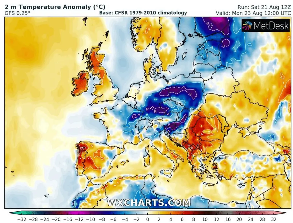
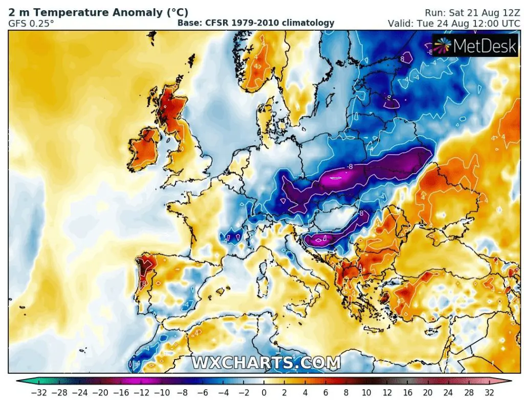
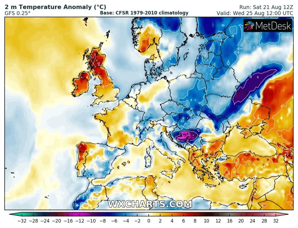
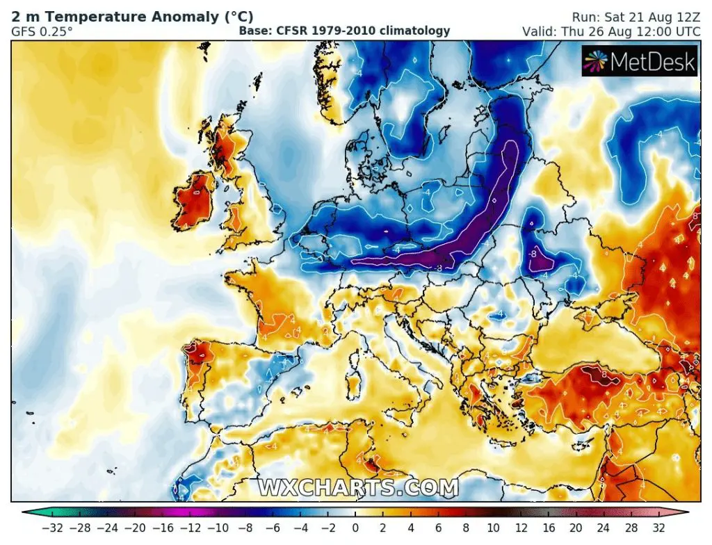
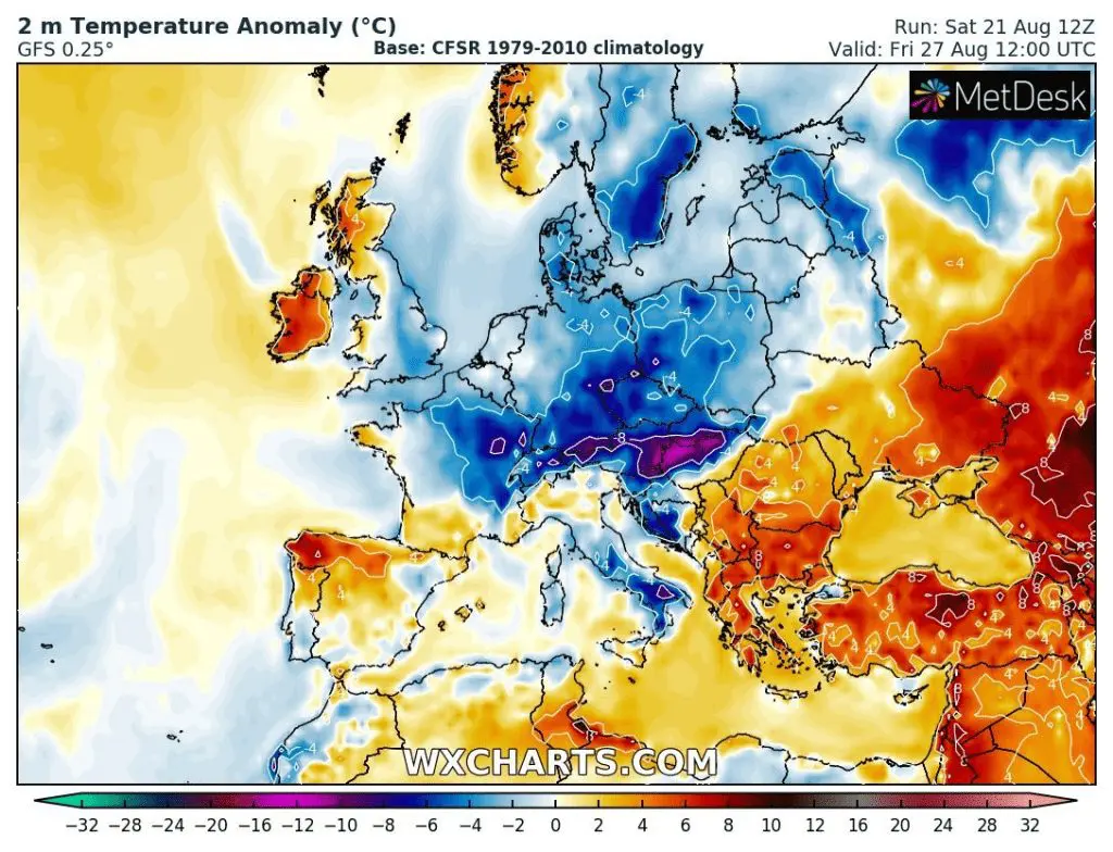
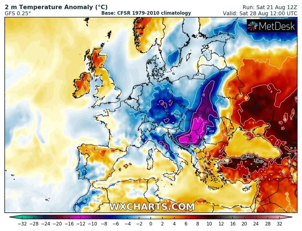
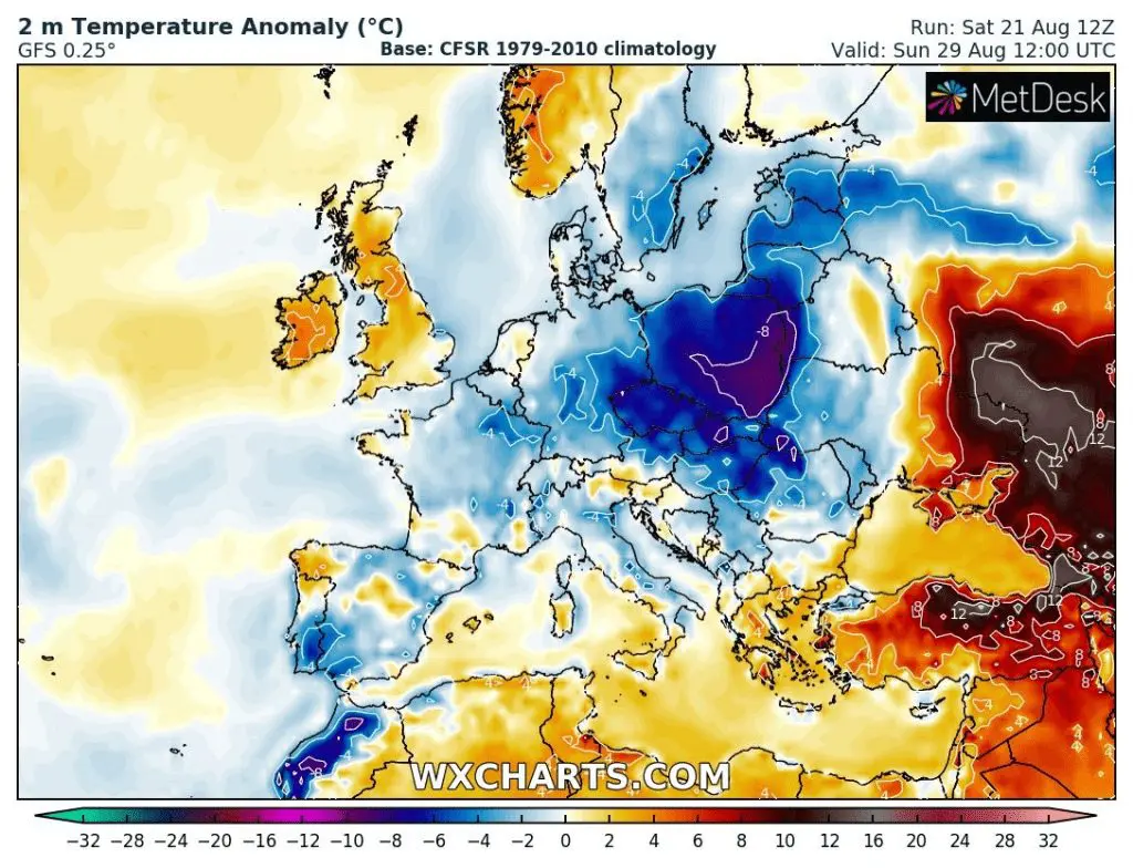
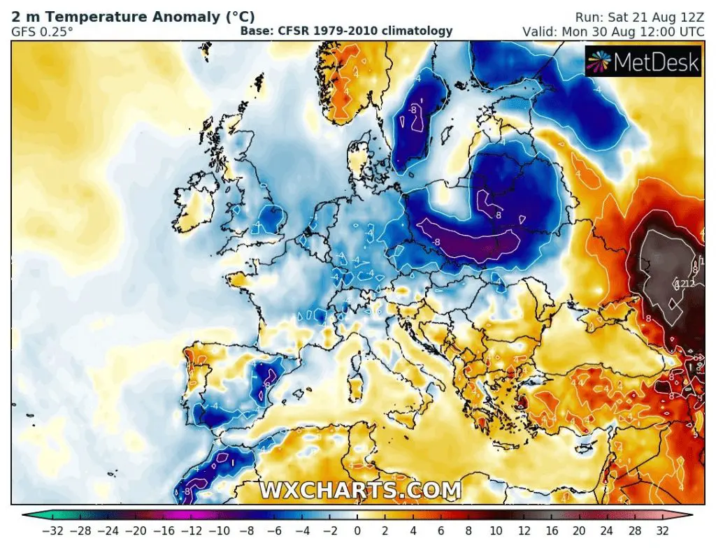
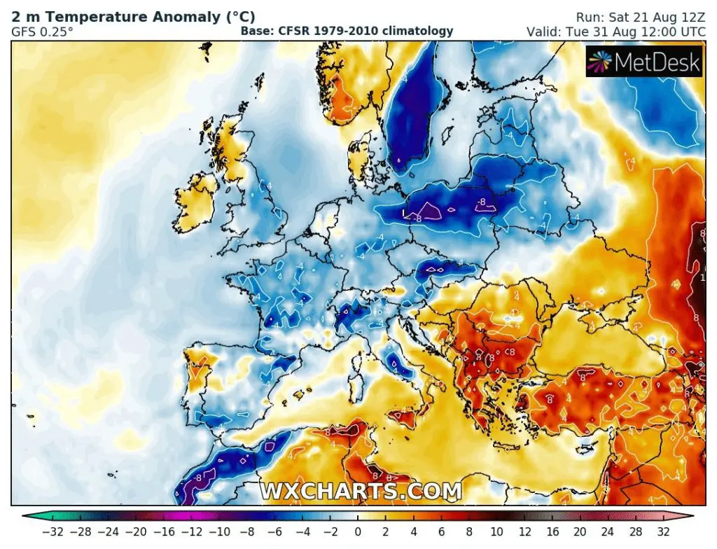
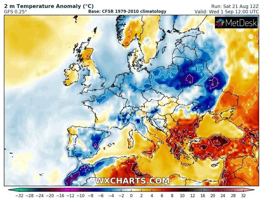
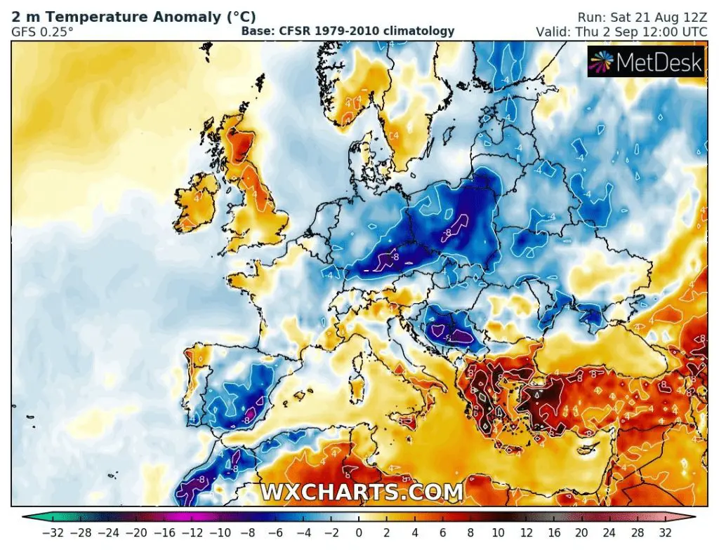
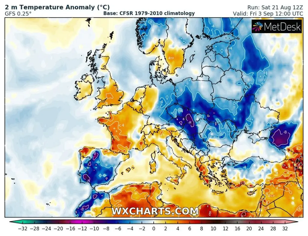
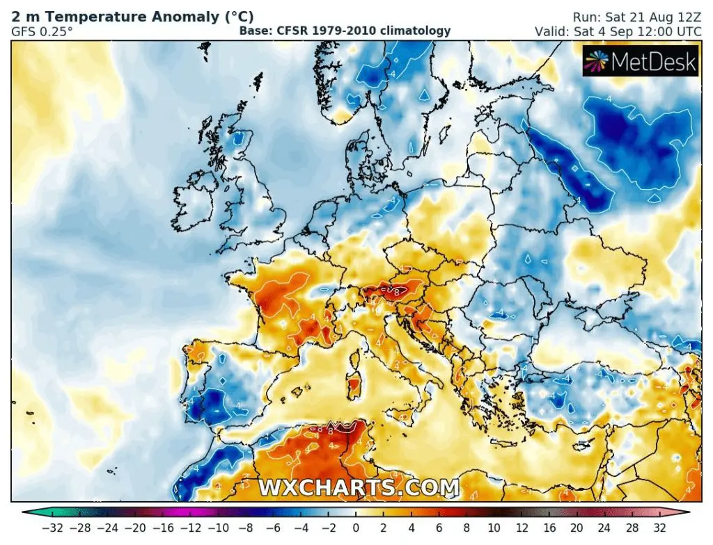
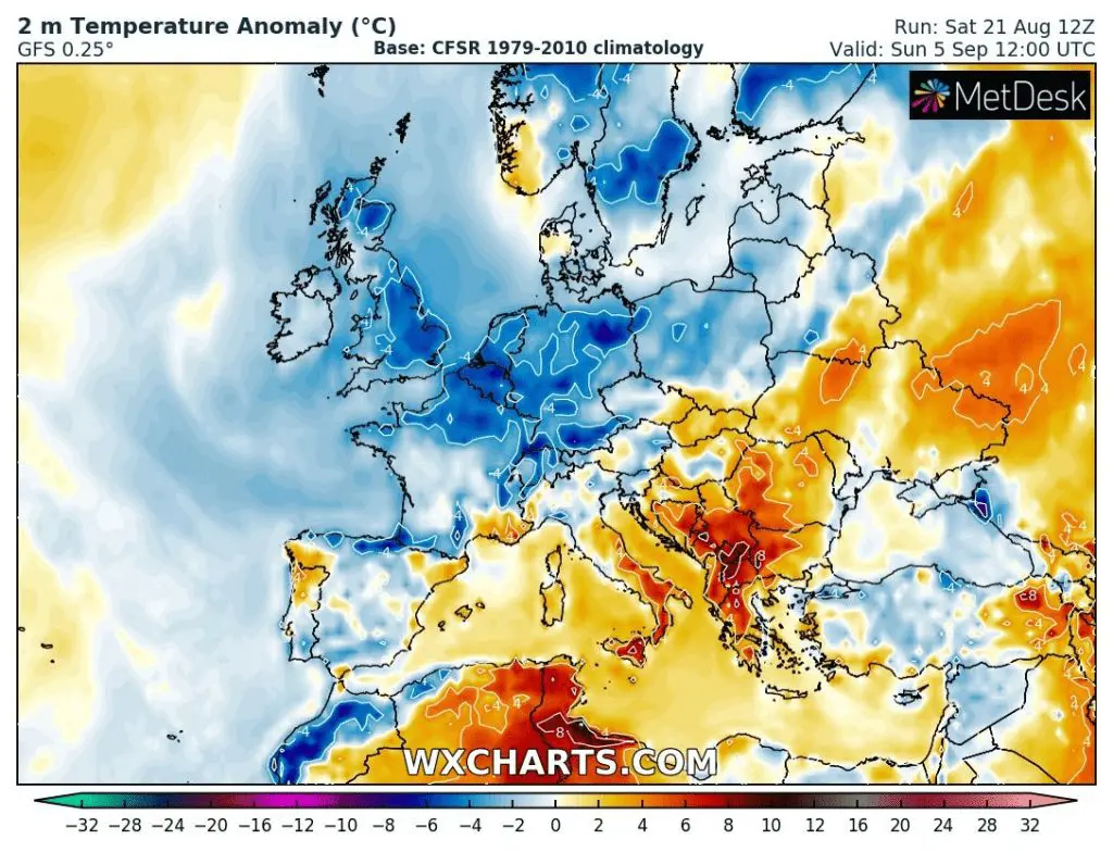
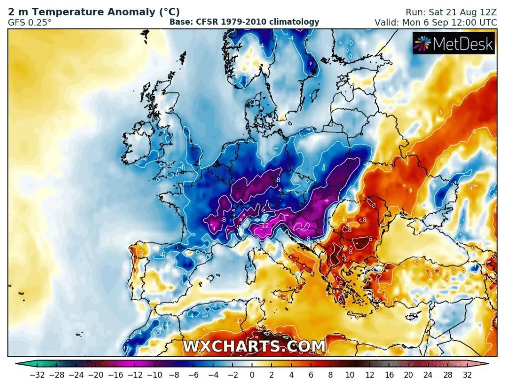
Source: wxcharts.com
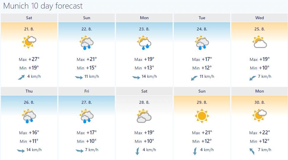
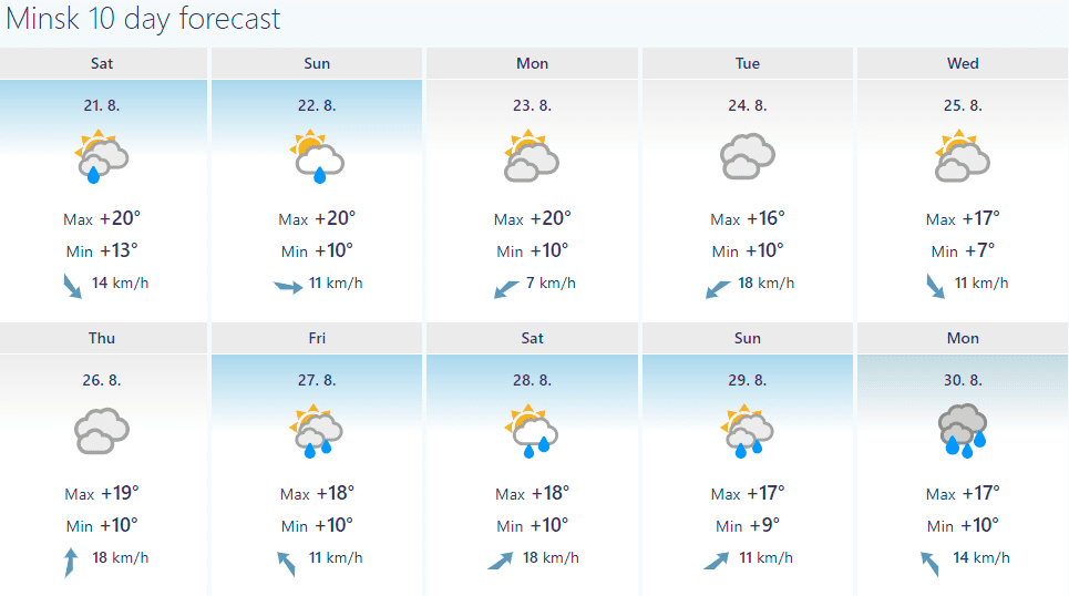
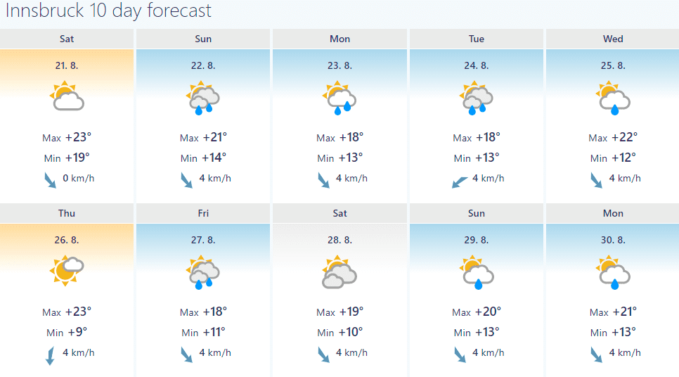
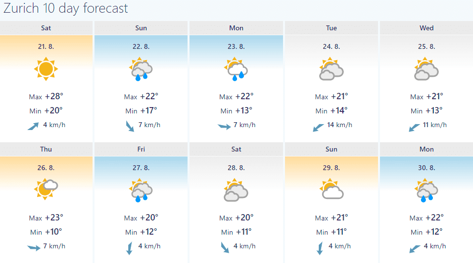
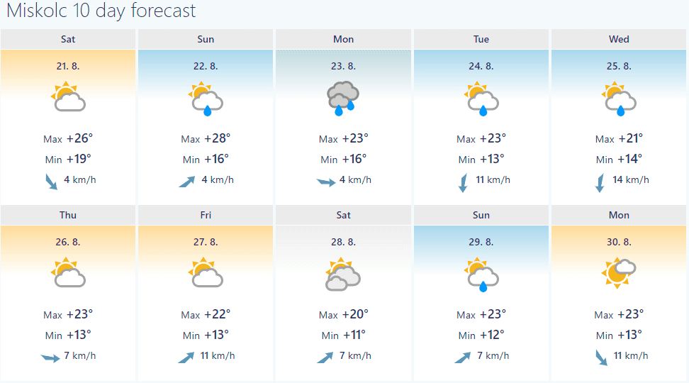
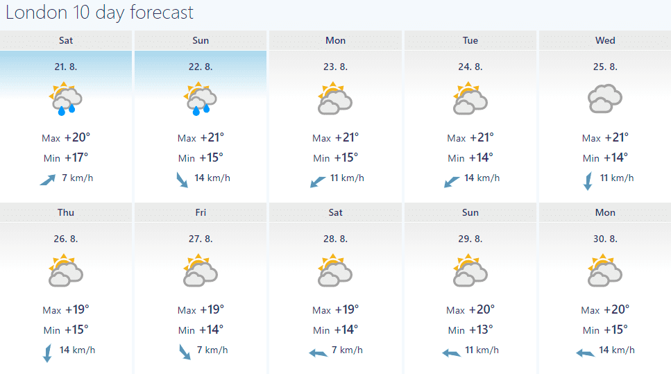
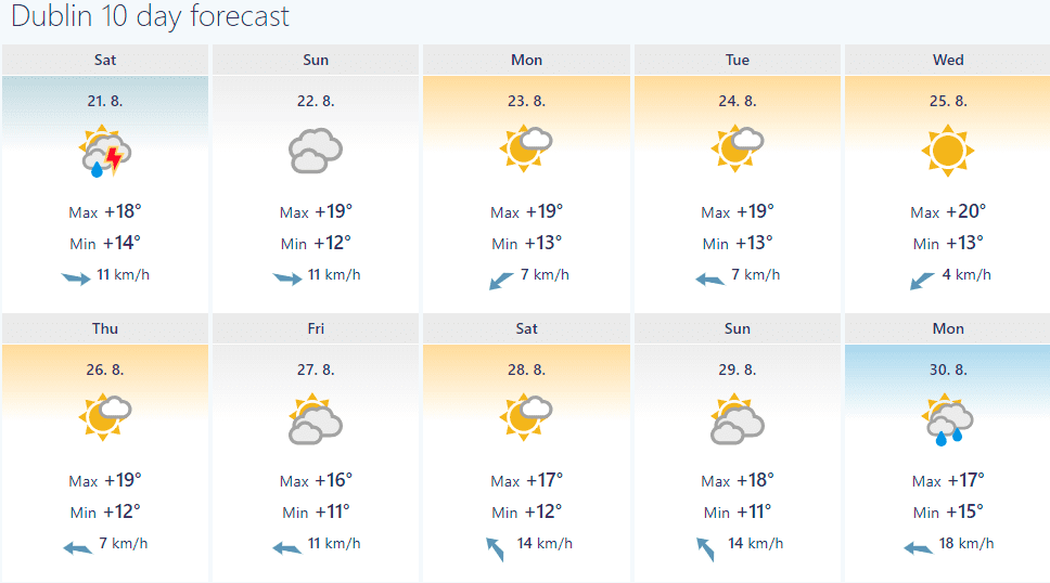
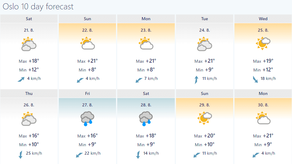
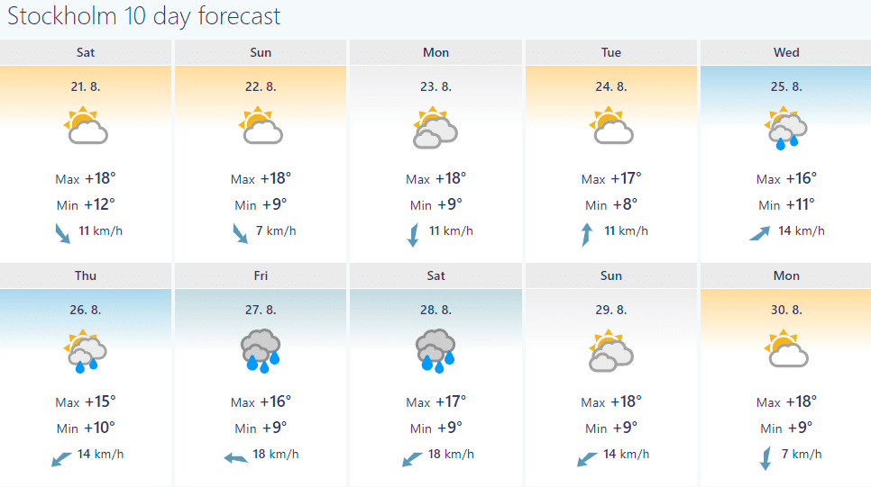
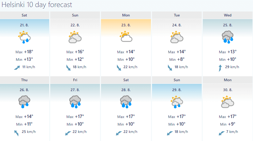
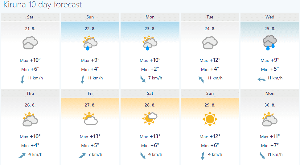
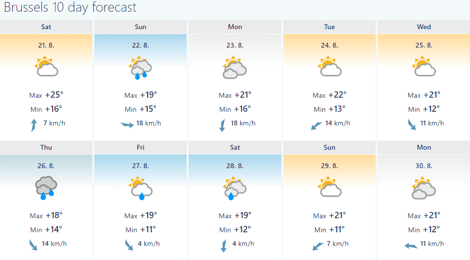
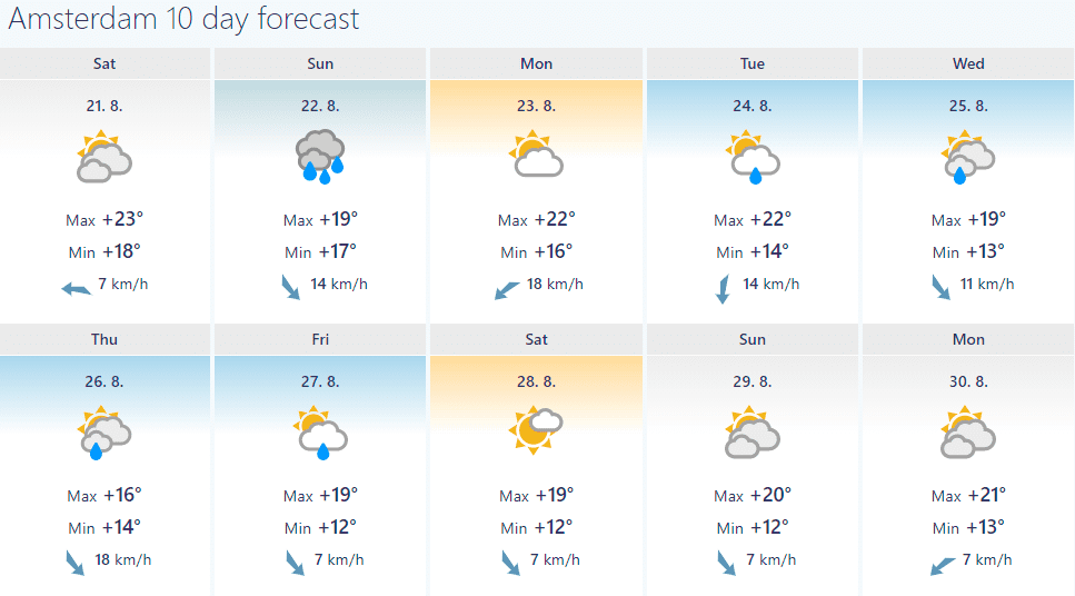
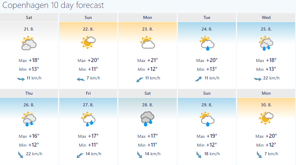
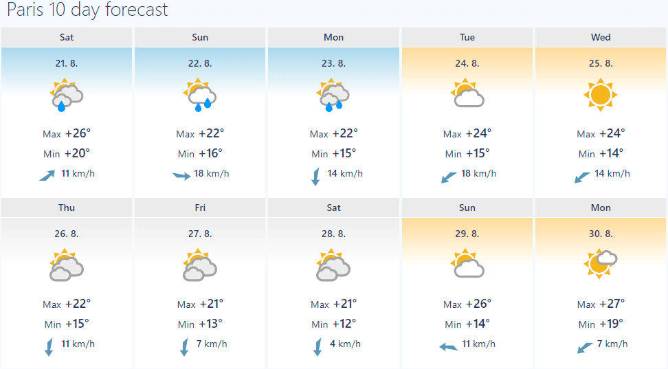
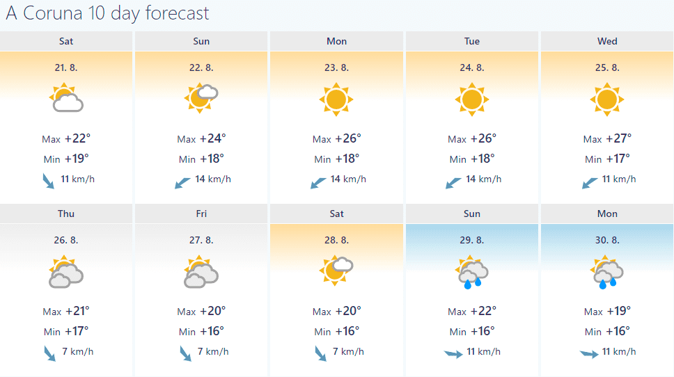
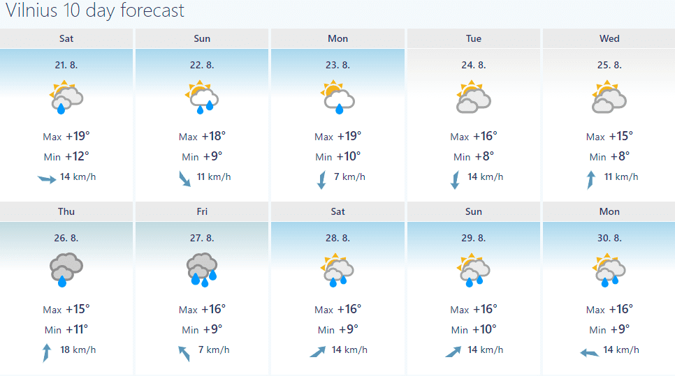
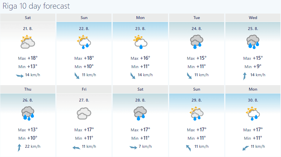
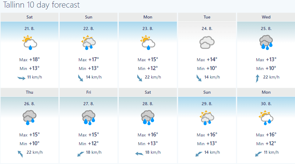
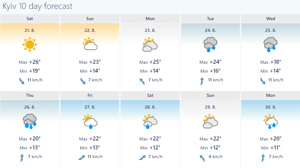
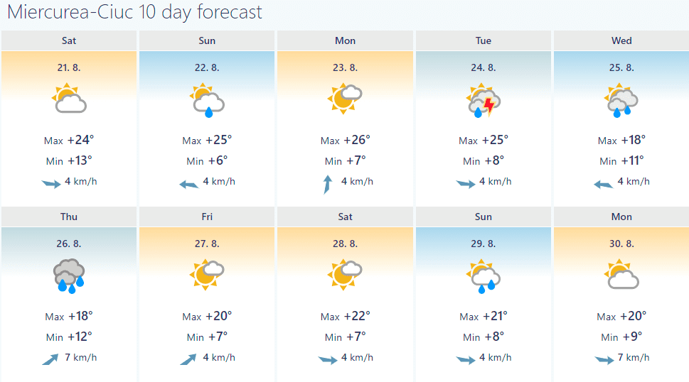
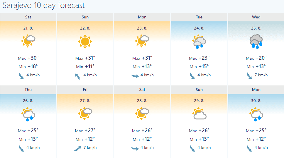
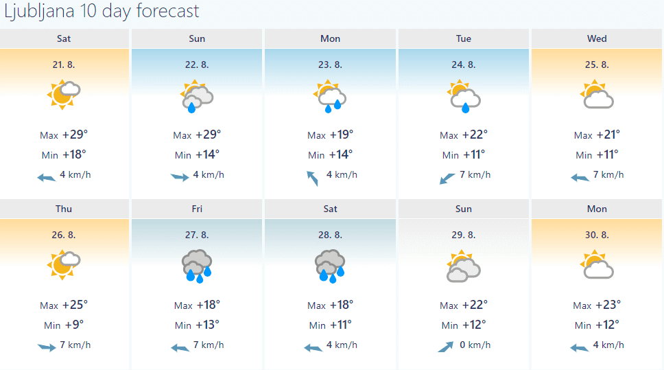
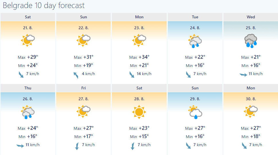
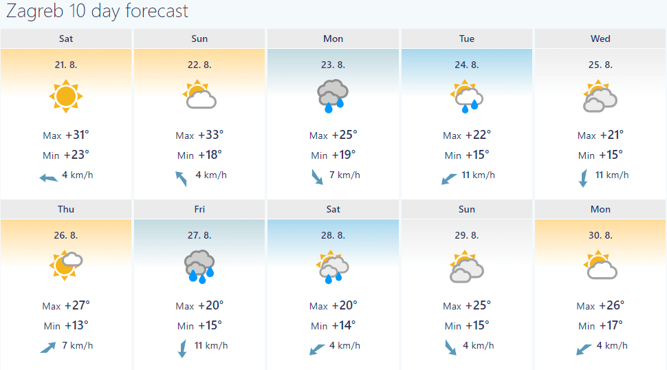
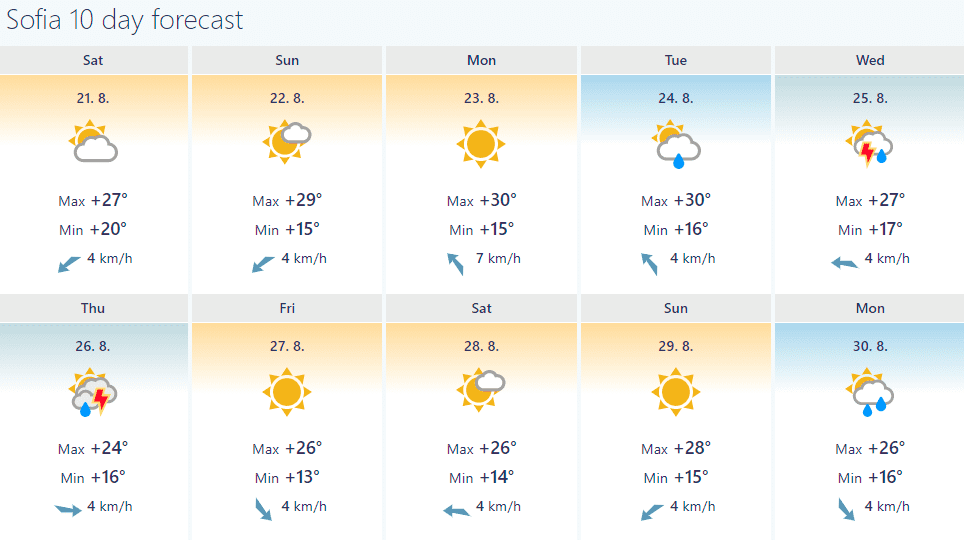
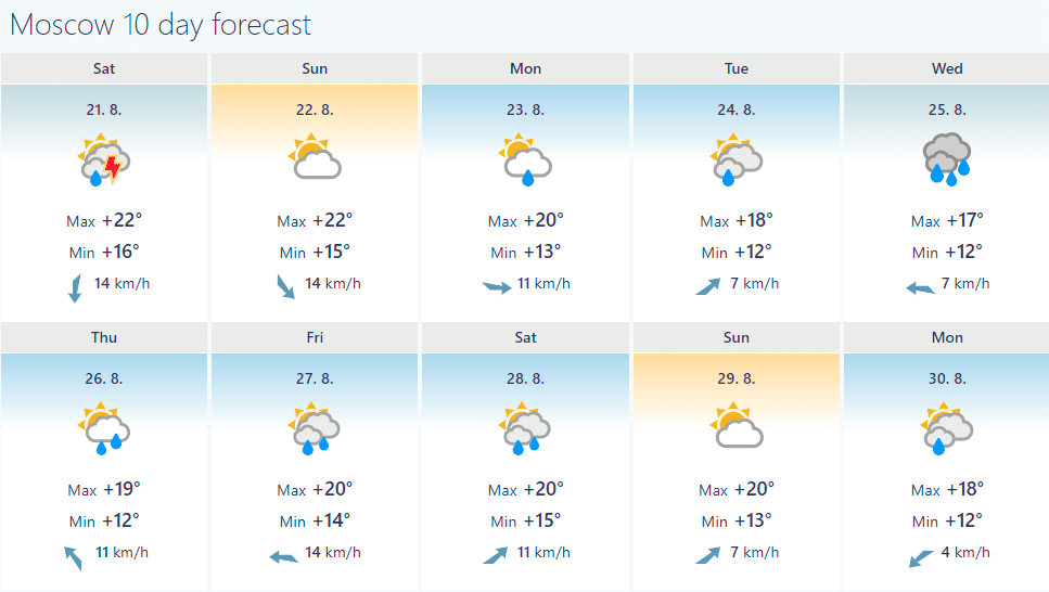
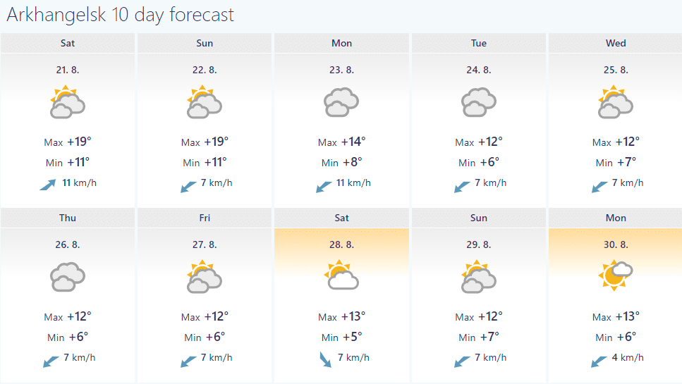
Source: foreca.com /https://www.foreca.com//


