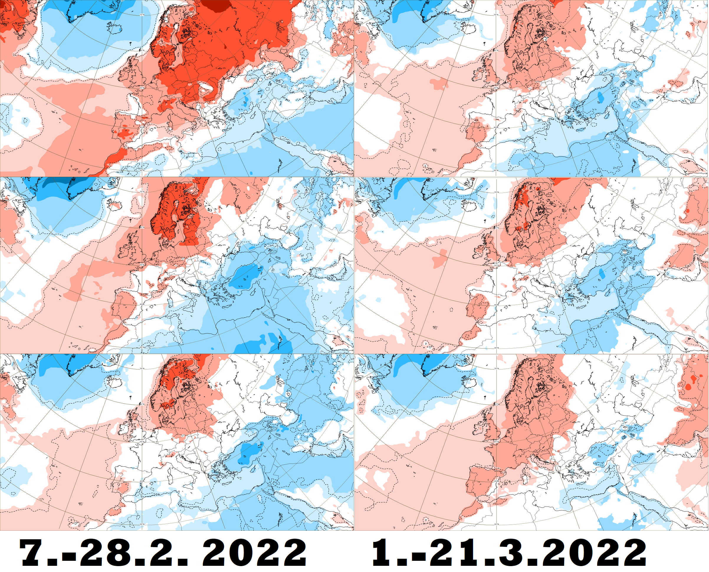
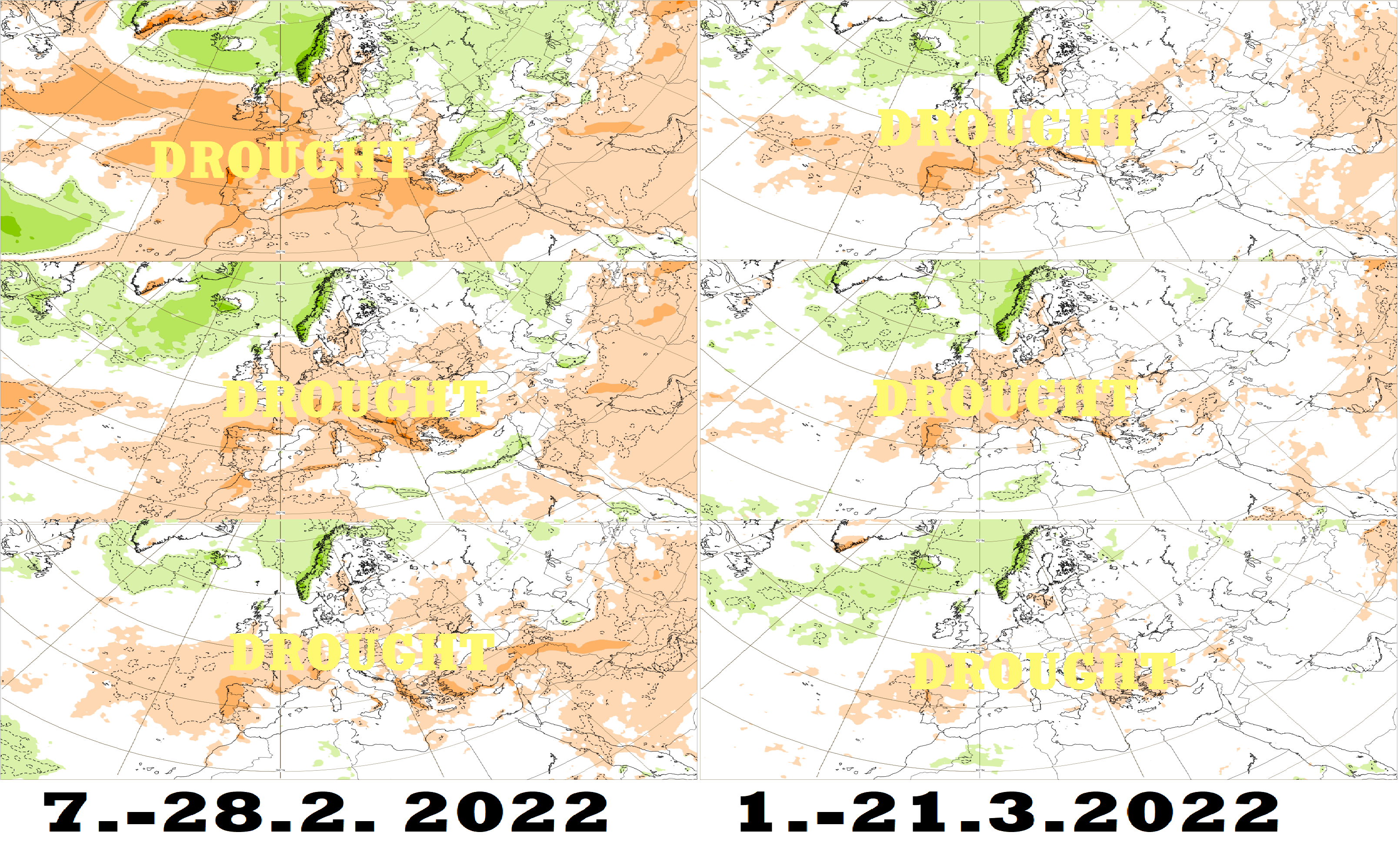
ECMWF 6-week forecast for Europe (until 21. March 2022): A widespread drought!
Already in the last articles, we described predicted forecast regimes in Europe until early April 2022 /https://mkweather.com/43-as-an-estimated-ratio-of-days-with-leading-nao-versus-blocking-pattern-until-20-march-2022-in-europe/; https://mkweather.com/will-bring-early-april-2022-extreme-frosts-in-europe-and-damage-to-harvest-there-are-the-first-signals//.
Now, we should look at the ECMWF 6-week forecast for Europe (and in the next article for the USA) – if early-spring conditions are still confirming.
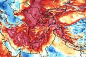
More interesting as warm temperature anomalies above western, northern, and central Europe should be a persisting drought, which is forecast to hit large parts of Europe in the following 6 weeks, maybe longer.
NAO+ regime with Azores highs above Europe is really bringing weather like this – dry anomalies should appear across all Europe and the Mediterranean, despite Scandinavia, Scotland and in the first week, parts of eastern Europe, yet.
Cold anomalies will be persisting from the Balearic Islands, through Sicily, Greece to Turkey, and the northern Middle East / NE Africa, such remnants of a previous long-term winter period. These regions will be initially wet, but gradually very dry, too.
The warmest appears the following week (7.-14.2. 2022) and a week 14.-21.3. 2022, so far, but above the northern sector of Europe, the extremely warm anomaly will be persisting during almost all next 6 weeks.
Mainly Norway and Iceland should be very stormy, with a risk of floods and landslides (a typical NAO+, precipitation in Bergen correlates with NAO+ around 0.75).
NW Africa should be very hot and dry initially, later should appear in Atlas region storms.
In April 2022 (link above), damaging frosts from late-season Arctic blasts will be after the long-term warm period in February and March 2022 preliminary possible.