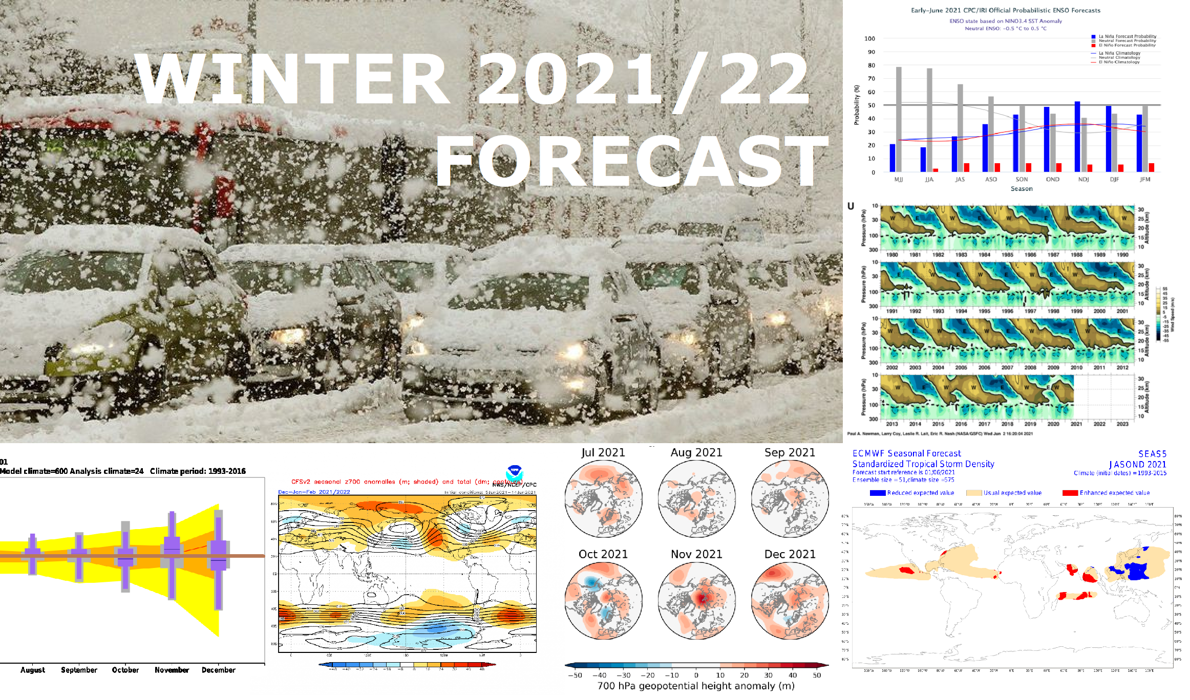
*** First forecast for Winter 2021/2022: Weaker La nina such as in 2020/2021, but still big hopes for extreme coldwaves ***
Forecast models are still relative inconsistent in relation with the first forecasts for Winter 2020/2021, but for big interest we will try to describe main parameters, which should significantly effect a character of upcoming winter, including the first estimates, what we should expect during the following winter.
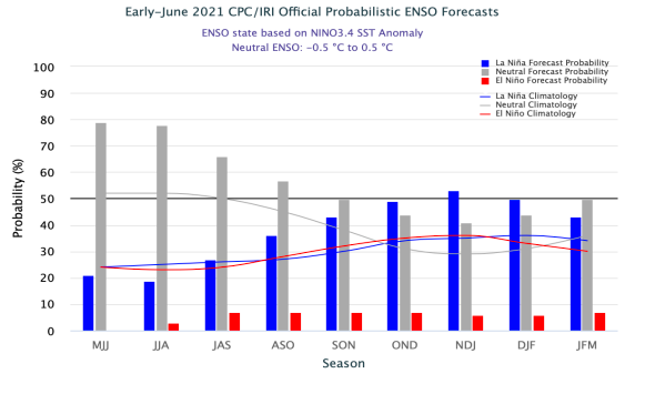
Already in one of the last articles, we have summarized, that during the next winter, cold La nina pattern is forecasted /The next cold winter? Strong La nina in Winter 2021/2022 forecasted! – mkweather/.
Simultaneously, we are only shortly after the peak of minimum of solar cycle and volcanic activity in 2020 and 2021 was / is relatively high /2021/22 = Little ice age? Years with volcanic activity in last 30 years had tendency to be La nina during solar cycle minimum – mkweather; Solar cycle behind NAO- coldwaves in Europe and La nina coldwaves around the world? – mkweather/.
Thanks to La nina and mentioned other main factors, the first 5 months of the year 2021 in Europe brought extreme coldwaves and anomalous circulation pattern /A big European circulation anomaly in 2021: totally oppositely such as in the World (!) and showing, what climate change should bring until 2100 – mkweather/.
During Winter 2020/2021, extreme frosts hit Europe, such as North America, Asia and Africa. In continental Europe, frosts up to -35°C appeared, while in Colorado, USA, -47°C or in Siberia, -60°C frosts were measured – in many regions it was the strongest frosts in decades (mostly since 1980s), or minimally, since the last La nina in 2010-2014 /see our archive of articles in sidebar for details/.
Winter season didn´t want leave parts of Northern Hemisphere, mainly Europe until the start of Summer 2021, with widespread frosts or snowing. E.g. in Slovenia, -20,6°C was measured in early April and snowing has appeared in May 2021 in parts of Europe or North America regionally the first time in 50 years, or there was measured one of the last snowfalls ever.
Summer 2021 is however surprising with extreme heatwaves in Europe /+40°C in Germany around 20. June is according to forecasts possible and +40°C in Helena, Montana was already in the middle of the month measured/.
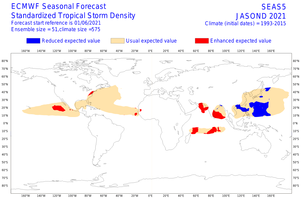
While for the rest of June and July 2021 extremely hot weather across Northern Hemisphere is possible, in August we should experience with early autumn weather, thanks to expected above-average Atlantic hurricane season 2021.
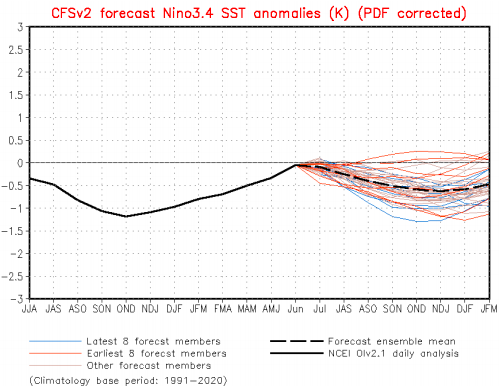
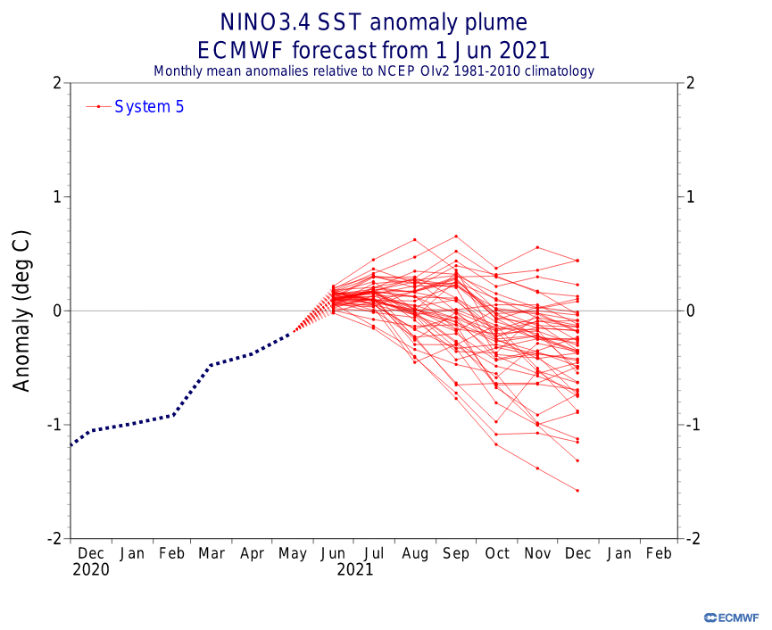
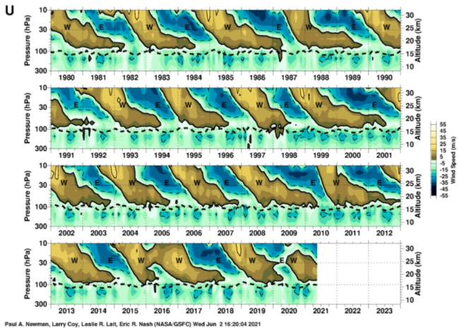
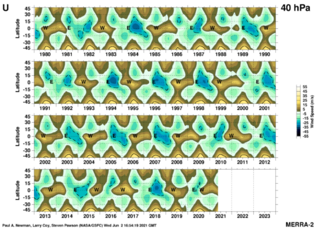
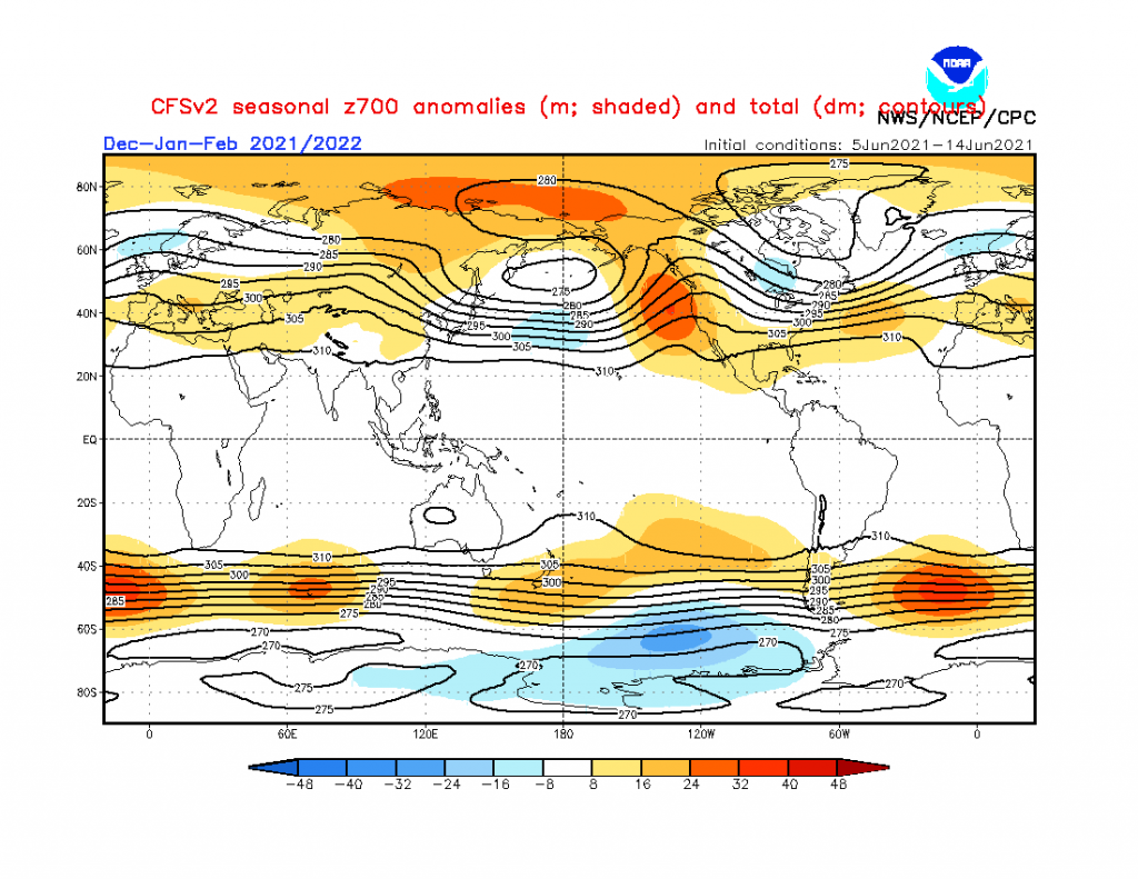
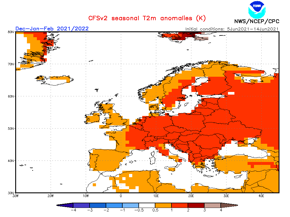
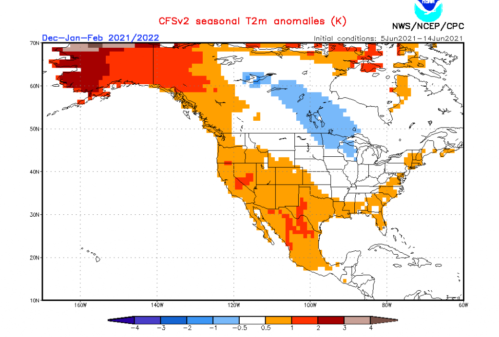
Very cold weather is according to ECMWF such as CFSv2 forecasted for parts of Northern Hemisphere, mainly Europe during Autumn 2021, when Global warming hole, melting Arctic and predominating NAO- phases, together with returning La nina and still easterly QBO phase will be anomalously cold combination for Arctic and Siberian outbreaks during the season.
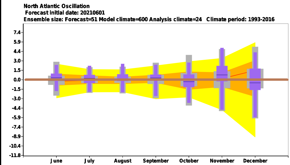
Winter 2021/2022 however should be little different, because while La nina pattern will be strengthening, QBO should move into warm westerly phase, what should have impact into gradual transition from NAO- phases in Autumn 2021 and early Winter 2021/2022 to NAO+ phases in late winter.
Similar Mkweather forecast was expected for Winter 2020/2021, too, but reality was thanks to La nina much colder.
However, La nina in Winter 2021/2022 won´t be so extremely strong such as in previous year, what should give more chances for NAO+ / AO+ phases and milder character of the season.
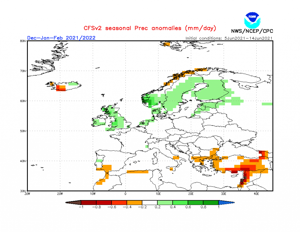
Overall, relatively good conditions for Arctic and Siberian outbreaks should appear, mainly thanks to La nina and cold Earth, after stronger hurricane season – mainly in northern and western Europe, while southern and eastern Europe should be warmer.
Stormtrack is for now, according to CFSv2 forecasted more northward such as usual, what means NAO+ / AO+, but ECMWF sees strong NAO- possibility for December 2021, what is quite inconsistent.
Surely, NAO+ means colder eastern and central USA and Canada and warmer Europe and NAO- reversely.
Potential for strong coldwaves however, in these circulation conditions still should be preserved.