Swamps in Dyje – Morava confluence such as a factor of deadly EF3-4 tornado in Czechia?
The deadliest tornado in Europe in last 20 years (6 fatalities, 1200 homes damaged, 0,5 billion dollars damages), EF3-EF4 tornado from 24. June 2021 in Czechia /https://mkweather.com/czechia-hit-ef3-tornado-150-people-injured-7-villages-destroyed-if-is-something-apocalyptic-so-scenes-captured-from-hit-areas-june-2021/; https://mkweather.com/deadliest-tornado-ef3-4-in-europe-in-20-years-czechia-after-natural-disaster-footages-day-after/; https://mkweather.com/tornado-in-czechia-has-the-6th-victim-only-2-year-baby-2021// should be associated with one potential factor, which hasn´t been a subject of public discussions about an extreme event.
After more detailed physical-geographical research of the hit region, there was evident one overlooked landscape factor, which should contribute to the development of an anomalously strong tornado event in the otherwise calm region of Central Europe on the border region of Czechia (Moravia), Austria, and Slovakia.
Although into an occurrence of tornado contributed surely other factors, such as wide and quasi-stationary frontal boundary above western Europe, between extremely cold /https://mkweather.com/the-coldest-june-times-in-the-uk-in-30-years-scotland-33c-england-14c-only-23c-from-all-time-june-national-record// and extremely hot air masses /https://mkweather.com/460c-in-caltagirone-italy-dangerous-anomalous-and-deadly-heatwave-is-peaking-even-stronger-heatwave-next-week-june-2021/; https://mkweather.com/hungary-400c-the-first-time-in-june-all-time-june-national-record/; https://mkweather.com/slovakia-380c-only-02c-below-all-time-national-june-record-june-2021// or moisture resulting from the peaking of Central-European monsoon period, which is traditionally the strongest in June, there should be an important source of moisture for the EF3-EF4 tornado development.
While in Midwest, the USA, the Gulf of Mexico provides traditionally large amounts of moisture for the development of tornadoes during arrivals of cold fronts, in Europe, it shouldn’t be hot and dry Saharan air, and there is needed to find another source of moisture for the devastating system.
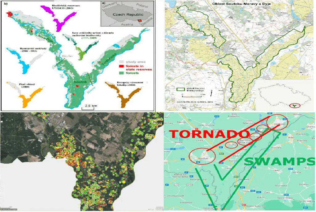
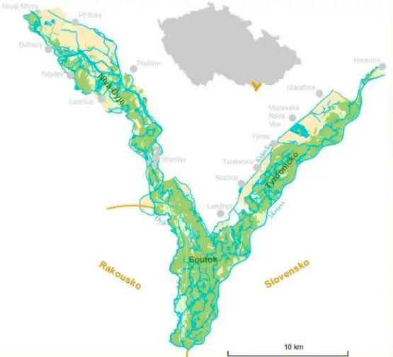
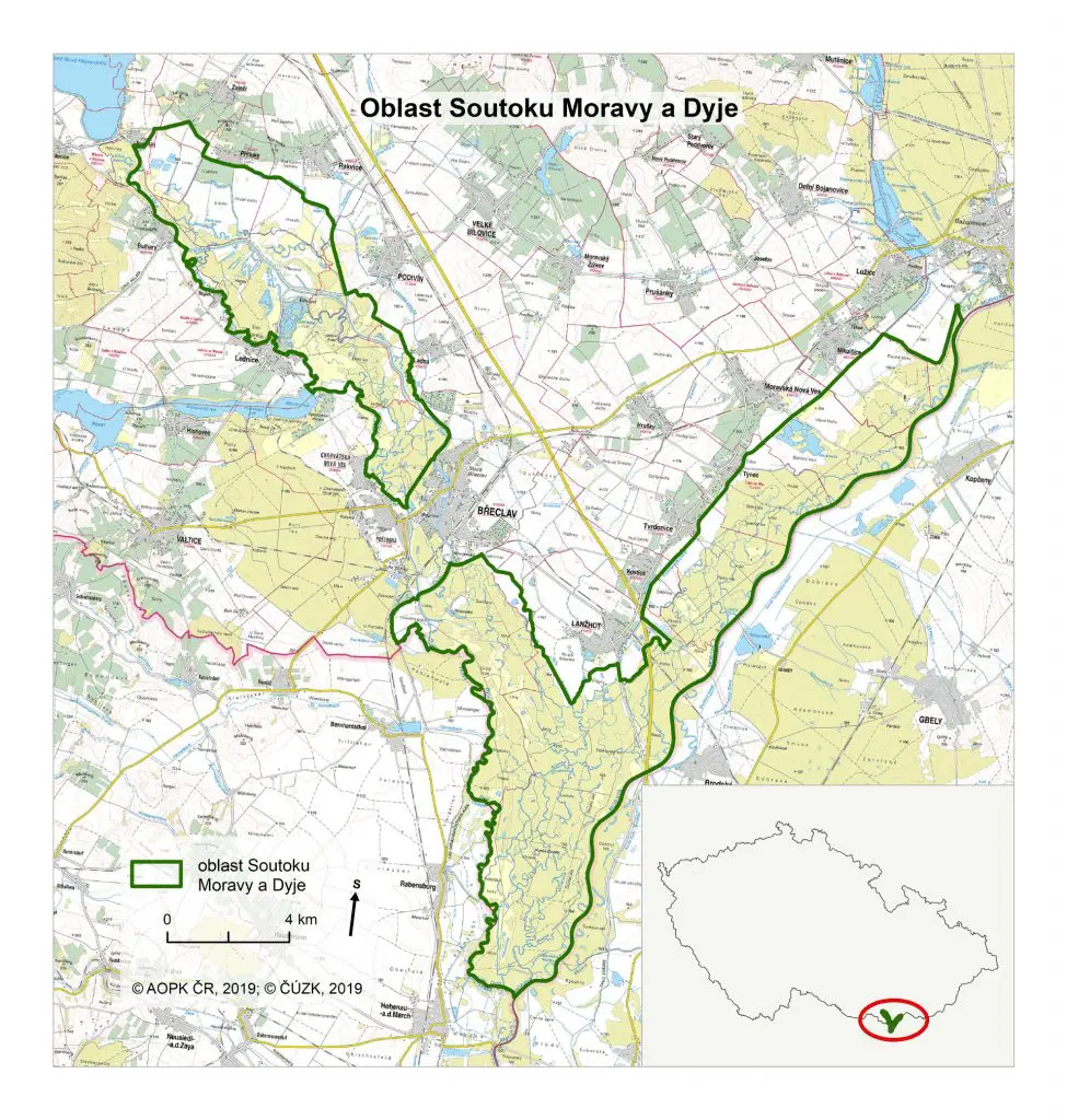
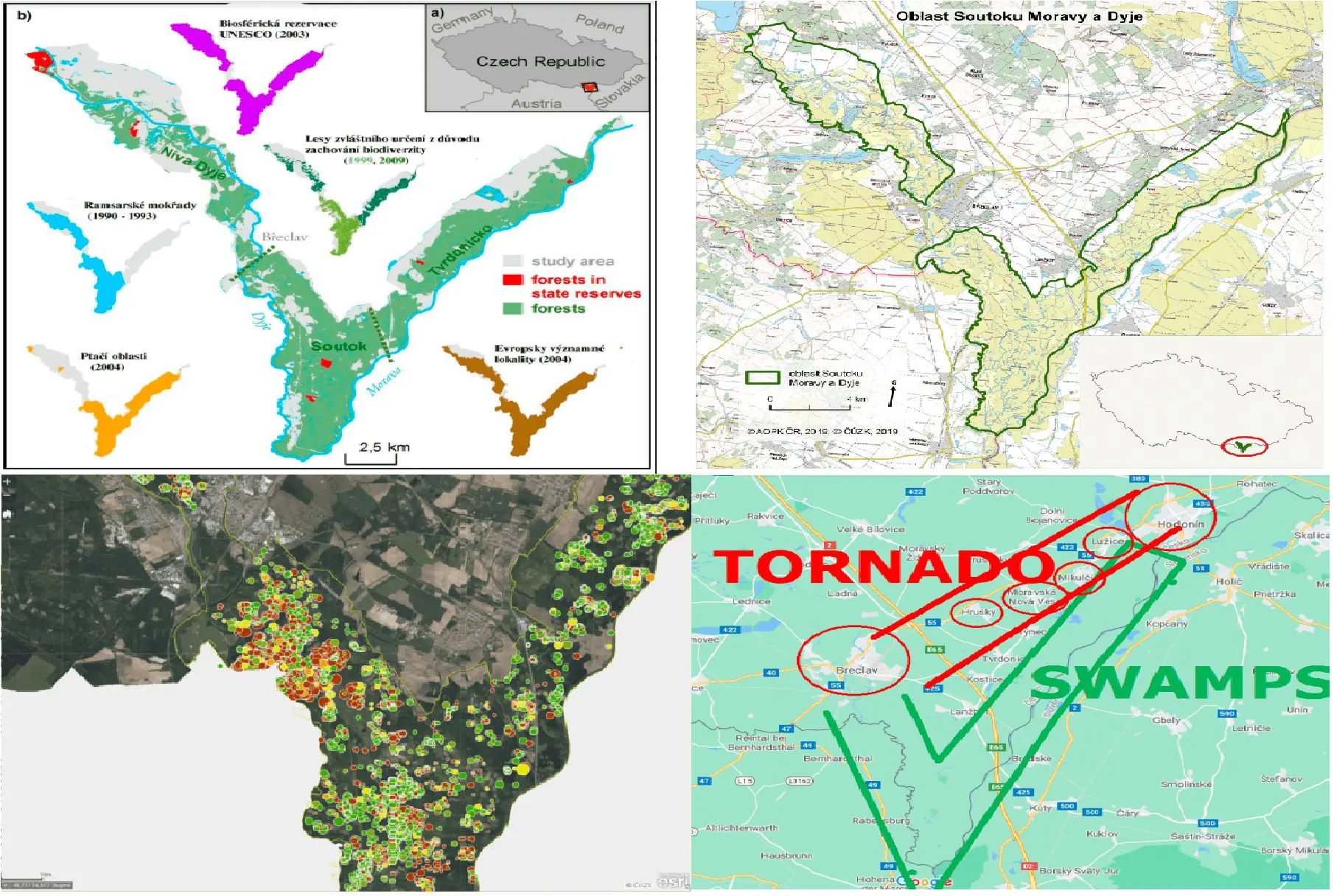
As one of more alternatives for an explanation of the severity of the Czechian tornado, there appeared a possibility of the contribution of a large area of swamps near Dyje and Morava confluence.
As we should see on maps below, the region has a status of a Biosferical Reservation UNESCO (2003) with Ramsar Wetlands (1990-1993), Protected Bird Areas (2004), and Areas of European Importance (2004), and there are located large areas of swamps and wetlands, which should in S-SW airflow give an important source of moisture for the vortex.
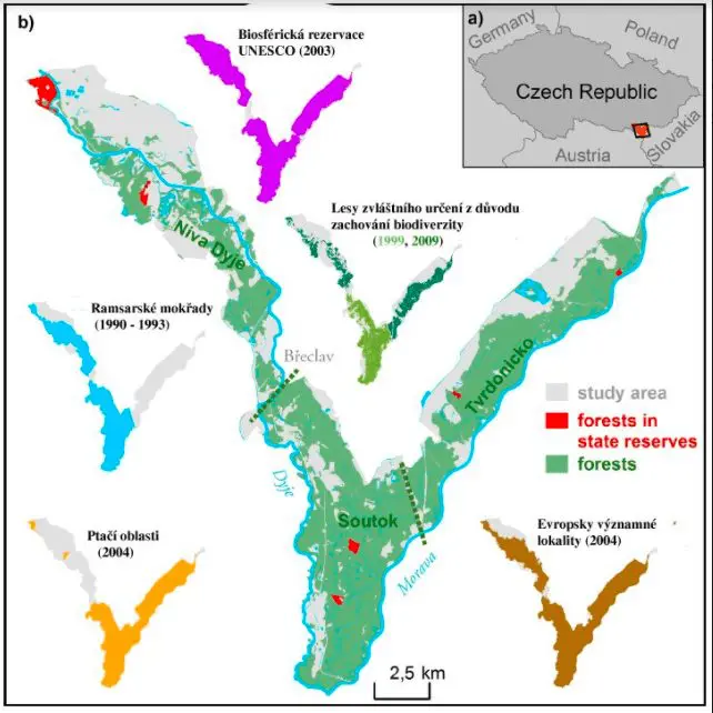
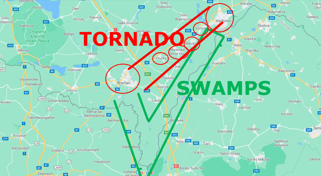
Such we should notice on the maps below, the most hit villages – Hrušky, but mainly Lužice, Mikulčice and Moravská Nová Ves are located immediately near wetlands of River Morava and northward from the confluence of Dyje and Morava rivers, in the possible direct impact of moisture from the area.
Tornado was moving directly along the wetland region, therefore moisture should be drawn from its western side, such as near initial states, from the region southward, near the confluence of big rivers.
As additional information, we should mention a fact, that on Slovakian border, in Gbely, oil production thanks to swamp accumulations were operated for a long time in 20th and 21st century, therefore evidence of source of moisture is evident prehistorically, too.
Such we should see in media or television, the impacts of the tornado in the region were in Europe unseen and extremely extensive.
The main goal of this article is to point into the next possible and probably an important factor of extreme tornado(es) development in the region of Vienna Basin and the wider region of Europe, where extreme tornadoes should in the future potentially appear more frequently mainly near water sources, such as lakes, big rivers or wetlands/swamp areas, in comparison with dry lowlands.
Acknowledgements: The author thanks the Bohemian American from the US Midwest for cooperation in obtaining materials.