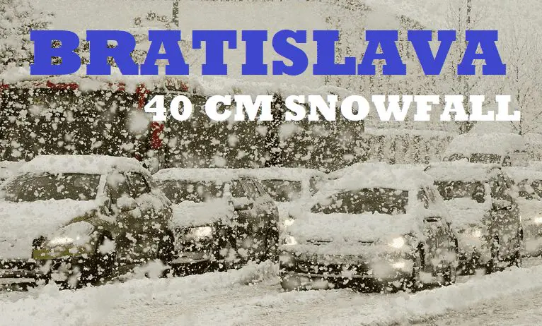
Bratislava should surprise 40 cm of snowfall, the metropolitan city is preparing for snow calamity!

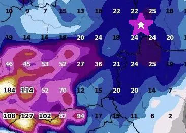
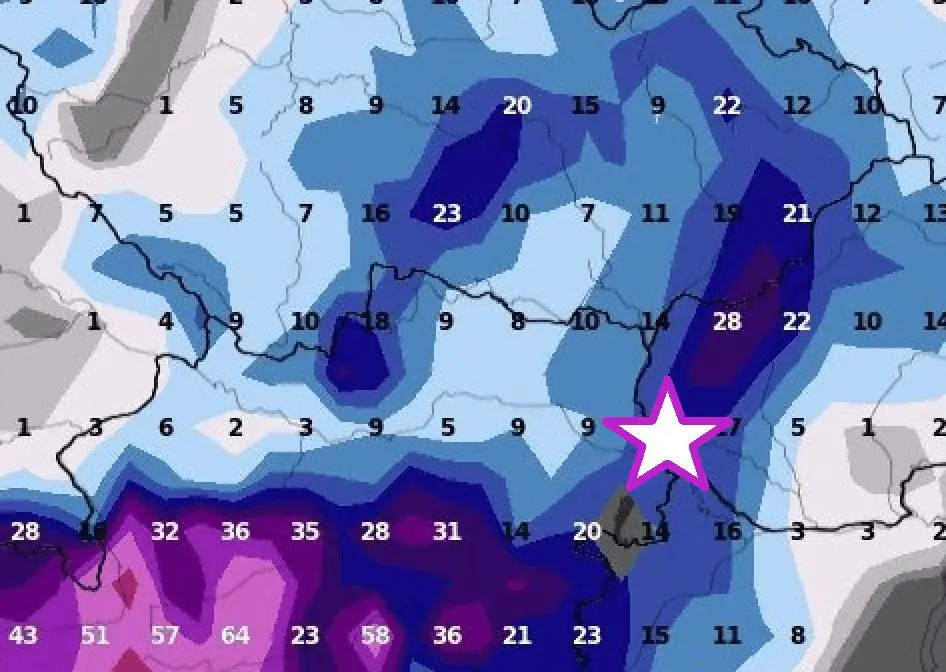
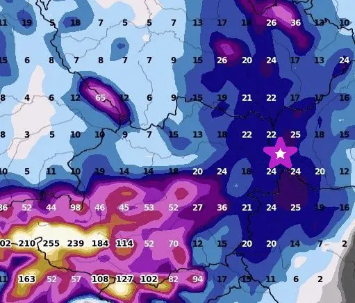
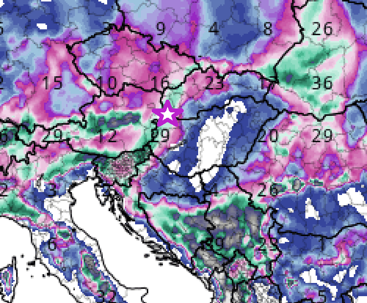
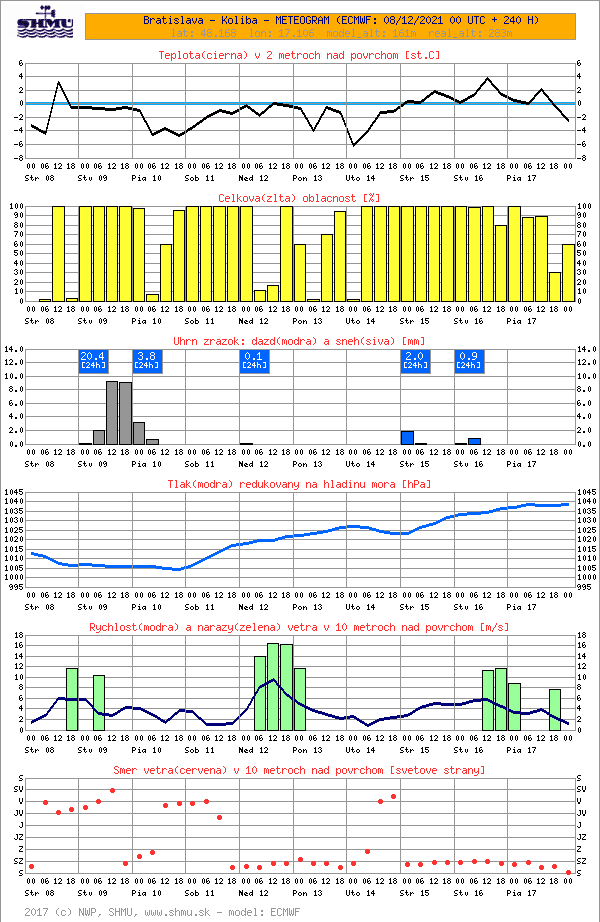
Weather models although reduced severe snowfall for the mountainous parts of the country in the Carpathians, but the warmest lowlands in southwestern and western Slovakia should already on Thursday and Friday, 9.-10. December 2021 receive surprisingly 20 – 40, rarely up to 50 cm of snowfall, including Slovakian capital, Bratislava!
Densely populated hills in the Little Carpathians above the city in elevations only 200 – 400 MASL should according to Mkweather estimates receive up to 40 cm of fresh snow (wxcharts tool estimates often underestimate regional differences between parts of the city situated in lowland, only around 100-150 MASL and these hills).
Anomalous 20-30 cm is however possible in the lowest parts of the metropolitan city, which should be linked with widespread snow calamity.
Snow calamity will be possible in Vienna, Gyor, or Brno, too, and similarly in many Austrian, Czechian, Hungarian, Polish, or even Ukrainian, Romanian, Slovenian, Croatian, Bosnian, Serbian (!), and other Balkan regions.
From Balkan, the worst snowfall is forecasted in Serbia or Austria, in basins and valleys possibly up to 1 meter (!).
Bratislava should be however the worst-hit capital city in Europe.
The start of the blizzard is forecasted already around midday on Thursday, 9. December and the end of the event is forecasted for Friday, 10. December, morning.
The city should find itself under a deep snow cover already in the next 48 hours.
After the severe blizzard, anomalous frosts will be at the weekend and in the next week during clear nights, with dry air, weak winds, and high snow cover possible.
In Slovakian valleys, -20/-25°C should appear gradually – mainly in those with deeper snow cover.
Frosts up to -20°C have already appeared before the arrival of the blizzard on 8. December in Austria /the next Mkweather article/, but after the blizzard, temperatures in the Alpine and Carpathian region should drop even lower.
All during extreme temperature records across all Northern Hemisphere:
Only before a few hours have appeared the strongest early frosts in the Siberian coldest region in all-time history (-61,0°C) /https://mkweather.com/historical-times-for-siberia-610c-has-never-been-measured-so-early//.
In Canadian Arctic, frosts up to -46,0°C have appeared, so far – in many regions, it´s the strongest earliest frosts since 2004 /https://mkweather.com/eureka-431c-the-lowest-temperatures-in-canadian-arctic-in-early-winter-since-2004/; https://mkweather.com/canada-460c-daily-records-in-yukon-were-broken//.
In Europe, the strongest early frosts since 1945 have surprised Sweden (-43,8°C) /https://mkweather.com/the-strongest-early-frosts-in-the-baltic-region-in-62-years-since-1959-tartu-estonia-276c-zoseni-latvia-264c//, the strongest early frosts since 1959 Estonia (-27,6°C) /https://mkweather.com/the-strongest-early-frosts-in-the-baltic-region-in-62-years-since-1959-tartu-estonia-276c-zoseni-latvia-264c// and in valleys in continental Europe was measured -22,0°C so far /https://mkweather.com/220c-in-pontets-france//.
All after anomalously cold Arctic, with the 2nd highest Arctic Sea Ice Extent in the last 15 years /https://mkweather.com/arctic-sea-ice-extent-is-the-2nd-highest-in-15-years/; https://mkweather.com/20-vessels-stuck-and-ice-locked-in-northern-sea-route-the-arctic//.
Therefore, stay safe and warm and will be prepared for the next manifestations of severe winter.
