Only in the last series of Mkweather articles, we have brought information about a severe blizzard, which hits the Alpine region, East-Central Europe, and Balkan already in the next days /https://mkweather.com/bratislava-should-surprise-40-cm-of-snowfall-the-metropolitan-city-is-preparing-for-snow-calamity/; https://mkweather.com/20c-in-austria-before-an-arrival-of-blizzard-20-30-cm-for-vienna-after-blizzard-will-be-even-colder/; https://mkweather.com/serbia-expects-extreme-blizzard-1-meter-snwofall-all-balkan-will-be-under-the-snow//.
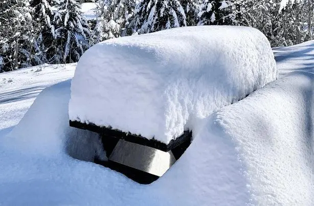
Extreme blizzards are however reported from Spain and France, too – mainly from northern Spain and Pyrenees, Spain, France, where record amounts of snowfall were measured.
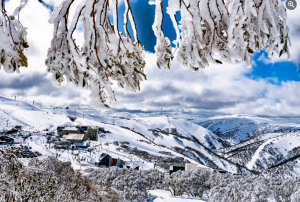
While in densely populated parts of northern Spain fell in big cities in elevations around 1200 MASL up to 60 cm of snow, in the Pyrenees around 1200 MASL is the situation even worse, with 1 meter of snow. It´s a record December snowfall.
The 1,37 m of snow recorded at Arette La Pierre Saint Martin (1,650m) on December 6th is a record for the month since the weather station since December 1971, the 1,36 m recorded at the Soum Couy is in the top four accumulations recorded there since the station since January 1997 according to server thelocal.fr.
The Local /thelocal.fr/ is continuing in its journey in the hunting of snow record in the Pyrenees – record 2 m of snow was recorded at Cauterets in the Hautes-Pyrénées, on December 6th, while the 1,75m of snow recorded at lac d’Ardiden (2,445m) is the highest since the station since 1995.
Moreover, the next blizzards are on the way until the half of December 2021, with a possible snowfall in lower situated, populated areas up to 2 meters!
Snowing in the last period appeared even in the warmest parts of France – legendary Occitania.
From 2 to 5 cm of snow below 500 MASL, and 15 – 40 cm of snow in 500 – 1000 MASL is reported from the lower situated basins and valleys of the Pyrenees, the highest in Nord Belledonne region.
In the French Alps is situation very similar and -22,0°C was measured here only before a few days /https://mkweather.com/220c-in-pontets-france//.
After a shift of Alpine blizzard eastward, the next severe frosts in the region should appear – not only in French, but too in Spanish, Italian, or even Portugalese basins and valleys.
All during extreme temperature records across all Northern Hemisphere:
Only before a few hours have appeared the strongest early frosts in the Siberian coldest region in all-time history (-61,0°C) /https://mkweather.com/historical-times-for-siberia-610c-has-never-been-measured-so-early//.
In Canadian Arctic, frosts up to -46,0°C have appeared, so far – in many regions, it´s the strongest earliest frosts since 2004 /https://mkweather.com/eureka-431c-the-lowest-temperatures-in-canadian-arctic-in-early-winter-since-2004/; https://mkweather.com/canada-460c-daily-records-in-yukon-were-broken//.
In Europe, the strongest early frosts since 1945 have surprised Sweden (-43,8°C) /https://mkweather.com/the-strongest-early-frosts-in-the-baltic-region-in-62-years-since-1959-tartu-estonia-276c-zoseni-latvia-264c//, the strongest early frosts since 1959 Estonia (-27,6°C) /https://mkweather.com/the-strongest-early-frosts-in-the-baltic-region-in-62-years-since-1959-tartu-estonia-276c-zoseni-latvia-264c// and in valleys in continental Europe was measured -22,0°C so far /https://mkweather.com/220c-in-pontets-france//.
All after anomalously cold Arctic, with the 2nd highest Arctic Sea Ice Extent in the last 15 years /https://mkweather.com/arctic-sea-ice-extent-is-the-2nd-highest-in-15-years/; https://mkweather.com/20-vessels-stuck-and-ice-locked-in-northern-sea-route-the-arctic//.
Therefore, stay safe and warm and will be prepared for the next manifestations of severe winter.
