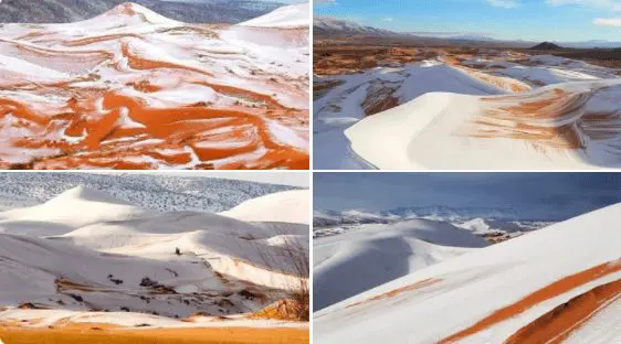
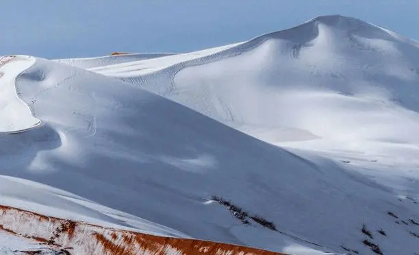
Collapse of atmospheric circulation: Snowing in Ain Sefra, Sahara, Algeria!
Moments like this are rare, and they are linked mainly with strong AO- and NAO- phases and so-called “collapses of atmospheric circulation” in the Northern Hemisphere, associated with a destabilization of a polar vortex.
And just a situation like this occurred in the Northern Hemisphere in the last 2 weeks with many temperature records across continents of Northern Hemisphere /the last part of the article/.
Ain Sefra elevated around 1000 MASL is still counted such as lower situated, densely populated area and mainly – already Saharan desert.
In some parts of the region, snow will appear every few years in Winter 2021/2022 we had luck already in early December, which agrees with our Winter 2021/2022 forecast for Africa /https://mkweather.com/winter-and-summer-2021-2022-forecast-for-africa//.
Extreme snowfall is meanwhile reported from the Pyrenees and Spain /https://mkweather.com/record-snow-in-pyrenees-france-spain-the-next-blizzards-are-only-coming// and severe blizzards are forecasted for Alpine region, Central Europe and Balkan, too /https://mkweather.com/bratislava-should-surprise-40-cm-of-snowfall-the-metropolitan-city-is-preparing-for-snow-calamity/; https://mkweather.com/20c-in-austria-before-an-arrival-of-blizzard-20-30-cm-for-vienna-after-blizzard-will-be-even-colder/; https://mkweather.com/serbia-expects-extreme-blizzard-1-meter-snwofall-all-balkan-will-be-under-the-snow//.
In valleys and basins in Algeria below 1000 MASL, minimum temperatures in the last period dropped up to approximately -5°C, and from all Atlas region is reported heavy snowfall.
Anomalously cold weather and snow are reported from Morocco and Tunisia, too.
Libya and Egypt for the peak of coldwave are already waiting and December winter should surprise already in the half of the month.
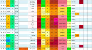
From Alger, the lowest minimum temperature of +9,2°C and the lowest maximum temperature of +14,3°C were during the period reported already on 29. November 2021.
Medea, 981 MASL, reported on 4. December maximum temperature of only +4,9°C.
Batna, 826 MASL, reported on 5. December minimum temperature of only -3,3°C.
Very stormy weather in the region should persist in the region almost until the end of December 2021 /https://mkweather.com/white-christmas-2021-a-big-snow-forecast-for-europe-until-10-january-2022//, with the next possible Mediterranean lows and snow and frosts below 1000 MASL.
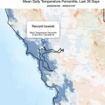
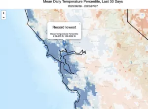
All during extreme temperature records across all Northern Hemisphere:
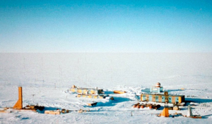
Only before a few hours have appeared the strongest early frosts in the Siberian coldest region in all-time history (-61,0°C) /https://mkweather.com/historical-times-for-siberia-610c-has-never-been-measured-so-early//.
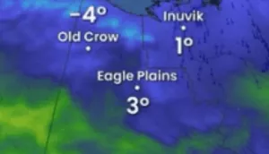
In Canadian Arctic, frosts up to -46,0°C have appeared, so far – in many regions, it´s the strongest earliest frosts since 2004 /https://mkweather.com/eureka-431c-the-lowest-temperatures-in-canadian-arctic-in-early-winter-since-2004/; https://mkweather.com/canada-460c-daily-records-in-yukon-were-broken//.
In Europe, the strongest early frosts since 1945 have surprised Sweden (-43,8°C) /https://mkweather.com/the-strongest-early-frosts-in-the-baltic-region-in-62-years-since-1959-tartu-estonia-276c-zoseni-latvia-264c//, the strongest early frosts since 1959 Estonia (-27,6°C) /https://mkweather.com/the-strongest-early-frosts-in-the-baltic-region-in-62-years-since-1959-tartu-estonia-276c-zoseni-latvia-264c// and in valleys in continental Europe was measured -22,0°C so far /https://mkweather.com/220c-in-pontets-france//.
All after anomalously cold Arctic, with the 2nd highest Arctic Sea Ice Extent in the last 15 years /https://mkweather.com/arctic-sea-ice-extent-is-the-2nd-highest-in-15-years/; https://mkweather.com/20-vessels-stuck-and-ice-locked-in-northern-sea-route-the-arctic//.
Therefore, stay safe and warm and will be prepared for the next manifestations of severe winter.