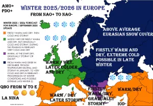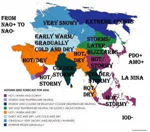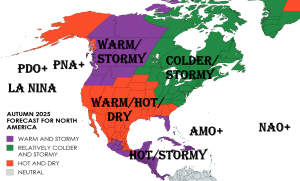
Spring 2022 is slowly coming and we are bringing continental updates of predicted weather patterns for Europe /https://mkweather.com/spring-2022-forecast-for-europe-early-dry-late-stormy-very-warm//, North America, Asia, Africa (Spring + Autumn 2022), Australia (Autumn 2022), South America (Autumn 2022), and Antarctica (Autumn 2022).
In this article, we will look at the forecast of Spring 2022 conditions in North America.
A few main teleconnection patterns will be affecting conditions during an upcoming Spring 2022:
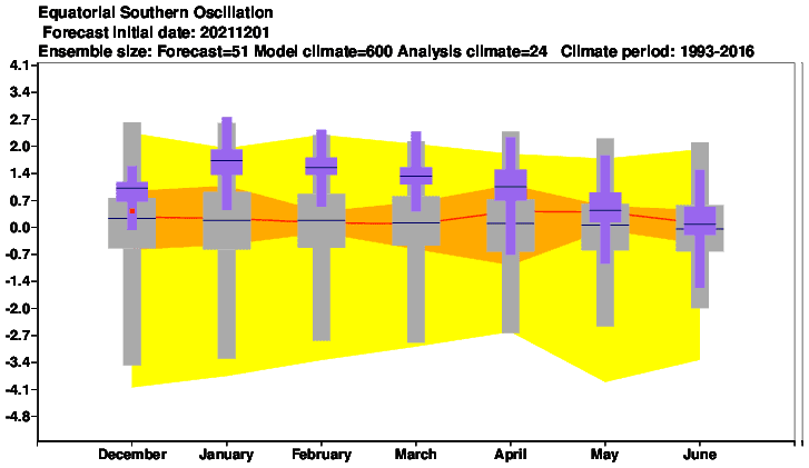
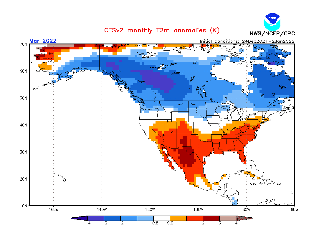
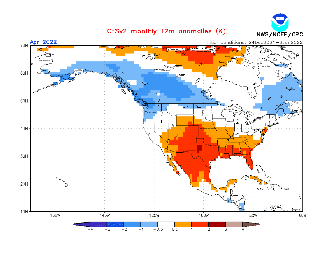
1. Still very strong La Nina: should be associated with colder Earth conditions, but is usually linked with AO+ and NAO+, which is the case of upcoming Spring 2022. Cold western half Canada, Alaska, N, and NW USA thanks to La Nina, while warm southern USA and northern Mexico. According to current forecasts, the “Kentucky-like tornado pattern” should stay above the USA in January and February 2022 /https://mkweather.com/kentucky-like-tornadoes-for-the-usa-in-january-and-february-2022-cfs-sees-extreme-temperature-differences-across-the-continent-and-sharp-frontal-boundaries-for-midwest-southeast//, which should be associated with La Nina. This pattern should persist in early Spring 2022, too. A hope for El Nino is forecast only from Autumn 2022, which should have later during the year impact on weaker hurricane season 2022, than in previous 2 extreme years.
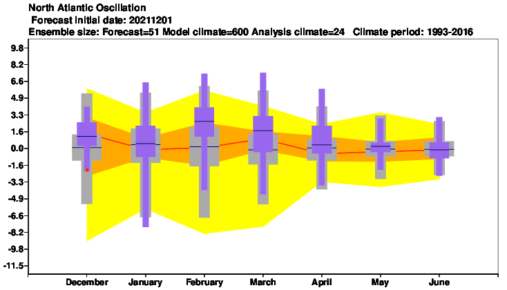
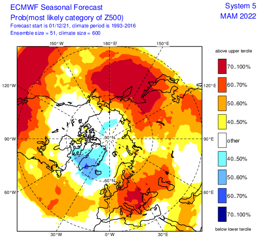
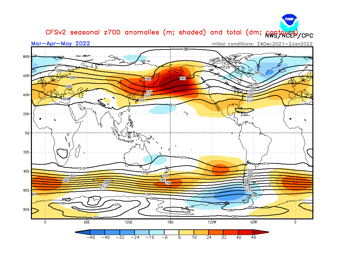
2. Shift from NAO+/AO+ to neutral NAO/AO: While the start of Spring 2022 should bring strong NAO+ / AO+, in April or May should appear temporary neutral or even NAO- / AO- phases. NAO+ in March 2022 means very cold Eastern Canada and the neighboring USA and warm and stormy region southward from Great Lakes (eastern Midwest, Northeast,…). Southern USA should stay thanks to AO+ very hot and dry.
3. Very cold Arctic (in previous winter): At the start of Winter 2021/2022, very cold Arctic conditions were observed /https://mkweather.com/arctic-sea-ice-extent-is-the-2nd-highest-in-15-years// and anomalously cold conditions were persisting until New Year 2022. In January 2022, northern Siberia and Canada report still severe coldwaves. A higher amount of Arctic Sea Ice should affect near NAO+ mainly Canada and cause very cold conditions in March, NAO+ should be mainly in March 2022 linked with a prolonged low ice Arctic cover (colder Arctic near NAO+).
4. QBO in Westerly phase: It should mean more zonal airflow, explained by NAO+ (strong zonal winds = strong Icelandic low, strong Azores high.
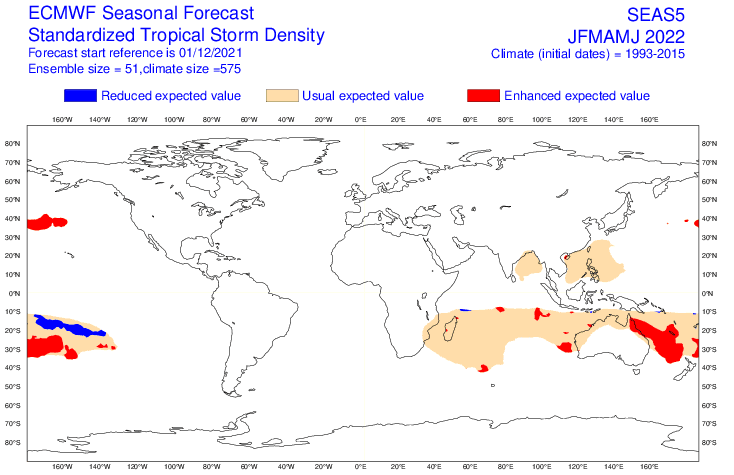
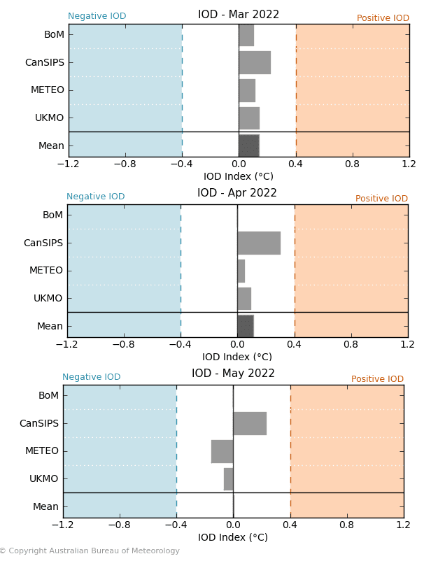
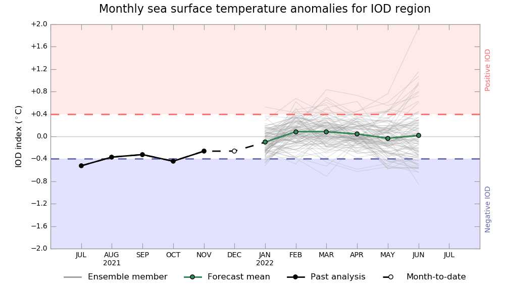
5. Shift to positive IOD: Positive IOD correlates with NAO+ and stronger cyclone season in the eastern Indian Ocean, therefore, a pattern appears to be preserved.
6. Awakening sun activity: should be in contrast with a transition from La Nina to El Nino during the year 2022 and the year 2023. Overall, there are signals, that the last colder winters are associated with a weakening of solar cycles after 2000, especially during the last minimum before a few years.
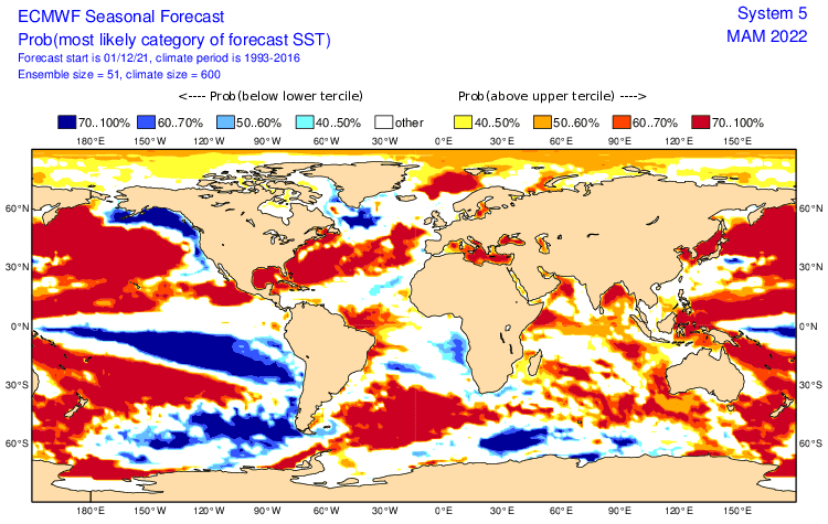
7. SST: Cold near Pacific coast and southward from Greenland (Global Warming Hole) and warm near Eastern, Southern USA and Mexico should have contribution to weather regimes in mentioned regions.
8. NE Pacific Warm Blob: Warm and high-pressure anomaly above NE Pacific associated with very cold conditions in the western half of Canada, Alaska, and N/NW USA. Correlates with NAO+ / AO+. Forecast until May 2022, but will be slowly weakening.
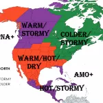
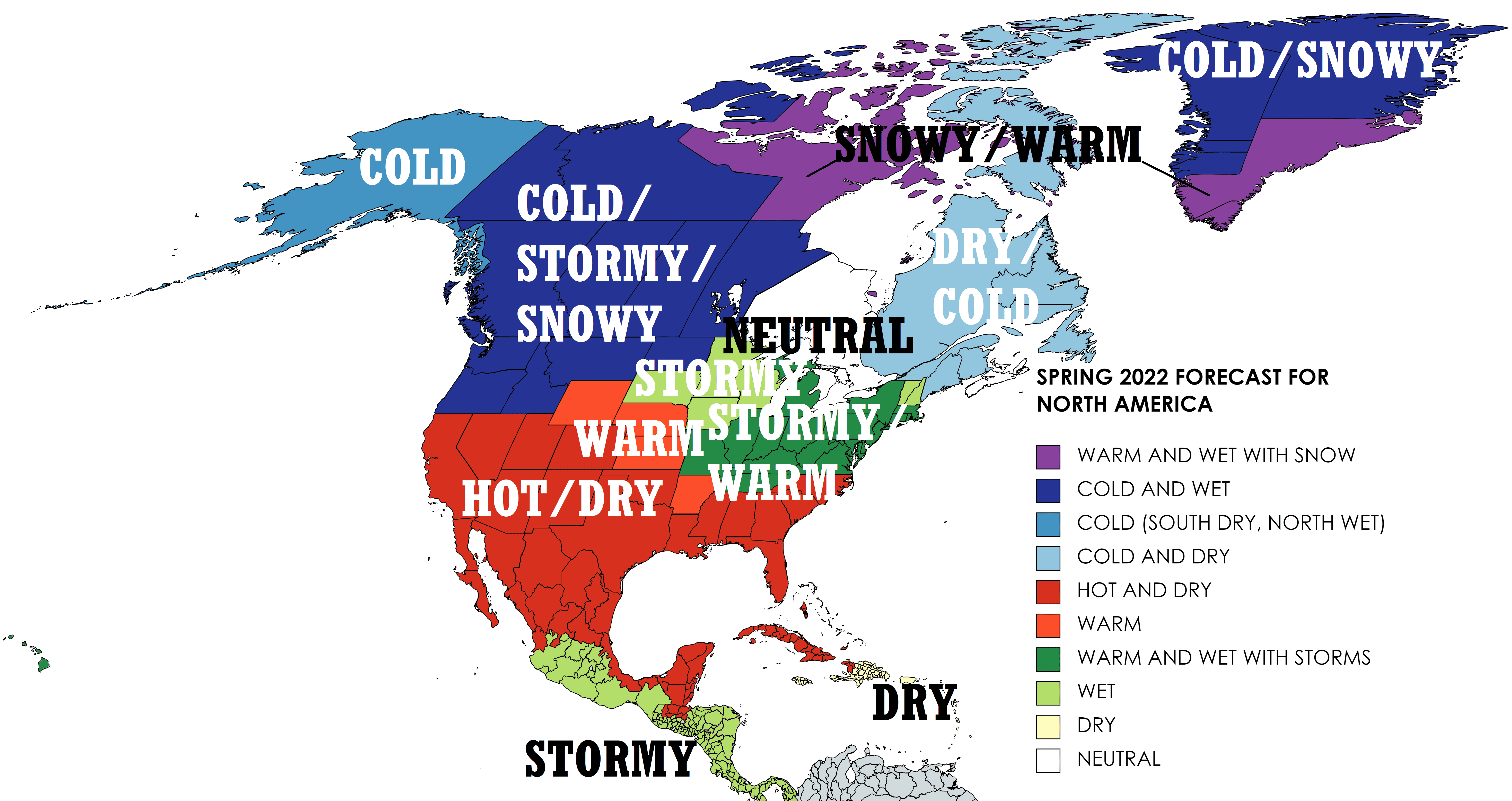
Now, we should look at a forecasted map for Spring 2022 for North America and 10 main sectors, with similar regimes of weather:
A) WARM AND WET WITH SNOW (PURPLE) – S/E GREENLAND, NUNAVUT: Thanks to strong Icelandic low snowy/stormy S/E Greenland, mostly warmer. Nunavut warmer probably thanks to Arctic Amplification. From severe frosts and blizzards up to -58°F / -50°C in early March to early warm spells in May (59°F / +15°C, southern Nunavut 68°F / +20°C).
B) COLD AND WET (STORMY/SNOWY): WESTERN HALF OF CANADA, N/W GREENLAND: Cold La Nina pattern with a combination of NE Pacific Warm blob and mainly in the first half of Spring 2022 NAO+/AO+ will create specific very cold and stormy conditions with blizzards, later heavy rains, and storms. Snow calamities and floods, weaker heatwaves. In early March up to -49°F / -45°C, May with first tropical heatwaves in southern parts of Canada, N/NW USA (86°F / +30°C).
C) COLD (SOUTH DRY, NORTH WET) – ALASKA: Specific conditions – wet north affected by Arctic Amplification, cold anomaly thanks to a combination of factors La Nina – NE Pacific Warm Blob – NAO+ / AO+. Southwestern Alaska dry thanks to NE Pacific Warm Blob and strong Hawaii high (shifted northward). Early frosts up to -49°F / -45°C, May heatwaves around 77°F / +25°C.
D) COLD AND DRY – EASTERN CANADA: Leading pattern NAO+ in the first half of Spring 2022, with arctic air masses with Greenlandic origin, moving above the region on the backside of deep Icelandic low. Should affect the Great Lakes region temporarily in March 2022. Early frosts up to -40°F / -40°C, in May heatwaves above 86°F / +30°C.
E) HOT AND DRY – SOUTHERN USA, NORTHERN MEXICO: La Nina and AO+ / NAO+ will create a hot and dry pattern in the region, with severe heatwaves, drought, and early wildfires. In northwestern regions temporarily coldwaves from the western half of Canada mainly in the first half of the season. In March 2022 frosts in basins up to 5°F / -15°C, in May heatwaves up to 113°F / +45°C.
F) WARM – STATES IN MIDWEST: Transient region between wet north and east and dry south.
G) WARM AND WET WITH STORMS- EASTERN MIDWEST, NORTHEAST: Thanks to NAO+, many collisions of Arctic air masses from the north with hot and dry masses in the south. Tornadic potential. In March blizzards, yet and up to -4°F / -20°C, May with up to 95°F / +35°C.
H) WET – CENTRAL AMERICA AND NORTHERN PLAINS: Stormy Central America (La Nina) and a transient region between cold north and warm south in the USA. A lot of blizzards in March 2022, strong May 2022 heatwaves. Later tornadoes. March up to -40°C, May up to +35°C.
I) DRY – HAITI, DOMINICAN REPUBLIC, AND ANTILLES: Dry part of Caribbean thanks to La Nina and NAO+. Warm summer, later tropical weather.
J) NEUTRAL – ONTARIO, NOVA SCOTIA: Region on crossroads between cold and warm and wet and dry masses. Circulation mechanisms described in the regions above. Great Lakes region wetter than Hudson Bay.
Winter (Summer) 2021/2022 forecasts are available here: Europe /https://mkweather.com/winter-2021-2022-forecast-for-europe-early-extreme-arctic-and-siberian-blasts-and-blizzards-late-dry-and-very-warm-conditions//, North America /https://mkweather.com/winter-2021-2022-forecast-for-north-america-a-peak-of-winter-with-extreme-arctic-blasts-and-blizzards-in-february-2022//, Asia /https://mkweather.com/winter-2021-2022-forecast-for-asia-early-extreme-arctic-and-siberian-blasts-and-blizzards-late-dry-and-warm-conditions//, Australia and Oceania /https://mkweather.com/summer-2021-2022-forecast-for-australia-and-oceania-stormy-colder-la-nina-pattern-above-the-continent//, South America /http://mkweather.com/summer-2021-2022-forecast-for-south-america-stormy-north-hot-and-dry-south-cold-and-dry-pacific-coast//, Africa /https://mkweather.com/winter-and-summer-2021-2022-forecast-for-africa//, and Antarctica /https://mkweather.com/summer-2021-2022-forecast-for-antarctica//.

Mkweather Spring 2022 forecast for North America. Base map: https://mapchart.net/americas-detailed.html
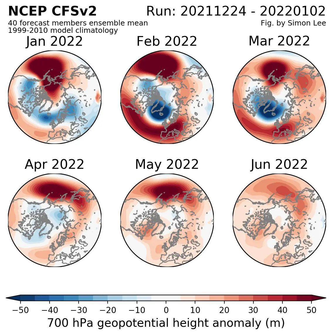
Source: https://simonleewx.com/cfsv2_monthly-anomalies/
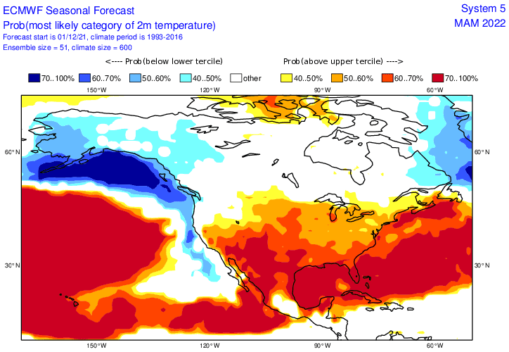
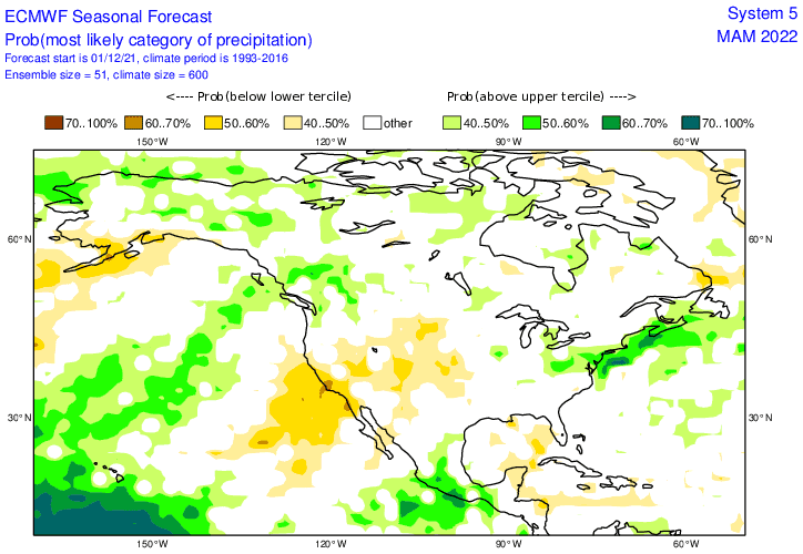


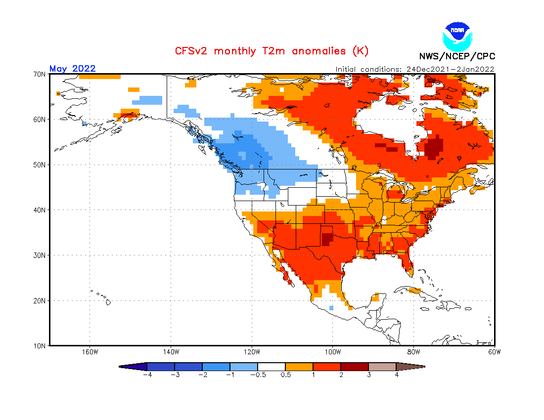
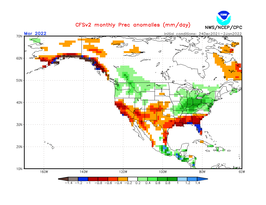
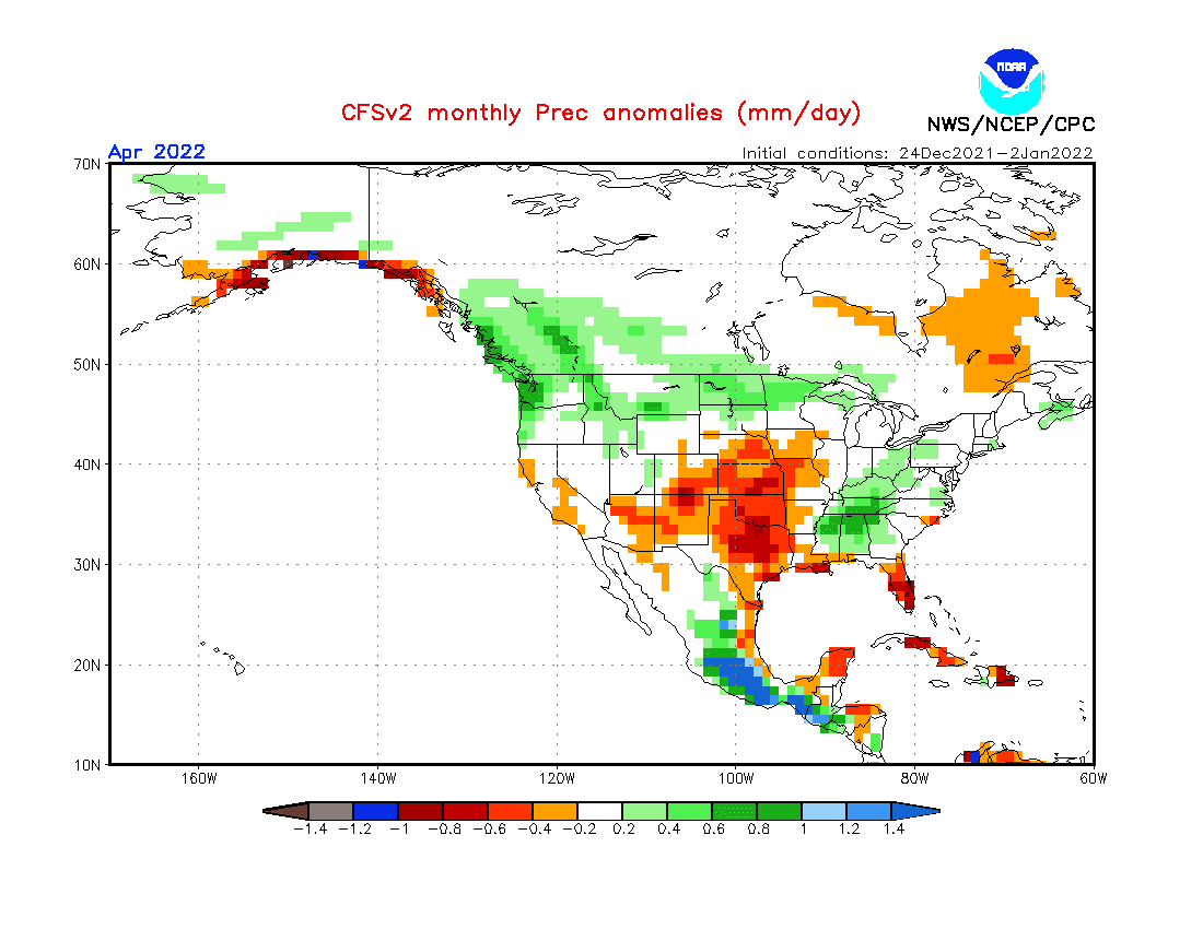
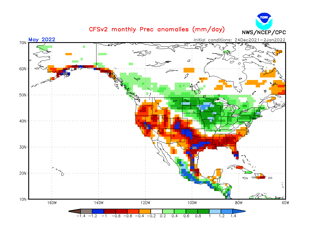
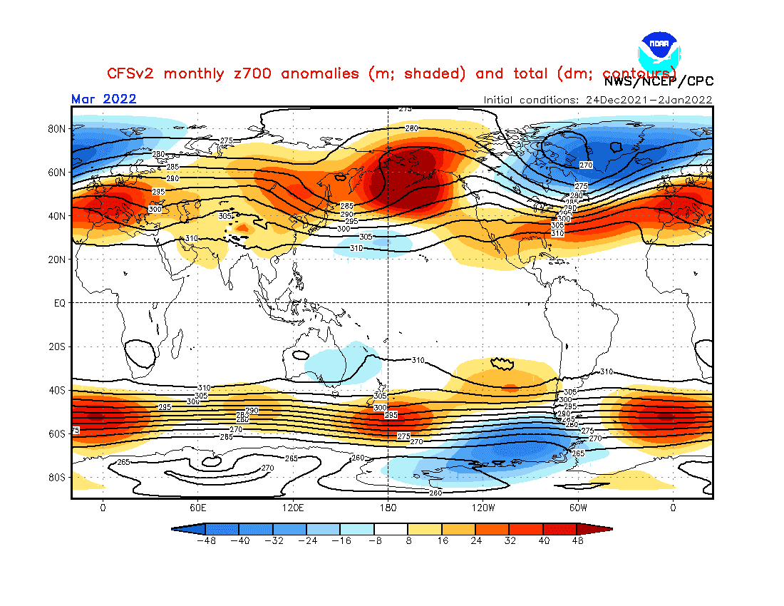
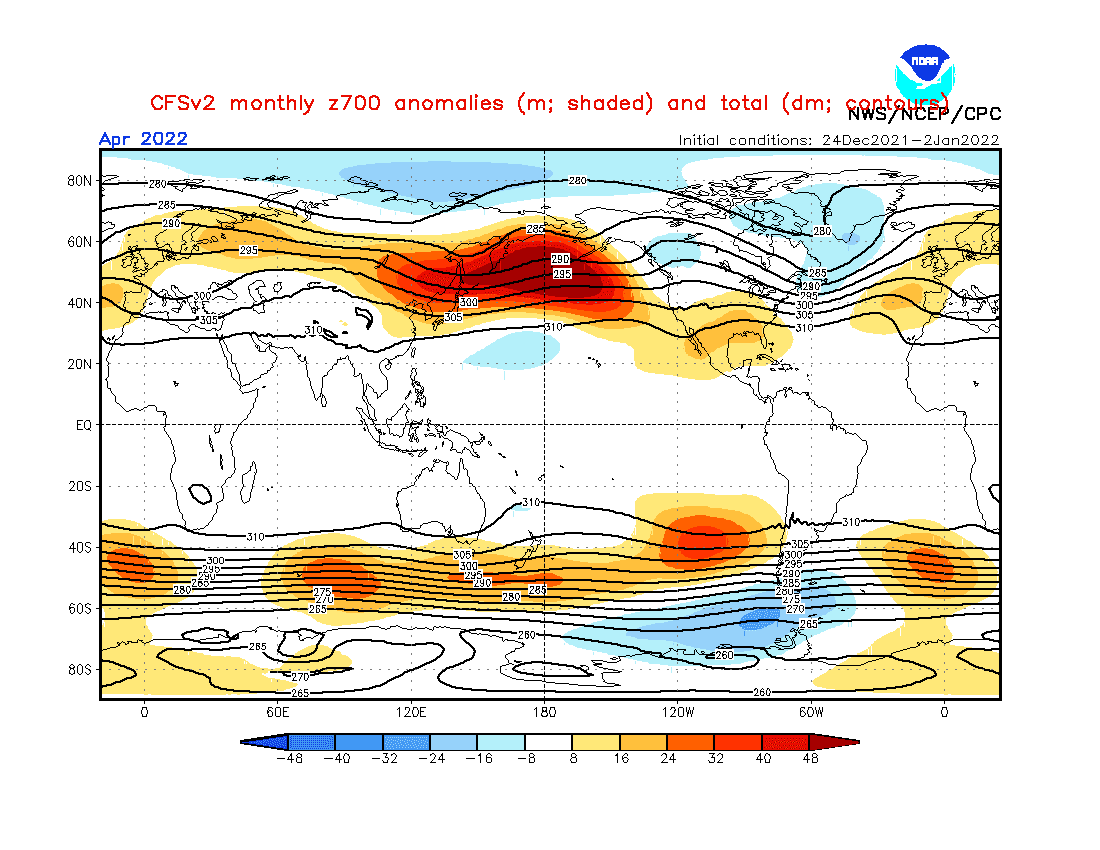
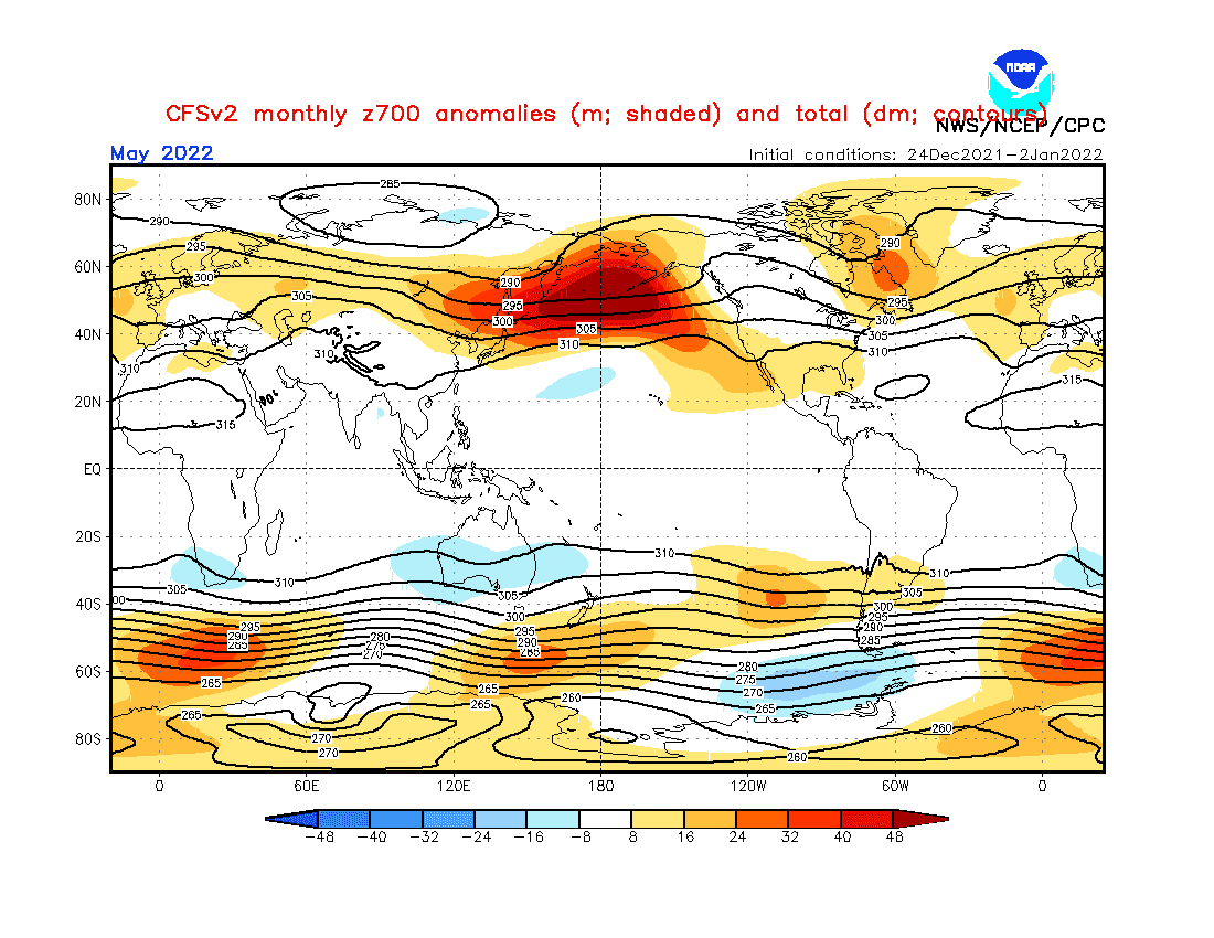
Source: https://www.cpc.ncep.noaa.gov/products/CFSv2/CFSv2_body.html
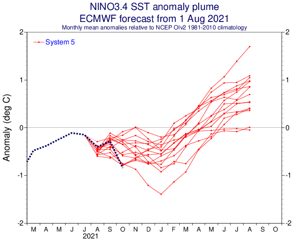

Source: https://iri.columbia.edu/our-expertise/climate/forecasts/enso/current/?enso_tab=enso-cpc_plume
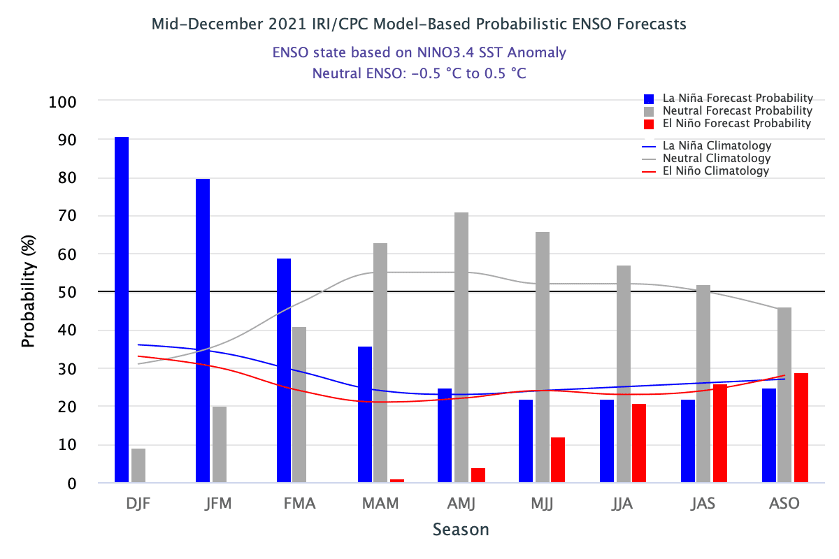
Source: https://iri.columbia.edu/our-expertise/climate/forecasts/enso/current/?enso_tab=enso-iri_plume
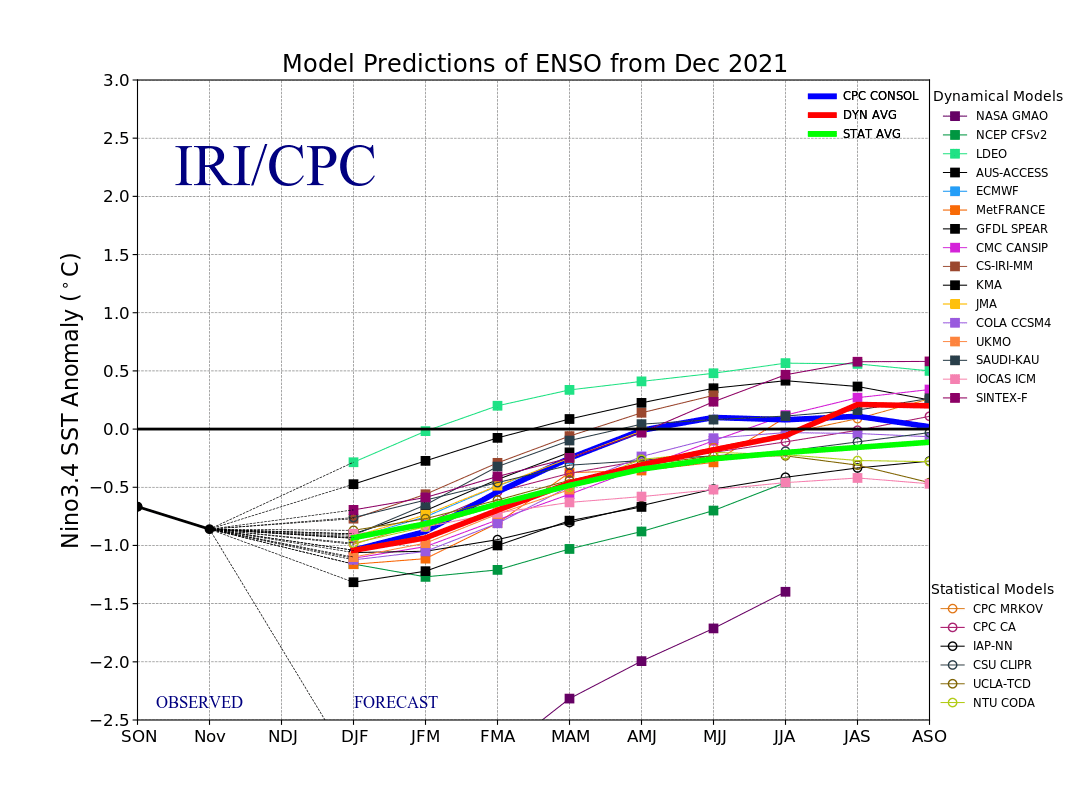
Source: https://iri.columbia.edu/our-expertise/climate/forecasts/enso/current/?enso_tab=enso-sst_table

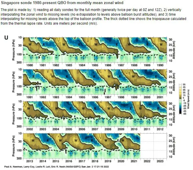
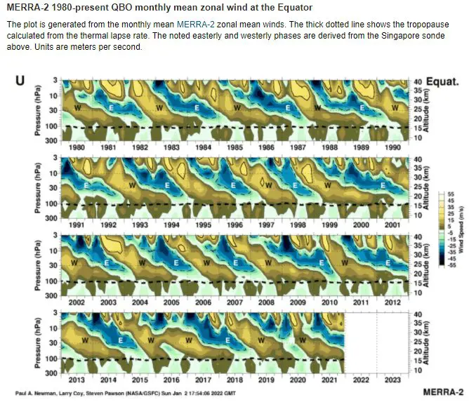
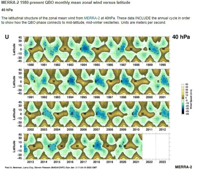
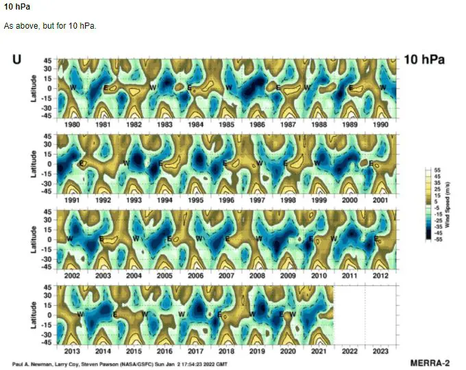
Source: https://acd-ext.gsfc.nasa.gov/Data_services/met/qbo/qbo.html
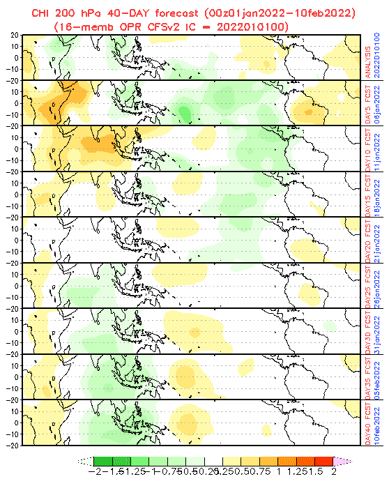
Source: https://www.cpc.ncep.noaa.gov/products/people/wd52qz/mjo/chi/cfs.gif
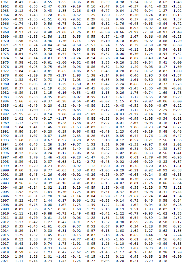
NAOi. Source: https://www.cpc.ncep.noaa.gov/products/precip/CWlink/pna/norm.nao.monthly.b5001.current.ascii.table
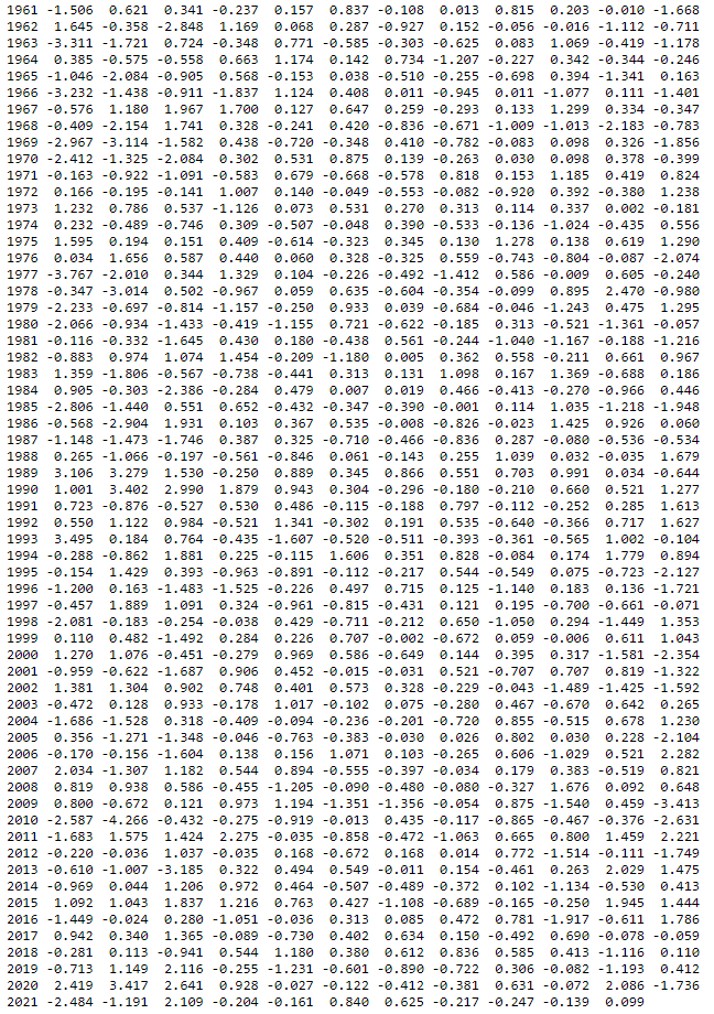
AOi. Source: https://www.cpc.ncep.noaa.gov/products/precip/CWlink/daily_ao_index/monthly.ao.index.b50.current.ascii.table
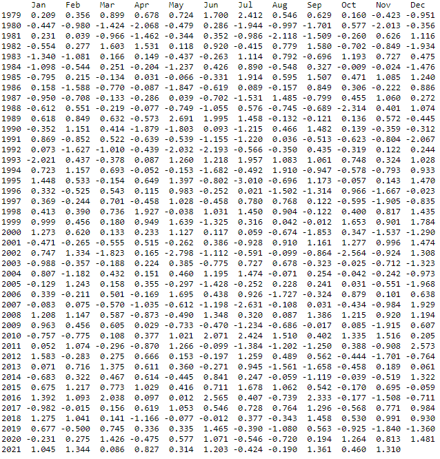
AAOi. Source: https://www.cpc.ncep.noaa.gov/products/precip/CWlink/daily_ao_index/aao/monthly.aao.index.b79.current.ascii.table
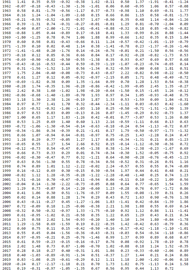
PNAi. Source: https://www.cpc.ncep.noaa.gov/products/precip/CWlink/pna/norm.pna.monthly.b5001.current.ascii.table
