Winter 2022 in Southern Hemisphere is here already in 4 months and we are bringing the first continental updates of predicted weather patterns for Europe (Summer 2022), North America (Summer 2022), Asia (Summer 2022), Africa (Winter+Summer 2022), Australia (Winter 2022), South America (Winter 2022), and Antarctica (Winter 2022).
This article will look at the forecast of Winter 2022 conditions in South America.
A few main factors will be affecting conditions during an upcoming Winter 2022:
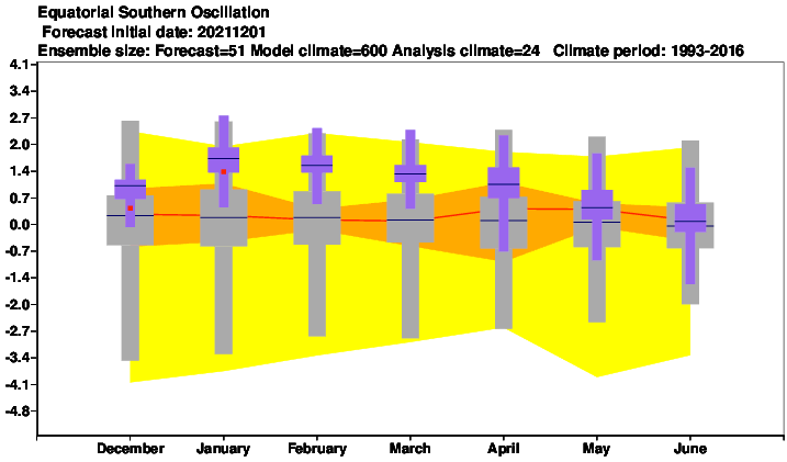
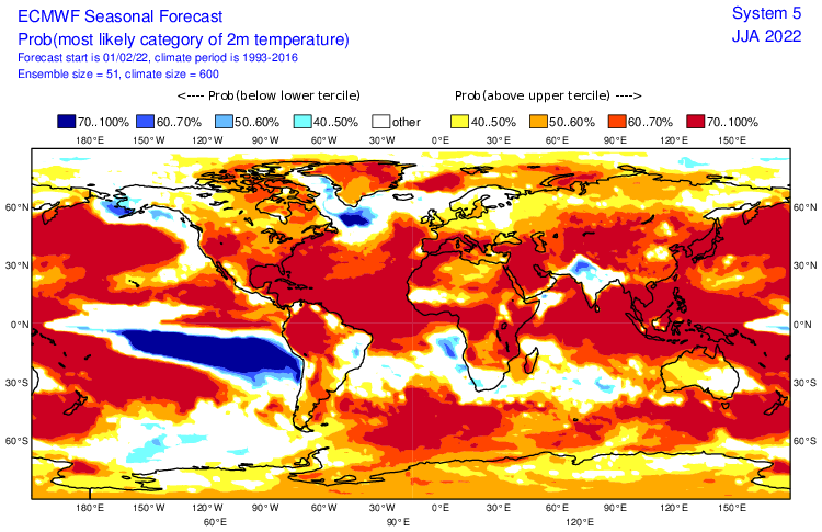
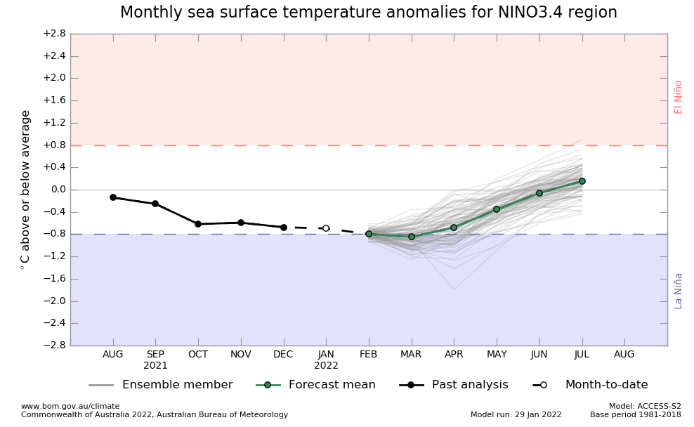
1. Weakening La Nina: During Winter 2022, a shift from La Nina to El Nino will be ongoing (Autumn in Southern Hemisphere (MAM) will be La Nina, yet, but Spring (SON) probably El Nino already). The previous 2 La Nina years should be associated with accumulated colder Earth conditions. La Nina is in the summer season linked with the stormy northern half and the hot and dry southern half of the continent, but in winter, weather patterns are changing and the season of rains with stormy effects of La Nina are shifted northward, where, severe floods, landslides, and storms are possible (mainly Colombia, Venezuela, N Ecuador, N Amazon, Guyana region). Winter heatwaves, drought, and wildfires in continental parts of South America are very possible, too. The cold and dry Pacific coast is a sign of La Nina, too. La Nina patterns will be slowly weakening and already in the last months of the year 2022, El Nino patterns should appear, with changes in weather patterns, opposite to the previous 2 years. La Nina is more fertile in Eastern Brazil and northern South America, while El Nino in Southern Brazil /https://mkweather.com/el-nino-is-coming-autumn-2022-a-big-changes-in-circulation-patterns-worldwide//.
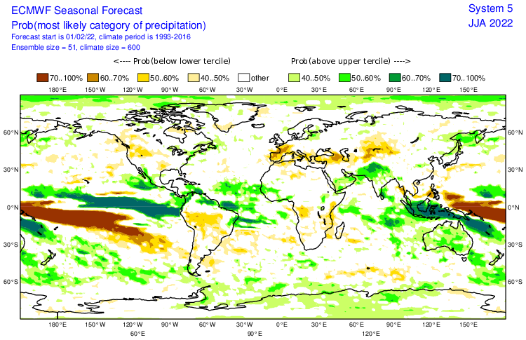
2. Shift of season of rain northward: During the summer season, ITCZ is shifted southward, above central parts of the continent, while in winter, stormy patterns are shifted to northern parts of South America. During La Nina, a season of rain is stronger than is usual. It should mean severe floods and landslides for Colombia, Venezuela, the Guyana region, northern Ecuador, or northern Amazon. A relatively warm anomaly however should mean, that floods won´t be so extreme such as in the previous 2 seasons.
3. AAO+: Higher probability of AAO+ phase should mean more southern situated stormtrack in southern Argentina and Chile, with lesser or normal frequency of severe winterstorms, but shorter AAO- phases should be thanks to anomalously cold air with origin in Antarctic masses very strong in their peaks.
4. Cold Antarctica: Last winter season the coldest in the South Pole in history /https://mkweather.com/the-south-pole-with-the-coldest-winter-in-history-average-temperature-april-september-half-year-only-610c//. Near shorter AAO- phases, therefore, less frequent, but possible severe Antarctic blasts in Patagonia.
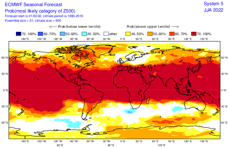
5. A shift of Hadley Cell southward and northward: An expansion of high pressure in equatorial and tropical latitudes should be linked with hot and dry anticyclonic anomalies above central parts of the continent.
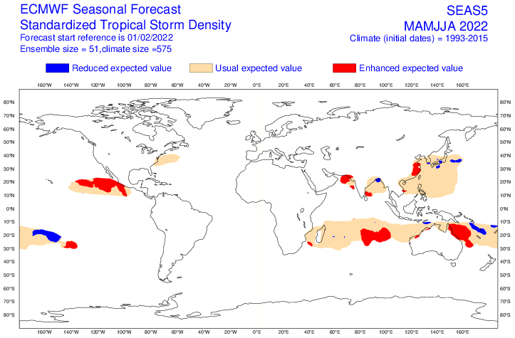
6. Stronger start of Atlantic Hurricane season: Despite weakening La Nina, thanks to AMO+, is expected the next above-average Hurricane season 2022. It should mean more tropical depressions, tropical storms, and hurricanes at the end of Summer 2022 on the northern coast of South America (Colombia, Venezuela, Guayana region), especially in the second half of the summer. Autumn 2022 should be thanks to the upcoming El Nino relatively calmer in comparison with previous autumns.
7. Stronger start of Pacific Hurricane season: Very strong and early Pacific Hurricane season is forecast, which should mean more tropical disturbances/threats for the Panama region, including northern Colombia.
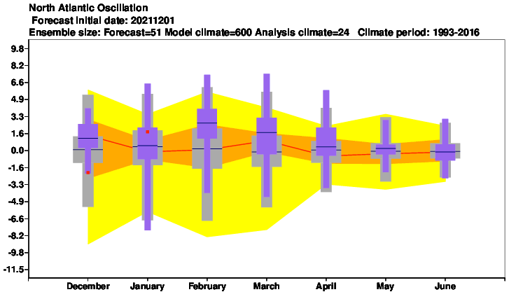
8. Mostly NAO- and AO-: After the year 2000, approximately 2/3 of winters were NAO+, while 2/3 summers NAO-. Weaker Azores high should mean more stormy NE Brazil.
9. AMO+: Warmer seas near North America with effect on stronger hurricane season and tropical threats in late summer in northern Colombia, Venezuela and Guyana region.
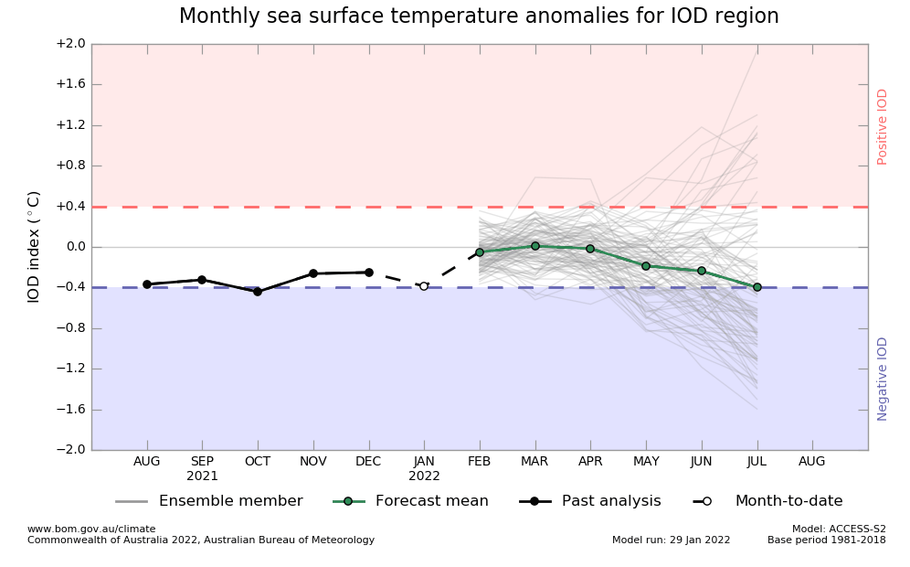
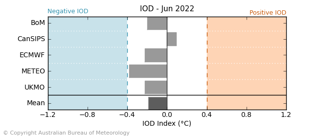
10. Negative IOD: Correlates with NAO- / AO-. Effect together with MJO on the belt of equatorial cyclonic activity, too.
11. QBO in Westerly phase: Support for zonal airflow, despite possible NAO- / AO- conditions.
12. Awakening sun activity: should be linked with warmer global signals not only in Summer 2022 but in the next years.
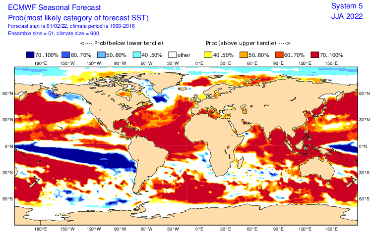
13. SST: very cold SST near Pacific coast linked with La Nina pattern. Warm seas near E/NE Brazil and N South America should contribute to stronger storm activity.
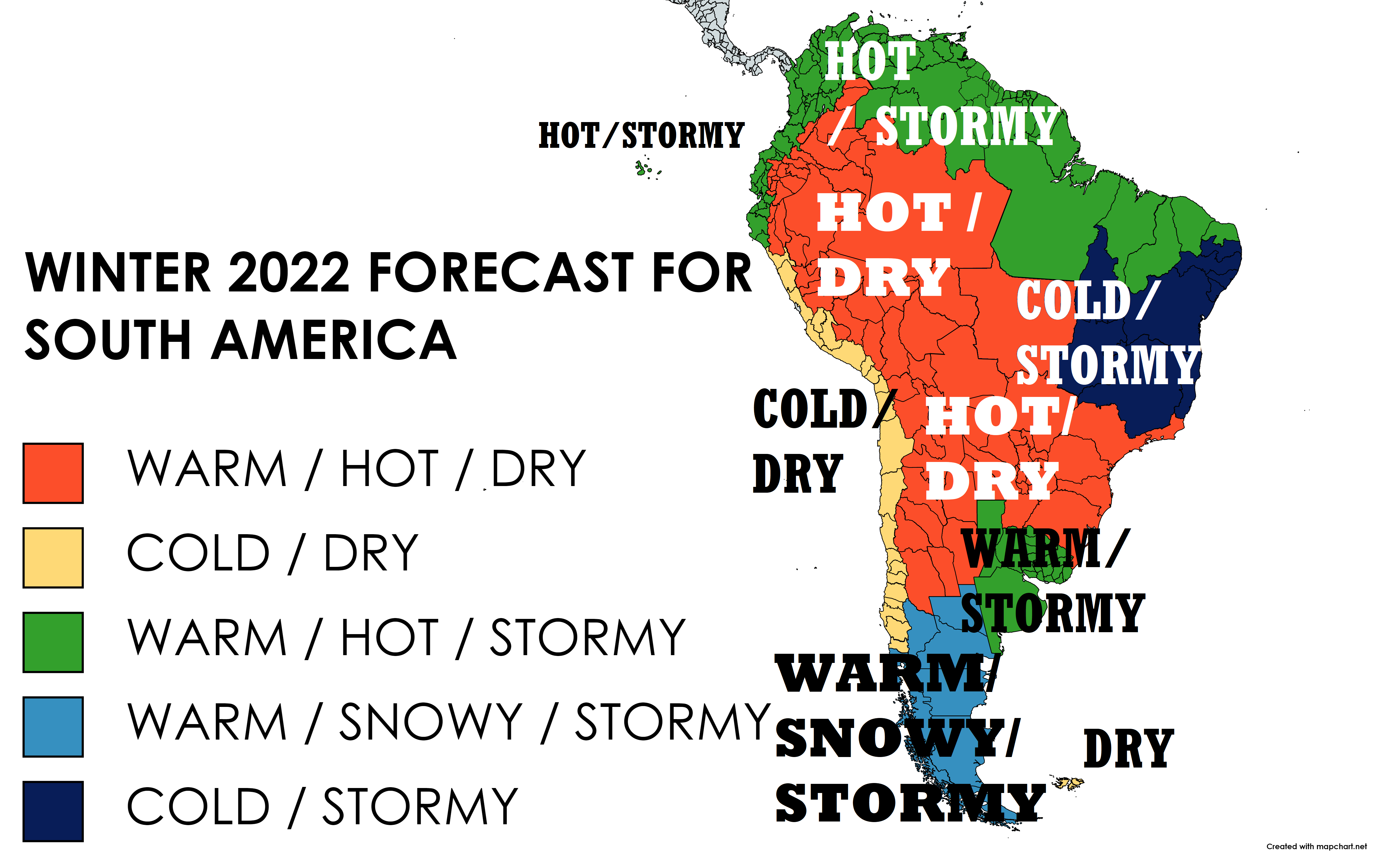
Now, we should look at a forecast map for Winter 2022 for South America and 5 main sectors, with similar regimes of weather:
A) WARM / HOT / DRY (LARGE CONTINENTAL PARTS OF SOUTH AMERICA FROM NORTHERN ARGENTINA AND SOUTHERN BRAZIL TO WESTERN AMAZON): Weakening La Nina pattern, a shift of a season of rain northward and Hadley Cell expansion should mean together with AAO+ warm/hot and dry conditions above continental parts of South America. It means possible drought, more northward heatwaves and wildfires, and bad conditions for agriculture in many regions. During shorter AAO- phases should appear less frequent, but strong Antarctic blasts, which should be the next threat for plants in moderate and subtropical, maybe shortly tropical climate zones. In northern Patagonia should appear stronger frosts up to -20°C, but in northern parts of the region, temperatures up to +40°C during heatwaves will be still possible. Mainly southern Brazil should be very dry, with significant harvest losses and a lack of water supplies.
B) COLD AND DRY (THE PACIFIC COAST): Caused mainly by ending La Nina along the coasts of Chile, Peru, and partially Ecuador. Colder SSTs near the shores of the continent are traditionally linked with below-average storm activity. Temperatures not above +40°C in populated regions in desert parts, but up to -15°C in southernmost parts during Antarctic blasts. Possible problems with water supplies and drought and relatively stable weather, in southern parts disrupting by cold fronts. Falklands drier, too, but relatively warmer.
C) WARM / HOT AND STORMY (NORTHERN SOUTH AMERICA, LA PLATA REGION, THE GALAPAGOS): Effect of La Nina and a shift of rain season above northern parts of the continent. Warm temperature anomalies should mean, that La Nina will be already very weakened and possible floods and landslides will be a little milder such as in the previous 2 seasons. The stronger start of Hurricane 2022 seasons (Atlantic and Pacific) in Central America and the Caribbean (and AMO+) should, however, produce the next unexpected surprises in a form of hurricanes, tropical storms, and tropical depressions along the northern coast of South America. NAO- should mean stormier patterns, too. Maximum temperatures mostly up to +35°C, minimum up to +10°C. La Plata region warm and stormier, too, thanks to collisions of hot air from the north and cold air from the south.
D) WARM / SNOWY / STORMY (SOUTHERN, SOUTH-CENTRAL ARGENTINA AND CHILE): Warmer, but still stormy and snowy pattern in southern parts of the continent should mean relatively high amounts of blizzards and winterstorms including windstorms. Possible AAO+ should mean more southern stormtrack as usual, during AAO- and neutral AAO, Antarctic blasts will be shifting shorter above central parts of the continent. Severe frosts up to -25°C rarely possible, but winter relatively good mainly thanks to the snow. Near warmer weather in northern parts and snow melting possible floods, too.
E) COLD AND STORMY (SOUTHERN-EAST BRAZIL): Typical stormy Eastern Brazil for La Nina, with a high risk of deadly floods and landslides. Temperature anomalies thanks to heavy rains and storms even below long-term averages. A possible contributions of NAO- / IOD- / wet MJO. A similar situation persists / will persist in the region in Winter 2021/2022 and Spring 2022. On the other hand relatively fertile and not supporting desertification. For better preparedness will be good to watch weather news, forecasts, warnings, and advisories. Temperatures mostly from +10 to +40°C.
Spring (Autumn) 2022 forecasts are available here: Europe /https://mkweather.com/spring-2022-forecast-for-europe-early-dry-late-stormy-very-warm//, North America /https://mkweather.com/spring-2022-forecast-for-north-america//, Asia /https://mkweather.com/spring-2022-forecast-for-asia//, Australia and Oceania /https://mkweather.com/autumn-2022-forecast-for-australia//, South America /https://mkweather.com/autumn-2022-forecast-for-south-america//, Africa /https://mkweather.com/spring-and-autumn-2022-forecast-for-africa-mostly-stormy-and-hot-south-colder//, and Antarctica /https://mkweather.com/autumn-2022-forecast-for-antarctica-snowy-with-severe-blizzards//.

Mkweather Winter 2022 forecast for South America. Base map: https://mapchart.net/europe.html
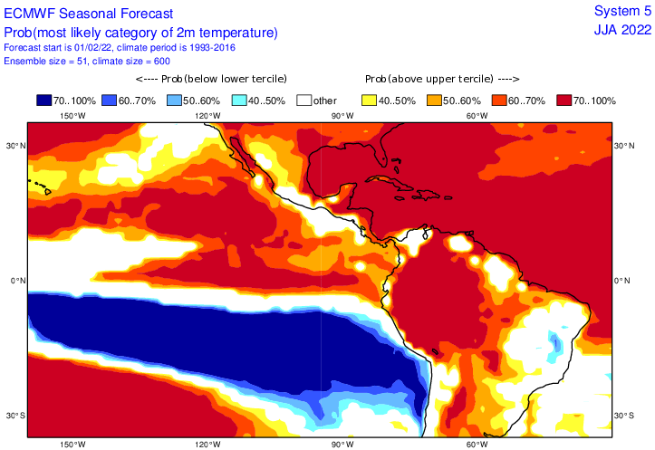

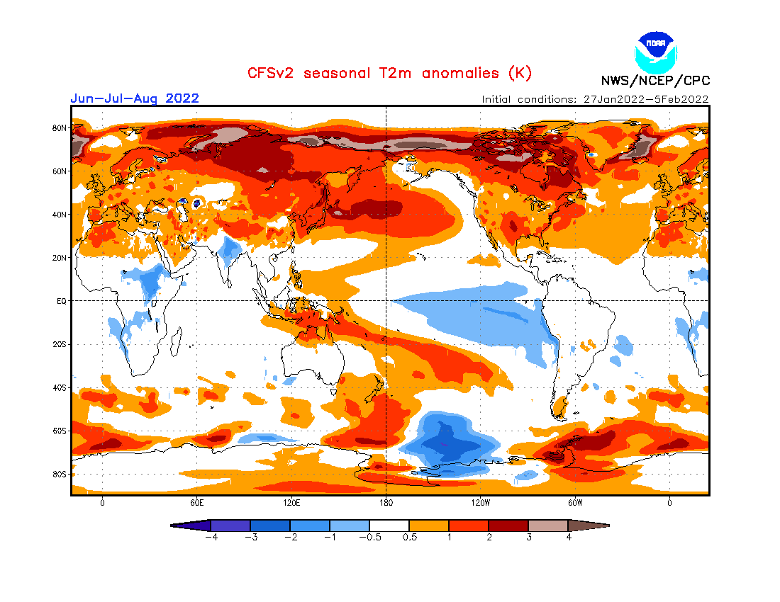
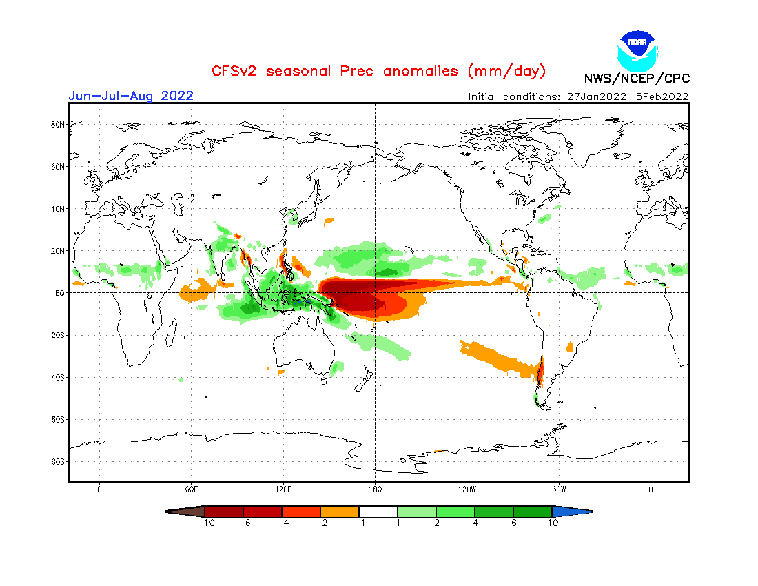
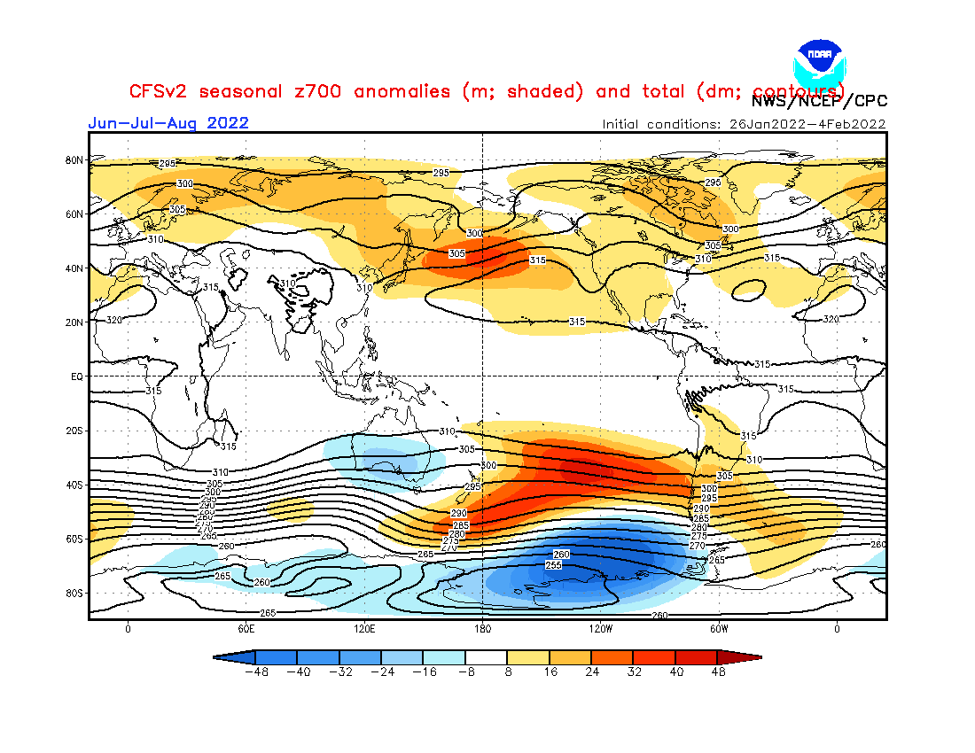
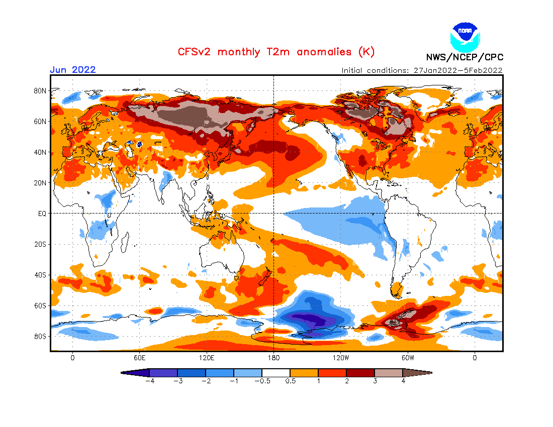
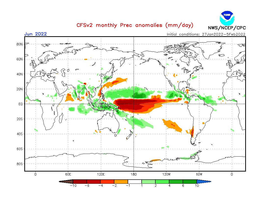
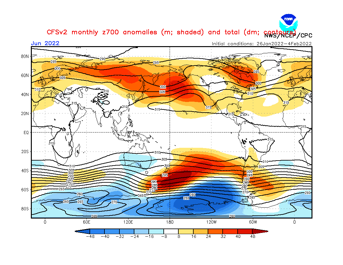
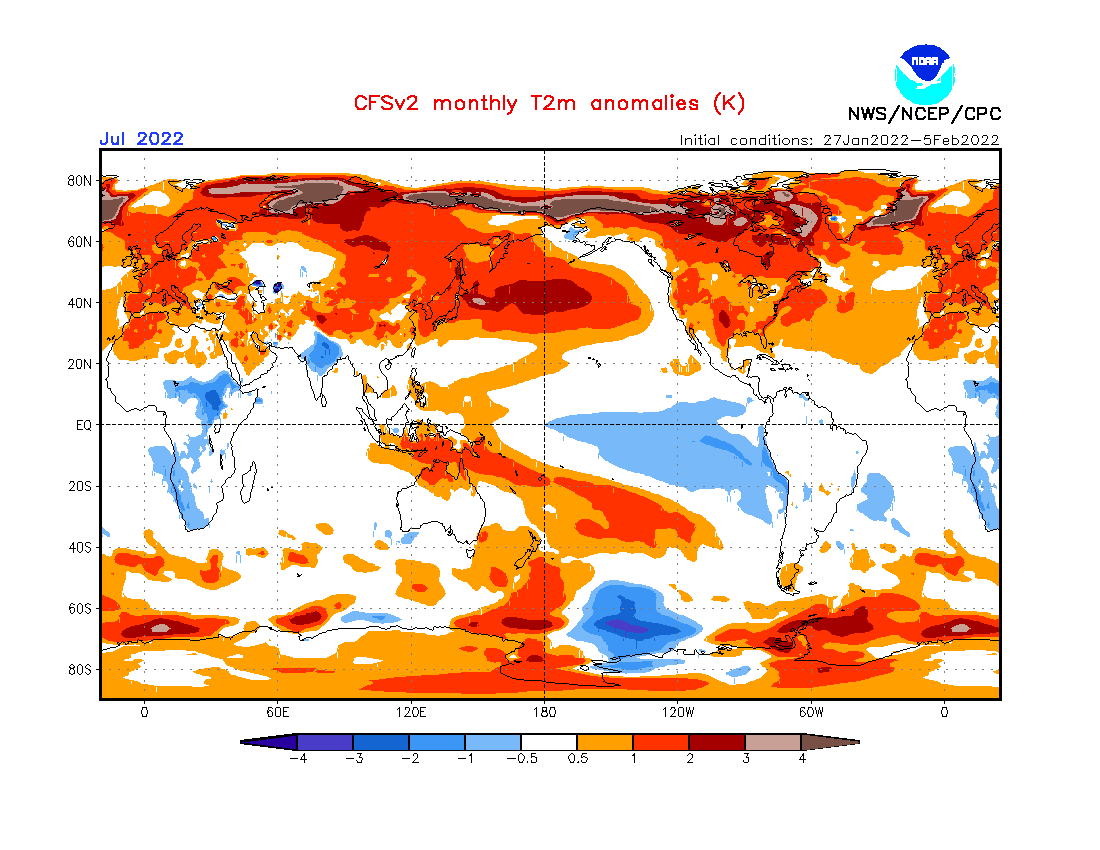
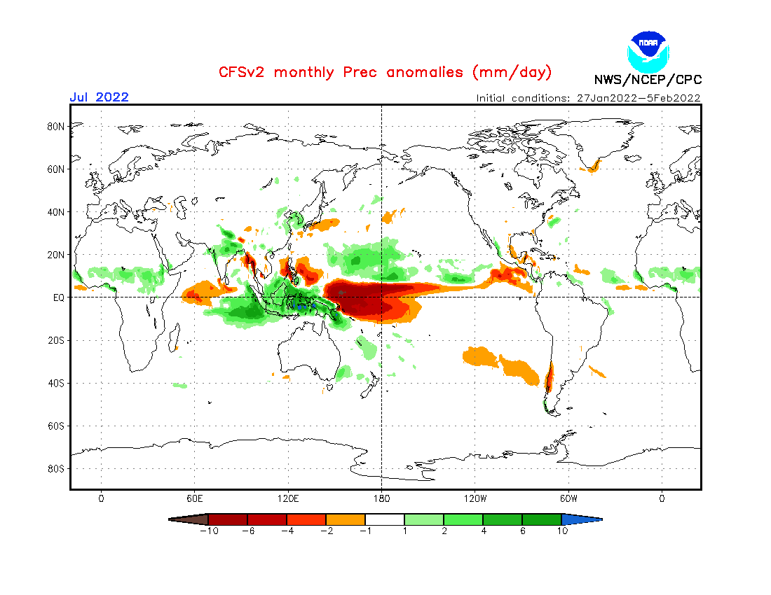
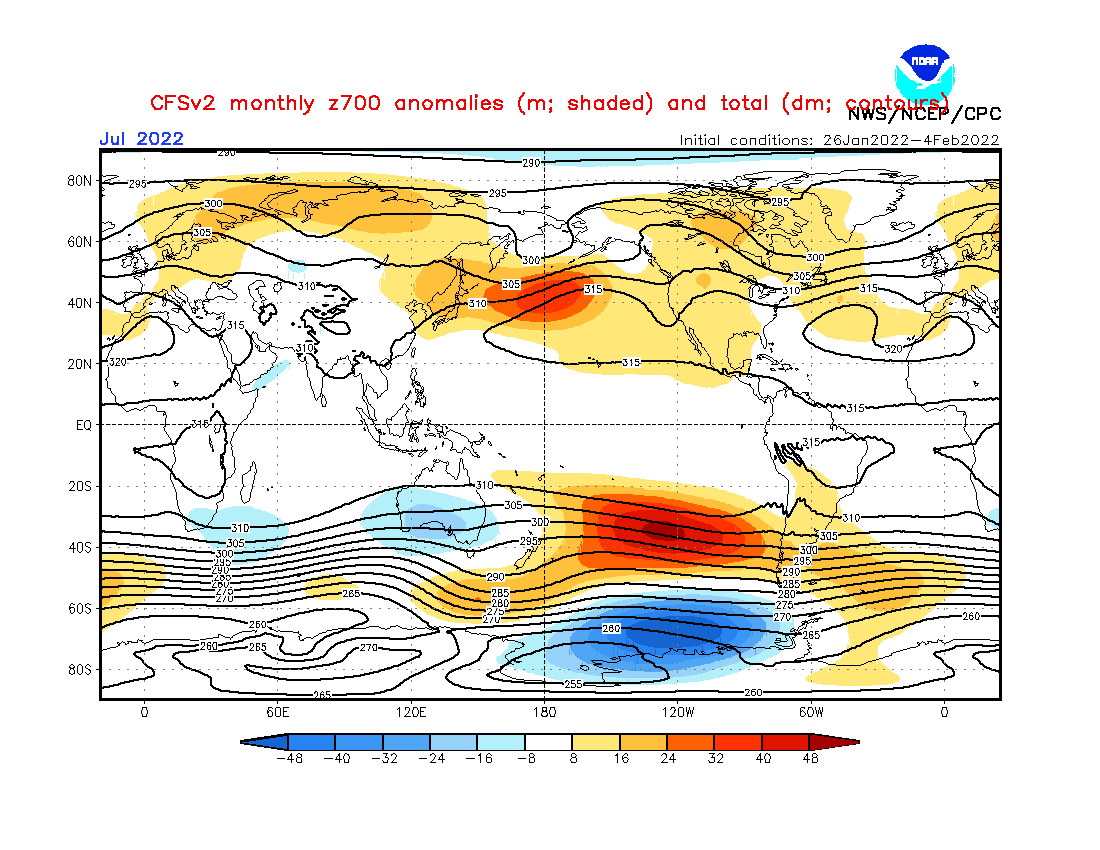
Source: https://www.cpc.ncep.noaa.gov/products/CFSv2/CFSv2_body.html
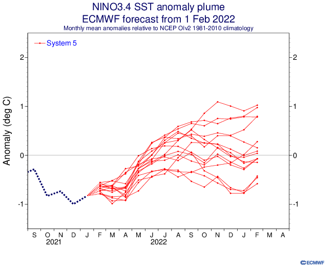
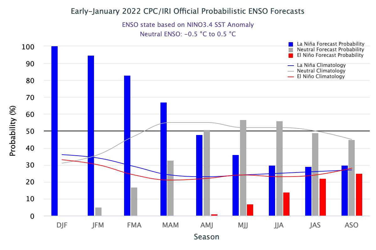
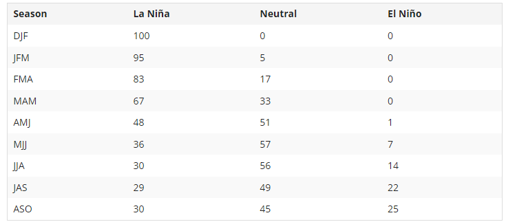
Source: https://iri.columbia.edu/our-expertise/climate/forecasts/enso/current/?enso_tab=enso-cpc_plume
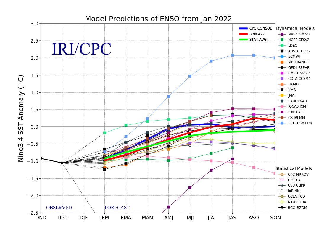
Source: https://iri.columbia.edu/our-expertise/climate/forecasts/enso/current/?enso_tab=enso-sst_table
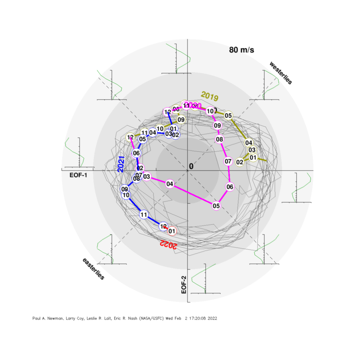
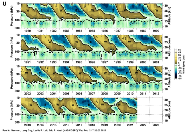
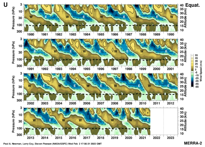
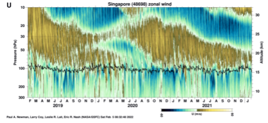
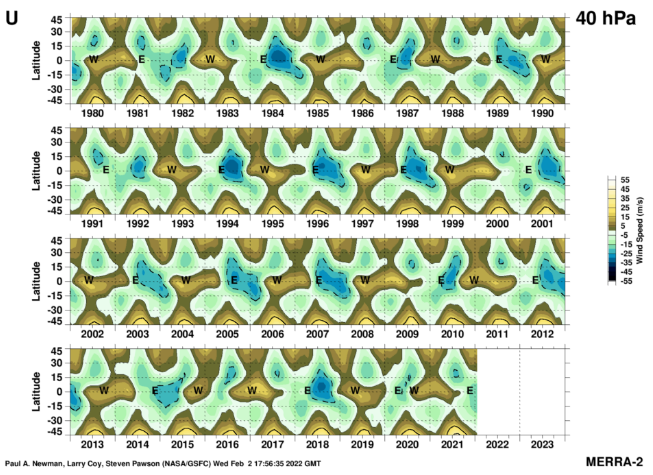
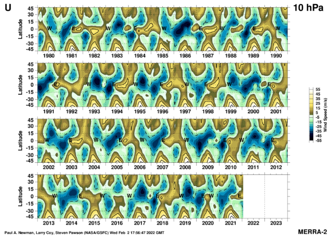
Source: https://acd-ext.gsfc.nasa.gov/Data_services/met/qbo/qbo.html
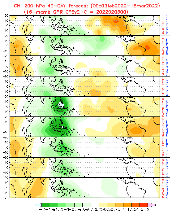
Source: https://www.cpc.ncep.noaa.gov/products/people/wd52qz/mjo/chi/cfs.gif
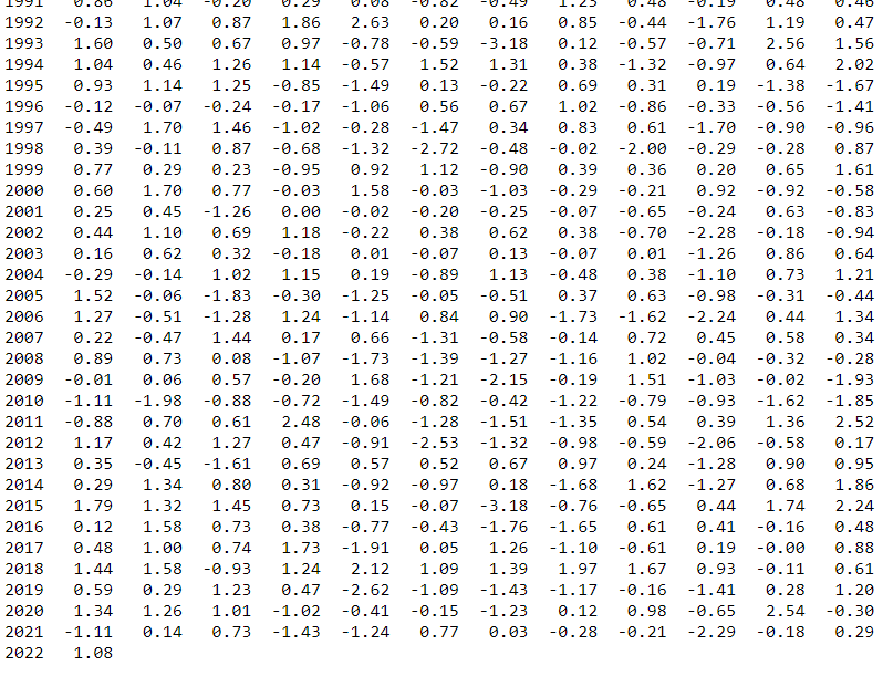
NAOi. Source: https://www.cpc.ncep.noaa.gov/products/precip/CWlink/pna/norm.nao.monthly.b5001.current.ascii.tabl0e
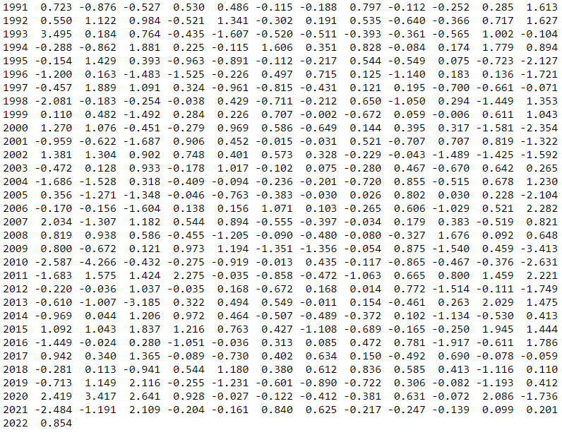
AOi. Source: https://www.cpc.ncep.noaa.gov/products/precip/CWlink/daily_ao_index/monthly.ao.index.b50.current.ascii.table

AAOi. Source: https://www.cpc.ncep.noaa.gov/products/precip/CWlink/daily_ao_index/aao/monthly.aao.index.b79.current.ascii.table
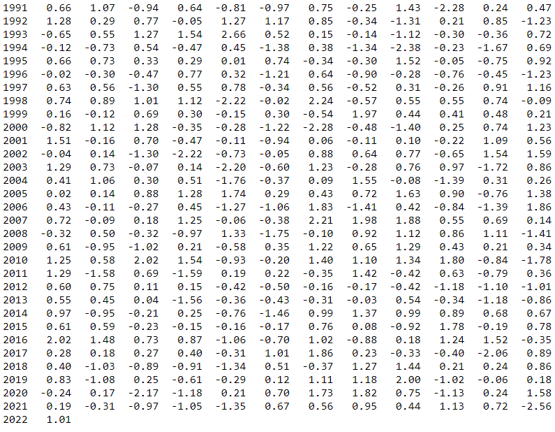
PNAi. Source: https://www.cpc.ncep.noaa.gov/products/precip/CWlink/pna/norm.pna.monthly.b5001.current.ascii.table
