Spring (in Southern Hemisphere Autumn) 2022 is slowly coming and we are bringing continental updates of predicted weather patterns for Europe /https://mkweather.com/spring-2022-forecast-for-europe-early-dry-late-stormy-very-warm//, North America /https://mkweather.com/spring-2022-forecast-for-north-america//, Asia /https://mkweather.com/spring-2022-forecast-for-asia//, Africa (Spring + Autumn 2022), Australia, South America /https://mkweather.com/autumn-2022-forecast-for-south-america//, and Antarctica.
In this article, we will look at the forecast of Autumn 2022 conditions in Australia and Oceania.
A few main teleconnection patterns will be affecting conditions during an upcoming Autumn 2022:
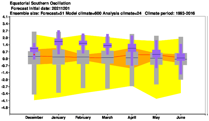
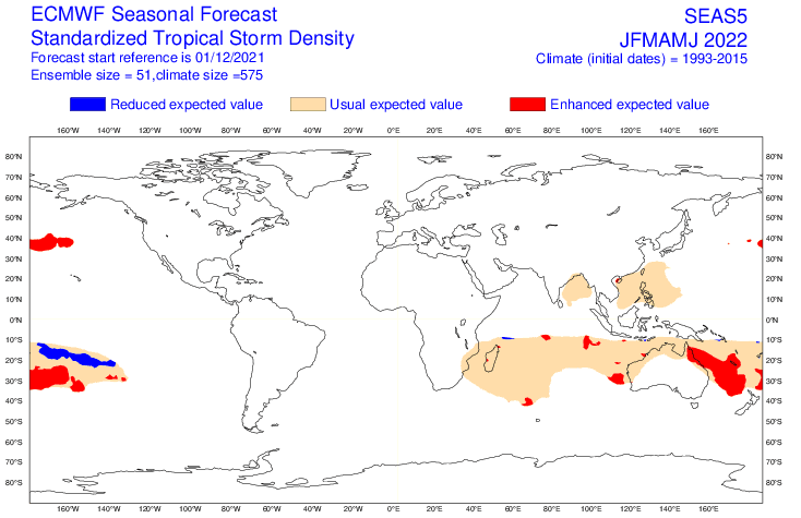
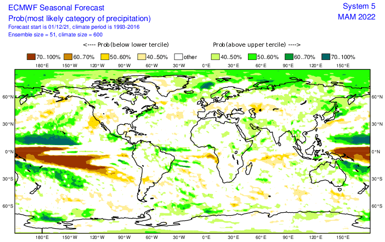
1. Still very strong La Nina: should be associated with colder Earth conditions. Typical La Nina pattern across Australia is bringing strong Cyclone season in the Pacific and the Indian Ocean and is linked with very stormy and colder conditions across the continent. Severe floods or storms should appear, heatwaves, drought, and wildfires aren´t so strong such as during El Nino. Mice plague and strong Spider season are again possible. In Oceania, characteristic temperature and precipitation patterns are during La Nina created.
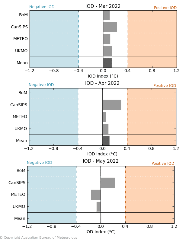
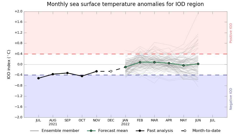
2. Shift to positive IOD: Positive IOD is associated with a shift of severe storms and cyclones from SE Asia and Australia above Eastern Africa. During the positive phase of IOD, weaker cyclonic activity should be measured in Western Australia, but still strong La Nina = above-average storm activity.
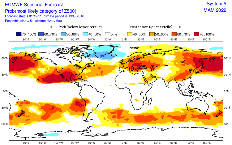
3. AAO+: Higher probability of AAO+ phase should mean more southern situated stormtrack in southern Australia and New Zealand (Tasmania and Southern Island warm or dry), but Australia, including northern regions still very stormy thanks to La Nina.
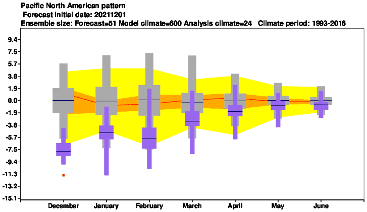
4. NE Pacific Warm Blob: Warm and high-pressure anomaly above NE Pacific. Effect on islands in Northern Hemisphere on the southern side of Hawaii high.
5. Shift from AO+ to neutral AO: Should have some impact on Kiribati and Marshall Islands (Northern Hemisphere), but La Nina stormy pattern will be here leading.
6. Very cold Antarctica and the Arctic: The South Pole after the 3rd coldest year in history (2021) – effect of AAO neutral and AAO- shorter episodes on powerful cold blasts, with possible early blizzards and severe frosts in the second half of the season. in early January the 2nd highest Arctic Sea Ice Extent anomaly in 18 years. Only northern parts of the Pacific.
7. QBO in Westerly phase: It should mean more zonal airflow, overall.
8. MJO: Wet phases MJO should be shifting from the eastern Indian Ocean to the western parts, partially following the IOD pattern. Indonesia with neutral precipitation anomalies mainly in western and stormy anomalies in eastern parts, which should mean wetter Northern Territory, with more wet MJO.
9. Awakening sun activity: should be in contrast with a transition from La Nina to El Nino during the year 2022 and the year 2023. Overall, there are signals, that the last colder years are associated with a weakening of solar cycles after 2000, especially during the last minimum before a few years.
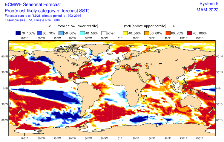
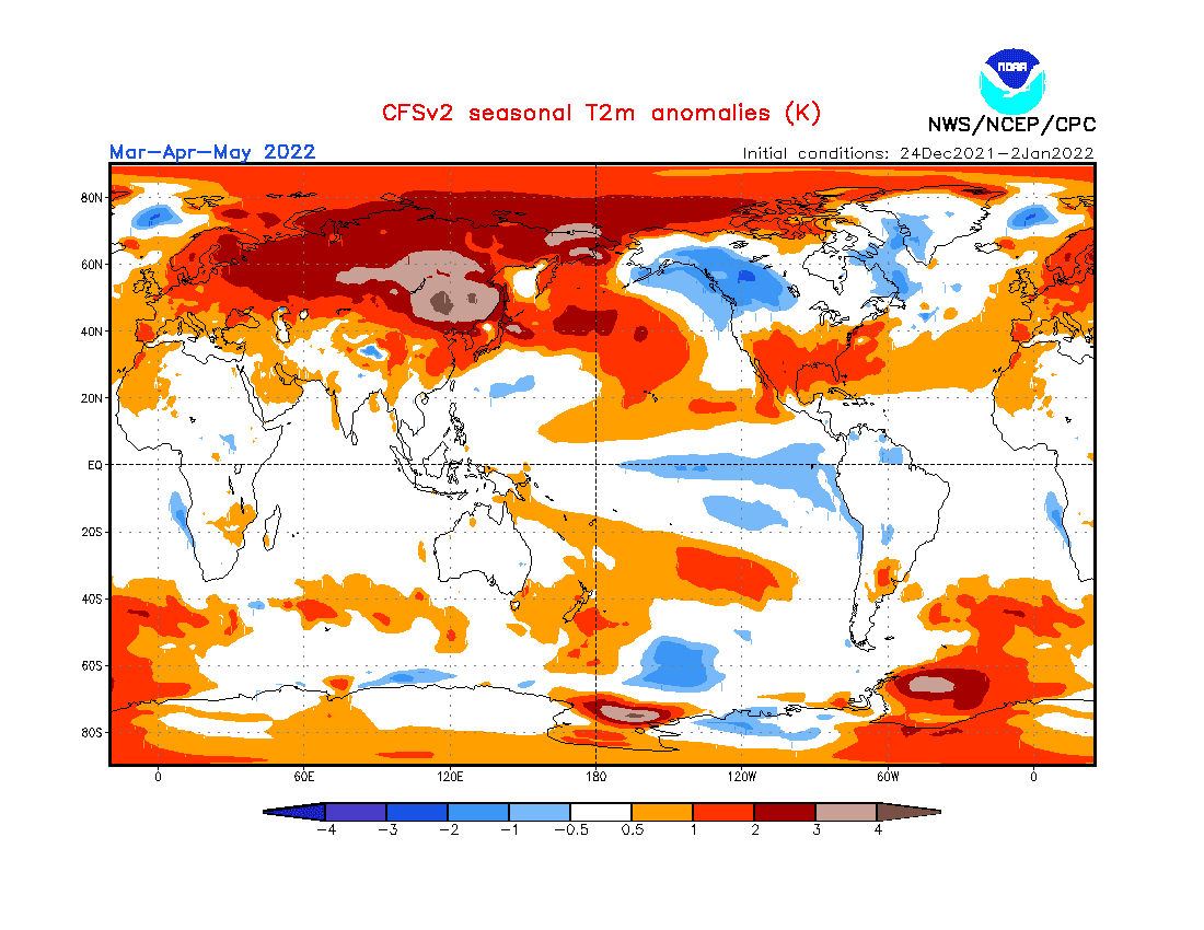
10. SST: Widespread effect of Pacific cold / warm SST anomalies on temperature regimes of islands in Oceania. Cold SST is linked with cooling, warm with warming (look at the last map in the article).
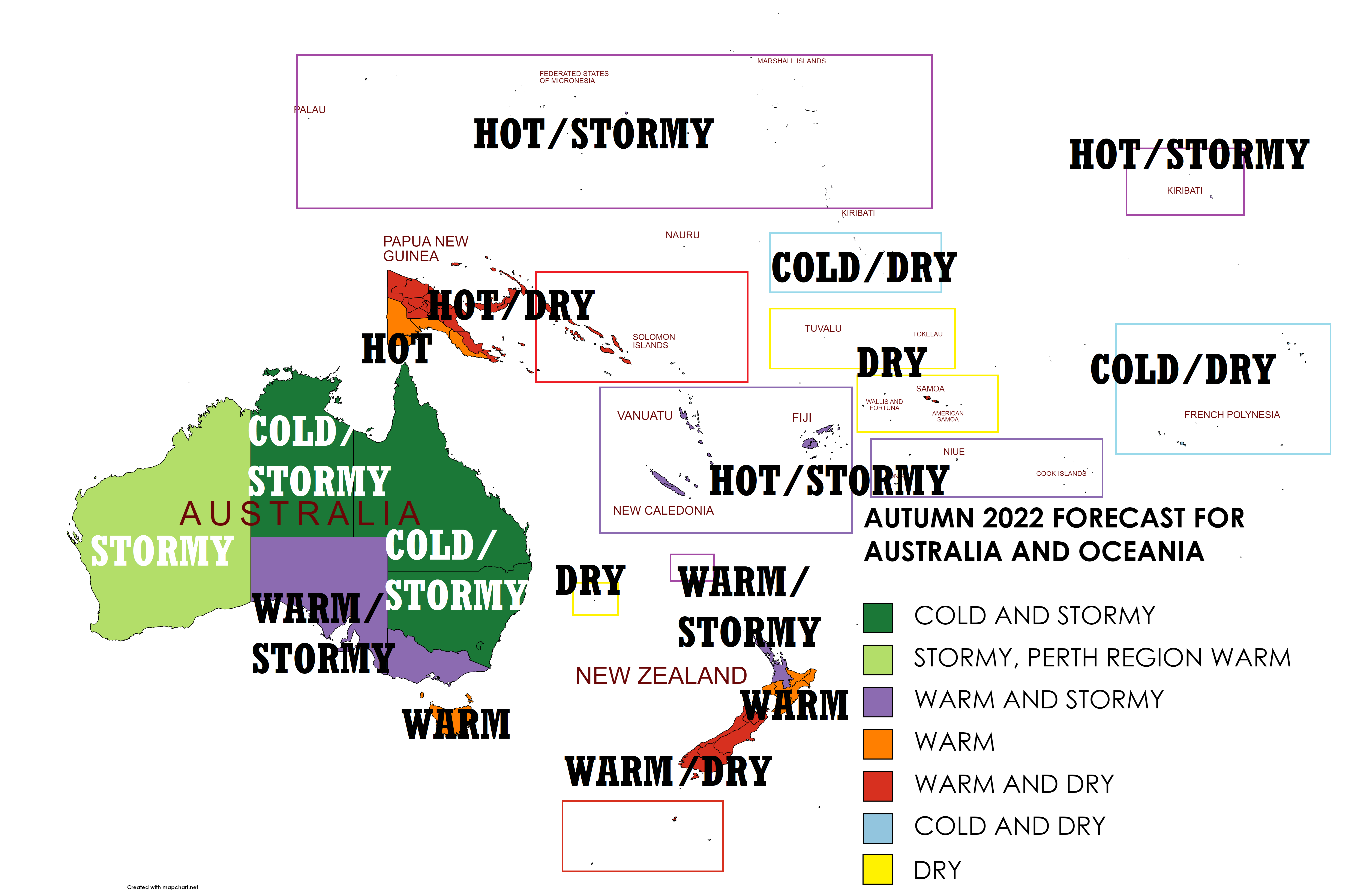
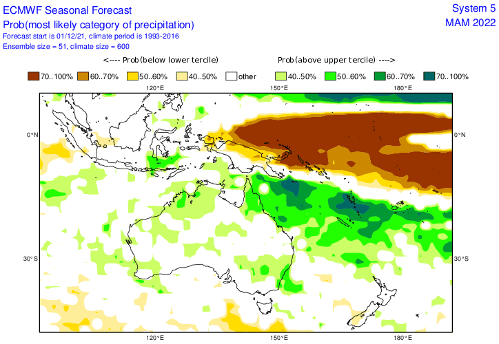
Now, we should look at a forecasted map for Autumn 2022 in Australia and Oceania and 7 main sectors, with similar regimes of weather:
A) COLD AND STORMY – NORTHERN AND EASTERN AUSTRALIA (DARK GREEN): Typical La Nina pattern with storms and colder conditions in Australia. Stronger Cyclone season, than average, the possibility of floods and severe storms, with large hail, gusting winds, and heavy rains (or rarely tornadoes). Heatwaves and drought limited. Mice plague and spider season mainly in the southern parts. Despite positive IOD, MJO wetter. From +40°C in March to the first frosts in the south in May.
B) STORMY, PERTH REGION WARM – WESTERN AUSTRALIA (GREEN): Mostly stormy thanks La Nina, IOD positive, with some chances for heatwaves and periodical drought, Perth with a warm anomaly. Possible flash floods, spider season, and mice plague in the south. Desert parts mostly temperature neutral. From +45°C in March to first frosts along the southern coast in May.
C) WARM AND STORMY – SOUTH AUSTRALIA, VICTORIA, NORTHERNMOST NEW ZEALAND, FIJI, NEW CALEDONIA, VANUATU, TONGA, NIUE, COOK ISLANDS, NORTHERN KIRIBATI, MARSHALL ISLANDS, PALAU (PURPLE): Still stormy La Nina pattern, regionally warmer anomaly, still with floods and severe storms. Northernmost New Zealand partially hit by strong Cyclone season. Islands in Oceania with strong Cyclone season or typical La Nina patterns, following SST anomalies. Up to +45°C above continent in March, frosts up to -10°C in late May in Australia. New Zealand up to +30°C in March and up to 0°C in May. Islands in Oceania warm, but with often warnings before cyclones and storms.
D) WARM – NORTHERN ISLAND IN NEW ZEALAND, TASMANIA, SOUTHERN PAPUA-NEW GUINEA (ORANGE): Effects of La Nina and possible AAO+ in southern regions and La Nina, MJO and IOD in Papua. Far away from the activity of cyclones. In March up to +30°C, in May up to -10°C ib valleys. Papua with maximum temperatures +25/+35°C.
E) HOT AND DRY – SOUTHERN ISLAND IN NEW ZEALAND, NORTHERN PAPUA-NEW GUINEA, SOLOMON ISLANDS (RED): Effects of La Nina, MJO and IOD above Papua and Solomon Islands (La Nina pattern leading) and La Nina and AAO+ above New Zealand. Problems with drought, wildfires. Papua with maximum temperatures +30/+35°C, southern New Zealand up to +30°C in March, and up to -15°C in May.
F) COLD AND DRY – FRENCH POLYNESIA, SOUTHERN KIRIBATI (LIGHT BLUE): La Nina pattern. Stable weather, without dangerous extremes excluding drought or wildfires. Maximum temperatures around +25/+30°C.
G) DRY – SAMOA, TUVALU, TOKELAU, WALLIS AND FORTUNA (YELLOW): Regional La Nina pattern around the Equator. Temperatures around +30°C, drought.
Winter (Summer) 2021/2022 forecasts are available here: Europe /https://mkweather.com/winter-2021-2022-forecast-for-europe-early-extreme-arctic-and-siberian-blasts-and-blizzards-late-dry-and-very-warm-conditions//, North America /https://mkweather.com/winter-2021-2022-forecast-for-north-america-a-peak-of-winter-with-extreme-arctic-blasts-and-blizzards-in-february-2022//, Asia /https://mkweather.com/winter-2021-2022-forecast-for-asia-early-extreme-arctic-and-siberian-blasts-and-blizzards-late-dry-and-warm-conditions//, Australia and Oceania /https://mkweather.com/summer-2021-2022-forecast-for-australia-and-oceania-stormy-colder-la-nina-pattern-above-the-continent//, South America /http://mkweather.com/summer-2021-2022-forecast-for-south-america-stormy-north-hot-and-dry-south-cold-and-dry-pacific-coast//, Africa /https://mkweather.com/winter-and-summer-2021-2022-forecast-for-africa//, and Antarctica /https://mkweather.com/summer-2021-2022-forecast-for-antarctica//.

Mkweather Autumn 2022 forecast for Australia. Base map: https://mapchart.net/americas-detailed.html

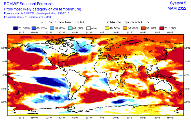
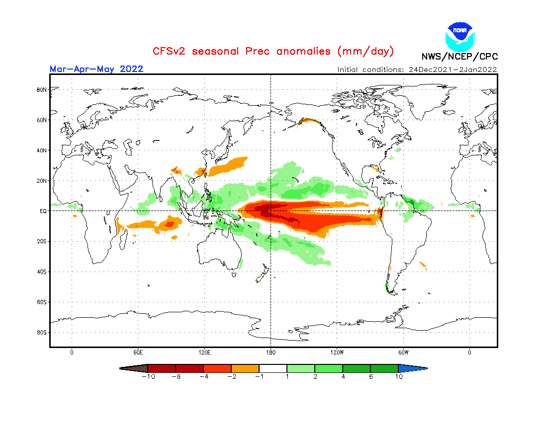
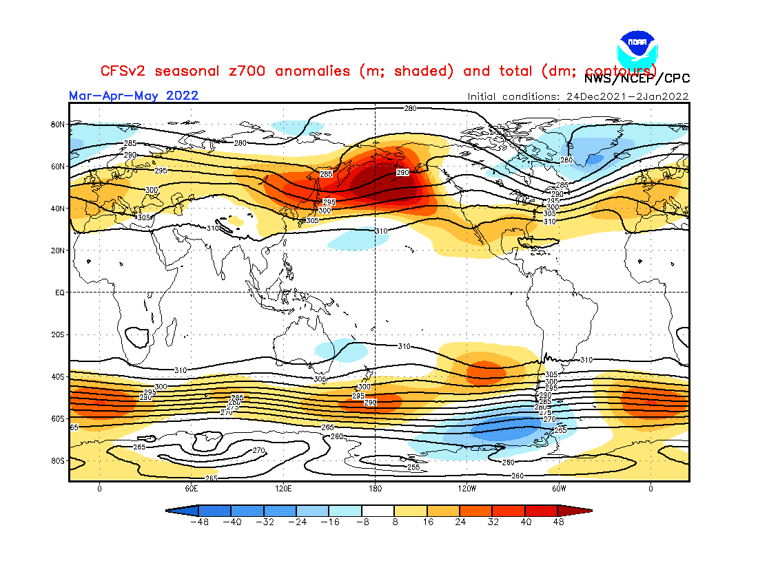
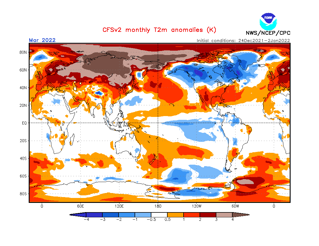
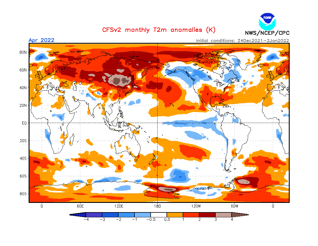
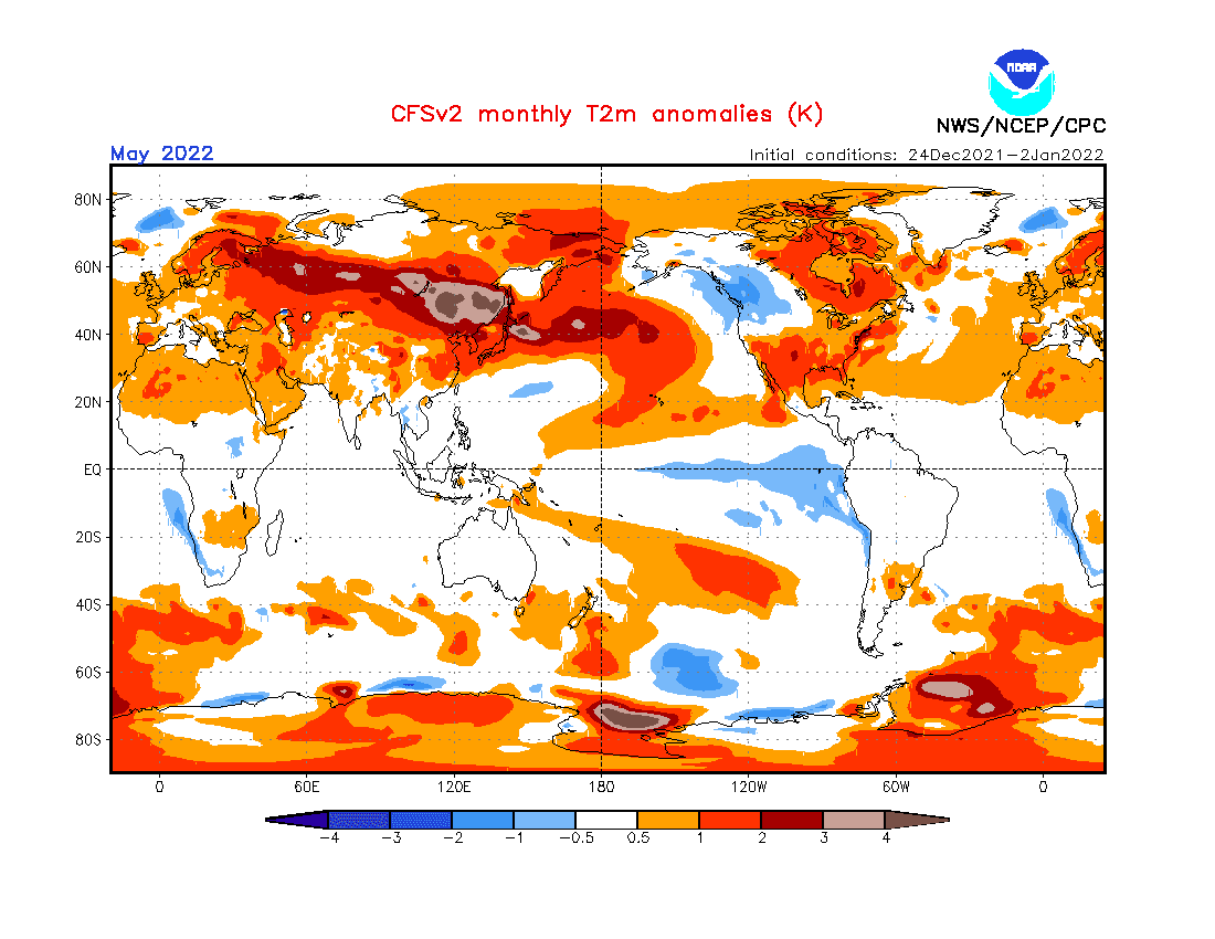
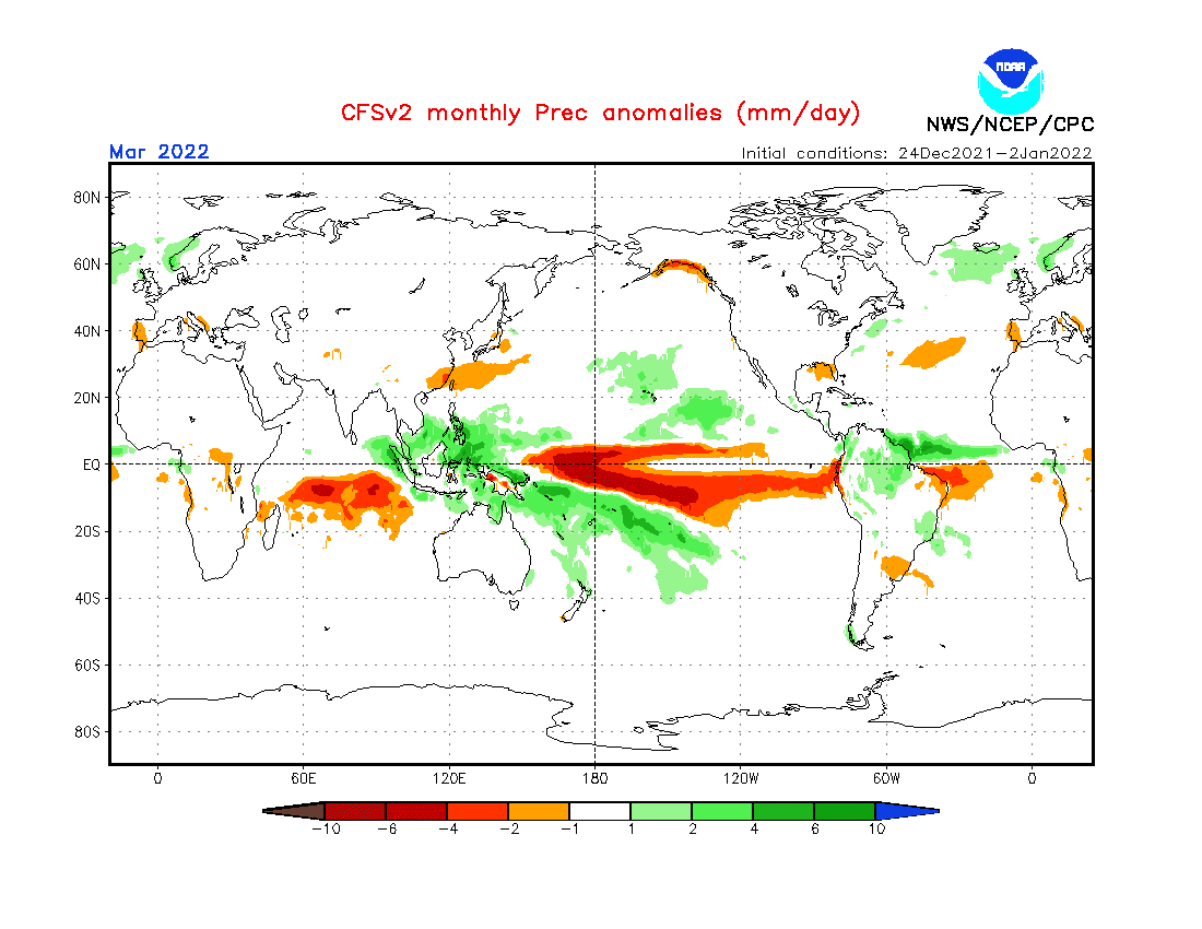
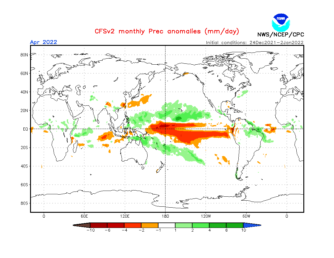
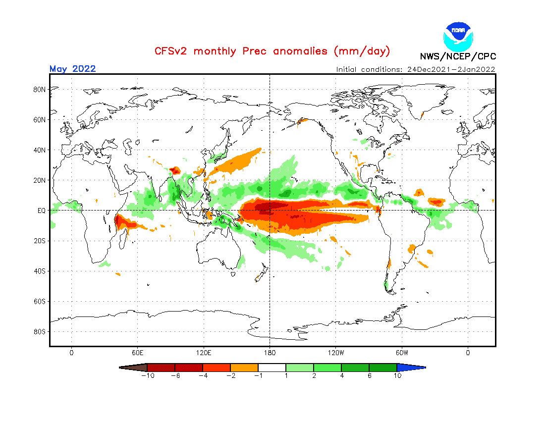
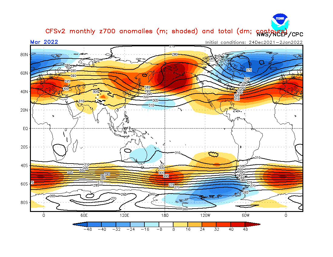
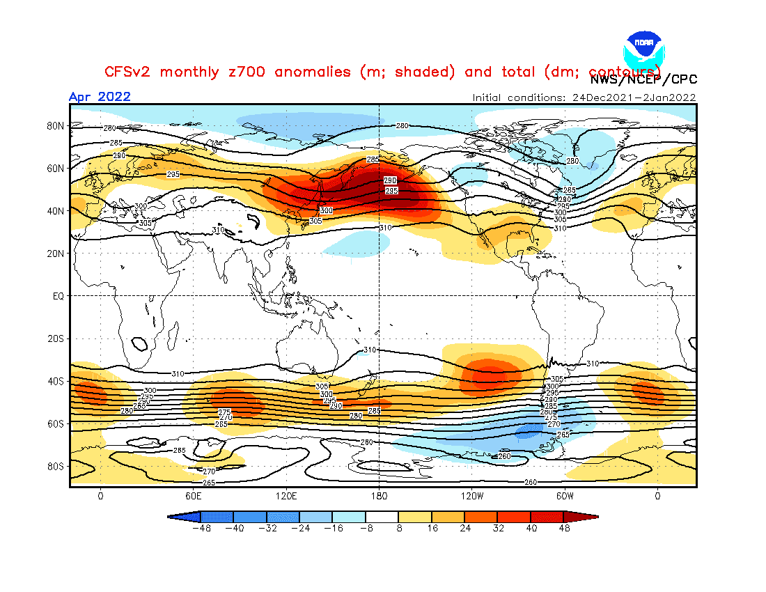
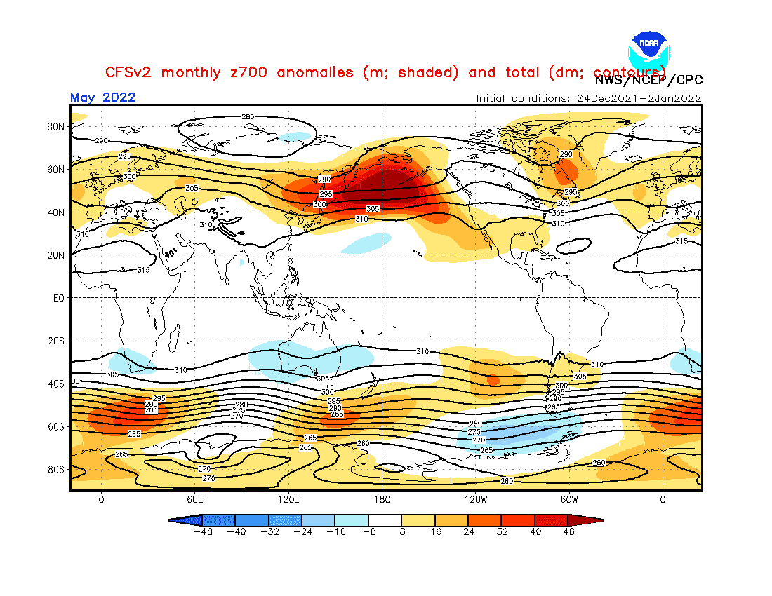
Source: https://www.cpc.ncep.noaa.gov/products/CFSv2/CFSv2_body.html
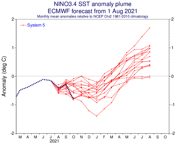

Source: https://iri.columbia.edu/our-expertise/climate/forecasts/enso/current/?enso_tab=enso-cpc_plume
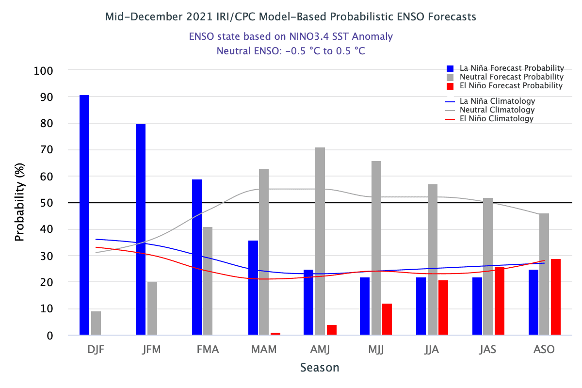
Source: https://iri.columbia.edu/our-expertise/climate/forecasts/enso/current/?enso_tab=enso-iri_plume
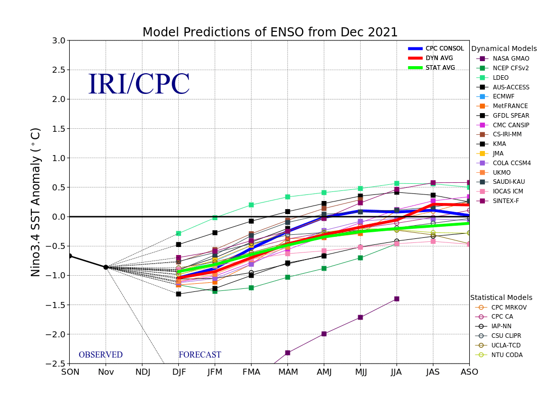
Source: https://iri.columbia.edu/our-expertise/climate/forecasts/enso/current/?enso_tab=enso-sst_table

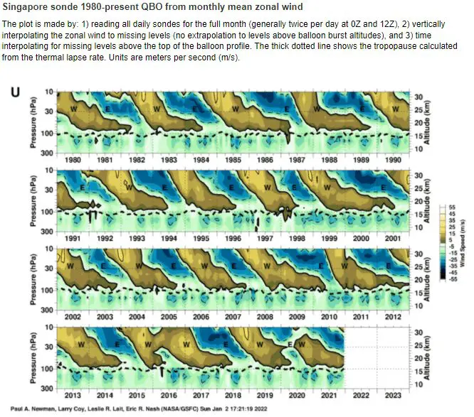
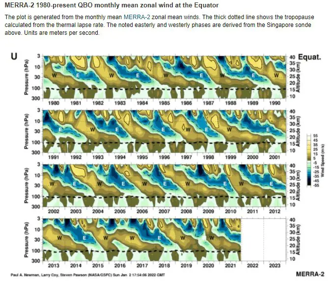
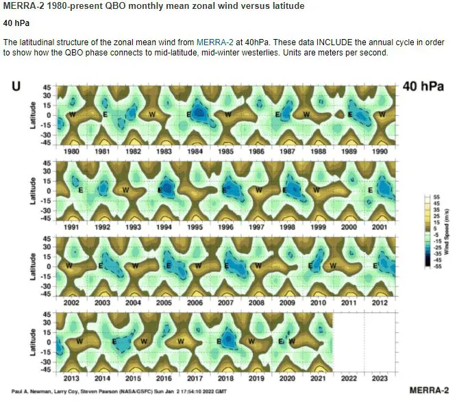
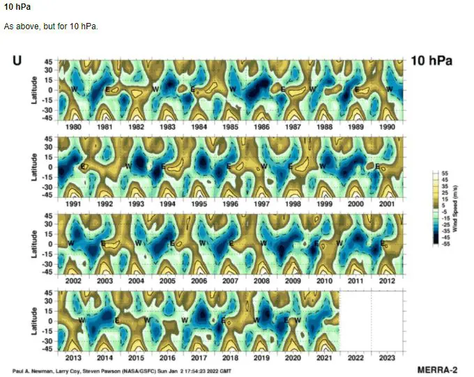
Source: https://acd-ext.gsfc.nasa.gov/Data_services/met/qbo/qbo.html
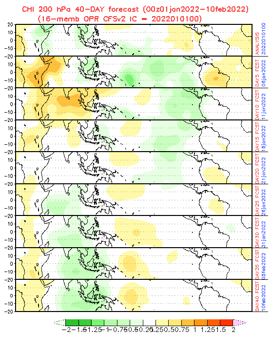
Source: https://www.cpc.ncep.noaa.gov/products/people/wd52qz/mjo/chi/cfs.gif
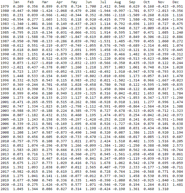
AAOi. Source: https://www.cpc.ncep.noaa.gov/products/precip/CWlink/daily_ao_index/aao/monthly.aao.index.b79.current.ascii.table
