Spring and Autumn 2022 forecast for Africa: Mostly stormy and hot, South colder
Spring (in Southern Hemisphere Autumn) 2022 is slowly coming and we are bringing continental updates of predicted weather patterns for Europe /https://mkweather.com/spring-2022-forecast-for-europe-early-dry-late-stormy-very-warm//, North America /https://mkweather.com/spring-2022-forecast-for-north-america//, Asia /https://mkweather.com/spring-2022-forecast-for-asia//, Africa (Spring + Autumn 2022), Australia/https://mkweather.com/autumn-2022-forecast-for-australia//, South America /https://mkweather.com/autumn-2022-forecast-for-south-america//, and Antarctica.
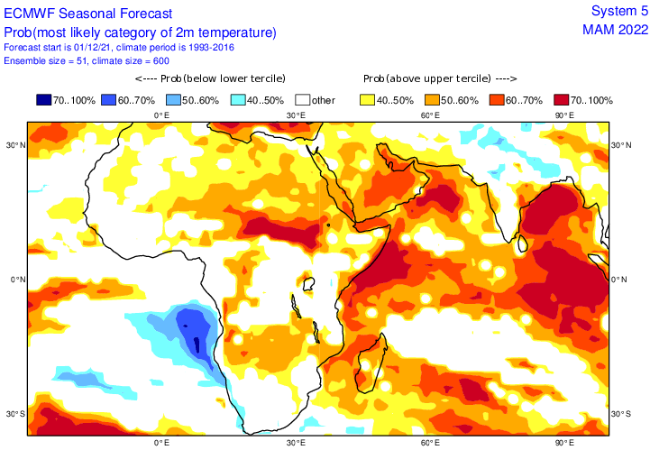
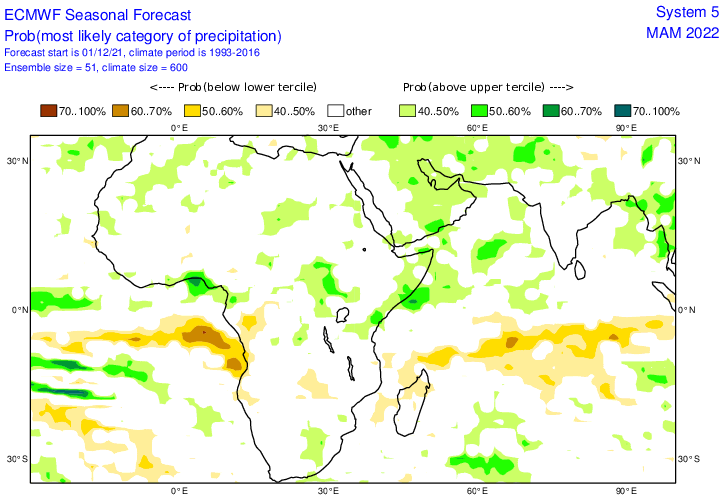
In this article, we will look at the forecast of Spring and Autumn 2022 conditions in Africa.
A few main teleconnection patterns will be affecting conditions during an upcoming Spring and Autumn 2022:
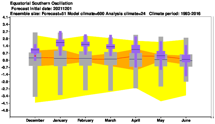
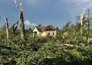
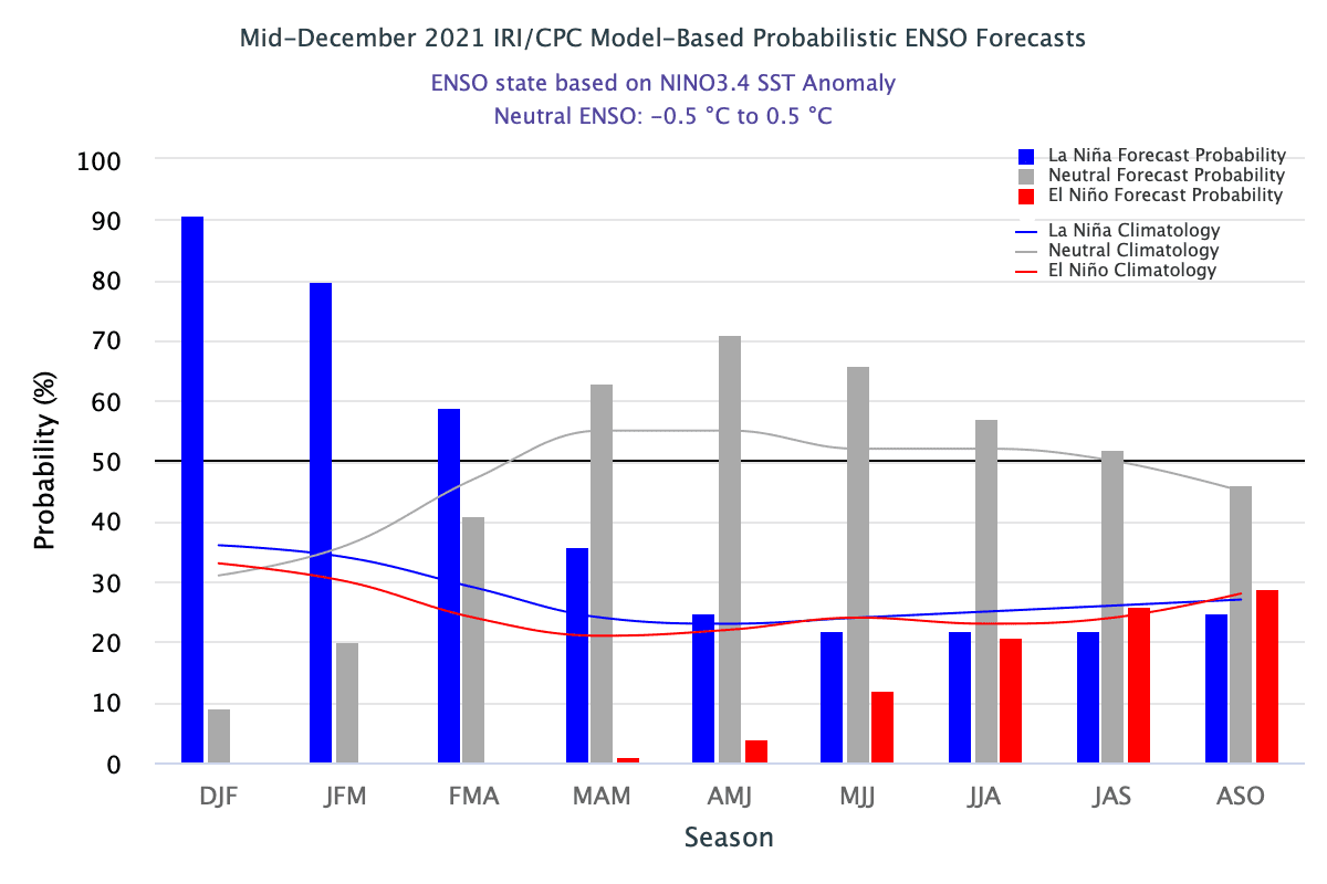
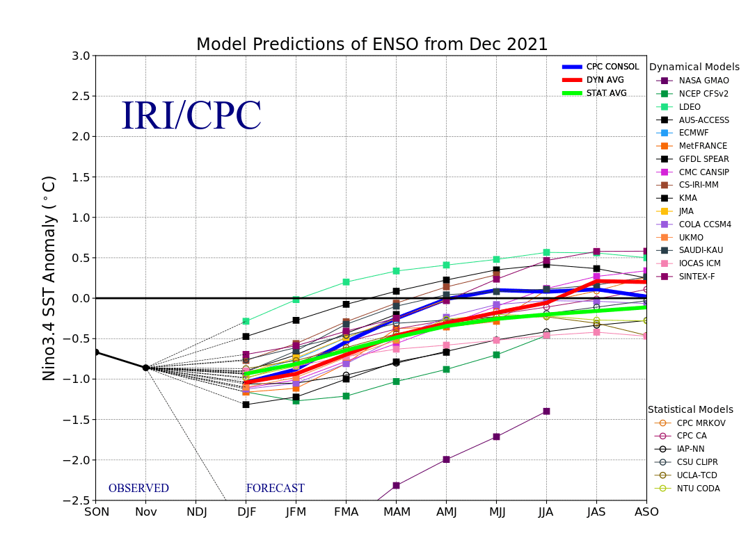
1. Still very strong La Nina: should be associated with colder Earth conditions. La Nina in Africa is associated with mostly more fertile conditions, although other factors such as wet MJO or positive IOD for cyclone activity in East and Southern Africa are important. It should mean a higher probability of floods or landslides in some regions. La Nina is bringing colder and more stormy conditions into southernmost Africa.
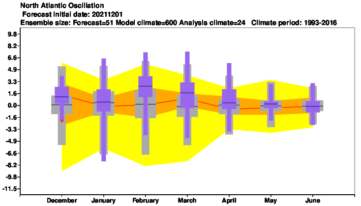
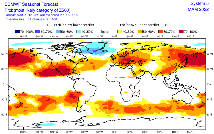
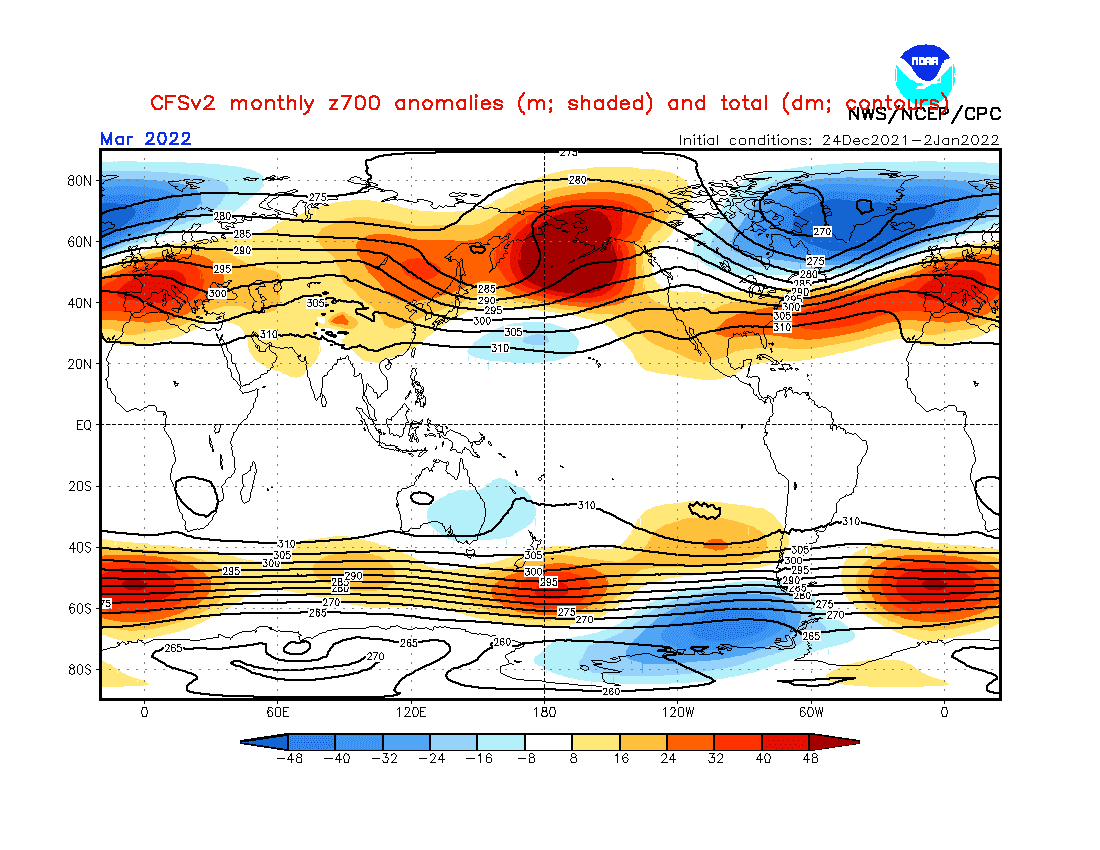
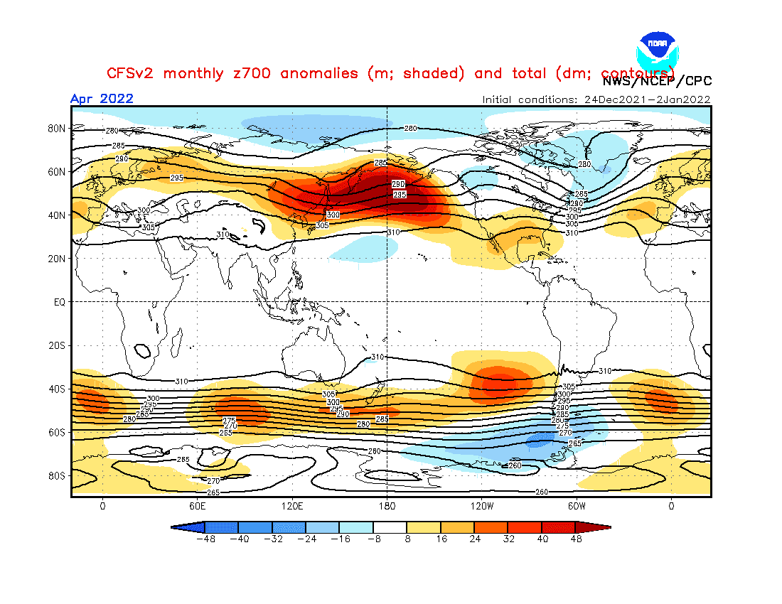
2. Shift from NAO+/AO+ to neutral NAO/AO: While the start of Spring 2022 (Feburary and March 2022) in North Africa should bring strong NAO+ / AO+, in April or May should appear temporary neutral or even NAO- / AO- phases. NAO+ in March 2022 means a strong Azores high and prolonged periods of drought, with fresh clear mornings and hot days along the Mediterranean coast. The highest probability of storms and the last Arctic blasts from the north should bring April 2022 thanks to overall neutral NAO with NAO- episodes. May should bring the first serious heatwaves, but the stormy pattern should be in some regions preserved.
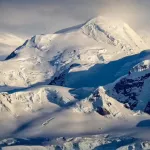
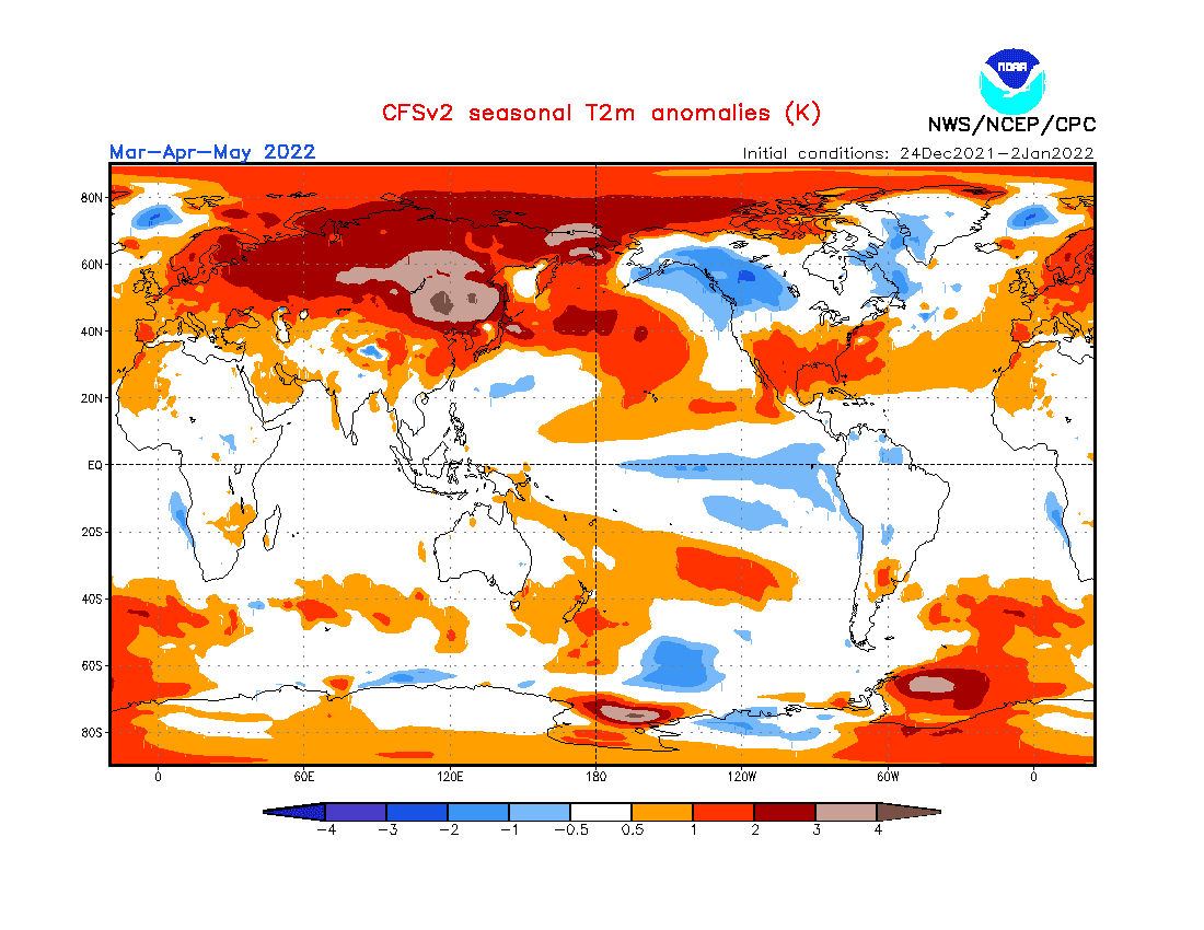
3. Very cold Arctic (in previous winter) and Antarctica: At the start of Winter 2021/2022, very cold Arctic conditions were observed /https://mkweather.com/arctic-sea-ice-extent-is-the-2nd-highest-in-15-years// and anomalously cold conditions were persisting until New Year 2022 (in early January 2021 the 2nd highest Arctic Sea Ice Extent in since 2002!). After February – March 2022 NAO+ /https://mkweather.com/spring-2022-will-come-in-february-nao-and-extremely-warm-early-spring-conditions-in-february-and-march-2022-are-predicted-cfs-ecmwf//, collapse of circulation should bring in North Africa serious late-season Arctic blasts. South Pole registered the 3rd coldest year in history (2021), with impact of Antarctic cold air masses to SAR and neighboring countries during shorter AAO neutral and negative episodes (AAO+ dominant).
4. QBO in Westerly phase: It should mean more zonal airflow, explained by NAO+ (strong zonal winds = strong Icelandic low, strong Azores high mainly in early Spring 2022.
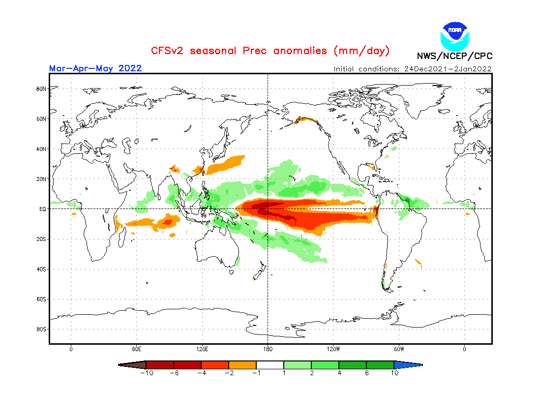
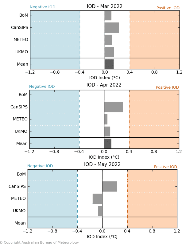
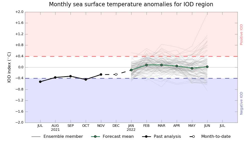
5. Shift to positive IOD: Positive IOD (IOD+) phase correlates with NAO+: A shift of cyclonic activity above the Indian Ocean from the Indonesia / Malaysia region and southern India above the Middle East and East and Southern Africa. It means more cyclones for East Africa! (in Winter 2021/2022 bothered by severe drought). Madagascar region should be drier.
6. MJO: Wet phases MJO should be shifting from the eastern Indian Ocean to the western parts, partially following the IOD pattern. Above East Africa region wet MJO with stronger ITCZ cells.
7. Awakening sun activity: should be in contrast with a transition from La Nina to El Nino during the year 2022 and the year 2023. Overall, there are signals, that the last colder winters in the Northern Hemisphere / colder last years globally are associated with a weakening of solar cycles after 2000, especially during the last Solar minimum before a few years.
8. SST: Warm SST anomalies (Sea Surface Temperature) near northern and eastern Africa and colder near western and southern coasts will have effect on temperature and storm regimes in neighboring regions.
9. NE Pacific Warm Blob: Strong mainly in early Spring, correlates with NAO+.
10. AAO+: Higher probability of AAO+ phase should mean drier conditions in some north-South African states (lack of prolonged cold fronts into northern areas).
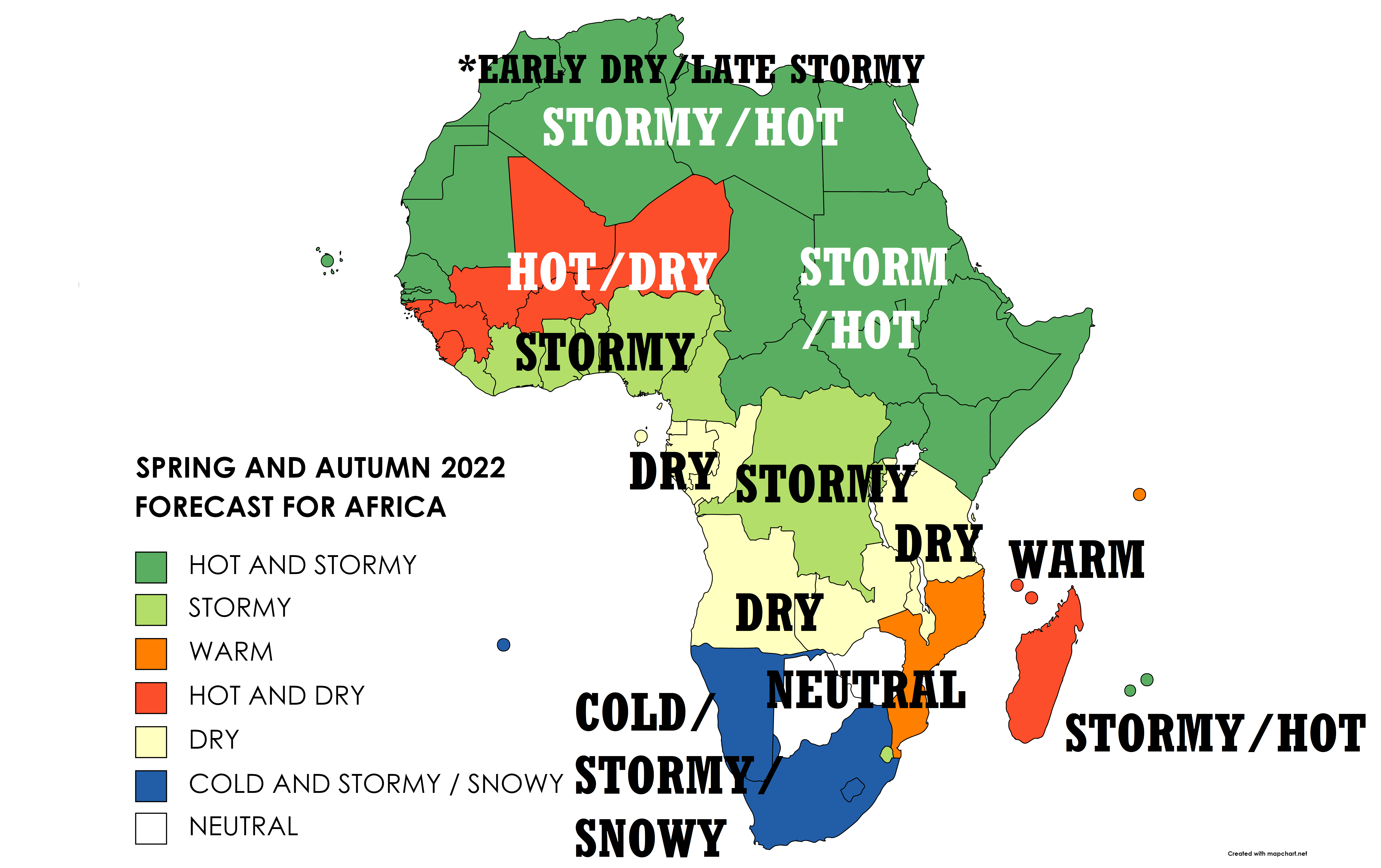
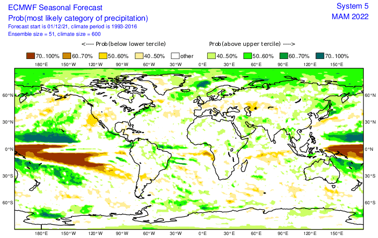
Now, we should look at a forecasted map for Spring and Autumn 2022 in Africa and 7 main sectors, with similar regimes of weather:
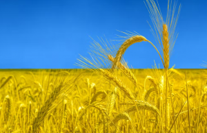
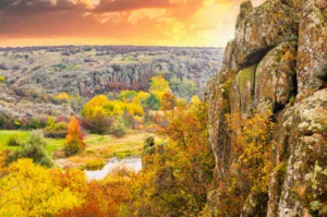
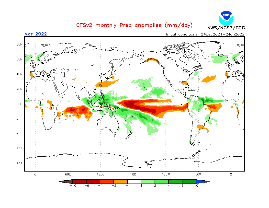
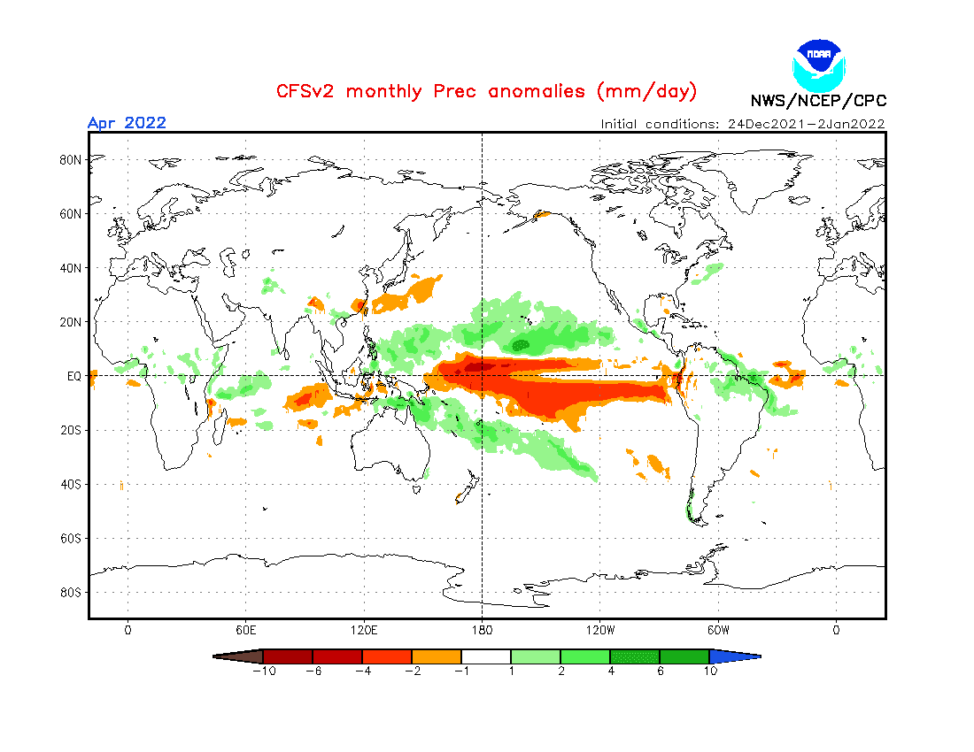
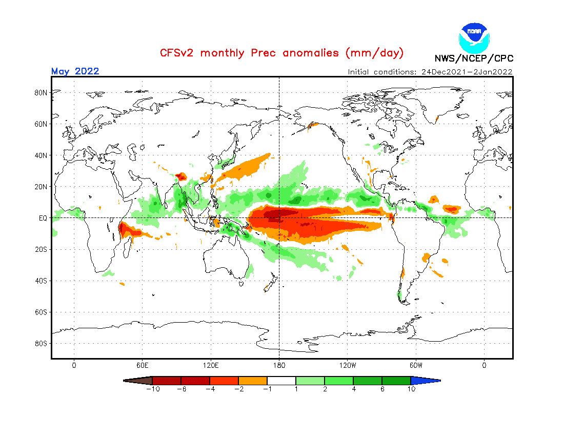
A) STORMY AND HOT – NORTH AFRICA, EAST AFRICA, EASTERN SAHEL (DARK GREEN): North Africa with early dry conditions along the Mediterranean coast thanks to NAO+/AO+, in April possible late Arctic blasts and storms (more neutral NAO with NAO- episodes), a season of rains should arrive in the eastern Sahel earlier (positive IOD, La Nina, NAO+). East Africa will profit from IOD+, which means stronger Indian Cyclone season just near its shores, La Nina is a good factor, too, but without IOD, dry conditions are persisting (IOD is therefore leading pattern). The end of the drought in the region, but floods and landslides possible. North Africa with March frosts up to -5°C and May heatwaves up to +50°C, the eastern Sahel in March up to +10°C in May up to +45°C, East Africa with maximum temperatures +25/+35°C, regionally +40°C.
B) STORMY – NORTHERN GUINEA COAST (NIGERIA,…) AND CONGO (LIGHT GREEN): Mostly stormy pattern, but in northern provinces of West-African countries possible drought, regionally too in Congo. The stormy pattern however leading in the most populated areas. Mostly wet MJO. Risk of floods, changes of weather regimes from stormy to drier phases. Thanks to storms temperature neutral anomalies in many parts. Maximum temperatures +25/+35°C.
C) WARM – MOZAMBIQUE, SEYCHELLES (ORANGE): Regional pattern, interesting is not so strong Cyclone season despite IOD+. Heatwaves up to +45°C in the early season and late cold spells up to +5°C in the south. Near cyclones possible floods, winds. Seychelles with maximum temperatures around +30°C.
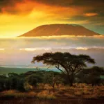
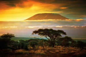
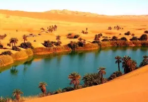
D) HOT AND DRY – WESTERN SAHEL, MADAGASCAR AND ISLANDS NW FROM MADAGASCAR (RED): Possible drought in the western Sahel in Spring 2022, with early powerful heatwaves. Should be linked with early-season NAO+ and late-season neutral NAO (a shift of hot air masses will stay conservated above the same region). Madagascar region surprisingly dry despite IOD+, with a possible famine in southern parts of the island.
E) DRY – NORTH-SOUTHERN AFRICA (YELLOW): A possible effect of AAO+ and lack of longer cold fronts from the south, such as La Nina, IOD, MJO impacts. Heatwaves, drought, and wildfires possible. The coast of Angola cold, continental parts warm. Early heatwaves up to +45°C, late rare cold blasts in valleys up to 0°C.
F) COLD AND STORMY / SNOWY – SOUTH AFRICA AND NAMIBIA, ST. HELENA (DARK BLUE): Effect of La Nina, enough of a cyclone and frontal systems despite the possible tendency to AAO+, cold anomaly mainly in Cape Town region, NE SAR warmer. IOD+ means more cyclones for NE SAR, Mozambique will be however with a neutral signal. Cold SST near shores. Early heatwaves up to +45°C, late frosts and snowfall up to -10°C in valleys. Saint Helena colder and stormier. Then, the last La Nina winter in a row.
G) NEUTRAL – BOTSWANA, ZIMBABWE (WHITE): Transient region between stormy south and dry north.
Winter (Summer) 2021/2022 forecasts are available here: Europe /https://mkweather.com/winter-2021-2022-forecast-for-europe-early-extreme-arctic-and-siberian-blasts-and-blizzards-late-dry-and-very-warm-conditions//, North America /https://mkweather.com/winter-2021-2022-forecast-for-north-america-a-peak-of-winter-with-extreme-arctic-blasts-and-blizzards-in-february-2022//, Asia /https://mkweather.com/winter-2021-2022-forecast-for-asia-early-extreme-arctic-and-siberian-blasts-and-blizzards-late-dry-and-warm-conditions//, Australia and Oceania /https://mkweather.com/summer-2021-2022-forecast-for-australia-and-oceania-stormy-colder-la-nina-pattern-above-the-continent//, South America /http://mkweather.com/summer-2021-2022-forecast-for-south-america-stormy-north-hot-and-dry-south-cold-and-dry-pacific-coast//, Africa /https://mkweather.com/winter-and-summer-2021-2022-forecast-for-africa//, and Antarctica /https://mkweather.com/summer-2021-2022-forecast-for-antarctica//.
Mkweather Spring and Autumn 2022 forecast for Africa. Base map: https://mapchart.net/americas-detailed.html
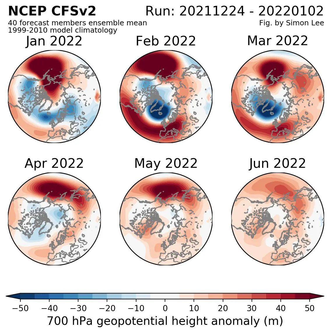
Source: https://simonleewx.com/cfsv2_monthly-anomalies/
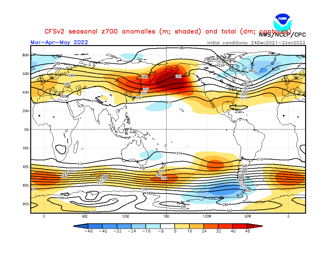
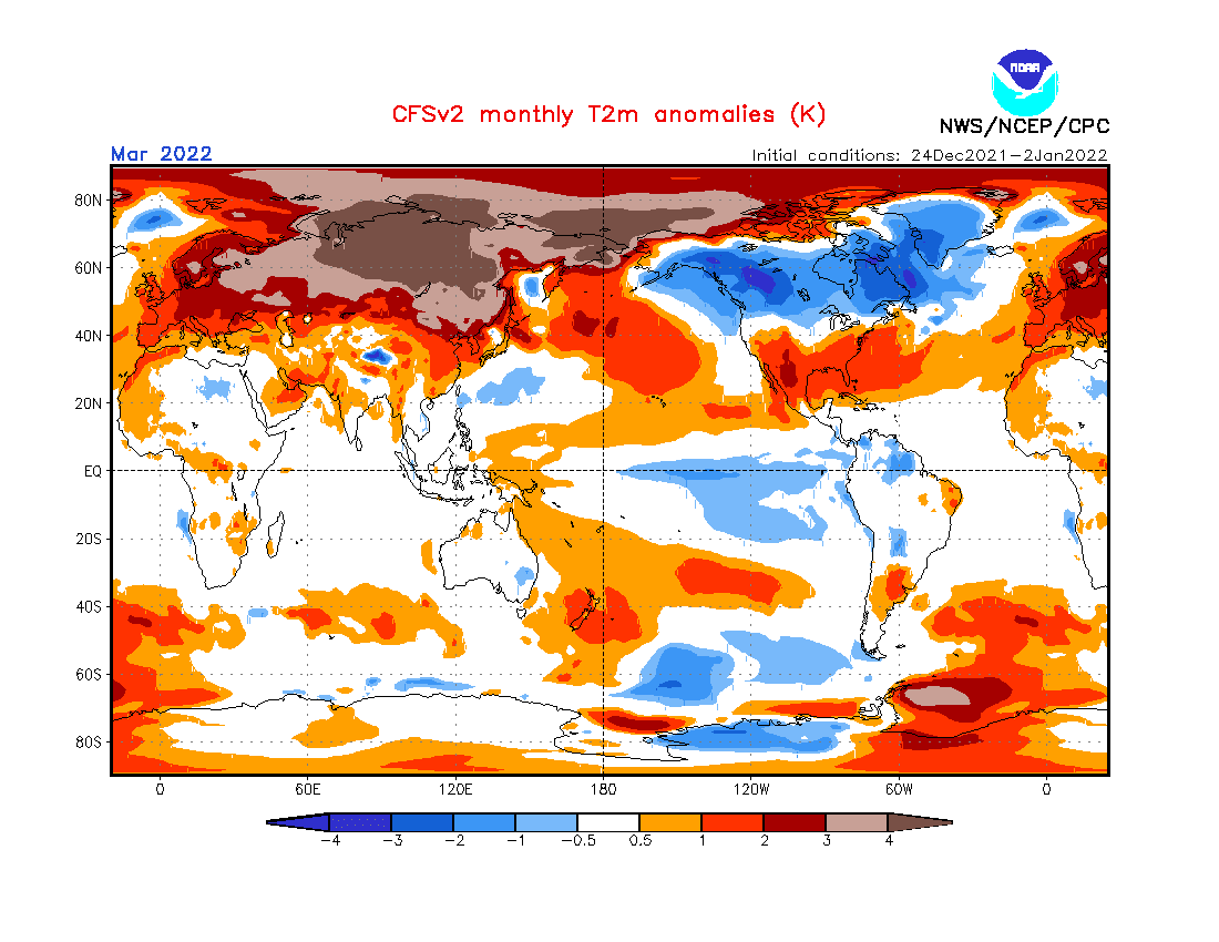
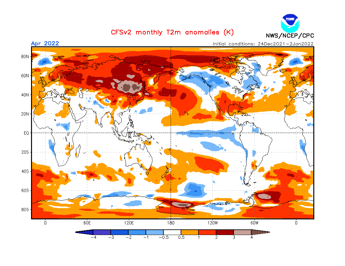
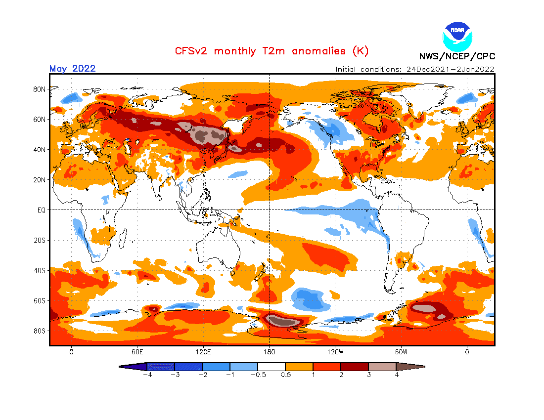
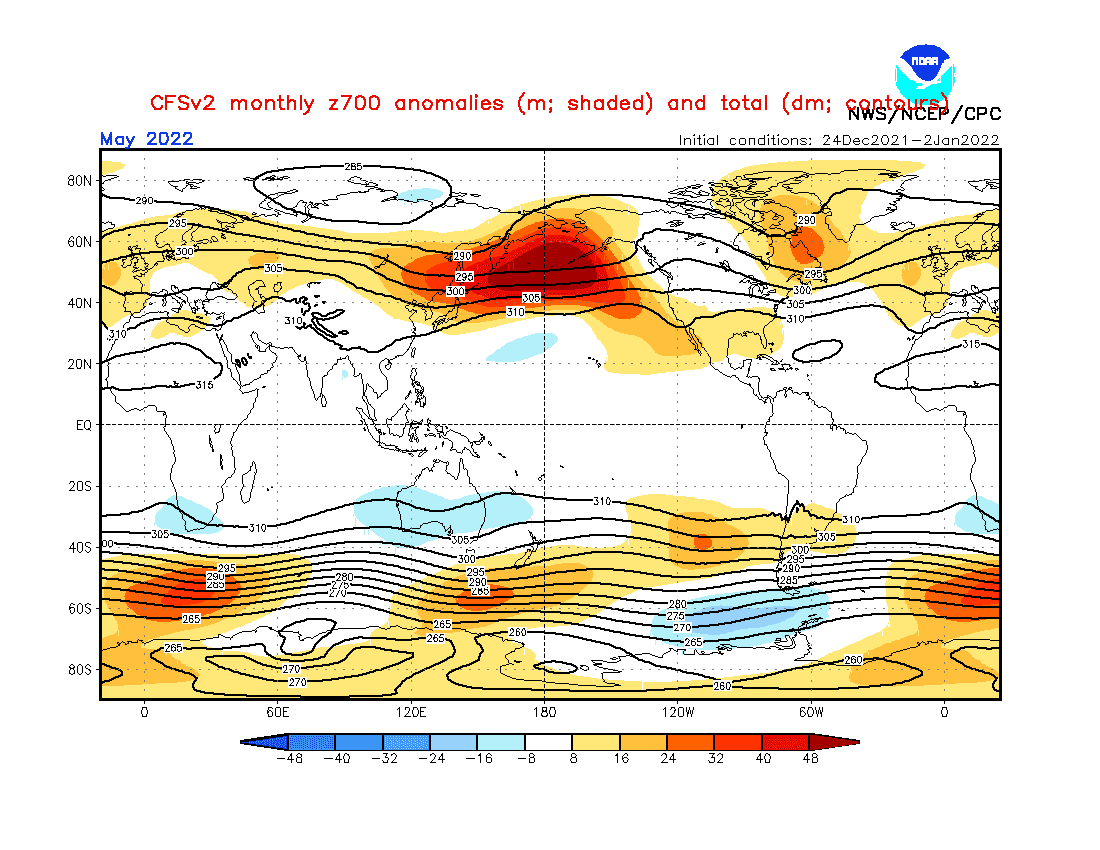
Source: https://www.cpc.ncep.noaa.gov/products/CFSv2/CFSv2_body.html
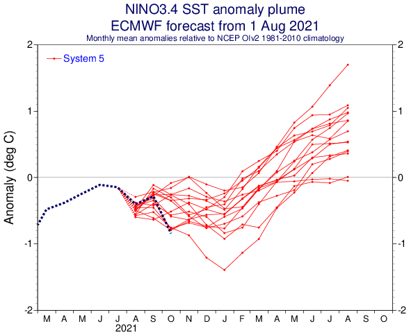

Source: https://iri.columbia.edu/our-expertise/climate/forecasts/enso/current/?enso_tab=enso-cpc_plume
Source: https://iri.columbia.edu/our-expertise/climate/forecasts/enso/current/?enso_tab=enso-iri_plume
Source: https://iri.columbia.edu/our-expertise/climate/forecasts/enso/current/?enso_tab=enso-sst_table
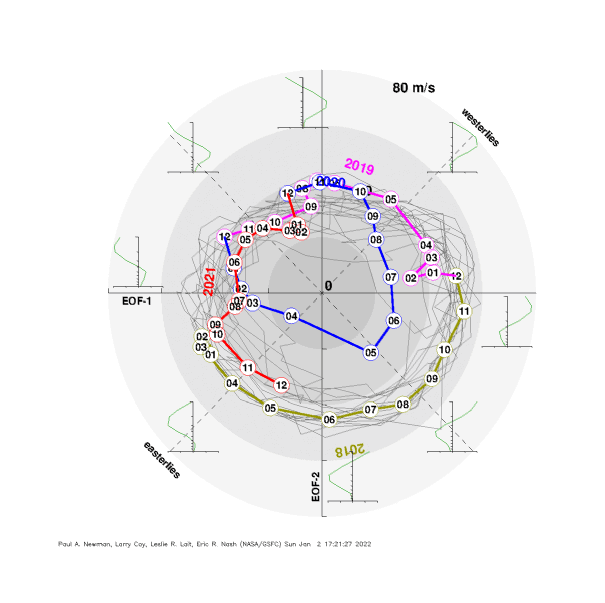
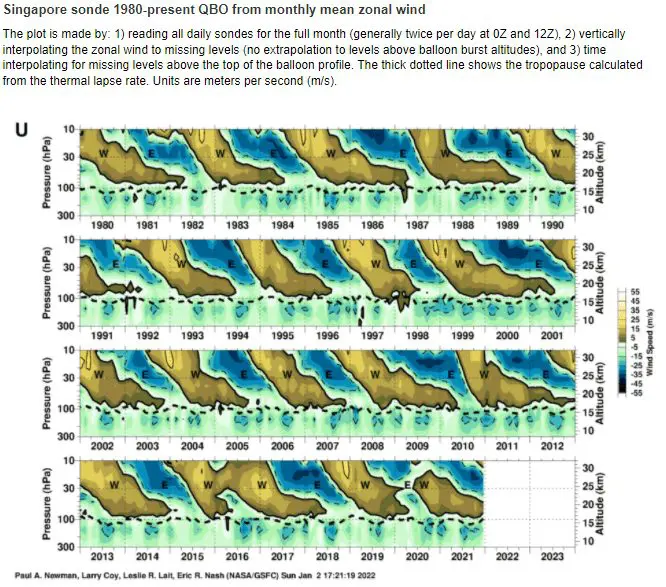
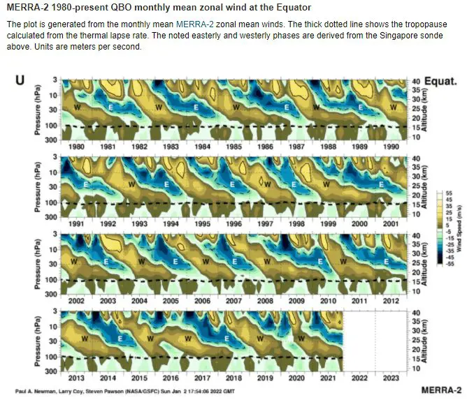
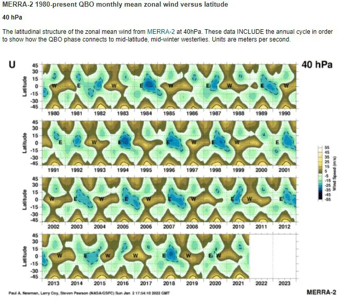
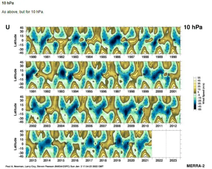
Source: https://acd-ext.gsfc.nasa.gov/Data_services/met/qbo/qbo.html
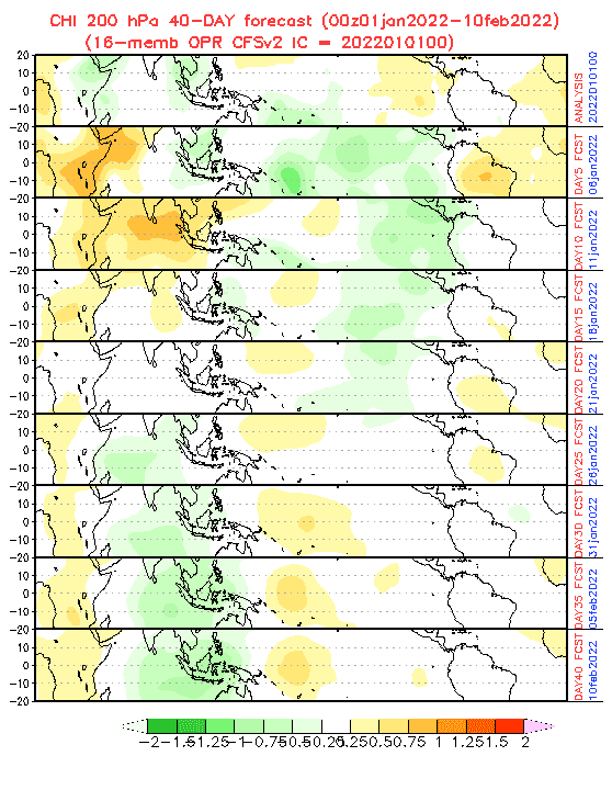
Source: https://www.cpc.ncep.noaa.gov/products/people/wd52qz/mjo/chi/cfs.gif
NAOi. Source: https://www.cpc.ncep.noaa.gov/products/precip/CWlink/pna/norm.nao.monthly.b5001.current.ascii.table
AOi. Source: https://www.cpc.ncep.noaa.gov/products/precip/CWlink/daily_ao_index/monthly.ao.index.b50.current.ascii.table
AAOi. Source: https://www.cpc.ncep.noaa.gov/products/precip/CWlink/daily_ao_index/aao/monthly.aao.index.b79.current.ascii.table