Spring 2022 is slowly coming and we are bringing continental updates of predicted weather patterns for Europe, North America /https://mkweather.com/spring-2022-forecast-for-north-america//, Asia, Africa (Spring + Autumn 2022), Australia (Autumn 2022), South America (Autumn 2022), and Antarctica (Autumn 2022).
In this article, we will look at the forecast of Spring 2022 conditions in Europe.
A few main teleconnection patterns will be affecting conditions during an upcoming Spring 2022:
1. Still very strong La Nina: should be associated with colder Earth conditions, but is usually linked with AO+ and NAO+, which is the case of upcoming Spring 2022, which means, that overall conditions in Europe should be very warm. A hope for El Nino is forecast only from Autumn 2022, which should have later during the year impact on hurricane season and its manifestations in a form of ex-hurricanes in Europe.
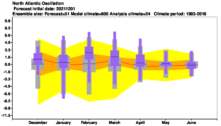
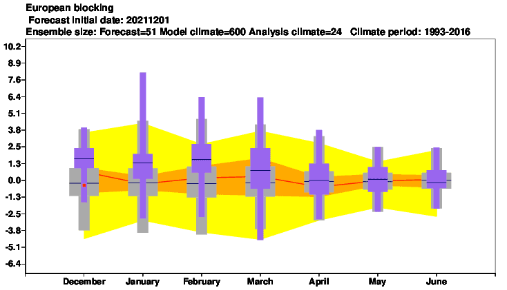
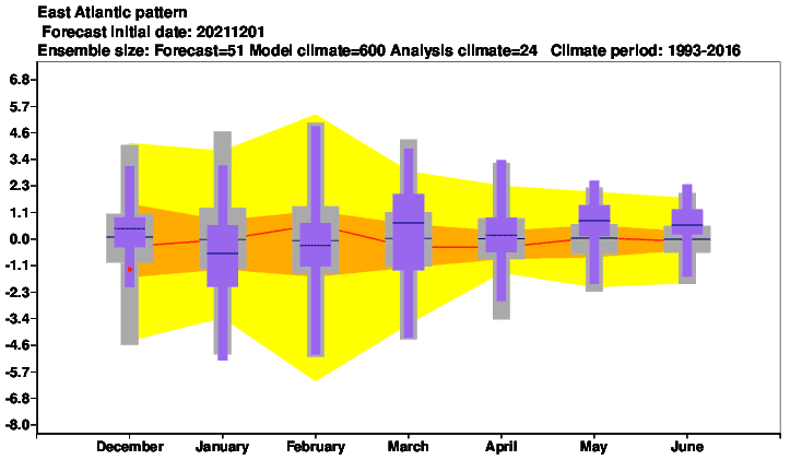
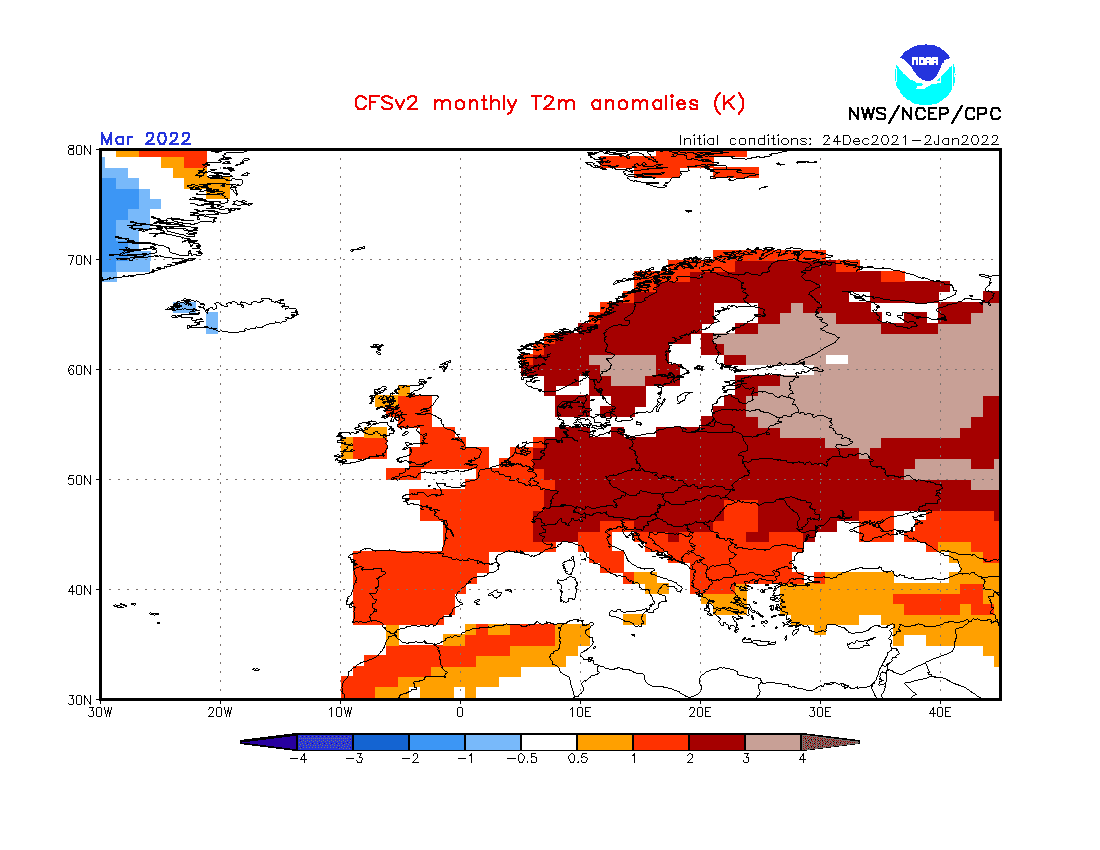
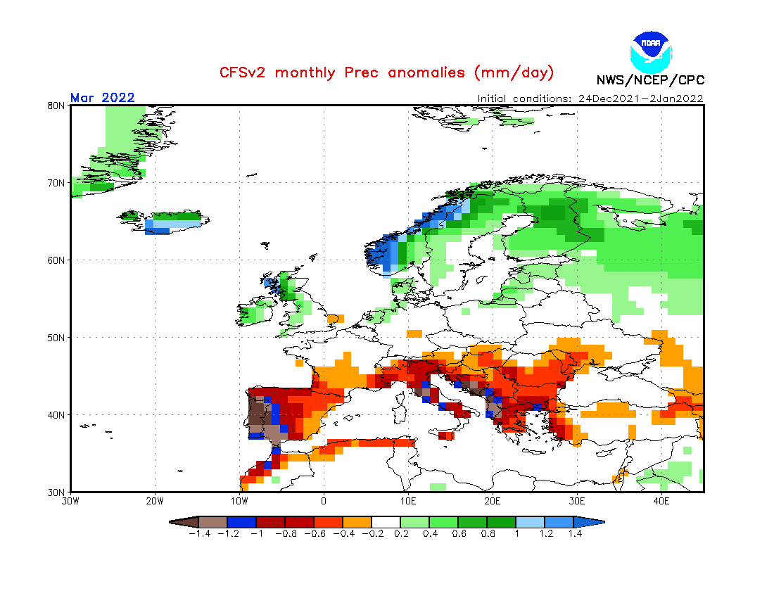
2. Shift from NAO+/AO+ to neutral NAO/AO: According to current forecasts, extremely warm and dry Spring 2022 should start very early thanks to NAO+ already in February (and March) 2022 /https://mkweather.com/spring-2022-will-come-in-february-nao-and-extremely-warm-early-spring-conditions-in-february-and-march-2022-are-predicted-cfs-ecmwf//. While the start of Spring 2022 should bring strong NAO+ / AO+, in April or May should appear temporary neutral or even NAO- / AO- phases with temporary cooldowns. Very dry Mediterranean and stormy Scandinavia in March 2022 are signs of NAO+.
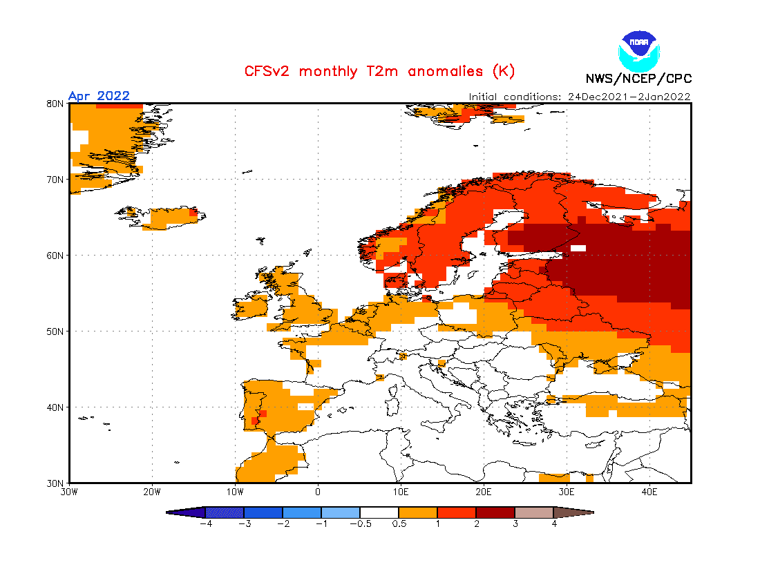
3. Very cold Arctic (in previous winter): At the start of Winter 2021/2022, very cold Arctic conditions were observed /https://mkweather.com/arctic-sea-ice-extent-is-the-2nd-highest-in-15-years// and anomalously cold conditions were persisting until New Year 2022. In January 2022, northern Siberia and Canada report still severe coldwaves. A higher amount of Arctic Sea Ice should affect early warming in Europe after NAO+ (e.g. coldwaves after NAO+ February and March 2022 in April 2022, from relaxed circulation), or earlier, NAO+ should have mainly in March 2022 an effect on a prolonged low ice Arctic cover (colder Arctic near NAO+).
4. QBO in Westerly phase: It should mean more zonal airflow, explained by NAO+ (strong zonal winds = stormtrack shifted above Scandinavia), paradoxically with dry continent before the storm season.
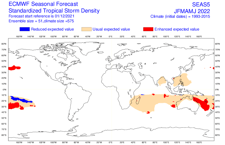
5. Shift to positive IOD: Positive IOD correlates with NAO+ and stronger cyclone season in the eastern Indian Ocean, therefore, a pattern appears to be preserved.
6. Awakening sun activity: should be in contrast with a transition from La Nina to El Nino during the year 2022 and the year 2023. Overall, there are signals, that the last colder winters are associated with a weakening of solar cycles after 2000, especially during the last minimum before a few years.
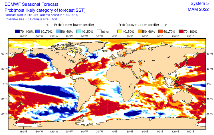
7. SST: The warm Mediterranean Sea, Norwegian seas, and relatively colder Icelandic, British, Faroe seas, and the Atlantic near Portugal should have contribution to weather regimes in mentioned regions.
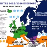
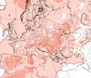
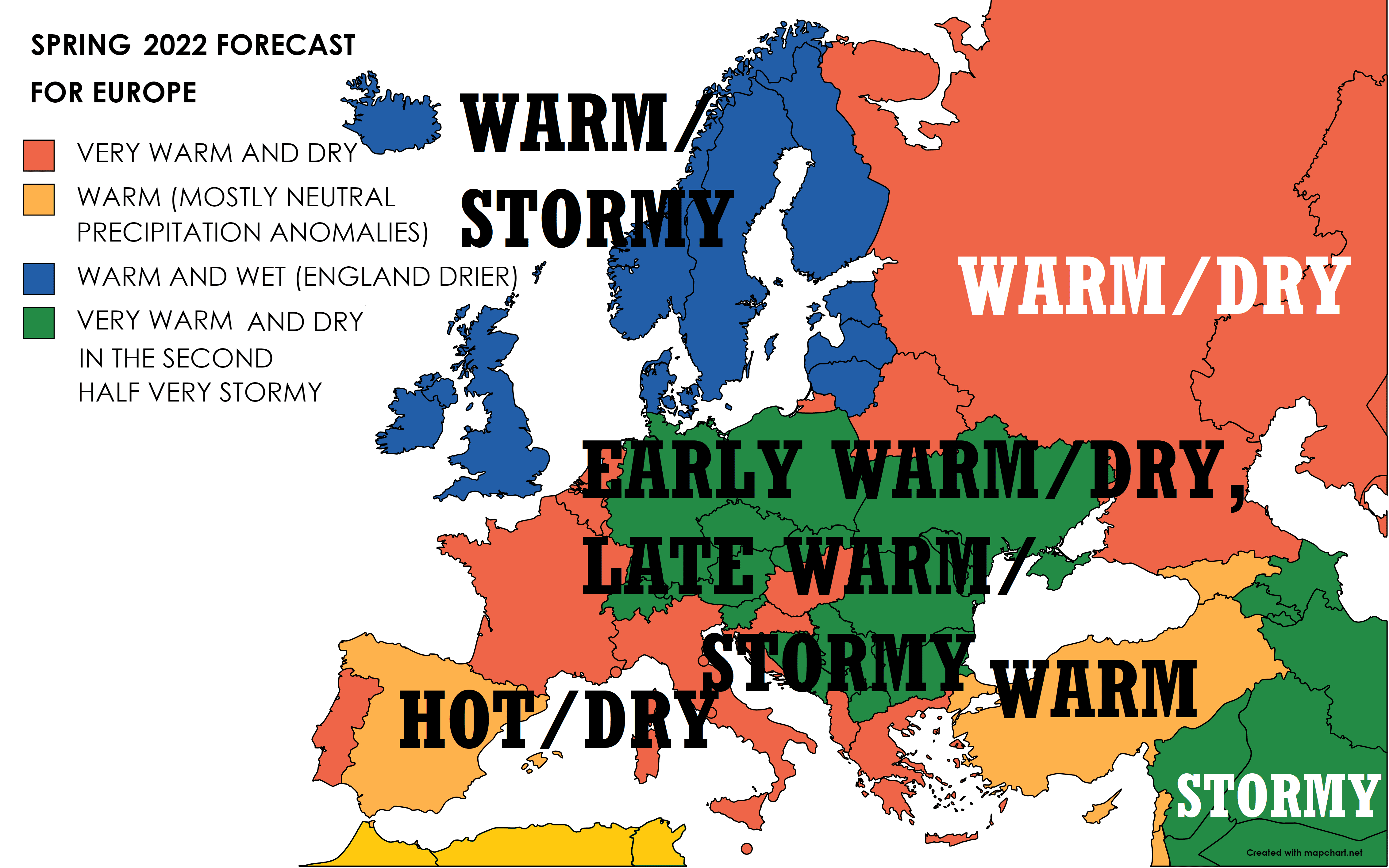
Now, we should look at a forecast map for Spring 2022 for Europe and 4 main sectors, with similar regimes of weather:
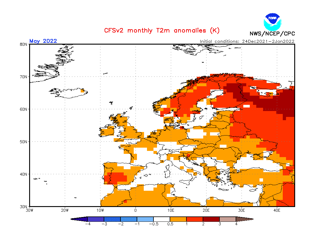
A) SCANDINAVIA, SCOTLAND, IRELAND, BALTIC REGION, NORTHERN RUSSIA (DARK BLUE): NAO+ Spring 2022 brings very warm conditions with an anomalously stormy pattern. Firstly, severe blizzards are possible in Lapland, but gradually, precipitation will shift to heavy rains and storms. The pattern should start changing in April 2022 and May 2022 should bring regionally dry and hot weather with heatwaves. Minimum temperatures up of to -25°C in March in Lapland to +32°C in May.
B) PARTS OF CENTRAL EUROPE AND BALKAN (DARK GREEN): Very dry start of Spring 2022 with NAO+, but the strong arrival of storm season in the second half of the spring, with severe storms in late April and during May 2022. Early spring should be very dry, mainly in southern regions, closer to the Mediterranean, in April should thanks to NAO neutral appear temporary Arctic blasts with the last severe frosts or snow. Gradually severe storm activity. In March and April up to -10°C, in May up to +35°C.
C) LARGE PARTS OF MEDITERRANEAN, RUSSIA (WITHOUT ARCTIC), FRANCE, BENELUX, GREECE, ALBANIA, CROATIA, HUNGARY, BELARUS (RED): Mostly very warm and dry, late storm activity not so much extreme such as in Central Europe and Balkan. Problems with drought, early heatwaves. Early summer days above +25°C and tropical days above +30°C. In the Mediterranean in May 2022 +40°C and higher heatwaves. Thanks to NAO+, very cold nights in March, but only of up to -10°C, April with possible late frosts and damages on harvest (-5°C, rarely -10°C). May with a lot of hot days.
D) SPAIN, TURKEY, CYPRUS, ISRAEL, LEBANON, NORTH AFRICA,…(ORANGE): Mostly very warm, later hot, but neutral precipitation anomalies. Possible sharp changes of weather from stormy to dry patterns. Early heatwaves, with a possibility of severe T-storms, with hail, winds, heavy rains, lightning, tornadoes, flash floods,…Nights in March fresh, locally below 0°C. In May above +40°C in populated areas.
Winter (Summer) 2021/2022 forecasts are available here: Europe /https://mkweather.com/winter-2021-2022-forecast-for-europe-early-extreme-arctic-and-siberian-blasts-and-blizzards-late-dry-and-very-warm-conditions//, North America /https://mkweather.com/winter-2021-2022-forecast-for-north-america-a-peak-of-winter-with-extreme-arctic-blasts-and-blizzards-in-february-2022//, Asia /https://mkweather.com/winter-2021-2022-forecast-for-asia-early-extreme-arctic-and-siberian-blasts-and-blizzards-late-dry-and-warm-conditions//, Australia and Oceania /https://mkweather.com/summer-2021-2022-forecast-for-australia-and-oceania-stormy-colder-la-nina-pattern-above-the-continent//, South America /http://mkweather.com/summer-2021-2022-forecast-for-south-america-stormy-north-hot-and-dry-south-cold-and-dry-pacific-coast//, Africa /https://mkweather.com/winter-and-summer-2021-2022-forecast-for-africa//, and Antarctica /https://mkweather.com/summer-2021-2022-forecast-for-antarctica//.

Mkweather Spring 2022 forecast for Europe. Base map: https://mapchart.net/europe.html
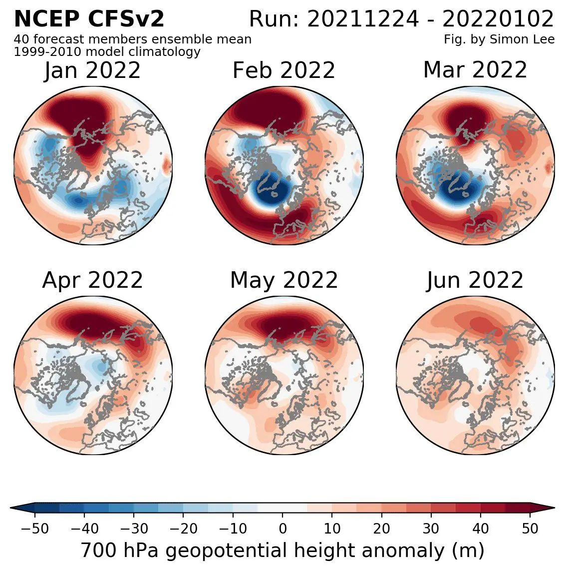
Source: https://simonleewx.com/cfsv2_monthly-anomalies/
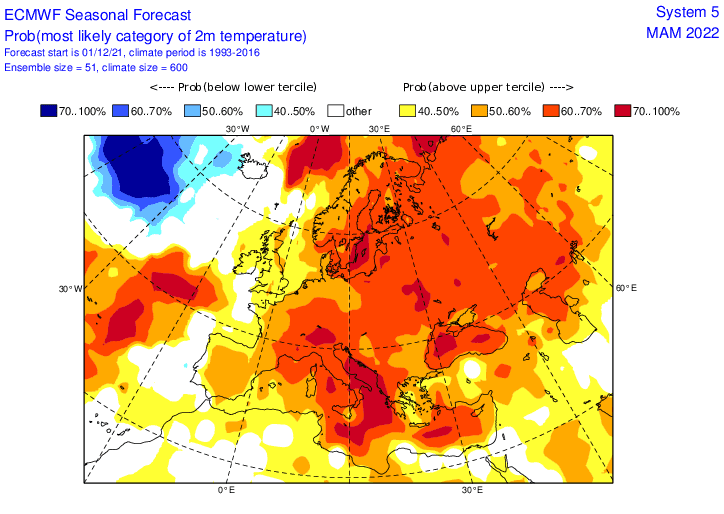
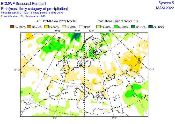
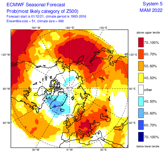
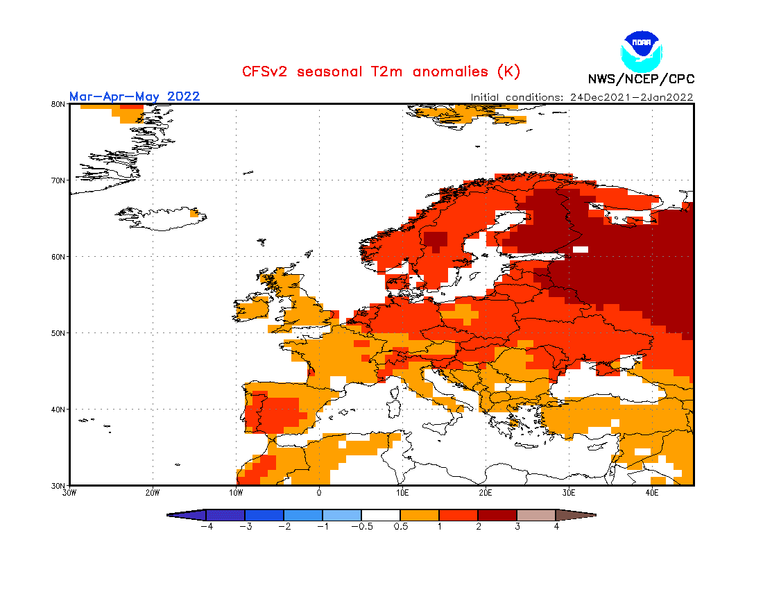
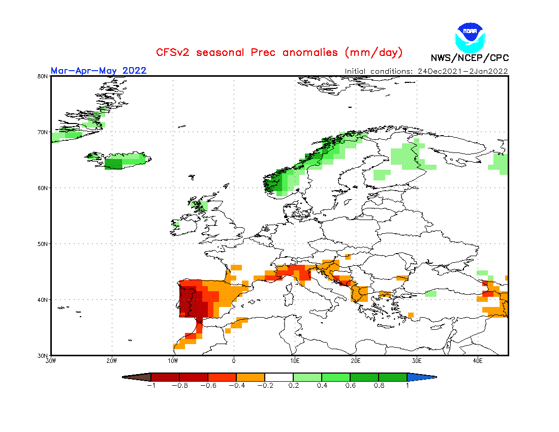
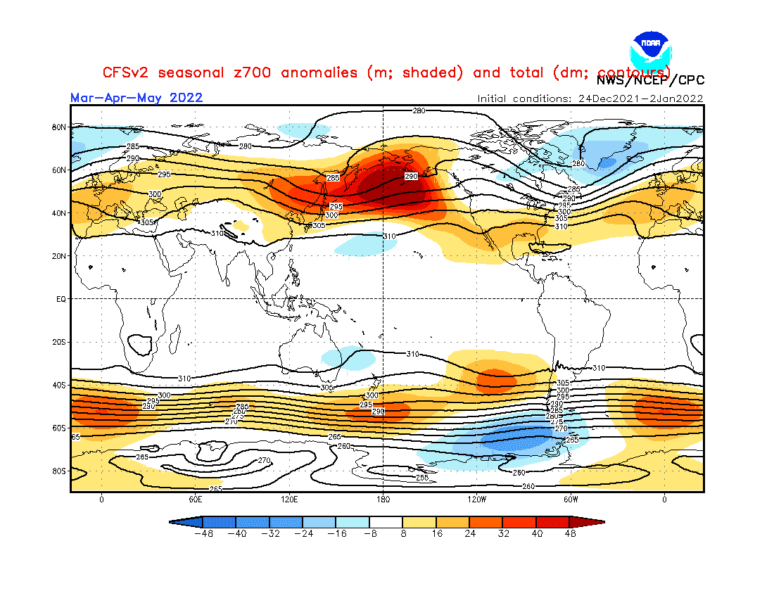
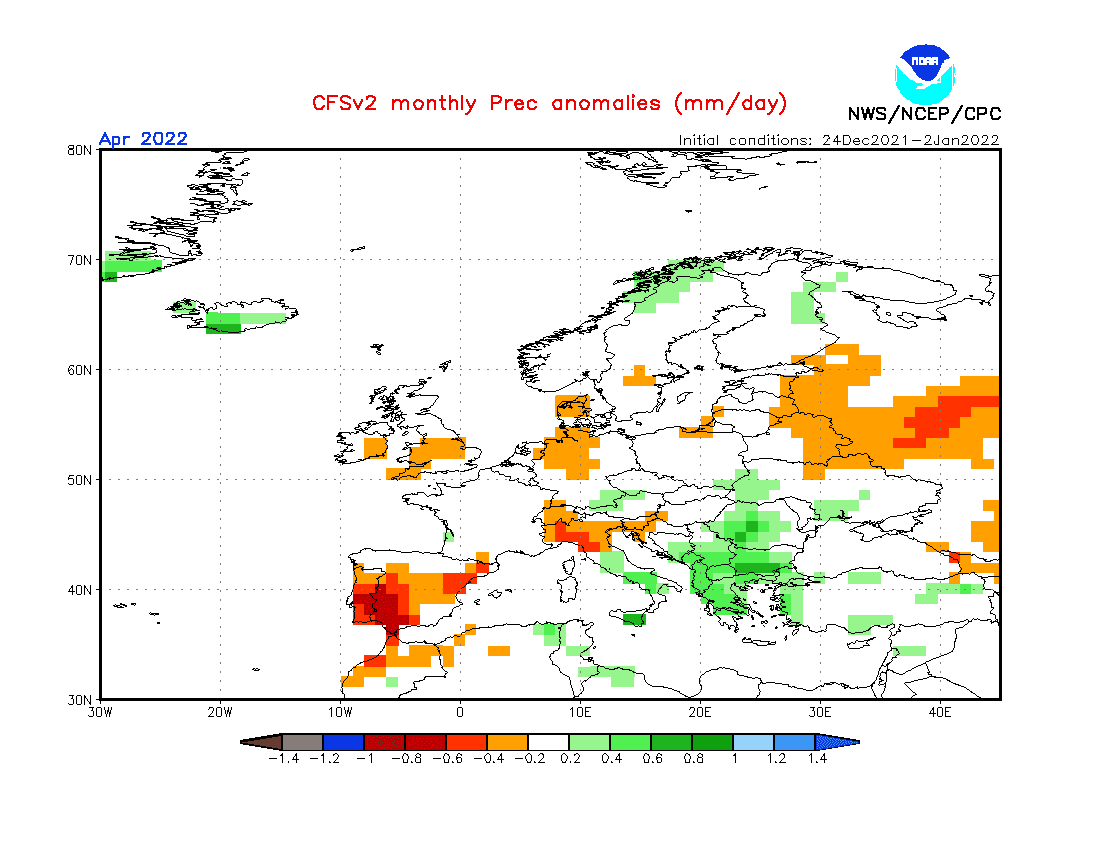
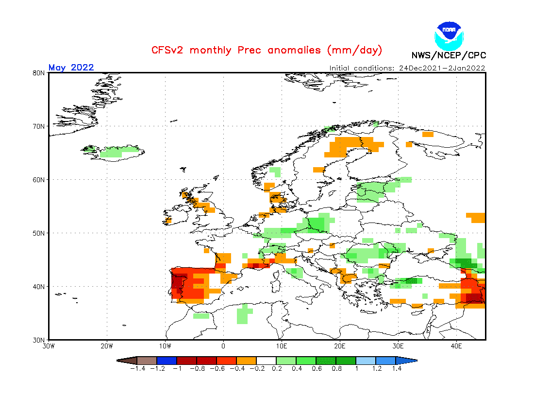
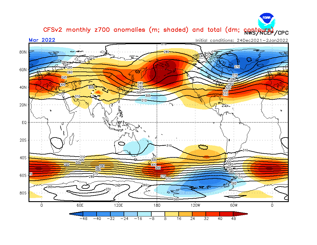
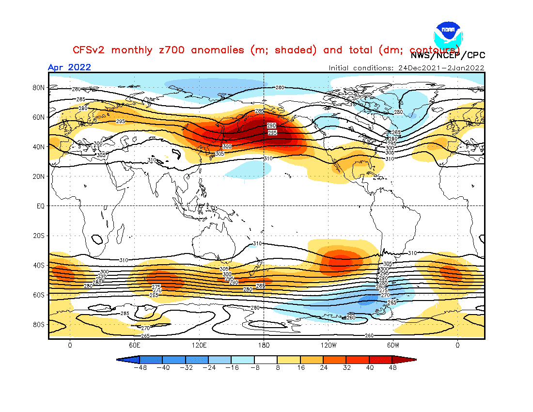
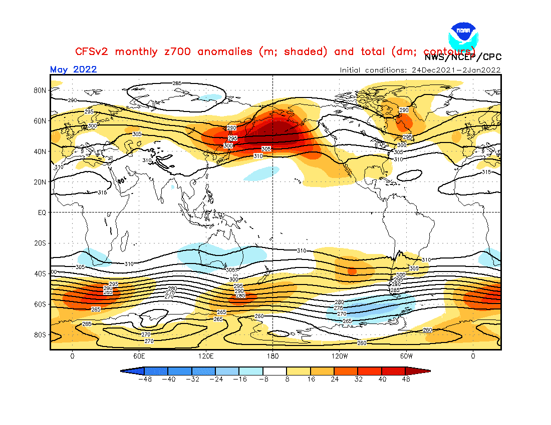
Source: https://www.cpc.ncep.noaa.gov/products/CFSv2/CFSv2_body.html
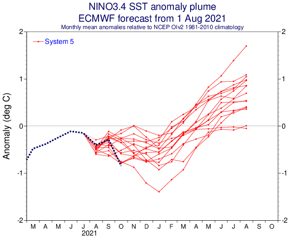

Source: https://iri.columbia.edu/our-expertise/climate/forecasts/enso/current/?enso_tab=enso-cpc_plume
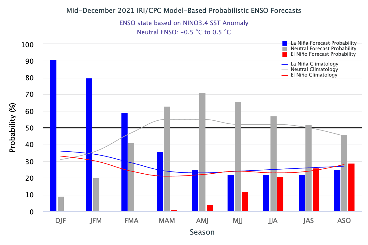
Source: https://iri.columbia.edu/our-expertise/climate/forecasts/enso/current/?enso_tab=enso-iri_plume
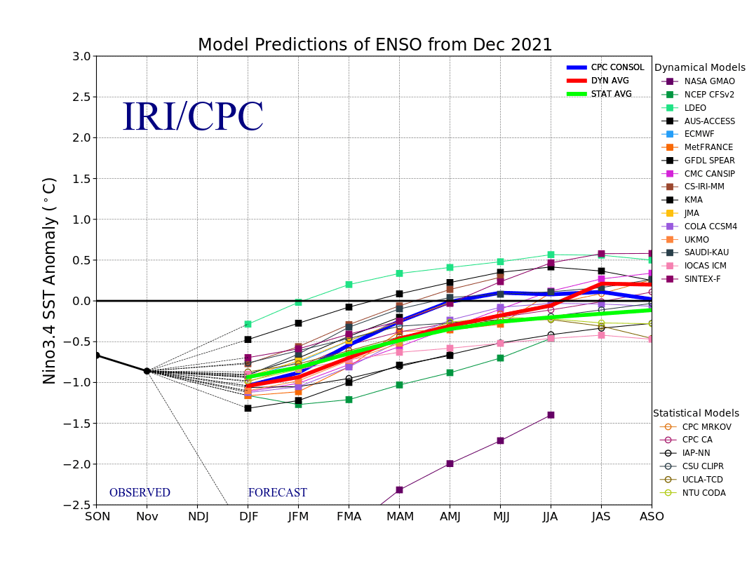
Source: https://iri.columbia.edu/our-expertise/climate/forecasts/enso/current/?enso_tab=enso-sst_table
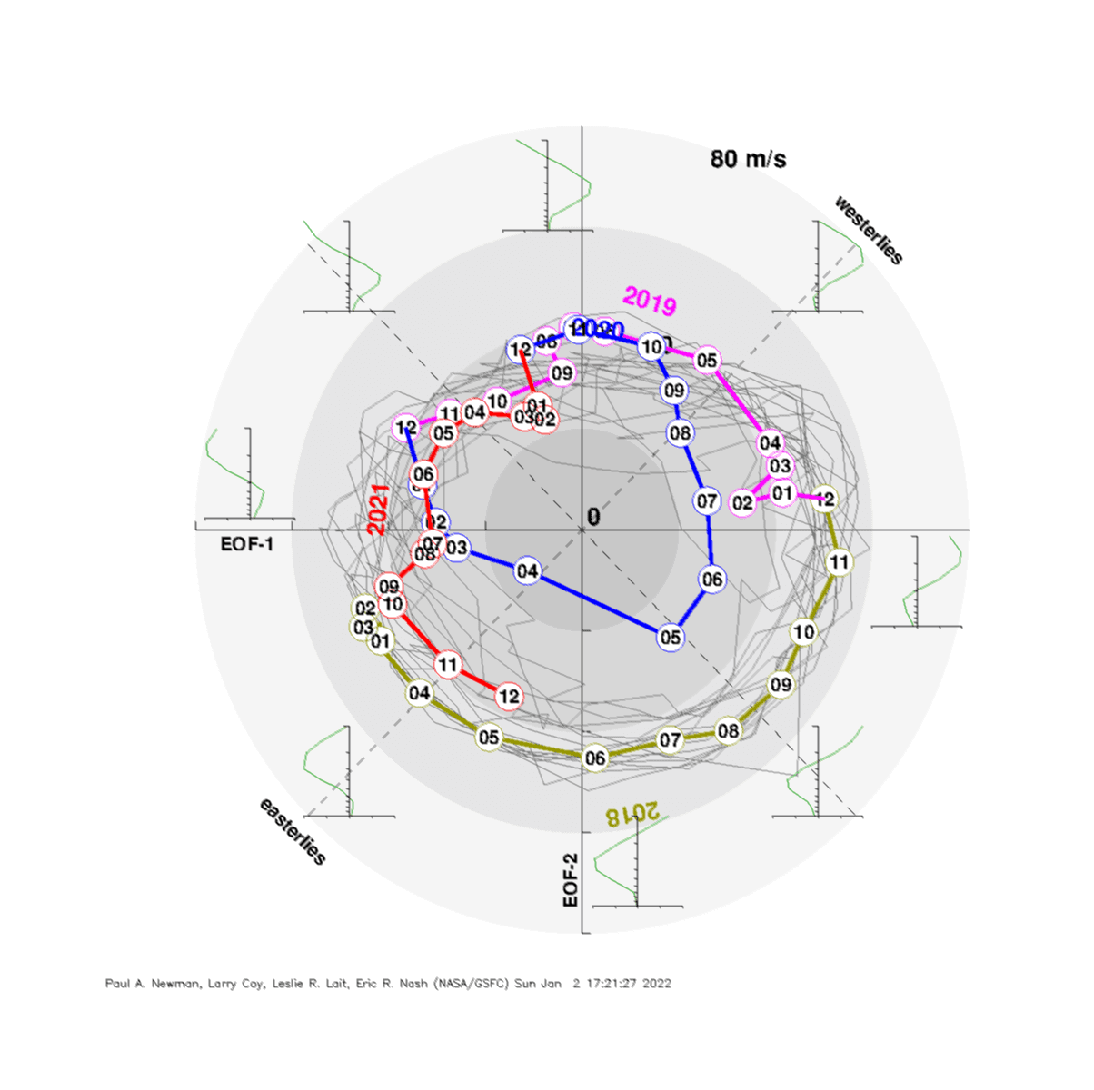
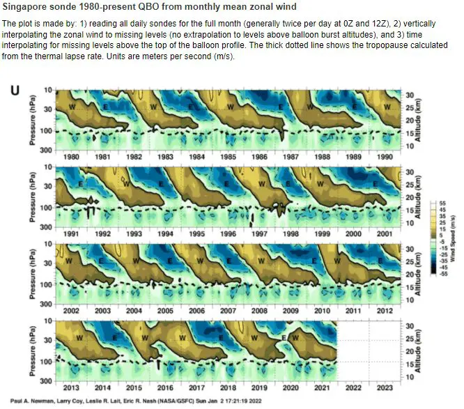
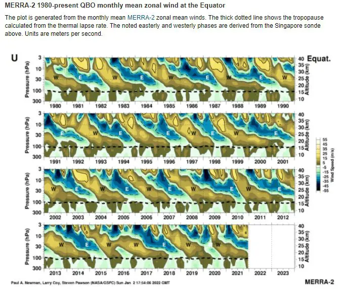
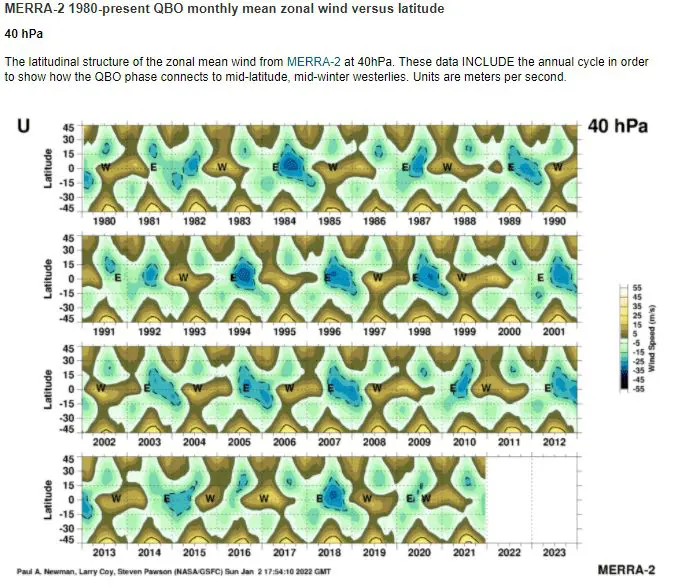
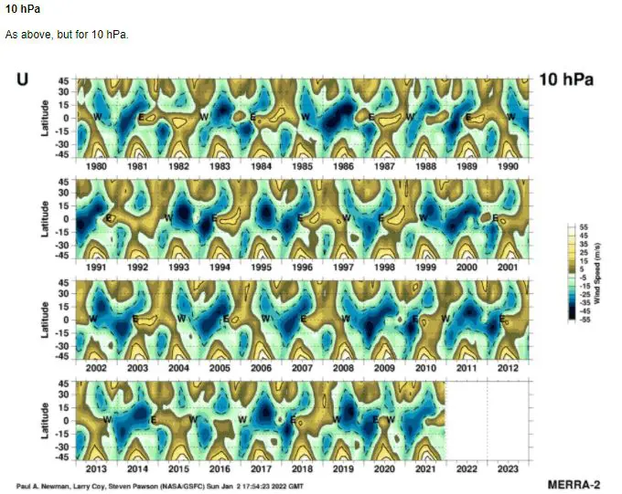
Source: https://acd-ext.gsfc.nasa.gov/Data_services/met/qbo/qbo.html
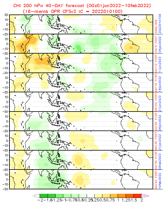
Source: https://www.cpc.ncep.noaa.gov/products/people/wd52qz/mjo/chi/cfs.gif
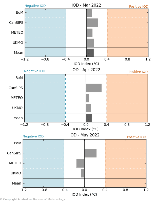
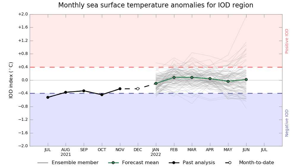
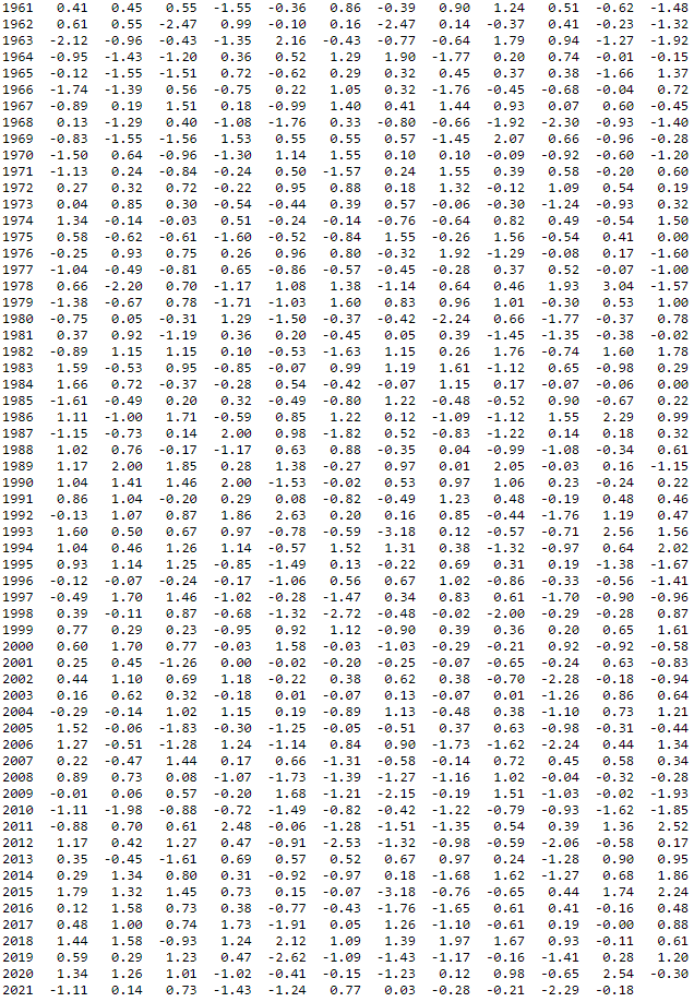
NAOi. Source: https://www.cpc.ncep.noaa.gov/products/precip/CWlink/pna/norm.nao.monthly.b5001.current.ascii.table
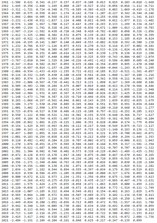
AOi. Source: https://www.cpc.ncep.noaa.gov/products/precip/CWlink/daily_ao_index/monthly.ao.index.b50.current.ascii.table
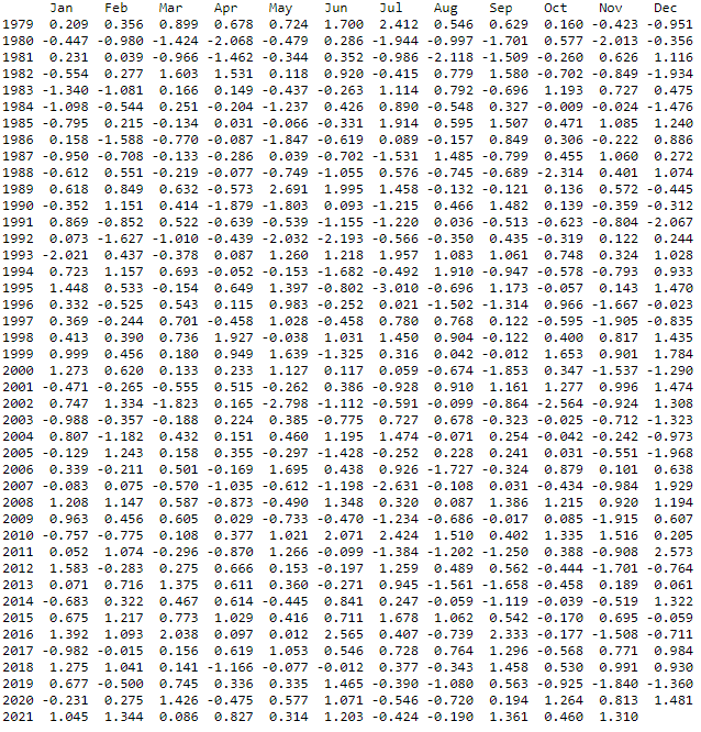
AAOi. Source: https://www.cpc.ncep.noaa.gov/products/precip/CWlink/daily_ao_index/aao/monthly.aao.index.b79.current.ascii.table
