Summer 2022 is here already in 4 months and we are bringing the first continental updates of predicted weather patterns for Europe, North America, Asia, Africa (Winter+Summer 2022), Australia (Winter 2022), South America (Winter 2022), and Antarctica (Winter 2022).
This article will look at the forecast of Summer 2022 conditions in Asia.
A few main factors will be affecting conditions during an upcoming Summer 2022:
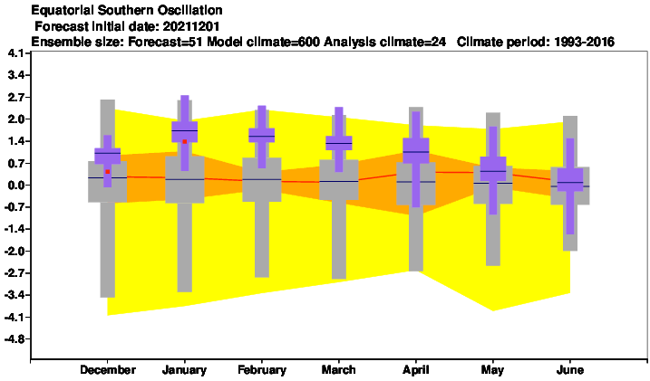
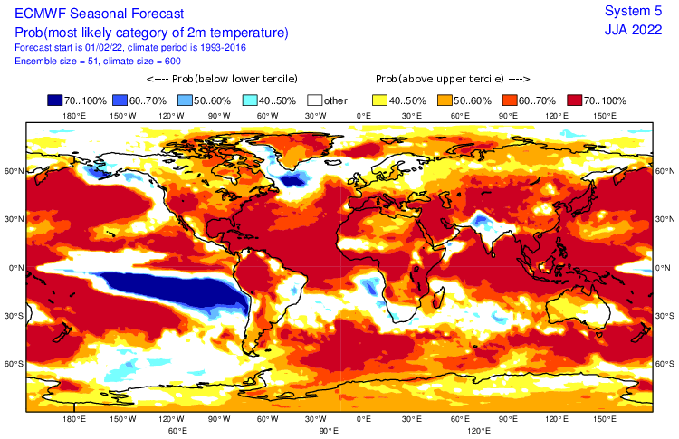
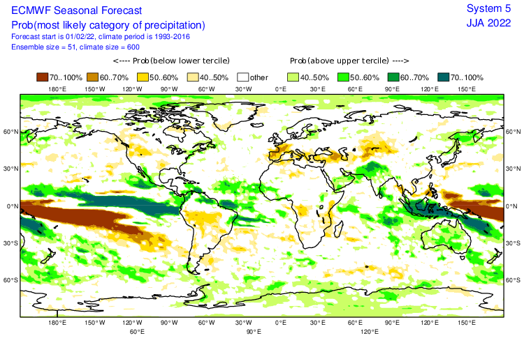
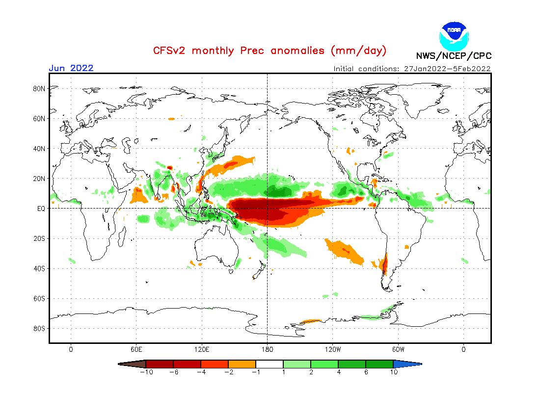
1. Weakening La Nina: During Summer 2022, a shift from La Nina to El Nino will be ongoing (Spring will be La Nina, yet, but Autumn probably El Nino already). The previous 2 La Nina Years should be associated with accumulated colder Earth conditions. La Nina is in many parts of Asia more fertile as El Nino /https://mkweather.com/el-nino-is-coming-autumn-2022-a-big-changes-in-circulation-patterns-worldwide//. Strong La Nina pattern should be associated with the strong monsoon season in many parts of Asia (e.g. SE Asia, S Asia, south of Arabian Peninsula, parts of E Asia). In India should be monsoon rains this year so strong, that they will produce regional cold seasonal anomalies. In SE Asia La Nina should correlate with IOD- and wet MJO.
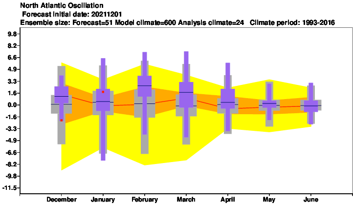
2. Mostly NAO- and AO-: After the year 2000, approximately 2/3 of winters were NAO+, while 2/3 summers NAO-. It should mean stronger heatwaves in central parts of Asia and in Siberia, alternated with severe storms in wetter regions.
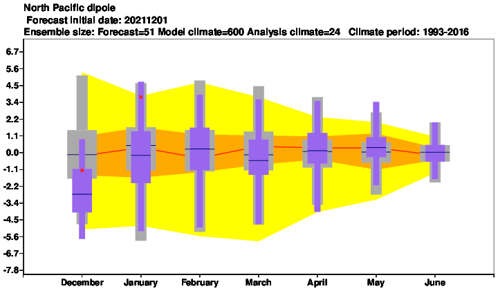
3. Negative IOD: Correlates with NAO- and bringing very stormy pattern above SE Asia, while East Africa (Western Indian Ocean regions) is very dry. In winter we were mostly in IOD+, in Spring 2022 is predicted short and weak IOD+. In Summer 2022 we will shift again to the traditional La Nina and AO- pattern, with a high risk of floods and landslides in Indonesia and Malaysia regions.
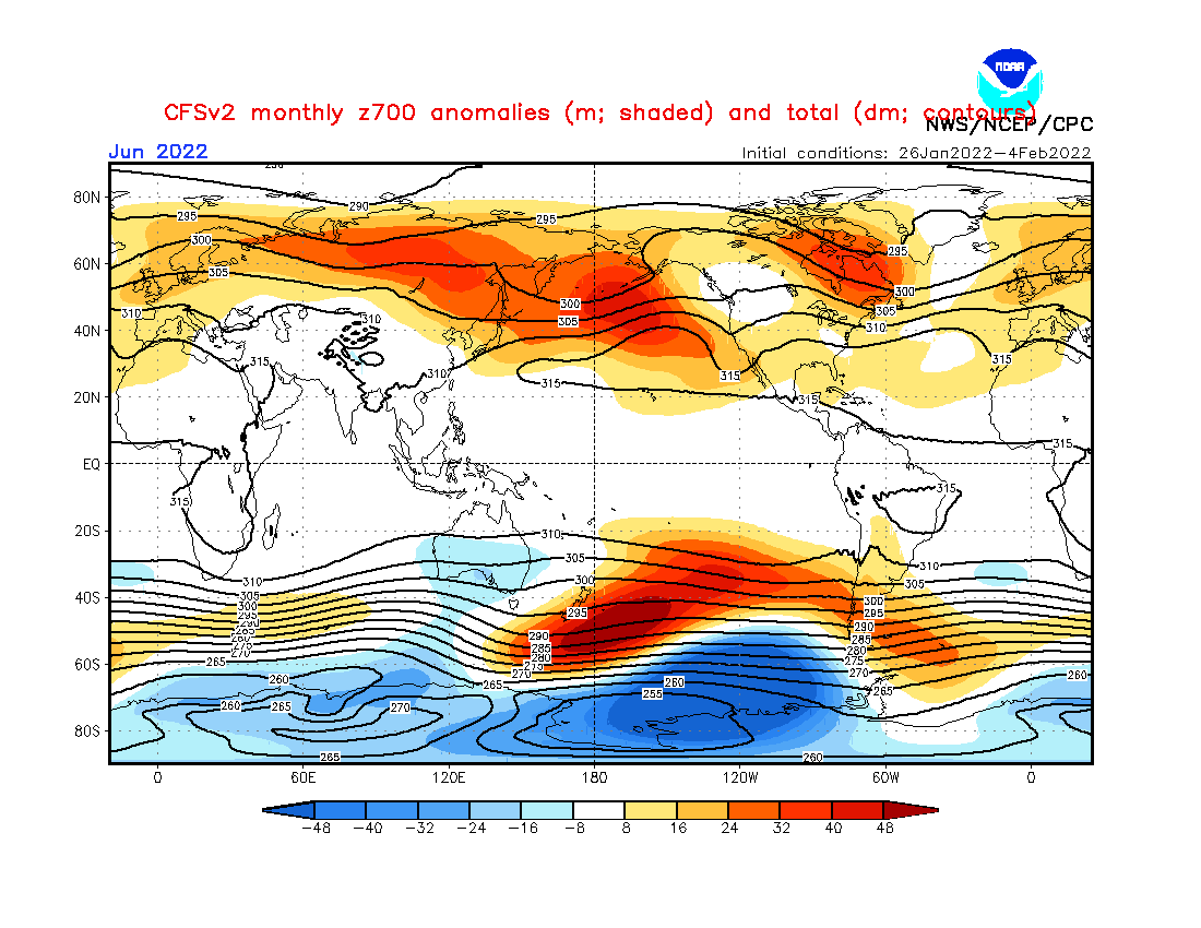
4. A shift of Hadley Cell northward: The shift of Hadley Cell northward should push summer patterns to more northern regions, as usual. Often it should be manifested by the stronger effect of subtropical highs, despite possible NAO- (Icelandic and Aleutian stormtracks are in summer months significantly limited).
5. Extremely hot western Sahara: In the last years traditional pattern, linked with the shift of Hadley Cell or summer NAO- signals. There is a big stock of hot air for the Middle East, Turkey, Caucasian and Caspian region, and Central Asia (heatwaves will be shifting from Sahara northeastward, similarly such as in Europe).
6. A possible colder Arctic than usually: Arctic experiences partially thanks to La Nina with colder years and it´s possible that it won´t be a very warm season in Summer 2022, yet. SSTs of many Arctic seas are predicted to be below the temperature average in the summer and cold blasts or rare snowfall should still surprise northern parts of Siberia, mainly in early and late summer.
7. QBO in Westerly phase: Support for zonal airflow, despite possible NAO- / AO- conditions.
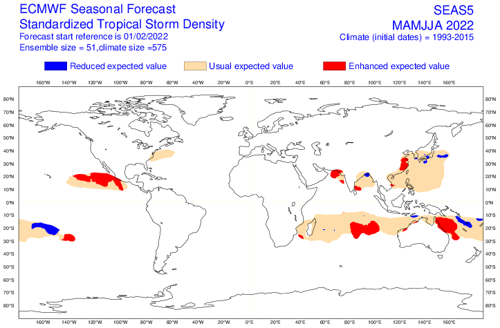
8. Stronger start of Hurricane season: Despite weakening La Nina, thanks to AMO+, is expected the next above-average Hurricane season 2022. It should mean more ex-tropical storms and ex-hurricanes at the end of Summer 2022 for northwestern Siberia /https://mkweather.com/the-first-hurricane-season-2022-forecast-a-busy-season-amo-weaker-than-2020-2021-upcoming-el-nino//.
9. AMO+: Warmer seas near North America with effect on stronger hurricane season and ex-tropical disturbances in late summer in Europe/northwestern Asia.
10. Remnants of NE Pacific Warm Blob: Remnants of warm anomaly above N Pacific should be linked with warmer advection on the backside of the system, above northeasternmost Asia.
11. Awakening sun activity: should be linked with warmer global signals not only in Summer 2022 but in the next years.
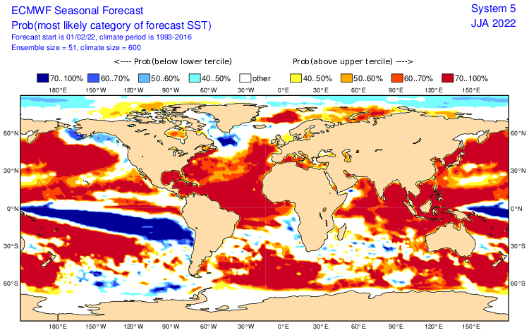
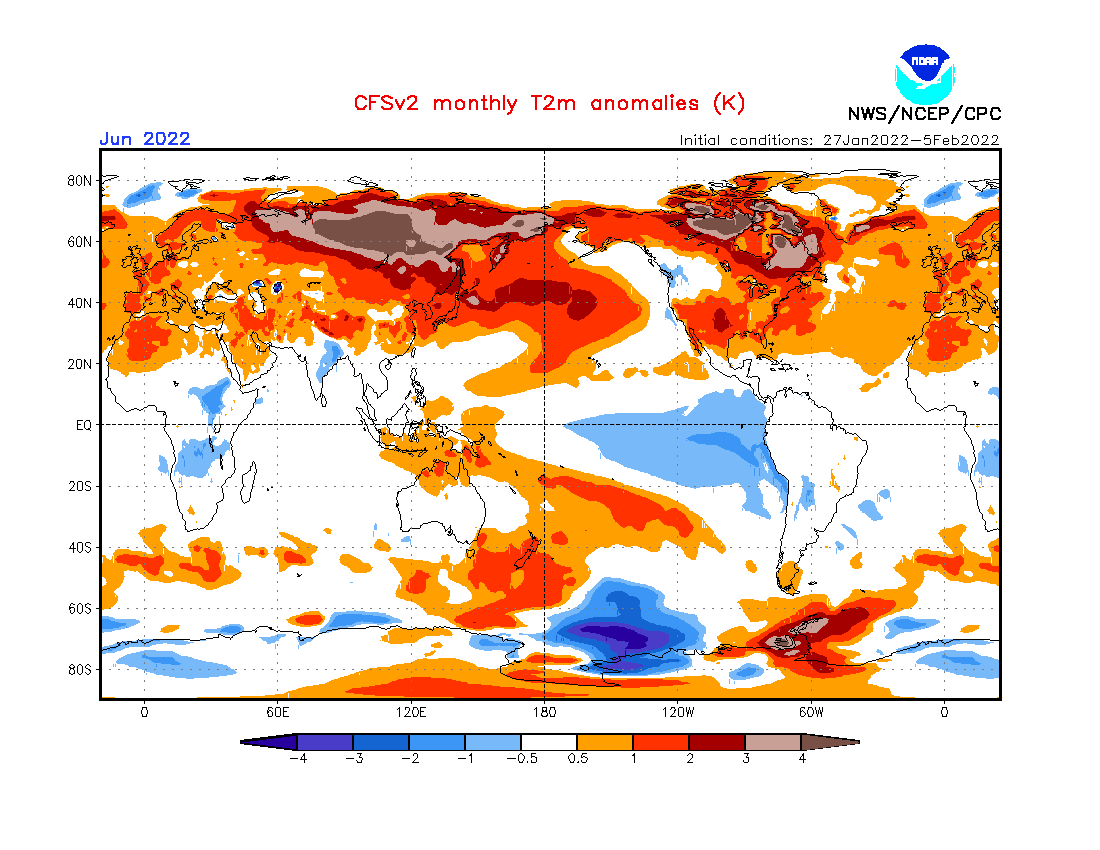
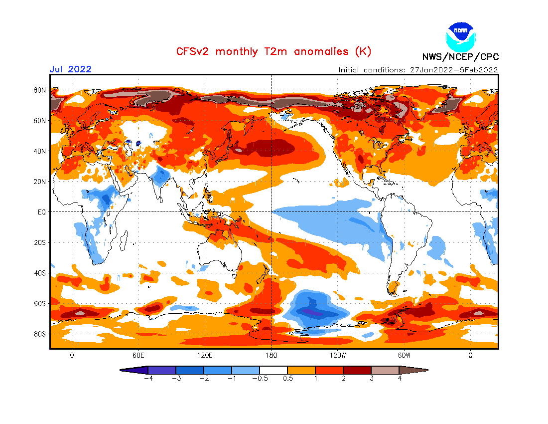
12. SST: mostly warm SSTs along the coasts of Asia. Only colder SST above the Arctic and southward from Arabian Peninsula.
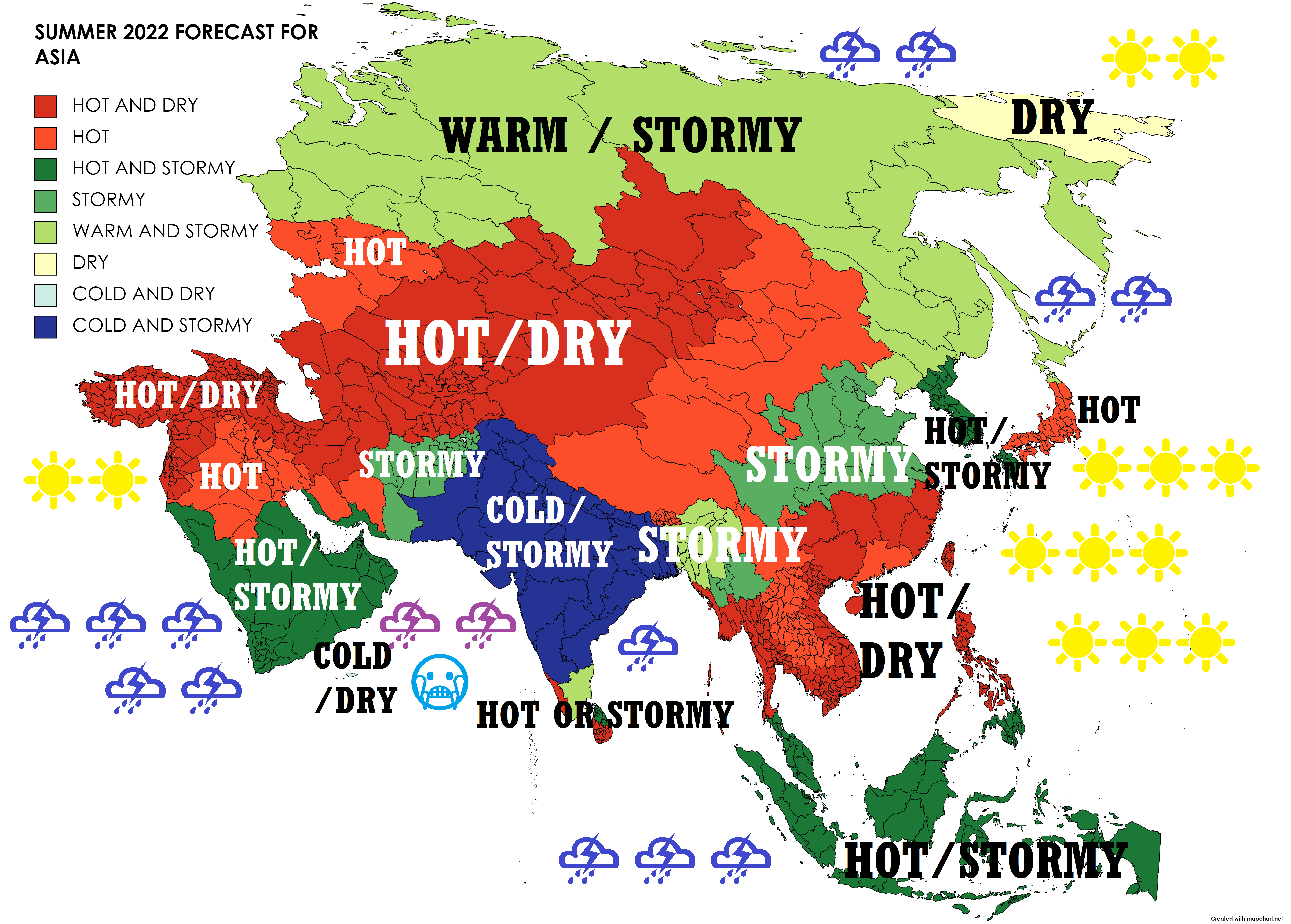
Now, we should look at a forecast map for Summer 2022 for Asia and 8 main sectors, with similar regimes of weather:
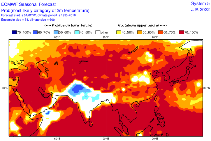
A) HOT AND DRY (TURKEY, NW MIDDLE EAST, N IRAN, CENTRAL ASIA, S SIBERIA, WESTERNMOST CHINA, W MONGOLIA, NORTHERN SE ASIA, NORTHERN AND CENTRAL PHILIPPINES, TAIWAN – DARK RED): Problems with drought, wildfires, in agriculture and water supplies. Possible deadly heatwaves. Regionally very strong wildfire season. The next hot year in the northern Middle East and Central Asia, with help from hot air masses from Sahara. Northern SE Asia hot and dry, too, probably thanks to the weakening La Nina pattern and the next relatively weaker Typhoon season 2022. Heatwaves in the Middle East up to +52°C, in Central and N SE Asia +40/+48°C during the peak of the season. In southern Siberia and northern Central Asia possible taiga extensive wildfires. Drier and hotter northern and central Phillipines, probably due to partial lack of typhoons and tropical storms and disturbances.
B) HOT (N MIDDLE EAST, NE CASPIAN REGION, PARTS OF CONTINENTAL CHINA AND MONGOLIA, MOST OF JAPAN, S SRI LANKA, CONTINENTAL N SE ASIA – RED): More storms such as a previous cluster, but still very hot, and possibly higher humidex. In N Middle East and continental Asia only relatively wetter, in SE Asia more storms. In N Middle East up to +54°C, Central Asia and continental N SE Asia +40/+48°C. Sri Lanka and N SE Asia more storms and possible floods or landslides. Problems with heatwaves, drought, wildfires, too. Weaker Typhoon season in E/SE Asia weaker, hot Saharan air in the Middle East and Central Asia, desertification, and a shift of Hadley Cell.
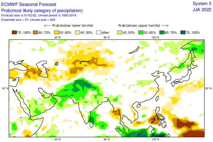
C) HOT AND STORMY (SOUTHERN MIDDLE EAST, SE ASIA, KOREAN PENINSULA, SOUTHERNMOST PHILIPPINES – DARK GREEN): La Nina is a very fertile pattern in SE Asia. IOD- means even more precipitation for the region and possible prolonged wet MJO phases. A lot of floods, landslides, and severe storms in the region. Relatively good typhoon season for Korean Peninsula should mean higher flooding potential, but more fertile conditions, too. Southern Middle East is during IOD- usually drier, but probably with a contribution of weaker La Nina it should be more stormy, but still very hot, up to +54°C in deserts. In SE Asia mostly up to +35/+40°C.
D) STORMY (SE CHINA, MYANMAR, PARTS OF PAKISTAN,…-GREEN): Higher storm activity in these regions should make temperature anomalies lower – only slightly above long-term average or neutral. Stronger monsoon in southern parts of Asia and southward from Beijing, China. La Nina, IOD effects in the south, and NAO- effect in China. In China possible severe storms and flash floods, storms with hail, gusting winds, or damaging lighting. Westward and eastward from N India an effect of very strong monsoon season. Up to +52°C in Pakistan and +40/+46°C in China and Myanmar.
E) WARM AND STORMY (MOST OF SIBERIA, FAR EAST, HOKKAIDO): Mostly very hot Siberia, however more stormy than average (NAO-, moisture from the Arctic, although, the northern Arctic should be relatively colder). A possible cold blasts and rare snowfall along the northern coast, too. During heatwaves, dry spells with possible wildfires very high temperatures +30/+38°C. Possible extensive taiga wildfires, such as severe storms with flash floods, hail, or gusting winds. Thanks to the possible NAO-, heatwaves should reach farther to the north.
F) DRY (CHUKOTKA REGION – YELLOW): Drier summer in NE-most Siberia should be linked with remnants of NE Warm blob above N Pacific and teleconnections above N Pacific such as relatively colder Arctic.
G) COLD AND DRY (SOCOTRA ISLAND REGION): Local cluster southward from the Arabian Peninsula, with calmer cyclone activity, possible colder and drier conditions. Despite wetter southern Middle East agree with IOD- pattern.
H) COLD/NEUTRAL AND STORMY (SOUTHERN ASIA – LARGE PARTS OF INDIA): Strong La Nina and possible IOD and MJO effects. A very powerful monsoon season, with widespread and deadly floods, is expected. Even so strong, temperature anomalies in many parts of India will be below the long-term average. Many landslides in the Himalayas and other mountainous regions. Despite it, above +50°C in Thar desert and Pakistan before the arrival of monsoon possible. However, neutral ENSO phases or weaker La Ninas are in the region more fertile (both extremes – strong La Nina and El Nino are mostly dry).
Spring (Autumn) 2022 forecasts are available here: Europe /https://mkweather.com/spring-2022-forecast-for-europe-early-dry-late-stormy-very-warm//, North America /https://mkweather.com/spring-2022-forecast-for-north-america//, Asia /https://mkweather.com/spring-2022-forecast-for-asia//, Australia and Oceania /https://mkweather.com/autumn-2022-forecast-for-australia//, South America /https://mkweather.com/autumn-2022-forecast-for-south-america//, Africa /https://mkweather.com/spring-and-autumn-2022-forecast-for-africa-mostly-stormy-and-hot-south-colder//, and Antarctica /https://mkweather.com/autumn-2022-forecast-for-antarctica-snowy-with-severe-blizzards//.

Mkweather Summer 2022 forecast for Asia. Base map: https://mapchart.net/europe.html
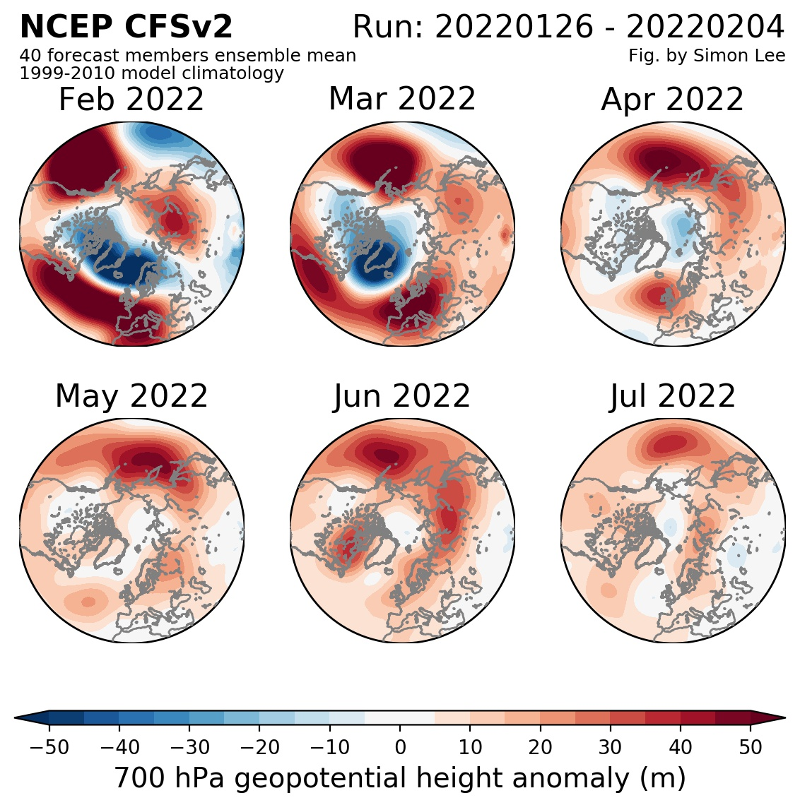
Source: https://simonleewx.com/cfsv2_monthly-anomalies/
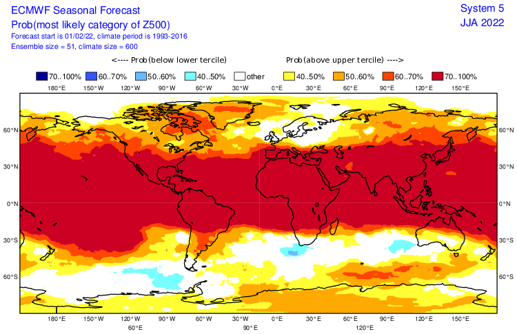
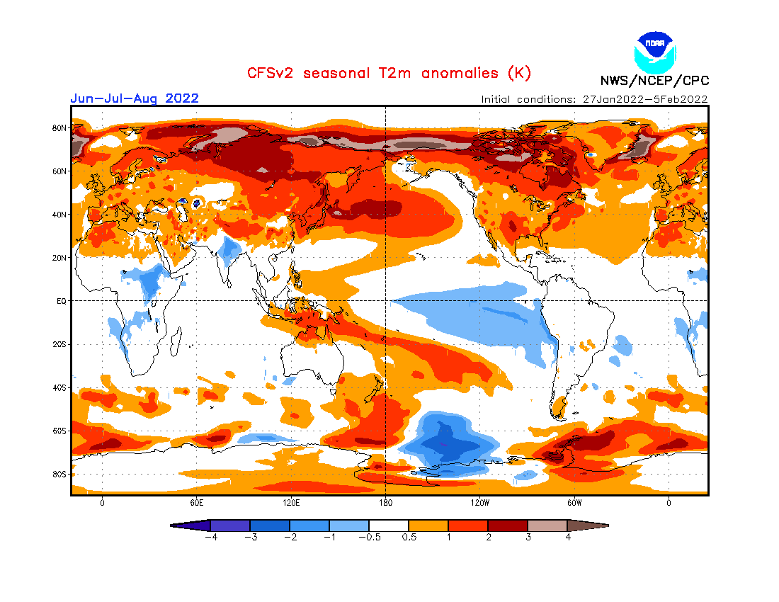
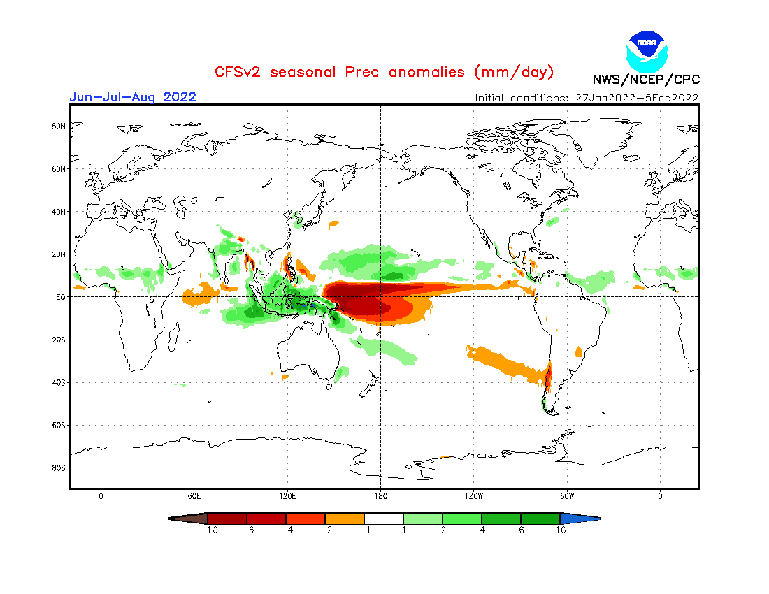
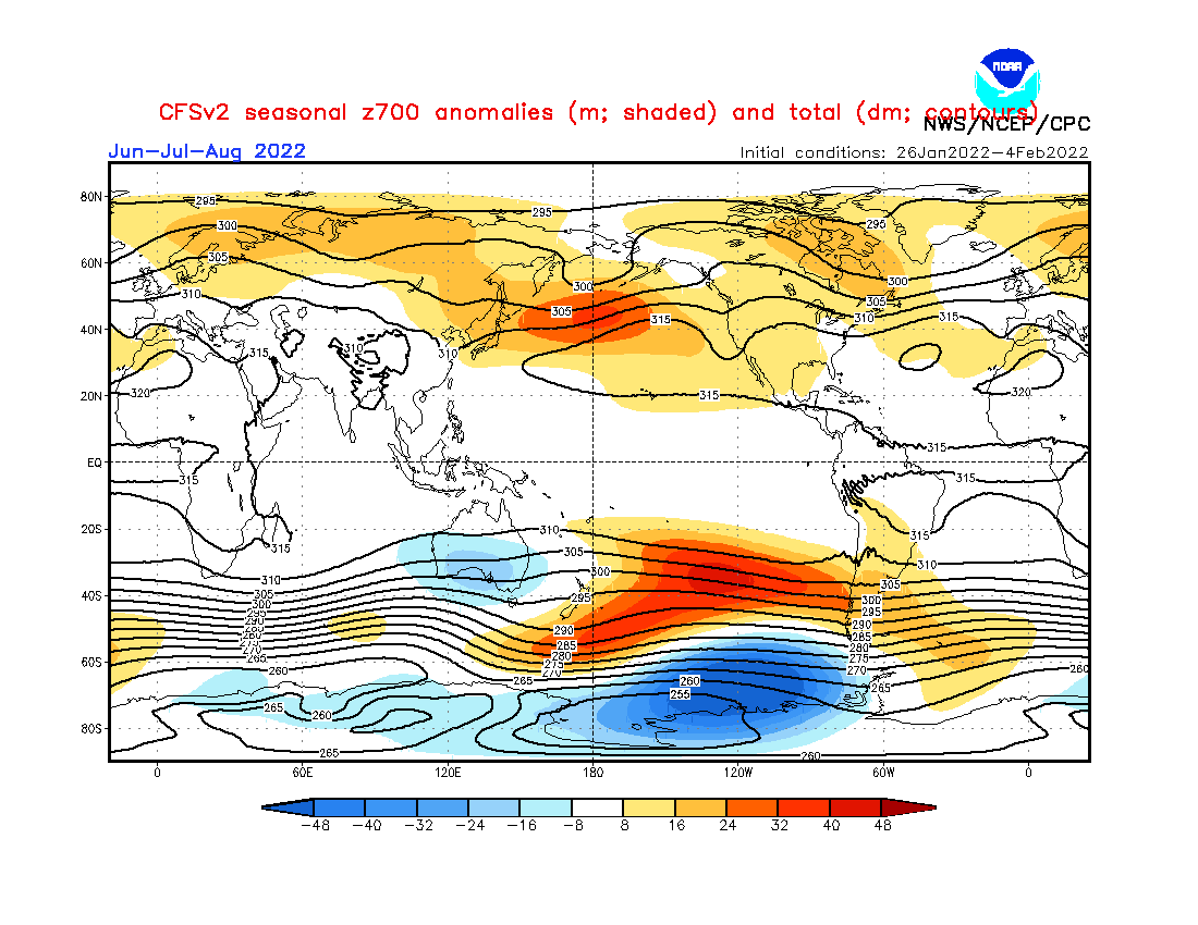
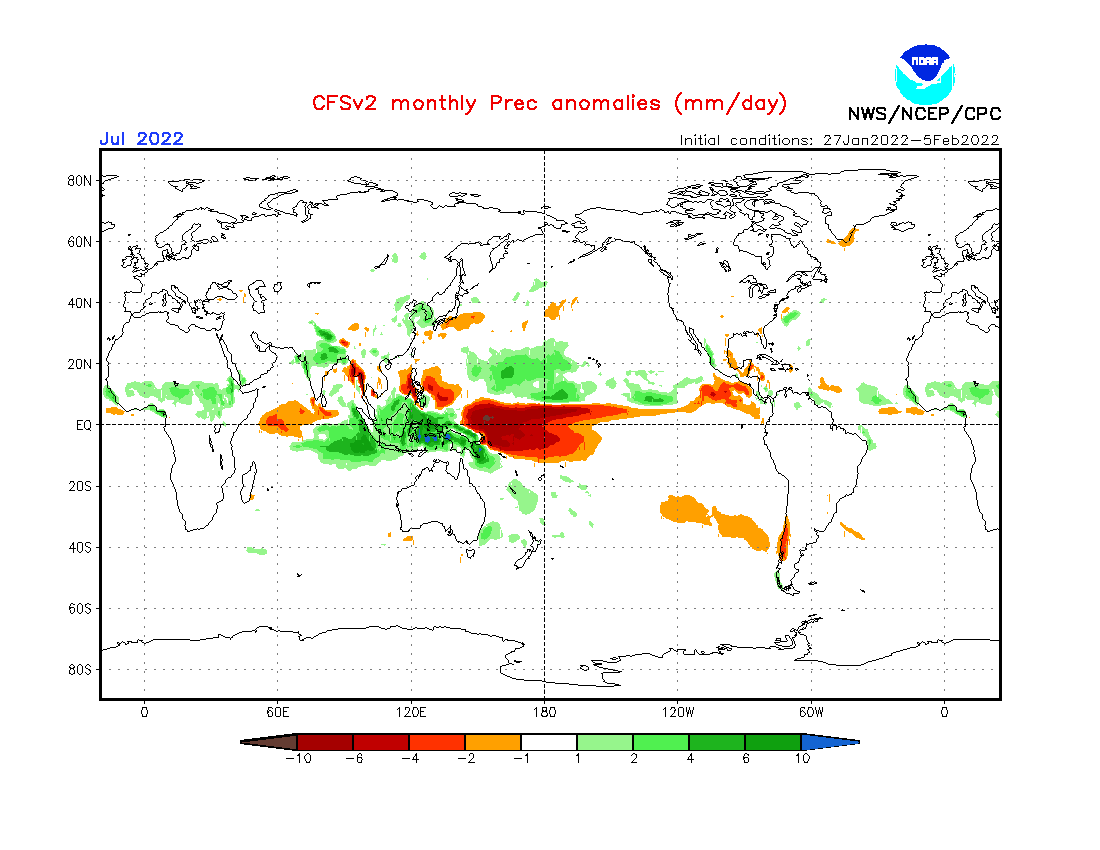
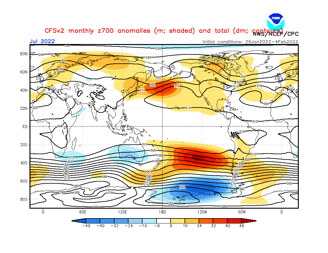
Source: https://www.cpc.ncep.noaa.gov/products/CFSv2/CFSv2_body.html
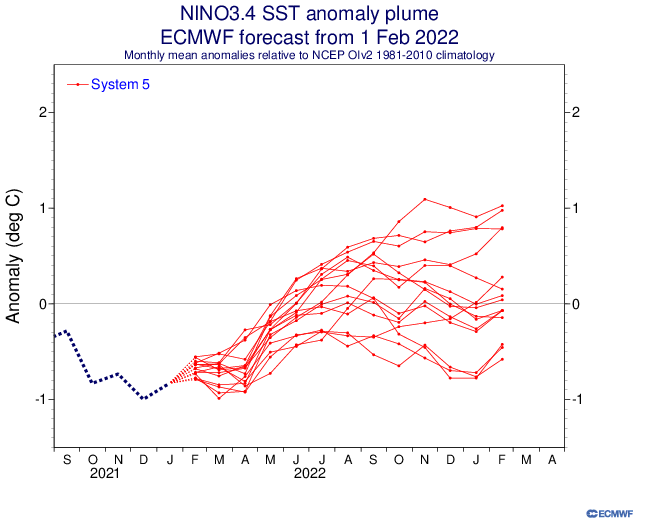
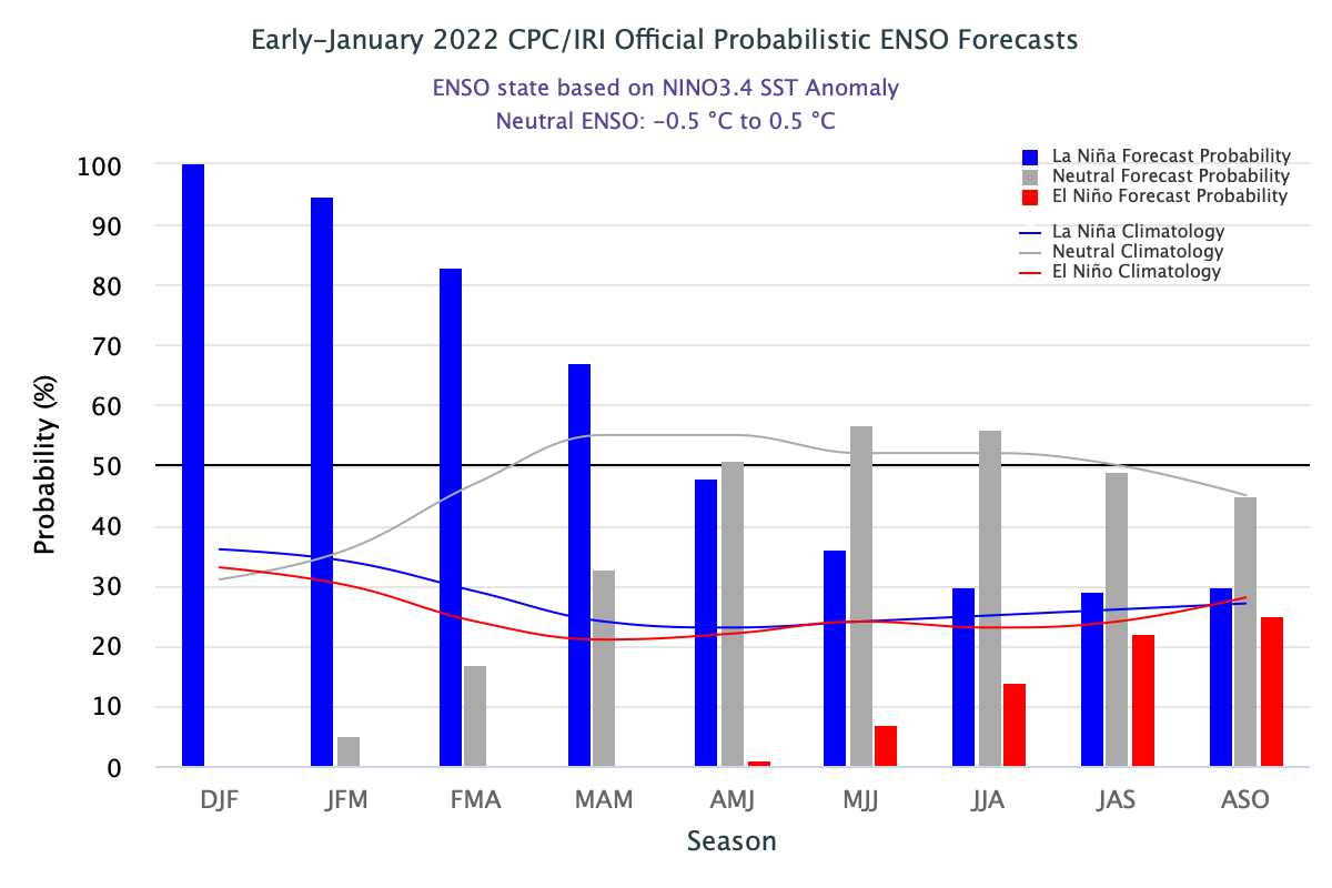
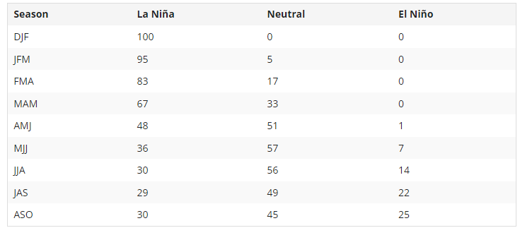
Source: https://iri.columbia.edu/our-expertise/climate/forecasts/enso/current/?enso_tab=enso-cpc_plume
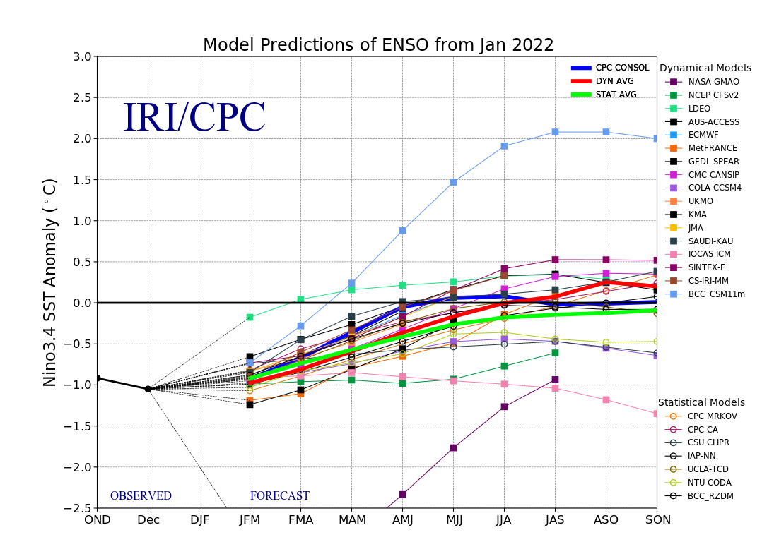
Source: https://iri.columbia.edu/our-expertise/climate/forecasts/enso/current/?enso_tab=enso-sst_table
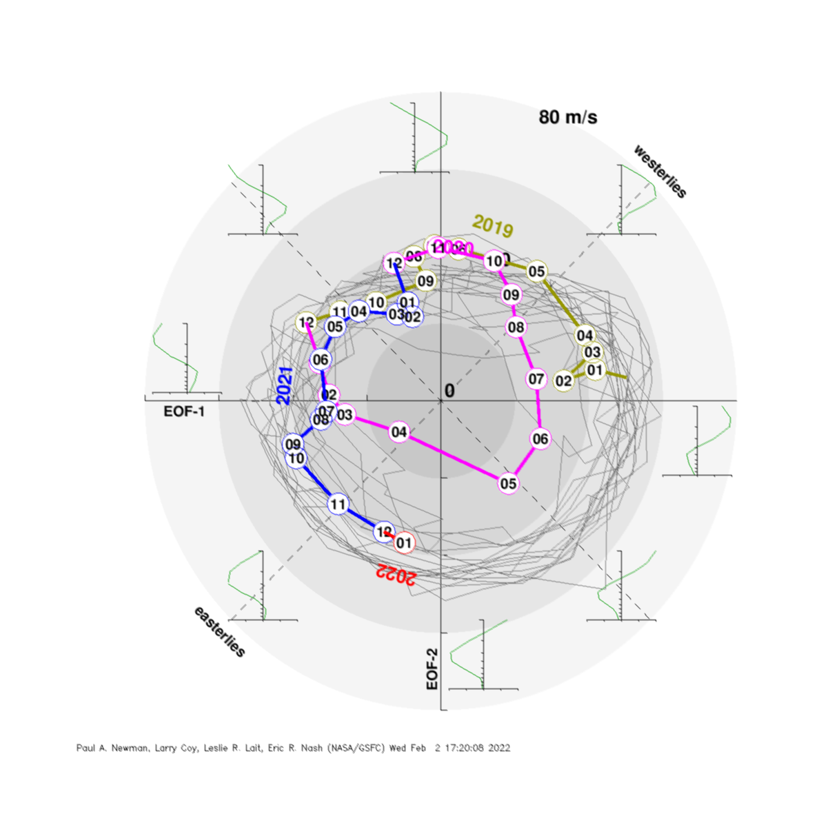
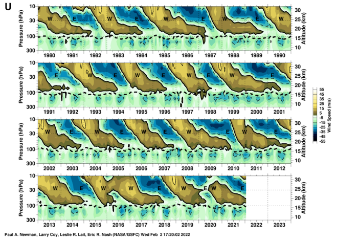
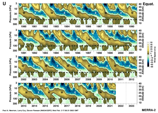
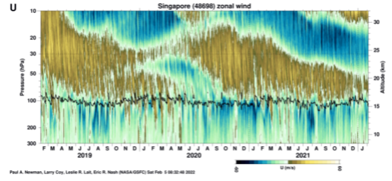
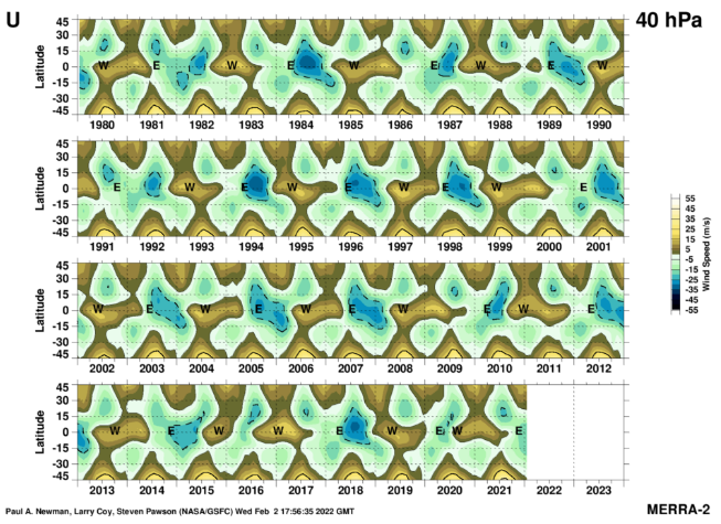
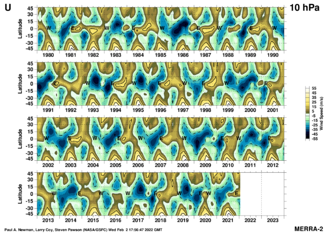
Source: https://acd-ext.gsfc.nasa.gov/Data_services/met/qbo/qbo.html
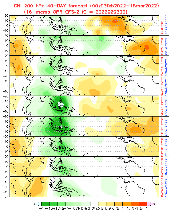
Source: https://www.cpc.ncep.noaa.gov/products/people/wd52qz/mjo/chi/cfs.gif
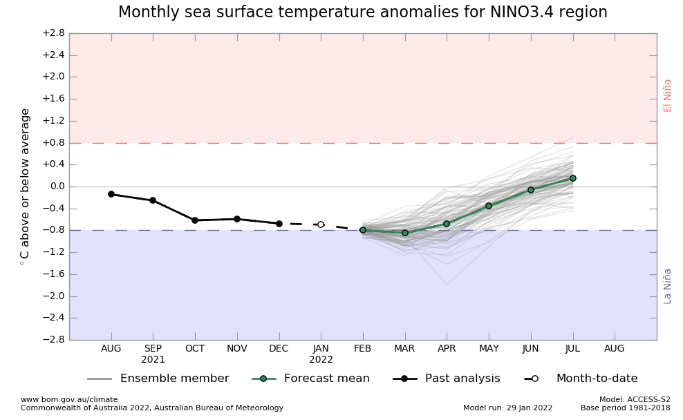
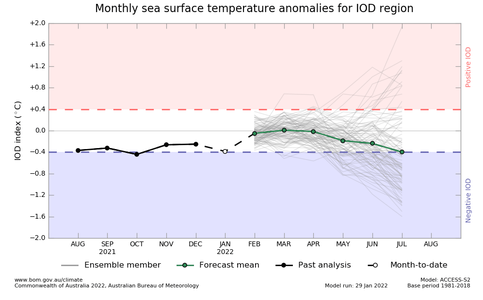
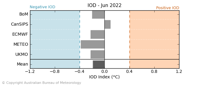
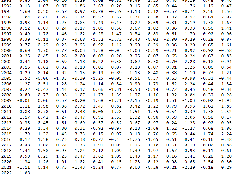
NAOi. Source: https://www.cpc.ncep.noaa.gov/products/precip/CWlink/pna/norm.nao.monthly.b5001.current.ascii.tabl0e
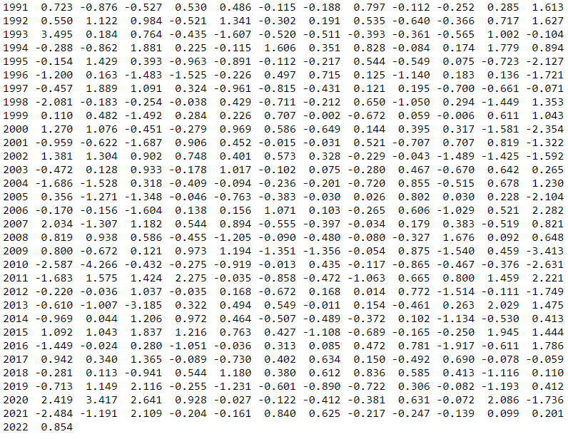
AOi. Source: https://www.cpc.ncep.noaa.gov/products/precip/CWlink/daily_ao_index/monthly.ao.index.b50.current.ascii.table

AAOi. Source: https://www.cpc.ncep.noaa.gov/products/precip/CWlink/daily_ao_index/aao/monthly.aao.index.b79.current.ascii.table
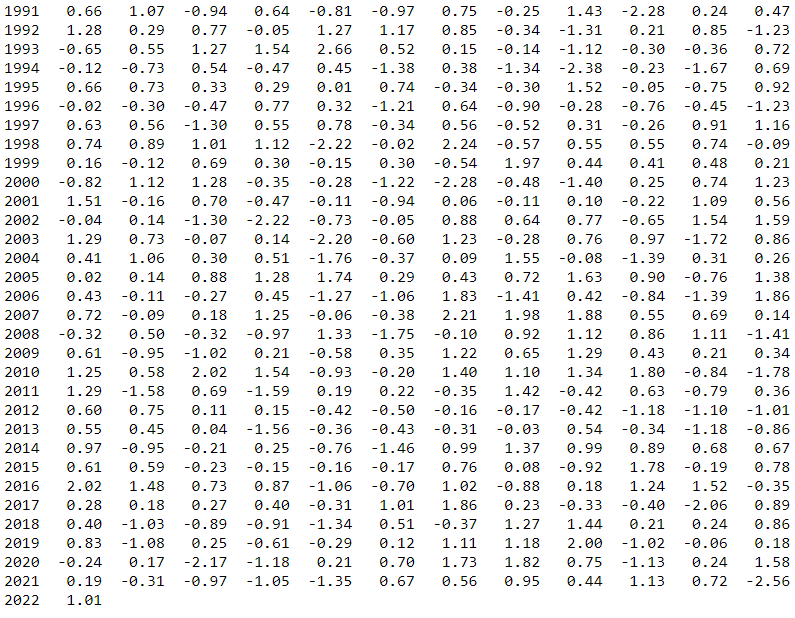
PNAi. Source: https://www.cpc.ncep.noaa.gov/products/precip/CWlink/pna/norm.pna.monthly.b5001.current.ascii.table
