Historic frosts below -10°C in London?!!! -20°C in Scotland possible! All UK and Ireland under the snow!
In the last series of articles, we brought the next extreme outputs of the GFS model, expecting anomalous coldwaves in late November and early December 2021 in Europe (and its wider region) /https://mkweather.com/hopes-for-a-very-rare-25c-in-november-central-europe-hits-extreme-frosts-and-snowfall-too/; https://mkweather.com/20c-in-france-still-possible-snow-is-forecasted-almost-everywhere-in-france-and-benelux/; https://mkweather.com/20c-and-heavy-snowfall-in-spain-are-still-possible-cold-weather-in-portugal-and-north-africa-too/; https://mkweather.com/extreme-frosts-20c-below-1000-masl-for-balkan-turkey-and-italy/; https://mkweather.com/30c-in-ukraine-belarus-and-moscow-region-russia-winter-in-2021-should-come-very-early/; https://mkweather.com/scandinavia-is-preparing-for-life-threatening-arctic-blasts-temperatures-up-to-35c-and-blizzards-in-the-baltic-region-are-forecasted/; https://mkweather.com/beast-from-the-east-for-british-islands-is-still-forecasted-snow-and-a-possibility-of-15-20c-frosts-in-scotland//.
About a predicted early arrival of Winter 2021/2022, we wrote already in July 2021 /https://mkweather.com/winter-2021-2022-in-europe-should-start-very-early-nao-and-cold-airflow-are-predicted-2021-2022-winter//.
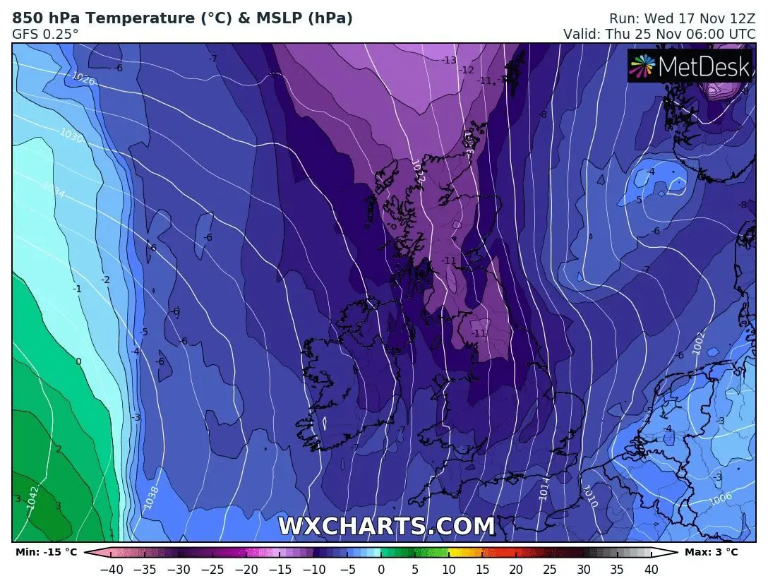
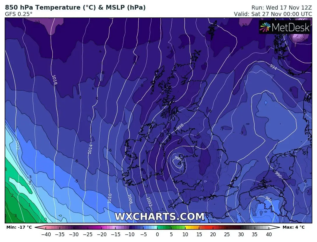
Extremely cold conditions will arrive after historically cold air masses above Greenland /https://mkweather.com/summit-camp-greenland-556c-possibly-never-has-been-so-extremely-cold-so-early-in-the-season// will flood Europe, soon, thanks to upcoming negative phases of Arctic and North Atlantic Oscillations (AO- and NAO-) /https://mkweather.com/be-prepared-for-an-extremely-long-and-strong-coldwave-arctic-blasts-in-europe-between-10-november-15-december-are-expected/; https://mkweather.com/the-end-of-november-should-bring-a-very-low-nao-index-greenlandic-arctic-and-siberian-winter-should-come-very-early-peaks-between-20-11-20-12-2021//.
There is a possibility, that the NAO index will fall in the last November 2021 days up to -2, which is a very rare value, with a result of Mediterranean lows activity, blizzards in southern parts of mid-latitudes, and expansion of extremely, regionally maybe abnormally cold air masses from Greenland, Arctic, and Siberia above many parts of mid-latitudes and shortly even, to tropical climate zone.
Extremely cold air from Greenland should flood British Islands such as one of the first regions in Europe, with a potential of extremely low temperatures.
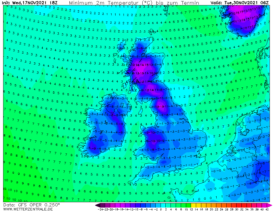
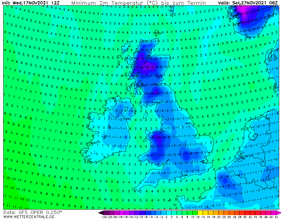
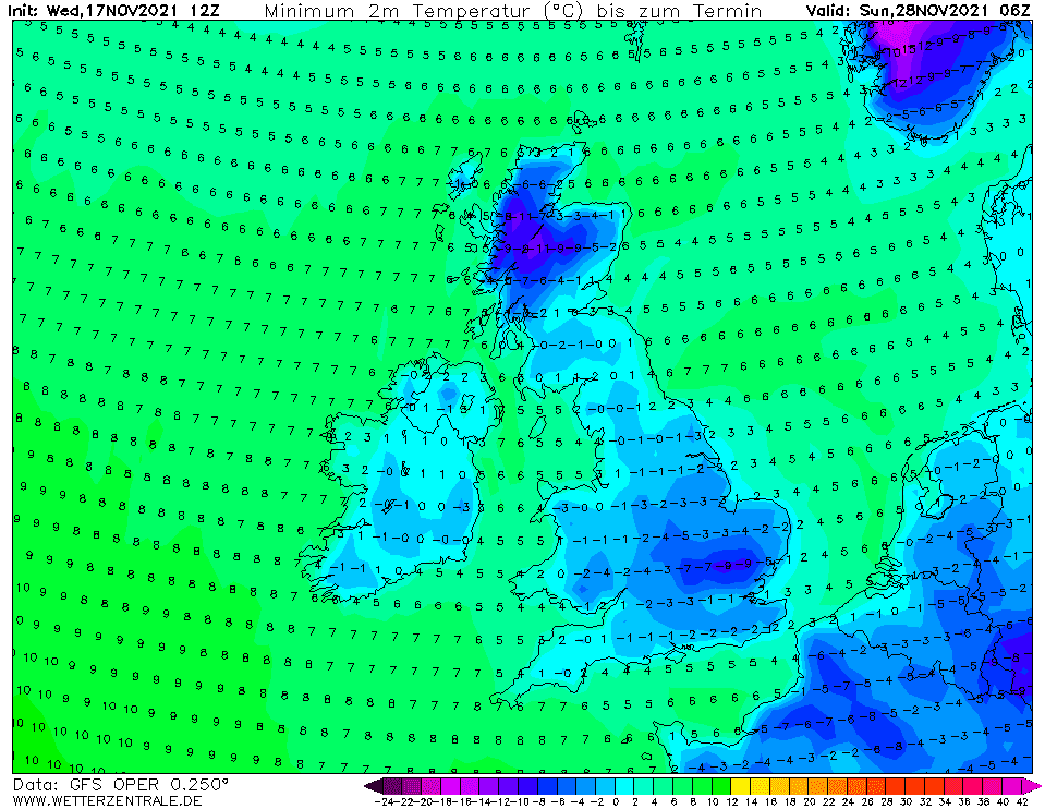
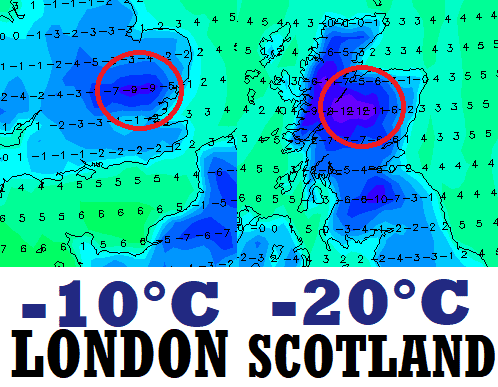
The last run of GFS returned for London region values up to -9°C, which should mean frosts below -10°C in the UK´s capital.
In Scotland, reality should be much colder – in frost basins and valleys with snow cover, temperatures up to -20/-25°C (-15°C on outputs minus estimated local anomaly).
Northern England or Wales should surprise with rare temperatures below -15°C, Ireland should end very close to -10°C in continental valleys.
The all-time November monthly record for Heathrow, -7,1°C should be broken – the coldest times are forecasted already in 9 days, on 27.-28. November 2021.
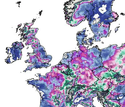
Moreover, almost all UK and Ireland expect snow cover or snowing during an extremely cold period and Winter 2021/2022 therefore really hits in full power very prematurely.
If you live in British Islands, we strongly recommend you to watch current weather news, forecasts, warnings, and advisories.
UPDATED MAPS: OUTPUTS FROM 18Z 17.11.2021! Update for the UK / Ireland!!! /Source: wetterzentrale.de. -25°C in Scotland should be possible if it would be confirmed!