Due to a big interest in Winter 2021/2022 forecasts, we are bringing the next update of predicted patterns for the winter season.
The last updates of the Winter 2021/2022 forecast we published here in August and September 2021: https://mkweather.com/mkweather-special-forecast-for-the-next-3-seasons-cold-autumn-2021-warmer-winter-2021-2022-cold-spring-2021-for-europe-a-peak-of-winter-in-its-colder-first-half-north-america-with-extreme-cold-2021-20/; https://mkweather.com/winter-2021-2022-forecast-the-first-reliable-estimates-extreme-cold-blasts-from-canada-and-western-siberia-snow-in-western-europe-and-eastern-asia-la-nina-qbo-to-qbo-shift-sufficient-nao-ao/ and we published ENSO outlook, too /https://mkweather.com/2022-2023-forecast-chances-for-el-nino//.
Continental forecasts for Autumn (in Southern Hemisphere Spring) 2021 we published here: https://mkweather.com/autumn-2021-forecast-for-europe-mostly-dry-and-frosty-autumn-be-prepared-for-early-severe-frosts/; https://mkweather.com/autumn-2021-forecast-for-north-america-long-indian-summer-and-weaker-hurricane-season-such-as-expected/; https://mkweather.com/autumn-2021-forecast-for-asia-strong-monsoon-for-s-se-e-asia-hot-and-dry-in-the-middle-east-late-siberian-cold-blasts-in-w-siberia-and-snow-calamities-in-e-siberia/; https://mkweather.com/spring-autumn-forecast-for-africa-mostly-hot-and-dry-parts-of-sahel-equatorial-africa-stormy-and-south-africa-stormy-and-cold/; https://mkweather.com/spring-2021-forecast-for-australia-and-oceania-under-la-nina-rules-cold-and-stormy-australia-warm-new-zealand-and-various-patterns-in-oceania/; https://mkweather.com/spring-2021-forecast-for-south-america-floods-and-drought-in-many-regions/.
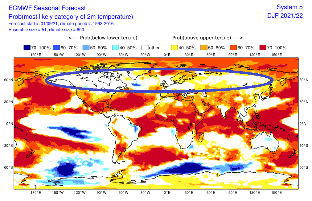
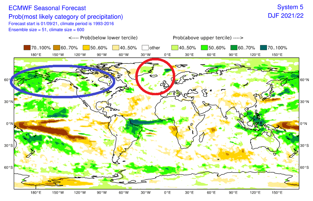
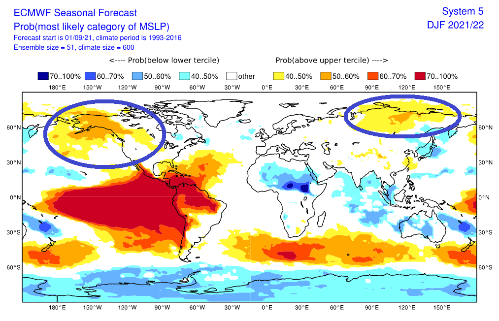
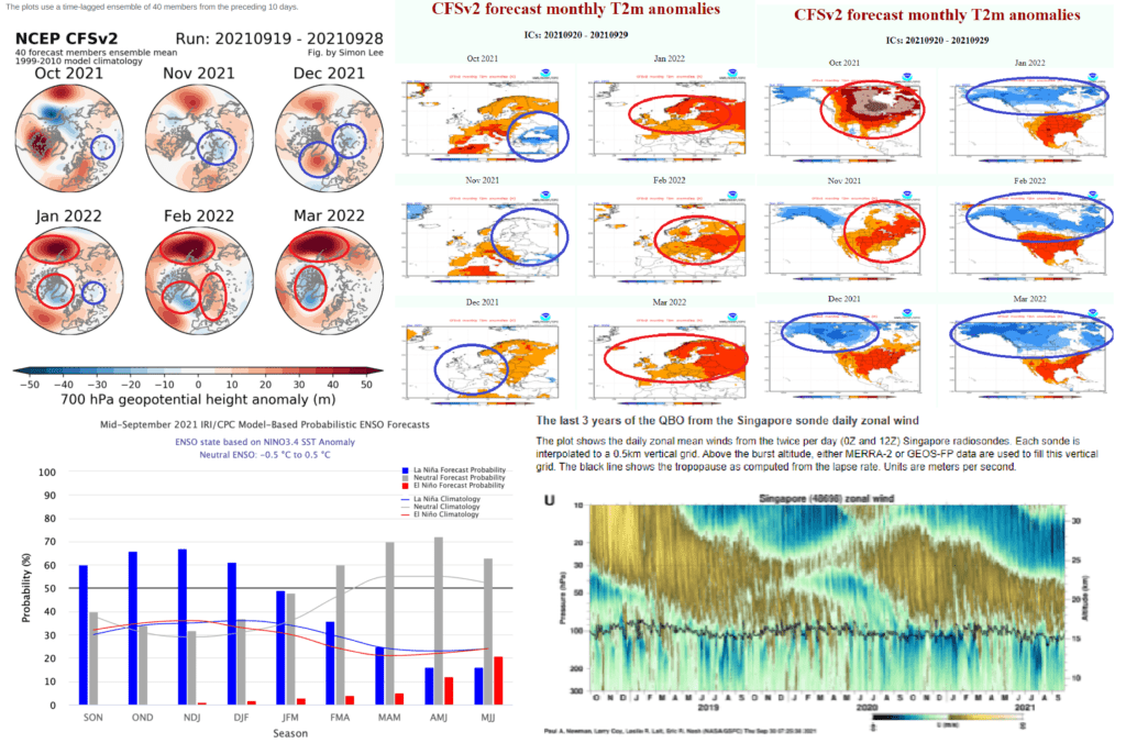
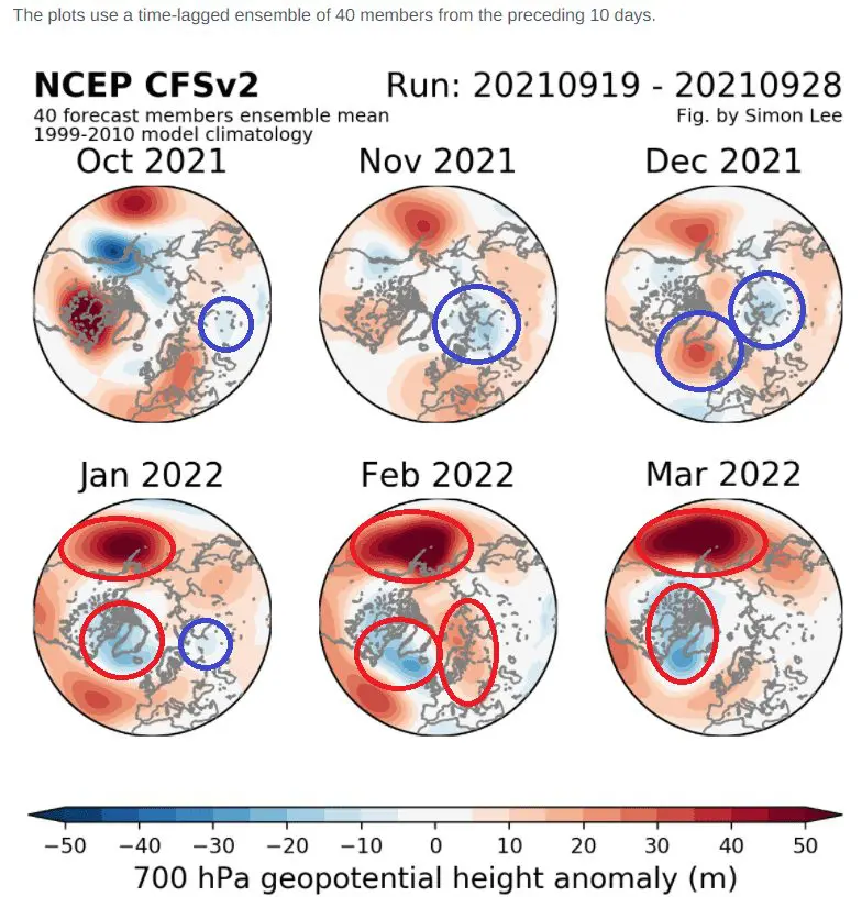
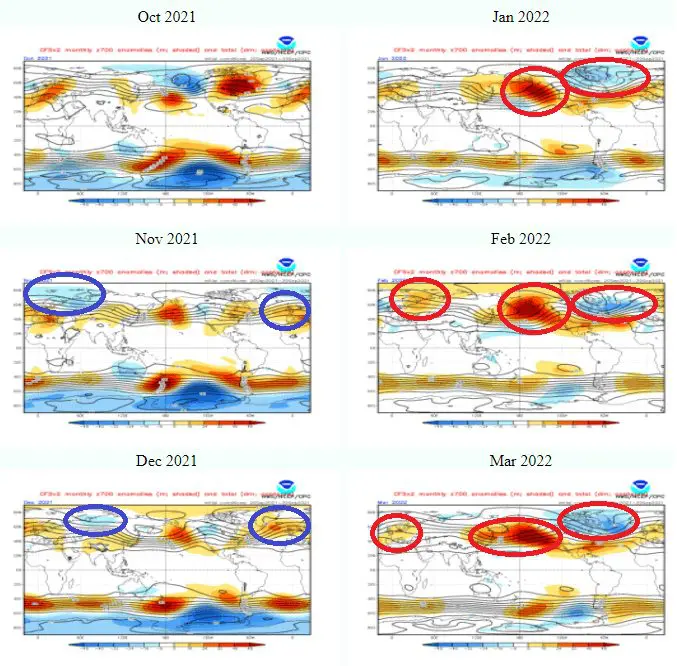
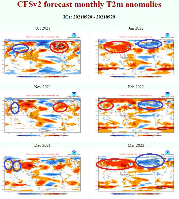
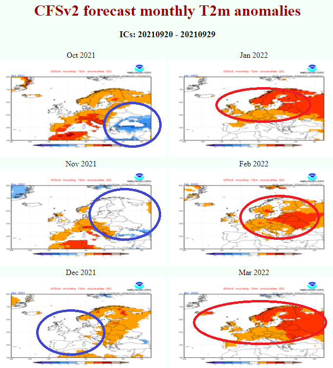
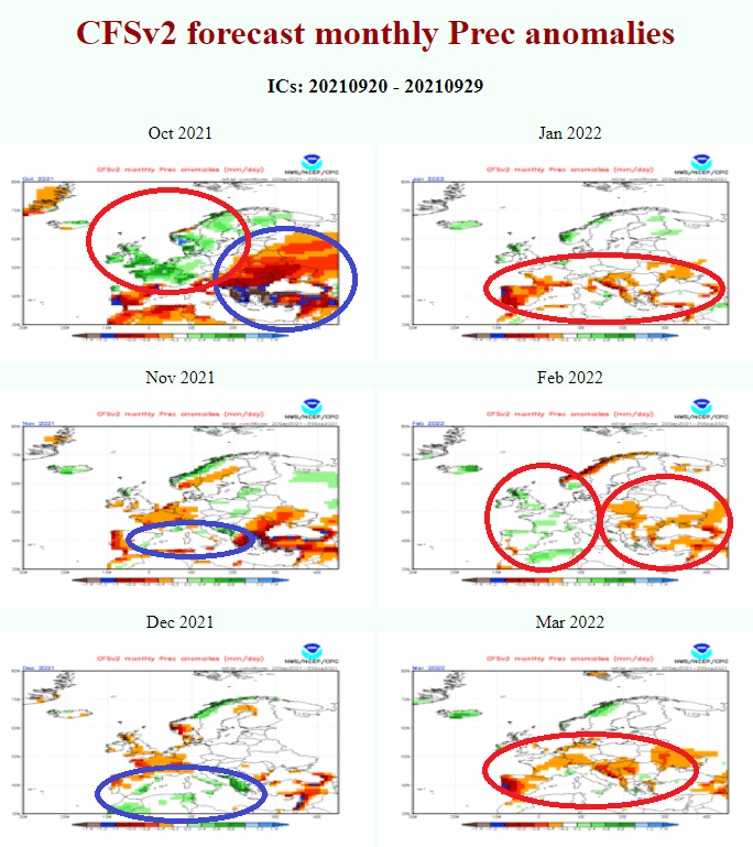
The projected character of Winter 2021/2022 is saying about cold the first ad warm the second half of the period for Europe and large parts of Asia (thanks to forecasted NAO- pattern, high pressure above Iceland, low pressure above northeastern Europe, more precipitation above the Mediterranean in early winter and NAO+, NE Pacific Warm Blob Anomaly, deep pressure above Iceland, dry Azores high above parts of Europe with S/W airflow, dry Mediterranean…).
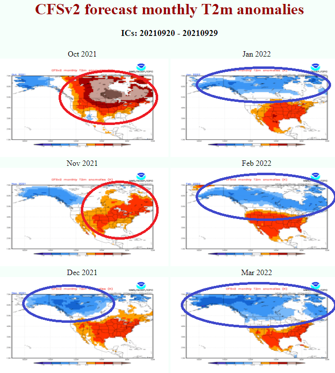
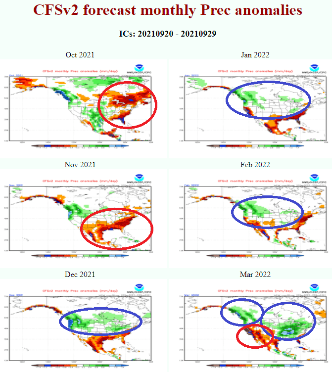
On the other hand, the situation should be thanks to NAO shift opposite in many parts of the USA and eastern Canada, with the warm start of Winter 2021/2022 and extremely cold end of the season. Cold anomaly will be spreading from late Autumn 2021 from Alaska and western Canada above almost all Canada, northern and later central and eastern USA.
Eastern Asia should be affected by NAO+ and NE Pacific Warm Blob anomaly both, during the winter months, with warmer weather, however, with above-average blizzard activity mainly in Eastern Siberia, Far East, Japan, Mongolia, or NE China.
In India and the Middle East, a peak of Winter 2021/2022 should arrive earlier with Western disturbances and NAO- phases in early winter.
Mexico, Central America, and the Caribbean should feel the strongest cooldowns in the second half of winter and early Spring 2021.
In North Africa, the first half of winter should be rainier, in the mountains snowy, while the second half should bring clear colder nights and hotter sunny days (drought).
Southeastern Asia and Amazon will be very stormy.
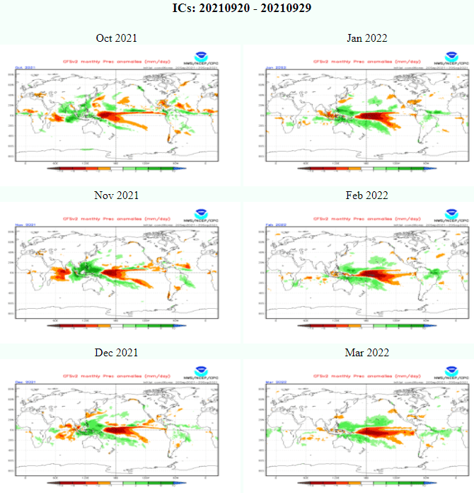
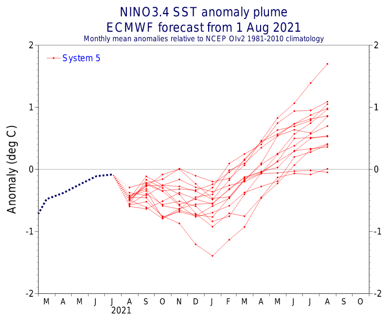
The next La Nina winter, with colder Earth conditions /https://mkweather.com/2022-2023-forecast-chances-for-el-nino// and a fact, that Arctic Sea Ice Extent yearly minimum (on 16. September 2021 at 4,72 million square kilometers (1.82 million square miles)) was 26% greater such as in the year 2020, 12-the lowest on record, and the greatest since 2014! /https://mkweather.com/arctic-sea-ice-extent-26-greater-than-last-year-12th-lowest-on-record-and-the-largest-since-2014// support a higher probability of extreme cold blasts across the Northern Hemisphere during the period, however in outlined character with a peak of winter in Europe and Asia in earlier and in North America in later phases of the season. QBO should stay in a colder easterly phase, yet, what is the next supporting parameter for colder conditions.
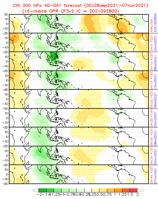
Hurricane season and wet MJO above the Atlantic should bring more tropical storms and hurricanes around 18.-25. October, simultaneously, the end of the month should bring the first bigger coldwaves in Europe, on the backside of low geopotential, gradually shifting eastward, maybe with the first snowfall in lower situated regions (higher tropical activity above North Atlantic correlates with cold spells in the region). The second half of Autumn 2021 appears colder in parts of Eurasia, with early cold blasts and neutral NAO or NAO-, but warmer in parts of North America, excluding northwestern regions.

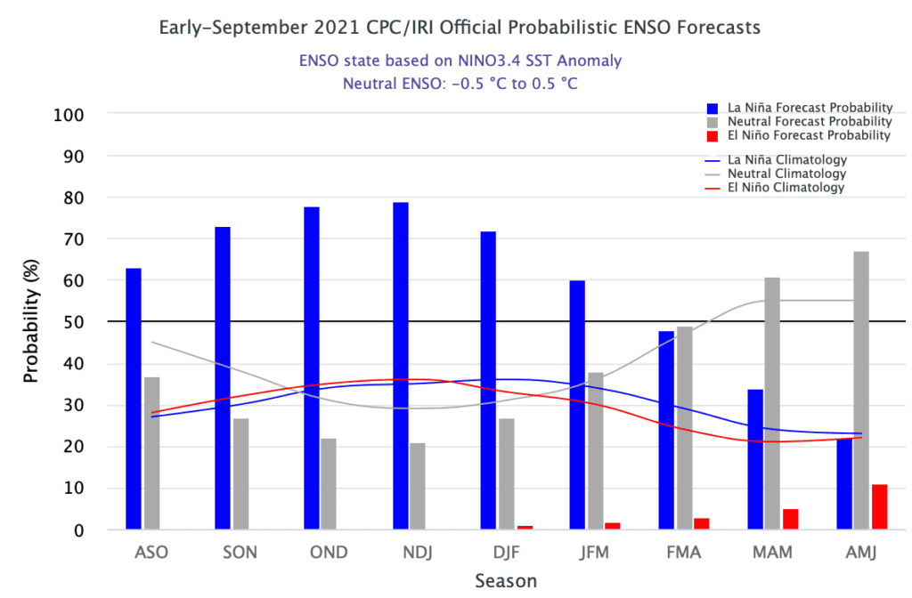
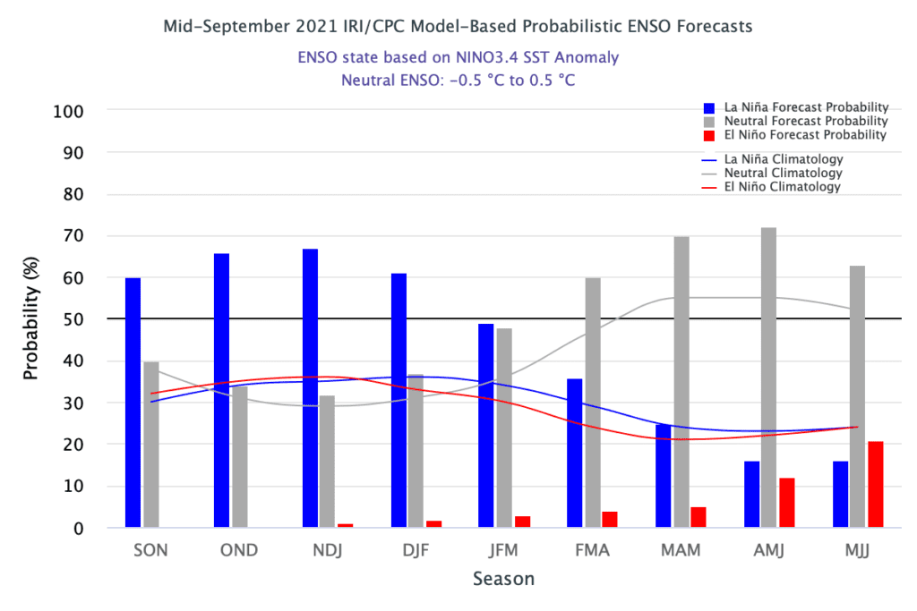
Source: https://iri.columbia.edu/our-expertise/climate/forecasts/enso/current/
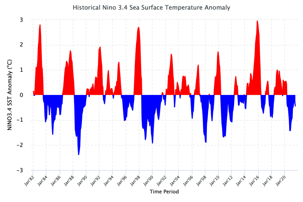
Source: https://iri.columbia.edu/our-expertise/climate/forecasts/enso/current/
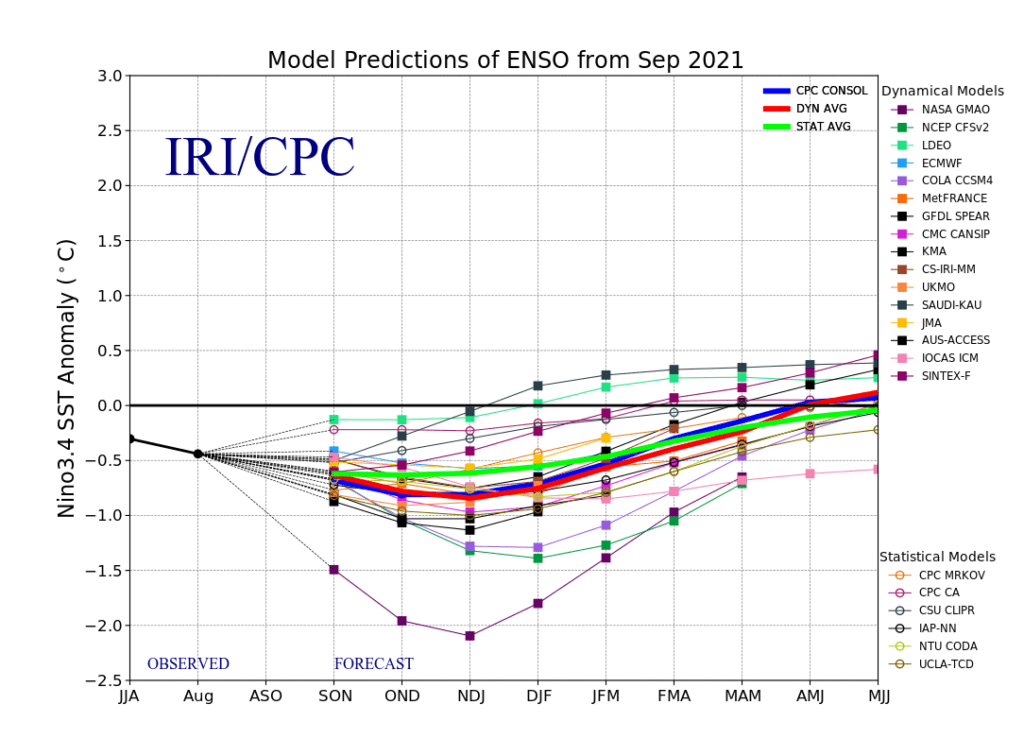
Source: https://iri.columbia.edu/our-expertise/climate/forecasts/enso/current/
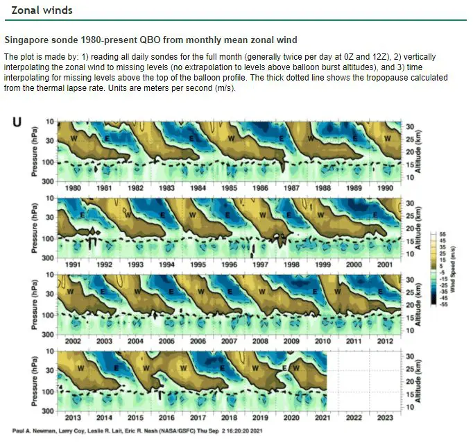
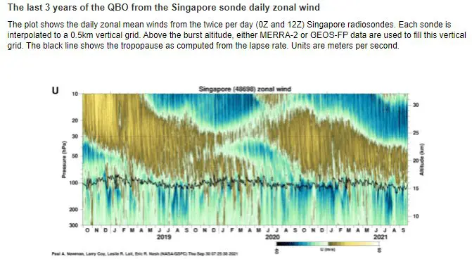
Source: https://acd-ext.gsfc.nasa.gov/Data_services/met/qbo/qbo.html
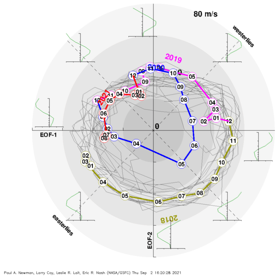
Source: https://acd-ext.gsfc.nasa.gov/Data_services/met/qbo/qbo.html
