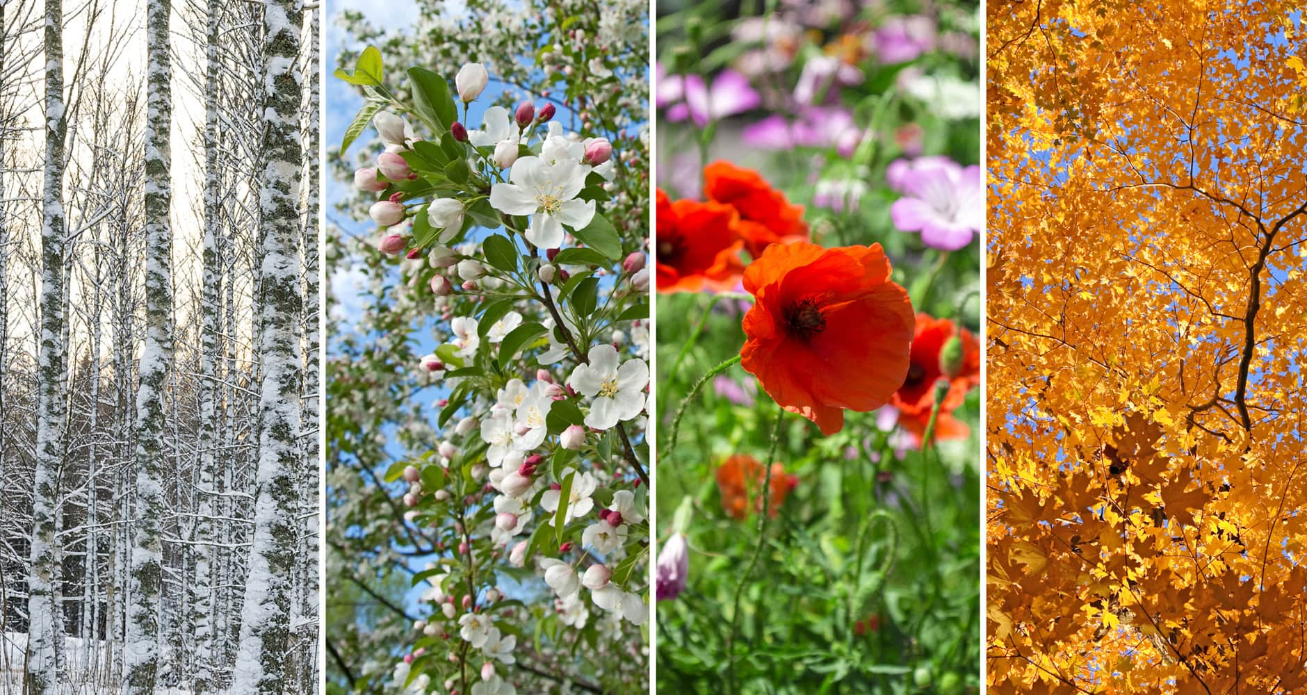
Autumn 2021 is here and we should look at Winter 2021/2022 forecast for Northern Hemisphere.
Continental forecasts for Autumn (in Southern Hemisphere Spring) 2021 we published here: https://mkweather.com/autumn-2021-forecast-for-europe-mostly-dry-and-frosty-autumn-be-prepared-for-early-severe-frosts/; https://mkweather.com/autumn-2021-forecast-for-north-america-long-indian-summer-and-weaker-hurricane-season-such-as-expected/; https://mkweather.com/autumn-2021-forecast-for-asia-strong-monsoon-for-s-se-e-asia-hot-and-dry-in-the-middle-east-late-siberian-cold-blasts-in-w-siberia-and-snow-calamities-in-e-siberia/; https://mkweather.com/spring-autumn-forecast-for-africa-mostly-hot-and-dry-parts-of-sahel-equatorial-africa-stormy-and-south-africa-stormy-and-cold/; https://mkweather.com/spring-2021-forecast-for-australia-and-oceania-under-la-nina-rules-cold-and-stormy-australia-warm-new-zealand-and-various-patterns-in-oceania/; https://mkweather.com/spring-2021-forecast-for-south-america-floods-and-drought-in-many-regions/ and some trends from Autumn will effect upcoming Winter 2021/2022 patterns.
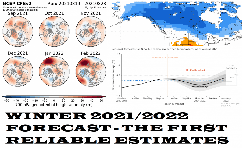
Overall, it appears, that relatively good, in some regions extremely strong Winter 2021/2022 is before us, with many snowfall events and the extreme Arctic and Siberian frosts periods. Relatively good means, that some regions should be with temperatures above average, but with extreme winter periods associated with favorable configurations of the polar vortex.
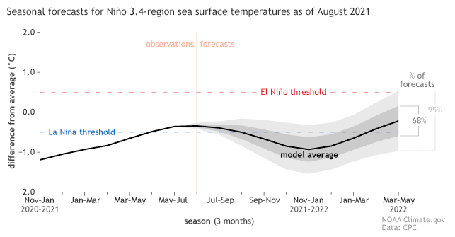
La Nina is forecasted to strengthen during Winter Season 2021/2022, with effects on colder Earth conditions.
It appears, that enough AO- and NAO- phases, bringing the severe Arctic and Siberian blasts will be observed, with main stocks of Arctic air above Canada and the northern USA and Western Siberia, and Eastern Europe. These cold temperature anomalies should produce many coldwaves in the USA and Europe during the upcoming winter – cold blasts should hit Gulf Coast or Iberia, temporarily.
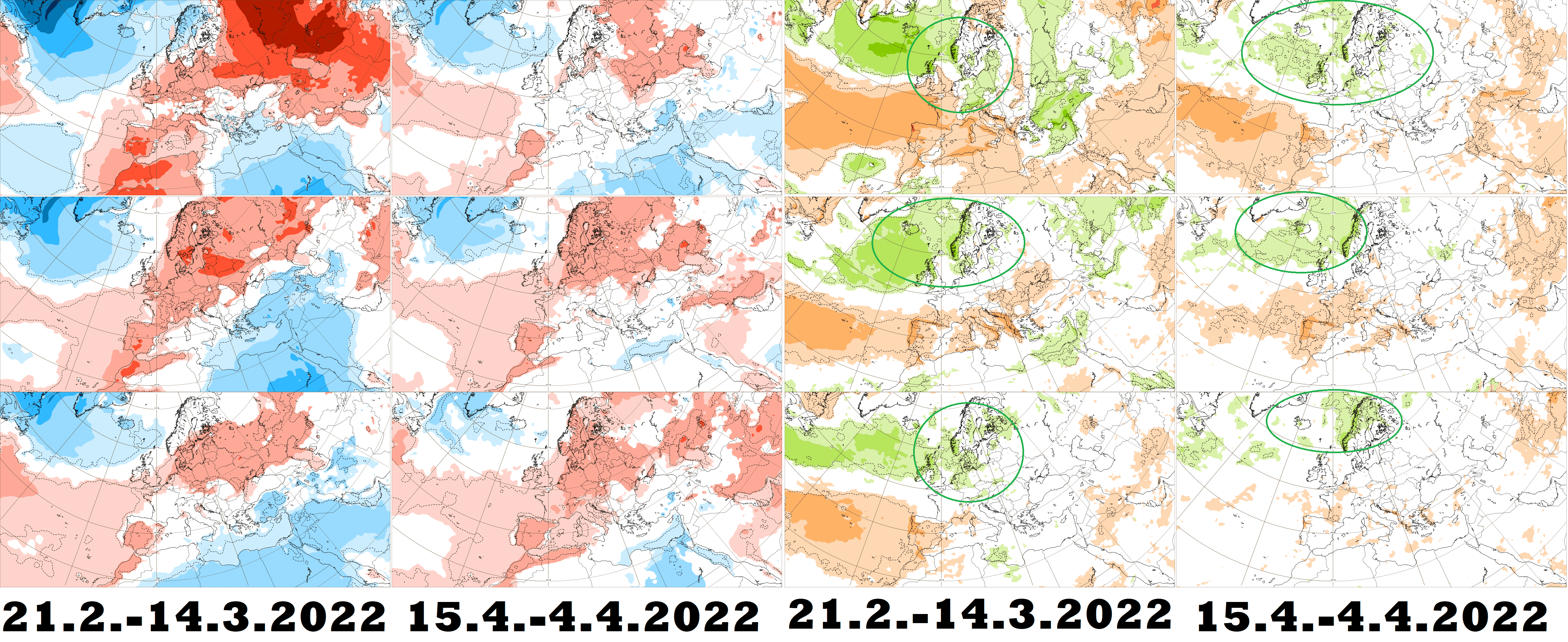
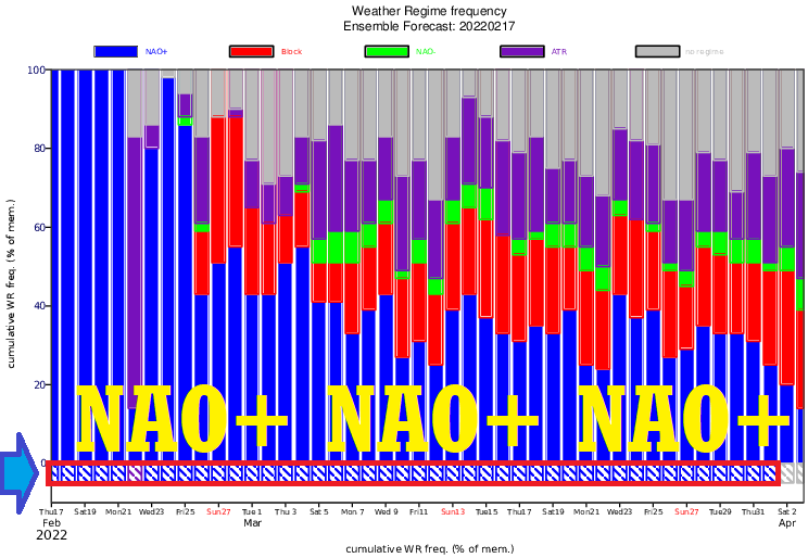
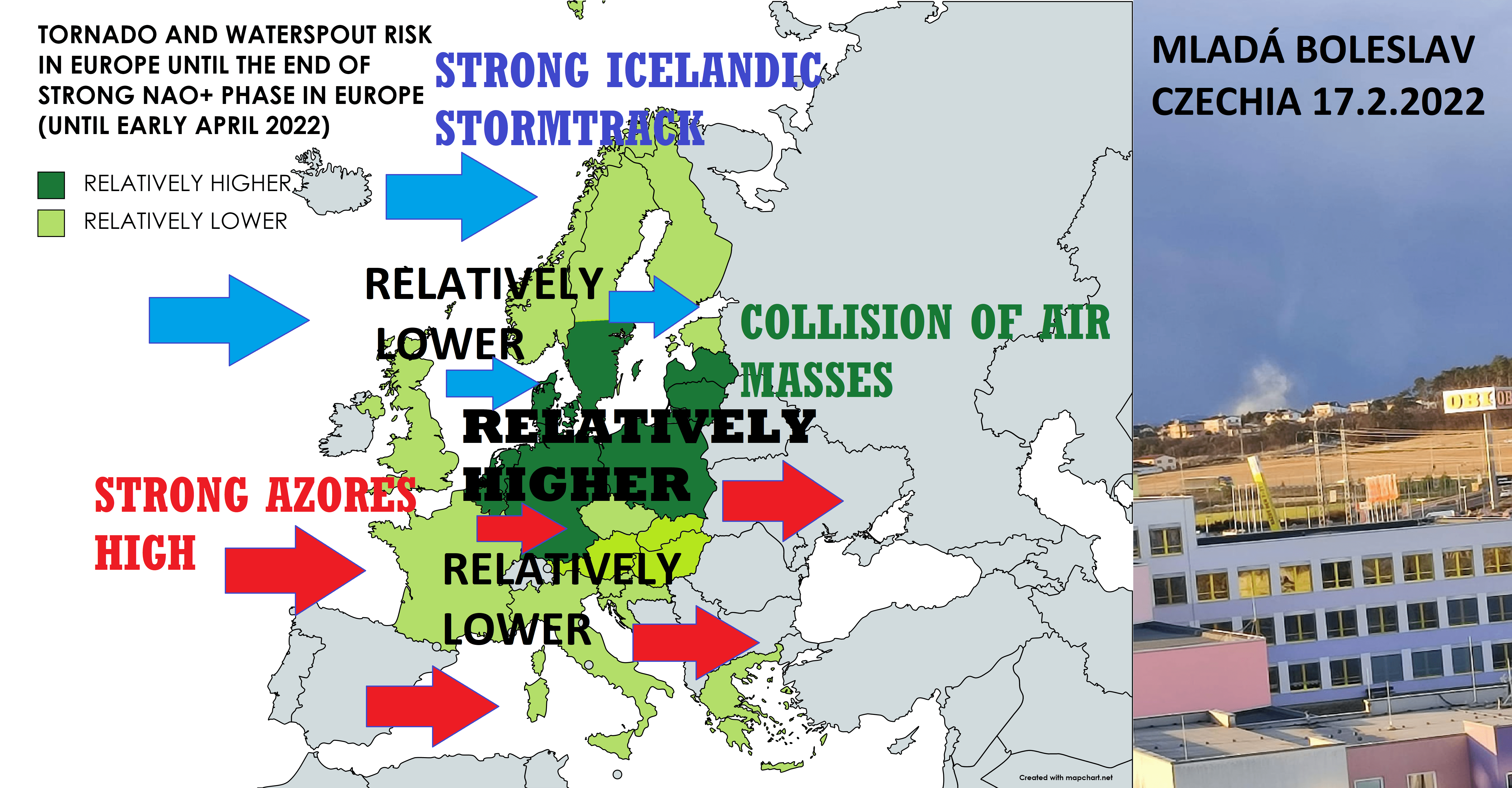
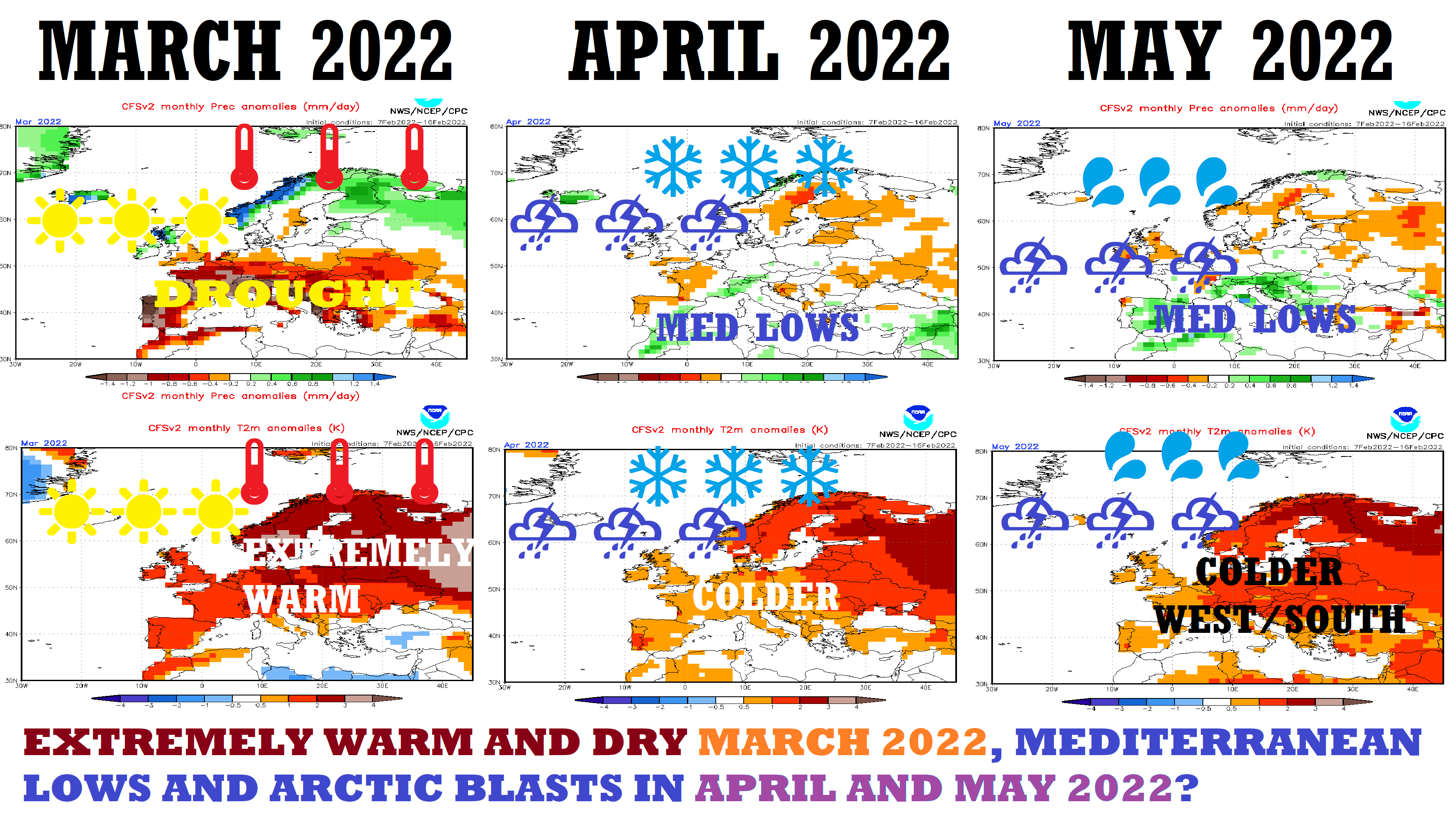
It appears, that later during Winter 2021/2022, low geopotential will be gradually shifting above the western half of Europe, firstly with heavy rains, winds, warm weather, and NAO+ (NE Pacific Warm Blob anomaly), but at the end of Winter 2021/2022 or in March – April 2022 with possible anomalous snowfall and Arctic blasts on the backside of this geopotential anomaly. Central parts of Europe should be thanks to this anomaly very warm on its front side, but eastern parts should be hit by cold Siberian air from Western Siberia, temporarily, too.
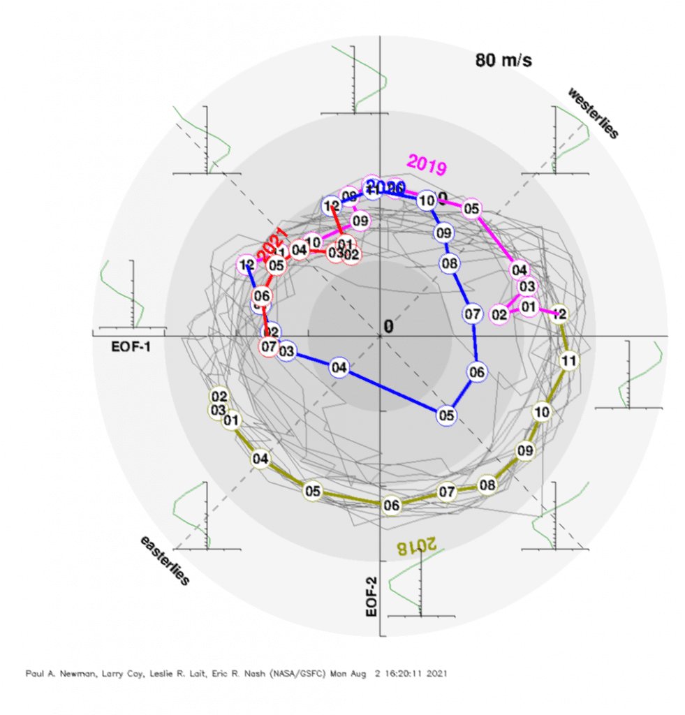
QBO will be shifting from its easterly to westerly phase, but it appears, that during most of Winter 2021/2022 stays neutral.
Surprising will be the extremely low PNA index, which will be associated with abnormal frosts in Canada, Alaska, and the northern USA, which should temporarily hit other parts of the USA or even Mexico, too. Above Northeastern Pacific will build an extremely strong positive geopotential (air pressure) anomaly and on its front side will be persisting during the upcoming winter cold northern air-flow from the Arctic, with above-average precipitation (snowfall).
Not only in Eastern Siberia but too in northern and northeastern China and Japan is expected to be very snowy (although warmer) Winter 2021/2022 – escaping moisture from still the warm Arctic will produce severe blizzards and windstorms.
Eastern Mediterranean should be very warm, but Western Sahara colder, mostly with above-average precipitation, probably thanks to wet anomaly above western half o Europe.
The Middle East is forecasted mostly hot and dry, Central Asia gradually with severe frosts from Western Siberia.
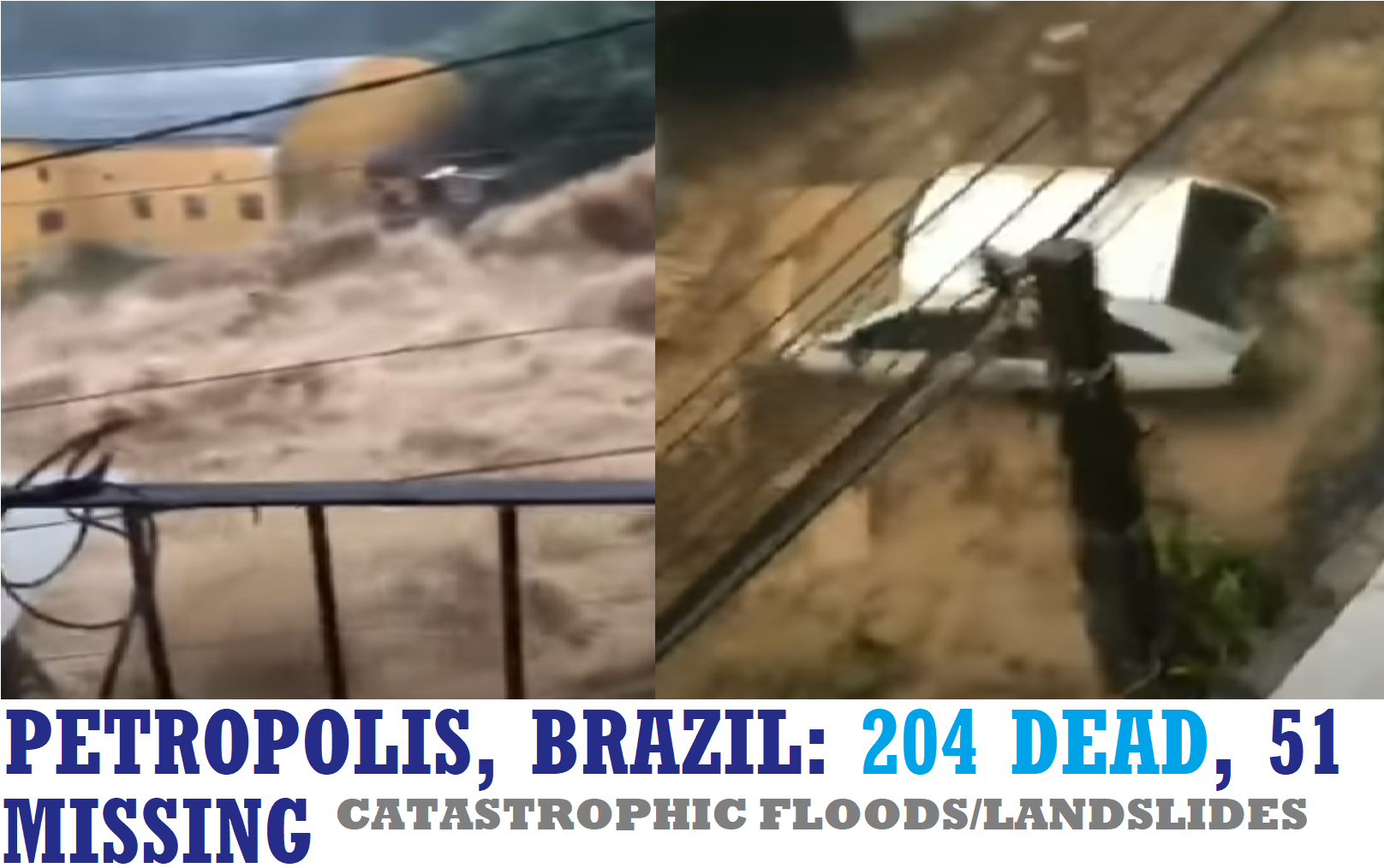
India will be colder and drier, only the southernmost parts should have still cyclone activity with above average rainfall. Thanks to La Nina with MJO and IOD configurations, Winter 2021/2022 in Southeastern Asia will be extremely stormy, with possible severe floods and landslides. A similar situation will be in Amazon and West Africa.
Mexico, parts of Central America, and the Caribbean appear dry or drier such as long-term averages.
Greenland should be very cold for a long time, with stocks of extremely cold air, flooding the western half of Europe, while into the eastern half, winter will be coming from the east.
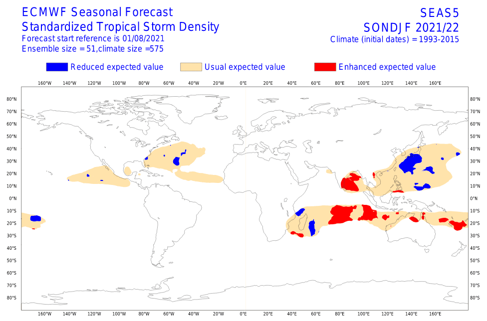
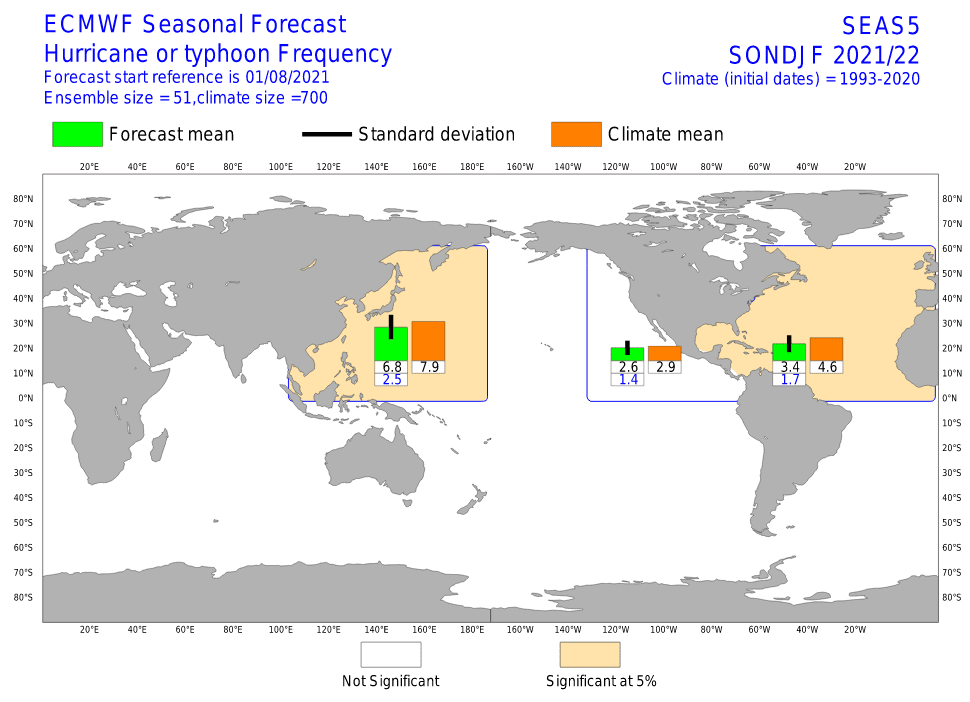
Hurricane season, despite of extreme Hurricane Ida, Category 5, should continue in weaker strength such as forecasted, with dry MJO after 15. September 2021 and possibly the most of October 2021. Some tropical storms or even hurricanes however will be possible in late Autumn 2021 or early Winter 2021/2022. The rest of the Typhoon season is forecasted to be below average, while the rest of the Cyclone season is above average – mainly in the Bay of Bengal.
Detailed forecasts for continents with colored maps and the next winter updates we will bring during Autumn 2021.

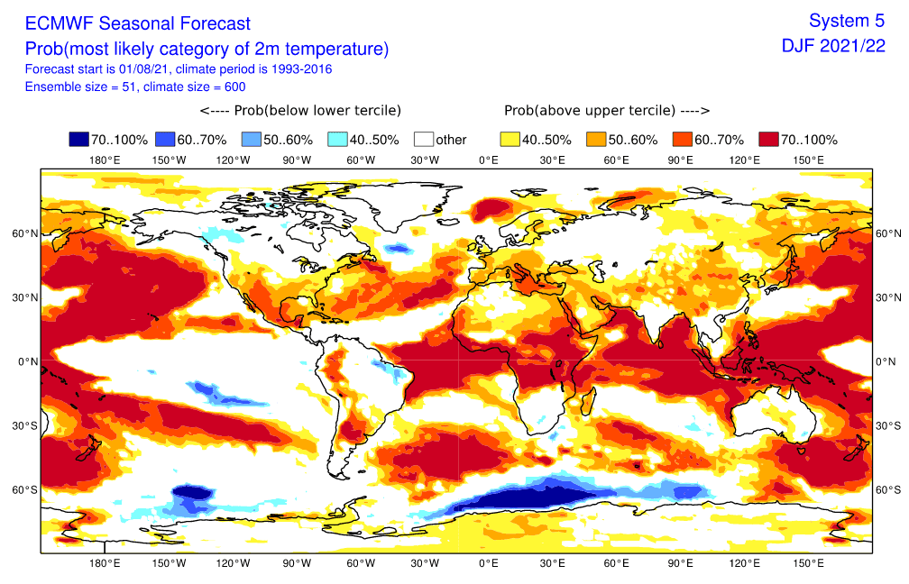
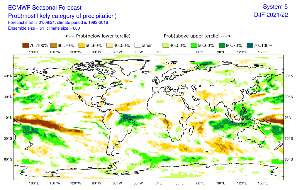
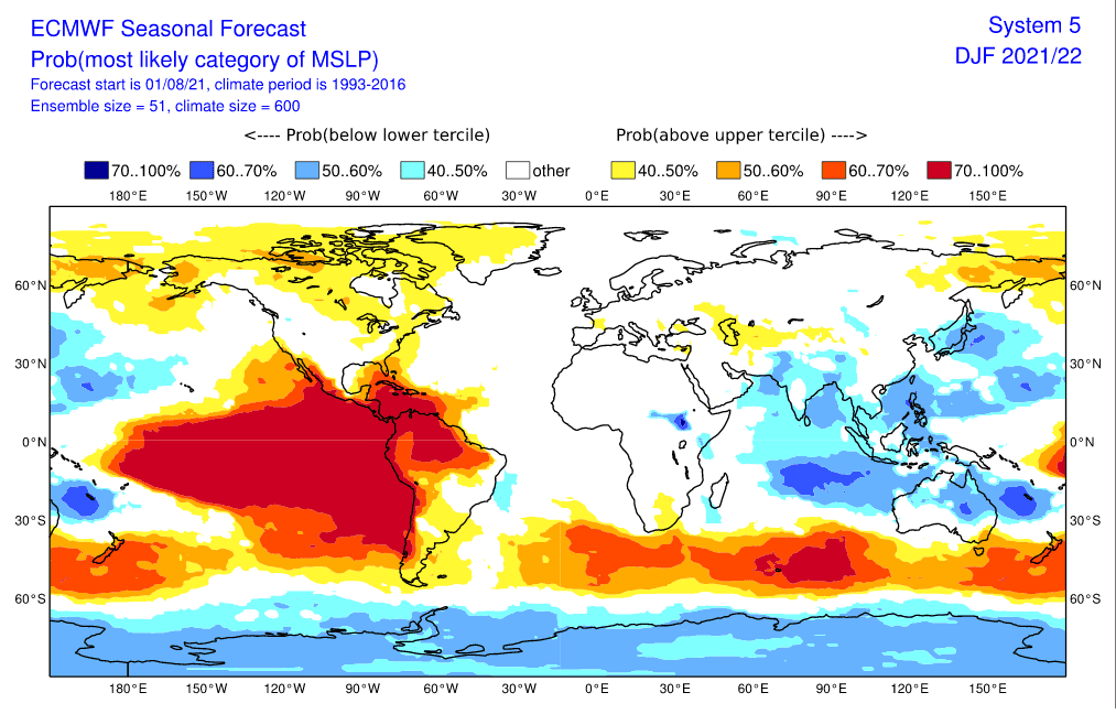
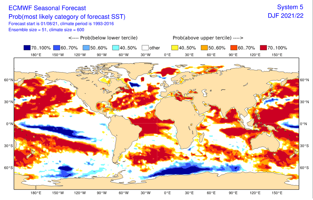
Sources: https://www.ecmwf.int/en/forecasts/charts
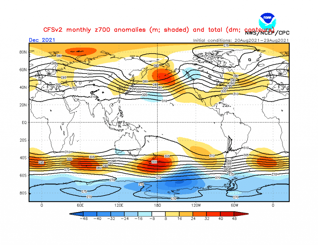
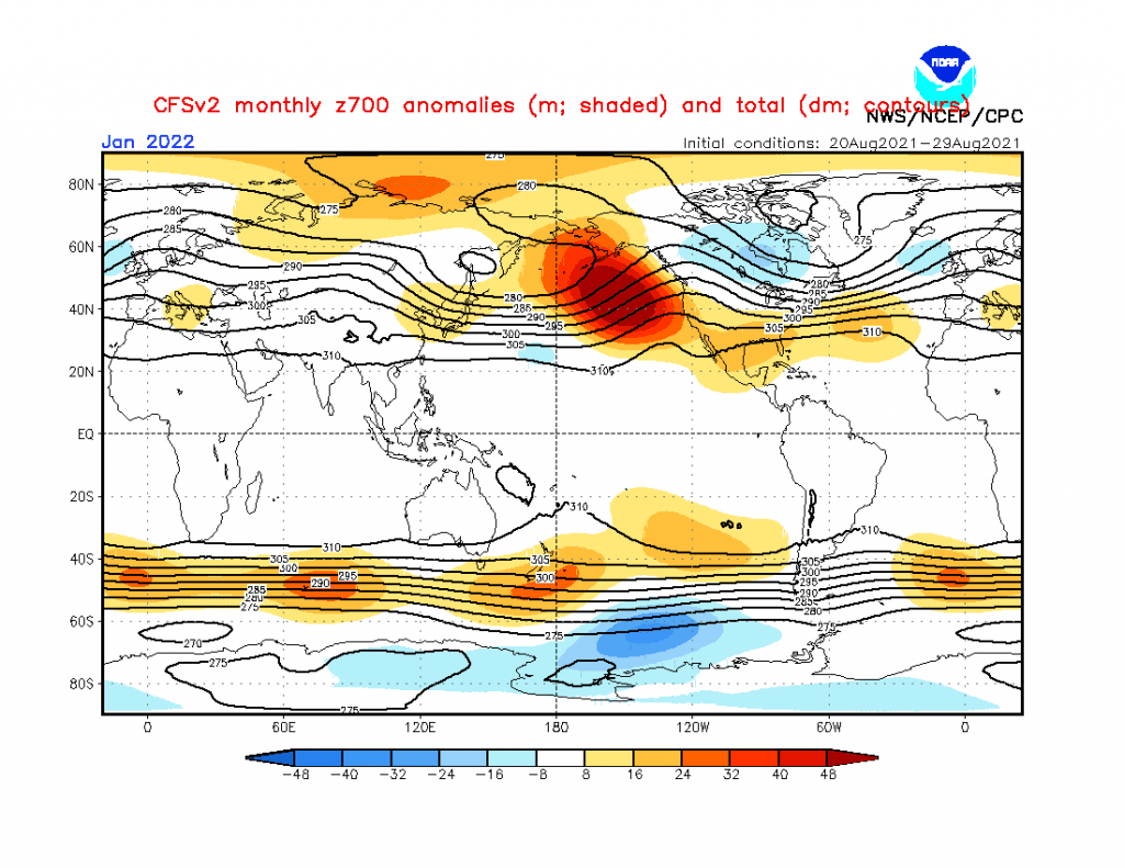
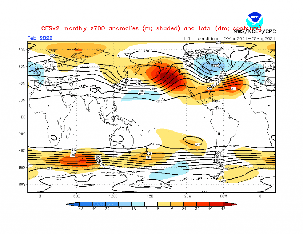
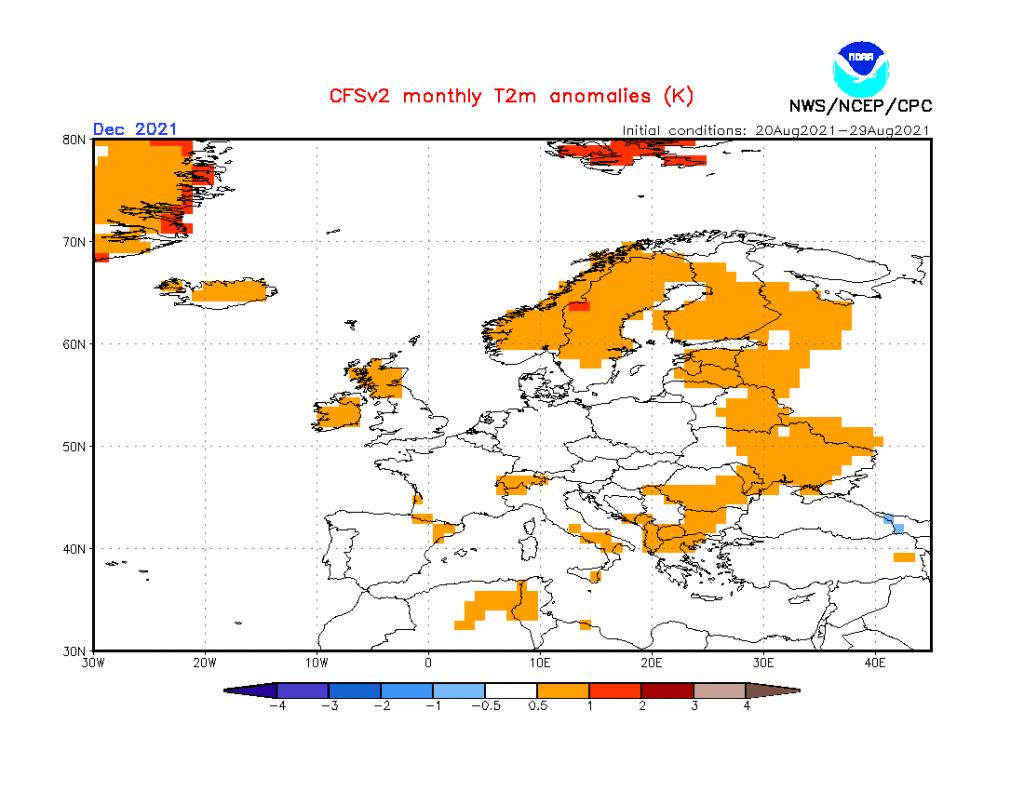
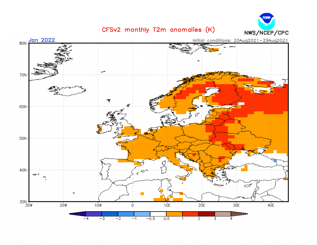
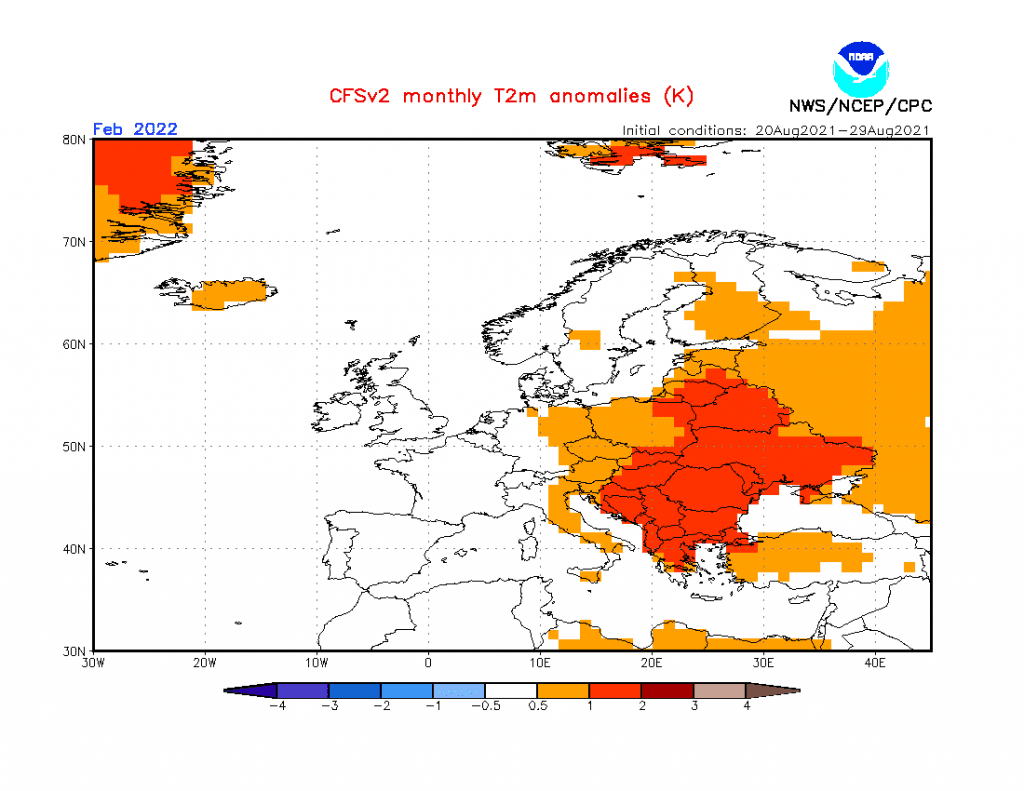
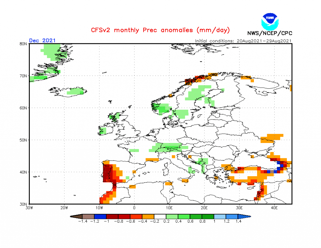
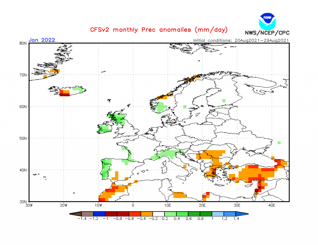
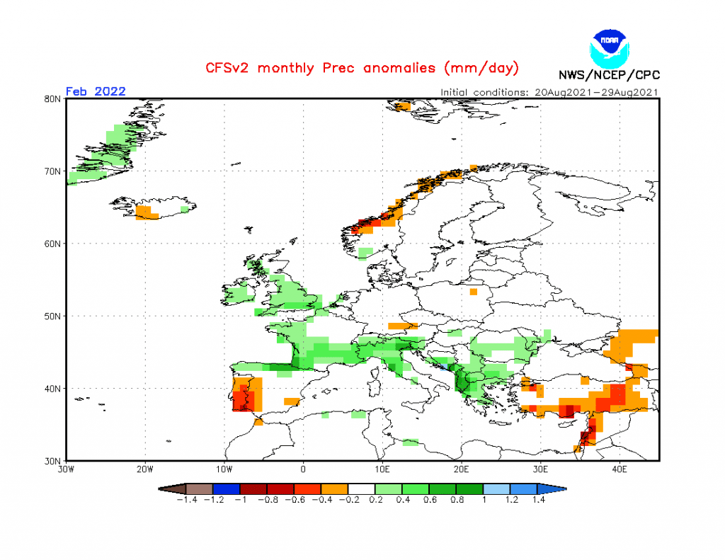
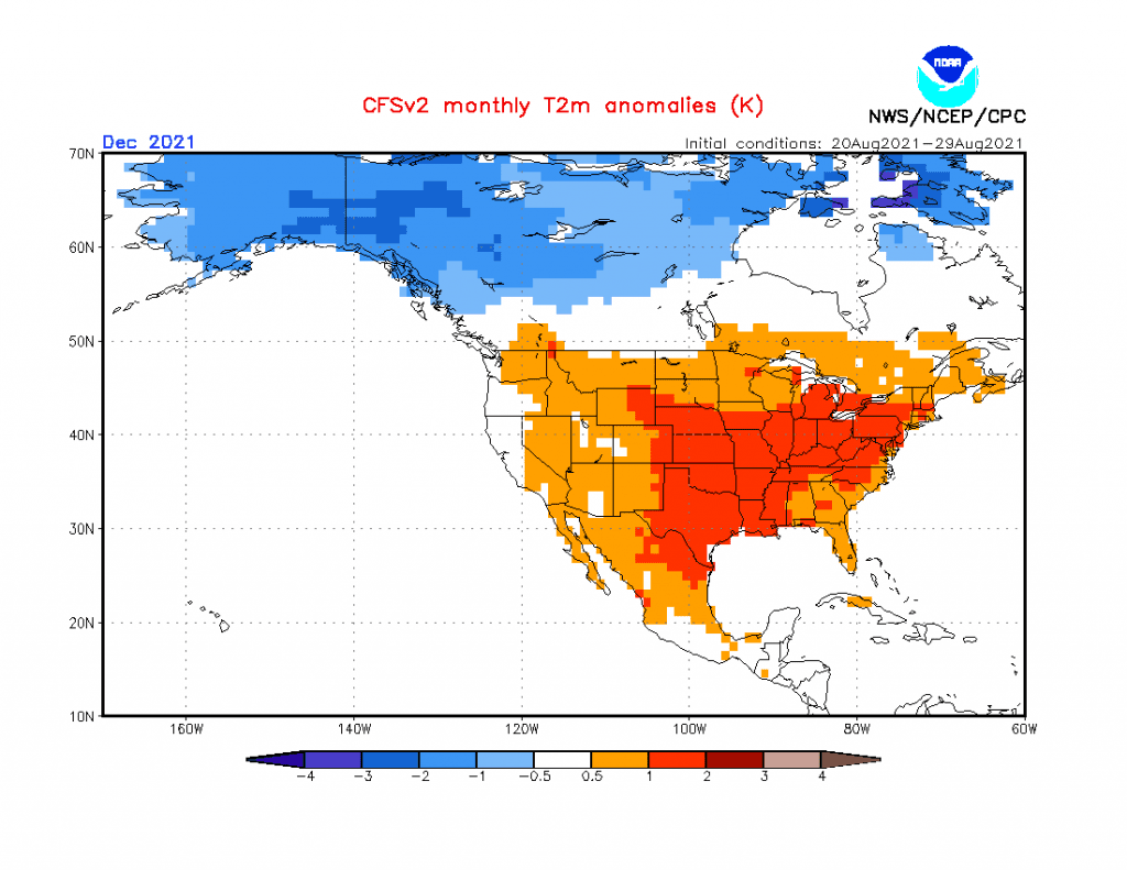
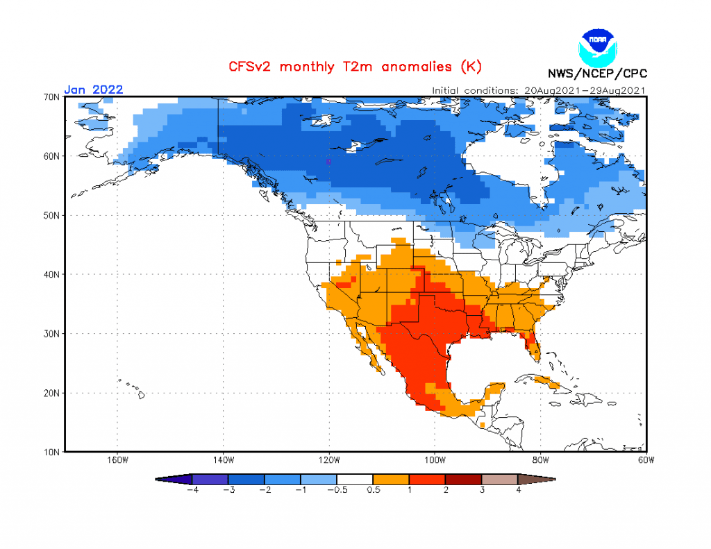
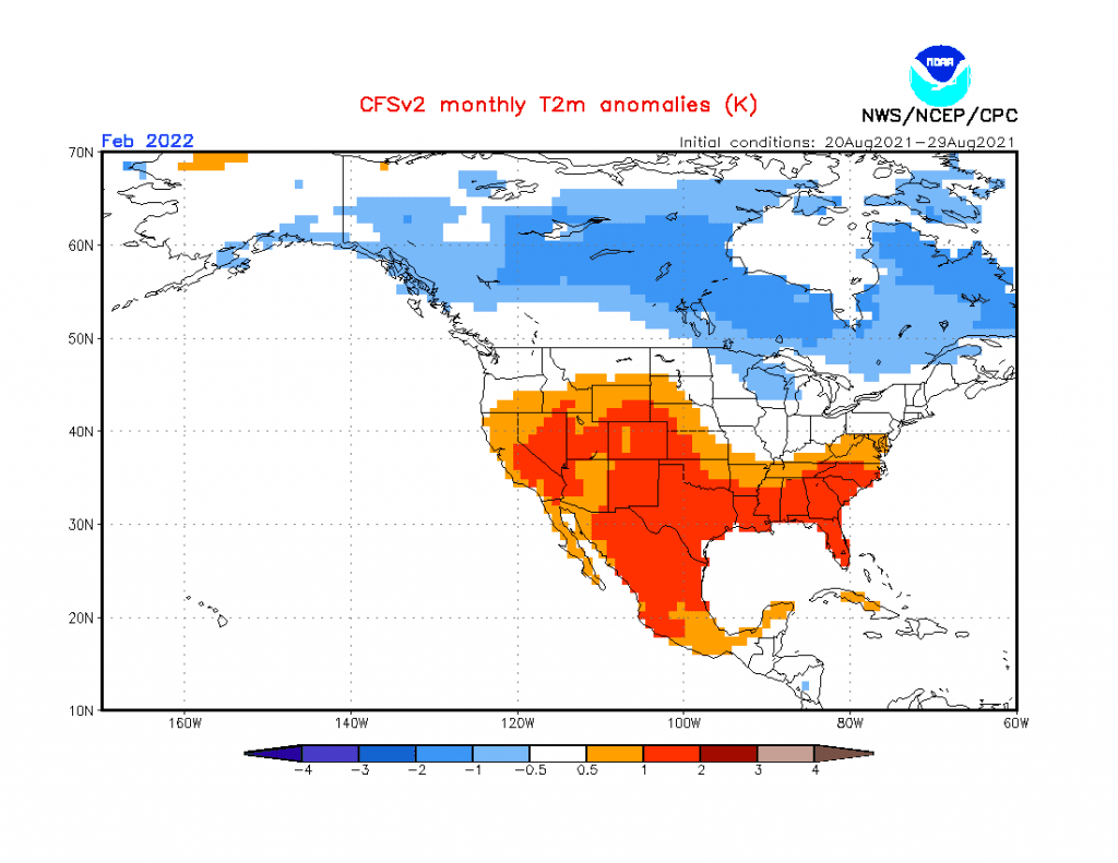
Sources: https://www.cpc.ncep.noaa.gov/products/CFSv2/CFSv2_body.html
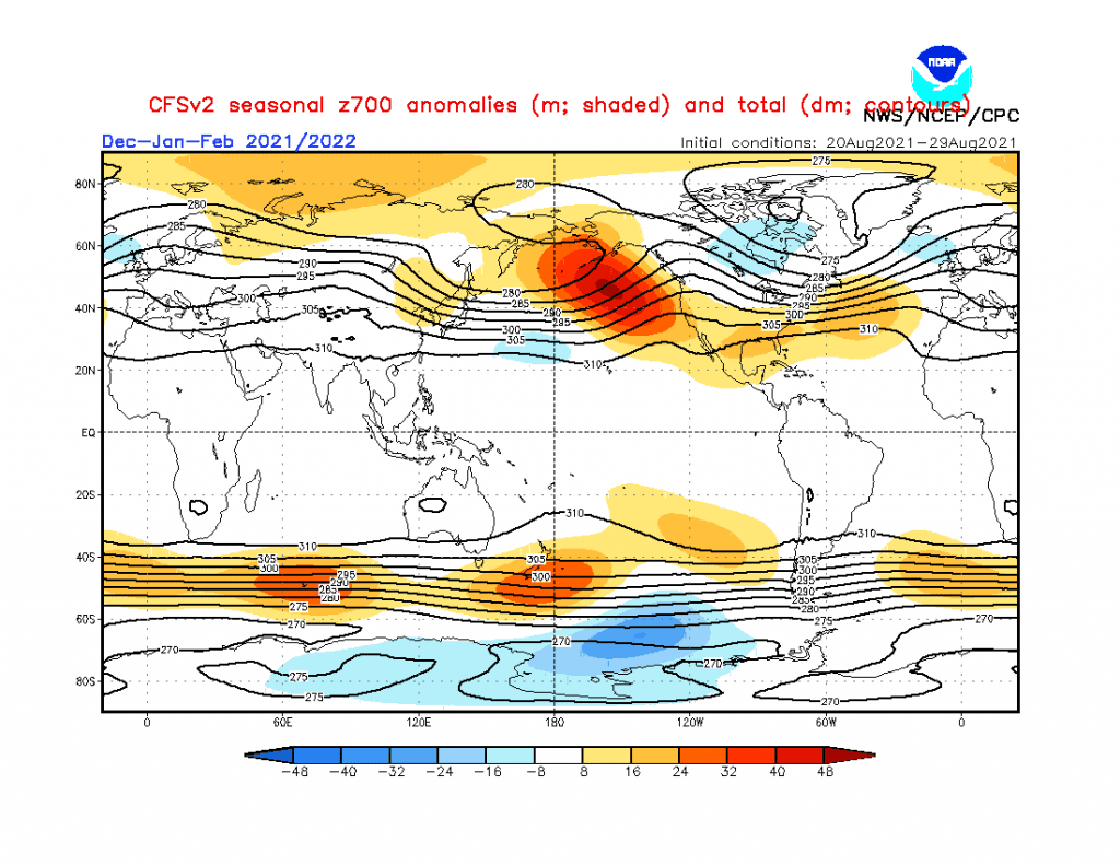
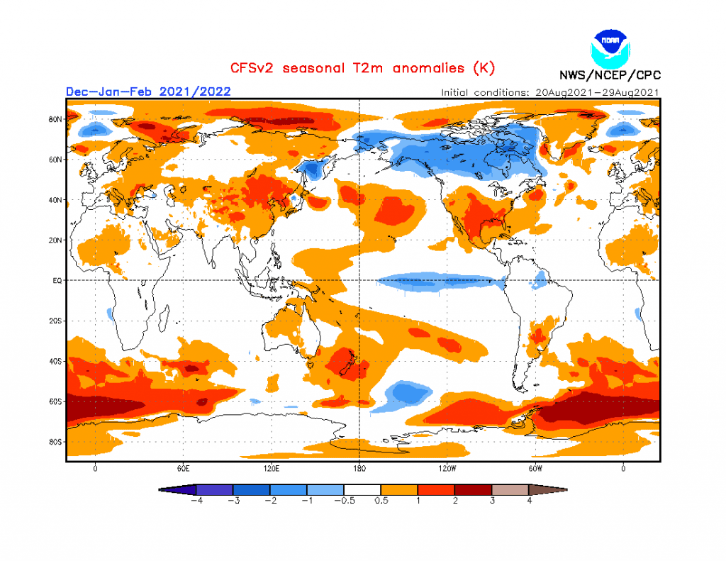
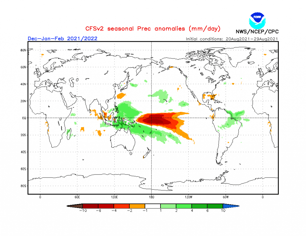
Source: https://www.cpc.ncep.noaa.gov/products/CFSv2/CFSv2_body.html
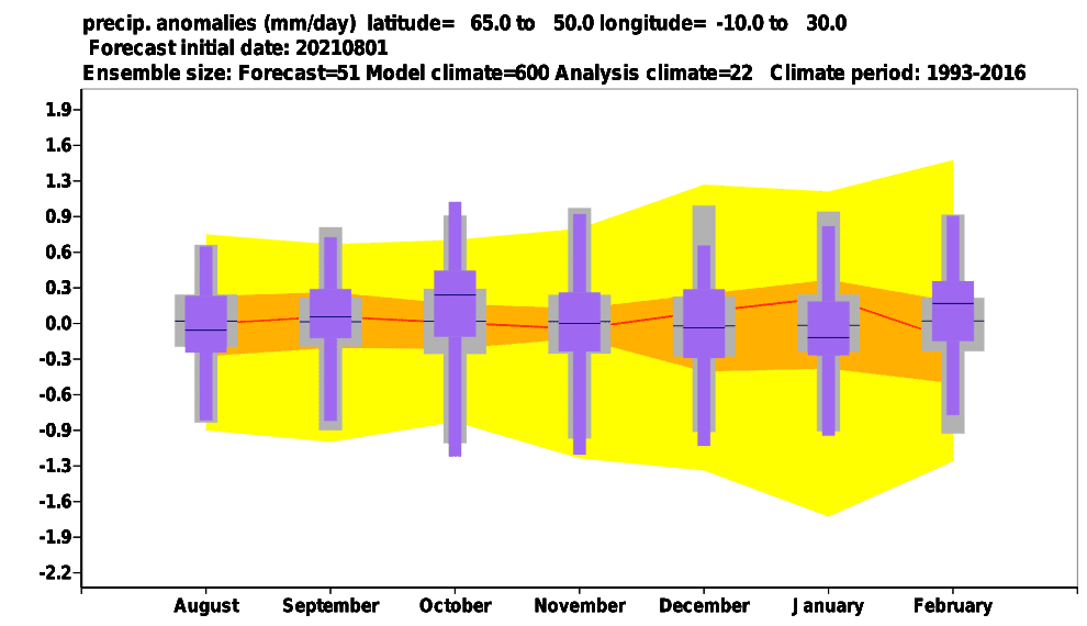
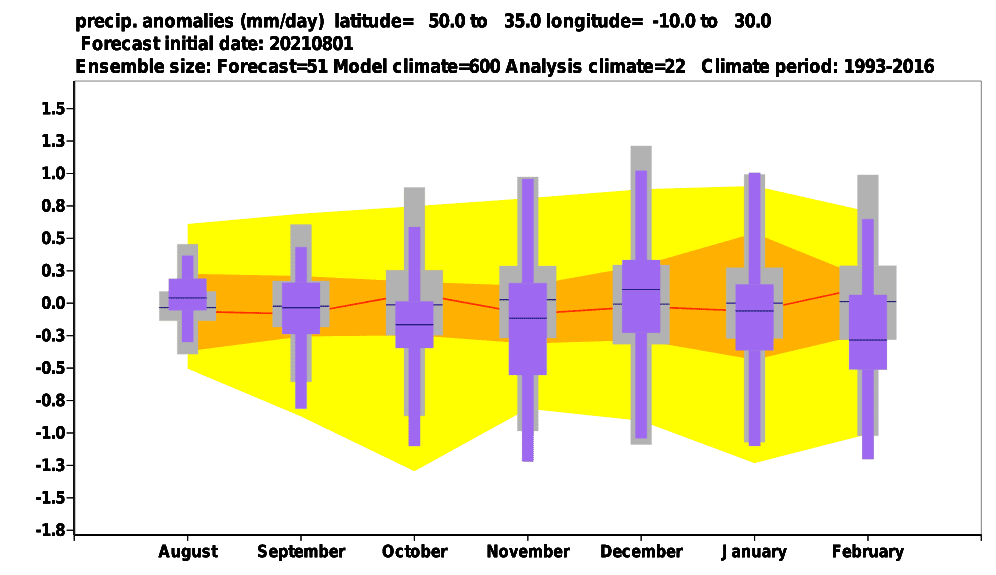
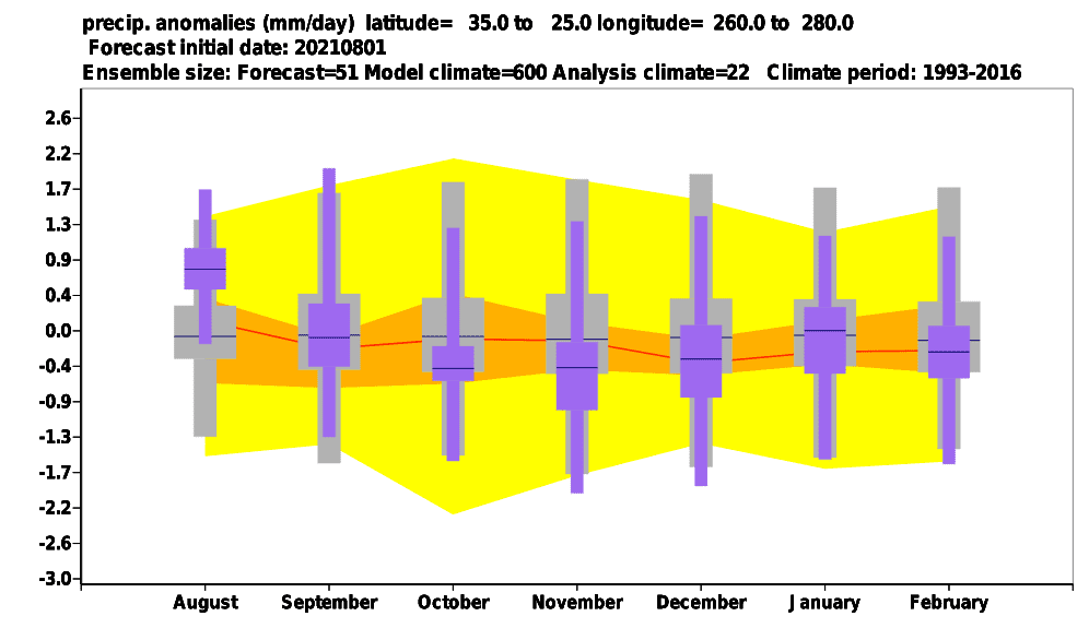
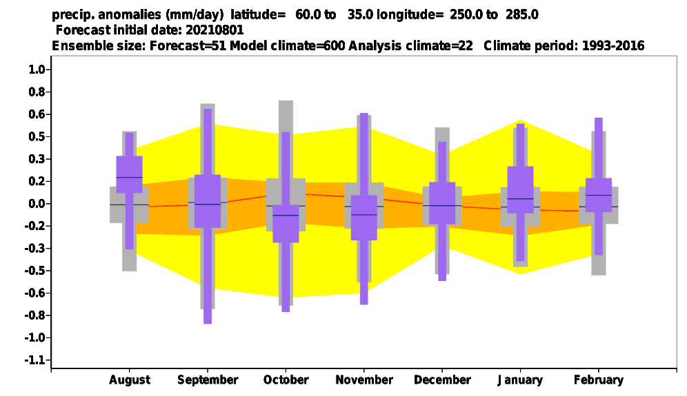
Precipitation – Central North America
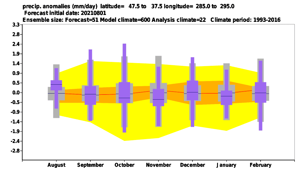
Precipitation – Northeast, USA
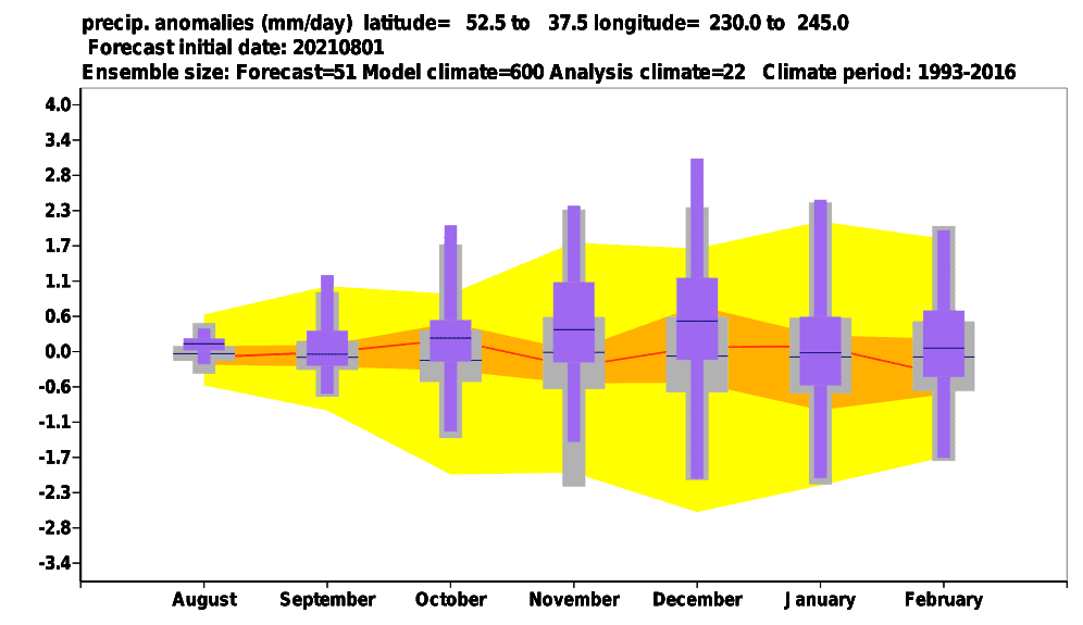
Precipitation – North West Pacific Coast
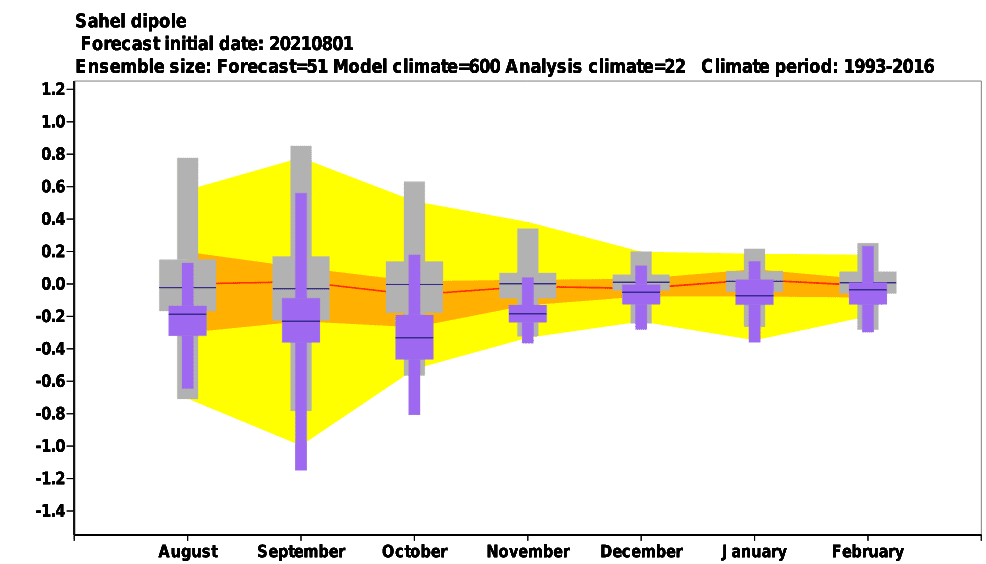
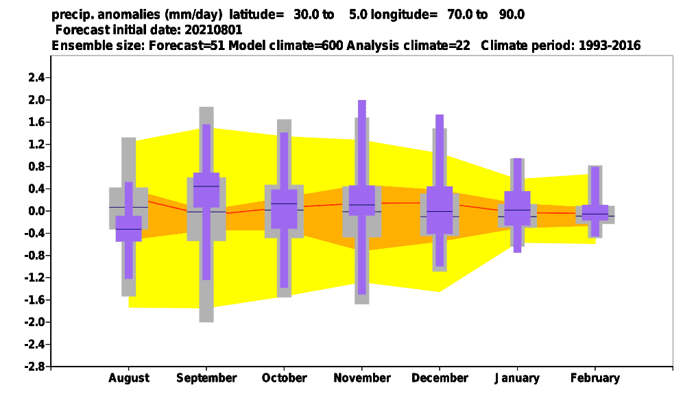
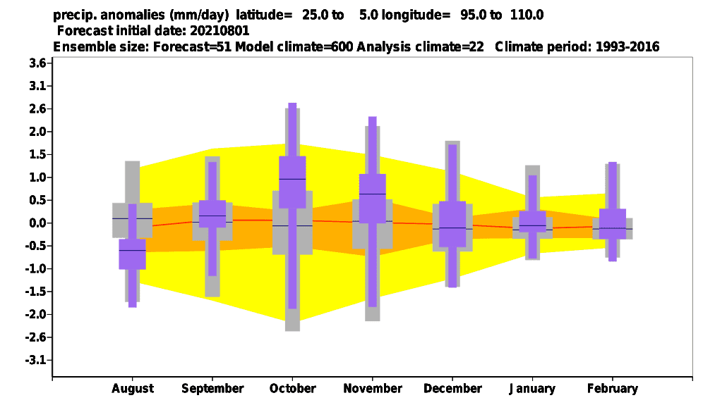
Precipitation: SE Asia
Source: https://apps.ecmwf.int/webapps/opencharts/products/seasonal_system5_climagrams_precipitation?base_time=202108010000&index_type=Southeast%20Asia
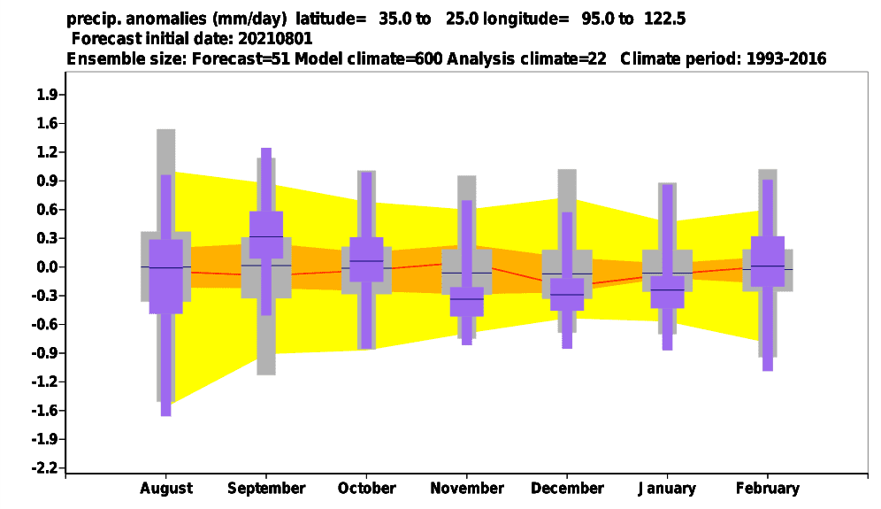
Source: https://apps.ecmwf.int/webapps/opencharts/products/seasonal_system5_climagrams_precipitation?base_time=202108010000&index_type=China
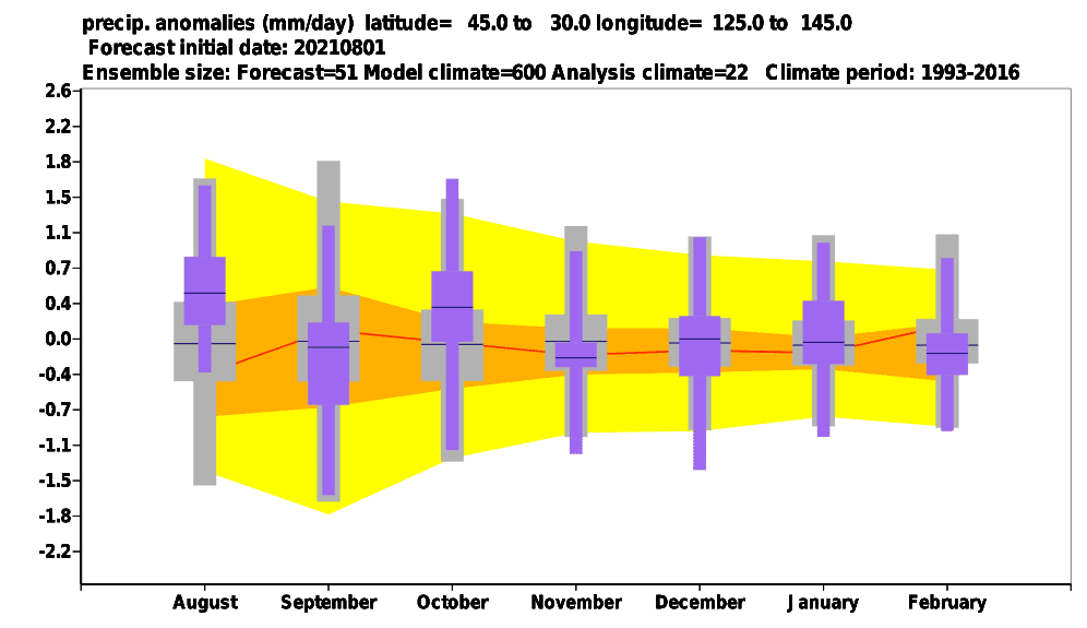
Source: https://apps.ecmwf.int/webapps/opencharts/products/seasonal_system5_climagrams_precipitation?base_time=202108010000&index_type=Japan%20Korea
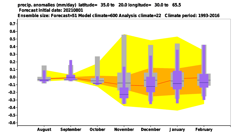
Source: https://apps.ecmwf.int/webapps/opencharts/products/seasonal_system5_climagrams_precipitation?base_time=202108010000&index_type=Middle%20East
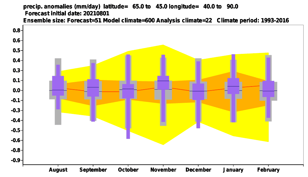
Source: https://apps.ecmwf.int/webapps/opencharts/products/seasonal_system5_climagrams_precipitation?base_time=202108010000&index_type=Central%20Asia
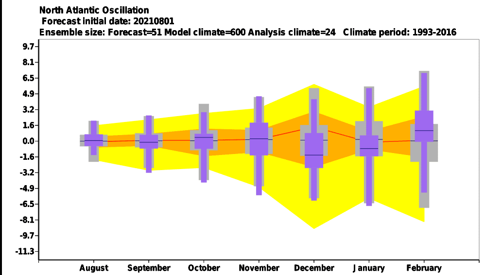
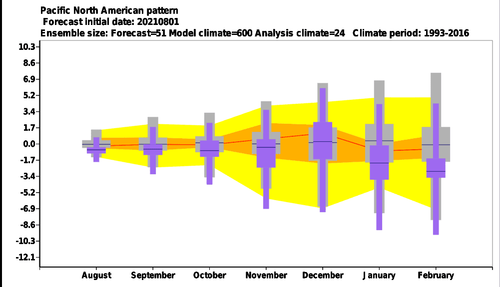
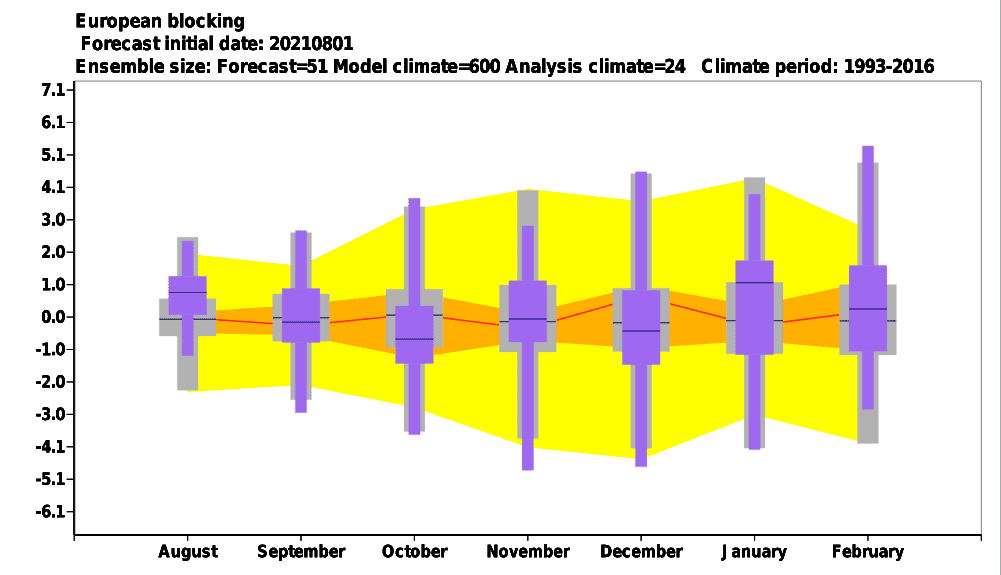
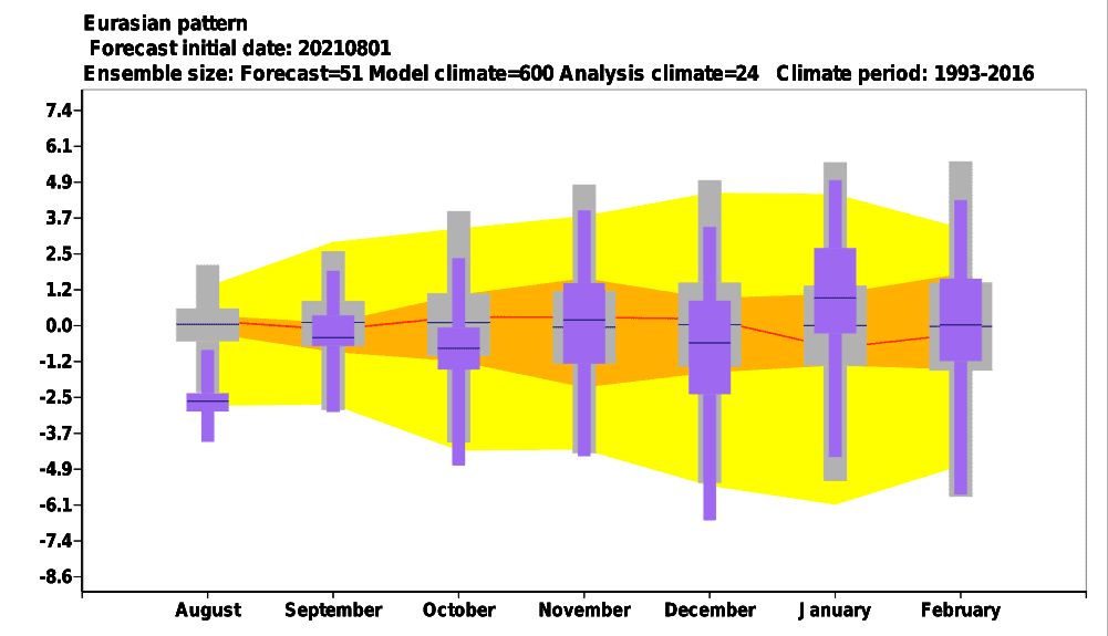
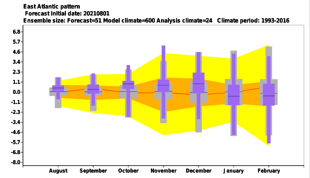
Sources: https://apps.ecmwf.int/webapps/opencharts/products/seasonal_system5_climagrams_teleconnection

