The last updates of the Winter 2021/2022 forecast we published here – and it appears, that while some patterns are staying in predictions, some forecasts have been already changed (and in this article we will look on them): https://mkweather.com/winter-2021-2022-forecast-extreme-frosts-in-eurasia-in-december-in-north-america-in-february-early-canadian-stratospheric-warming-ne-pacific-blob-la-nina-qbo-and-shift-from-nao-to-nao-such-le/; https://mkweather.com/winter-2021-2022-forecast-chances-for-white-christmas-2021-are-higher-than-usual-a-hope-for-nao-and-return-of-winter-conditions-in-february/; https://mkweather.com/winter-2021-2022-forecast-a-peak-near-nao-already-in-december-ne-pacific-warm-blob-nao-and-early-spring-in-february-north-america-oppositely-warm-start-cold-end-of-winter/https://mkweather.com/mkweather-special-forecast-for-the-next-3-seasons-cold-autumn-2021-warmer-winter-2021-2022-cold-spring-2021-for-europe-a-peak-of-winter-in-its-colder-first-half-north-america-with-extreme-cold-2021-20/; https://mkweather.com/winter-2021-2022-forecast-the-first-reliable-estimates-extreme-cold-blasts-from-canada-and-western-siberia-snow-in-western-europe-and-eastern-asia-la-nina-qbo-to-qbo-shift-sufficient-nao-ao/. You should look at ENSO outlook, too /https://mkweather.com/2022-2023-forecast-chances-for-el-nino//. It is also worth mentioning the Russian forecast for Siberia for Winter 2021/2022 /https://mkweather.com/russian-meteorologists-expect-extreme-winter-around-december-january-2021-22//.
Continental forecasts for Winter (in Southern Hemisphere Summer) 2021/2022 for Europe, North America, Asia, Africa, Australia and Oceania, South America and Antarctica we published here: https://mkweather.com/winter-2021-2022-forecast-for-europe-early-extreme-arctic-and-siberian-blasts-and-blizzards-late-dry-and-very-warm-conditions/; https://mkweather.com/winter-2021-2022-forecast-for-north-america-a-peak-of-winter-with-extreme-arctic-blasts-and-blizzards-in-february-2022/; https://mkweather.com/winter-2021-2022-forecast-for-asia-early-extreme-arctic-and-siberian-blasts-and-blizzards-late-dry-and-warm-conditions/; https://mkweather.com/winter-and-summer-2021-2022-forecast-for-africa/; https://mkweather.com/summer-2021-2022-forecast-for-australia-and-oceania-stormy-colder-la-nina-pattern-above-the-continent/; https://mkweather.com/summer-2021-2022-forecast-for-south-america-stormy-north-hot-and-dry-south-cold-and-dry-pacific-coast/; https://mkweather.com/summer-2021-2022-forecast-for-antarctica//.
Sun activity is increasing
In the last period, the first significant eruptions of the 25th cycle have appeared. Despite the current awakening of the Sun, in the next decades and centuries, very weak Solar activity is predicted, which should mean more El Nino phases and AO- / NAO- winters, such as in early 21. century. The last time, when solar activity was long-termly below average, during Little Ice Age, most of the years brought El Nino and strong AO-/NAO- with powerful cold blasts across Northern Hemisphere.
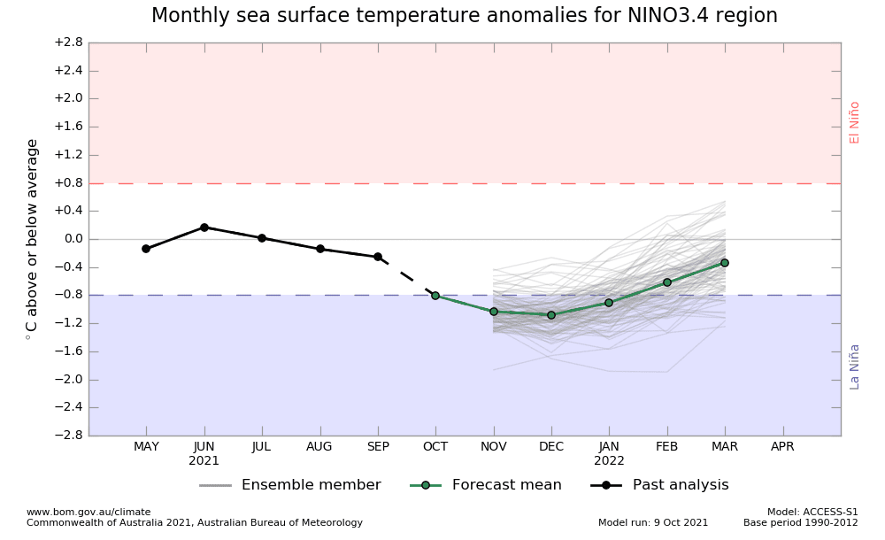
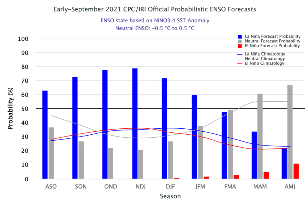
This winter, however, will be La Nina, with mostly neutral AO/NAO, and El Nino is forecasted to come around Autumn 2022, only, therefore, chances of NAO- in the next 3 winters will be thanks to El Nino quite increased.
La Nina brings cold winter to Canada and the northern USA
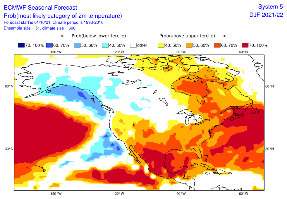
Together with possible NAO+ phases, and other important parameters (e.g. North Pacific Warm Blob anomaly), La Nina is bringing very cold winter conditions to Alaska, western and central Canada, near NAO+ including eastern Canada and Great Lakes area and severe cold blasts are affecting northern parts of the USA very strongly, too.
Across the world, La Nina has a positive effect on harvests in many equatorial and tropical regions, thanks to much rainfall (El Nino is dry, with heatwaves and wildfires).
La Nina is bringing cooling Earth conditions, but with mostly a result of NAO+ in northern latitudes, therefore effects of cold Earth are compensated by warmer extratropical circulation patterns.
In the case of Major SSW, La Nina should produce extreme coldwaves across Northern Hemisphere, too, including the last winter, Winter 2020/2021.
Neutral or slightly negative NAO / AO
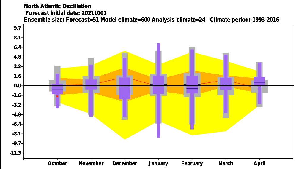
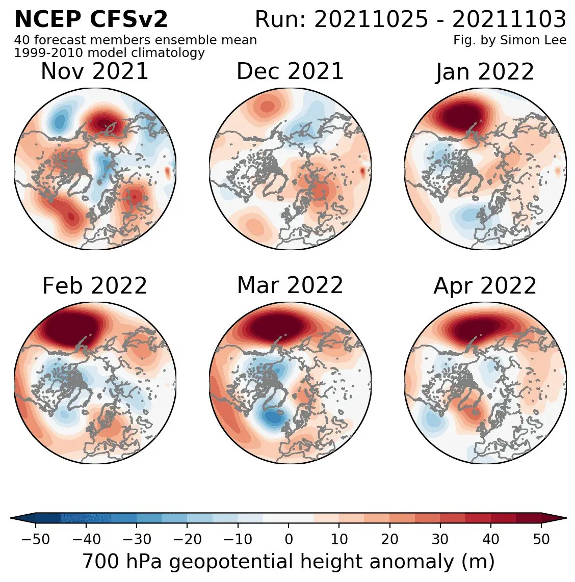
According to ECMWF forecasts, NAO should be in the next months mostly neutral, or in December and February slightly negative, in January positive. However, these outputs from October 2021 are not corresponding with a new CFS outlook, with a peak of Winter 2021/2022 in Europe in January 2022, NAO fluctuations forecasts, therefore, will be a little changed, yet, with a result of close to neutral conditions.
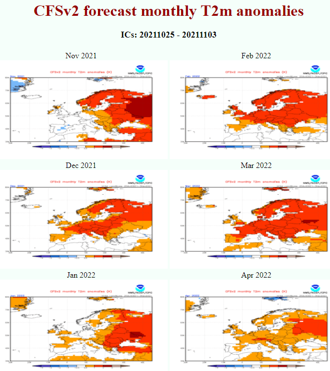
It appears, that cold early winter conditions in Europe should be peaking already in November and early December 2021 and then will return in January 2022, with the next NAO- period, while Christmas should be warmer than was expected.
In North America, NAO+ is bringing colder conditions in the Great Lakes region and all eastern Canada, while NAO- is above average. Every significant change of NAO therefore should produce shorter warm spells and coldwaves in Europe (Asia and North Africa) and northeastern North America,.
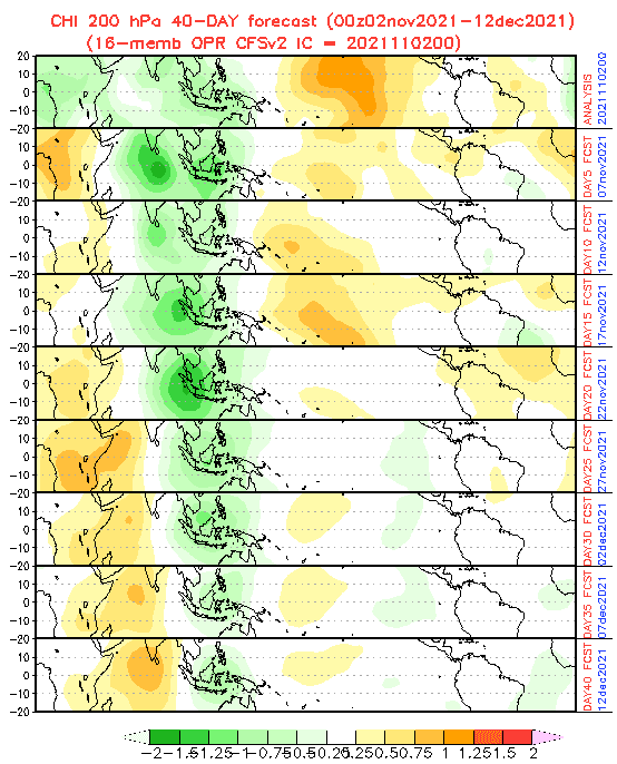
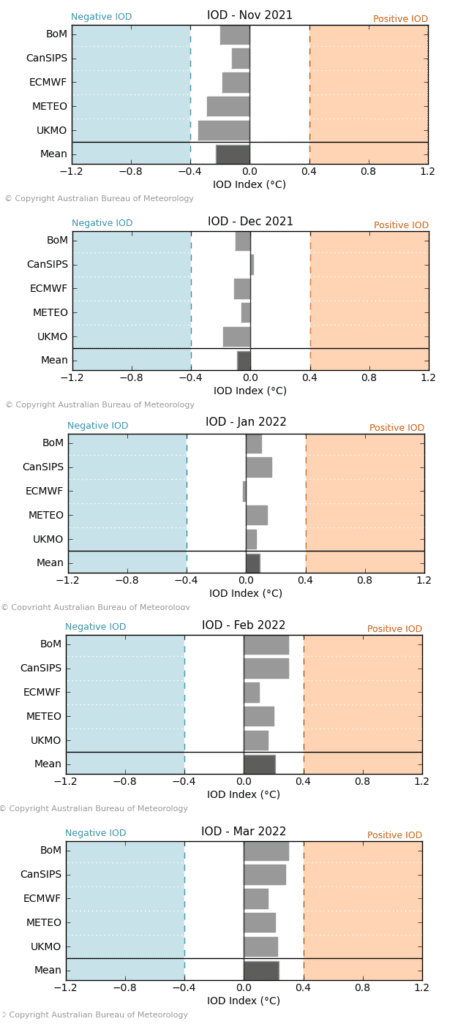
A shift of wet MJO and negative IOD to drier MJO and positive IOD during winter
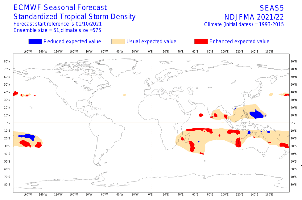
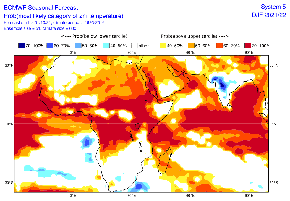
These circulation patterns have effects mainly on equatorial and tropical, partly moderate climates. While wet MJO and negative IOD are bringing extreme rainfall and floods to SE Asia (and the eastern Indian Ocean), drier MJO above the region and positive IOD triggers a strong Cyclone season in Africa, the southern Middle East, and the western Indian Ocean.
The first described (wet MJO, negative IOD, extreme precipitation in SE Asia) more correlate with NAO-/AO- phases, while opposite patterns with NAO+/AO+ phases.
For winter in Europe, North America, Asia, and North Africa will be therefore important to watch a behaviour above equatorial and tropical regions, too.
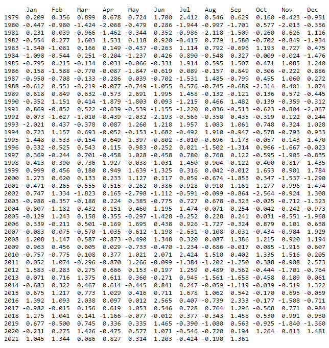
QBO-
QBO very probably stays in its negative (easterly) phase. In January, negative QBO in combination with NAO- is bringing severe cold blasts into western parts of Europe, which should be a reality according to the newest outputs.
NE Pacific Warm Blob
An anomaly that triggers/correlates with NAO+ appears above the northern Pacific in the second half of Winter 2021/2022. Although outputs for January and February already appear colder, than previous, there will be still a risk of NAO+ periods in both months.
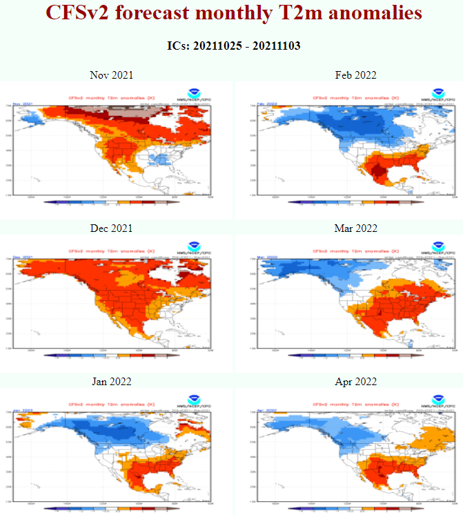
On the other hand, NE Pacific Warm Blob is bringing cold conditions across Canada and part of the USA, and this pattern is evident from forecast maps for Winter 2021/2022, with a strengthening of cold conditions in North America during the winter and a forecasted peaking around February 2022.
AAO+
Such as many surely notice, a behavior above Antarctica and Southern Hemisphere is thanks to climate change diametrically different, with triggering of AAO+ patterns after 2000 more and more often, which means cooling of Antarctica and less deep cyclonic systems above South America, South Africa and Australia.
This trend should be linked with a shift of Intertropical Convergence Zone above equator more southward, with the next effects above southern parts of Northern Hemisphere and winter period in Mexico, Sahara / Sahel states / India or SE Asia.
Winter in Europe should be peaking in January 2022
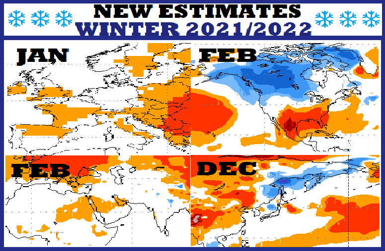
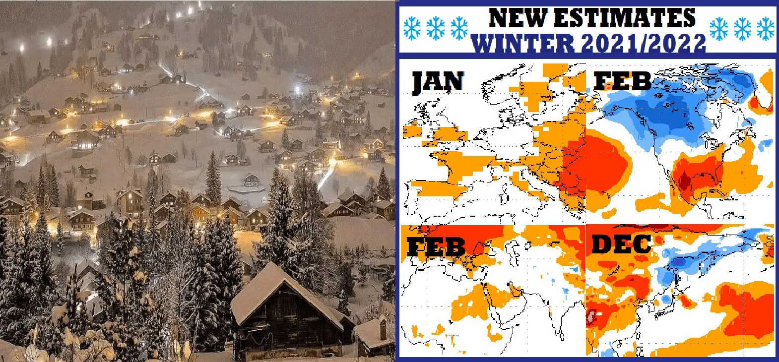
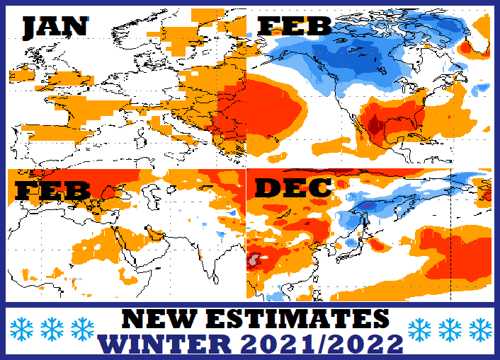
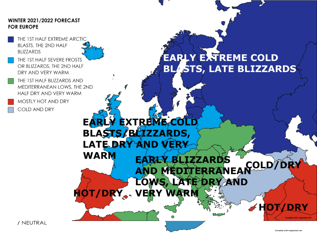
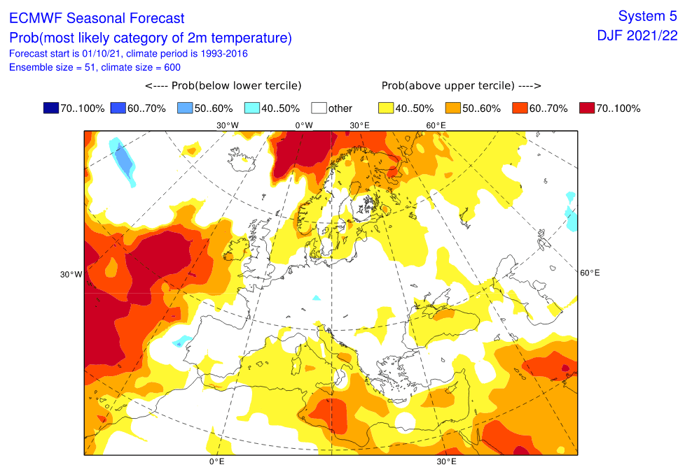
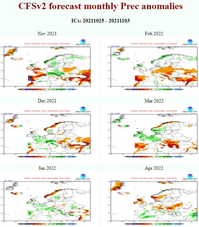
According to the newest CFS outputs, cold conditions in Europe should appear in November 2021 and January 2022, while December should be warmer than was forecasted. It still should mean colder the first half of the winter season in the region.
While cold conditions in Europe should persist between cca 10. November – 10. December 2021, Christmas time should be warmer and winter, therefore, should hit a little later – in January 2022, with even stronger frosts, such would be recorded around the holidays.
Cold January is for now forecasted mainly for the western half of Europe.
In December and February, high-pressure zones above the continent should bring worse conditions such was forecasted.
Winter in North America – the peak is still forecasted in February 2022
La Nina, NAO fluctuations, and NE Pacific Warm Blob should be the main reasons for extremely cold conditions in Canada and the northern USA at the end of Winter 2021/2022.
This forecast is staying stable and without a change, inhabitants of the region, therefore, should be prepared before extreme and record-breaking coldwaves.
Cold blasts will be temporarily hit southern parts of the USA or northern Mexico, too, mainly during AO-/NAO- period and a possible SSW around February.
Winter in East Asia should be peaking already in December 2021
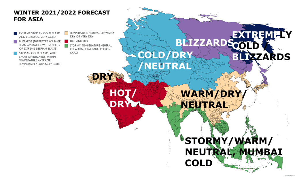
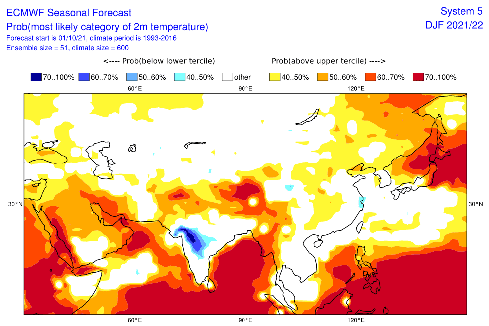
Although already November 2021 is in parts of Europe and Asia forecasted to be very cold (India, China, wider Central Asia, and western half of Europe), December should bring surprising coldwaves with blizzards in the Far East, Japan, Korea, or northern China, according to the newest CFS.
Already soon therefore should Oymyakon region surprise with untraditional strong early-winter frosts.
In northern Japan, extreme blizzards with meters of snowfall should appear already before Christmas.
India, the Middle East, and North Africa the coldest in February, North Africa already in December, too
The coldest times for southern, southwestern Asia, and North Africa are forecasted for February 2022, but Northwestern Africa will be cold already in December 2021.
In the region, NAO+ should be bringing cold clear nights, while NAO- rainy, in the mountains snowy Western Disturbances = remnants of Mediterranean lows.
In India and Central Asia, cold November should surprise, too, thanks to AO/NAO-.

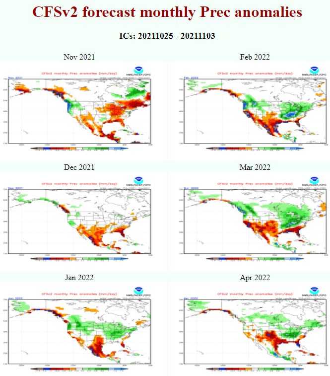
Source: https://simonleewx.com/cfsv2_monthly-anomalies/

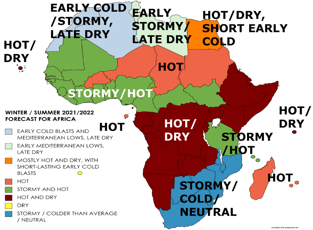
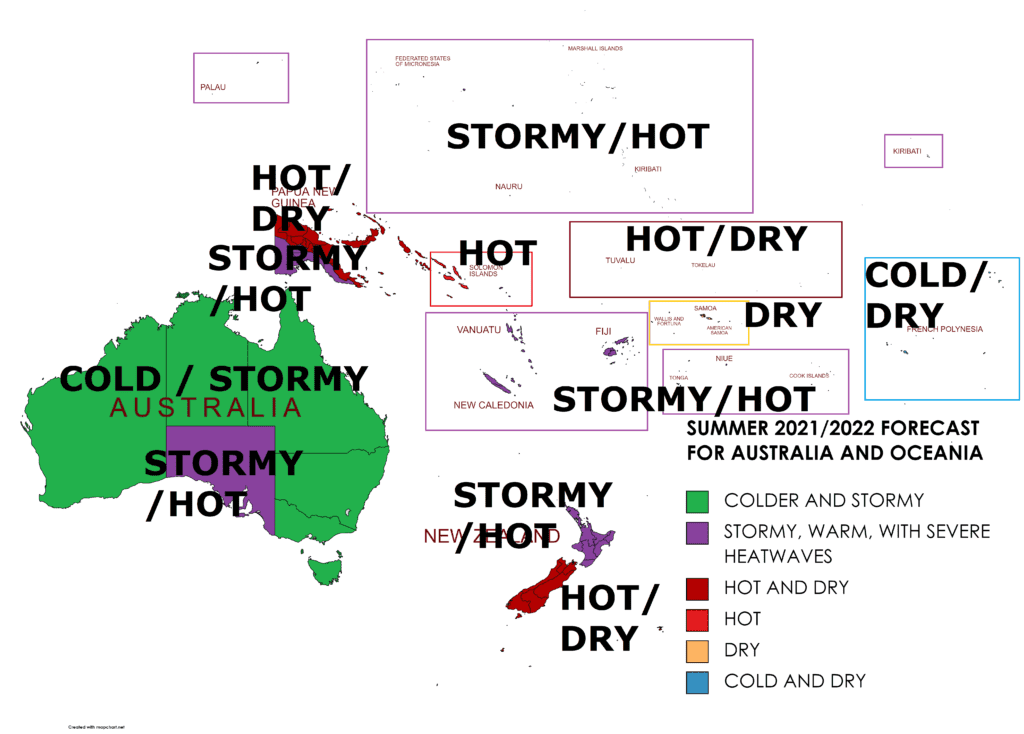
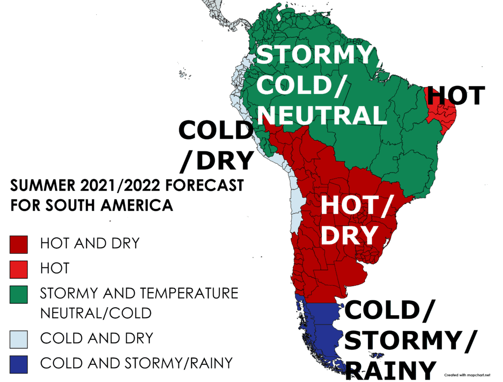
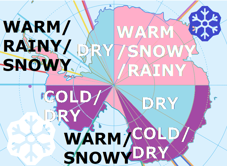
Sources: Continental Mkweather forecasts – links in the article.
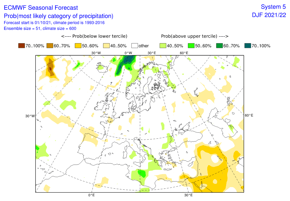
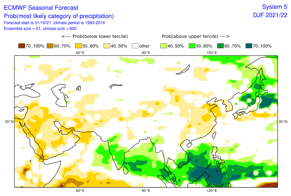
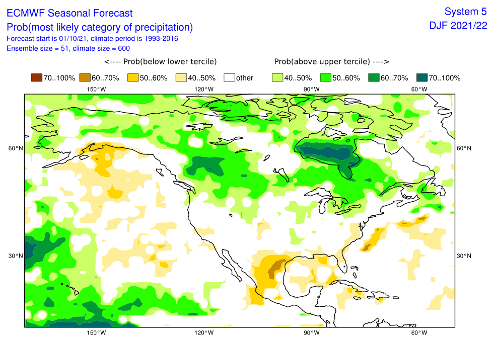
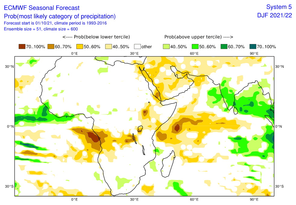
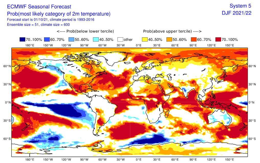
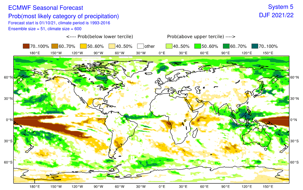
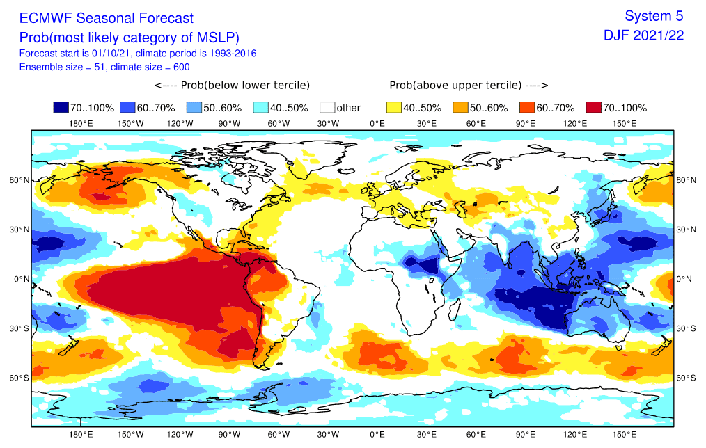


Source: https://iri.columbia.edu/our-expertise/climate/forecasts/enso/current/
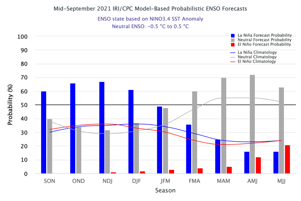
Source: https://iri.columbia.edu/our-expertise/climate/forecasts/enso/current/
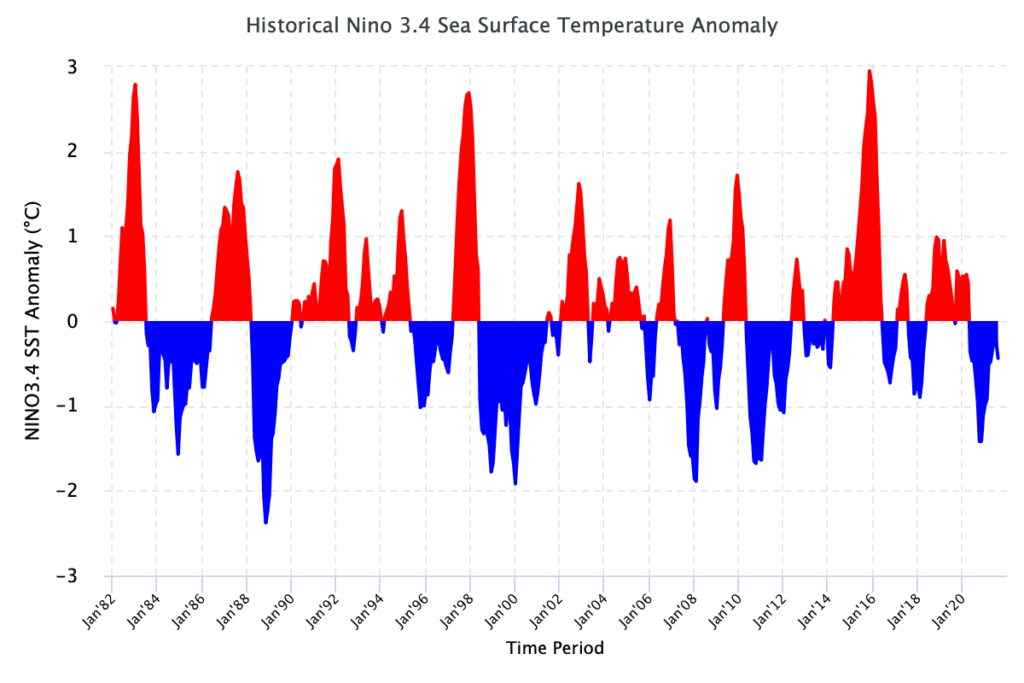
Source: https://iri.columbia.edu/our-expertise/climate/forecasts/enso/current/
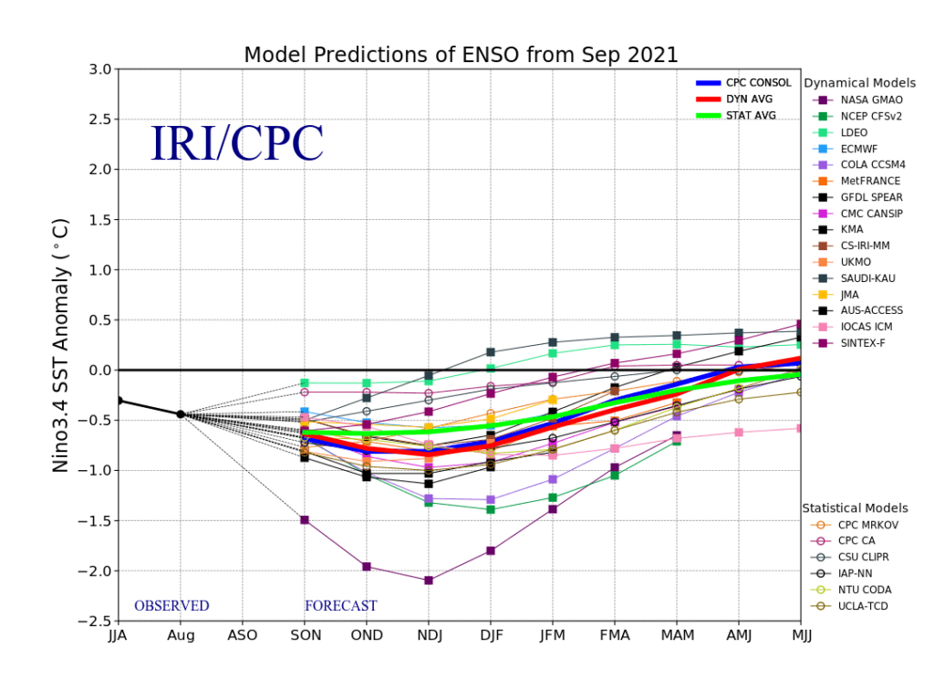
Source: https://iri.columbia.edu/our-expertise/climate/forecasts/enso/current/
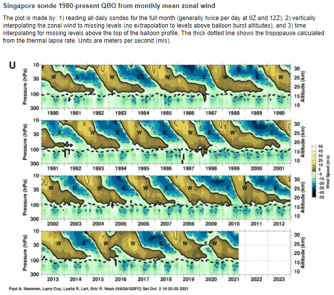
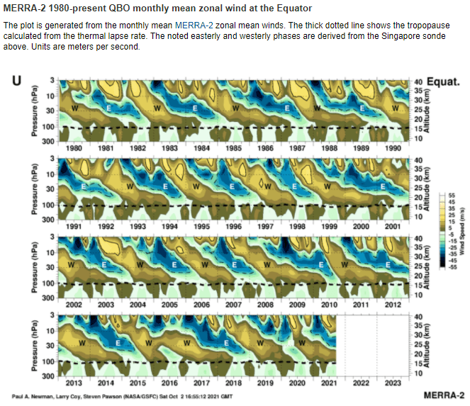

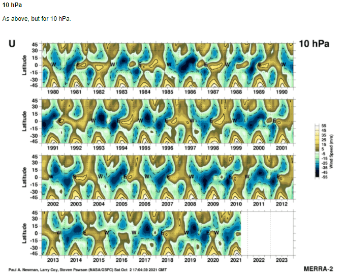
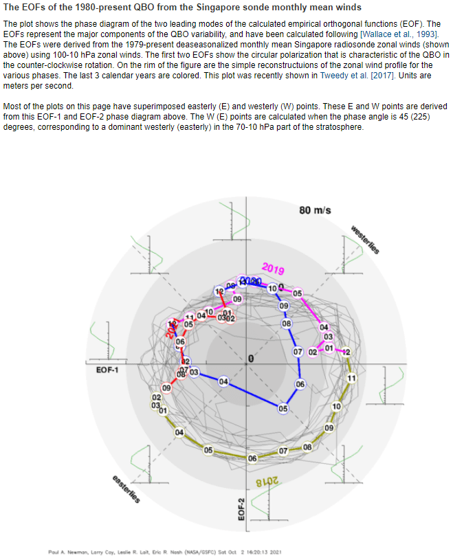
Source: https://acd-ext.gsfc.nasa.gov/Data_services/met/qbo/qbo.html
