Winter 2021/2022 is coming and we are bringing continental updates of predicted patterns for Europe, North America, Asia, Africa (Winter + Summer 2021/2022), Australia (Summer 2021/2022), and South America (Summer 2021/2022).
In the last articles, we looked at forecasted Winter 2021/2022 conditions in Europe /https://mkweather.com/winter-2021-2022-forecast-for-europe-early-extreme-arctic-and-siberian-blasts-and-blizzards-late-dry-and-very-warm-conditions// and North America /https://mkweather.com/winter-2021-2022-forecast-for-north-america-a-peak-of-winter-with-extreme-arctic-blasts-and-blizzards-in-february-2022//and Asia /https://mkweather.com/winter-2021-2022-forecast-for-asia-early-extreme-arctic-and-siberian-blasts-and-blizzards-late-dry-and-warm-conditions// and Summer 2021/2022 conditions in Australia and Oceania /https://mkweather.com/summer-2021-2022-forecast-for-australia-and-oceania-stormy-colder-la-nina-pattern-above-the-continent//. Now we will look at Summer 2021/2022 in South America.
The last update of the Winter forecast for the Northern Hemisphere we published here / https://mkweather.com/winter-2021-2022-forecast-extreme-frosts-in-eurasia-in-december-in-north-america-in-february-early-canadian-stratospheric-warming-ne-pacific-blob-la-nina-qbo-and-shift-from-nao-to-nao-such-le/ /.
9 main circulation patterns and important parameters will be affecting conditions in South America during an upcoming summer:
- Still low solar activity: We are still after a solar minimum, at the beginning of a 25. solar cycle, with a weaker predicted solar cycle. Weaker solar cycles were in the last centuries associated mainly with El-nino phases, but El-nino, maybe with a Godzilla character, is currently forecasted only for Autumn 2022 and years 2023, 2024 and maybe 2025 /https://mkweather.com/2022-2023-forecast-chances-for-el-nino//. Little Ice Age = low solar activity = El nino and high solar activity (stronger sun cycles) = La nina in long-term perspective.
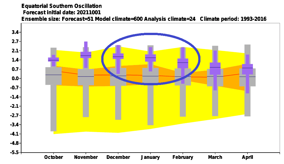
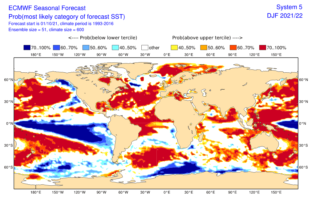
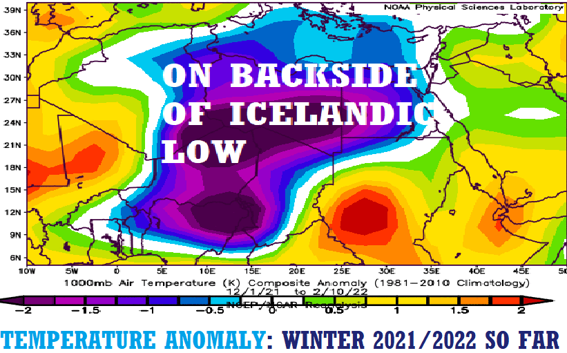
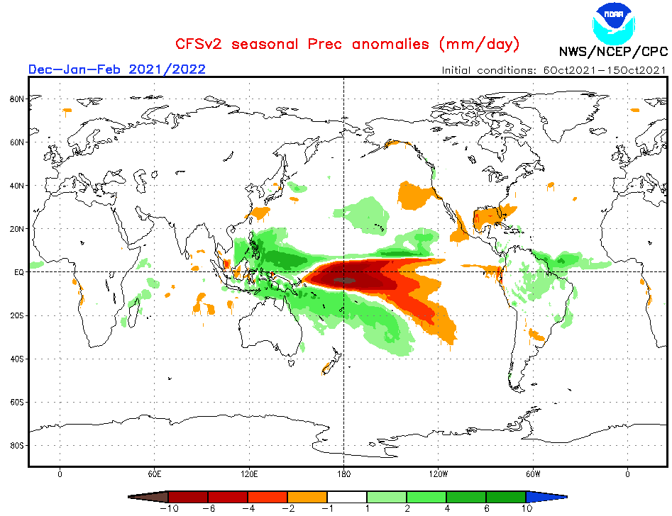
- Re-strengthening La Nina pattern: In Summer 2021/2022, re-strengthening of La nina is after the last La nina 2020/2021 winter, forecasted. La nina has a direct and significant impact on the South American region and circulation patterns mainly on the Pacific coast are possibly the most affected regions by La nina in the world. La nina in South America is traditionally linked with the very stormy Amazon, while southern Brazil and La Plata region should be hot and dry. Along northern Chilean, Peruvian and the coast of Ecuador, cold and dry anomaly thanks to a behavior above tropical Pacific is periodically appearing during La Nina phases.
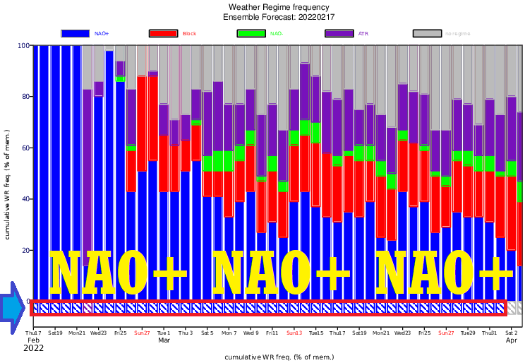
- Switch from NAO- / AO- to NAO+ / AO+ during Winter 2021/2022: A predicted NAO-/AO- phases in the first half of Winter 2021/2022 and mostly NAO+/AO+ in its second half should contribute to weather regimes across northernmost parts of South America – in Colombia, Venezuela, Guyana region, and NE Brazil, with very rare cold blasts from the north during the peaking of a possible Major SSW event.
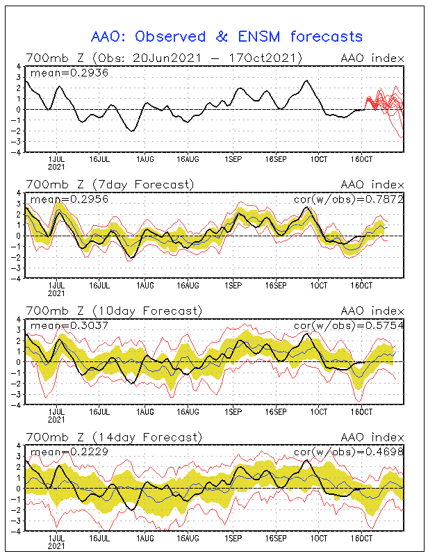
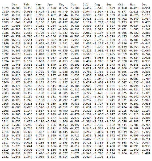
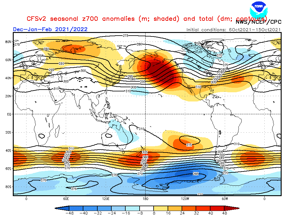
- AAO / SAM – Will bring Antarctic Oscillation positive phases and trend remains preserved? The South Pole experienced the coldest winter since records have begun /https://mkweather.com/the-south-pole-with-the-coldest-winter-in-history-average-temperature-april-september-half-year-only-610c// with anomalous temperatures even around 30. September 2021 /https://mkweather.com/vostok-794c-only-06c-from-the-all-time-october-record// thanks to positive phases of AAO / SAM (Antarctic Oscillation / Southern Annular Mode). After 2000, positive phases are more often throughout all year, including summer months (December, January, February), therefore Antarctic fronts should stay far from South American mid-latitudes during summer months, in the case of AAO+ / SAM+. The anomaly should be linked with dry and hot anomalies above Chile and Argentina, however, La nina pattern in the region is leading. Fronts however should hit southernmost parts of the continent.
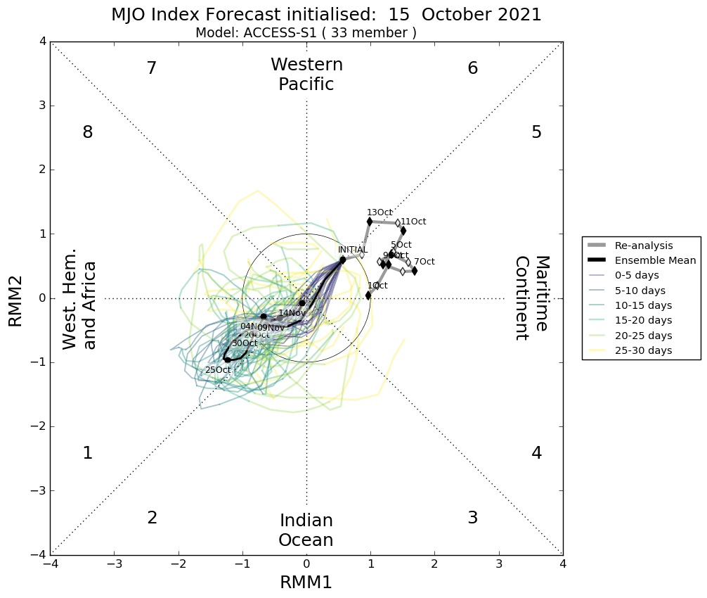
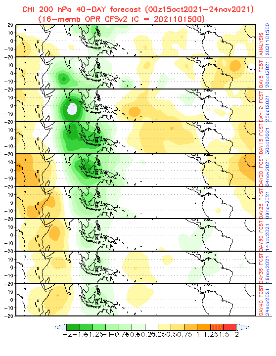
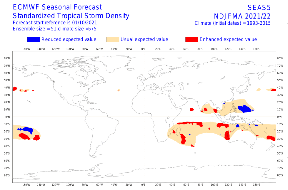
- MJO, a weaker end of a hurricane season: Dry MJO conditions above North Atlantic should mean milder end of Hurricane season 2021 in November. However, some probability of development of tropical depression, tropical storms or maybe very rare hurricanes will be here mainly in the southern Caribbean, including the coasts of Colombia, Venezuela and the Guyana region.
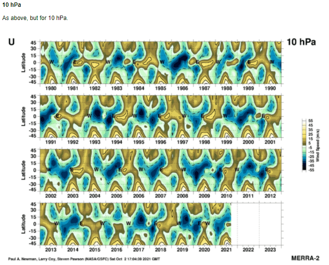
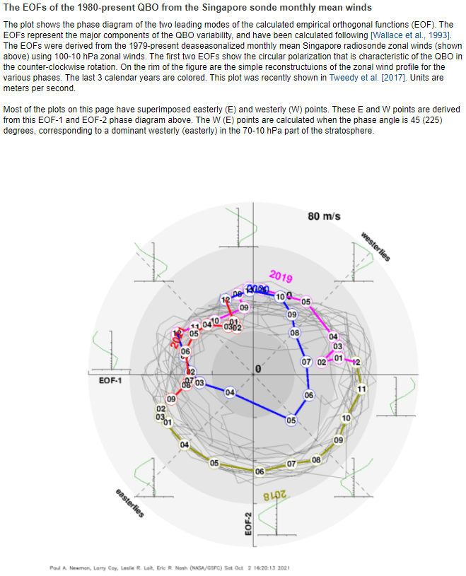
- QBO in Easterly phase: Although QBO is forecasted to stay in a colder phase during the season, with usual manifestations in tropical and mid-latitudes in Southern Hemisphere.
- Early Canadian Stratospheric Warming – Legendary December frosts not excluded: Around November, the Early Canadian Stratospheric Warming pattern is expected. This anomaly was in the past often associated with a subsequent NAO- / AO- around December and possible rare cold blasts in the northern coast of South America.
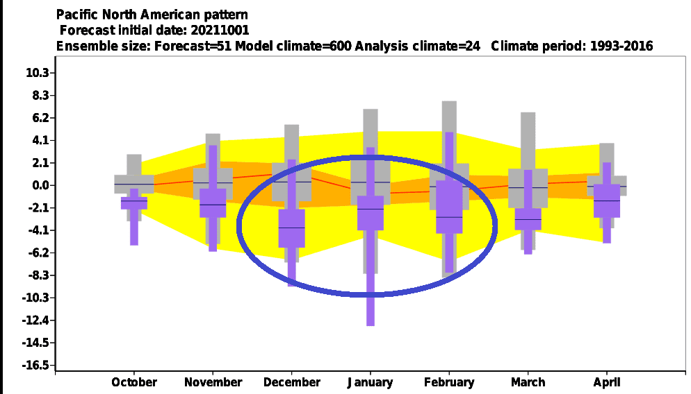
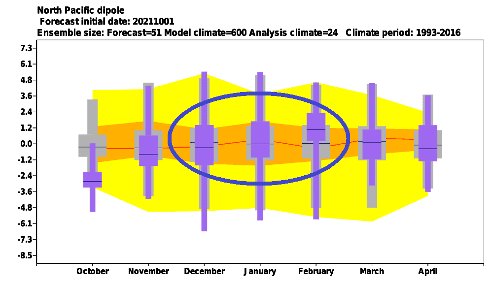
- NE Pacific Warm Blob Anomaly – NAO+ regime for the second half of winter?: This anomaly above Northern Pacific correlates with NAO+ conditions. Both regimes are forecasted to persist in January and this circulation should be peaking around February 2022. Northern South America therefore should stay far away from colder air masses from northern latitudes.
- Major SSW (Major Sudden Stratospheric Warming) already in the first half of Winter 2021/2022?: Are there chances for so-called “destabilization of polar vortex”, strongly associated with AO- / NAO- phases across the Northern Hemisphere and severe cold blasts? Yes! A probability of SSW will be here just during the first half of Winter 2021/2022. It means, that some strongest coldwaves should shift towards the equator, into the northern coasts of South America during the peaking of the collapse of the polar vortex.
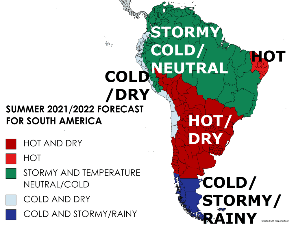
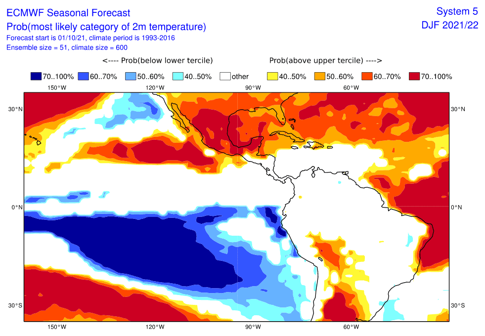
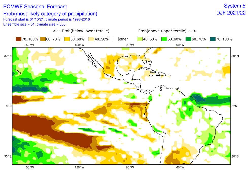
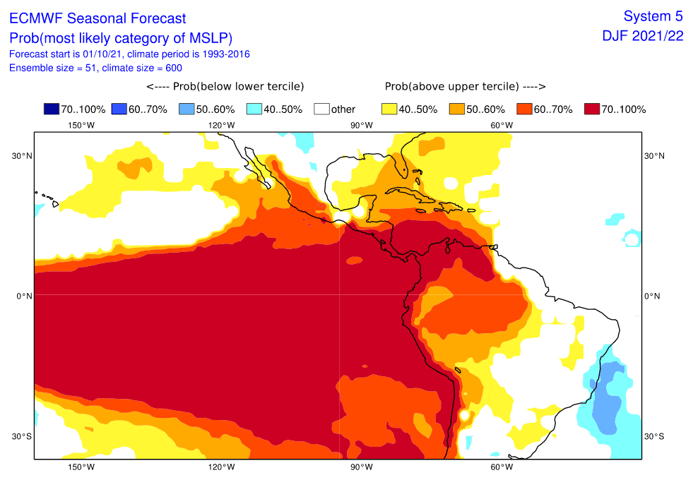
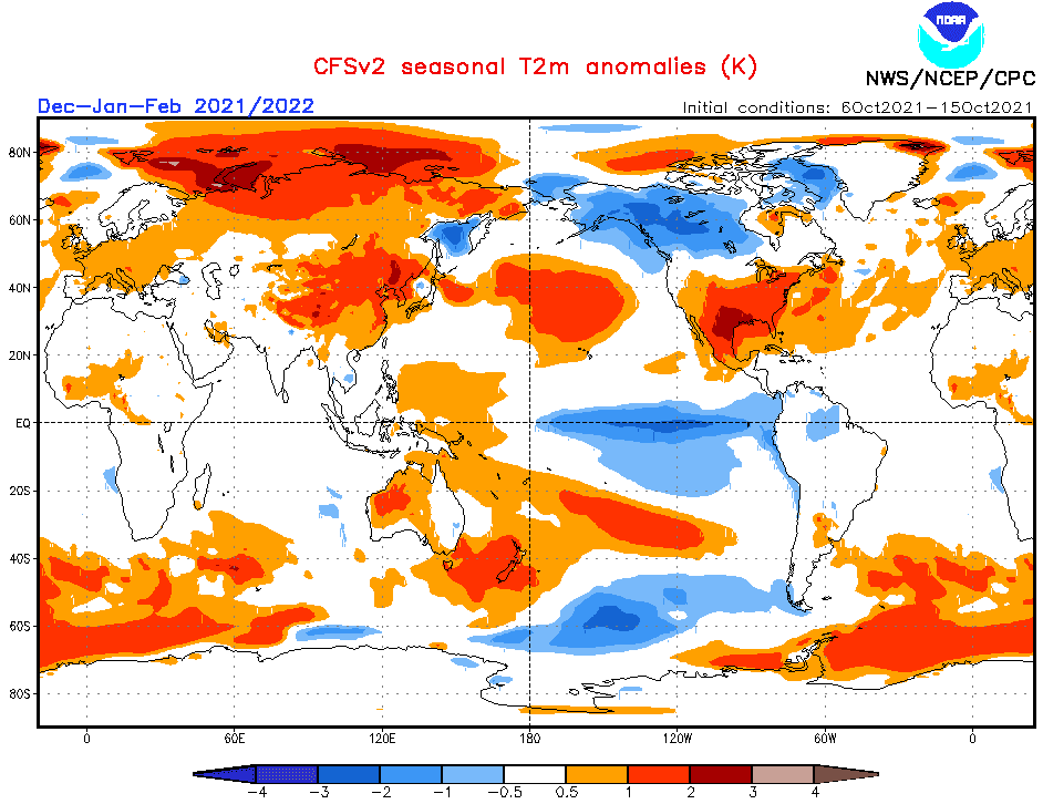
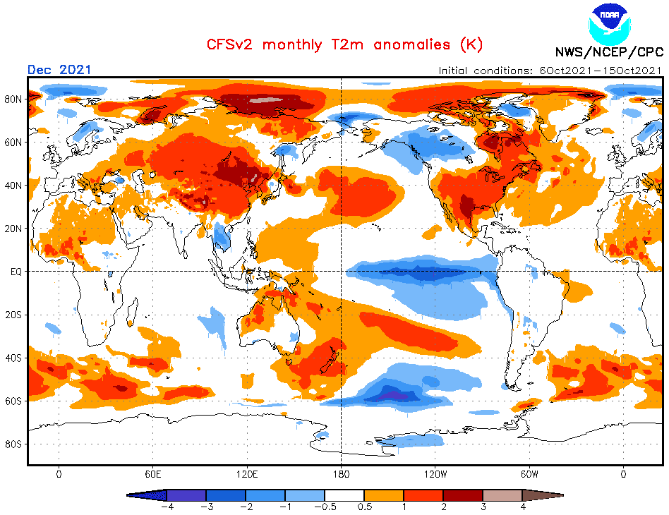
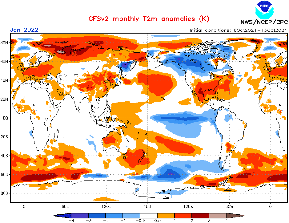
Now, we should look at a forecasted map for Summer 2021/2022 for South America and 5 main sectors, with similar regimes of weather:
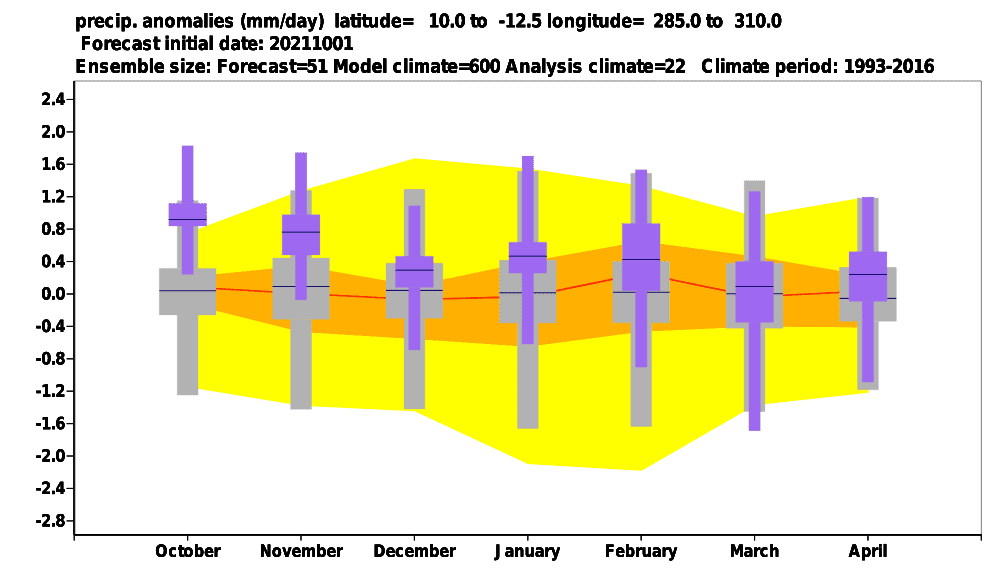
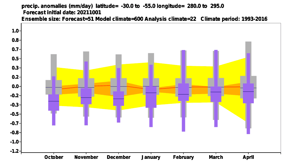
A) NORTHERN AND EASTERN BRAZIL, COLOMBIA, VENEZUELA, GUYANA REGION, CONTINENTAL ECUADOR, AND CONTINENTAL PERU: This region will be strongly affected by the amplified effect of La Nina to Amazon season of rain. The region, therefore, expects stronger, or least neutral precipitation anomalies with neutral or colder temperatures than the long-term average. Mainly regions southward from key regions of Amazon should hit a periodical drought, but storms will be leading. Drier and hotter periods should appear along the Colombian, Venezuelan coast and along the coast of the Guyana region, too. Thanks to a possible peak of Winter in the Northern Hemisphere in the first half of Winter 2021/2022, rare coldwaves from the north should appear across the northern coast of the continent. Regions farther from the Pacific ocean in Peru and Ecuador should report enough or above-average rainfall, too. Remnants of a hurricane season are on the northern coast of South America possibly mainly in December in a form of tropical depressions and tropical storms. Summer and tropical temperatures above +25/+30°C, in the south +35/+40°C, will be usual.
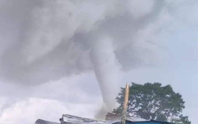
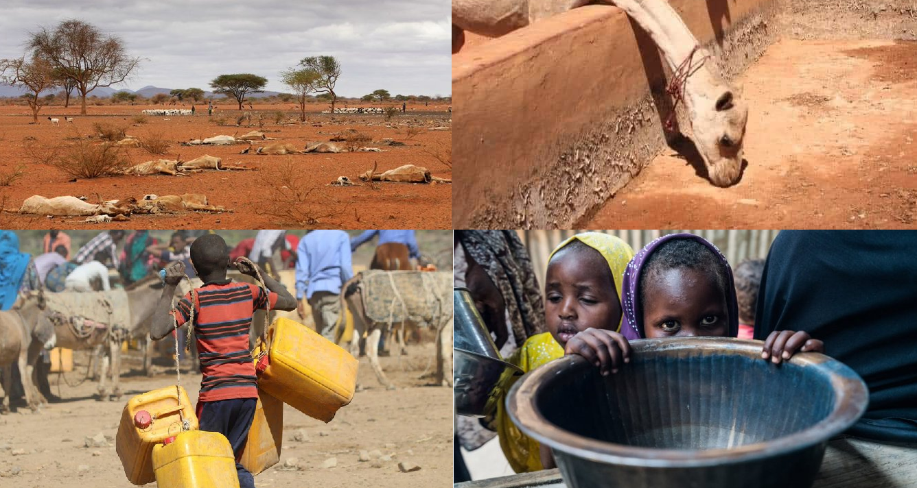
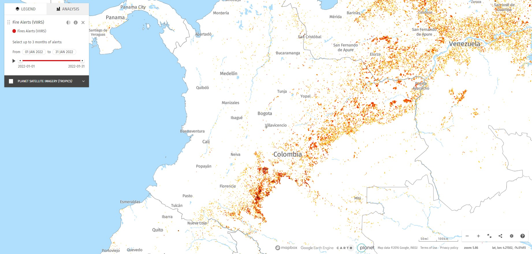
B) CENTRAL AND NORTHERN ARGENTINA, CENTRAL CHILE, PARAGUAY, URUGUAY, BOLIVIA, SOUTHEASTERN PERU: Hot and dry pattern associated with La Nina re-strengthening is forecasted to appear in the wider La Plata region. Possible AAO+ / SAM+ phases should contribute to this situation because Antarctic fronts should be farther on the south in the case of a strong Antarctic vortex. Anomalous heatwaves up to +50°C should appear, with a significant lack of harvest and a regional catastrophic drought. Wildfires and sandstorms are very possible. Shorter stormy periods should bring large hail, damaging winds, heavy rainfall, tornadoes, and floods.
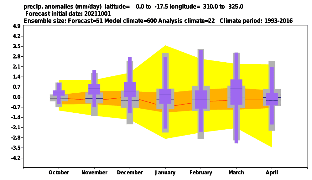
C) EASTERNMOST BRAZIL: A region hit by desertification will report less precipitation such as the rest of northern and eastern Brazil. The risk of drought, heatwaves, and wildfires in this region will be higher.
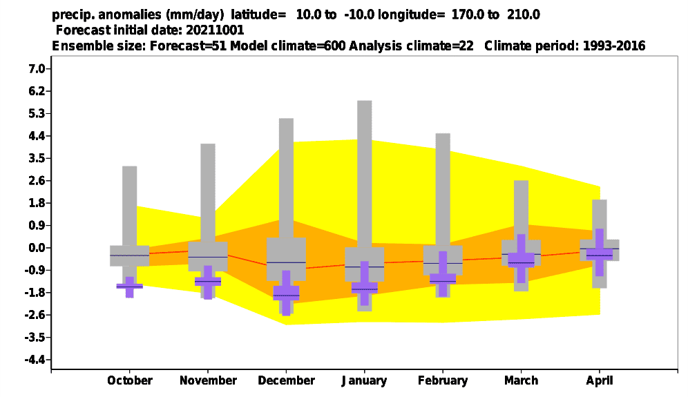
D) PACIFIC COAST (NORTHERN CHILE, PERU, ECUADOR, SOUTHWESTERNMOST COLOMBIA): Cold and dry La-Nina driven period is along the Pacific coast forecasted. Anomaly above the tropical Pacific, including Galapagos, will be the same. Drought should on the opposite side of Andes very quickly change into a stormy or hot and dry pattern.
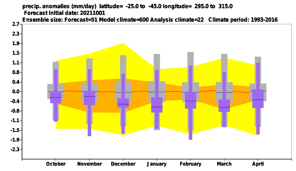
E) SOUTHERN ARGENTINA AND SOUTHERN CHILE: A colder and stormy and rainy pattern is forecasted for the southernmost parts of South America in southern Argentina and southern Chile. It should be associated with a tendency to AAO+. Temporarily, however, very hot air from central and northern Patagonia should shift anomalously southward, with short, but severe heatwaves. Highly in the Andes, snow will be during occasional Antarctic blasts possible.
Additional materials for Winter 2021/2022 in Northern Hemisphere and Autumn/Spring 2021 forecasts:
The last updates of the Winter 2021/2022 forecast for Northern Hemisphere we published here – and it really appears, that the upcoming winter will be probably peaking in Europe, Asia, and North Africa around December 2021 and early January 2022 and in North America around February 2022 (forecasts are still confirming): https://mkweather.com/winter-2021-2022-forecast-extreme-frosts-in-eurasia-in-december-in-north-america-in-february-early-canadian-stratospheric-warming-ne-pacific-blob-la-nina-qbo-and-shift-from-nao-to-nao-such-le/; https://mkweather.com/winter-2021-2022-forecast-a-peak-near-nao-already-in-december-ne-pacific-warm-blob-nao-and-early-spring-in-february-north-america-oppositely-warm-start-cold-end-of-winter/https://mkweather.com/mkweather-special-forecast-for-the-next-3-seasons-cold-autumn-2021-warmer-winter-2021-2022-cold-spring-2021-for-europe-a-peak-of-winter-in-its-colder-first-half-north-america-with-extreme-cold-2021-20/; https://mkweather.com/winter-2021-2022-forecast-the-first-reliable-estimates-extreme-cold-blasts-from-canada-and-western-siberia-snow-in-western-europe-and-eastern-asia-la-nina-qbo-to-qbo-shift-sufficient-nao-ao/ and we published ENSO outlook, too /https://mkweather.com/2022-2023-forecast-chances-for-el-nino//. It is also worth mentioning the Russian forecast for Siberia for Winter 2021/2022 (agree with our forecasts) /https://mkweather.com/russian-meteorologists-expect-extreme-winter-around-december-january-2021-22//.
Continental forecasts for Autumn (in Southern Hemisphere Spring) 2021 we published here: https://mkweather.com/autumn-2021-forecast-for-europe-mostly-dry-and-frosty-autumn-be-prepared-for-early-severe-frosts/; https://mkweather.com/autumn-2021-forecast-for-north-america-long-indian-summer-and-weaker-hurricane-season-such-as-expected/; https://mkweather.com/autumn-2021-forecast-for-asia-strong-monsoon-for-s-se-e-asia-hot-and-dry-in-the-middle-east-late-siberian-cold-blasts-in-w-siberia-and-snow-calamities-in-e-siberia/; https://mkweather.com/spring-autumn-forecast-for-africa-mostly-hot-and-dry-parts-of-sahel-equatorial-africa-stormy-and-south-africa-stormy-and-cold/; https://mkweather.com/spring-2021-forecast-for-australia-and-oceania-under-la-nina-rules-cold-and-stormy-australia-warm-new-zealand-and-various-patterns-in-oceania/; https://mkweather.com/spring-2021-forecast-for-south-america-floods-and-drought-in-many-regions/.Mkweather until 30. November will be updating Winter 2021/2022 forecasts for Northern Hemisphere, yet, approximately 3-5 times.
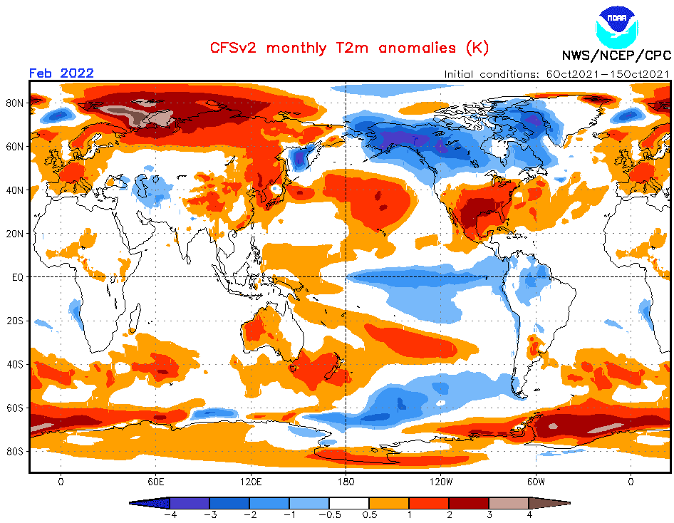
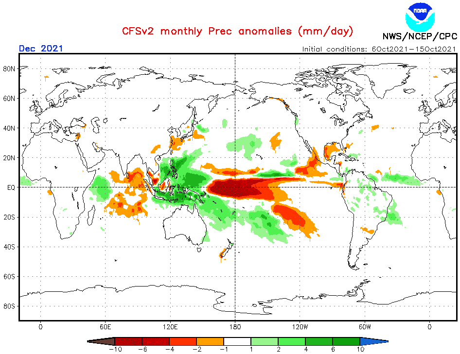
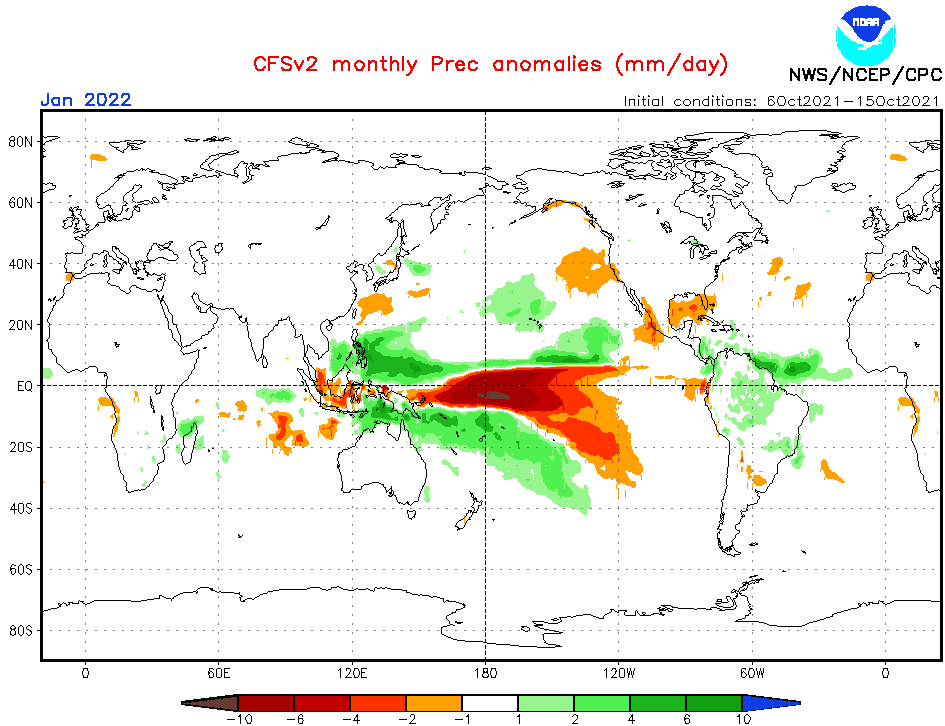
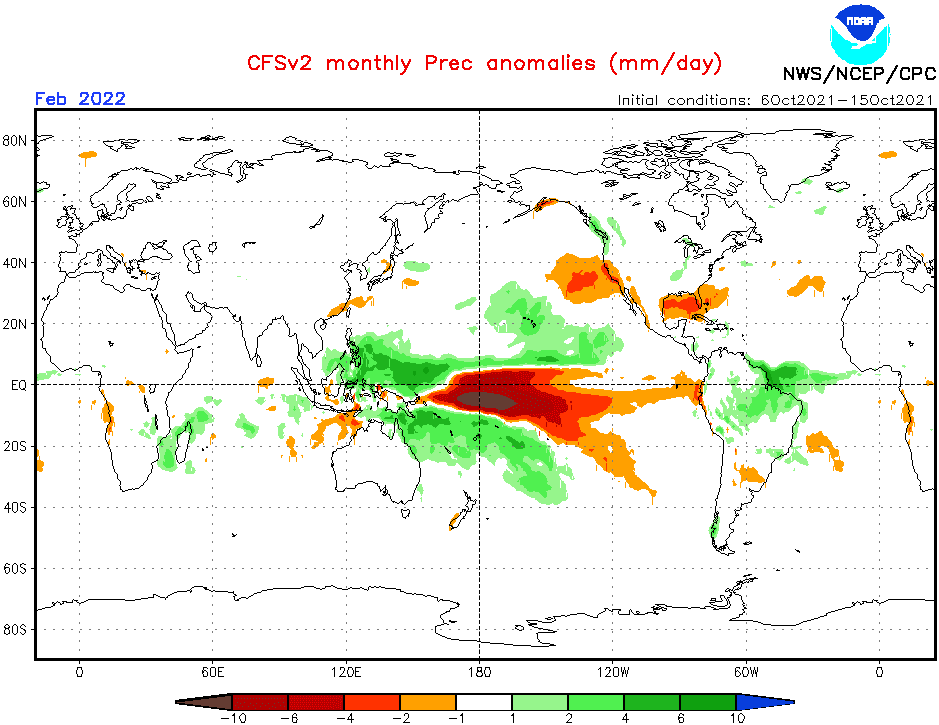
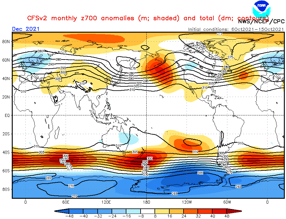
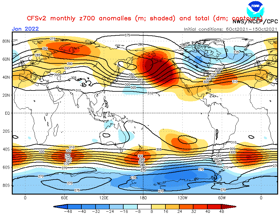
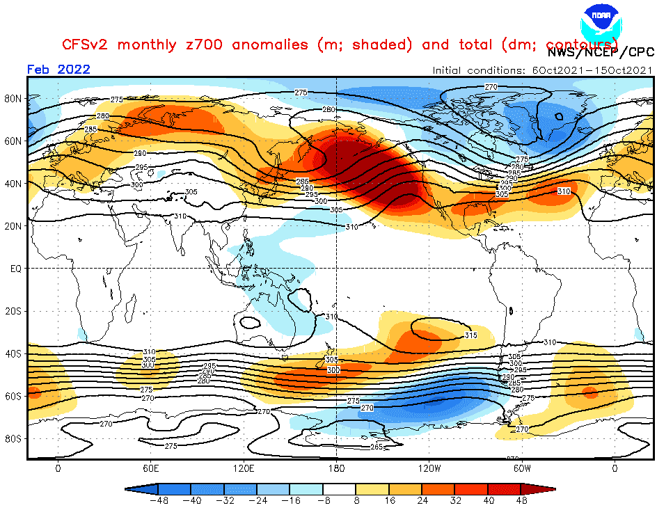
Source: https://www.cpc.ncep.noaa.gov/products/CFSv2/CFSv2_body.html
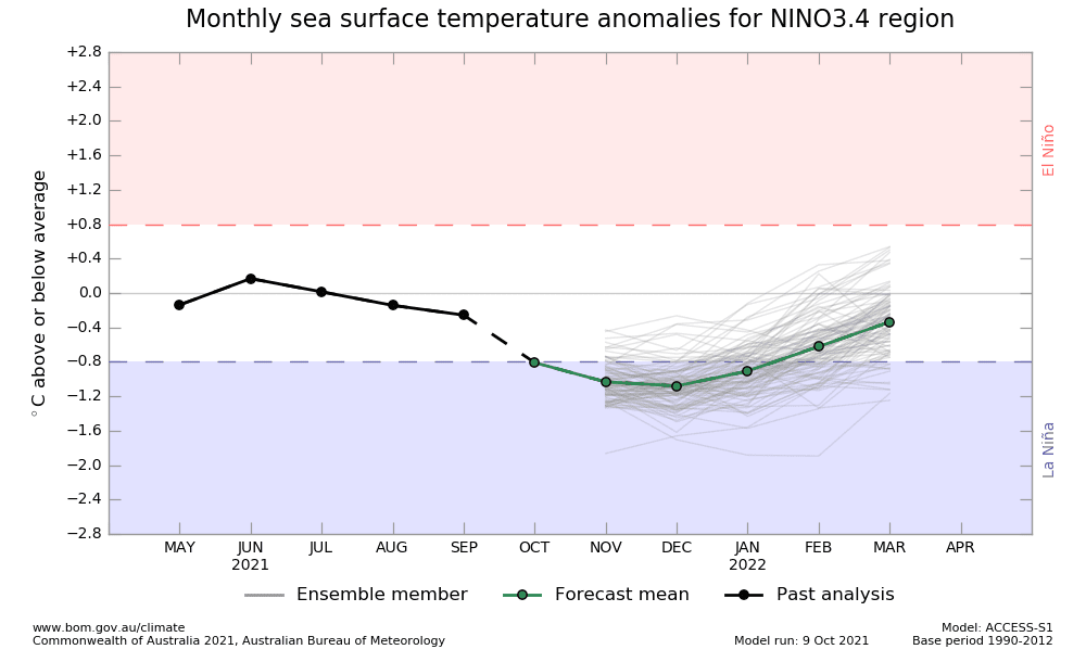
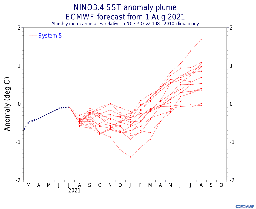
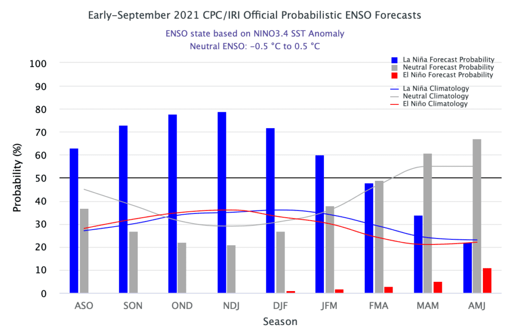
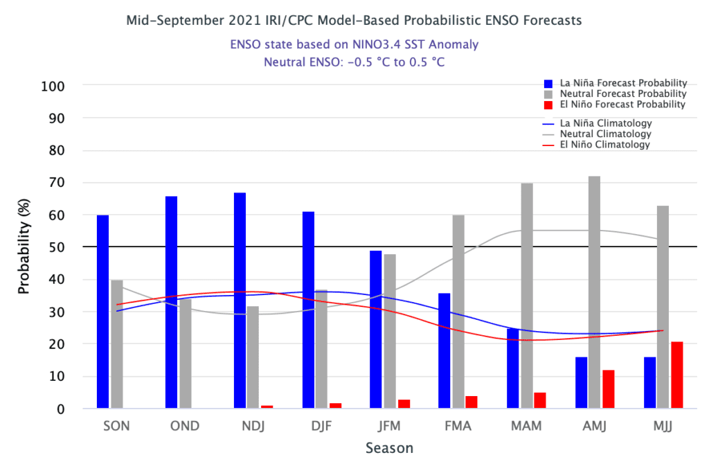
Source: https://iri.columbia.edu/our-expertise/climate/forecasts/enso/current/
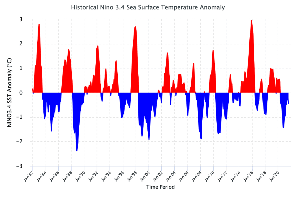
Source: https://iri.columbia.edu/our-expertise/climate/forecasts/enso/current/
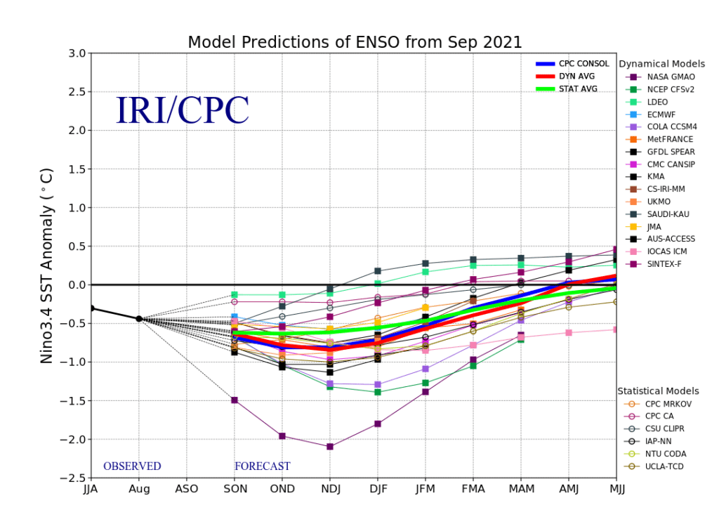
Source: https://iri.columbia.edu/our-expertise/climate/forecasts/enso/current/
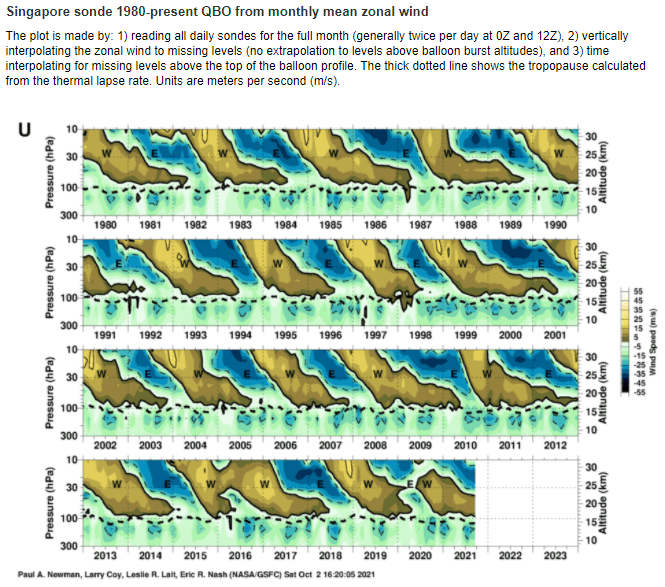
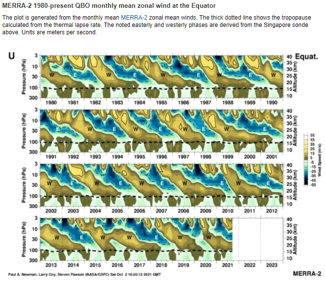
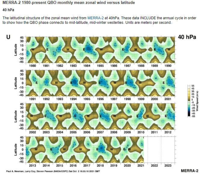
Source: https://acd-ext.gsfc.nasa.gov/Data_services/met/qbo/qbo.html
