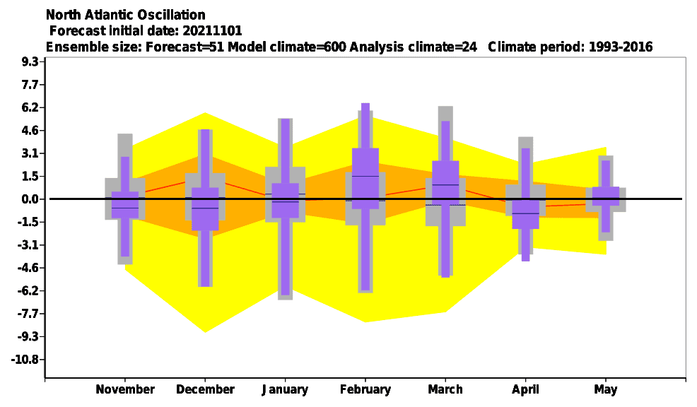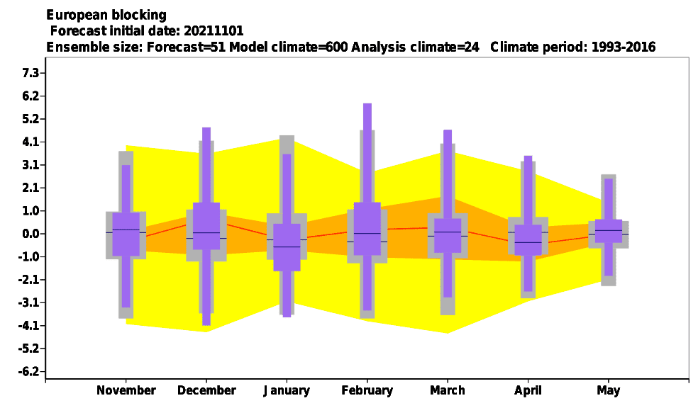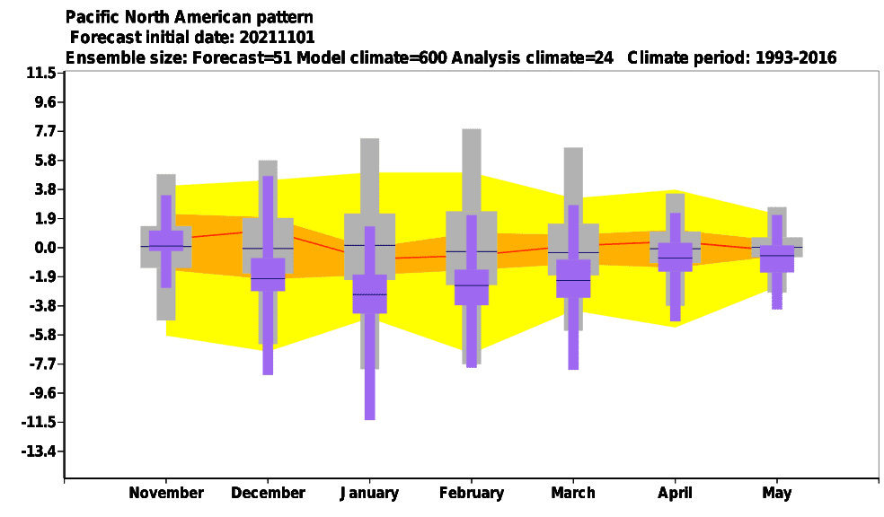
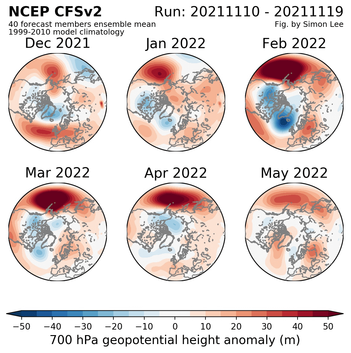
It´s already clear, that AO- phases will bring anomalously cold start of Winter 2021/2022 already in Europe, Asia, and North Africa, temporarily, cold conditions should hit North America, too, but near NAO-, warmer East Coast in Canada and the USA is possible. NAO index is in early Winter 2021/2022 forecasted to fall to the lowest values since extreme -35°C frosts in Europe, -45°C frosts in the USA, -55°C frosts in Canada and almost -65°C frosts in Siberia in January and February 2021, such as since extremely cold April 2021 in Europe, with -21°C in lower situated basins and valleys below 1000 MASL /https://mkweather.com/nao-index-falls-to-2-0-the-lowest-value-since-legendary-35c-frosts-in-europe-in-january-february-2021-or-206c-in-april-2021//. Severe blizzards in Europe and later Asia and mountains in North Africa are possible /https://mkweather.com/heavy-blizzards-hit-europe-in-these-regions-is-possible-snow-calamity//, and winter conditions will be strengthening very probably minimally until the New Year 2022 /https://mkweather.com/extremely-cold-weather-until-a-new-year-2022-arctic-air-should-come-in-3-peaks-around-30-11-14-12-and-christmas-wider-european-region-estimates//. E.g. in continental Europe, very rare and regionally historic frosts up to -30°C are according to the most aggressive GFS outputs possible /https://mkweather.com/central-europe-winter-should-start-with-historic-30c-in-frost-valleys-blizzards-and-snow-calamity-very-possible//.
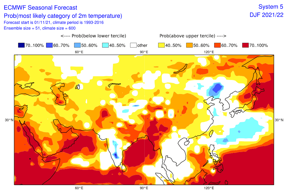
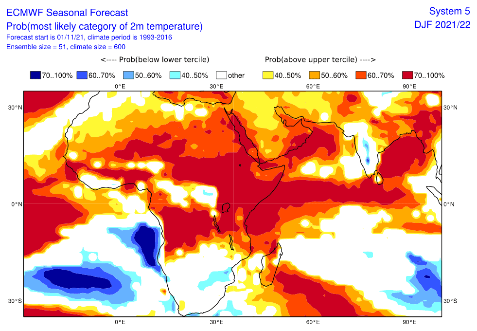
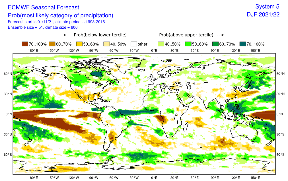
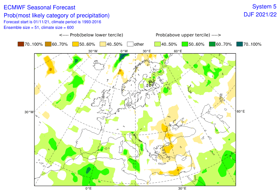
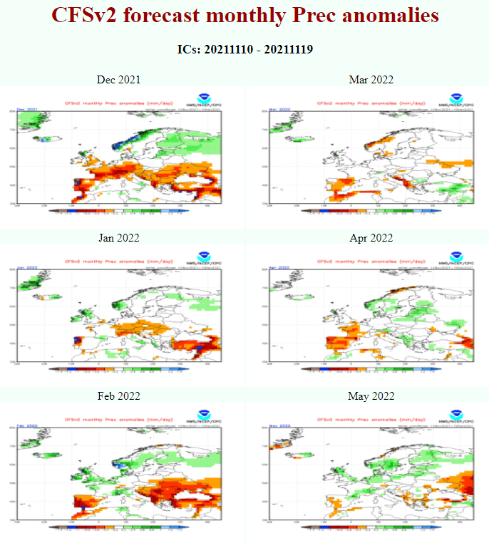
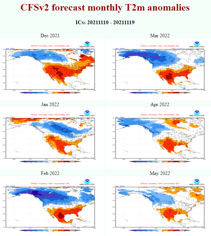
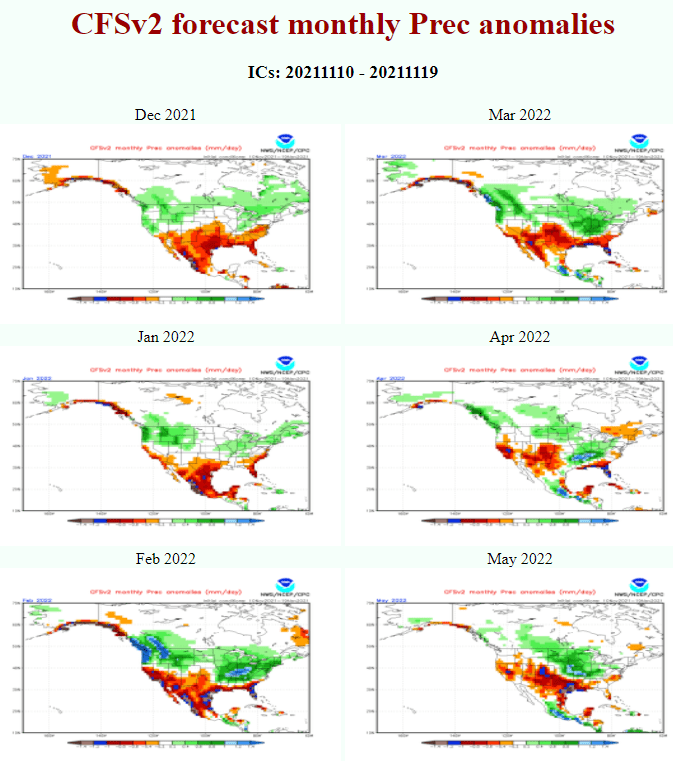
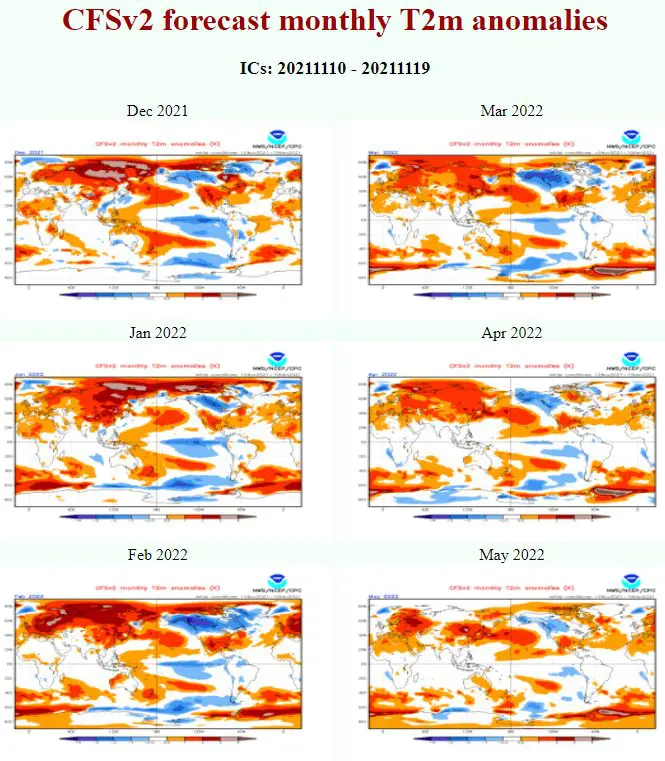
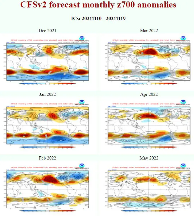
In this article, we will look at the latest updates of CFS and ECMWF Winter 2021/2022 forecasts for Europe, Asia, North America and North Africa from 20. November 2021.
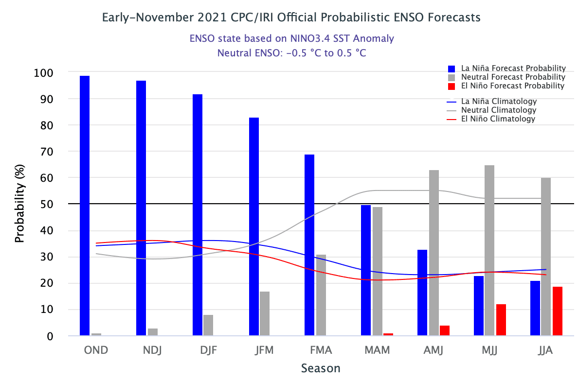
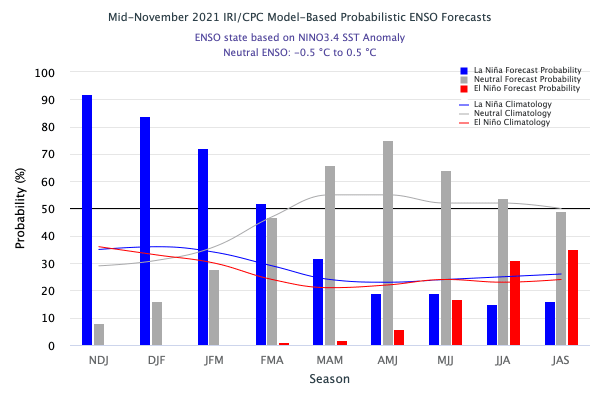
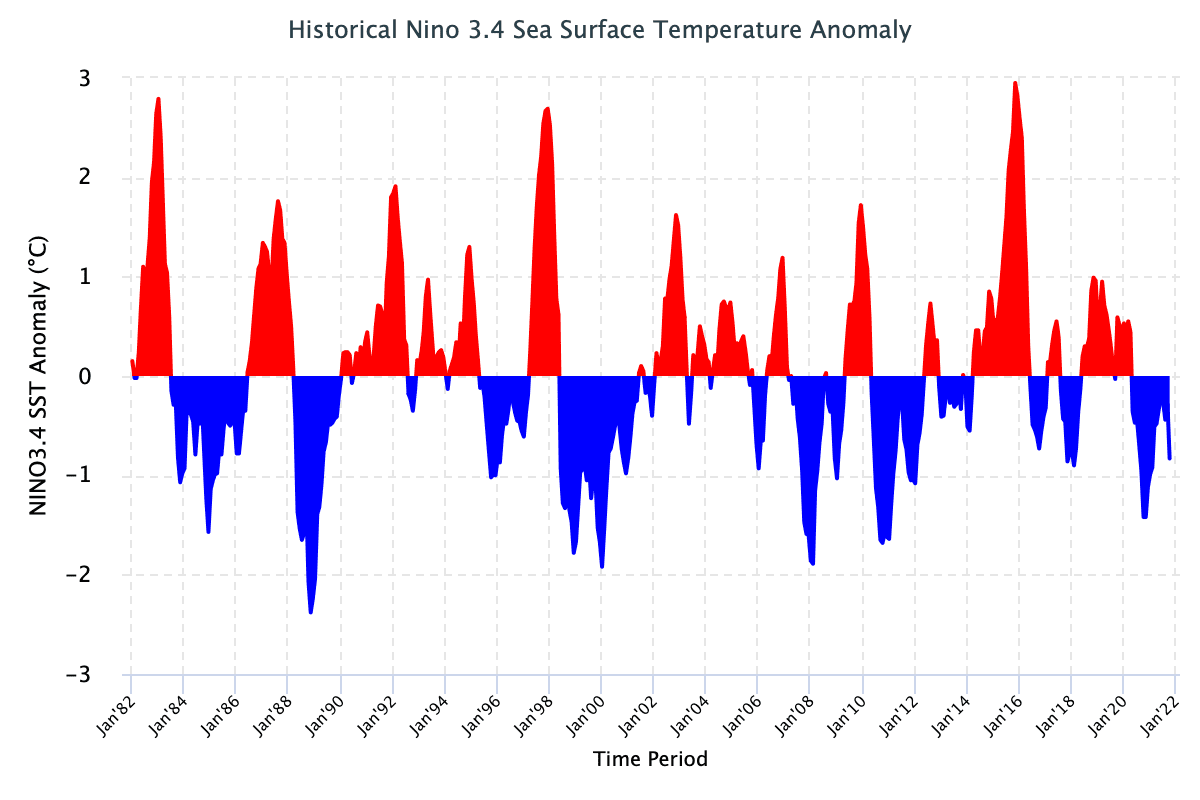
The last updates of the Winter 2021/2022 forecast we published here: https://mkweather.com/winter-2021-2022-forecast-for-northern-hemisphere-an-awakening-solar-activity-la-nina-neutral-nao-ao-wet-mjo-and-iod-to-drier-mjo-and-iod-qbo-ne-pacific-warm-blob-aao/; https://mkweather.com/winter-2021-2022-forecast-extreme-frosts-in-eurasia-in-december-in-north-america-in-february-early-canadian-stratospheric-warming-ne-pacific-blob-la-nina-qbo-and-shift-from-nao-to-nao-such-le/; https://mkweather.com/winter-2021-2022-forecast-chances-for-white-christmas-2021-are-higher-than-usual-a-hope-for-nao-and-return-of-winter-conditions-in-february/; https://mkweather.com/winter-2021-2022-forecast-a-peak-near-nao-already-in-december-ne-pacific-warm-blob-nao-and-early-spring-in-february-north-america-oppositely-warm-start-cold-end-of-winter/https://mkweather.com/mkweather-special-forecast-for-the-next-3-seasons-cold-autumn-2021-warmer-winter-2021-2022-cold-spring-2021-for-europe-a-peak-of-winter-in-its-colder-first-half-north-america-with-extreme-cold-2021-20/; https://mkweather.com/winter-2021-2022-forecast-the-first-reliable-estimates-extreme-cold-blasts-from-canada-and-western-siberia-snow-in-western-europe-and-eastern-asia-la-nina-qbo-to-qbo-shift-sufficient-nao-ao/. You should look at ENSO outlook, too /https://mkweather.com/2022-2023-forecast-chances-for-el-nino//. It is also worth mention the Russian forecast for Siberia for Winter 2021/2022 /https://mkweather.com/russian-meteorologists-expect-extreme-winter-around-december-january-2021-22//.
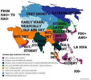
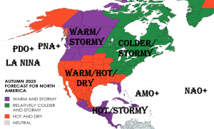
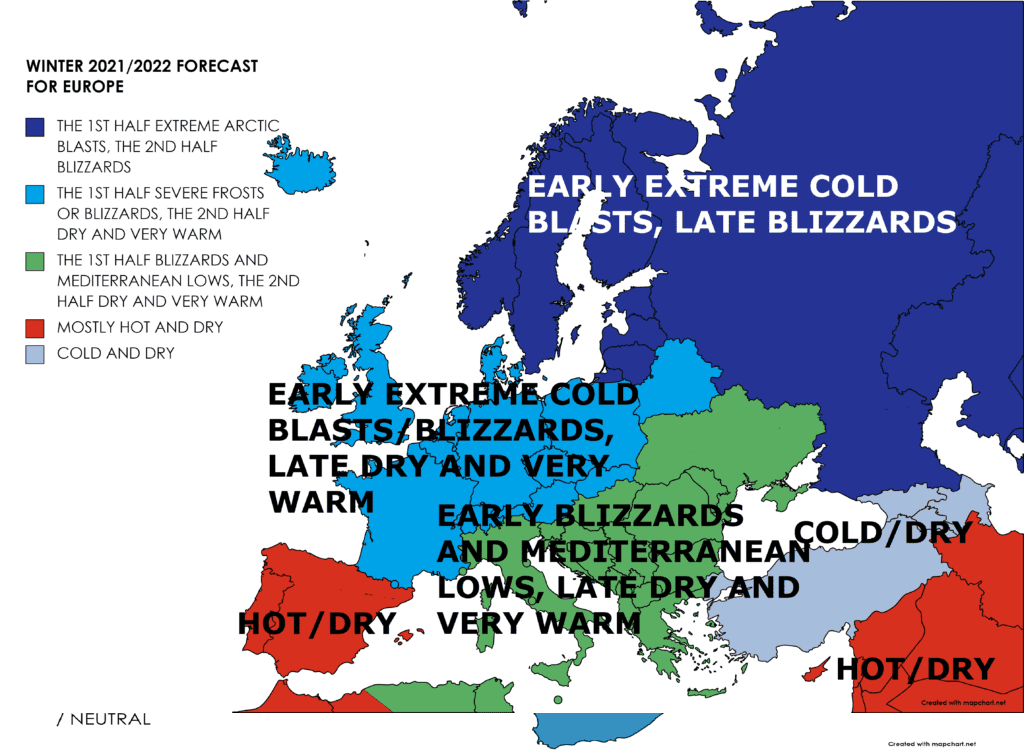
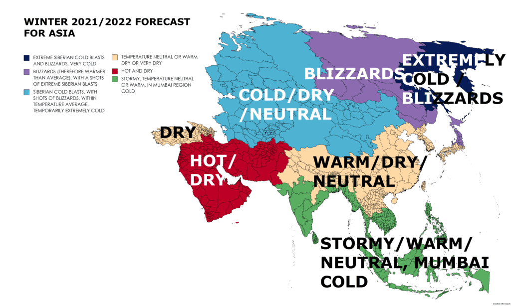
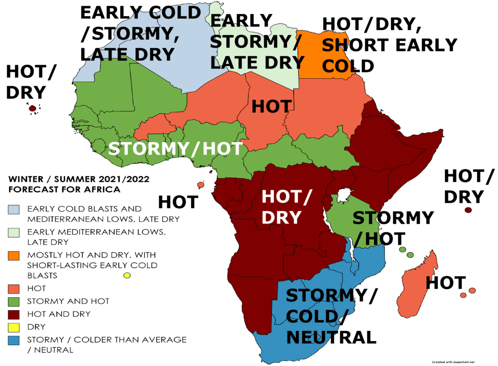
Continental forecasts for Winter (in Southern Hemisphere Summer) 2021/2022 for Europe, North America, Asia, Africa, Australia and Oceania, South America and Antarctica we published during early Autumn 2021 here: https://mkweather.com/winter-2021-2022-forecast-for-europe-early-extreme-arctic-and-siberian-blasts-and-blizzards-late-dry-and-very-warm-conditions/; https://mkweather.com/winter-2021-2022-forecast-for-north-america-a-peak-of-winter-with-extreme-arctic-blasts-and-blizzards-in-february-2022/; https://mkweather.com/winter-2021-2022-forecast-for-asia-early-extreme-arctic-and-siberian-blasts-and-blizzards-late-dry-and-warm-conditions/; https://mkweather.com/winter-and-summer-2021-2022-forecast-for-africa/; https://mkweather.com/summer-2021-2022-forecast-for-australia-and-oceania-stormy-colder-la-nina-pattern-above-the-continent/; https://mkweather.com/summer-2021-2022-forecast-for-south-america-stormy-north-hot-and-dry-south-cold-and-dry-pacific-coast/; https://mkweather.com/summer-2021-2022-forecast-for-antarctica//.
Sun cycle
In the last period, the first significant eruptions of the 25th cycle have appeared.
Lower Sun activity is traditionally linked with El Ninos and NAO- / AO- phases (2/3 of the peak of a Little Ice Age were El Ninos and AO- / NAO-).
In the next years, despite stronger Sun activity, El Nino years, with a possibility relatively stronger AO-/NAO- winters are forecasted (probably until 2025).
After 2100, overall (approximately minimally until 2500), very low Sun activity is however according to long-term modeling studies possible, what should have a positive effect on climate change.
December 2021
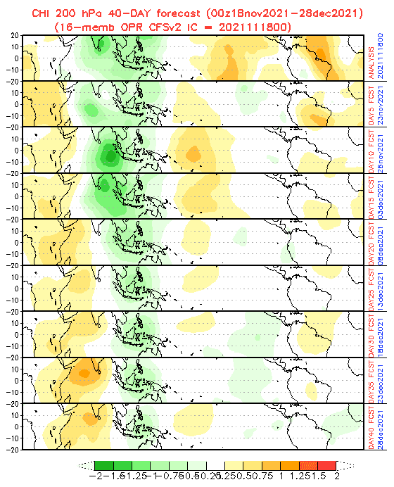
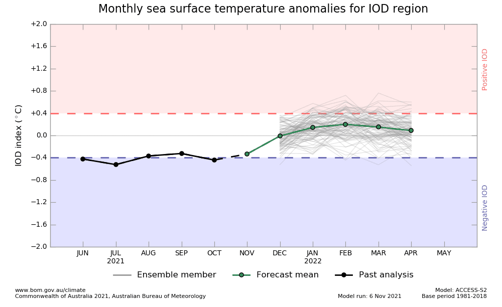
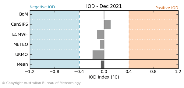
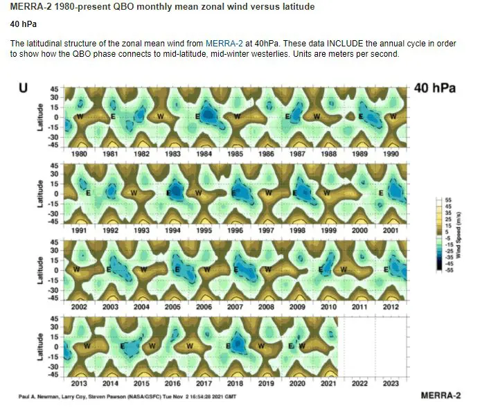
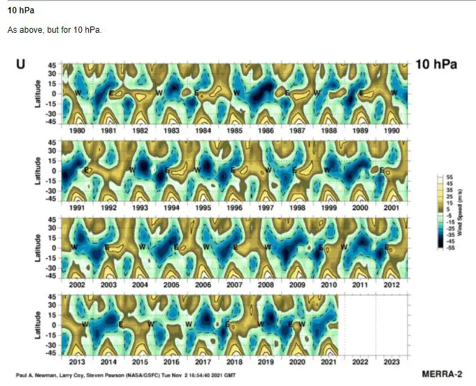
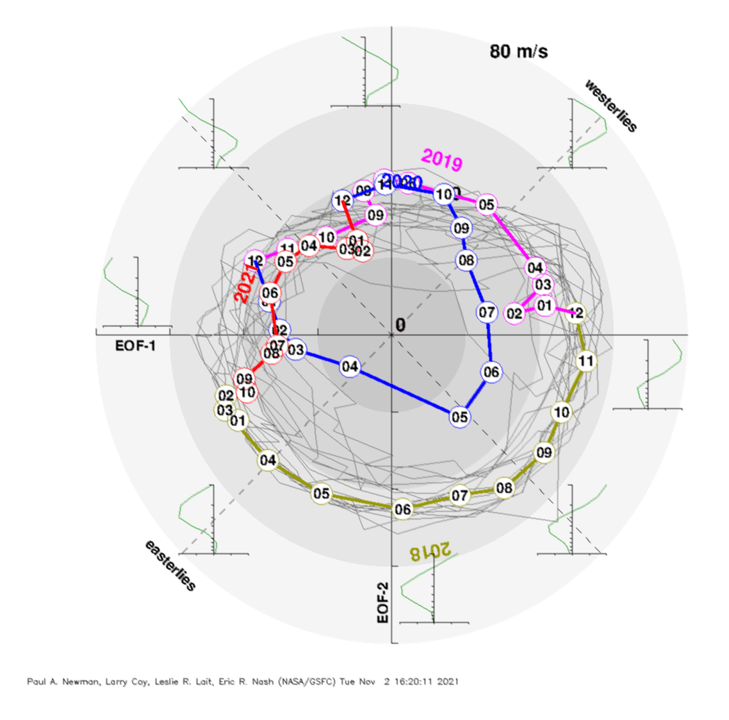
In December 2021, the lowest AO- / NAO- is generally expected, with stronger winter in Eurasia/ North Africa, and weaker winter conditions in many parts of North America. MJO is forecasted to be very wet above SE Asia, QBO still in easterly phase, NE Pacific Blob won´t be developed yet, SSWs should appear, negative IOD is still possible and La Nina will be strengthening.
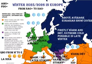
Europe
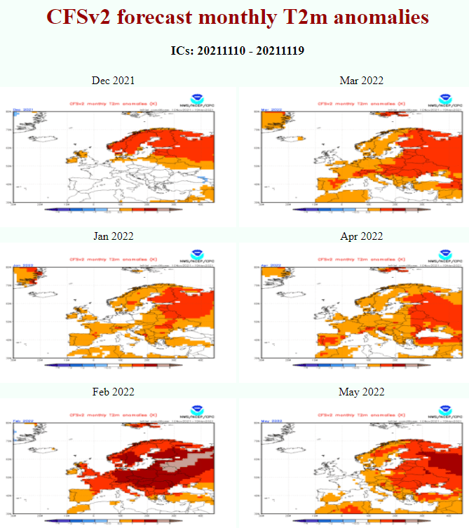
NAO / AO: Negative phases of North Atlantic Oscillation and Arctic Oscillation should bring rounds of extreme, possibly regionally historic/legendary December frosts above the wider European region /see materials on our homepage/. Many Mediterranean lows with possible blizzards, Greenlandic, Arctic, and Siberian air outbreaks are highly possible, with a strengthening of winter conditions until the New Year 2022. Shorter warm periods should appear, too, but cold conditions will be leading. Frosts up to -20°C in British Island and Iberia, -25°C in Balkan, Eastern Europe, and France, -30°C in Central Europe and -35°C in Scandinavia are very possible during the peaking of extreme coldwaves.
MJO: Wet MJO above SE Asia correlates with NAO- phases above Europe, both are in December 2021 expected. It´s mainly phases 4-7 when tropical systems are situated above the eastern Indian Ocean.
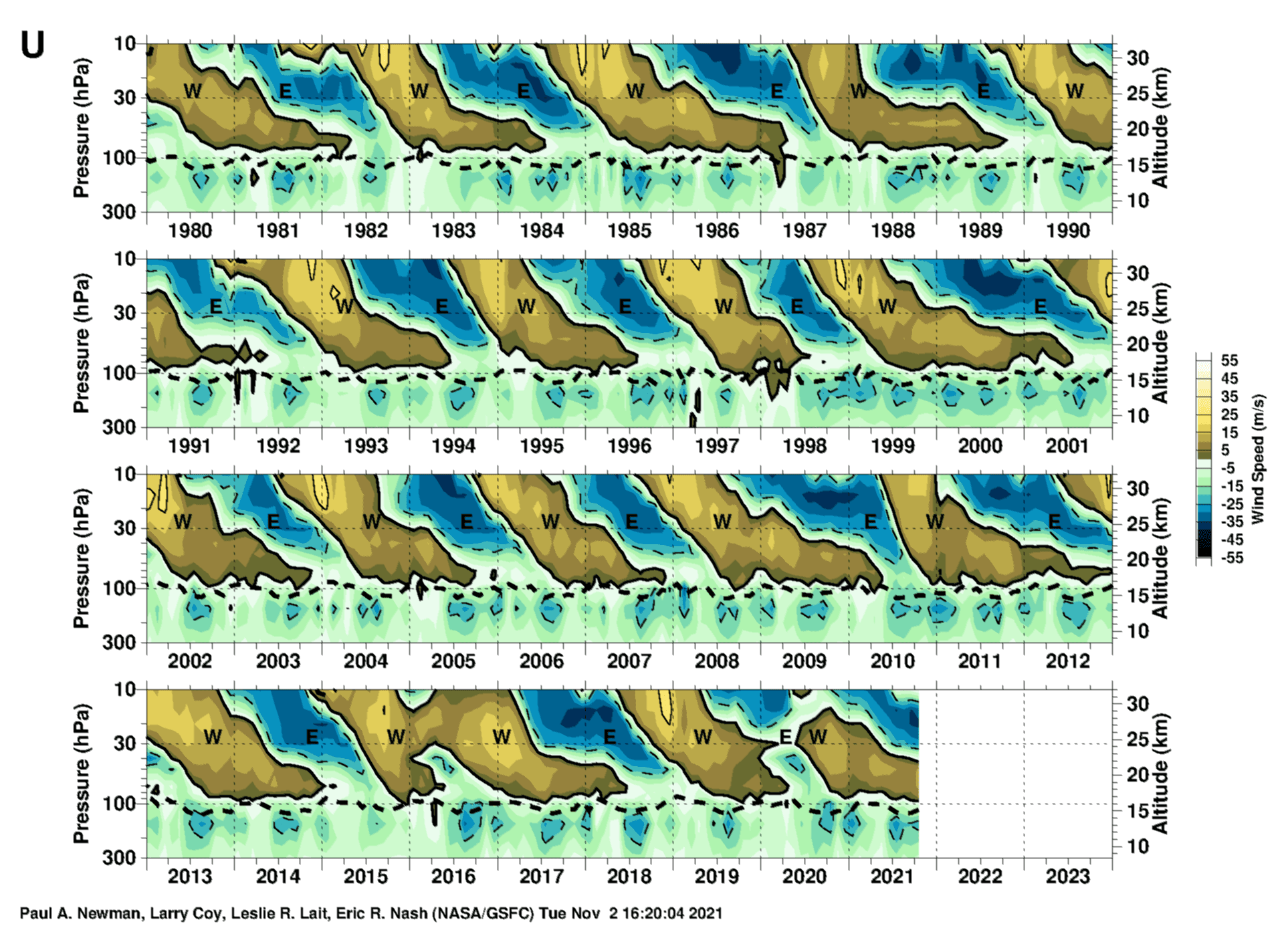
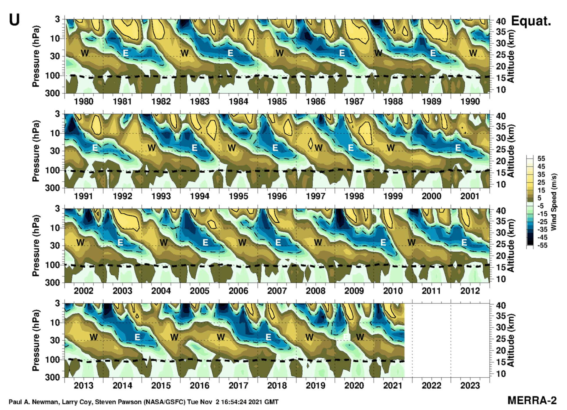
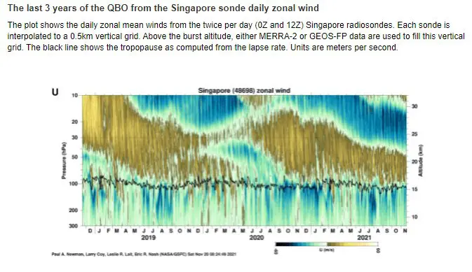
QBO: Easterly QBO should mean relatively increased chances for continental airflows.
NE Pacific Blob: Still not a very developed anomaly, which is bringing warm conditions and NAO+ in Europe. Favorable for coldwaves.
SSW: Possible fall of AO and NAO indices very low and destabilization of polar vortex very possible from late November to early January 2021-2022.
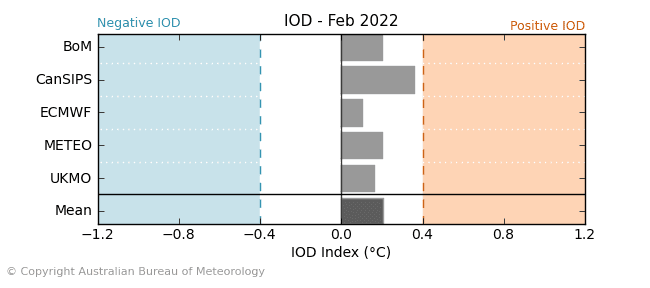
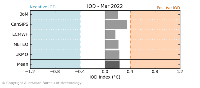
IOD: Slight negative phase, with the tropical system above the eastern Indian Ocean, correlates with NAO- and colder conditions in Europe.
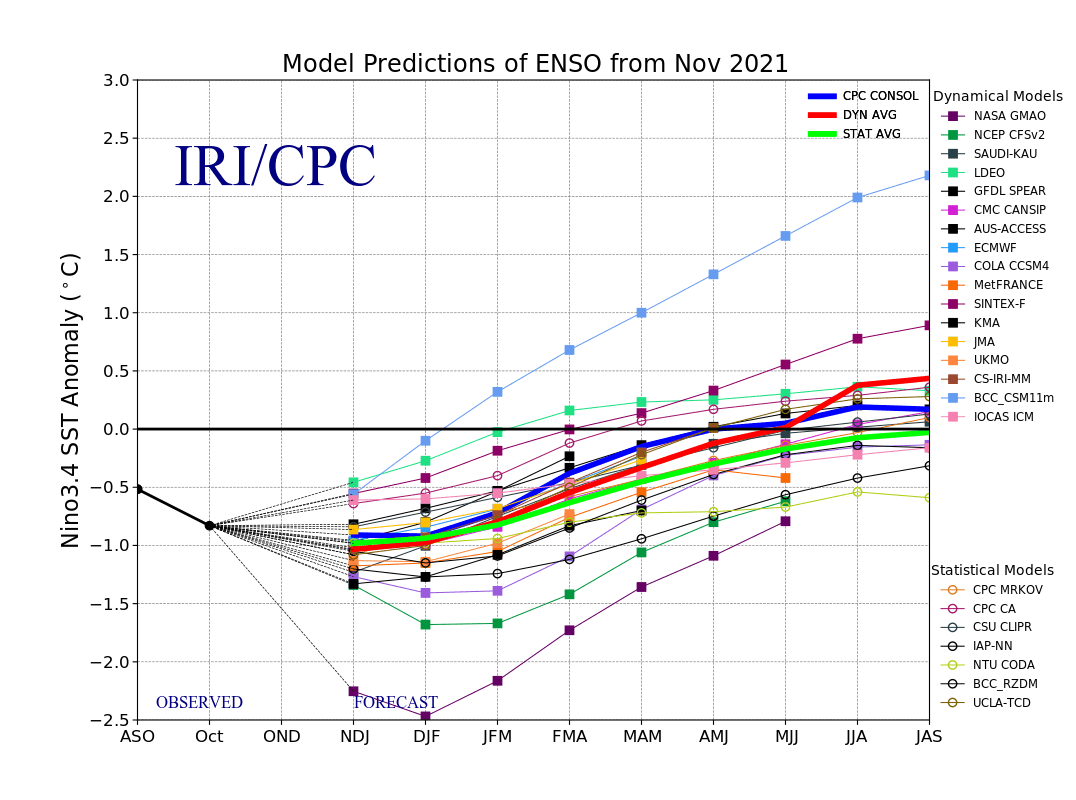
La Nina: Strengthening La Nina should mean during AO-/NAO- phases colder planetary conditions.
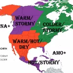
North America
NAO / AO: Negative AO should bring some coldwaves to all North American sector, but NAO- is associated with the warm East Coast in Canada and the USA.
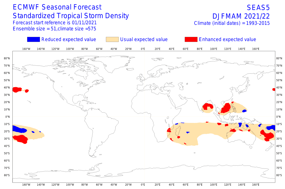
MJO: Mostly dry MJO above Northern Atlantic, without significant remnants of hurricane season.
QBO: Easterly phase, with relatively weaker zonality.
NE Pacific Blob: Still not fully developed, weaker coldwaves, situated mainly in Alaska and Western Canada.
SSW: During a very low AO index, the highest probability of extreme cold blasts despite other important warming factors.
IOD: NAO- driven (look NAO / AO above).
La Nina: Cold anomaly in Alaska, Western Canada, maximally Central Canda, and Northern USA, with warmer conditions in the southern USA.
Asia
NAO / AO: NAO- and AO- will bring gradually possible severe frosts, firstly in the Middle East and Central Asia, later in Siberia, India (Western Disturbances), and East and Southeastern Asia. Peaks of Siberian and Arctic blasts a few weeks later than in Europe.
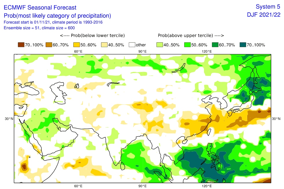
MJO: Wet MJO above SE Asia, with strong monsoon rains in SE Asia and India – here mainly in the Bay of Bengal. Supporting cold blasts above the Asian continent.
QBO: Easterly phase with more continental airflow conditions.
NE Pacific Blob: Colder effect into Asia, still not developed.
SSW: During very low AO- a possibility of belt extremely cold air across all Northern Hemisphere, with a shifting of Siberian air masses across the continent, Europe, and North Africa.
IOD: Still negative phase, with higher precipitation in the eastern Indian Ocean and drier in the western Indian Ocean (including the southern Middle East). Supporting colwaves across the continent.
La Nina: Strengthening La Nina means very wet conditions in southern monsoon Asia, but East Asia should be mostly drier, with winter monsoon.
North Africa
NAO / AO: Negative NAO/AO conditions bring Mediterranean lows with snowing and frosts in Atlas, and rarely in deserts. A possible coldest period of winter regionally. Anomalously stormy, possibility of floods.
MJO: Mostly drier cyclone season, drier conditions above the western Indian Ocean.
QBO: Easterly, continental phase.
NE Pacific Blob: Favorable for NAO-/AO-, Mediterranean lows and Arctic blasts.
SSW: Possibility of premature peaks of winter, together with Europe – west earlier, east later.
IOD: Negative, with drier cyclone season and western Indian Ocean (East and Southern Africa). More NAO-(AO-).
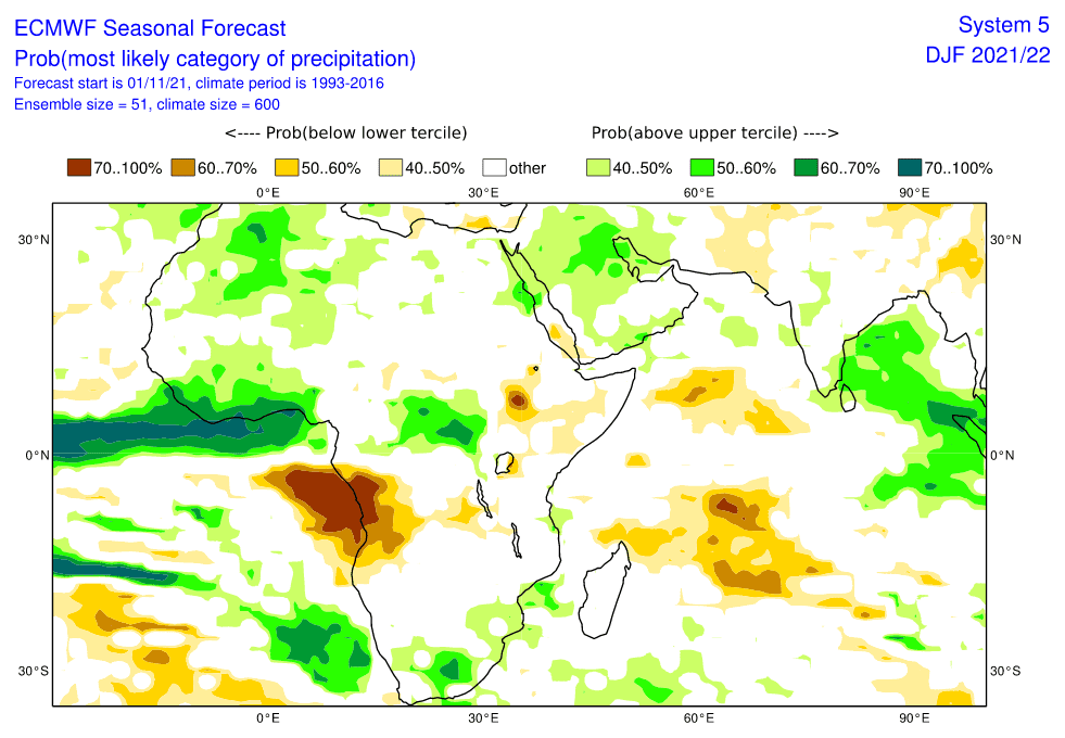
La Nina: Despite negative IOD and drier MJO, positive effect on precipitation regimes across Africa with more fertile conditions such as during El-Nino.
AAO: Possible positive phases, with effects of more southern ITCZ positions such usual.
January 2022
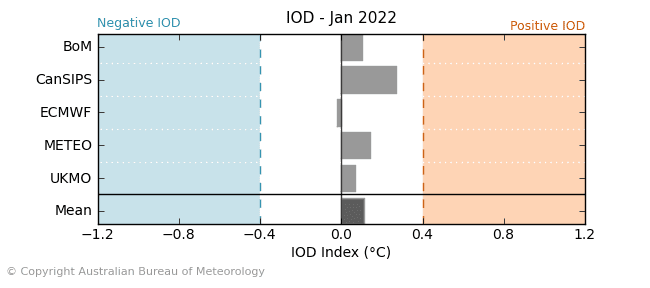
In January 2022, possible transitions from NAO-/AO- to NAO+/AO+ phases are forecasted. MJO is forecasted to be weaker above SE Asia such as in December, but still wet, QBO still in easterly phase, NE Pacific Blob will be strongly developing, SSWs should appear mainly around the New Year, transition to slightly positive IOD and La Nina will be still strengthening.
Europe
NAO / AO: Still relatively good, neutral, or slightly negative conditions, remnants of dry and cold air should persist above continental Europe (from eastern France to Ukraine). Iberia, British Islands, Eastern Europe, and Scandinavia little warmer than December. The Mediterranean with more clear nights and fewer Mediterranean lows, but still snow calamities during NAO-/AO- periods possible.
MJO: Weakening of wet MJO above SE Asia, but still relatively good conditions for polite coldwaves and NAO- episodes.
QBO: Still in easterly phase, during NAO- with a possibility cold blasts in British Islands, Iberia, and Western Europe.
NE Pacific Blob: Developing anomaly, correlating with warmer conditions in Europe and more NAO+ / AO+. Late January is more probable warm conditions than New Year.
SSW: Early January possibly higher probability of SSWs such as in late January.
IOD: Transition from negative to positive numbers, but still mostly neutral conditions.
La Nina: Strong La Nina should mean colder planetary conditions in case of SSWs or AO-/NAO-.
North America
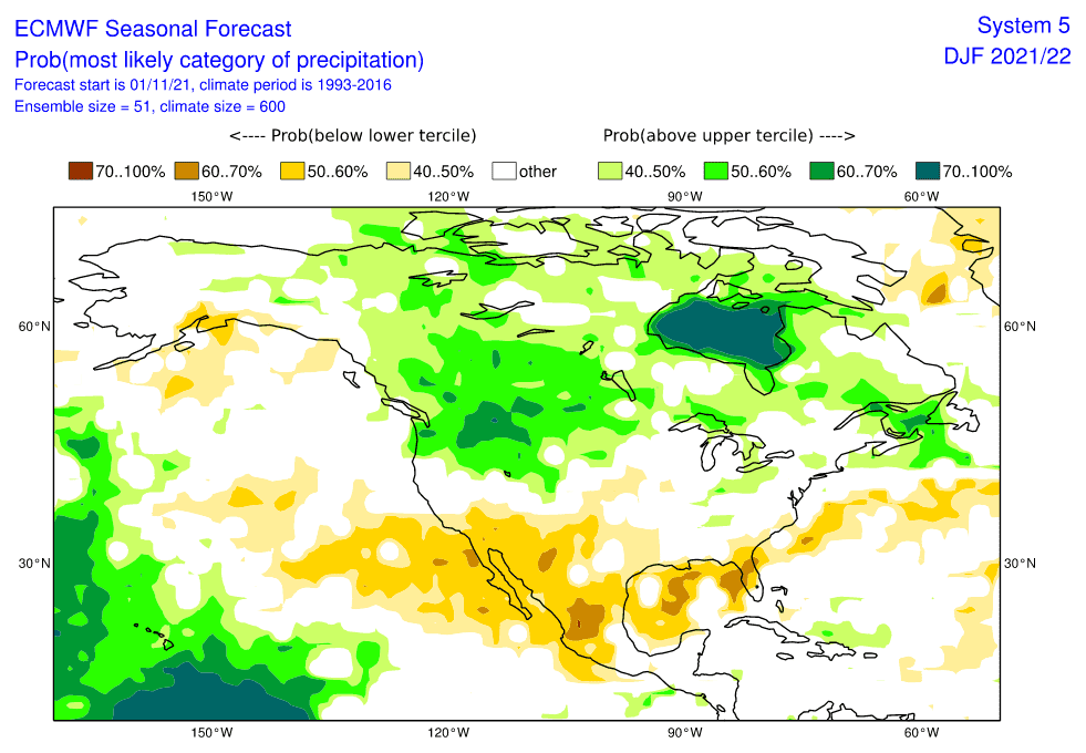
NAO / AO: Weaker NAO-/AO- conditions should mean colder East Coast, Canada, the USA and more coldwaves for North America. Spreading of cold anomaly from Alaska and Western Canada to Central Canada, Great Lakes region, Northern USA, temporarily southern and eastern USA, eastern Canada and Mexico.
MJO: Hurricane activity minimalized.
QBO: Still easterly continental phase.
NE Pacific Blob: Strengthening of anomaly, while for Europe it means warmer NAO+ conditions, for North America colder airflow on the front side of strong Hawaiian high from NW North America to east and south.
SSW: More probable in early January than in late in the month.
IOD: Neutral conditions.
La Nina: Strong pattern associated with cold anomalies across the continent (Alaska, Western, Central Canada, Northern USA) and warmer Southern USA. Together with NE Pacific Warm Blob main pattern bringing strengthening of winter conditions in continent.
Asia
NAO / AO: December coldwaves from Europe in the first half of the month should shift above Asia, with a possible peak of Winter 2021/2022. More NAO-/AO- on New Year, more NAO+/AO+ late in January.
MJO: Weakening, but still heavy rains, storms, and floods in SE Asia and India (monsoon Asia). Supporting NAO- epizodes.
QBO: Easterly continental phases, should bring more Siberian blasts in western parts of the continent.
NE Pacific Blob: Strengthening of anomaly means warmer contributions for Asia, thanks to higher chances to NAO+/AO+, mainly in late January.
SSW: Possible early January SSW should bring peaks of winter across Asia.
IOD: Neutral, later positive phase means a shift of tropical activity above the Indian Ocean from eastern to western parts. Weaker monsoon in SE Asia, stronger in India, and more precipitation in the southern Middle East.
La Nina: Strong, with support for monsoon conditions in southern parts of Asia and more fertile conditions.
North Africa
NAO / AO: Possible peaks of winter mainly in eastern parts, while from west gradual warming thanks to possible transitions from NAO-/AO- to NAO+/AO+. The declining activity of Mediterranean lows and floods. Coldwaves with snow and frosts mainly in early January.
MJO: Shift tropical activity westward, with better cyclone season conditions in East and Southern Africa and less probability of drought, heatwaves, and wildfires.
QBO: Easterly, colder phase.
NE Pacific Blob: Contribution to shift from NAO- to NAO+ and a possible warming up during the month.
SSW: Still possible mainly in early January 2022.
IOD: Transition to a slight positive phase, with an awakening of cyclonic activity from Somalia to South Africa. More fertile conditions.
La Nina: Contribution to more precipitation, mainly in central and southern African states, with more fertile conditions such as during El Nino.
AAO: Little more northern position of ITCZ such as in December.
February 2022
In February 2022, possibleNAO+/AO+ phases are forecasted. MJO is forecasted to be weaker above SE Asia, QBO in a weaker easterly or neutral phase, NE Pacific Blob will be strongly developed, hemispheric SSWs are less probable, positive IOD and La Nina will be still strong.
Europe
NAO / AO: Forecasted NAO+/AO+ conditions mean more western and southern airflow above Europe and wider European region, with more Azores high effects. Icelandic low should be deep and stormtrack more northward, with heavy rainfall in Scotland, Scandinavia, or Baltic region, but continental Europe (mid-latitudes) and the Mediterranean should be very warm and dry (the only Mediterranean thanks to lower humidity with a possibility of colder nights). Early spring conditions possible and above +20°C in mid-latitudes (from France to Ukraine) should be possible, while in Mediterranean peaks of winter heatwaves with summer temperatures (above +25°C).
MJO: The next weakening above SE Asia, the possibility of phases 8, 1-3. Supporting for NAO+/AO+ conditions (warm Europe).
QBO: Weaker easterly or neutral phase, higher possibility of oceanic conditions.
NE Pacific Blob: Fully developed, bringing NAO+/AO+ and very warm conditions in Europe.
SSW: Probably not very strong declines of AO index and lesser probability of SSWs.
IOD: Positive IOD, with contributions into NAO+/AO+ and warmer conditions in Europe.
La Nina: Still relatively strong, but other factors will be more important for Europe and most of the Northern Hemisphere.
North America
NAO / AO: NAO+/AO+ should mean very cold conditions in Eastern Canada, the Great Lakes region of NE USA. During AO+ less of Arctic blasts in southern USA and Mexico but still a possibility of combination NAO+ with AO- / AO neutral.
MJO: Not important.
QBO: Stronger oceanic neutral or still weaker easterly phase.
NE Pacific Blob: Fully developed, significantly affecting extremely cold conditions across Canada, northern USA, the Midwest, and temporarily other parts of the USA. The peak of Winter 2021/2022.
SSW: An only continental peak of Winter 2021/2022.
IOD: Positive phase, linked with NAO+ and colder Eastern Canada, Great Lakes, and NE USA.
La Nina: Still strong, effects on cold Alaska, Canada, N USA, Midwest, temporarily up to northern Mexico during AO-.
Asia
NAO / AO: AO+/NAO+ means warmer Siberia, East Asia, Central Asia, with early spring conditions in southern regions and early heatwaves from the Middle East to East Asia.
MJO: Weaker above SE Asia, effect to more NAO+/AO+ and warmer conditions above the continent, above monsoon Asia colder nights and fewer floods, but less fertile.
QBO: More oceanic.
NE Pacific Blob: Fully developed, linked with possible warm conditions across Asia, arriving from the west.
SSW: Low probability.
IOD: Positive phase with cyclone season in Western India and the southern Middle East.
La Nina: Still strong, with contributions into monsoon rain in southern Asia, but other factors will be more important.
North Africa
NAO / AO: Hot NAO+/AO+ phases – heatwaves, early spring, drought, but a possibility of colder nights in the Mediterranean.
MJO: Supporting cyclone season from Somalia to South Africa.
QBO: More oceanic.
NE Pacific Blob: Associated with NAO+/AO+ and early spring conditions in the region.
SSW: Low probability.
IOD: Positive phase, the possibility of strong cyclone season, with floods, but high fertility.
La Nina: Supporting stormy conditions, fertile season.
AAO: Possibly more negative/neutral, with a more northern position of ITCZ.


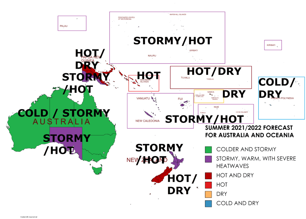
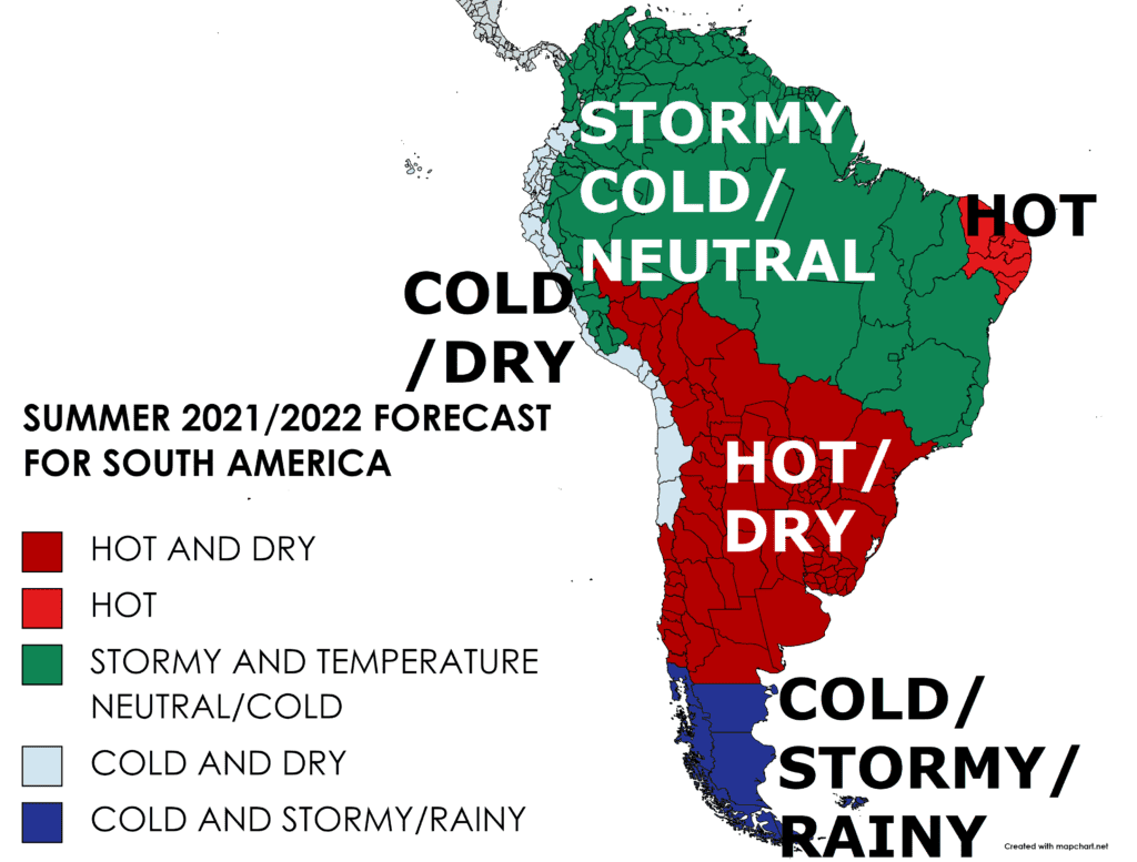
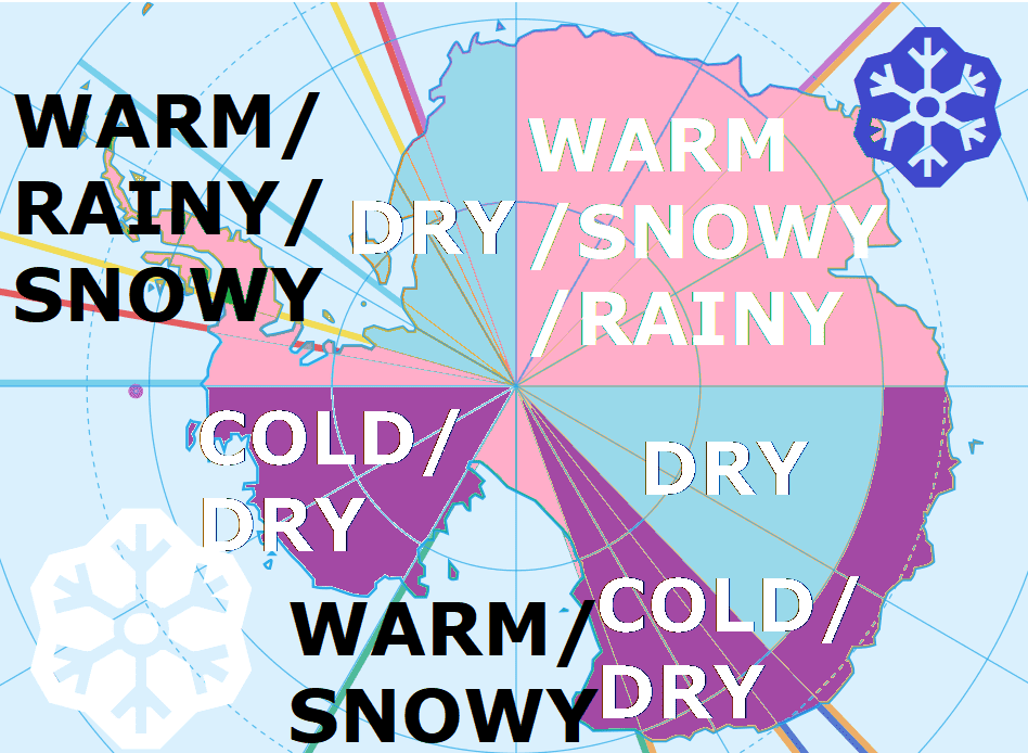
Sources: Continental Mkweather forecasts – links in the article.
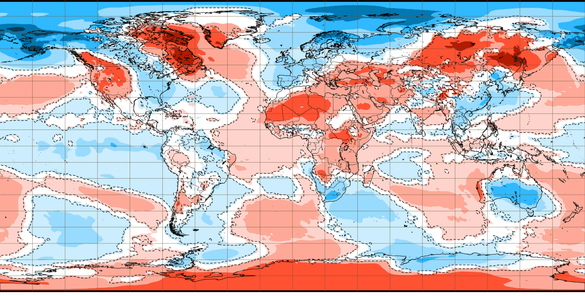
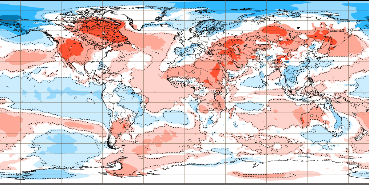
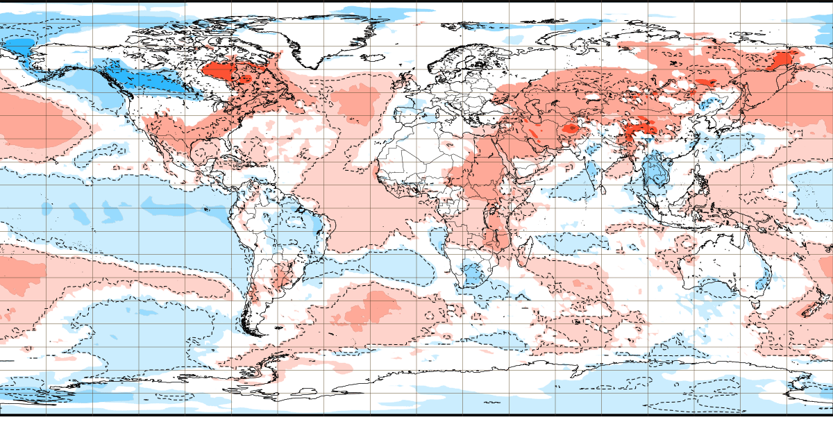
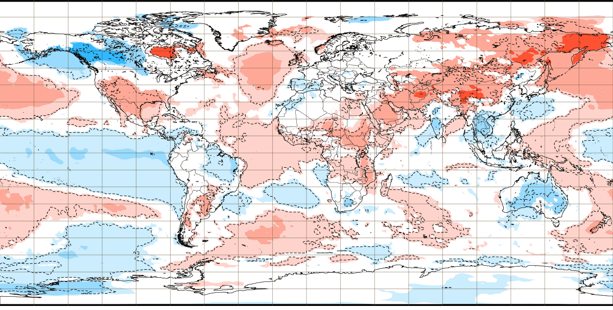
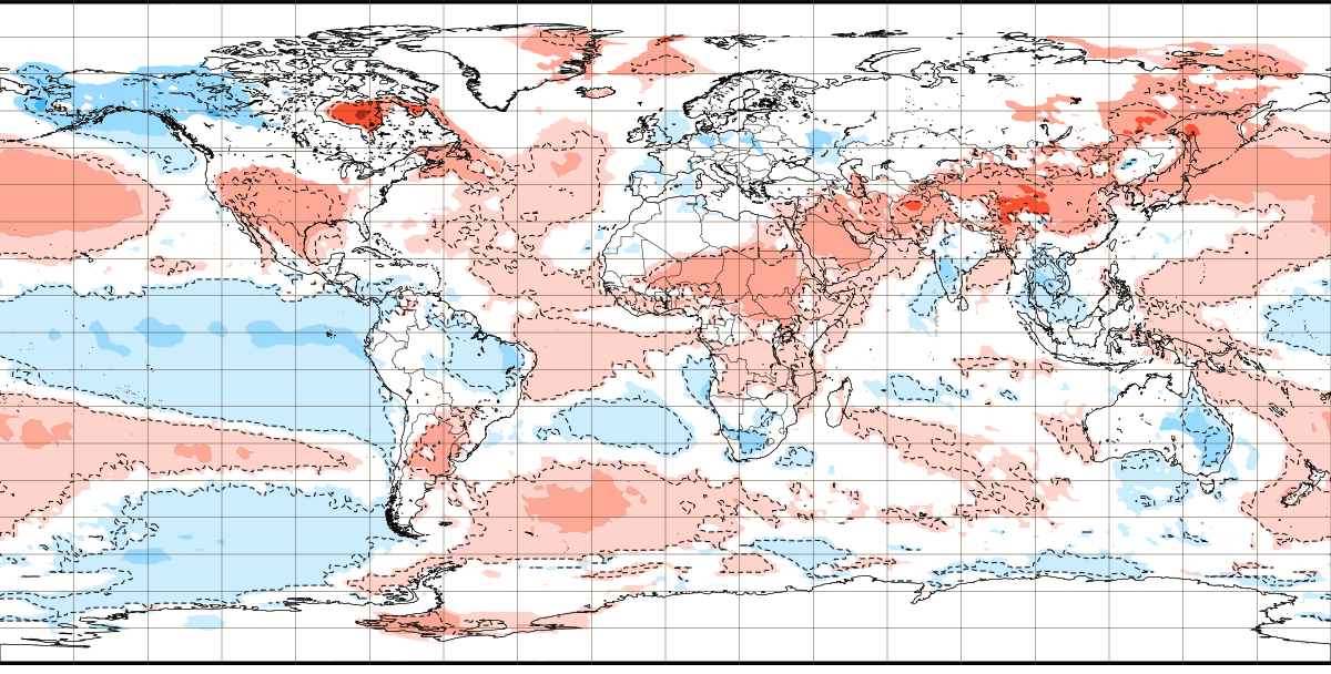
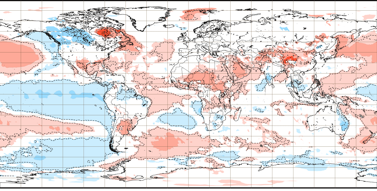
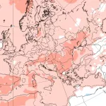
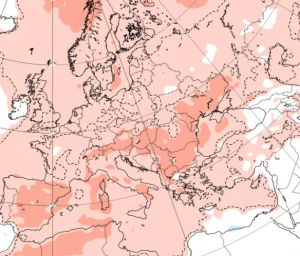
ECMWF 6-week global temperature forecast for a period 22. November 2021 – 3. January 2022 /Source: https://apps.ecmwf.int/webapps/opencharts/products/extended-anomaly-2t?base_time=202111180000&projection=opencharts_global&valid_time=202201030000
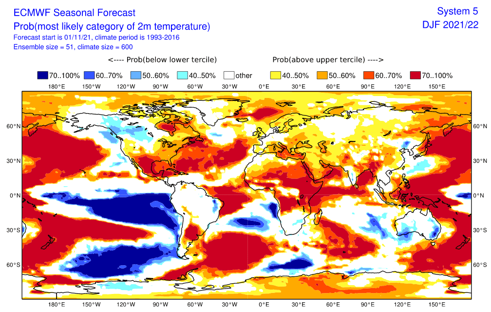
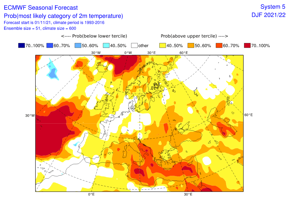
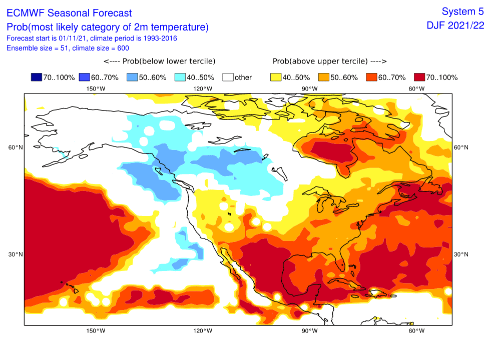
Source: https://acd-ext.gsfc.nasa.gov/Data_services/met/qbo/qbo.html
