Pacific hurricane season 2021 is bringing the first tropical storm, Andreas, in early May 2021, with impact in Mexican coast.
Chances for formation of the first tropical storm were before 48 hours (on Friday, 7. May 2021) around 60%, now it is the first tropical storm in North American sector of the year.
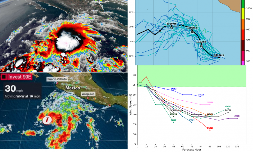
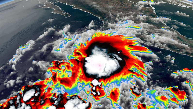
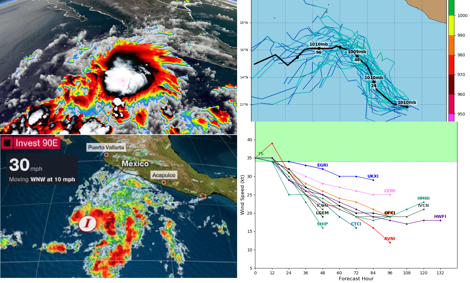
Despite of complications near development with negative impact of moderate west-southwesterly wind shear on the system, disturbance was designated as a Tropical Depression 90E Invest on 8. May 2021, 9:00 and only 6 hours later has become the earliest tropical storm in Eastern Pacific ever, in all-time satellite era measurements. The previous record held Tropical storm Adrian from 2017, which formed 12 hours later, on 9. May 2017.
50 -75 mm (2-3 inches) of rain and hailstorms were forecasted for Colima and Jalisco states, Mexico around Sunday, 9. May 2021, with significant threat of severe weather along southwestern Mexican coast.
Pressure in the middle of system reached 1005 hPa and wind gusting 85 km/H, while 1-minnute sustained winds up to 65 km/h at the weekend, 8.-9. May 2021.
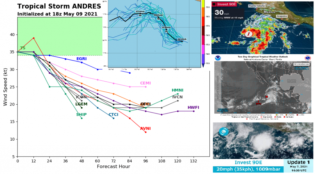
System is forecasted to shift northwestward, later westward above Pacific Ocean and desintegrated until Tuesday – Wednesday, 11.-12. May 2021.
Thanks to strong La nina, severe Hurricane and Tornado seasons in 2021 are in North America expected /https://mkweather.com/hurricane-and-tornado-season-2021-in-the-usa-above-average-expected-thanks-to-la-nina-forecast//.
Stronger monsoon in NW Mexico and SW USA is in Summer 2021 possible, but stormy east of the continent is forecasted, too, with early summer tornadoes and late summer hurricanes /https://mkweather.com/summer-2021-forecast-for-north-america-hot-stormy-east-and-dry-west/; https://mkweather.com/accuweather-summer-2021-forecast-for-the-usa-agrees-with-mkweather//.