NAO+ anticyclonic weather: Forecasts for April in Europe are sunny and warm
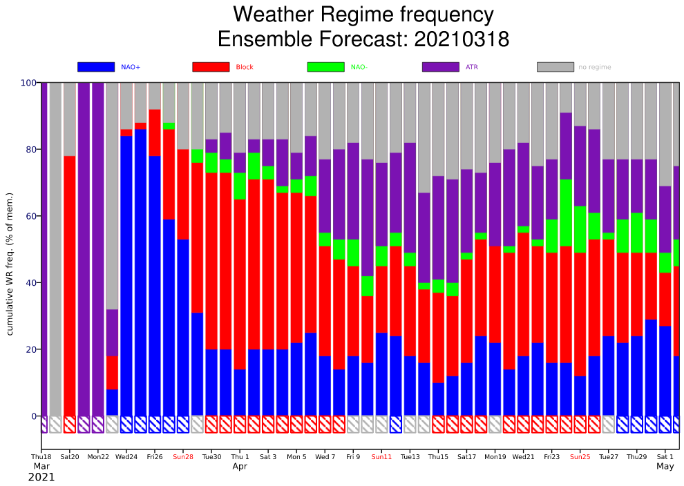
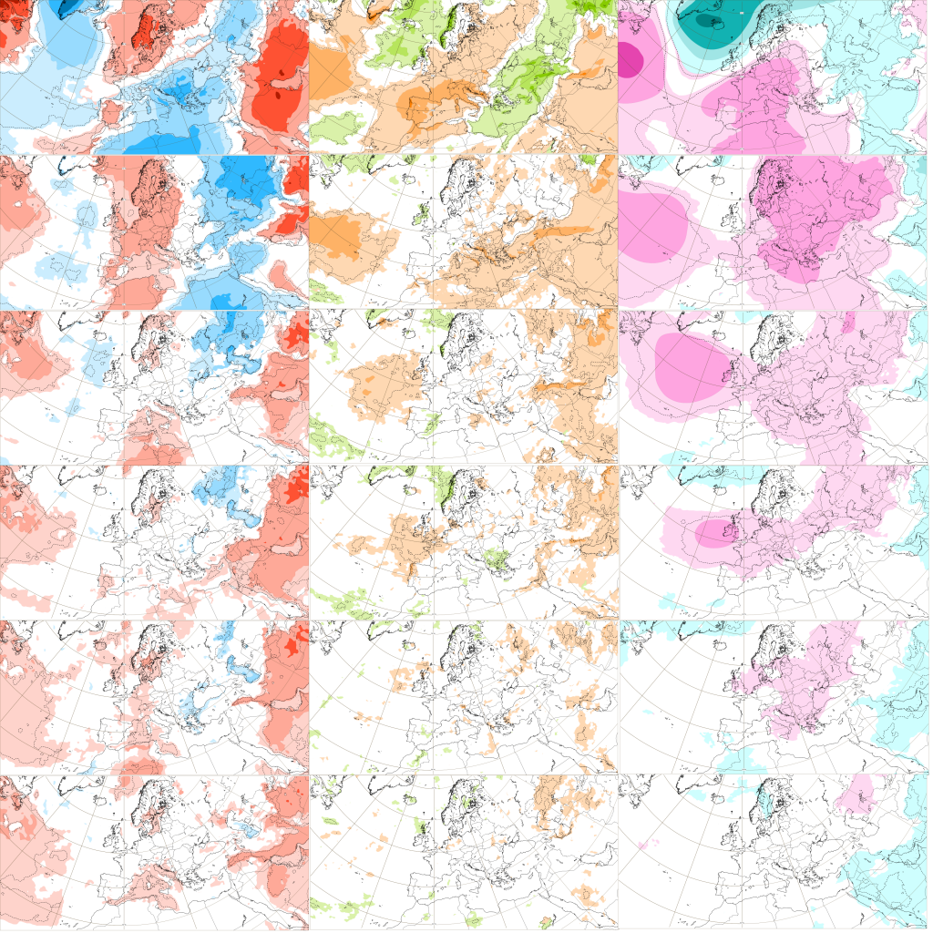
The newest ECMWF forecasts of Weather Regime frequency and temperature, precipitation and air pressure anomalies for Europe expect still very sunny, anticyclonic and warm April 2021.
Dominant circulation pattern should be atmospheric blocking, but NAO+ will be stronger than NAO-, with result of shifted subtropical belt of high pressure into northern latitudes.
This NAO+ signal should be responsible for many expected high pressure anomalies across Europe during a month, with strong Azores high, often above parts of Europe.
Dry and sunny weather should bringing days above +20°C, or even summer days above +25°C on tha back sides of anticyclones.
After extreme warm spell at the end of March and at the start of April 2021 /https://mkweather.com/paris-27c-at-the-end-of-march-is-possible-extreme-hw/; https://mkweather.com/summer-and-stormy-start-of-april-2021-in-the-uk-france-germany-and-benelux-extreme/; https://mkweather.com/the-first-summer-heatwave-25c-and-powerful-storms-on-cold-front-already-at-the-end-of-march-extreme-weather//, when around +27°C should be measured in Paris region, France and above +25°C in close parts of Germany, Benelux and England, possibly cold front intterrupts this advection of heat and weather closer to normal should persist over Europe after Easter.
The second half of April 2021 should bring the next warming and the next possibility of summer days, according to the newest materials.
Any bigger or extreme cold spells in Europe aren´t in circulation such this (NAO+ and blocking) forecasted until 3. May 2021, but light late frosts should surprise, yet, mainly on the front side of Azores high, in relatively colder and very dry air.
If you need an information about possible next rounds of frosts during Spring 2021, watch our forecasts – late frosts will be surely a topic of our articles in the case, that colder anticyclonic situation will be expected.