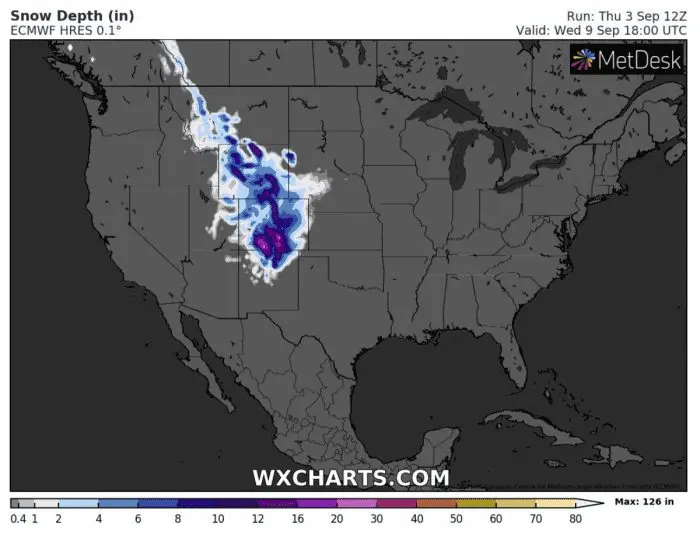
Snow in lower areas across the USA! Colorado 60°F fall of temperature from morning to evening

US will be expecting with the biggest coldwave on the planet next week, with snowing in lower areas and powerful cooldown, in Colorado on Wednesday 60°F for 18 hours!
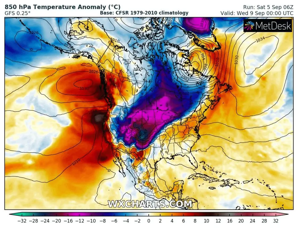
As we pointed in previous series of articles /COLD WEEK IN THE US; 50 F COOLDOWN AND SNOWING/ and as noticed other extreme weather websites /https://www.severe-weather.eu/global-weather/cold-forecast-fall-temperature-drop-mk//, large parts of US (and Canada) are expecting abnormally strong early autumn coldwave.
In some states, such as Colorado or Wyoming, weather will literally go from tropical summer to cold winter!
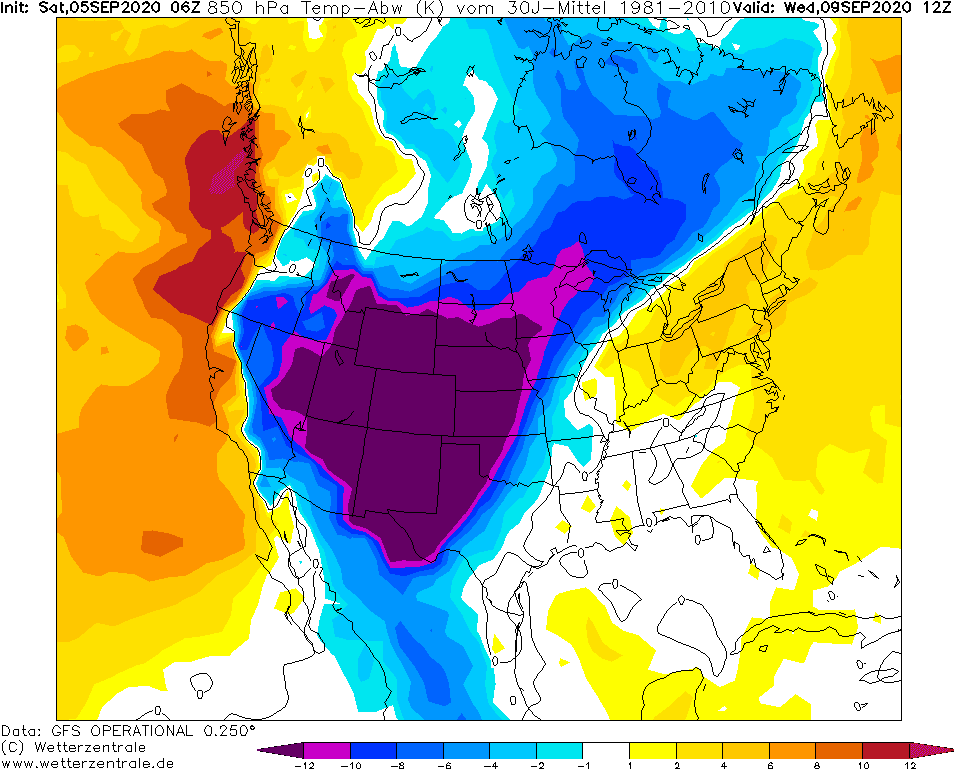
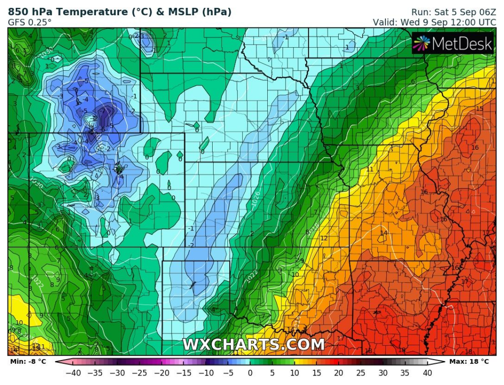
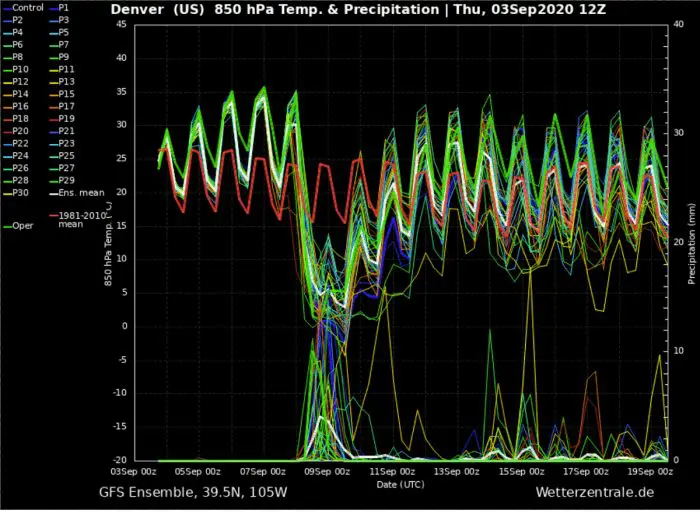
Drastic cooldown in Denver from 35°C (95°F) to 0°C (32°F) in 850 hPa will be accompanied with similar cooldown in 2m level. Anomaly in 850 hPa below -22°F / 12°C will appear above 13 American states at the same moment.
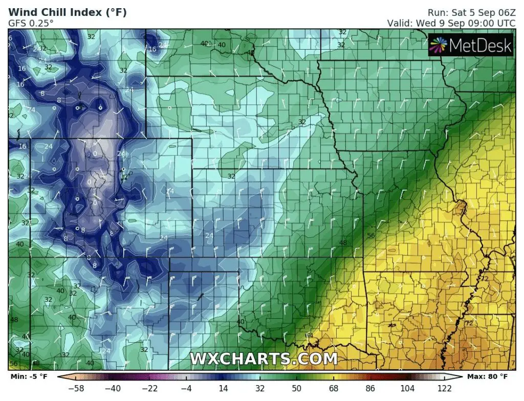
In some parts of Colorado GFS model predicts cooldown from +97°F at Tuesday´s midnight to +37°F in Wednesday´s evening, 18:00 – 60°F for only 18 hours! Similar conditions will be rule across large and populated areas from Montana to New Mexico and Texas. 2 American states – Colorado and Wyoming will be whole under the snow!
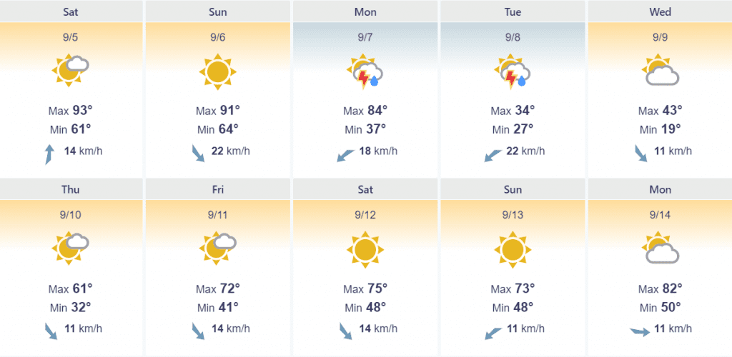
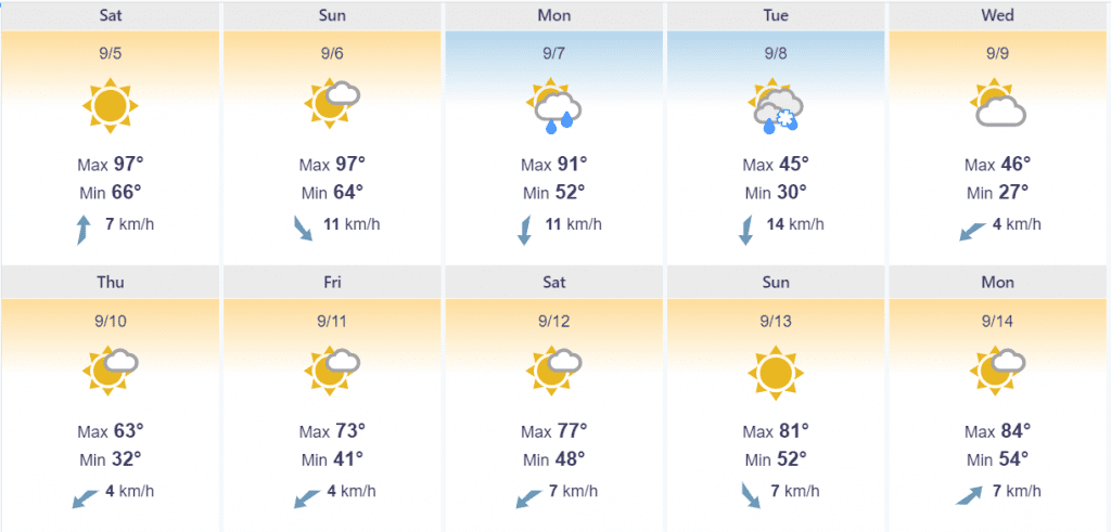
While at the weekend Denver, Colorado delights tropical +36°C (97°F), on Tuesday maximum temperature reaches only +7°C (45°F) and on Wednesday +8°C (45°F) with morning -3°C (27°F) frost and snowing!
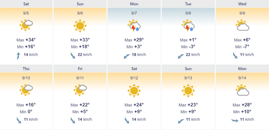
Cheyenne, Wyoming alives cooldown from 93°F (34°C) to 19°F (-7°C) from Sunday to Wednesday, on Tuesday with maximum temperature only 34°F (+1°C) and possible snowstorm.
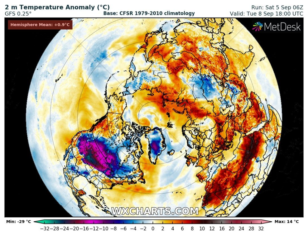
Coldwave will be the strongest during all next week across planet. Stronger cooldowns or temperature anomalies from long-term average occur nowhere.
Moreover, powerful cold front will be linked with severe storms in eastern half of US territory in next days.
Instead of Autumn 2020 in some parts of USA comes straight a winter.
Infographics: Expected cooldown according to wetterzentrale.de, wxcharts.com, severe-weather.eu and foreca.com
Denver, Colorado
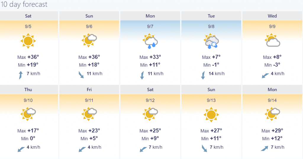
Cheyenne, Wyoming