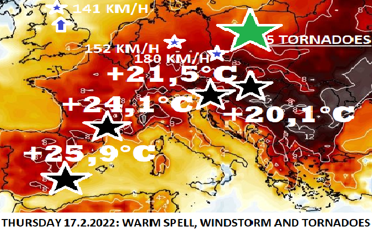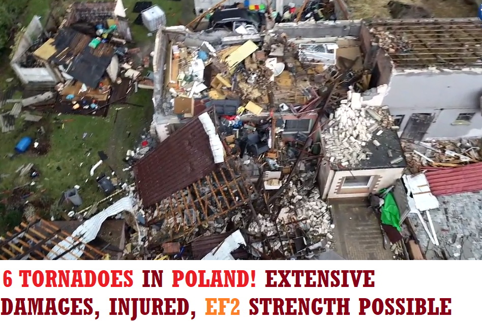

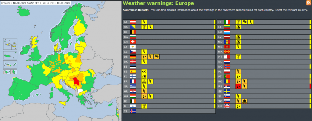
On Tuesday, still severe storms and heavy rain bother large parts of Europe. According to ESTOFEX, 2. level of warnings before storms is valid for Serbia, Croatia, Slovenia, Bosnia and Herzegovina, Montenegro, Kosovo and parts of Italy, Austria, Hungary and Romania. In Serbia, 3rd level before heavy rain is actual and many countries has valid 2. level before storm and heavy rain (Germany, Poland, Slovakia, Hungary, Croatia and Romania) in Tuesday early evening on meteoalarm.eu.
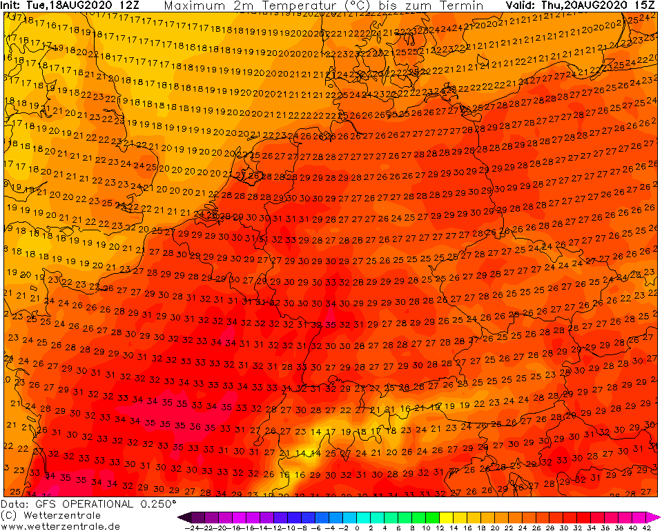
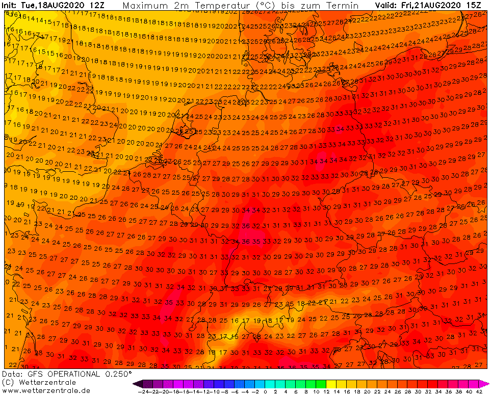
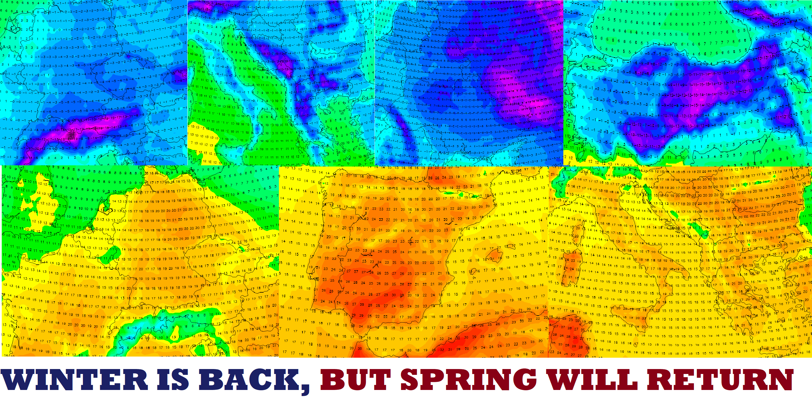
After storm period, a short, but relative powerful heatwave will come from Wednesday to Friday above France and Central Europe, with maximum temperatures over France up to +38°C and over Germany up to +36°C.
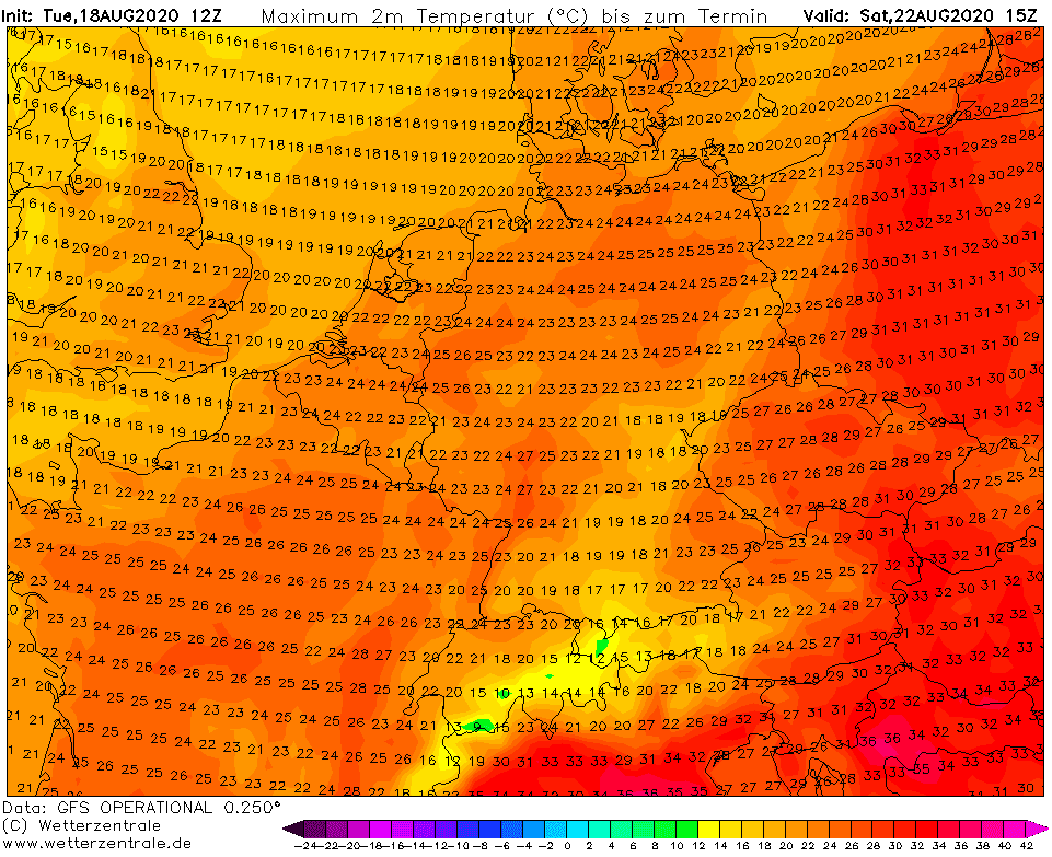
Weekend and the start of the next week will be colder, after cold front linked with ex-tropical storm Kyle.
Next week, a similar situation will repeat, but with ex-tropical storm Josephine. Firstly short heatwave, but then longer cold period after ex-tropical low with southern stormtrack, with rain, then cold mornings and fresh air.
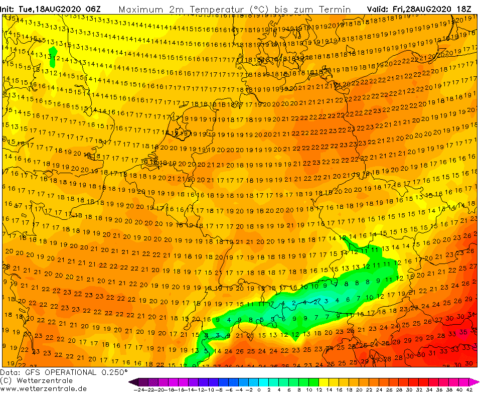
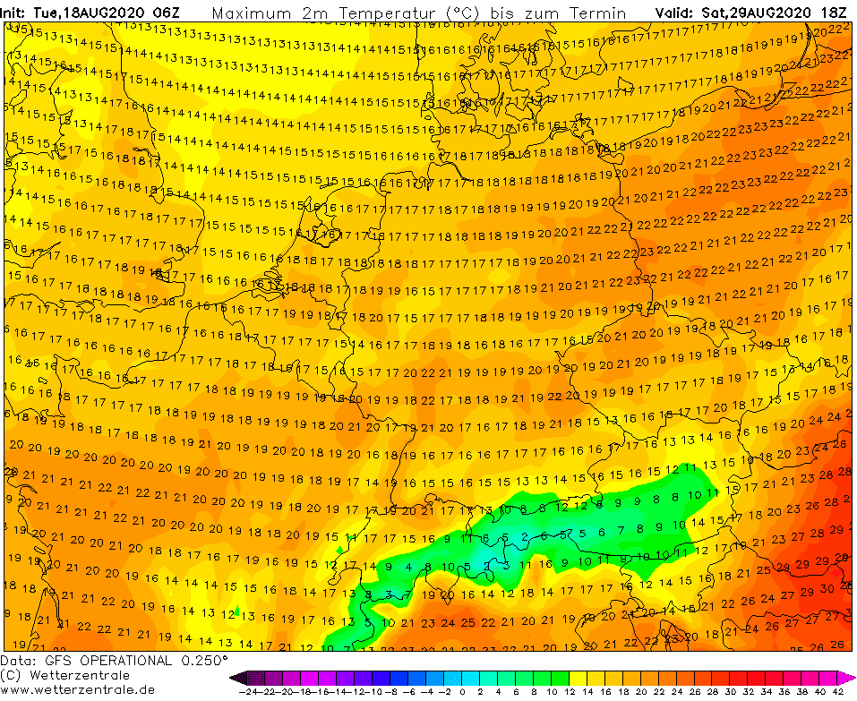
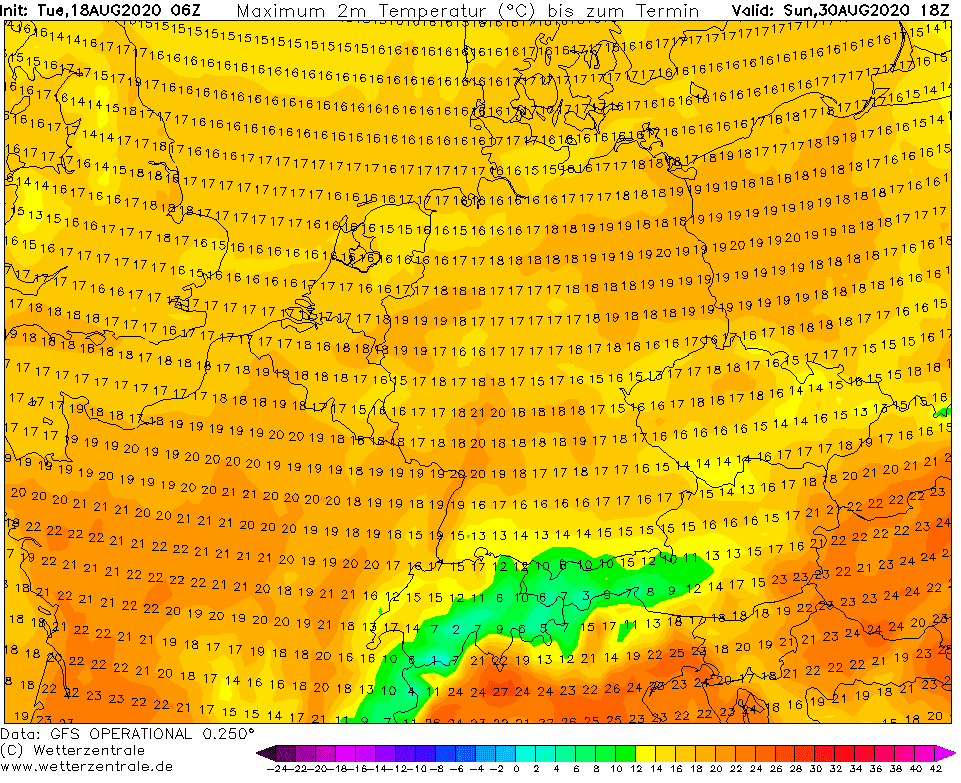
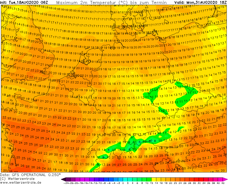
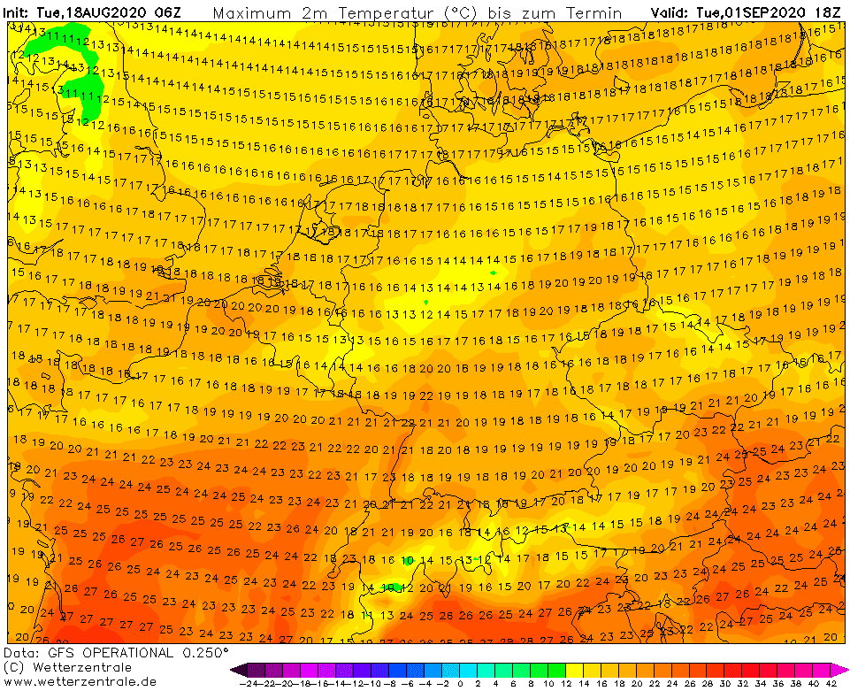
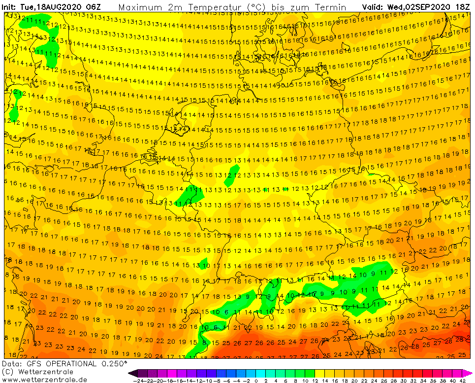
Maximum temperatures will during the last August days reaching only +15/+20°C, regionally only +10/+15°C near rain over Central Europe. Cooling by 10-15°C, regionally up to 20°C is expected during a time only few days.
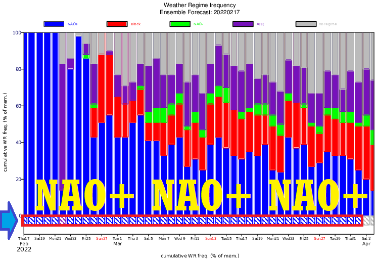
Autumn 2020 then will start with cold weather pattern, with pressure through from Scandinavia and in the air in front of Azores high, in NW flow.
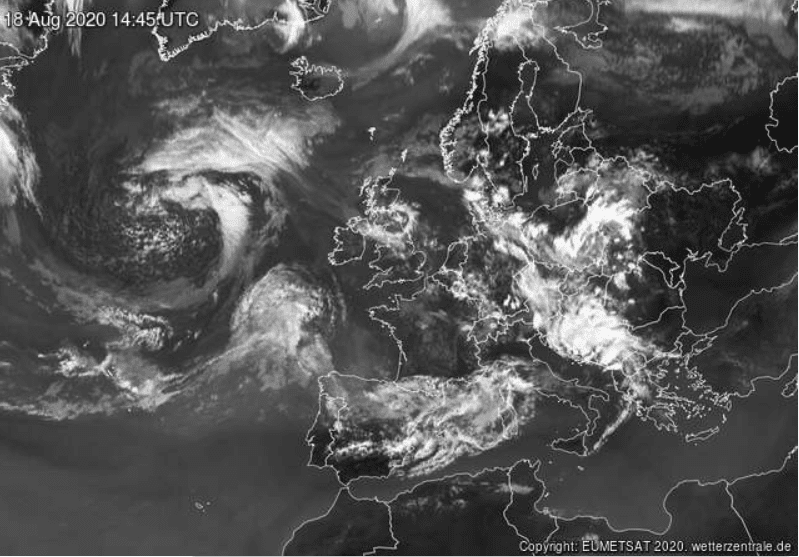
Storms over Central Europe and Balkan in satellite image from Tuesday, 18. August, afternoon /sat24.com/:
Reports on ESWD from last 7 days /eswd.eu/:

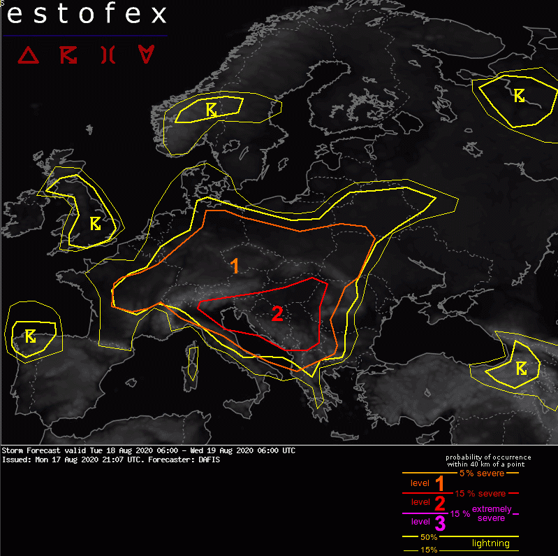
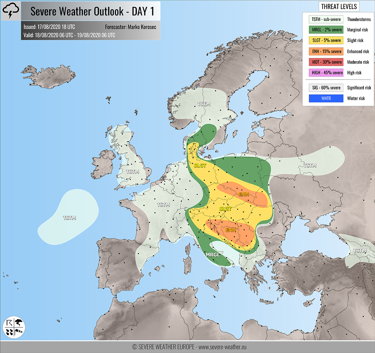
Tuesday´s warnings on meteoalarm.eu, ESTOFEX and Severe Weather Europe:
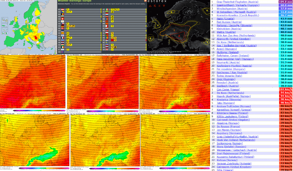
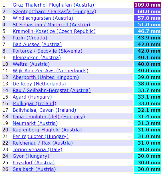
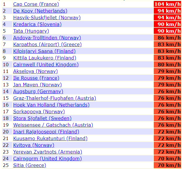
The highest preciptation and wind gusts for last 24 hours in Europe /Till Tuesday 12:00; ogimet.com/:
Maximum temperatures from Wednesday to Friday, 18.-20. August 2020 (short heatwave in warm sector of ex-Kyle) and low maximum temperatures during the period 28.8.-2.9.2020 /wetterzentrale.de/: