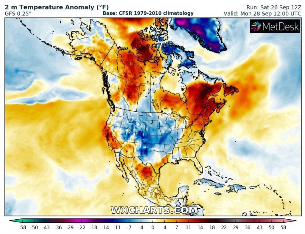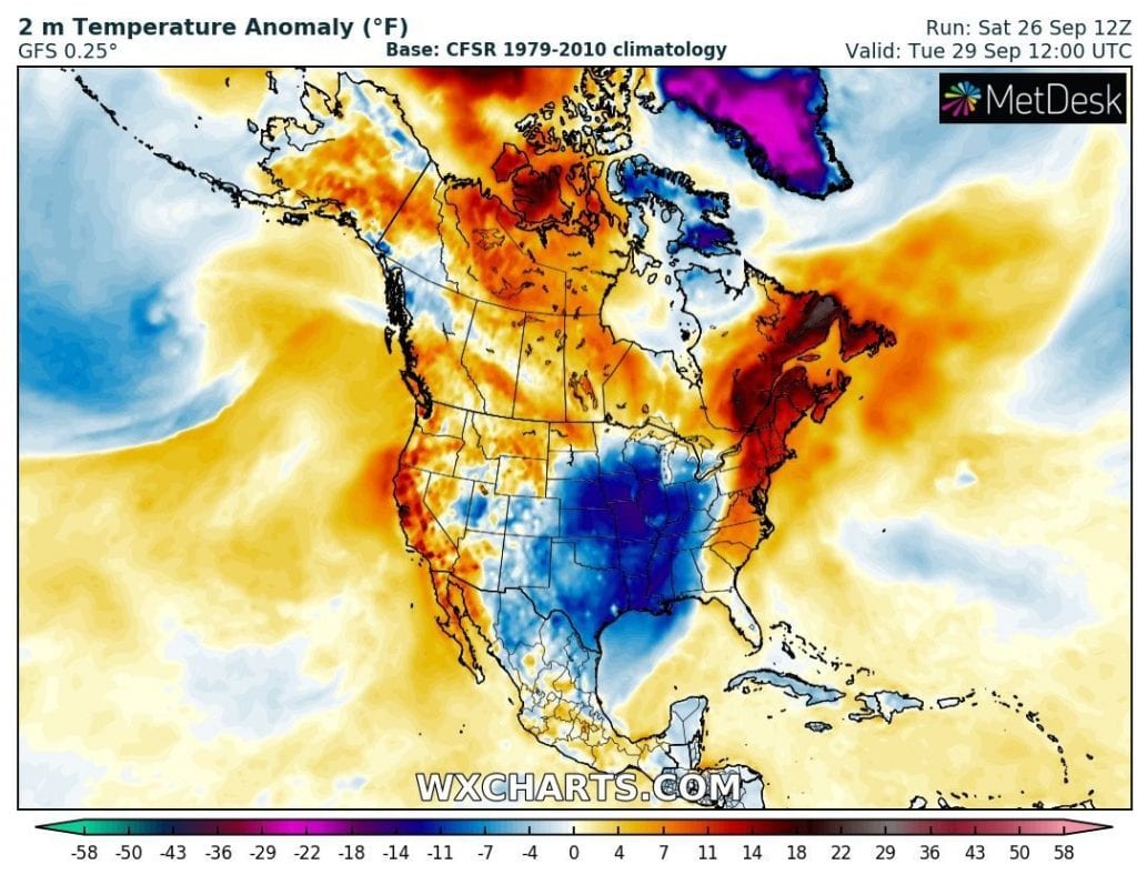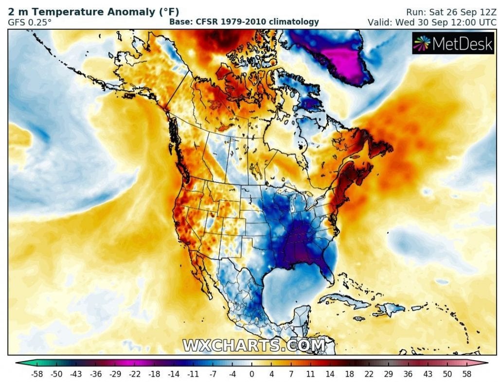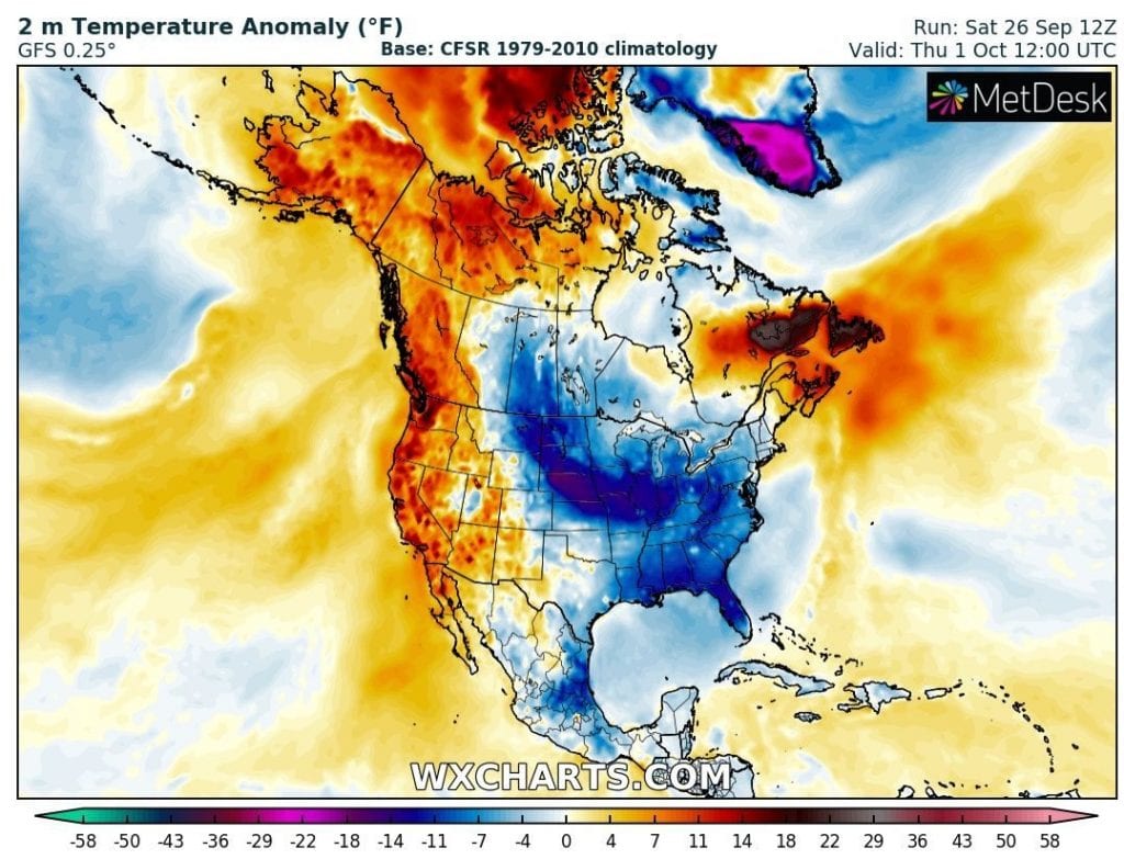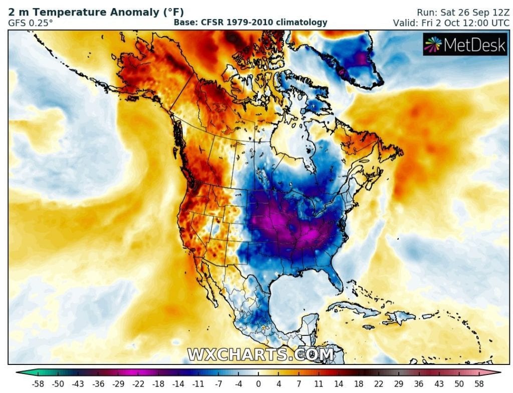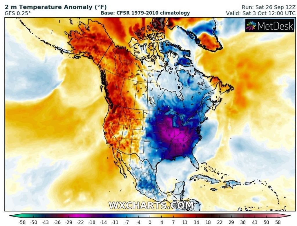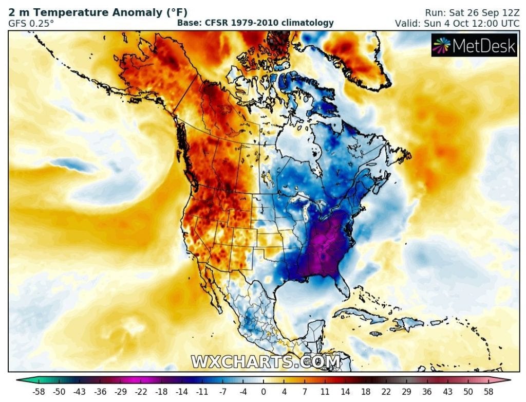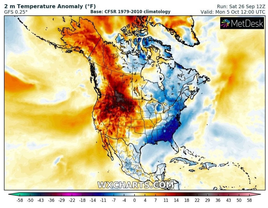
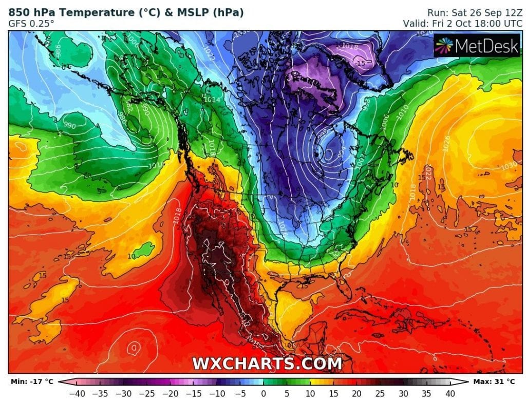
Although, very dry and warm October in the USA is expected /https://mkweather.com/2020/09/22/warm-and-dry-october-monthly-forecast-for-the-usa-from-noaa//, the start of the month will be very cold in eastern half of US, with extreme codlwave.
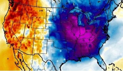
Cold and dry Arctic air hits almost all states in central and eastern US, with -5°C in 850hPa isotherma over northern Illinois, Indiana and Ohio and 0°C isotherma up to Tennessee, with severe frosts in this area and possible rarely snow showers southward from Great Lakes.
In International Falls region, temperatures should dropp up to 14°F (-10°C) and harvest in more southern states is needed to be collected and flowers hidden.
Temperature anomalies will be in large area below -20°C from long-term average for the beginning of October, but afternoons will be reatively pleasant thanks to sunny and calm weather.
Thanks to dry phase of MJO, any hurricane threats aren´t expected next 2 weeks, but around 9. October, next hurricane is forecasted according to GFS in Eastern Gulf Coast, and it should be a major threat. Around 10. October, MJO will start shifting to its wet phase and severe hurricane actitivy should appear during rest of the month above Atlantic, with the next Greek alphabet names of tropical storms and hurricanes.
In the Southwest, dry and hot weather will be continue with continuing wildfire risk, mainly in California.
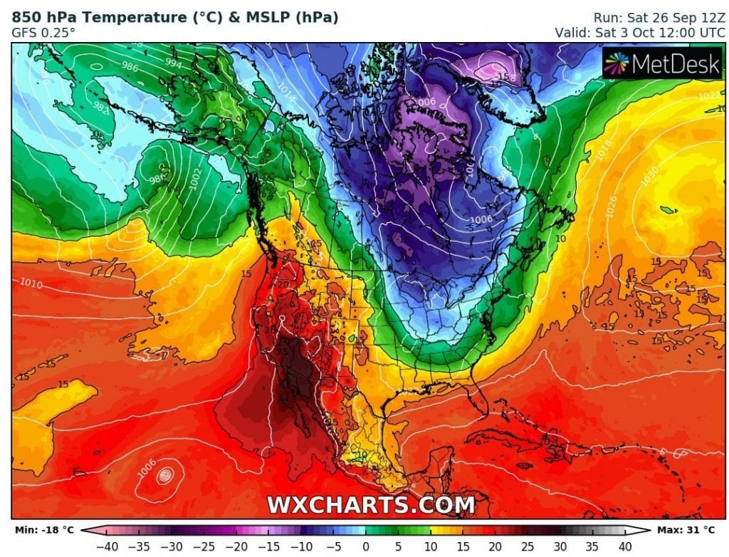
T850 during the peak of expected cooldown, Friday and Saturday 2.-3. October 2020 /wxcharts.com:
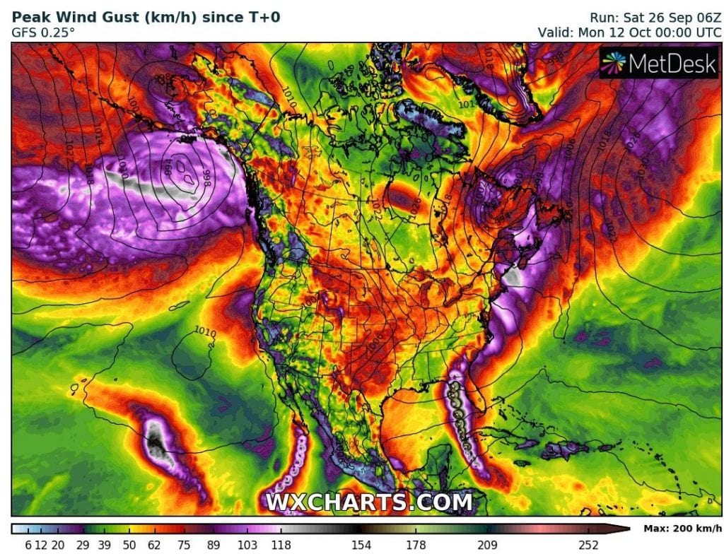
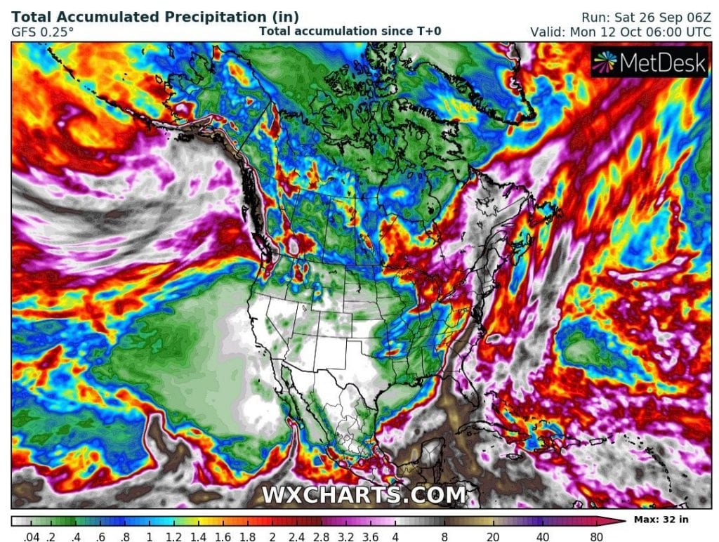
Expected Peak Wind Gust and Accumulated Precipitation until 12. October in North America /wxcharts.com:
Temperature anomalies during the period 28.9.-5.10. 2020 in North America /wxcharts.com: