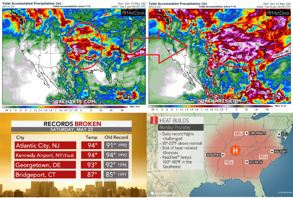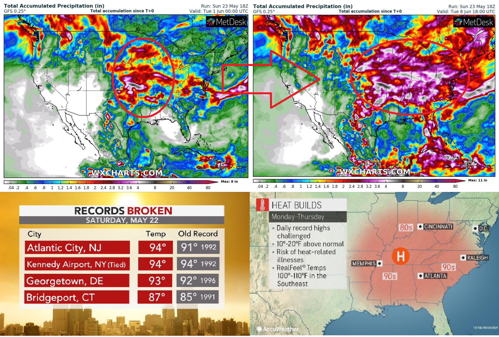
Cold front, which brought temperature shock in Canada last week, when before its arrival, +33,4°C was in Saskatchewan measured and after its transition eastward, snowing surprised Alberta, including Edmonton /https://mkweather.com/from-summer-into-winter-after-334c-saskatchewan-snowing-in-edmonton-alberta-canada//, has moved above central USA already, with powerful heatwave in eastern and southeastern USA on its front side.
Interesting is temperature measured in New York at the weekend (Saturday, 22. May), 94°C / +34,4°C, what is the new daily record for the city for 22. May.
In Southeast, temperatures locally reached up to 104°F / +40°C last days, but mostly was above 90°F / +32°C and in the first half of current week, still will be very hot.
Meanwhile, in Northwest, late-May snowing surprised Montana, Idaho and Wyoming (the next article).
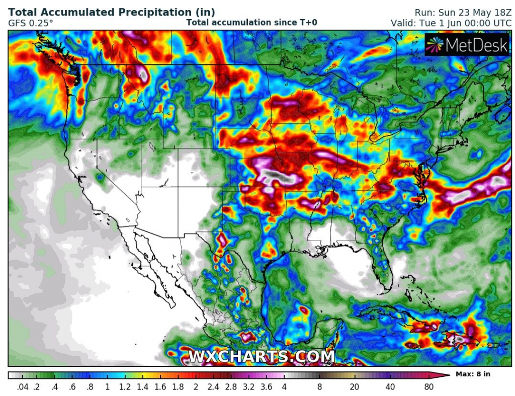
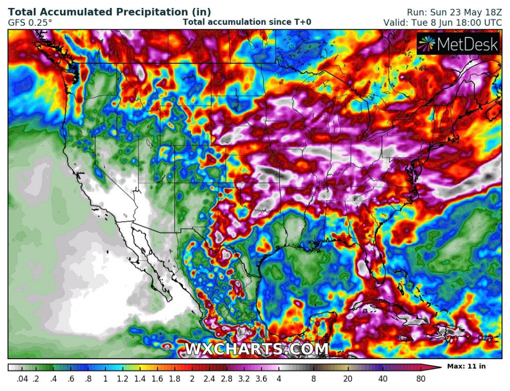
According to current storm forecast, until the end of May 2021, severe storm rounds are forecasted for Midwest, mainly Oklahoma, Kansas and Missouri, while during the first June 2021 decade, severe storms will shift towards East Coast, including metropolitan areas of New York or Washington D.C.
Meanwhile, the first tropical storm of Atlantic hurricane season 2021, Ana, downgraded above Atlantic and its remnants are slowly moving towards Europe.
Tropical depression 91L Invest caused local floods in Texas and Louisiana, but status of tropical storm hasn´t been reached.
